


Ashlu Mountain - East Ridge, August 2009

As was the case with Mount Rexford, Welch Peak, Overseer Mountain, Mount Matier and probably a handful of other peaks in BC that I have since forgotten about, I first learned of Ashlu Mountain while perusing the many trip reports on Bivouac.com. The Ashlu report describes a stout 5.10a rock climb on the peak's impressive South Face. Though the climb itself certainly intrigued me, the photos depicting the wild, glaciated scenery in this remote corner of the Coast Range were really what captured my imagination. Years went by and I would have all but forgotten about Ashlu were it not for a chance sighting while heli-skiing near Powder Mountain last March. Seen as an aesthetic pyramid of rock towering above neighboring peaks, Ashlu's lure was too much to resist a second time around. Content with simply scrambling up the peak's East Ridge, Eli and I chose Ashlu as our 'debut' climb for a two-week romp in the mountains of BC and AB.
The Scrambles Guidebook to Southwest BC by Matt Gunn describes the approach and climb with a level of detail not commonly found in other guidebooks. This helped a great deal in demystifying what is otherwise a confusing 4wd high-clearance 'drive' along the Ashlu Main forest road just to reach the trailhead. Note that if you value the paint on your low-clearance vehicle, you will want to park at the 9km marker across from the upper-power project on Ashlu Creek and bike the remaining 40+ kilometers (25+ miles) to the bridge over Shortcut Creek. For those without the forethought to bring a GPS or an odometer however, the approach is tricky.
Fortunately for all you slackers I've put together a nifty cheat sheet to help keep you on the right track! But before I spill the beans, allow me a few words to explain how all this came about. You see, prior to the climb with Eli, yours truly sacrificed an overcast August Saturday to...um...reconnoiter the approach to Shortcut Creek. Obviously, if the weather should by some fluke have defied Environment Canada's 60% chance of rain, I was prepared to make a dash for Ashlu. Needless to say, the rain arrived an hour sooner than was forecasted, but I was at least successful in navigating the maze of forest roads, spurs, forks and sinkholes to reach the partially collapsed bridge over Shortcut Creek. All in all, it took me under 4 hours to reach the trailhead, and only two to return to the car. In any case, my suffering is your gain and without further ado I present to you Ashlu Main for dummies! Note that the photos in the cheat sheet were taken on return (see final photo in album); in other words, pay no attention to the orientation of the car (just go where the finger is pointing).
A week later and without the worry of getting lost on Ashlu Main, Eli and I casually made our way to Squamish from Seattle. We crossed the bridge over Squamish River and once again signed-in with the Ledcor Construction gatekeeper/foreman at the hydropower project staging area. We continued up the road, passing a small sign indicating the Sigurd Creek Trailhead (the approach for Ossa, Pelion and Tantalus' North Ridge). Shortly beyond this point we encountered some heavy construction equipment and noticed a couple pipes large enough to drive a bus through protruding from tunnels bored through a rock wall. It seems that once construction is complete (by October 2009), these giant pipes will cross the road before descending to the powerhouse located near the bottom of the embankment adjacent to Ashlu Creek. I suspect they might just build the road up and over the pipes, but who knows.
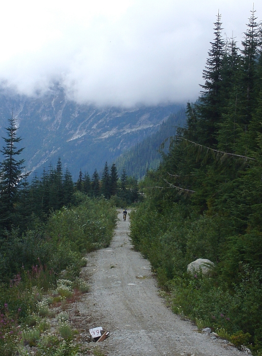
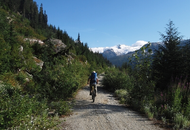
Next we crossed a bridge over Ashlu Creek and lamented how the hydro facility would likely reduce the volume of water and undoubtedly alter the flow of this surprisingly wild and scenic 'creek' (anywhere else it would be considered a river). Continuing up the well-maintained road, we passed the junction where I parked last time. The road becomes considerably rougher and overgrown beyond this point, but we pressed on nevertheless. We managed to drive Eli's WRX another 10 miles or so before stopping at a small pullout just beyond the second creek crossing where a rockslide means the end of the road for vehicles without high-clearance. We then biked the remaining distance with overnight packs to Shortcut Creek, arriving there around 5 or 6PM.
Although there are good camp spots in a basin (as seen in photo) about an hour up the trail towards Ashlu, it appears that most just call it a night on the road. This is what we did. We had dinner and settled into our bivies under clearing skies. Morning dawned clear and cool - the first nice day following a week of overcast and showery weather no less. Locating pink flagging along the road's edge a few paces south of the creek, we scampered up a mossy step and started hiking a well-traveled climber's path. Note that this is now the current trail for Ashlu and replaces the trail that starts on the creek's north-side (there is flagging at the start here as well).
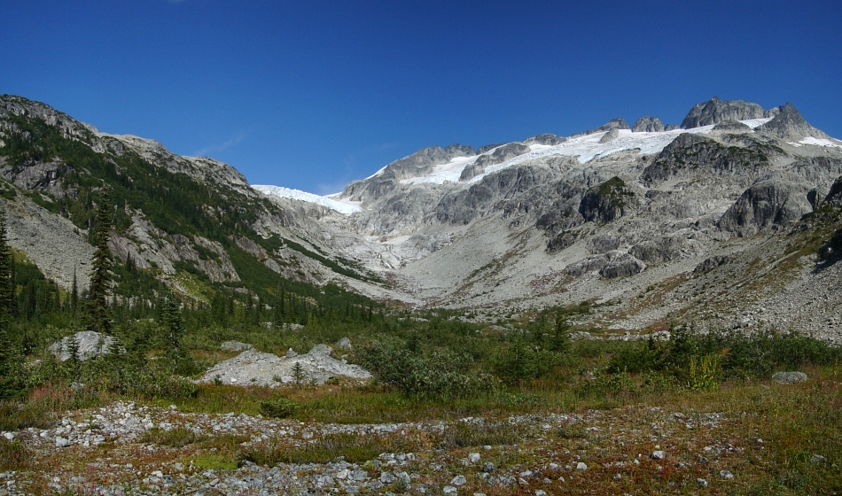
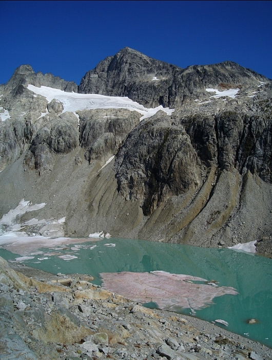
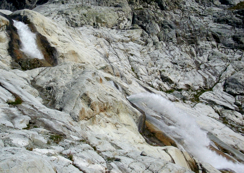
We reached a large, open basin after about an hour of easy hiking and gawked at the large, slabby headwall with hanging glacier looming above. Although I definitely recommend walking up the slabs starting looker's left (easy - we returned this way), Eli and I instead skirted the slabs by traversing the large talus slope at right. There is another smaller basin between the aforementioned slabs and hanging glacier (seen here). Foreshortening over distance makes it appear as if teetering seracs could fall on you from above, but once there you'll notice that the basin is actually much deeper than it appears from afar. Any threat of being struck by falling ice is virtually nonexistent.
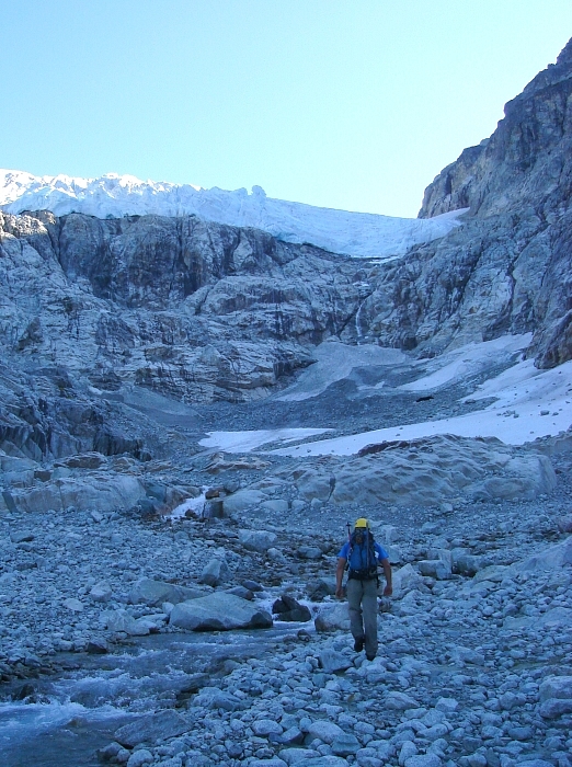
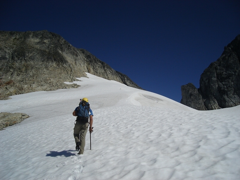
Looking left, we spied the ascent gully shortly beyond an obvious lateral moraine. We crossed the creek and headed up to it. A couple 4th-class moves at the constriction low in the gully leads to easier terrain above. A short boot up a scree slope above the gully leads to a large, flat slabby area overlooking a tarn or lake beneath Ashlu's South Face. We traversed right over the top of the slabs before descending to the lakeshore to avoid a cliffy section. From the muddy saddle at the lake's eastern end we proceeded to the base of a headwall. Walking right, we located a weakness and scrambled up a left-trending gully before veering back right to gain the crest of a spur below Ashlu's sub-summit. We then scrambled up the spur to the edge of a small glacier. Mindful of the two crevasses we could see, a short slog saw us to a moat crossing onto rock near a notch at the head of this glacier.
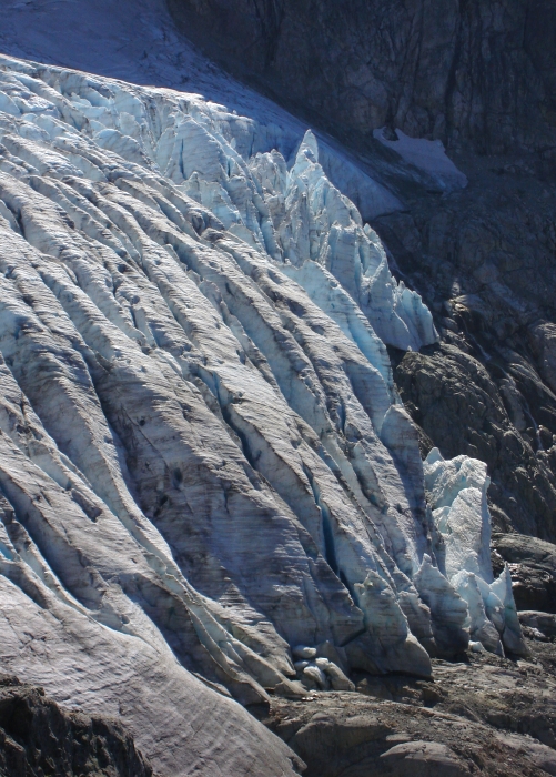
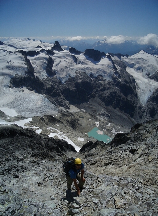
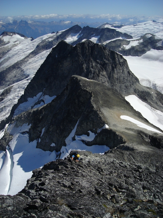
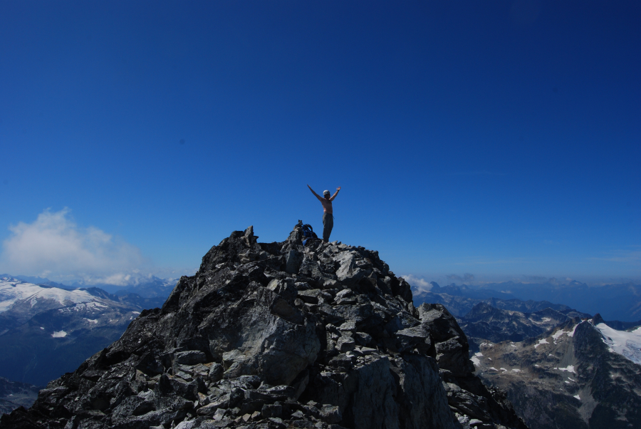
We left our crampons and ice axes behind at this point and started up the ridge. Easy scrambling on lichen-covered rock leads to the top of a rounded sub-summit. To the right, the rock falls away steeply into an impressive north-facing glacier and is well worth a couple minutes to check out. From the sub-summit we walked to the saddle below the true summit. The rest of the East Ridge now lay before us and looked steeper than it was. Initially tedious travel over loose talus gives way to relatively firm rock near to or directly on the crest. Rather than following the guide book's suggestion to make a short jog leftward in order to avoid a brief bit of steeper rock, we instead stayed mostly on the crest of the East Ridge. Avoiding the loose rock at left, we scrambled up relatively solid 3rd-class rock to reach the summit proper.
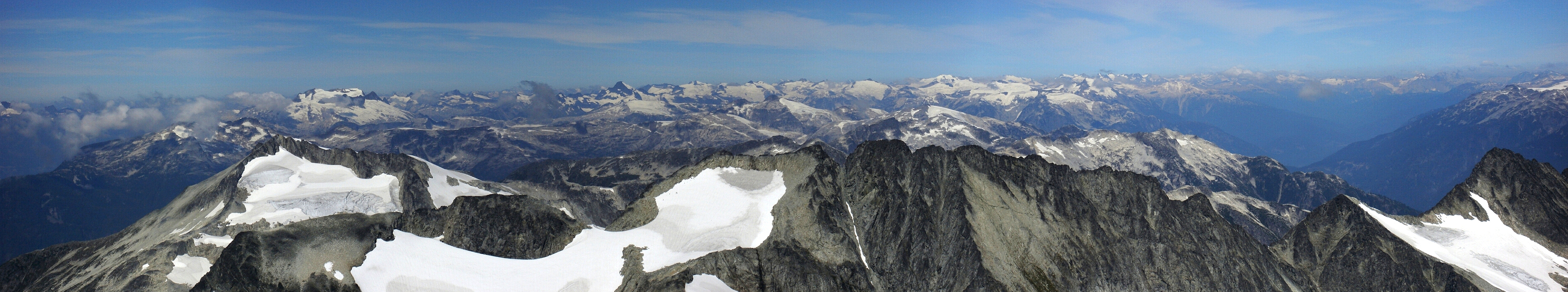
Yeah, ok so this isn't really much of a climb per se, but perhaps I can convince you that the scenery, views and adventure just to get to the peak makes it all worthwhile in the end. From the summit, several lifetimes worth of climbing objectives are yours to behold and comprehend. Almost maddening and at the same time inspirational, it boggles the mind how extensive these mountains are. With only a handful of forest roads plying the untold thousands of miles of remote wilderness, humanity has barely scratched the surface of what is possible out here.
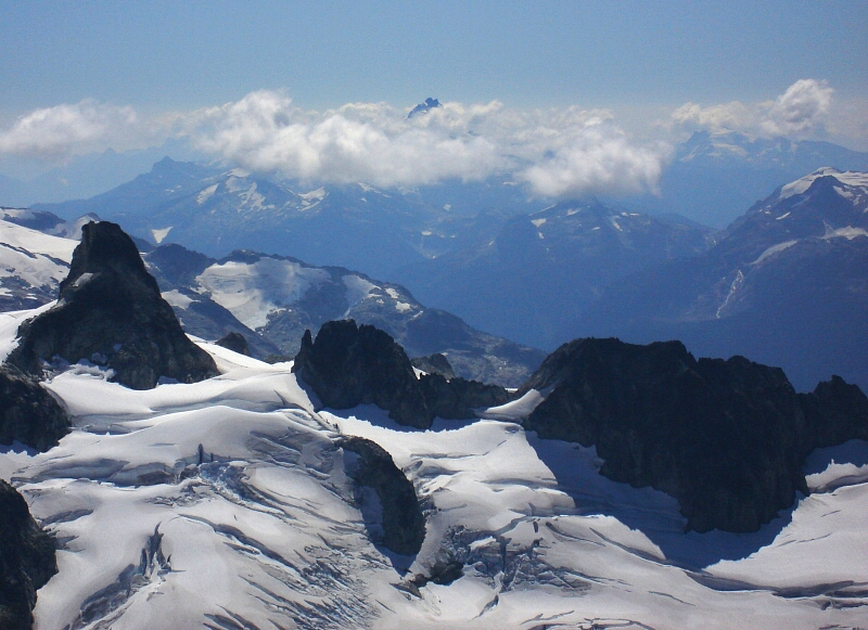
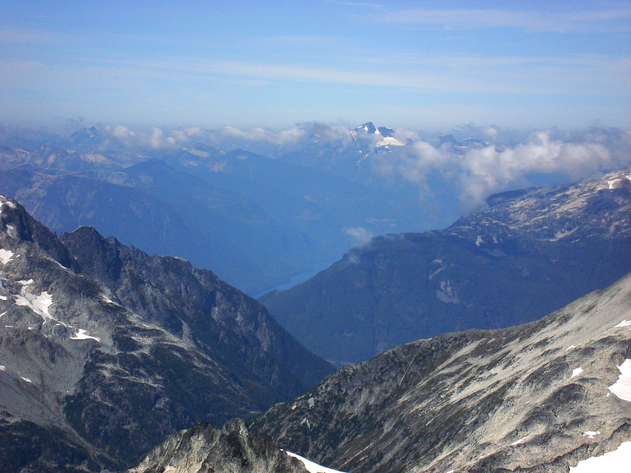
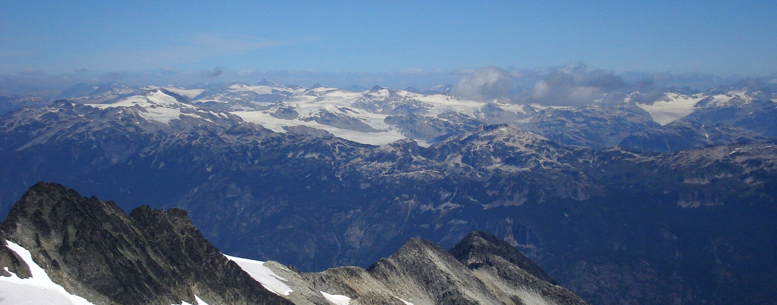
Needless to say, the views were breathtaking! Looking over Porterhouse Peak (at left), we could see the very tip of Mount Tantalus poking above some isolated clouds. Ah yes, that pesky Mount Tantalus! Such a dominant mountain in these parts and yet still relatively accessible. Its popularity is certainly understandable and deserved. To the west Princess Louisa Inlet could be seen snaking through a remote valley. The inlet drains to the Sunshine Coast near Saltery Bay. Agata and I would actually take the ferry across the mouth of the inlet some weeks later en route to Powell River. It's neat how the mountains and coast are connected in this way! The Pemberton Ice fields span an enormous area to the northeast and inspired me to want to take a closer look in the very near future. Nearby, the wildly serrated Mount Fee and Powder Mountain beyond it brought back fond memories of heli-skiing in the area earlier in the year. Looking north, the peaks of the Elaho and Meager groups present an impressive high glaciated crest. The tips of a couple larger peaks could be seen peeking above this crest and though the guide book suggests one of them could be the elusive Mount Waddington itself, I remain somewhat skeptical myself. Others have suggested they might instead be peaks in the Grenville area.
We spent about a half hour on top before beginning the descent. Retracing our up-route, we returned to the road after a relatively short 8-hour day. We packed our gear and hopped on our bikes for a mostly downhill ride back to the car. The beers Eli had stashed behind one of the rear tires were evidently swapped by dirt bikers for a couple cans of Molson Ice. Hey, at least they were decent enough to trade! A dusty, bouncy ride saw us back to the bridge over the Squamish River and soon thereafter to the glorious paved Squamish River Valley Road.
One down, four to go!
Click here to view photos.
![]()


