Select from list below to jump to a specific area on this site.
| Latest Posts |
Saturday, June 27, 2026
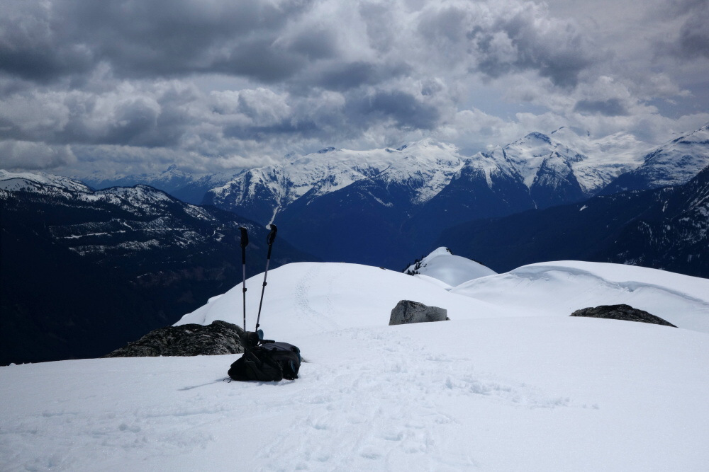
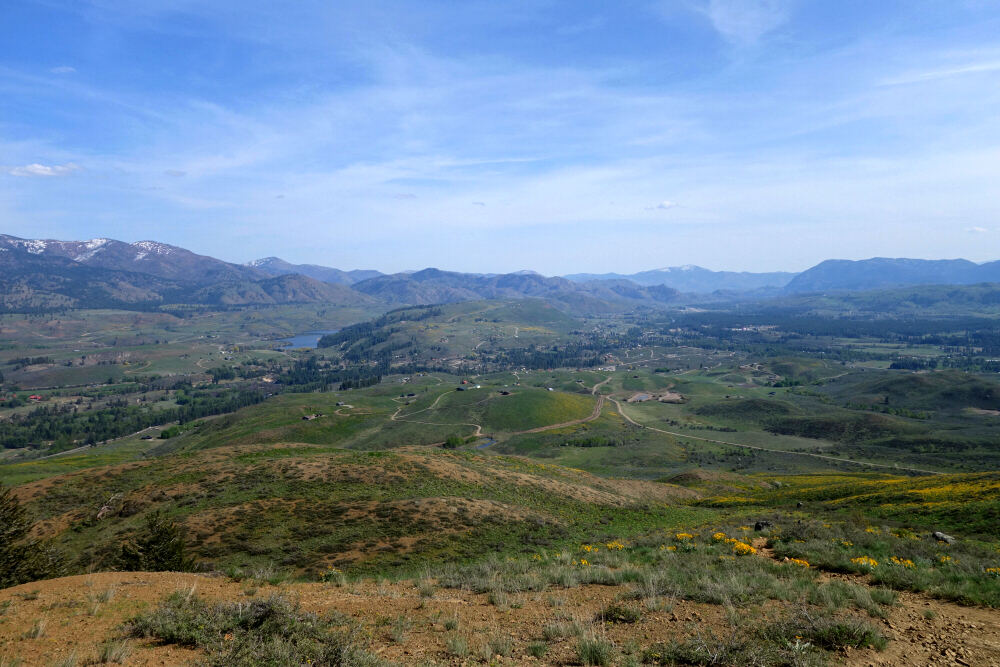
Shovelnose Creek "Peak" (Pk. 1956) - via Shovelnose Creek Knoll, May 2025
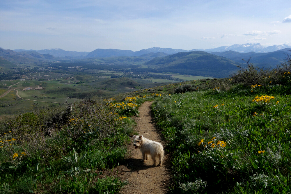
Shovelnose. What an odd name for a creek, from which the local FSR takes its name and, by extension, the informal name given to the area immediately west of Mount Fee. Google tells me it's also a type of shark, which got me thinking: given that this area is well known as an early-season ski touring destination, perhaps the runs here are notoriously "sharky"—thin snow coverage with hidden rocks just waiting to ruin your skis or snowboard, not to mention a knee or ankle. I can check all three boxes, so let's just say I have a personal connection with the damn Shovelnoses! That aside, my curiosity was piqued not only by the name but also by the area's apparent quick access to the Squamish-Cheakamus Divide between Mount Fee to the north and Cypress Peak to the south. With nothing better coming to mind for a relaxed spring day hike with Pepper, I set out to explore this enigmatic mountain selachian.
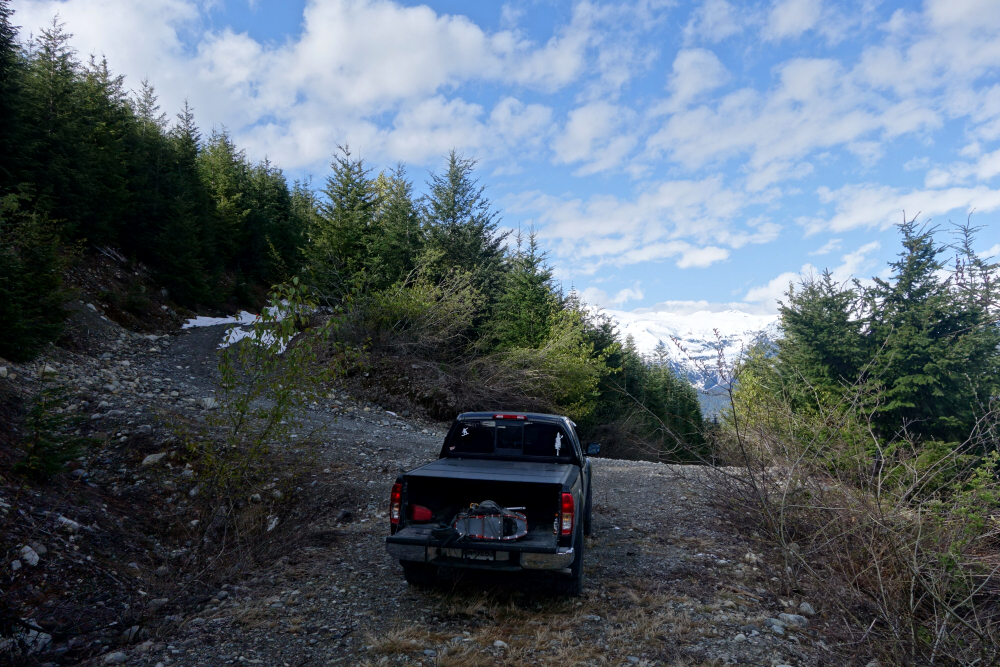
We drove up the Squamish FSR before turning onto Branch 700 about 7 kilometres short of the Elaho Mainline junction. This branch is particularly rough and steep in places, enough to have me wondering if I'd somehow taken a wrong turn lower down. I eventually made it to a switchback about 8 kilometres in before snow brought further progress to an end. We parked there and continued on foot, with snow becoming continuous on the road not long afterward.
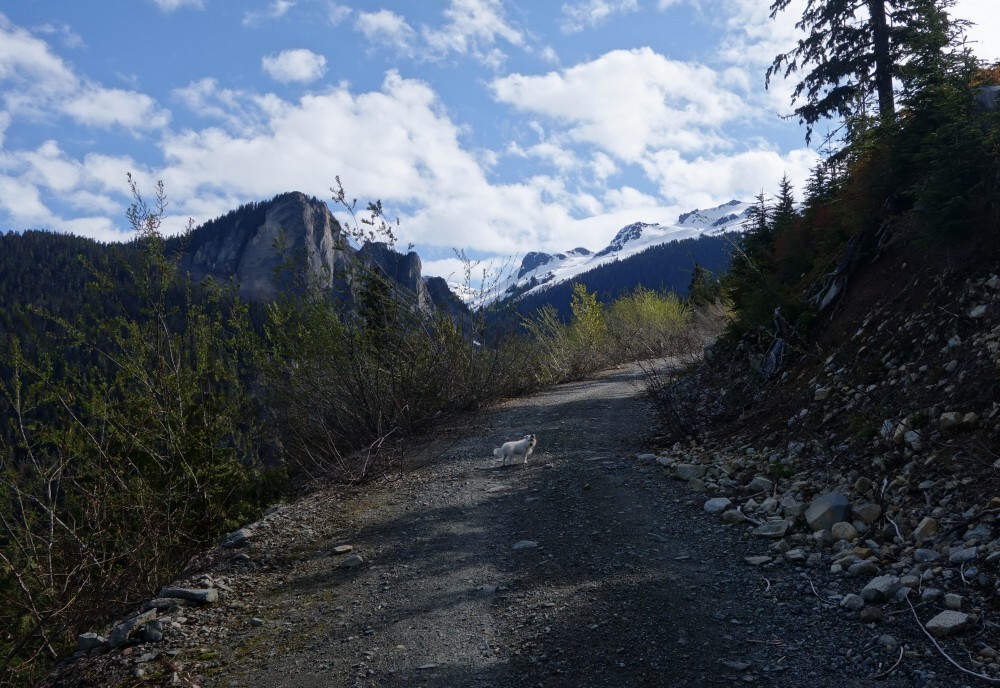
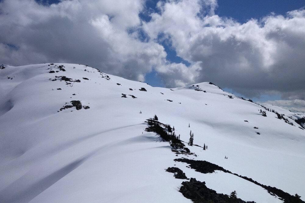
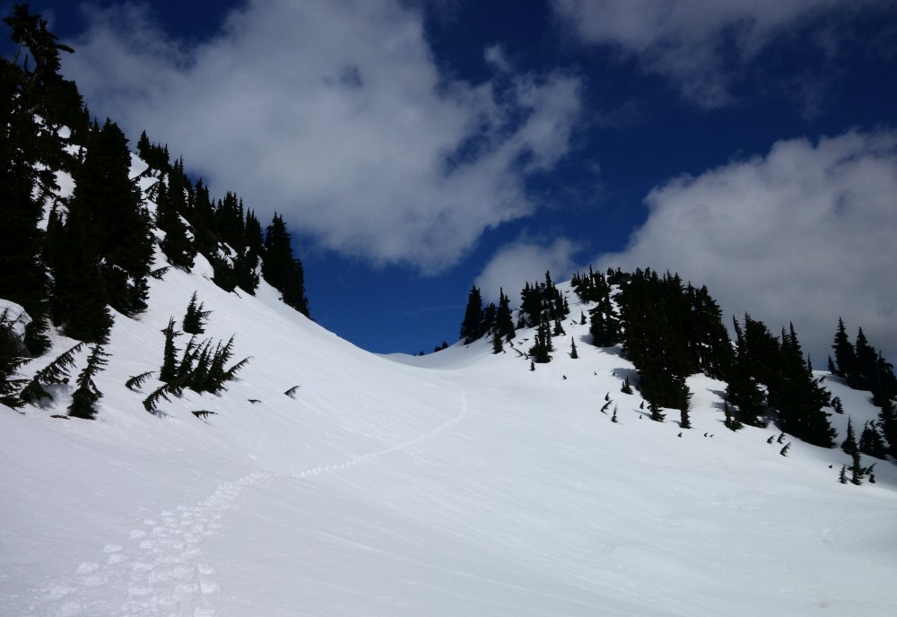
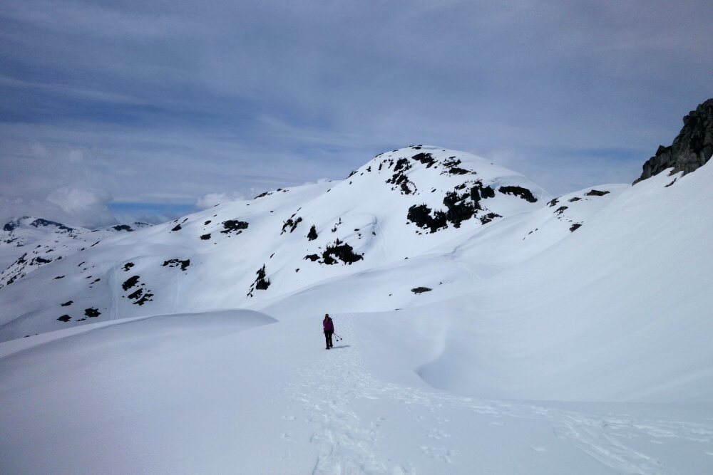
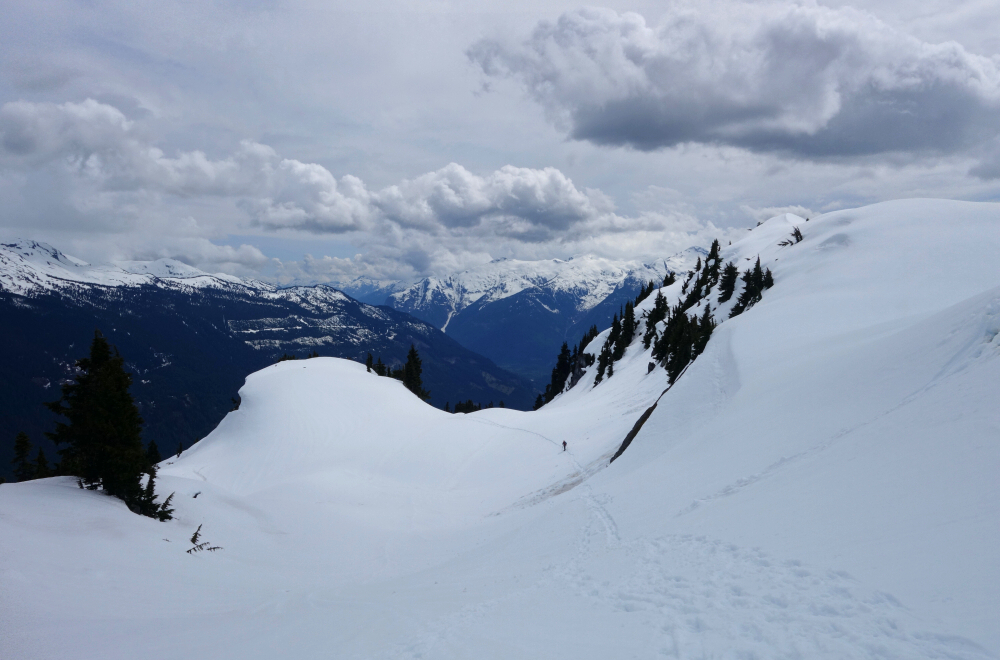
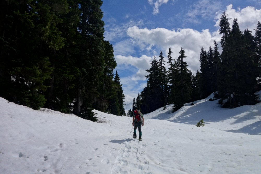
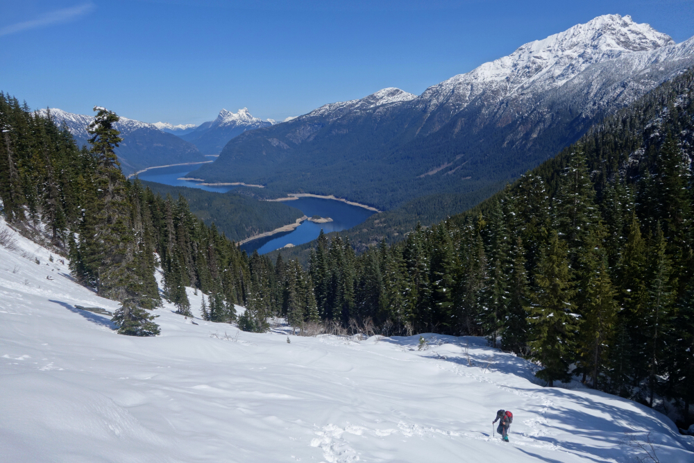
About four switchbacks later, we left the road and climbed through a cutblock toward the forest above. The snow was already getting punchy despite wearing snowshoes, so progress wasn't especially quick. A few short but steep grunts through the trees eventually brought us onto the broad western spur of the provisionally named Shovelnose Creek Knoll. From there, we rounded a gentle shoulder onto the open north-facing slopes, with the so-called knoll finally coming into view. Thankfully, the snow had firmed up again, meaning no more postholing for either Pepper or me.
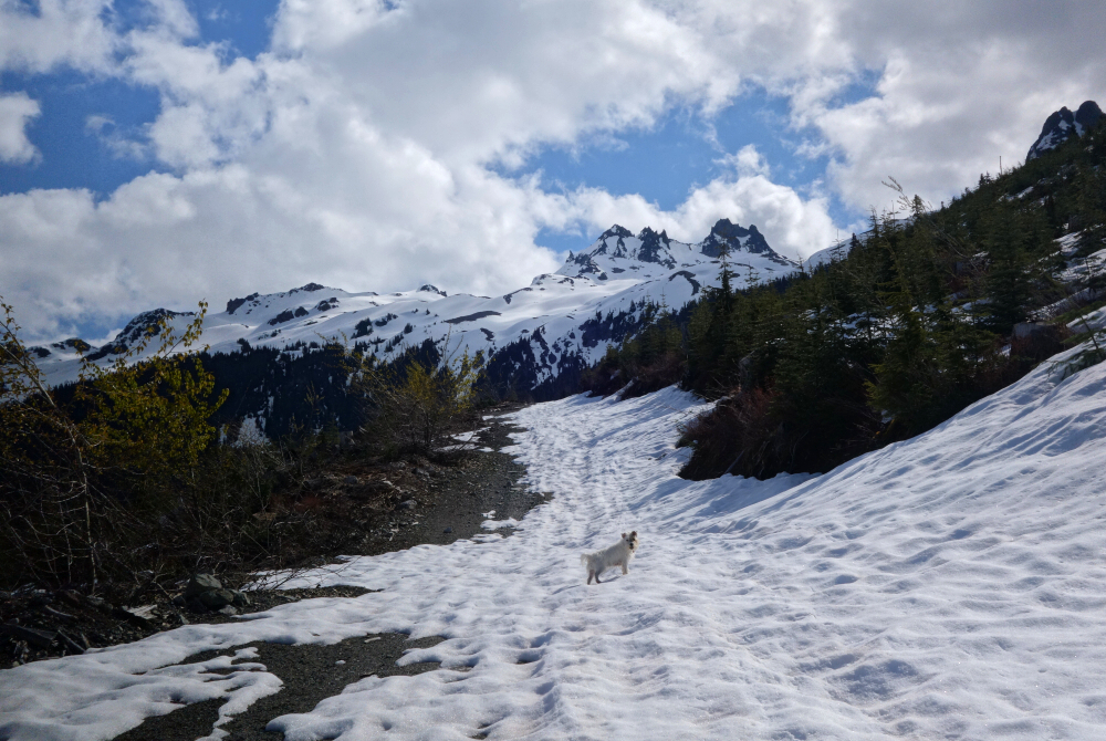
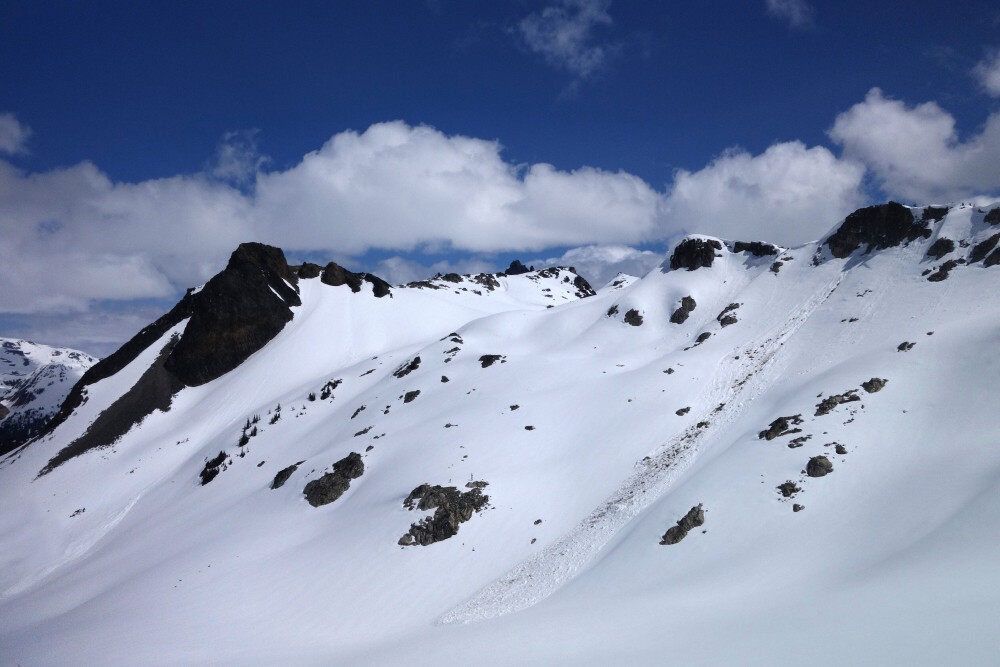
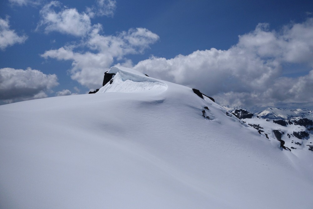
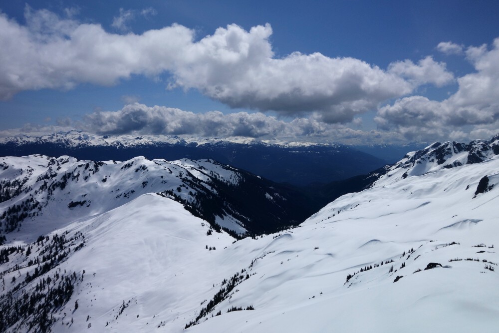
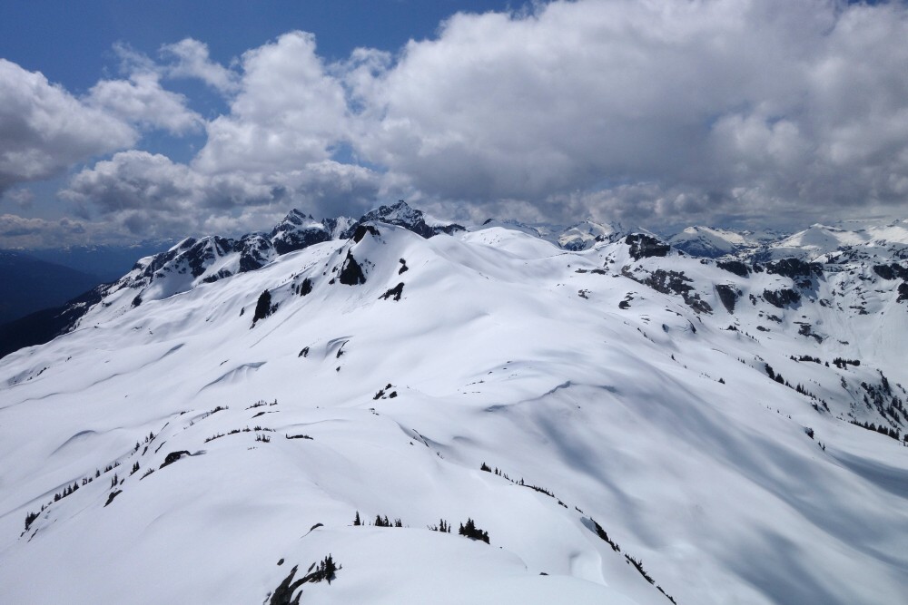
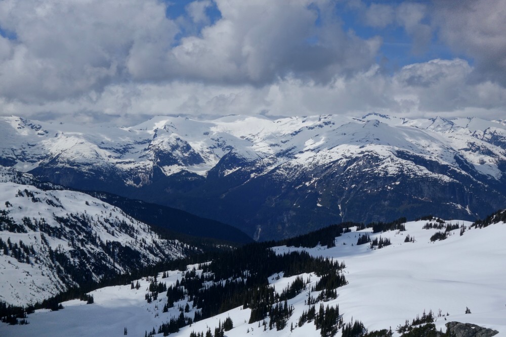
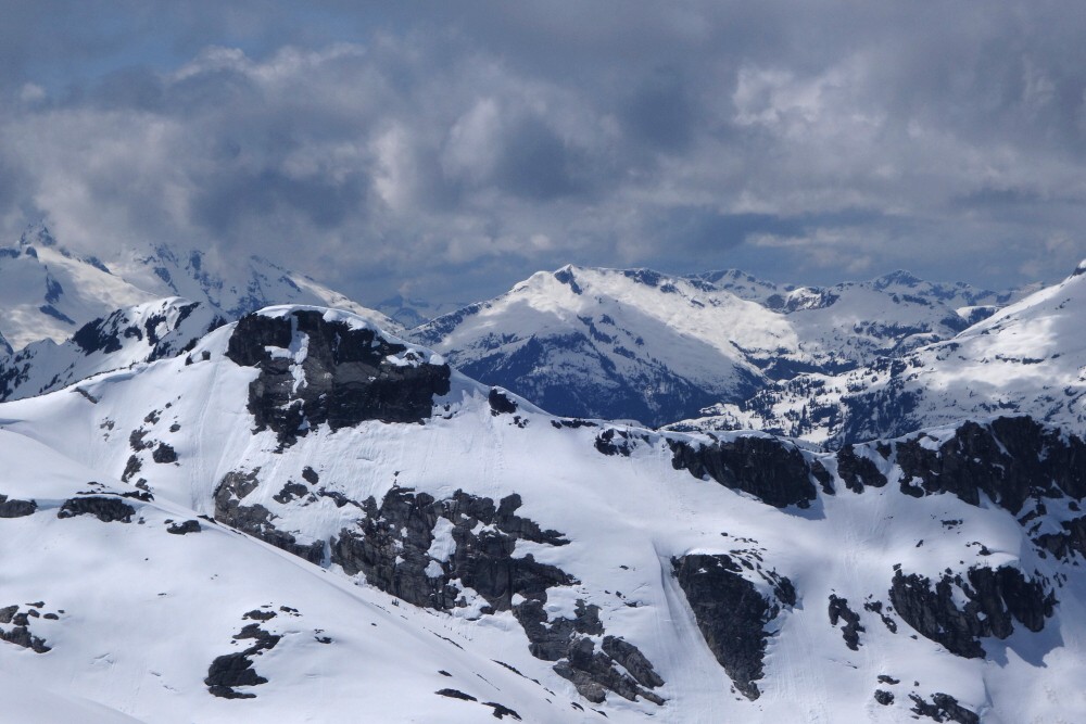
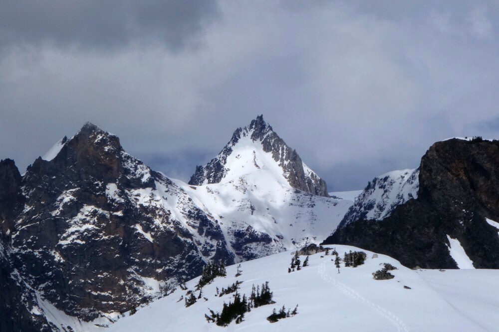
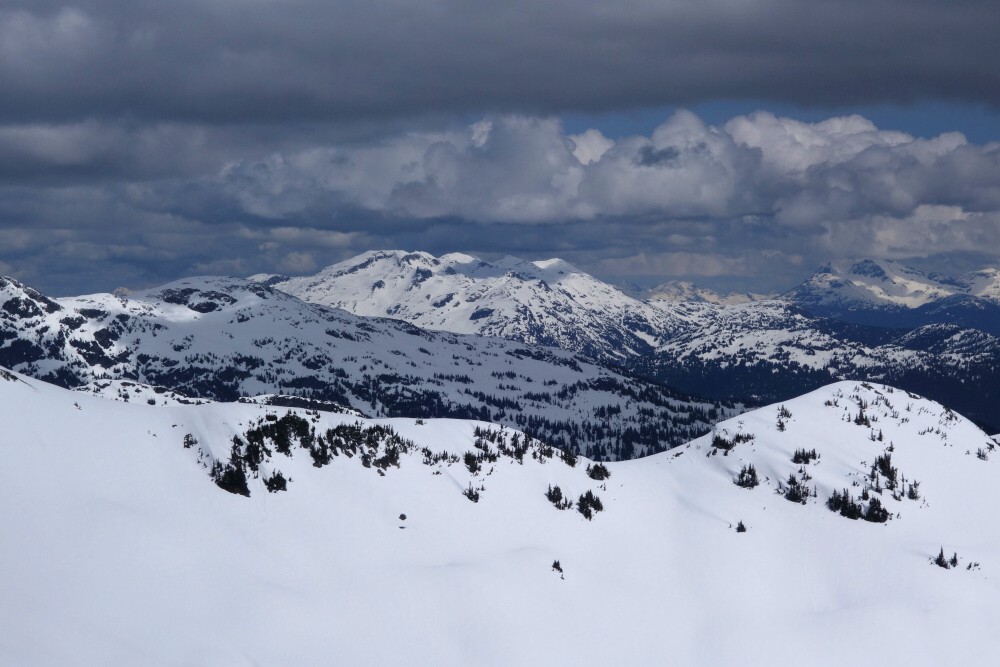
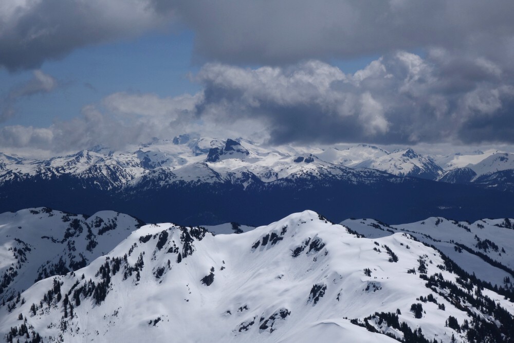
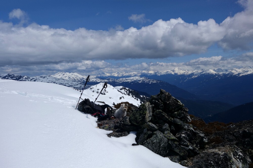
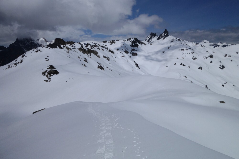
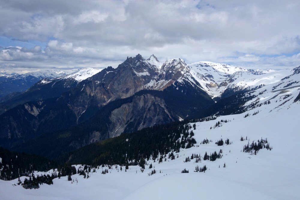
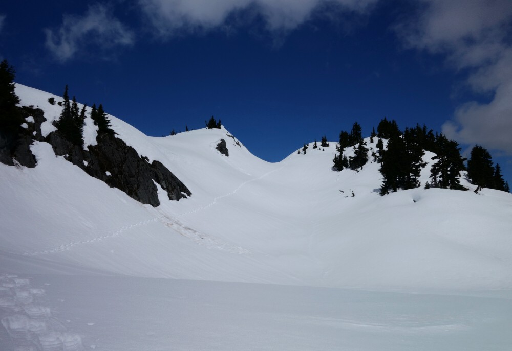
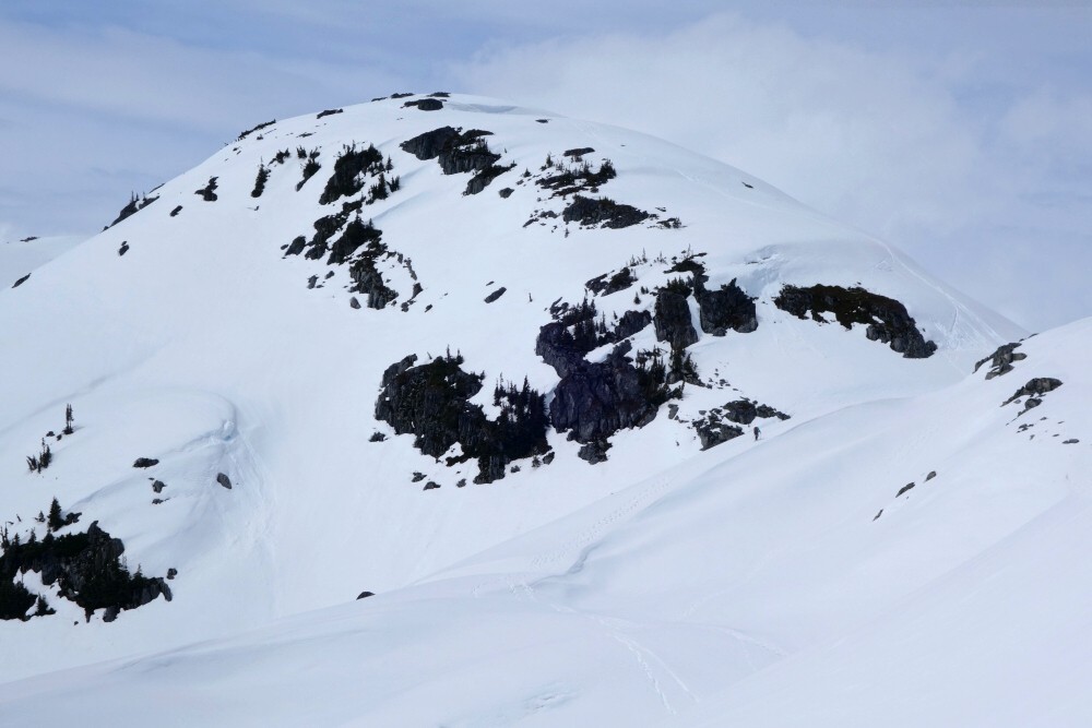
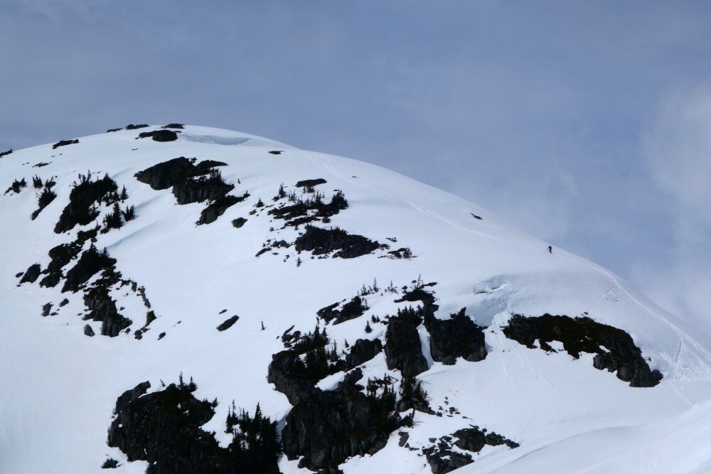
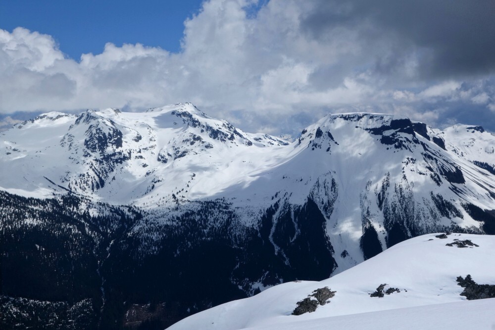
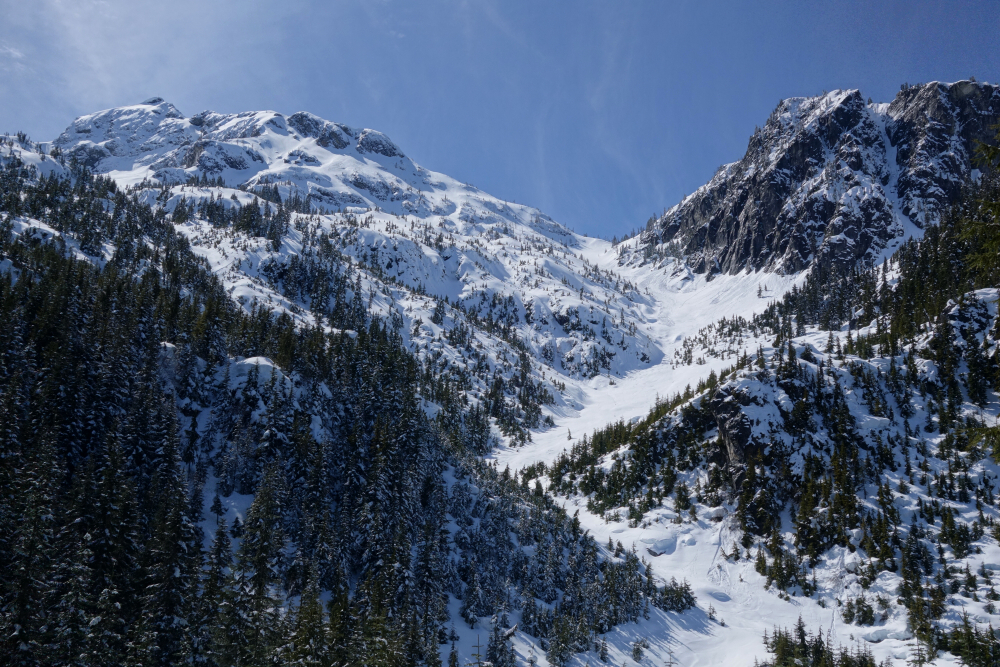
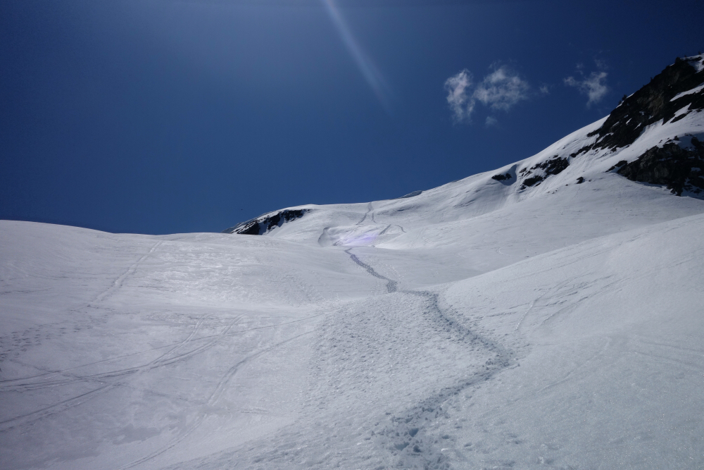
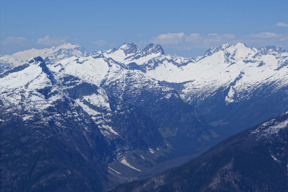
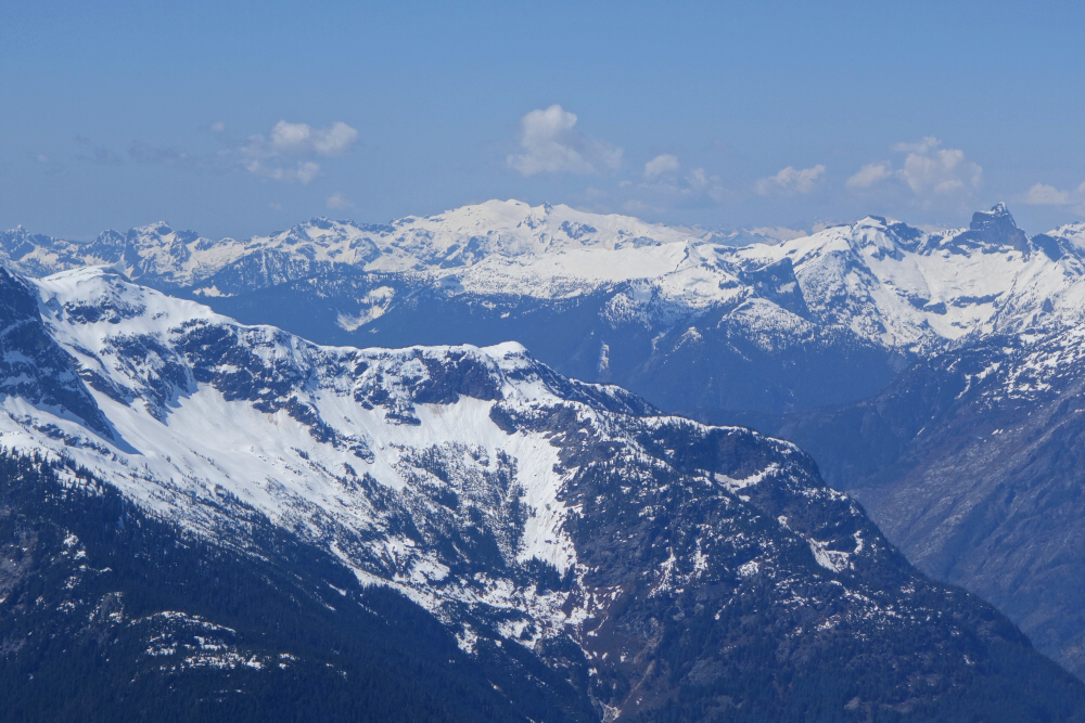
Up and over the knoll we went, continuing toward the crest of the divide a short distance beyond. At the saddle I turned left to explore the ridge south of Fee, soon reaching the day's highest point and my original turnaround. I could have continued to the next slightly higher bump... then the next one after that... and before long would find myself all the way on Mount Fee. Madness. Looking south instead, I noticed an aesthetic little point of snow and rock just beyond the saddle and decided it looked like the more interesting objective. Easy snow slopes led to a neat little arete for the finish, complete with a cairn on top to remind me that others had beaten me there. A fine little perch, and exactly what the doctor ordered despite lacking an official name.
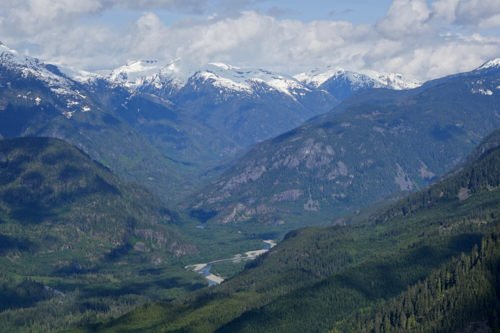
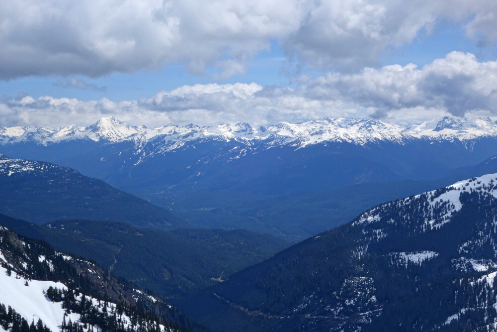
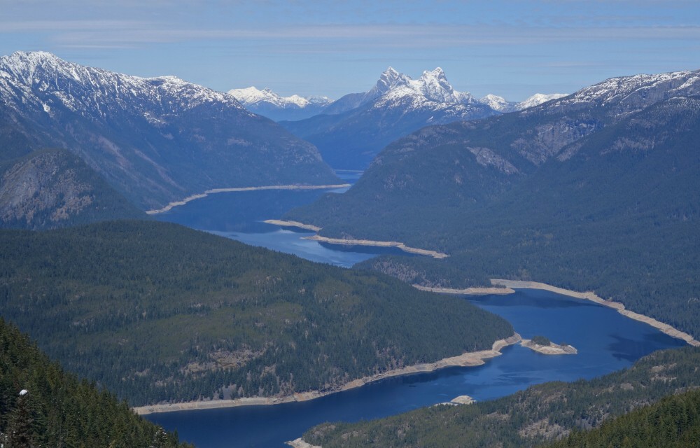
The panorama from this unnamed summit was outstanding. Fee and Cayley dominated the skyline to the north, while Roe, Cypress, and Tricouni lined the divide to the south. Looking east and west, the Squamish and Cheakamus River valleys stretched away below, flanked by countless familiar giants. I was briefly tempted by nearby Sheila Peak to the south—it's a named summit on Peakbagger, after all—but quickly came to my senses after considering the extra elevation loss and regain. Besides, I'm fairly certain I snowboarded off it during a Powder Mountain heli-ski trip back in 2011. It counts in my book.
After lingering for a while, we retraced our steps toward the truck. A cool breeze and increasing cloud cover made for a noticeably chillier finish to the day. Pepper started shivering, so I stopped to warm her up before continuing down the remaining stretch of road. Once we reached the gravel, however, she refused to take another step. That left me carrying her until my arms gave out, at which point I tried stuffing her into my backpack. In typical Jack Russell fashion, she wanted absolutely nothing to do with that.
Back on the ground you go, Pep. The so-called "train" is leaving with or without you—move your ass!
And move it she eventually did, returning to the truck under her own power. Soon enough we were enjoying cold beer for me, spicy pork rinds, and a well-earned nap for Pepper on the passenger seat.
Carnival Peak - South Route via Dipper Creek FSR, May 2025
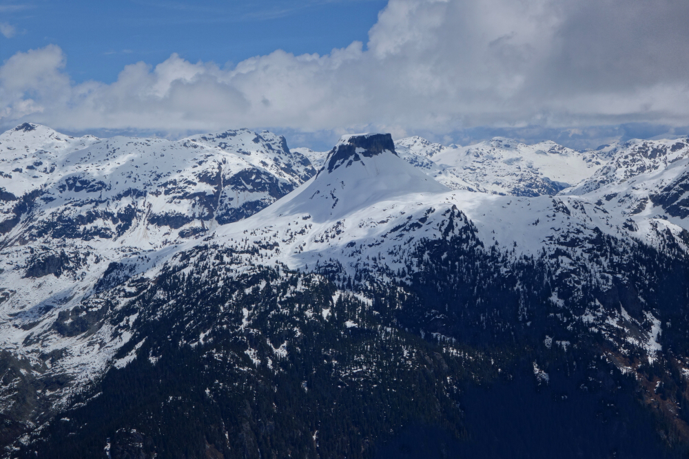
Carnival Peak is a rather unremarkable summit on the southern terminus of the Pemberton Icecap highlands, dividing the East Fork of upper Dipper Creek from the Squamish River. However, being set back somewhat from the deep valleys, towering peaks, and glaciers that surround it, the views from its summit are surprisingly good. That, combined with my long-standing desire to explore the Squamish Headwaters area, made it an appealing objective. So, when a recent trip report surfaced containing nothing but praise for what sounded like a thoroughly enjoyable outing to Carnival, I knew it was time to pounce.
Once again accompanied by Wes, I motored into Squamish and continued up the Squamish Valley FSR for a whopping 37 kilometres of dust and gravel toward the head of the valley. To put that into perspective, it's roughly the same distance as driving the paved Sea-to-Sky Highway between Squamish and Whistler. We then turned onto the unsigned S-400 branch, followed it for a little over a kilometre, and eventually worked our way to near the end of the S-426 spur before parking, about 8 kilometres from where we'd left the main road. One other vehicle was already parked there, and given the relatively remote location, we were fairly certain we'd have company on or near the peak that day. Better yet, there would likely be tracks to follow.
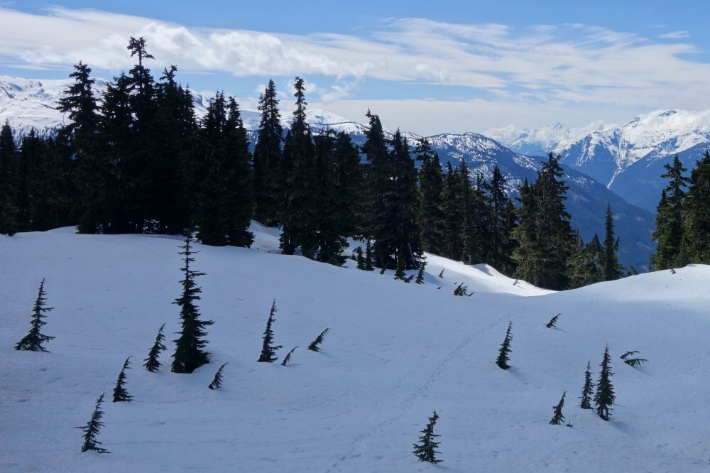
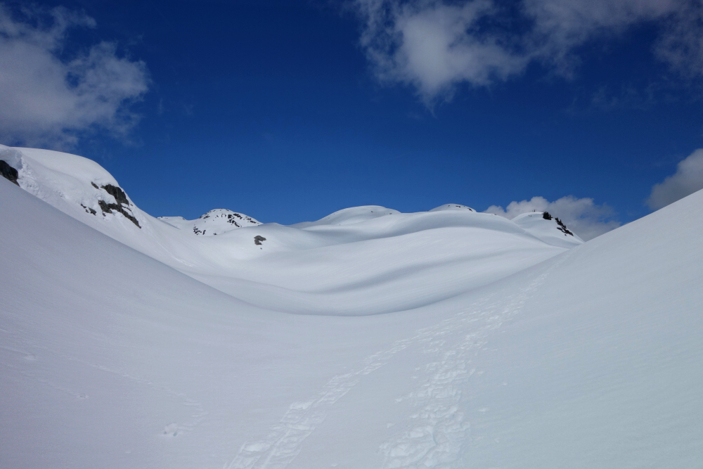
Beyond the end of the road, we entered a small cutblock, following bits of flagging into the forest. Heather and duff quickly gave way to snow as we continued upward. Since our route started slightly west of Carnival's South Spur, we turned up and right after reaching a small pond area early in the approach—still buried beneath the snowpack—and made an ascending traverse toward the rounded crest above. We gained the ridge just as the trees gave way to open slopes, reaching a minor saddle with the last of the forest now behind us and a glorious landscape of rolling snow domes and rounded summits stretching ahead.
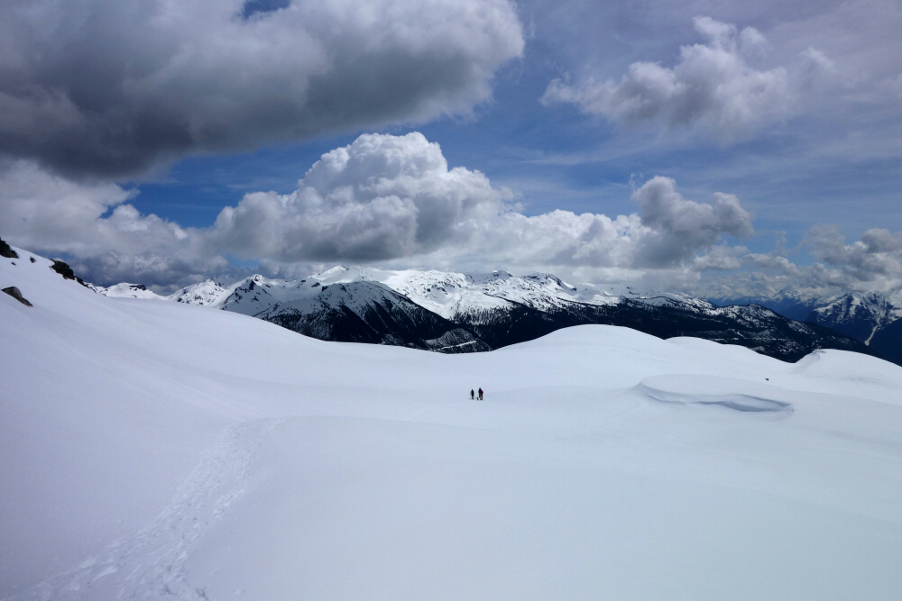
With our objective finally in sight and a set of tracks leading the way, the route ahead was obvious. Travel through this section was scenic and enjoyable, featuring one short descent and a stretch of sidehilling on still-firm snow that wasn't ideal for snowshoes, though conditions improved shortly thereafter. Before long, I was closing in on the party ahead.
At the base of the summit headwall, where the other group had kicked in a veritable trench through the soft, unconsolidated snow, I briefly considered grabbing my ice axe. In the end, I left it stowed and continued upward in snowshoes. The slope looked more intimidating than it actually was, and before long I found myself on gentler terrain just below the summit. Along the way I encountered Joanne and Ling descending from the top. We exchanged a few words before continuing in opposite directions. As it turned out, we'd end up climbing Fire Mountain together later that August—but that's a story for another report.
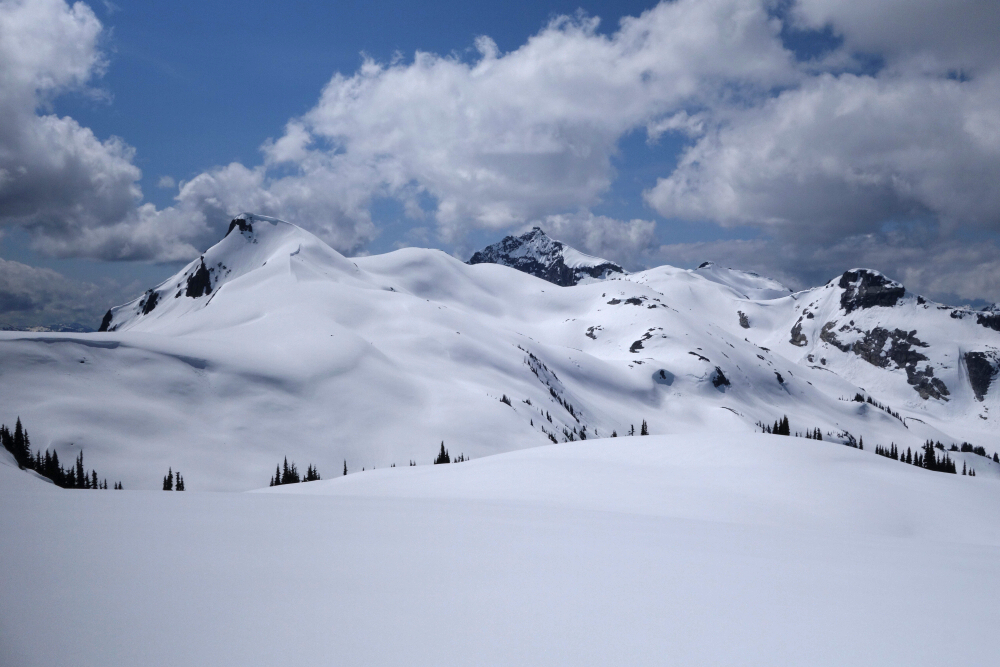
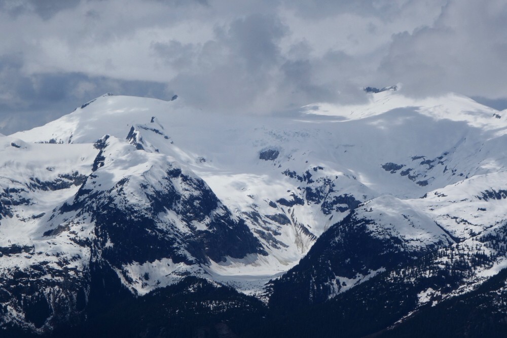
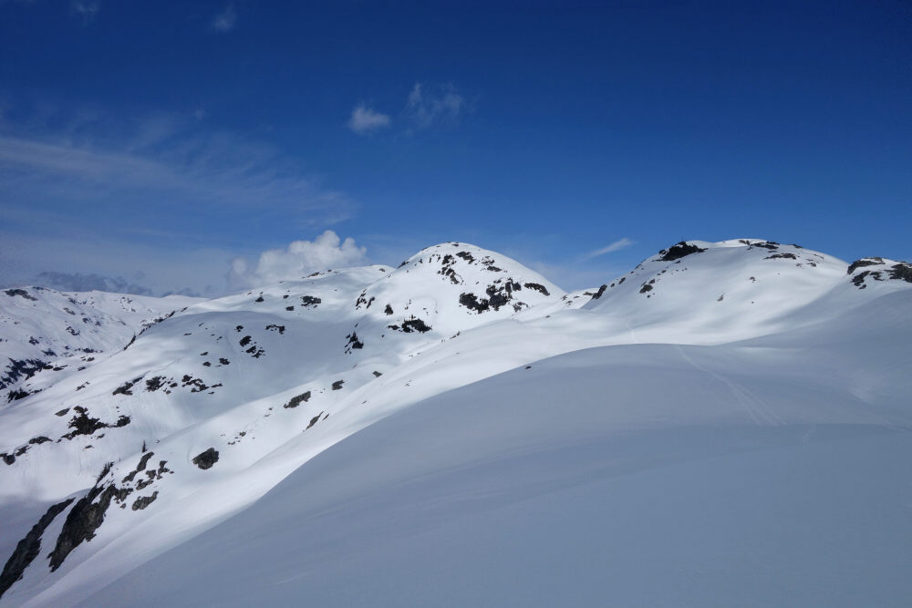
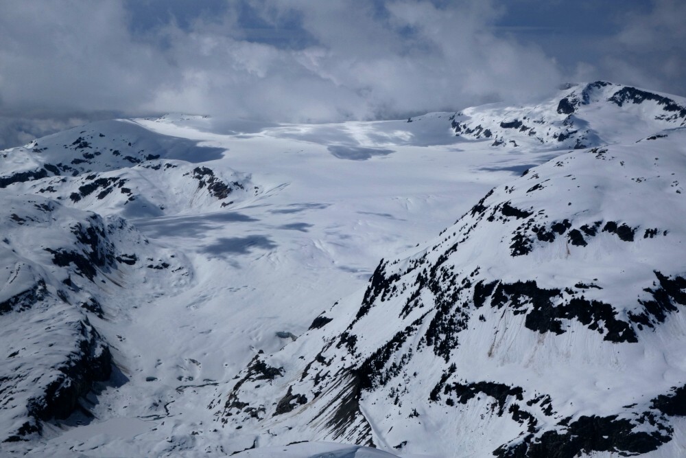
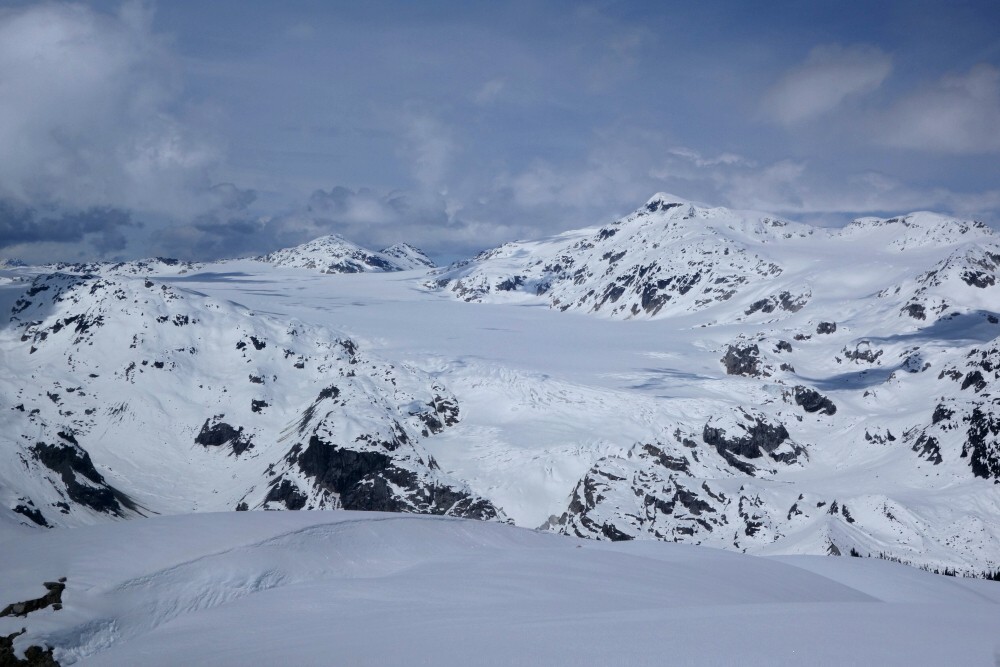
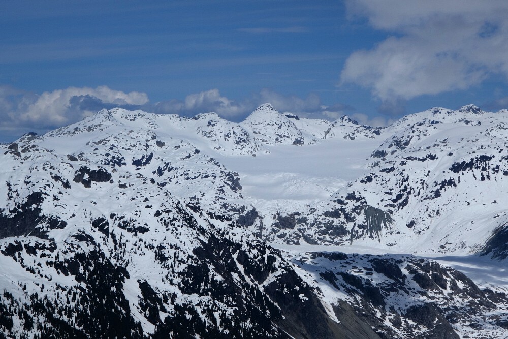
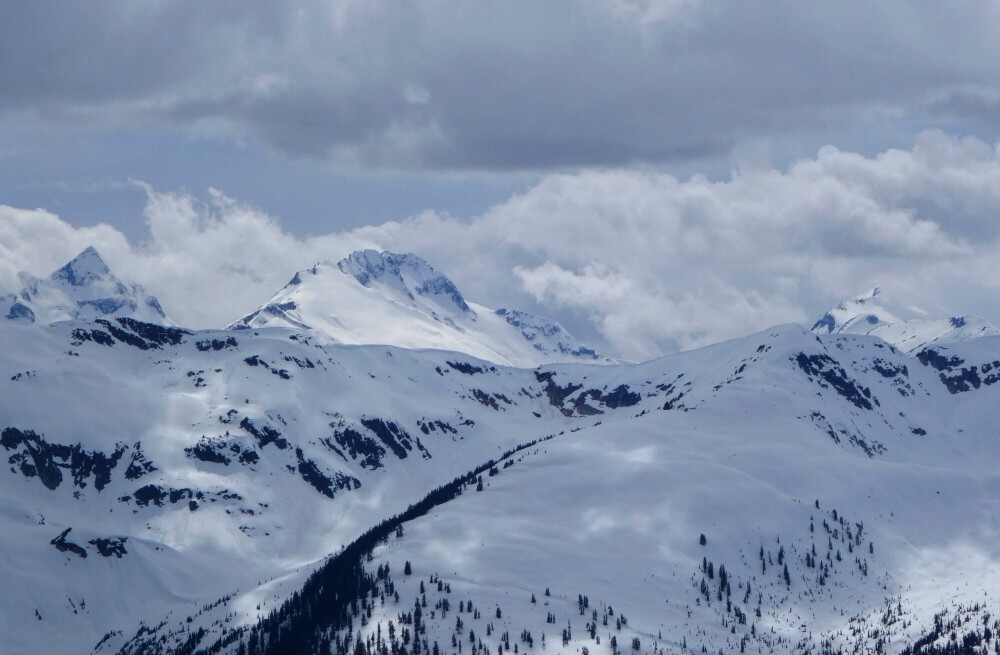
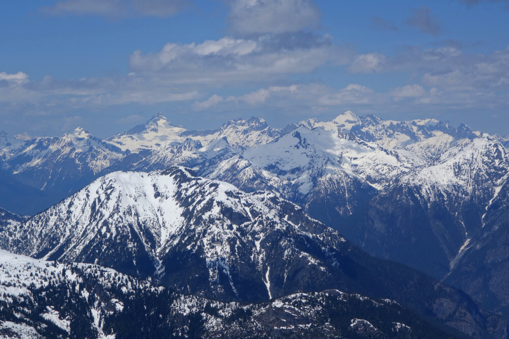
The summit views were every bit as good as advertised. For me, the standout was the view toward Exodus Peak at the southwestern edge of the icefield. Other highlights included looking northeast toward Famine Peak and the impressive icefall immediately south of it, Ring Mountain and Little Ring Peak with Mount Callaghan framed neatly between them, and finally the view north toward Torah Peak rising dramatically above the broad expanse of ice to its west and south.
Having thoroughly satisfied myself with the scenery, I began the descent, dispatching the steepest section with a quick and efficient butt-slide. Rejoining the other party—now four people strong plus a dog—we lingered for a while just below the southeastern bump they had chosen instead of the true summit. We waited there for Wes to finish his brief stay on top before resuming the trek back to the truck. In the end, it took us just under three and a half hours to reach the summit and about six and a half hours round trip. Not bad at all for a peak I'd initially written off as little more than a viewpoint and well worth the effort to visit!
Mount Oleg - South Route via Spetch Creek FSR, May 2025
The last time I visited the Place Glacier area was with Eli R. back in the summer of 2009 during a whirlwind peakbagging tour of BC and Alberta. At the time, I had been perusing Matt Gunn's Scrambles in Southwest British Columbia and was captivated by the photos of a wild glaciated landscape that seemed utterly remote and full of adventure. I was especially drawn to the route description for Cirque Peak, one of the principal summits overlooking the Place Glacier, albeit not the tallest. For a guidebook that generally avoids glacier travel and limits scrambling difficulty to a user-friendly Class 3, Cirque is a bit of an anomaly. The peak seemed to offer it all: glacier travel, engaging scrambling on an exposed ridge rated "difficult" (one of only a handful of routes in the guide to receive that designation), an aesthetic approach complete with raging waterfalls, and the promise of outstanding summit views. It didn't take much convincing for Eli and me to make Cirque the debut scramble of our summer road trip.
Since I was still based in Seattle at the time, we faced a long drive to the trailhead and decided to spread the outing over two days, each overnighting in our own "private" glaciology hut rather than squeezing into the climbers' hut, which seemed a bit cramped and dirty by comparison. We climbed the peak the following day, enjoying the exposed scrambling and the final somewhat loose knife-edge before the summit. Cirque delivered everything I had hoped for and more. We then returned to camp, packed up, and made a beeline for Harrison Hut at the foot of Overseer Mountain-all in the same day. After that, it was on to other objectives, and I was content to leave the Place Glacier area behind for many years. That changed when reports of other peaks in the area began rekindling my interest, particularly Mount Oleg, the highest summit in the group.
Unfortunately, sometime during the intervening years, the traditional Place Creek approach had fallen out of favour following a major washout that rendered much of the route impractical. Anyone wishing to reach the area without undue suffering needed an alternative. That alternative finally emerged in the early 2020s via the already popular Spetch Creek FSR. The approach still sounded bushy and generally unpleasant, which did little to inspire me, until a variation was explored and shown to avoid most of the aforementioned nonsense. That was all the encouragement I needed. The time had finally come.
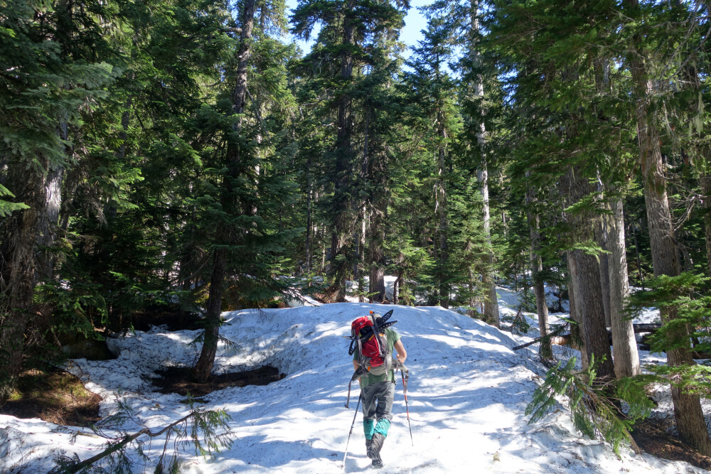
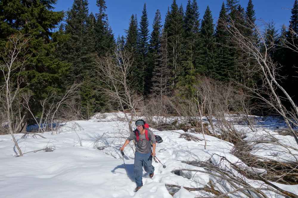
This time, with Wes in tow, we motored up the Spetch Creek FSR on a cool afternoon in early May. Since our route depended on a spring snowpack to suppress much of the alder lower down, we opted to car camp the night before and get an early start, hoping to take advantage of an overnight freeze and minimize the postholing that seemed inevitable. We made camp at the same pullout used for the Valentine Lake Trail, familiar to me from previous trips to Cassiope and Saxifrage and got moving shortly after sunrise the next morning. Thanks to sub-zero overnight temperatures, it was a cold start, though at least we could count on easier travel over firm snow—or so I hoped.
Crossing a plank spanning the old washout, we followed the abandoned FSR for a kilometre or two before crossing a cutblock and entering the forest near the head of the valley. Keeping the creek within earshot to our right, we wandered through the trees with only minor bushwhacking before looking for our exit. Upon reaching the first patches of semi-continuous snow, we crossed the main creek branch and followed a dry creek bed cutting through the alder-choked slope above. The plan was to use this feature to gain an open snow slope and then traverse left into the hanging basin containing the lowest of the four White Lakes.
This worked well, although we still had to battle through a short section of alder before reaching the slope. The traverse beyond crossed firm, mostly refrozen avalanche debris and was steep enough to warrant crampons and ice axes. We continued upward and across to a final steep forested section above the outlet falls of the lowest White Lake. I privately wondered how unpleasant this section would be on the return in soft afternoon snow, but that was a problem for another time. Above this steep section, the terrain eased considerably and we enjoyed easier travel to the lake, where we stopped for our first break of the day. Snow conditions deteriorated noticeably from here onward, prompting us to finally don snowshoes for the remainder of the climb.
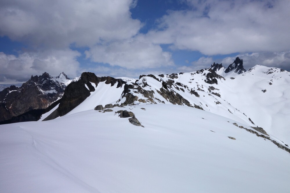
From the lake, we continued north through open forest, eventually rounding the lower shoulder of White Peak's West Ridge before working our way onto a snow-covered talus slope where seemingly every third step punched through into a void below. It was obvious conditions wouldn't improve on the return, but as before, we'd deal with that bridge when we came to it. Travel improved substantially after crossing a minor saddle into the upper lake basin south of Mount Oleg and Mount Olds. We skirted the mostly frozen lake along its western shore and headed up gentle slopes toward the final headwall separating the two peaks. Here the wallowing resumed. Progress slowed considerably as we slogged through punchy snow toward the broad saddle above. By this point, I was feeling pretty spent and more than happy to let Wes continue breaking trail. A couple of steeper pitches remained between us and the summit, and I simply put one foot in front of the other, mindlessly following Wes's tracks until there was no more Oleg left to climb.
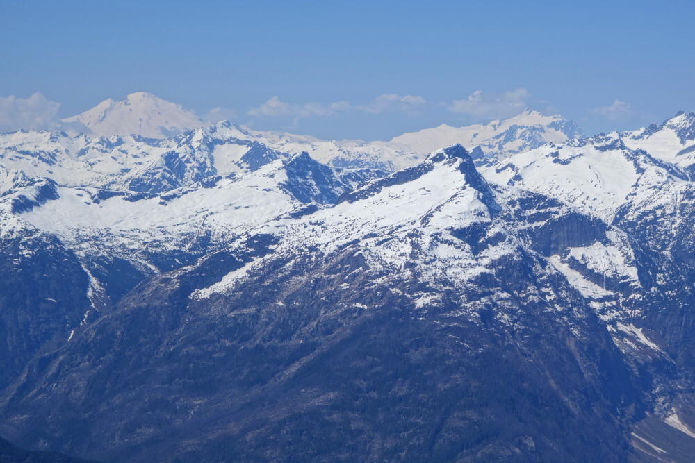
Finally, after about six gruelling hours, we stood atop Mount Oleg enjoying a glorious 360-degree panorama. Highlights for me included the views southwest toward Pemberton and up the Green River Valley beyond. The Joffre Group looked fantastic, as expected, but perhaps most satisfying was looking across the upper Place Glacier toward Cirque Peak, where I had stood some sixteen years earlier. That said, the standout view was down Oleg's East Ridge toward the saddle we had just crossed, with the prominent summit horn of Mount Olds rising immediately beyond—a perfect expression of alpine grandeur.
After about forty chilly minutes on top, we turned around and retraced our route. The various sections that had concerned me earlier proved every bit as problematic as expected. On the talus slope, I found butt-sliding through the worst of the punchy snow to be a far more efficient and less injury-prone alternative than trying to walk. Shortly below White Lake, I punched through to my waist despite wearing snowshoes. There was no telling how deep the void beneath me actually was, as I found myself dangling in space while attempting to extract myself. Then came the steep forested section, which was both too steep for snowshoes and too punchy without them. I chose the former, backing carefully down the slope facing inward. It was slow, sweaty work in the full afternoon sun.
Having had enough of the snow by that point, we decided to descend directly down the immense avalanche path and enter the forest at the first reasonable opportunity, whatever bushwhacking awaited us below be damned. Too tired and annoyed to stop and put crampons back on, I slip-slid my way down the firm-ish debris to the broad snow apron below, where I once again found myself punching through to my knees. Ugh.
Eventually we followed the creek as long as practical before diving into the forest for the final bushwhack back to the FSR. In truth, it wasn't all that bad—just indirect, with constant weaving around uneven terrain and dense vegetation. Still, crossing the cutblock and finally stepping back onto the road was a huge relief after so many hours of tedious travel. About eleven hours after leaving it, we returned to the truck. I'm glad we got it done, but speaking only for myself here, I'm pretty sure I'm good and done with the Place Glacier area now. A second visit was enough to remind me just how spectacular the scenery is—and just how much work it takes to get there!
Ruby Mountain - North Route via Happy Creek Falls Trail, April 2025
My second go at this one, having been stymied the previous year just below the alpine by steep, unconsolidated snow overlying a bomber crust. It was a no-go for snowshoes, with every step sloughing away thanks to the firm layer beneath, and too labour-intensive to plow through without them, especially considering the distance we still had left to cover—an "epic" in the making. Then there was the avalanche concern. It was quite warm out, and the roughly foot-deep surface snow wasn't bonded to the crust at all. We looked around for alternatives, but they all led toward an obvious gully descending from the peak's North Face, likely loaded and ripe for a trigger. For me, that put the kibosh on pursuing the summit any further, despite Wes, in his usual carefree manner, pushing on. Ought to know better by now, and heeding my better judgement, I called it.
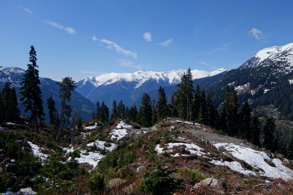
Fast forward a year, almost to the exact same date, and once again I found myself hiking up the Happy Creek Falls Trail—this time solo and hopeful for a happier outcome. Fortunately, unlike the year prior, the highway wasn't gated at the Ross Dam Trailhead, and I didn't have to sneak through the bush beside the highway for half a kilometre just to reach the normal starting point. Up through the forest I went, eventually reaching the falls at the end of the maintained trail, where an obvious climber's path takes over. Following this route generally east of Happy Creek, I worked my way through the forest to a clearing where the first glimpse of the objective finally revealed itself overhead.
The trail more or less ends here, and since this is primarily an early-season route, you ideally want enough snow to cover the alders and bushy nonsense that comes next. Sadly, winters haven't been what they once were around these parts, so with little snow covering anything at this elevation, I continued up and left across a talus slope, soon encountering one of a couple of parties I'd cross paths with that day. This pair had skis strapped to their backs, and I couldn't help but wonder whether the optimal ski season for this route had already passed. No words were exchanged, and we all continued on our way.
Up and across the talus, followed by a steep but mercifully short traverse through forest, brought me to an upper clearing. This area was already choked with alder, but with continuous snow coverage from here onward, it wasn't too difficult to tease out a route up the creek drainage and onto the open slopes above. Mind you, it was barely manageable in snowshoes, and I remember thinking how much more annoying it would be with skis. You'd really have to want to ski this thing to make it through here.
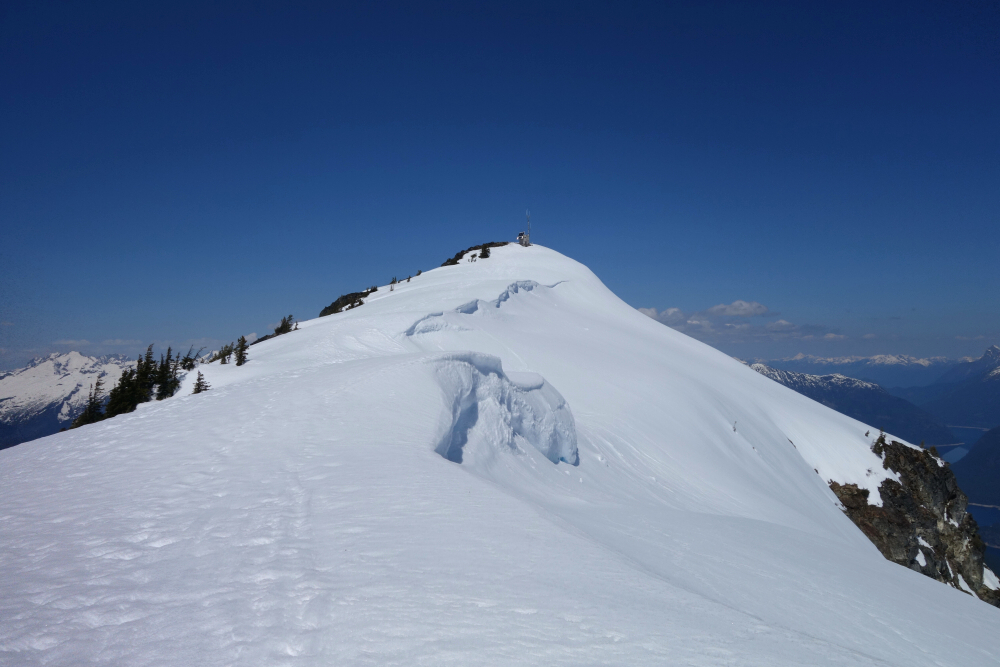
Travel improved considerably beyond that point. On the descent, however, I avoided the punchy afternoon snow through this section for fear of punching through and ending up in the rushing creek below. The forest immediately to climber's left provides a reasonably safe alternative. Next came a broad, mostly treeless "alder meadow" before I found myself back at the previous year's turnaround point. A steep forested pitch followed, this time with much better travel, leading onto the open slopes above and finally revealing the remaining distance to the summit. Breaking trail through a good six inches of slop, I worked my way upward over a series of rolls, each taking a little more out of me than the last. My pace slowed considerably, but upward and onward, as they say. Before long, I found myself staring up at the final steep pitch leading to the summit ridge. Old tracks were visible, though mostly filled in with fresh snow and offering little assistance. The reflected solar radiation and complete lack of breeze turned this section into a bit of a furnace, further adding to the struggle. I reached the ridge crest just before my vastus medialis seized up completely and stopped for a much-needed hydration break before tackling the final hop, skip, and jump to the summit—which, in my exhausted state, seemed to stretch on forever.
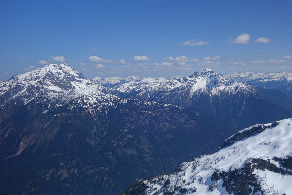
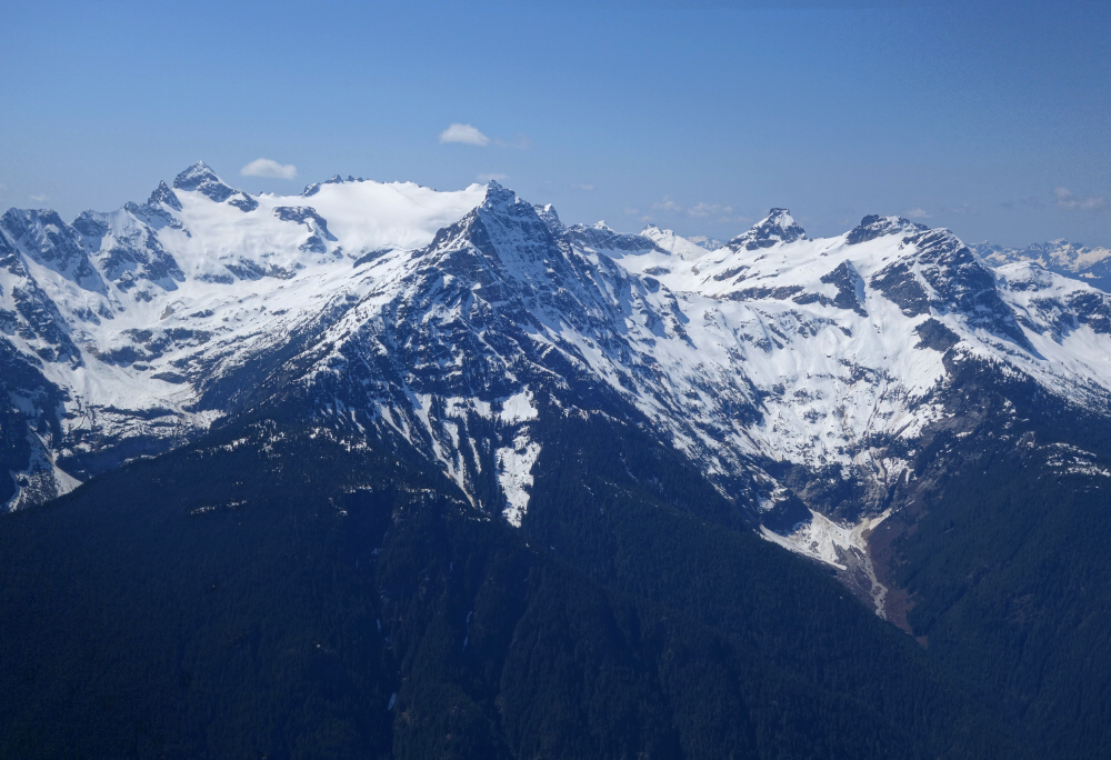
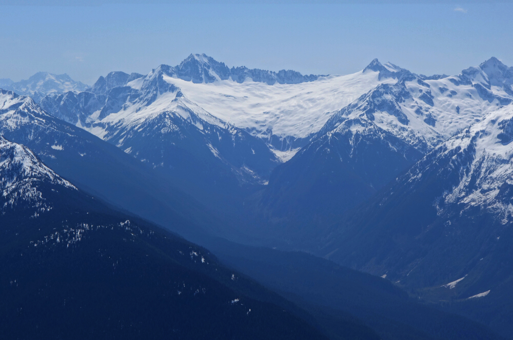
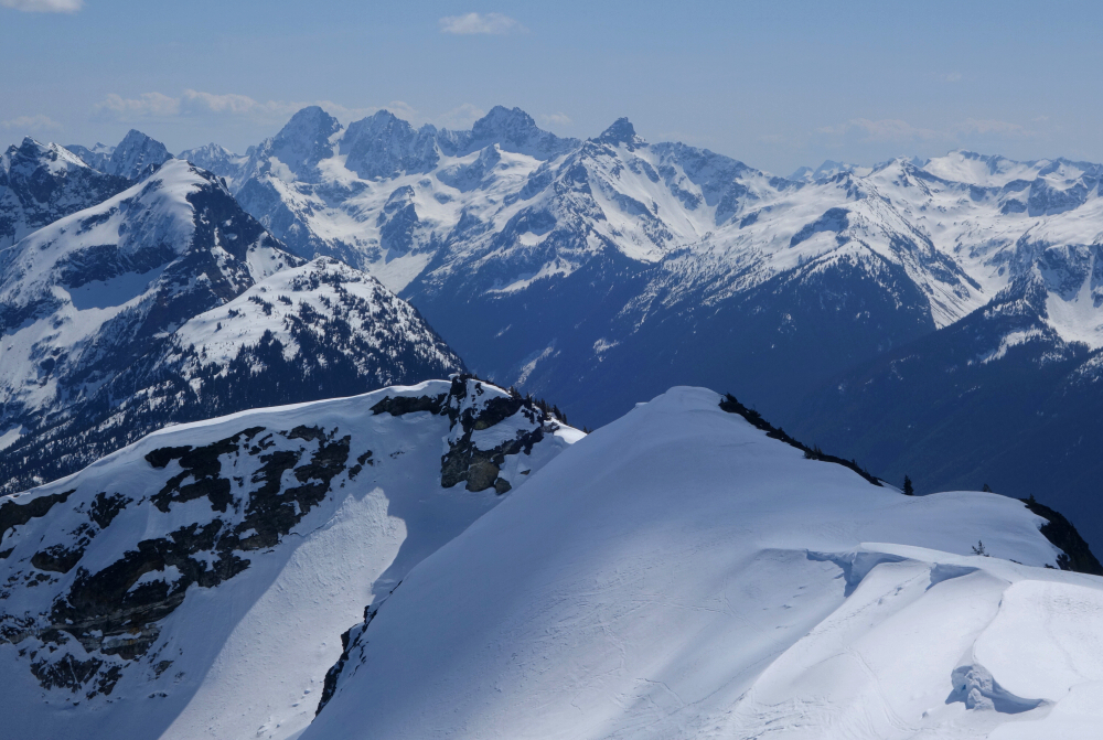
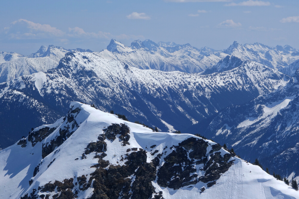
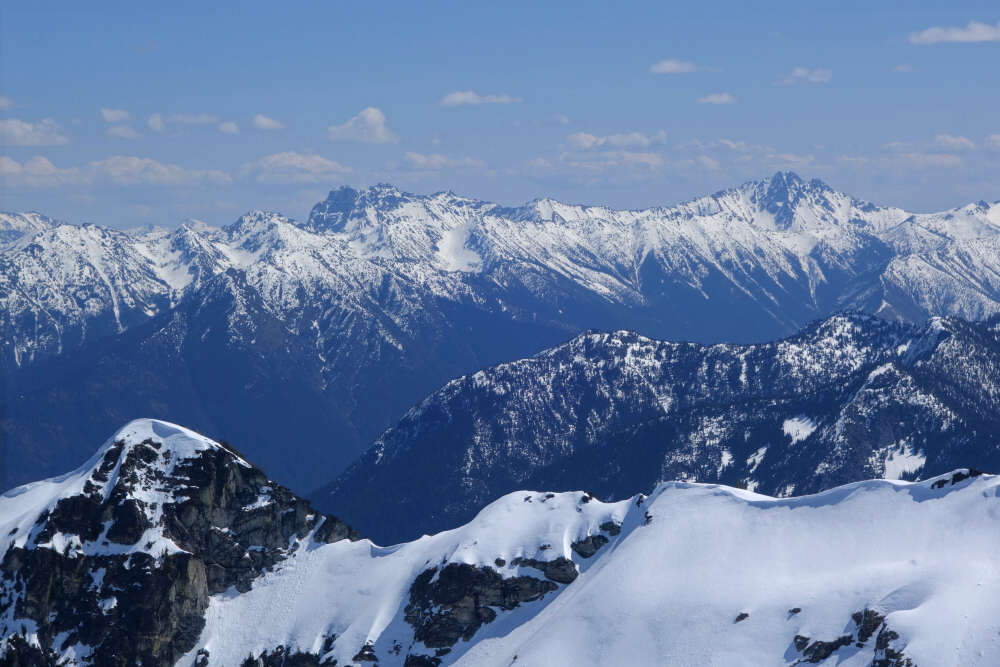
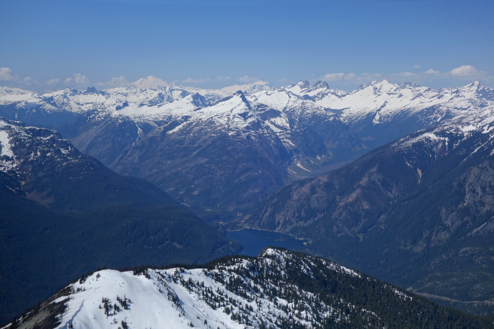
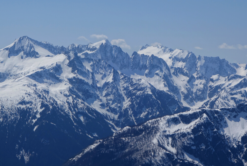
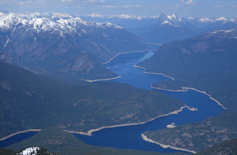
But forever eventually ends, and there I was at last, standing among the communications equipment on top, savouring the hard-won fruit of my labour. A trip up Ruby is primarily about the views, as it sits smack in the heart of North Cascades National Park. The obvious standout is Ross Lake, stretching away directly north of the summit. That view alone was enough reason to come back and finish the job. Other highlights, if I can remember them all, included Jack and Crater Mountains, Snowfield Peak and company, the mighty Boston Glacier with Buckner, Boston, and Forbidden towering above, the peaks of Ragged Ridge with the Rainy Pass, Easy Pass, and Washington Pass peaks beyond, Goode Mountain, Mount Logan, the Pickets, the magnificent McAllister Glacier peaks, Mount Redoubt, Mount Spickard, Bacon Peak, Mount Blum, and finally Mount Shuksan and Mount Baker off in the distance. Put another way: an epic view.
Several long glissades made quick work of the descent, and along the way I finally encountered the ski party from earlier, along with a couple of others slowly grinding their way upward. And here I thought my progress had been slow. Clearly, the skis had bogged them down where the alder was thickest. Yeah, no thanks.
All told, it came to five hours up and three and a half hours down, where Agata and Pepper were waiting in the campervan with cold refreshments at the ready. Some peaks are worth going back for despite the disappointment and effort of a failed first attempt, and Ruby is most certainly one of them. If there's a better perch overlooking Ross Lake and the surrounding North Cascades, I've yet to find it. Some summits are memorable because they come easily; others because you have to earn them. Ruby firmly belongs in the latter category.
The time had come to get outta dodge and blow the cobwebs out of the Eurovan Camper's tailpipe. I had designs on Ruby Mountain out by Ross Lake now that Highway 20 had reopened, but since this was more of a "family" outing, we first continued on to Mazama to spend a couple of relaxing days with friends at their cozy place off Lost River Road.
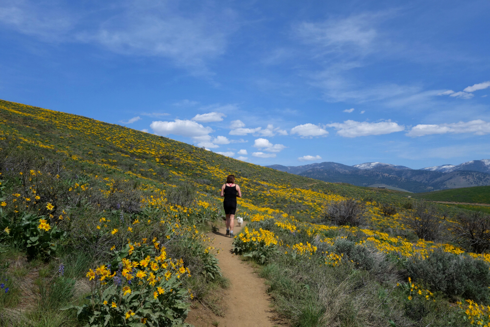
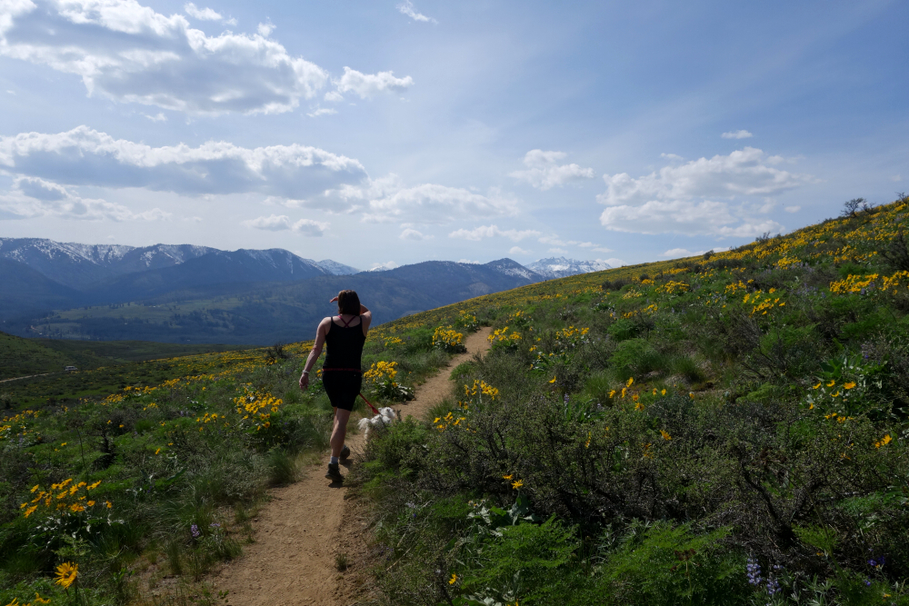
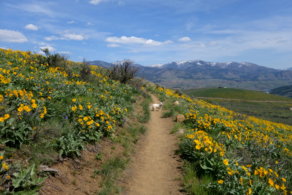
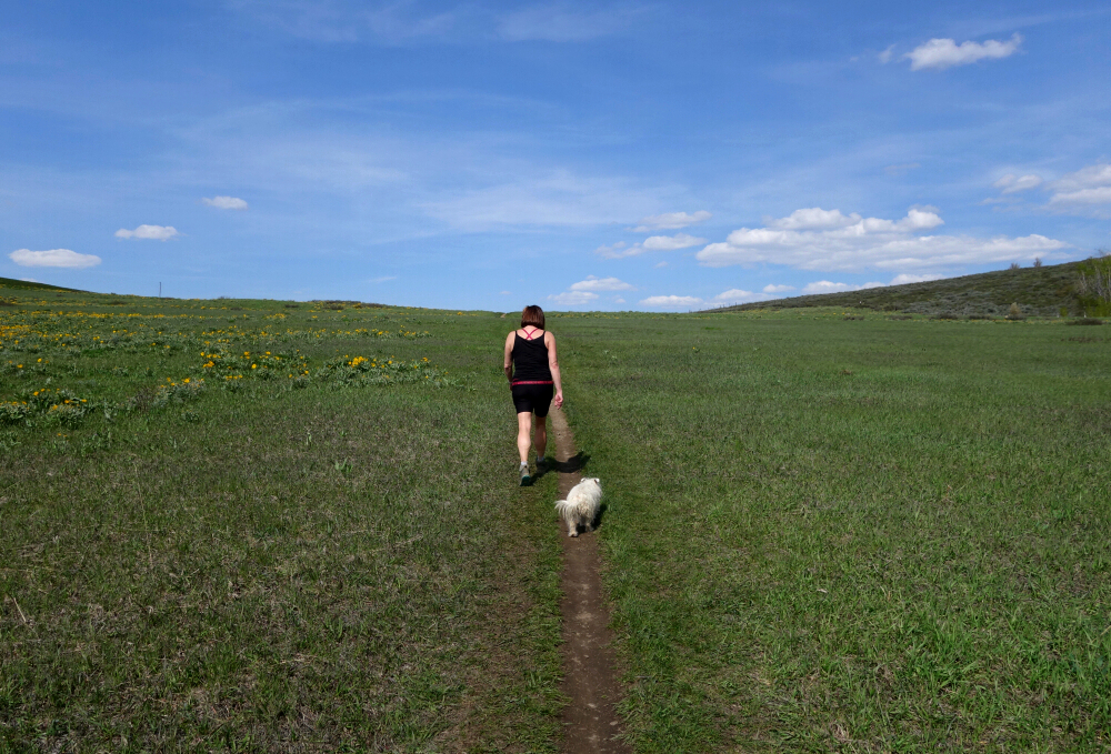
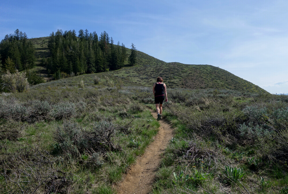
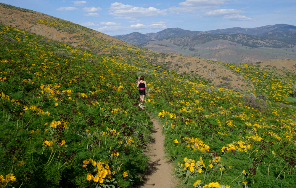
No cragging for us this time, despite Annette and Jerry having spent years establishing routes up and down the valley. If I'm being honest, we haven't really climbed at the crag in years—lost interest, I suppose. These days peakbagging is more my thing, as lame as that may sound to some. With that in mind, we motored over toward Winthrop the following day to bag the "mighty" Lewis Butte. Nothing especially exciting on paper, but with excellent trails and balsamroot flowers exploding across the hillsides, it proved to be exactly what the doctor ordered for a pair of vitamin D-deprived North Vancouverites.
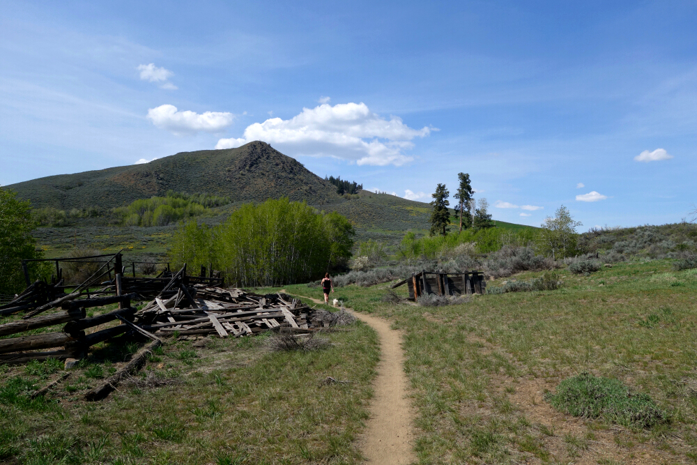
Starting from the parking area off Gunn Ranch Road, we headed up the Lewis Butte Trail, taking the left fork at the second switchback. The plan was to make a loop of it, so we continued northwest along the trail for a while, passing a collapsed old barn before arriving at another trailhead parking area. Picking up the trail again from the north end of the lot, we continued a short distance to a fork at a saddle. A right turn here put us back on the Lewis Butte Trail proper for the final ascent to the summit.
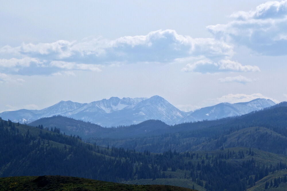
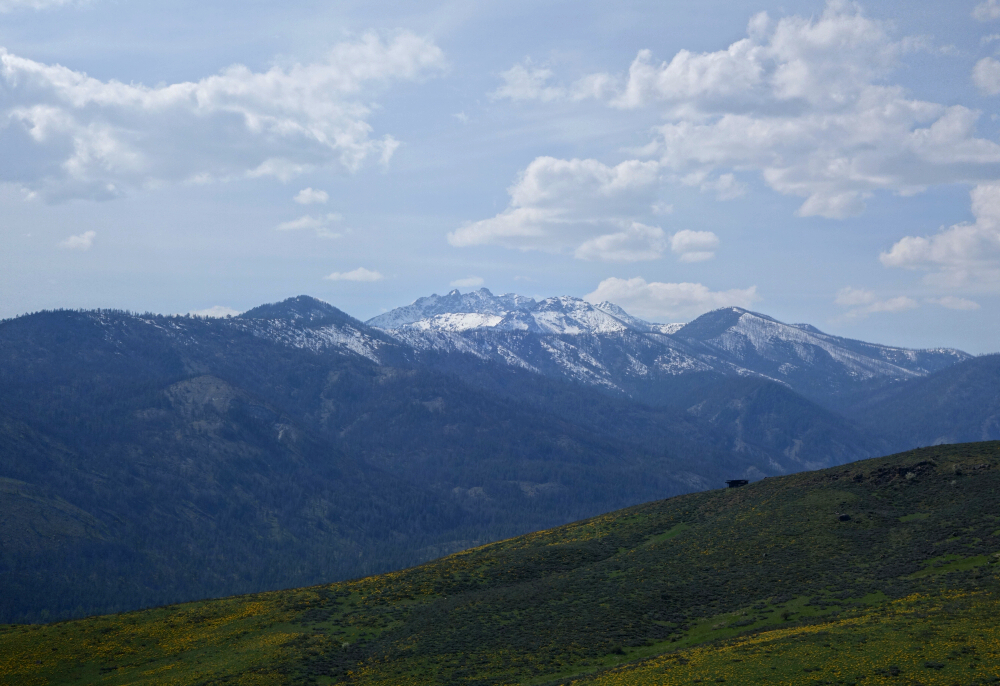
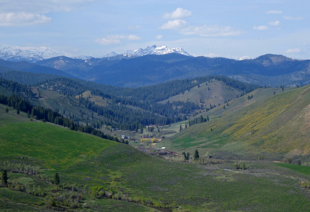
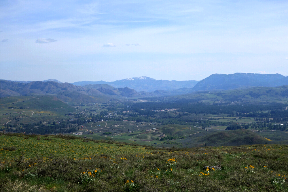
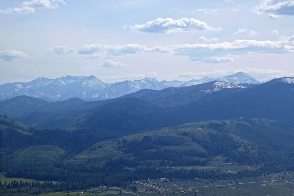
Lovely views awaited us overlooking the Methow Valley toward Winthrop and beyond. A couple of prominent peaks also stood out on the horizon—I believe these were part of the Big Craggy group to the north, with Abernathy and Gardner farther west. None of those are on my tick list yet, though we did once heli-ski from very near Gardner's summit, which was absolutely epic. Needless to say, they may now be finding their way onto the ever-expanding list.
We descended Lewis via the switchbacks on its south flank, winding down through a sea of blooming balsamroot—very nice to see in full force. Before long, we were back at the trailhead and making a beeline for Mazama, where cold beer and a soak in the hot tub awaited. All in all, a nice little prelude to the bigger day on Ruby still to come.
It would be very much appreciated if you please ask before copying and/or re-publishing content from any part of these pages. To do so, please click here to send a message via feedback form.


