


Borah Peak - Southwest Ridge, August 2010
 with Southwest Ridge visible on right skyline.")
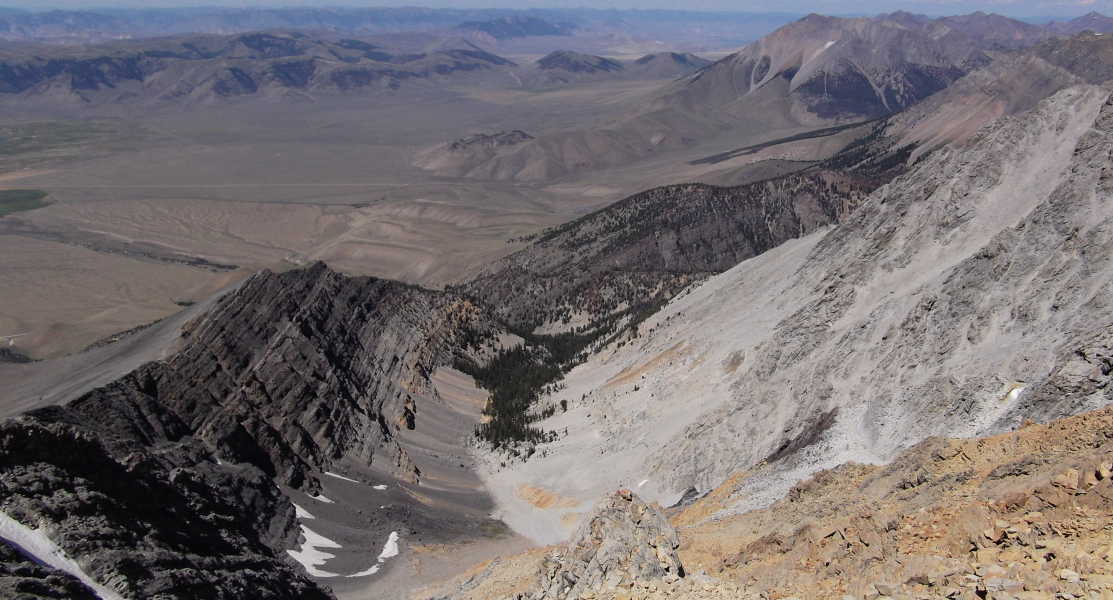
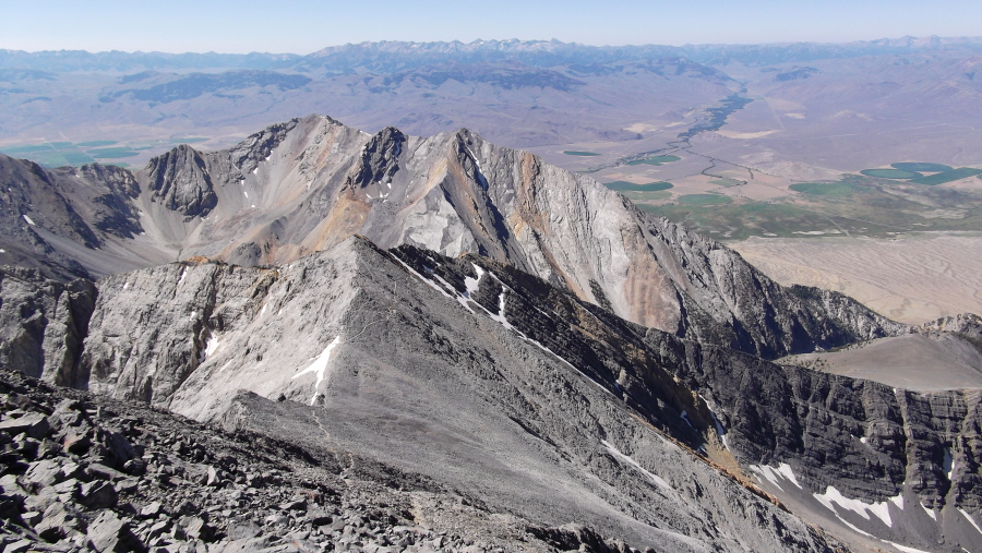
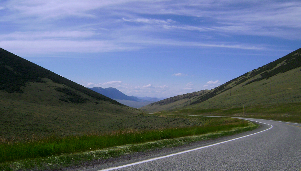
Borah Peak is the 12,662-ft monarch of the Lost River Range and the highest mountain in Idaho. The standard Southwest Ridge route is a third class scramble in late summer, ascending 5,262 vertical feet from the trailhead to the summit in just over 3.5 miles. Alternately referred to as "Chicken-Out Ridge", this is generally considered to be the primary route used to ascend the peak. Although short, the approach involves considerable elevation gain, making for a continuously steep hike in order to reach the start of the route's namesake feature. Rising on either side of the Lost River basin, these peaks have that classic American Wild West look. Adding to the effect, soft sagebrush greys blend with the yellowish sun-baked scrubland of late summer, reminding me of the scenery along I-15 through Montana and Idaho. I conveniently found myself passing through this wild and desolate area while taking the scenic route back to Seattle following my trip to Grand Teton, Yellowstone and Craters of the Moon. What better way to wrap up a climbing and sight-seeing trip to some of the nation's most scenic destinations than with a casual scramble on Borah's Southwest Ridge!
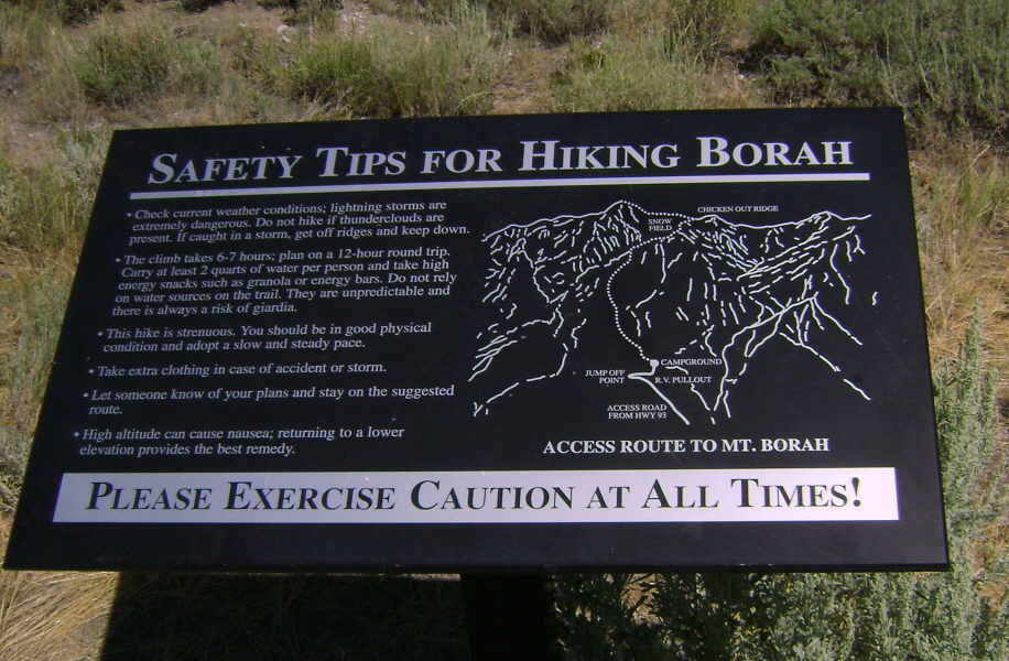
There's a cautionary sign at the trailhead for the multitudes drawn to this peak by its highpoint status. It suggests that the climb takes 12-hours round trip, which seems a bit excessive to me. Of course climbing there in the spring or winter would be more challenging and time consuming. This route begins at an elevation of about 7200 feet. The steep but well maintained trail leaves the trailhead parking/turn-around area and ascends a forested drainage before switchbacking steeply to reach the scree and talus slopes below the ridge crest. I passed a father and son party hiking up the trail and proceeded to close-in a solo climber ahead of me. Despite the route's apparent popularity, these were the only other parties I encountered on the mountain that day...nevermind the threesome gleefully snoring away in their bivies near the trailhead early that morning.
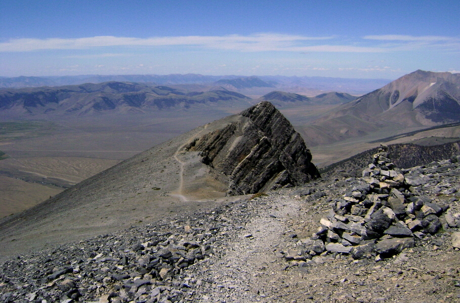
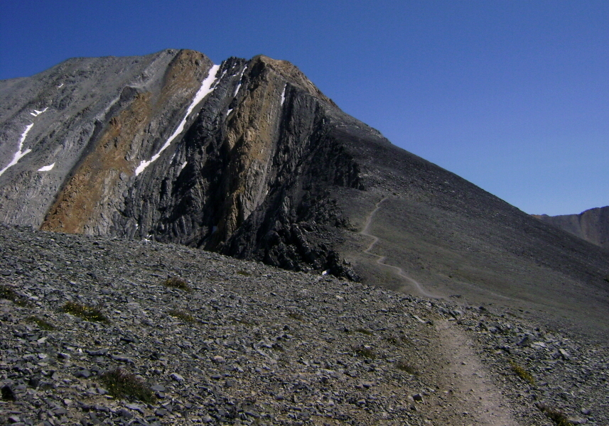
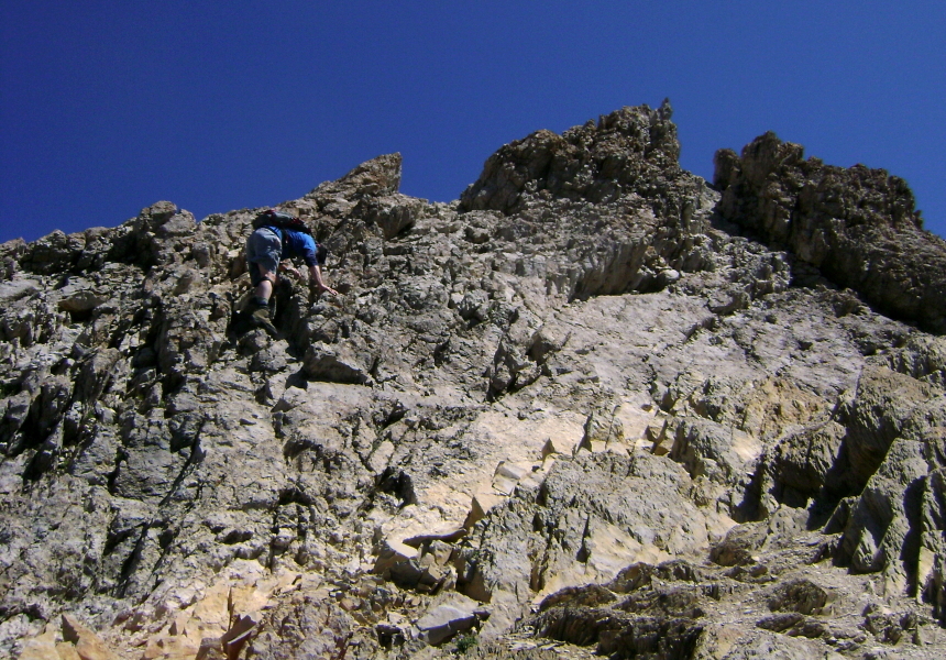
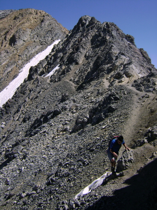
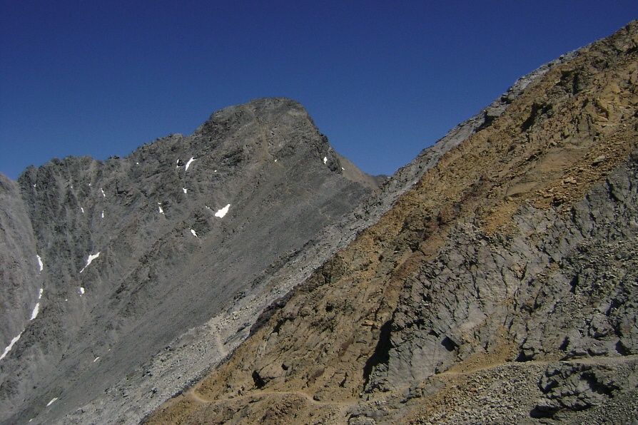
The rock early on the route is relatively solid, and with occasionally moderate exposure if one stays on the crest proper. It made for suprisingly fun scrambling! A brief section of trail interrupts the scrambling. For those looking for an easier alternative, the trail can be followed from this point onwards traversing below the ridge before reaching the saddle below the summit. As the trail veers left away from the ridge however, I found it more interesting to continue directly on the crest for some of the best scrambling the route has to offer. A short but tricky downclimb leads to a small snow saddle followed by some steeper climbing up a broken wall of yellowish rock. So-called "Chicken-Out Ridge" eases back considerably after a short pitch of steeper rock and leads to a broad saddle before the improbably loose slope below the summit proper. I met David Kellogg on Borah's summit and together we took in the views and discussed various aspects of life, politics, the economy, mountains, skiing and New Zealand of all things. Despite being an avid hiker, this was his first time on Borah as well. After a good 30 to 45 minutes up on top, we reluctantly began the descent this time sticking to the ridge crest down from the summit before traversing back right to meet the loose trail leading to the saddle. Staying on the trail for most of the remaining descent, we made it back down to the trailhead in reasonably good time.
It is safe to say that this trip insipred a newfound curiosity and interest in the mountains of Idaho. This part of the state bears little resemblance to the panhandle area up north, and for this peakbagger at least remains full of allure and discovery. I stopped in Pullman, WA on my way back home to reconnect with my old stomping grounds. It's been, what over 10 years since I visited last-where better to pay tribute to my alma mater than by downing a brewski or two at the (almost) on-campus pub: The Coug or whatever they call the place now? Unfortunately, a lack of available parking quickly reminded me how many parking tickets and wheel locks I endured during my tenure there and I decided to grab a burger and a beer at one of my other all-time favorite watering holes-Rico's Tavern, instead. I was however quite pleased to see that some things haven't changed at all in the intervening years. They make a big fuss these days about using hands-free devices or texting while driving etc, but I assure you that a loop through greek row this time of year will give you a new appreciation for distracted driving!
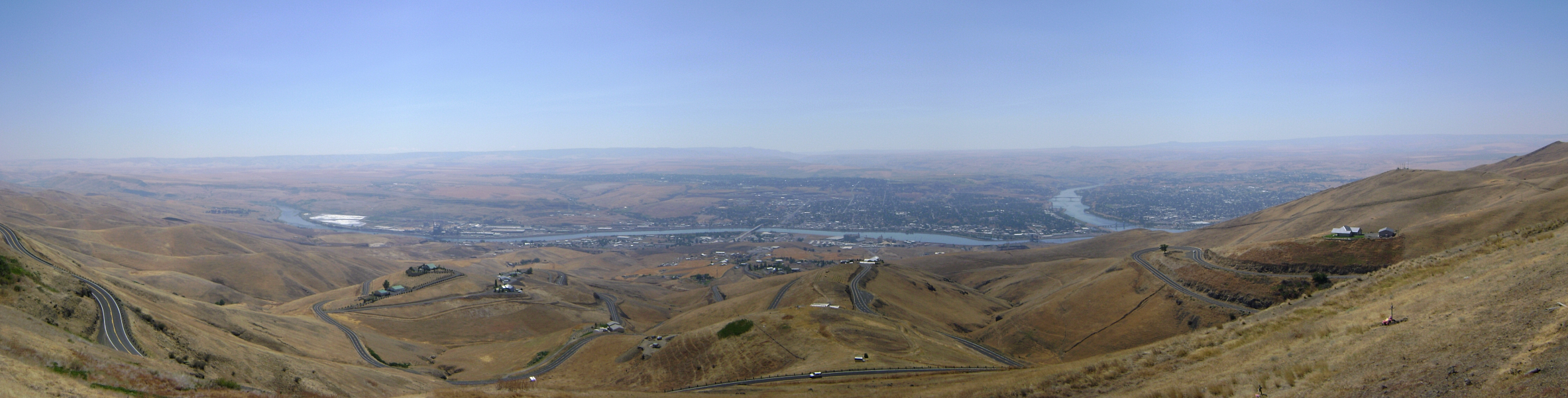
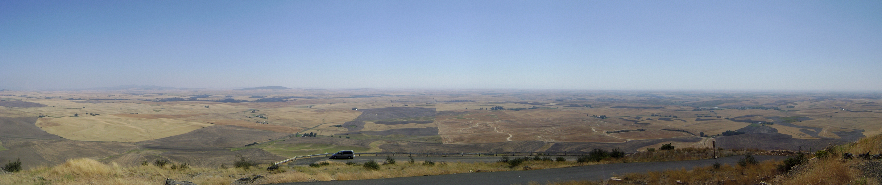
I made a couple quick detours to check out some other aspects of the local scenery before finishing-up the long boring drive back to Seattle. The view from the large pullout on ID-95 overlooking Lewiston and Clarkston gives a great perspective on where the borders of ID, WA and OR meet. Probably the best place to survey the Palouse from however, would be Steptoe Butte near the town of Steptoe. A quick drive up to the overlook on top yields expansive views in all directions. I used to think the Washington Lottery commercial titled Birds was filmed here, but now I'm not so sure anymore. In any case, now that I was finally done with sightseeing on this trip, I made a beeline for the interstate to return to my home in the land of Gray Skies and Strong Coffee.
Click here to view photos.
![]()


