Last Updated: April 2, 2024


Start

Recent content updates are viewable under what's new.

Reports in the queue for posting are coming soon!

Upcoming reports & photos:

Oh my! Quite the backlog here, eh?

  • Slahanay Peak - hike/scramble (April 2023)
  • American Mountain & Mount Lincoln - hike/snowshoe (May 2023)
  • Mount Mclean Attempt, Red Rock Trail, Dragons Back Trail - hike (May 2023)
  • Stawamus Chief (South, Middle & North) - hike/scramble (June 2023)
  • Flint & Feather - hike/scramble (June 2023)
  • Goat Ridge (Squamish) - hike (June 2023)
  • Grouty/Mortar Peaks - hike/scramble (June 2023)
  • Pebble-to-North Creek Traverse incl. Pebble, Thiassi, Wesley & Sugus - hike/scramble (July 2023)
  • Mount Truax - hike/scramble (July 2023)
  • Blackcomb Buttress - rock climb (July 2023)
  • Whitecap Peak - hike/scramble (July 2023)
  • Mount Hanover - hike/scramble (August 2023)
  • The "Long Traverse" incl. Long, Tynemouth, Arrowhead, Tabletop & Anemone - hike/scramble (August 2023)
  • Armchair Traverse - hike/scramble (August 2023)
  • Snowspider Mountain - hike/scramble (September 2023)
  • Mount Trorey - hike/scramble (September 2023)
  • Macleod Peak - hike/scramble (September 2023)
  • Ben Lomond - hike/scramble (September 2023)
  • Mount Killam & Gambier Island - hike (September 2023)
  • Lone Goat & Snow Camp Mountain - hike (September 2023)
  • Isollilock Peak - hike/scramble (October 2023)
  • Manson - Hatfield Traverse - hike/scramble (October 2023)
  • Gargoyles & Columnar Peak - hike/scramble (October 2023)
  • Opal Cone and Lava Glacier - hike (October 2023)
  • Park Butte (WA) - hike (October 2023)
  • Trappers Peak (WA) - hike/scramble (October 2023)
  • Rattlesnake Ledge (WA) - hike (November 2023)
  • Sauk Mountain (WA) - hike (November 2023)
  • Mount Daniel & Pender Hill (Sunshine Coast) - hike (November 2023)
  • Mount Dickerman (WA) - hike (November 2022)
  • Winter's End (Verona Peak) - hike/snowshoe (November 2023)
  • Dolomites (Italy) - snowboarding (December 2023)
  • Red Rock Canyon (NV) - hike (January 2024)
  • Flute & Oboe - split tour (February 2024)
  • Whistler misc. (Train Wreck, Loggers Lake, Shadow Lake etc.) - hike (February 2024)
  • Mount Underhill - hike (March 2024)
  • Bombtram Mountain - hike/snowshoe (March 2024)
  • Steep Peak - split tour (March 2024)
  • Ruby Mountain (WA) - hike/snowshoe (April 2024)
  • Blustry Mountain - hike (April 2024)

*As of 04/17/2024


Database

Query the reports database, selecting from criteria which include name, location, type, season etc.

Quick Links

Essential links & whatnot:


Jump To

Select from list below to jump to a specific area on this site.


| Featured Trip Report |


Last Updated: Mar. 25, 2002

Mount Daniel - East Peak, August 2000
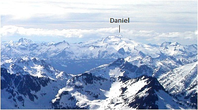


Mt Daniel along with neighboring Mount Hinman is one of the largest glaciated peaks of King County, Washington. Its modest elevation belies the fact that its slopes hold three substantial (and rapidly retreating) glaciers. The dome-like structure of these peaks, which allows for a very large accumulation of snowfall is likely responsible for a relatively large amount of glacial ice existing here at such a low elevation. In any case, it was to be a warm, sunny weekend in August and after reading Jim Nelson's description of Mount Daniel the 'Selected Climbs - v.1' guide book, I was inspired to climb this interesting glacier-clad peak. Joined by Chris and Tim, we drove out to Cle Elum for some last minute supplies and turned onto a gravel road for a dusty ride to the trailhead. A trip out to Mount Daniel's East Peak entails an easy trail approach followed by low to moderately angled snow slopes and a final easy scramble near the top. Its position just east of the Cascade Crest also makes for better weather as well as some uniquely scenic views.

We gained the ridge that afternoon and set up camp on a level area next to a small lake, similar to the one pictured. The mosquitos were voracious that evening. Tim decided to stay at camp that next morning as he didn't have adequate footwear and wanted to relax by the lake. Chris and I wished him well and set out on our way. We followed an obvious trail that led directly to the base of Cathedral Rock. We figured that the route continued along ledges on Cathedral Rock and so we climbed up short sections of rock to a series of level benches. We traversed below some cliffs, lost the trail and spent the next couple hours negotiating tricky chutes, gullies, scree slopes and steep brush-covered slopes en route to Peggy's Pond. The actual trail traverses the slope below us and leads directly to Peggy's Pond.

Eventually we reached Peggy's Pond with a high point on the long Southeast Ridge of Mt. Daniel somewhere north of Circle Lake visible behind. Alpine meadows soon gave way to broad red algae colored snow slopes and the long slog began. We angled to our left towards the ridge and once on top had very scenic views of alpine lakes still melting out from the winter. Excluding our navigational issues, we made it to the summit in good time. We were soon accompanied by two others, and together took pictures and named off the familiar peaks. Mount Stuart, Colchuk and Dragontail Peaks rise prominently behind us. The top of Cathedral Rock can just be seen above Chris' left shoulder. We stopped back at our camp site on our return and took a refreshing dip in the lake. Good times!

Click here to view photos.
home | email | copyright

All photos and text for sverdina.com are copyright © 2002-2024

It would be very much appreciated if you please ask before copying and/or re-publishing content from any part of these pages. To do so, please click here to send a message via feedback form.

Thank You.

©2024 sverdina.com |