Last Updated: March 4, 2023


Start

Recent content updates are viewable under what's new.

Reports in the queue for posting are coming soon!

Upcoming reports & photos:

Oh my! Quite the backlog here. Busy with life and adding to the queue every chance I get...

  • Flute & Oboe - ski tour (March 2022)
  • Suicide Bluffs - snowshoe (April 2022)
  • Slalok Mountain - ski tour (April 2022)
  • Dam Mountain, Little Goat, Thunderbird Ridge - snowshoe (May 2022)
  • Leading Peak - hike/scramble (June 2022)
  • Camelshoof Mountain - hike (June 2022)
  • Askom Mountain - hike (June 2022)
  • Metal Dome - hike (July 2022)
  • Mount Sproatt - hike (July 2022)
  • Mission Ridge/Peak - hike (July 2022)
  • Harris Ridge & Nea Peak - hike (July 2022)
  • Three Brothers Mountain - hike (July 2022)
  • Zupjok, Llama & Alpaca Peaks - hike (July 2022)
  • Shulaps Mountain - hike/scramble (August 2022)
  • Mount Sheer & Ben More - hike/scramble (August 2022)
  • Cathedral Mountain - hike/scramble (August 2022)
  • Mount Penrose - hike/scramble (August 2022)
  • Caltha Peak - hike/scramble (September 2022)
  • Beauty Peak - hike (September 2022)
  • Markhor-Needle Traverse & Flatiron - hike/scramble (September 2022)
  • Conway Peak - hike (September 2022)
  • Green Mountain/Pk 2200 - hike/scramble (September 2022)
  • Mount Brew (Whistler) - hike (September 2022)
  • Mount Barbour - hike/scramble (October 2022)
  • Mount Gillespie - hike/scramble (October 2022)
  • Cougar Mountain - hike/scramble (October 2022)
  • Barn Bluff (Red Wing, MN) - hike (October 2022)
  • Mount Steele - hike/snowshoe (November 2022)
  • Hunter Lookout - hike (November 2022)
  • Belcarra Mountain - hike (November 2022)
  • Oyster Dome - hike (November 2022)
  • Mount Thom & Cilliwack Mountain/Hillkeep - hike (December 2022)
  • Frenchman Mountain (Las Vegas, NV) - hike (January 2023)
  • Rolley Peak/Lookout - hike (January 2023)
  • Round Mountain - ski tour (February 2023)
  • Blowdown Peak - ski tour (February 2023)
  • Silverdaisy Mountain - ski tour (March 2023)
  • Spearhead Glacier/Husume Coulior - ski tour (March 2023)

*As of 03/24/2023


Database

Query the reports database, selecting from criteria which include name, location, type, season etc.

Quick Links

Essential links & whatnot:


Jump To

Select from list below to jump to a specific area on this site.


| Featured Trip Report |


Last Updated: Mar. 25, 2002

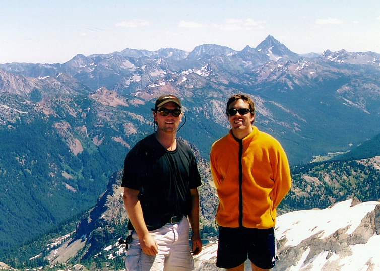
Mount Daniel - East Peak, August 2000


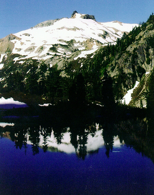
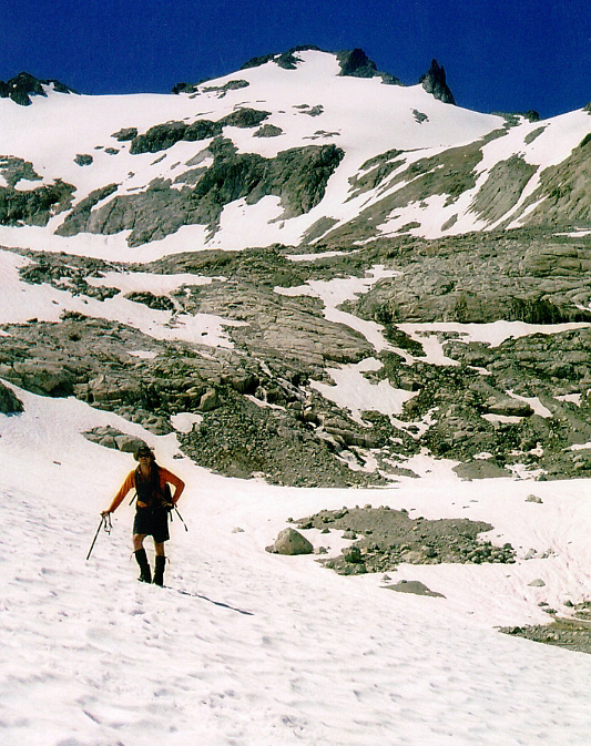
Mt Daniel along with neighboring Mount Hinman is one of the largest glaciated peaks of King County, Washington. Its modest elevation belies the fact that its slopes hold three substantial (and rapidly retreating) glaciers. The dome-like structure of these peaks, which allows for a very large accumulation of snowfall is likely responsible for a relatively large amount of glacial ice existing here at such a low elevation. In any case, it was to be a warm, sunny weekend in August and after reading Jim Nelson's description of Mount Daniel the 'Selected Climbs - v.1' guide book, I was inspired to climb this interesting glacier-clad peak. Joined by Chris and Tim, we drove out to Cle Elum for some last minute supplies and turned onto a gravel road for a dusty ride to the trailhead. A trip out to Mount Daniel's East Peak entails an easy trail approach followed by low to moderately angled snow slopes and a final easy scramble near the top. Its position just east of the Cascade Crest also makes for better weather as well as some uniquely scenic views.

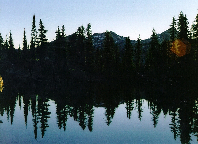
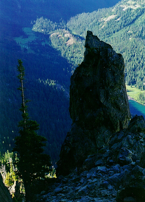
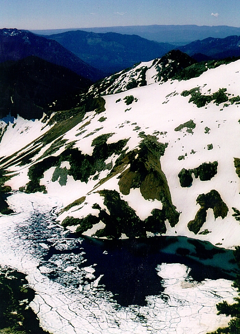
We gained the ridge that afternoon and set up camp on a level area next to a small lake, similar to the one pictured. The mosquitos were voracious that evening. Tim decided to stay at camp that next morning as he didn't have adequate footwear and wanted to relax by the lake. Chris and I wished him well and set out on our way. We followed an obvious trail that led directly to the base of Cathedral Rock. We figured that the route continued along ledges on Cathedral Rock and so we climbed up short sections of rock to a series of level benches. We traversed below some cliffs, lost the trail and spent the next couple hours negotiating tricky chutes, gullies, scree slopes and steep brush-covered slopes en route to Peggy's Pond. The actual trail traverses the slope below us and leads directly to Peggy's Pond. (more...)

Click here to view.
home | email | copyright

All photos and text for sverdina.com are copyright © 2002-2023

It would be very much appreciated if you please ask before copying and/or re-publishing content from any part of these pages. To do so, please click here to send a message via feedback form.

Thank You.

©2023 sverdina.com |