


Forbidden Peak - West Ridge, July 2002

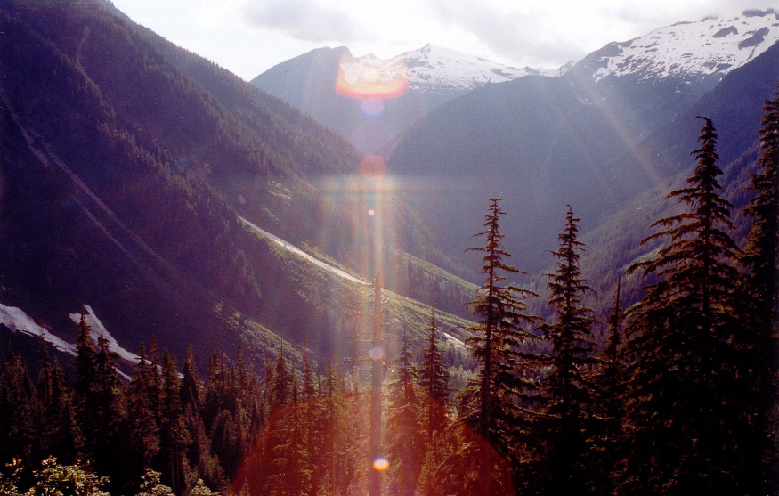
Considered one of the 50 "classic climbs" of North America, it was simply a matter of time before I felt I had what it takes to lead a climb of Forbidden Peak's West Ridge. And so, with a favorable weather forecast for a July weekend I made the call and together with Tom and Andy drove over to Marblemount early on a Friday afternoon. We secured the last available Boston Basin permit for the night and started making our way up the Boston Basin trail at 6:00pm that evening. We made good time hiking into Boston Basin. Despite having to slowly pick our way through a couple large swaths of forest flattened by what were surely massive spring-time avalanches, we still made it to camp in about two-and-a-half hours. We set up camp on some flattish rocks up high on the left side of the basin, below Forbidden's South Face. We awoke to low morning fog that burned off as the sun rose in the sky.
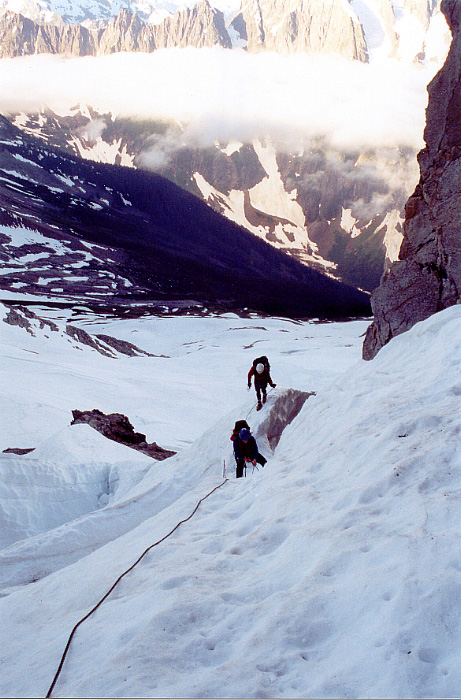
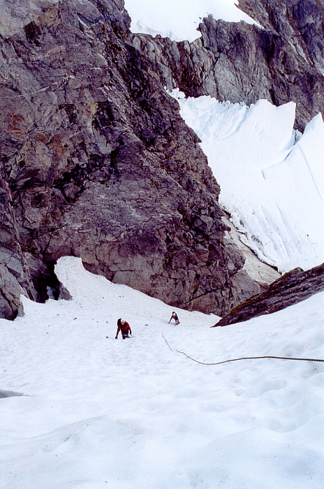
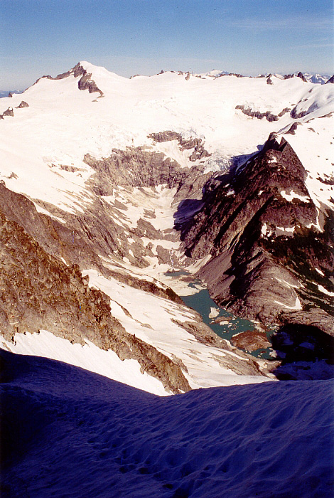
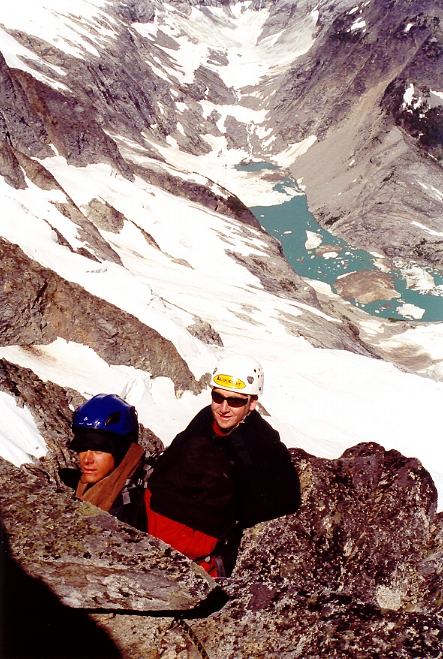
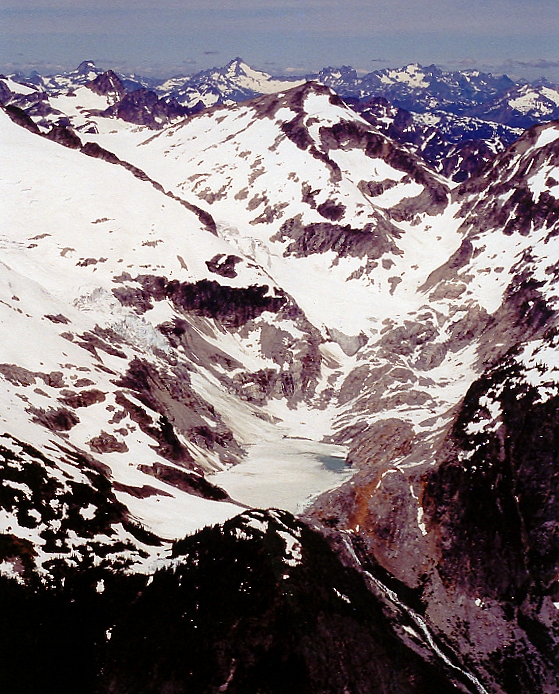
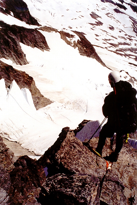
We walked straight up to the base of the couloir and roped up for the thin bergschrund crossing. Tom belayed Andy as he crossed over the snow bridge at the base of the West Ridge couloir. The couloir went at about 45/50 degrees. Firm snow made for enjoyable climbing. We reached the notch at the base of the West Ridge and were treated to spectacular views of Eldorado Peak and Moraine Lake. We belayed each other up the easier 4th class terrain lower down on the ridge to get a feel for how we would be able to manage a three-man team on a single 60m rope. While hanging out at the belay, I lost myself in the views of Spider Mountain, Dome Peak, Mount Formidable and Glacier Peak to the southeast. To the north lay Klawatti Lake with remote Primus Peak and Tricouni Peak behind it. Incidentally, Tricouni was a type of boot with nails for spikes sort of like an early version of crampons.
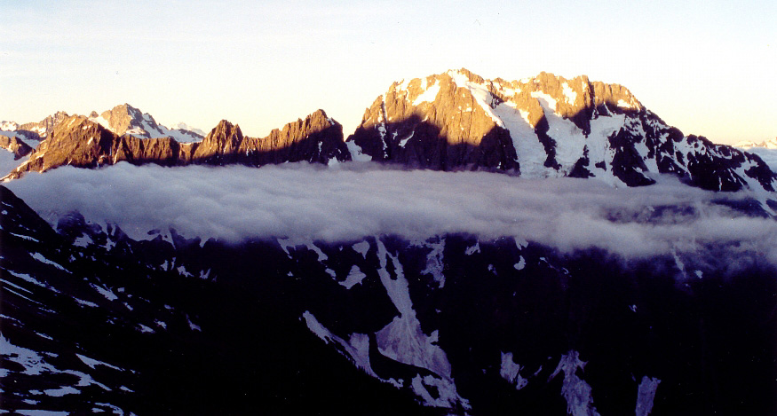
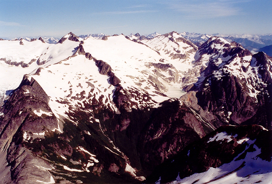
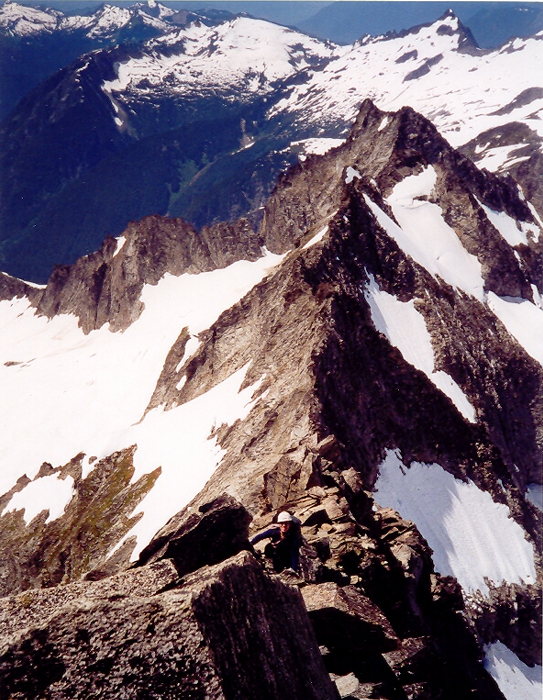
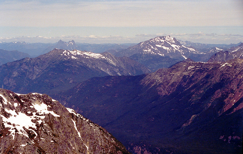
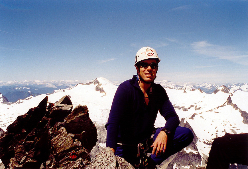
We switched leads and I led out for the remainder of the ridge. We started making good time on the rock and only stopped to belay the "crux" move somewhere half way up the ridge. It was a perfect day and summit views are among the finest that I have seen. One could virtually survey the entire horizon from the Olympics in the west to the snow-free peaks on the eastern fringes of the range. Klawatti Lake lay below us and we wondered what the prominent pyramidal snow clad peak in the distance was (Mount Redoubt). The mighty Boston Glacier lay at our feet with Mount Goode, Mount Buckner, and Boston Peak towering above all the rest. Jack Mountain and Hozomeen Mountain behind dominated the view to the northeast.
In summary, the route lives every bit up to its reputation of being a classic. The climbing isn't difficult (5.4) and though exposed, the ridge could be climbed un-roped with technical hiking boots. The rock is solid and offers great purchase with ample features for hands. We made about 3 or 4 rappells down the ridge before downclimbing back to the notch. Some choose to return via the East Ledges which is reported to be somewhat easier albeit exposed and loose. On the other hand, descent via the West Ridge takes about as long as it takes to climb it. We also rapped one rope length down the couloir and since a yawning moat prevented easy access to the various rap slings lower in the coulior, we had no choice but to face-in downclimb mushy snow to get past the sketchy 'schrund crossing. We then jogged and boot skied down the gentle snow fields back to camp and packed up...at which point we were for the first time approached by a climbing ranger wanting to see our climbing permits. Not five minutes earlier, I was talking how it would have been easy to poach a camp spot up in Boston Basin should we not have been able to obtain a permit. Fortunately we had ours this time!
Click here to view photos.
![]()


