


Grand Teton - Upper Exum Ridge, August 2010

Having contracted a bad case of road-tripperitis this summer, I settled on an alternate course of therapy and decided to let it run its course rather than attempt to fight it. With that in mind, I loaded-up the Passat for the umpteenth time since early June and motored across four western states for a much anticipated and long-awaited for climb of the Grand Teton. I partnered-up with Kyle Walcott on Mountain Project for the Upper Exum Ridge climb-my first time linking up with someone sight unseen for a technical climb.
Returning from 3 months in Alaska supporting ice climbing guides on the Matanuska Glacier, Kyle was making his way back to Salt Lake City via a somewhat indirect Anchorage-Idaho Falls-Grand Teton-SLC itinerary. I on the other hand had a day-and-a-half's worth of driving to slog through before rendezvousing with Kyle at Climbers Ranch within Grand Teton National Park. Speeding across I-90 for most of WA, ID and a good portion of MT, I turned south just west of Butte and continued on I-15 for what seemed like an eternity before entering Idaho for the second time that day. I poached the only available camp spot could find that evening-the camp host's-and high tailed it out of there first thing in the morning.
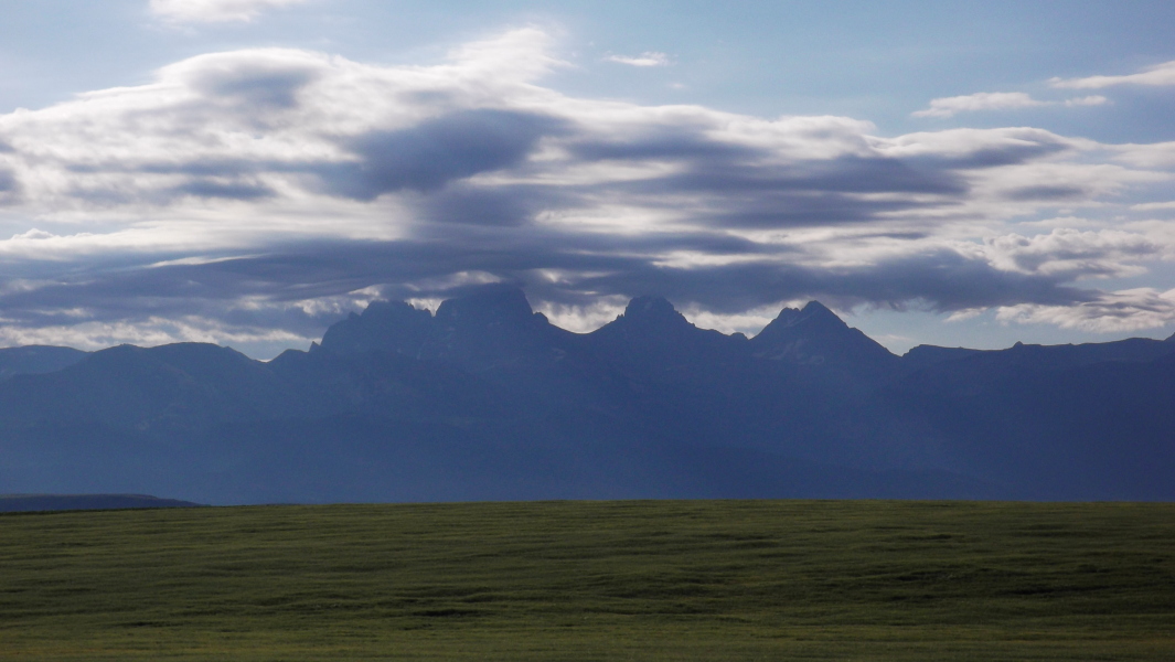
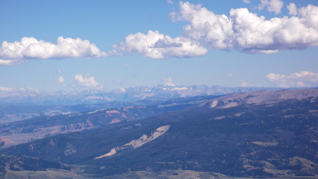
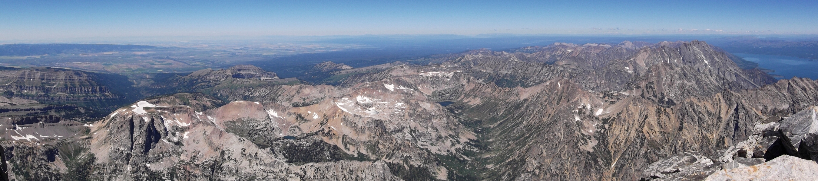
With broad, sweeping grassland valleys that rise up to form the mountain ranges flanking the I-15 corridor, the scenery here is the classic wild west inhabited by Marlboro Man. I wished I had more time to explore some scrambles in Montana's Bitteroots or the Lemhi Range of Idaho, but had a schedule to keep and so kept my foot firmly planted on the accelerator. Off in the distance to the east I began to make out a prominent series of peaks and wondered if these weren't in fact part of the Teton Range. By the time I turned off I-15 west of Rexburg there was no denying the fact that I was in fact eyeing the Tetons. For a mountain range so famously photographed from the broad Snake River Valley to the east, I hadn't expected such a striking profile also from the west.
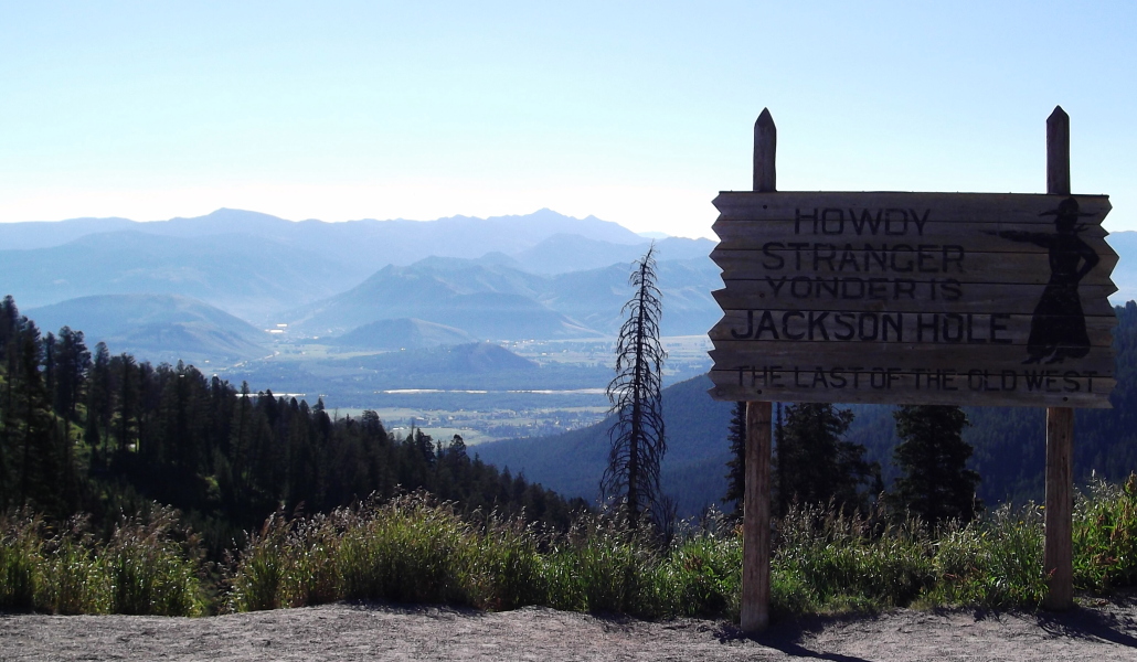
From 8429-ft Teton Pass I got my first glimpse of Jackson and the Snake River Valley. Having heard many tales of the "road runs" that are popular at or near the pass in winter, I struggled to keep my car on the road so intent I was at scoping out possible ski descents. One of these days I'll have to return here in the winter! After having rendezvoused with Kyle at Climbers Ranch, we piled our gear into Kyle's car and made our way over to the Lupine Meadows Trailhead. There wasn't any available parking anywhere near the trailhead and so had to wait for about ten minutes for a spot. I can't stress enough how popular this trailhead is on a summer weekend, yet somehow Kyle was able secure a camping permit at Lower Saddle. Never mind the fact that we ended up staying our first night at the Moraine Camp instead...
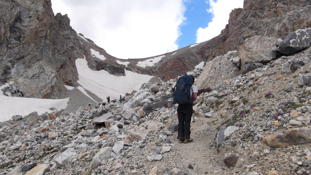
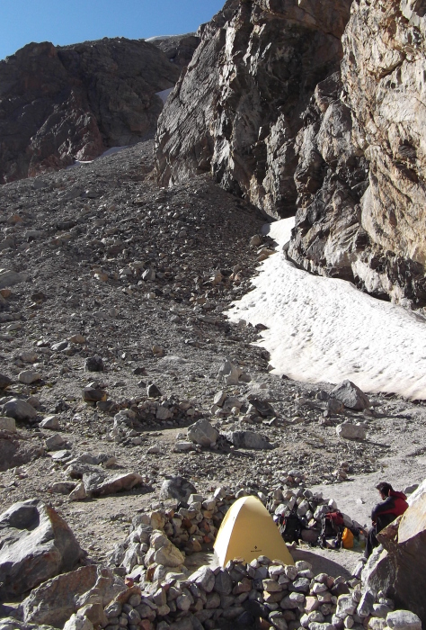
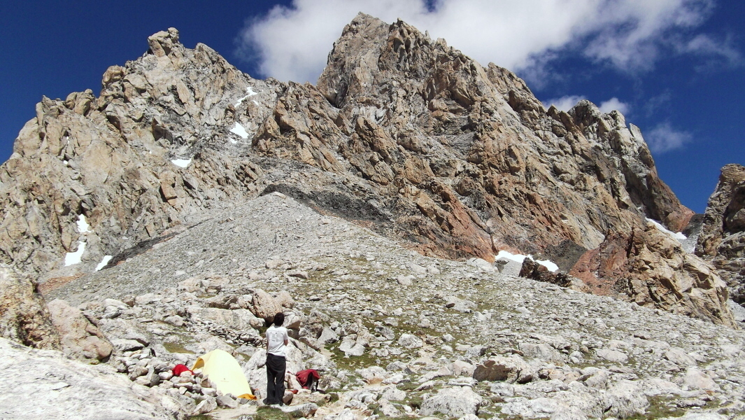
The approach to the Moraine Camp sites continues right of the waterfall at right. Before reaching the moraine, however the trail switchbacks steeply upwards passing an area referred to as The Caves before continuing up a tedious talus and scree slope. There are a limited number of camp spots available in the Moraine area to climber's left, but continuing up the trail a bit farther we located three or more roomy spots at right near the base of a large rock wall. The wind was whipping pretty good by this point and clouds were definitely building. We decided to take our chances sans camping permit and made camp down in the less exposed Moraine area. A stormy night of snow and rain blanketed our camp with a healthy dusting of fresh snow and put the kibosh on any attempt at the Upper Exum the next day. All parties returning from Lower Saddle that morning indicated the presence of about two to four inches of snow and verglass on the lower part of the route and on Wall Street in particular. Kyle and I weren't in any hurry and so decided to wait a day for the sun to work its magic.
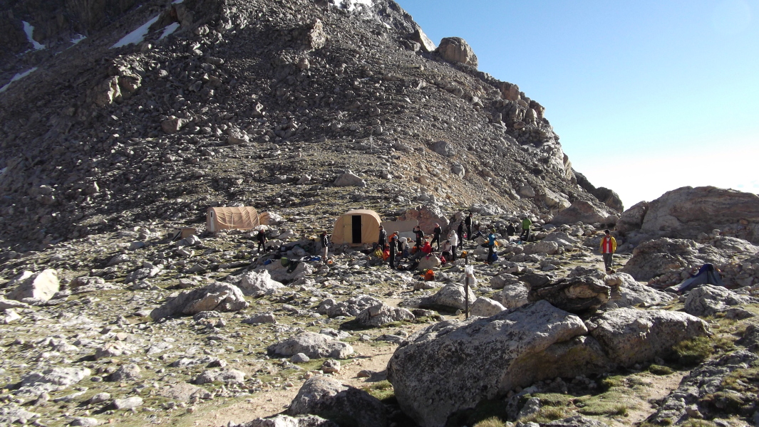
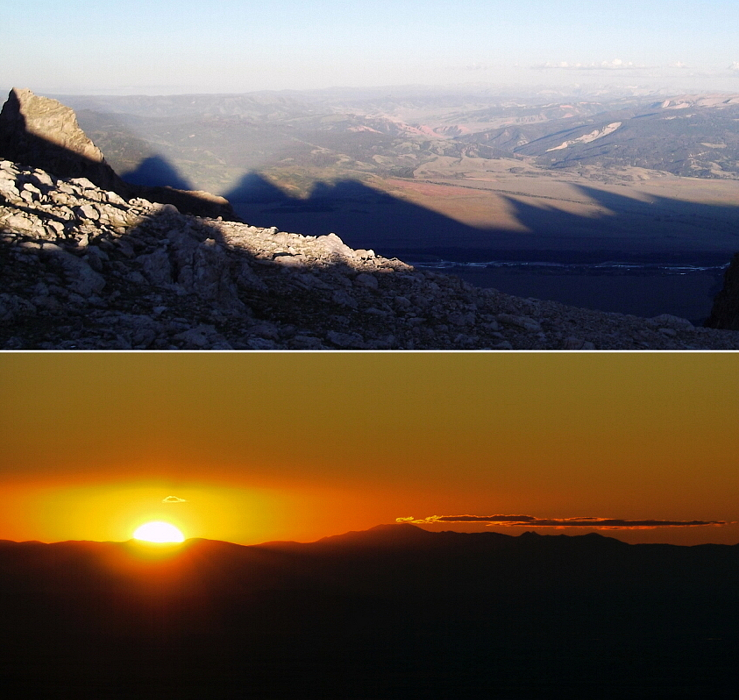
We had all day to move camp from the Moraine to Lower Saddle and from where Kyle put in a call to extend our climbing permit by another day. Even though we booked just one night, permits are generally good for two (and only two) nights and so we had no issues extending ours. Lower Saddle wasn't too terribly busy when we got there with only two or three other parties lounging about. Other parties gradually occupied the remaining camp spots as the afternoon wore on, but it wasn't until the Exum Guides arrived with their clients late in the afternoon that the place really got busy. Fortunately for us, the guided parties mostly stick to the Owen Spalding Route. I amused myself by eavesdropping on the many conversations being had at camp later that afternoon and evening. There was much discussion with regard to the various routes on Grand Teton, where various named features such as The Black dike, The Needle, The Eye of the Needle, The Enclosure and Wall Street were etc. Oh, and a word to the wise - don't bother looking for Wall Street until late in the afternoon when the low angle sunlight helps illuminate the elusive ledge.
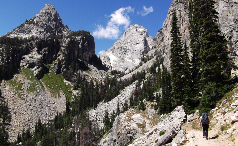
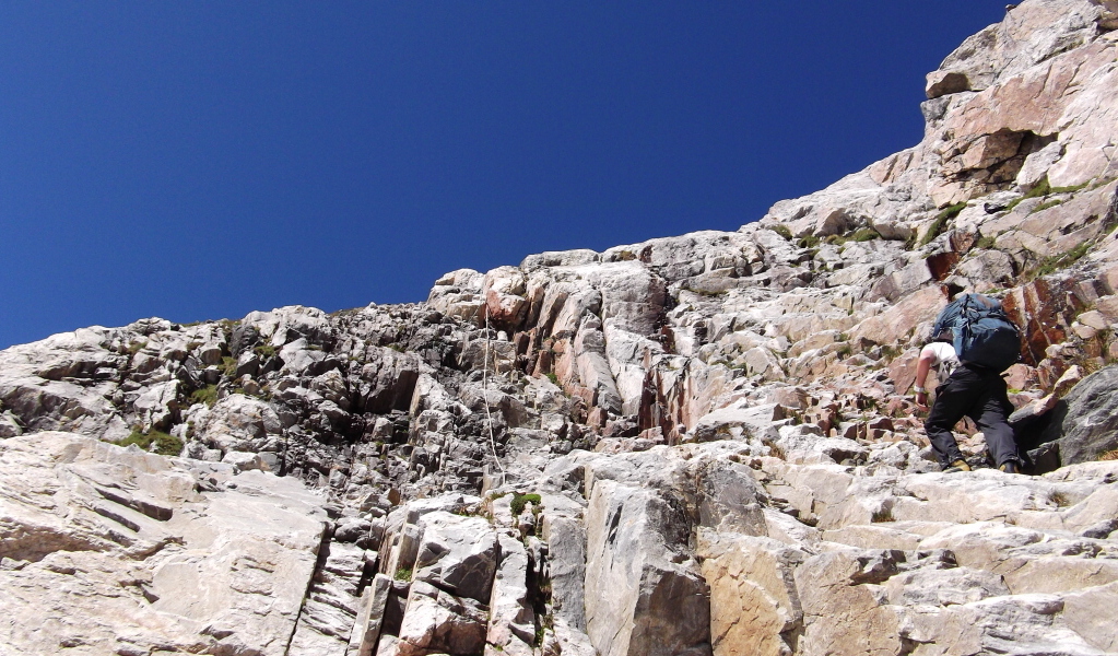
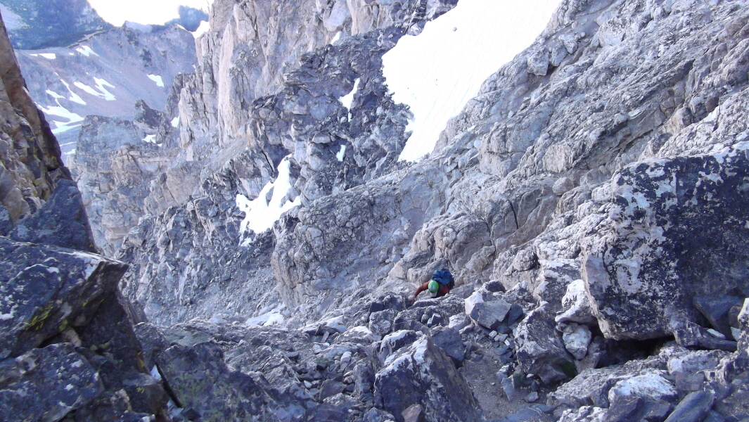
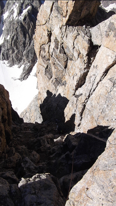
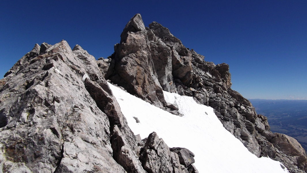
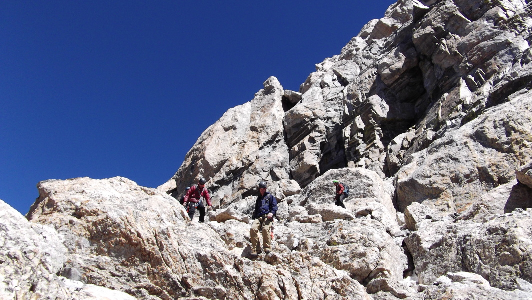
We got going the next morning around 6am or 7am, well after most other parties had already left. From camp, we followed the climbers path north up the gully past the Black Dike and toward "The Needle" which we passed on the left. With a slabby headwall split by two steep gullies seemingly descending from the Upper Saddle above us, we looked to our right for an easier exit from the amphitheater in which we now found ourselves. Directly behind "The Needle" is a gully that leads up to a minor ridge spur at right that hides Wall Street from view. This *may* be the proper way to go, but we didn't go this way so I cannot say for sure that it goes. A bit left of this gully is another smaller gully that ends at a headwall with a chock stone blocking the gully exit (see photo - taken on return). Getting up to the chock stone is a simple enough affair, but getting up over it does take a little effort. I passed it on the right while others (including Kyle) seemed to have an easier time of it by working left. There was some 4th if not a 5th-class move or two to get up over the headwall, YMMV. Either way, we saw no evidence of rap slings or anything here, and given the fact that both OS and Upper Exum parties must pass somewhere through this area, I expected some sign indicating this was the right way to go. Needless to say, I find the route descriptions for this part of the route very confusing.
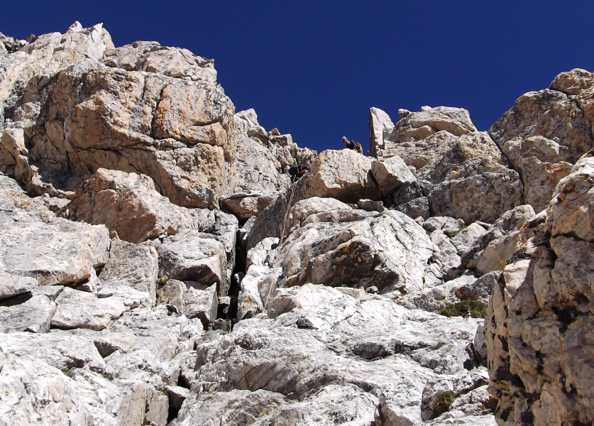
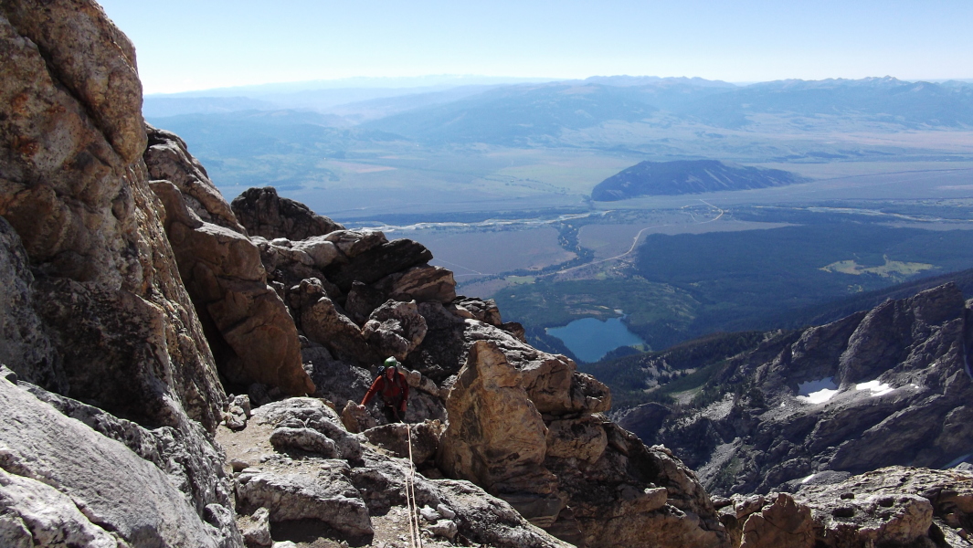
Above the headwall a gully and easier 3rd-class rock continues up and left to reach Upper Saddle (Owen Spalding Route). Rather than continue up this gully, Kyle and I instead proceeded directly upwards from the top of the headwall to reach the aforementioned ridge spur. If you look closely from below you can see a cairn atop the spur. From here an easy downward traverse leads to the start of Wall Street. I found it curious how such an unmistakable feature can be so well hidden from Lower Saddle. Starting out about 15 feet wide, Wall Street is really just a gently sloping ramp that narrows to nothing as it merges with Upper Exum Ridge. I noted a couple roped parties on the ramp and later also a pair of solo-climbers who'd apparently just climbed the Exum Direct variation below Wall Street. These two casually walked by us as we were roping-up, answering a cell call without even stopping before disappearing behind the buttress on the far side of Wall Street. Momentarily at a loss for words, I snapped back to reality at the sight of the tapering ledge before me.
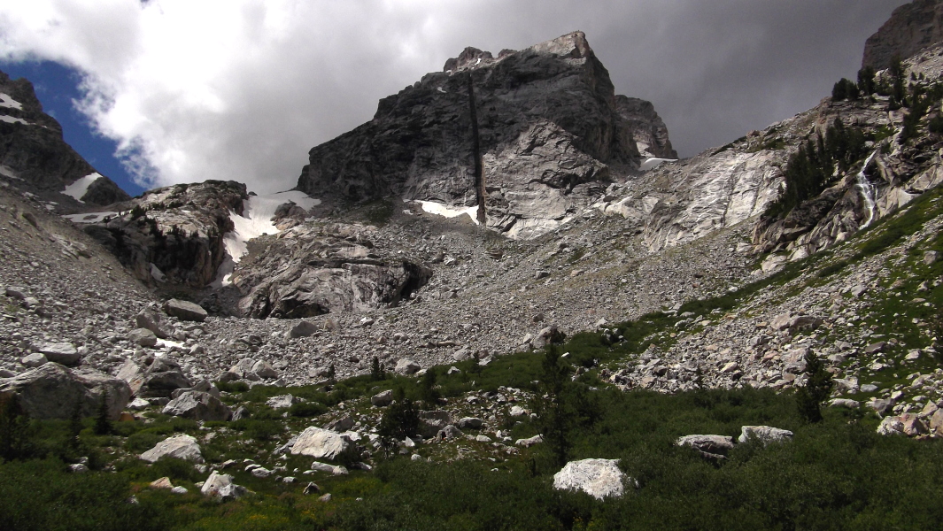
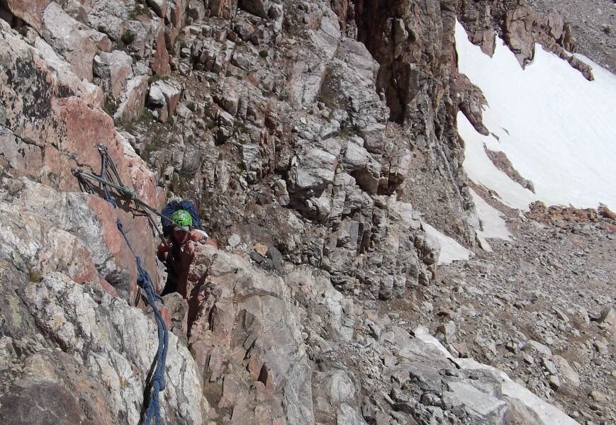
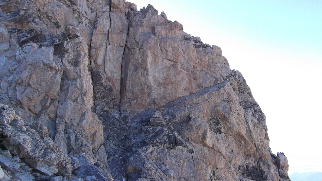
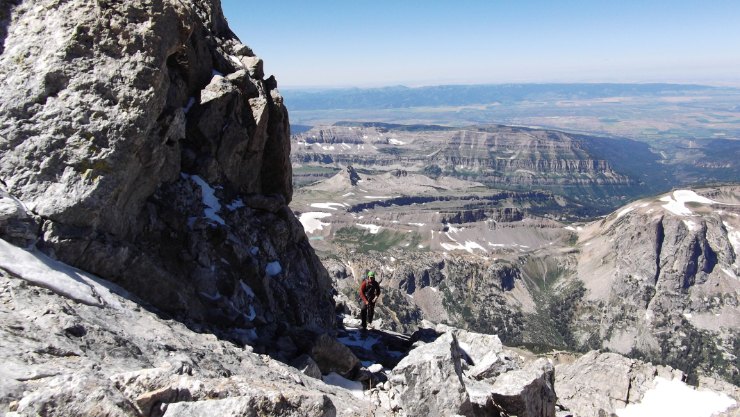
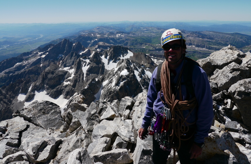
With a belay near the far end of the 'Street, I carefully inched out onto a small and very exposed ledge. The ledge fades into a polished slab that definitely lives up to its reputation of being the mental crux of the route, largely thanks to the exposure. A stem here, a tentative palm there, and a long committing reach to grasp the lip of the pedestal on which a large belay boulder was perched and I was home free! Phew! Now in the sun for the first time that day, I reeled Kyle in. Moving the belay to a comfortable alcove a bit off to the right, I gave Kyle the first pitch and basked in the majestic expanse of the Snake River Valley spread out before me. Kyle then reeled me up a short while later after which we each coiled some rope and proceeded to simulclimb. Following the path of least resistance, we continued up over easy terrain before dropping into a bit of a notch. Just left of the notch, a slotted gully with a chock stone or two led to a small amphitheater. From a large, sandy ledge at the top of this amphitheater I scrambled up a chimney to a belay stance. Hidden behind a small rib at right are a series of easy chimneys that apparently avoid the crack and 5.6 slab pitch that lay ahead - or so the fast moving soloist climbing past me indicated. The 5.6 slab pitch is supposedly the crux of the route, and I wasn't about miss it by punting up some uninteresting chimney.
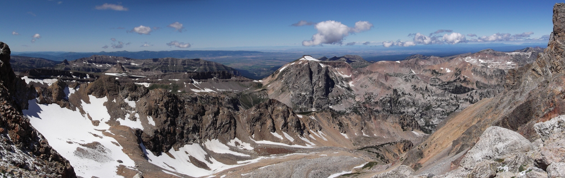
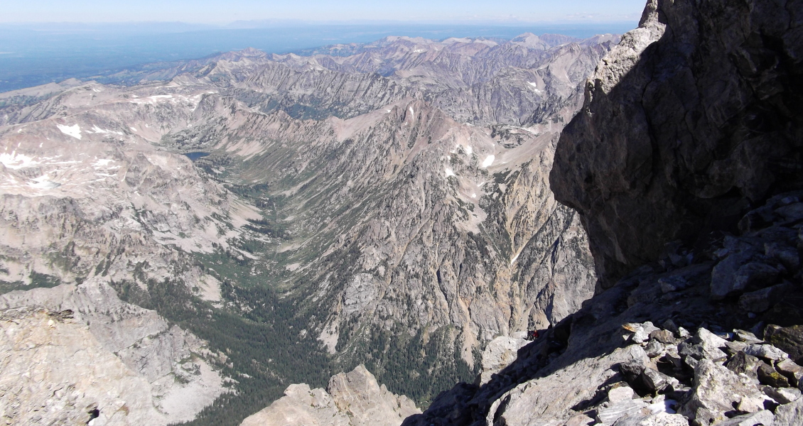
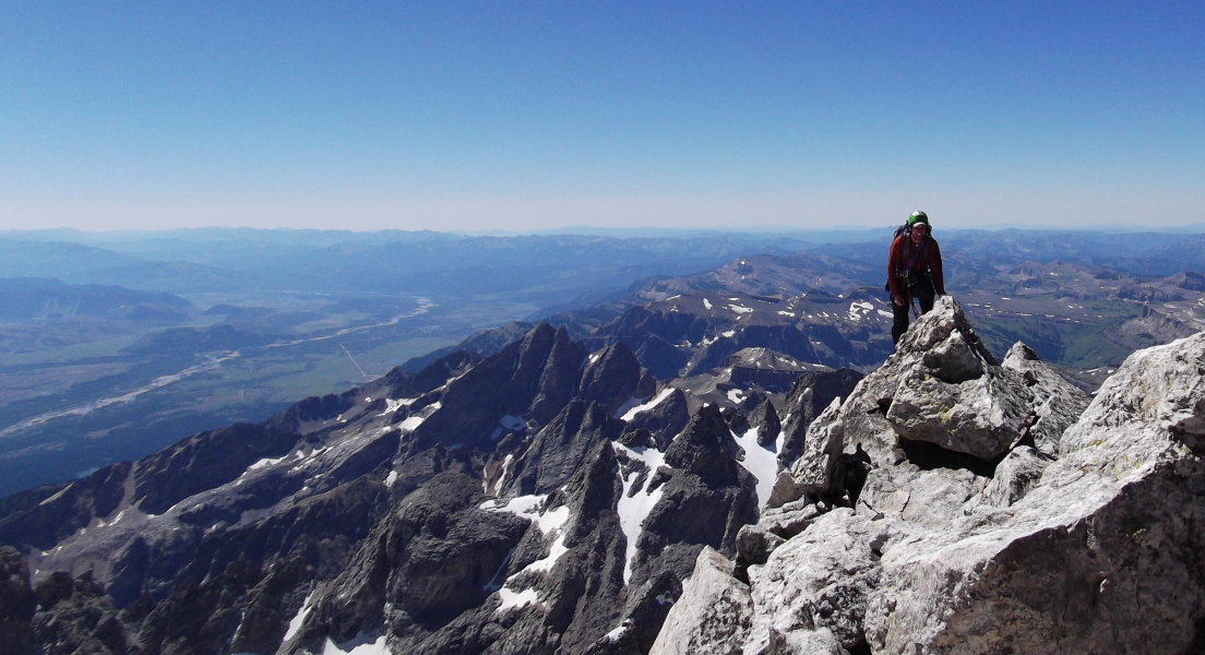
Now with a belay, I continued up the crack to reach a comfortable belay ledge above. With a belay from this ledge I started up the slab pitch, delicately picking my way from one thin hold to the next without any real opportunity to place gear. The slab is festooned with chickenheads a bit higher up, offering some mental relief from the lack of protection. An aesthetic arete provides an enjoyable finish to this pitch. Beyond the 5.6 slab, we continued again along the path of least resistance up and rightwards over easier blocky terrain. Skirting a small snowpatch, we worked our way up to reach a broad open face with a large, featureless slab at right. We avoided the slab by staying left as close to the crest as possible. A bit of hand-over-handing up a fun rock fin then brought us to the top of the wall/slab at which point we could look over the NE side of the peak and for the first time see parties climbing the Owen Spalding Route.
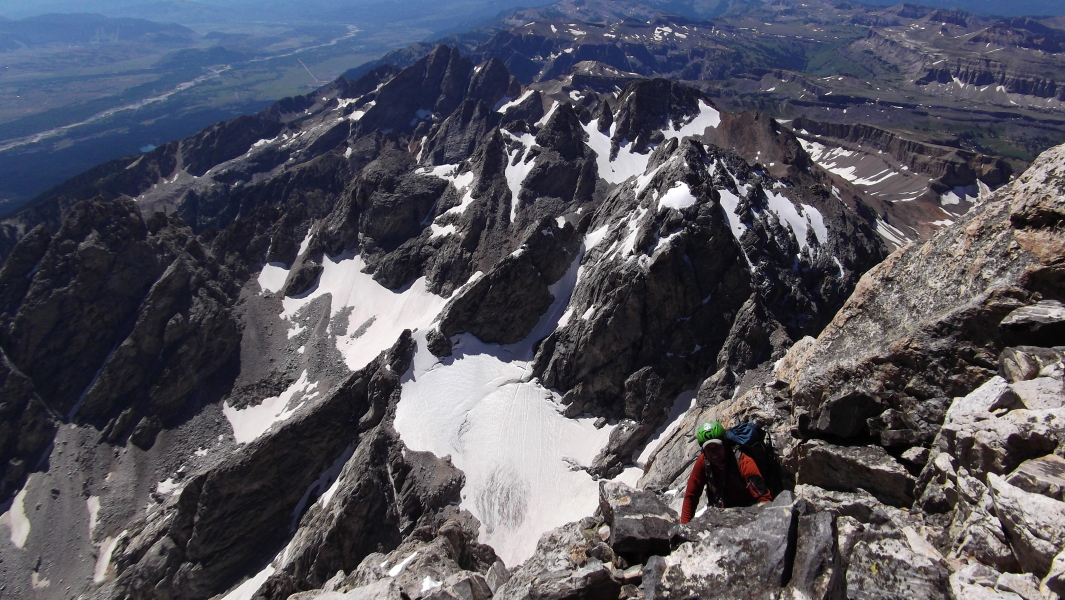
Easy walking along a ridge crest led to about 10 steps in snow before the final scramble to the summit proper. The only unavoidable steps in snow were had here on the short traverse beneath the small tower. This is the same large year-round snow patch that's easily visible from the valley below. It goes without saying that this is a rewarding summit to attain and its popularity among climbers the world over is certainly warranted. It also helps that Wall Street could be considered one of the more famous alpine features in the US. Carefully picking our way down and left over the slick snow dusted rock on the peak's NE side, we made our way to the first of two rappels down the Owen Spalding route. We found a rap station at the top of the well-iced Sargents Chimney and made a single rope rappel down to a large ledge below. Continuing left, we descended a bit before locating the next rappel anchor. The bolts/chains affixed to a smooth wall are for the double rope rappel while the adjacent rap slings are apparently intended for the two single rope rappels option. Choosing the former, I was first to lower myself off the ledge for what is a long and exhilarating test of one's faith in knots down to Upper Saddle.
The descent from Upper Saddle seemed pretty trivial, partly thanks to being shown the way by a returning OS party. The basic idea is to avoid the large gully at far right (Idaho Express) while also not getting suckered into the steep, cliffy couloir at far left. Either way, there are cairns and obvious signs of traffic to help keep you on track. A final rappel down the chimney-with-chockstone pitch and we put away the ropes for the remaining descent back to Lower Saddle. Save for the traffic jam back at the fixed ropes below Lower Saddle, the descent to the Lupine Meadows Trailhead went without incident. I'm not sure what some of the guided outfits must be thinking however, for parties without prior mountaineering experience really have no business climbing any of the routes on Grand Teton. With how terrified their clients were climbing up the fixed ropes even with a top belay, I struggle to see how they could possibly make it up the OS route. But, I digress...
All told, the Upper Exum Ridge is about 1500 vertical feet of 4th Class scrambling and low 5th Class climbing. Like the Owen-Spalding route, it is riddled with named features such as "The Golden Staircase," the "Wind Tunnel," the "Friction Pitch," and the "V-Pitch" though I'm not sure where exactly each of those features are located. That said, we were a bit disappointed to have somehow missed the classic "V-Pitch" and to this day wonder how that was possible. In any case, it's a great climb with excellent rock and would make for a fun solo save for perhaps the moves at the end of Wall Street.
Click here to view photos.
![]()


