


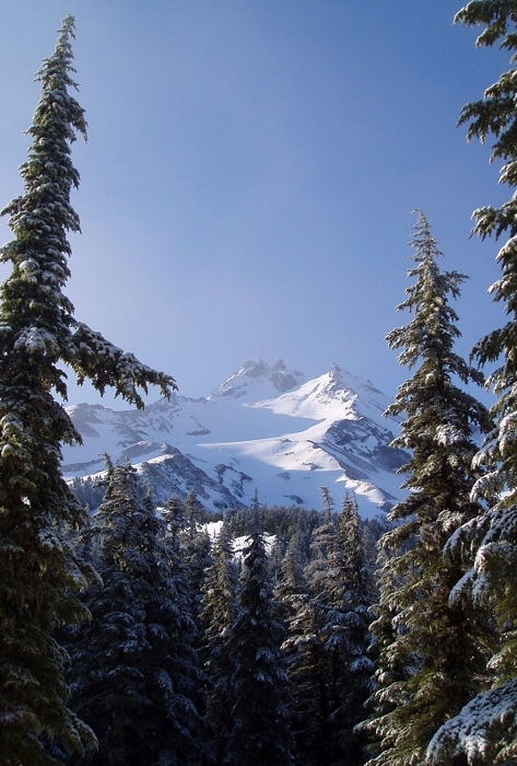
Mount Jefferson - Jefferson Park Glacier, May 2007

I had hoped to have written a report for a successfull climb of Jefferson by now, perhaps using photos from my failed attempt in May to augment those taken during a follow-up June or July attempt even. Alas, this has been a frustratingly slow start to the climbing season for me - one plagued by consistently rainy weekends, schedule and partner challenges. Now that the Jefferson Park Glacier route appears to have fallen out of condition for the season...at least for my tastes, I'm going to have to wait another 10 or 11 months before entertaining a return trip. Until then, this report will serve as a reminder of unfinished buisness in the Oregon Cascades.
Inspired by the description in Kerney's Classic Climbs of the Northwest, Tom and I set out to climb a route that many label as one of the finest alpine routes in the Oregon Cascades - the Jefferson Park Glacier. As with most volcano routes, we figured that well-iced early season conditions would be preferable to the choss and rockfall typicaly encountered in summer. Sure, the rime would make the knife-edge ridge and summit pinnacle more sporting, but we'd hopefully be able to bypass the notorious 'schrund without any issues. Pick your poison. In any case, we picked a 'good' weekend in May, loaded-up Tom's Escape and drove south. A seemingly endless 5-hour drive finally saw us to a snowy impasse about a half-mile shy of the trailhead. Hiking in white-out and drizzle did little to bolster our enthusiasm, but I had confidence in the forecast - it was supposed to turn partly cloudy on Sunday. We hiked to about 5500ft before making camp under a canopy of evergreens. Exhausted, I passed-out without eating dinner only to wake-up to the pitter-patter of rain falling on the tent. Rain, then snow conspired against us later Saturday night and early Sunday. Our wake-up call was promptly ignored and we stayed in the tent and caught a few more hours of sleep. Hours later, having had more than enough rest Tom and I began to stir. We packed-up and were moments away from returning to the car that morning when the fog started lifting and patches of blue sky started poking through. Go figure, eh? It was already 7:30 at this point. We decided to head on up to the glacier to 'check things out' anyway.
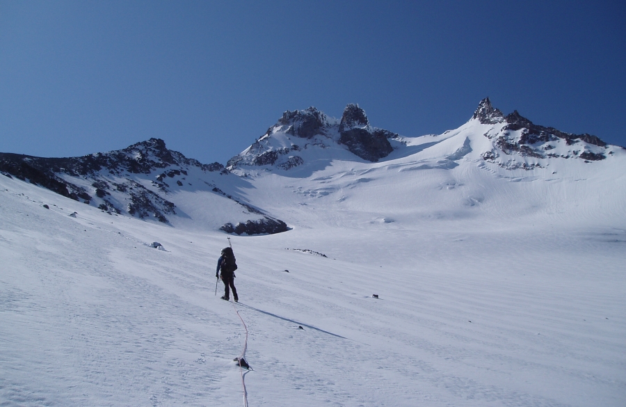
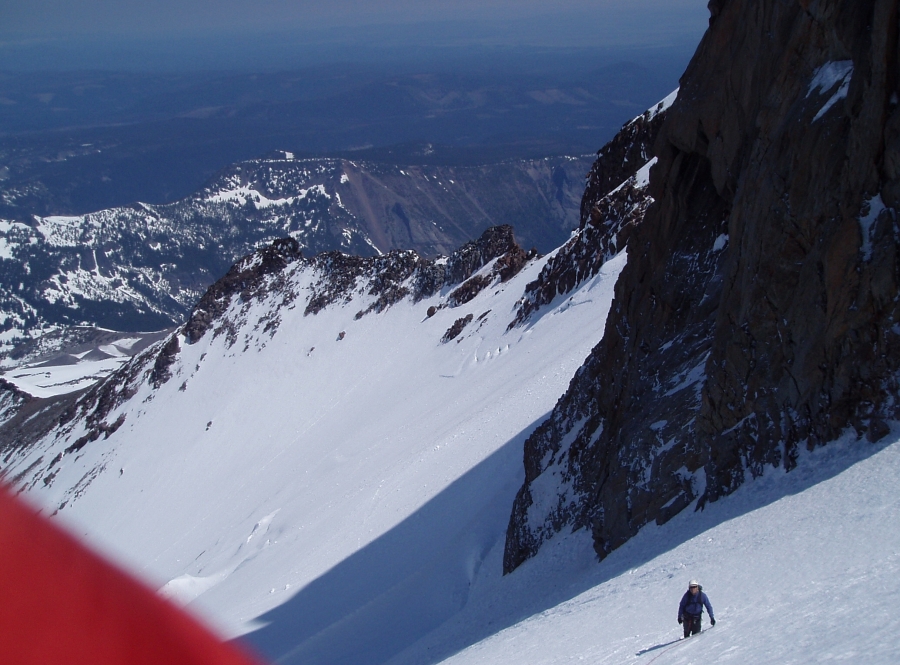
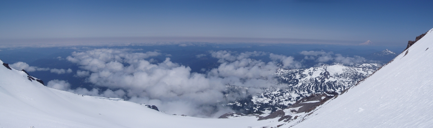
After futzing around - ditching our overnight gear, shedding layers, re-packing etc, we continued up, reaching the toe of the glacier around 9am. It was without question an absolutely perfect day and we were well above the clouds. Mt. Hood was plainly visible to the south, taunting Tom who had only the weekend prior been shut down by winds and whitehout on an attempt at Leuthold Coulior. Hesitant to continue thanks to our rather advanced departure time, I placed a call to Eric to divine the true meaning of Smoot's estimated 8 - 10 hrs. Apparently, those times are one-way from camp at Jefferson Park. The description in Oregon High also seems to confirm this. Although 8 - 10 hours seemed a bit much to us, I was in no mood to epic on a 10,000-ft volcano. I agreed to at least climb up to the high saddle above the Jefferson Park Glacier and make the final go/no-go decision once there. In the end, Tom and I made to within 800 ft of Jefferson's summit before calling it off due to insufficient time. We were pretty much at the saddle before the interesting ridge portion of the route.
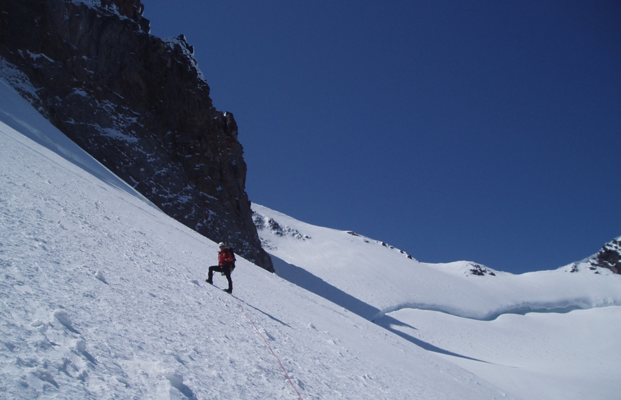
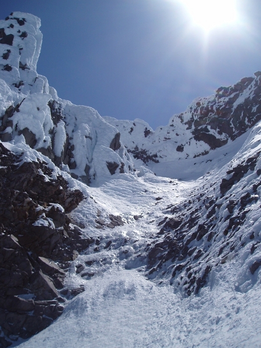
The climbing was enjoyable, if not a bit grueling on one's ankles thanks to the steep traversing. The tedious, bottomless mushy snow on the approach to camp was now long gone. The air was cold and crisp as we cramponed up firm styrofoam and ice. We continued up to the base of a small amphitheater just beneath the saddle. Above us was a short pitch of steep snow and ice to about 50 degrees or more to reach the saddle. Not wanting to have to down-climb this pitch if I didn't have to, I asked Tom for the time. It was now noon. Decisions, decisions... Though the ridge looked well rimed and relatively straight forward from our vantage point (Tom went a bit higher to get a better look), I knew there was much more that we weren't yet seeing. Factor in a potentially troublesome ascent of the summit pinnacle, a lengthy and unknown return via the Whitewater Glacier and a 5-hour drive back to Seattle, and it seemed pointless to continue. If only we had another day!
We descended to the flats beneath the 'schrund and snacked in the sunshine for a while before continuing down. More traversing then some butt-cheek bruising glissading saw us down to the terminal moraine in no time. Back to where we stashed our gear (~6000ft) by 4pm and back to the car sometime after 6pm. An early pre-dawn start is obviously required to pull this one off with enough daylight to get back to camp. It would also be wise to camp at the terminal moraine (~7000ft) rather than down near Jefferson Park proper. Snow, rime and ice conditions were perfect in May - everything was firmly plastered up there. As of this writing, the ridge is now almost completely snow-free with perhaps only the summit pinnacle holding any last bits of rime ice. The upper 'schrund is now apparently fully open and practically spans the entire glacier. Any ascent of the peak via the Jefferson Park Glacier at this point would be considerably more sporting and probably doesn't warrant the 5-hour drive for Seattle-based parties. For now I'll savor what I was able to experience of this wild corner of Oregon and look forward to revisiting the peak sometime in the future!
Click here to view photos.
![]()


