


Luna Peak - Southwest Ridge, July/August 2005

So, here I sit at Prost!, working on my second Spaten Pils, trying to come up with something creative to say. Oops, here comes my third one. I'm sitting here thinking, just starting to unwind after a long day in the office. Maybe I should have been climbing instead of working, eh? As if the life of a cube-rat was that simple. Ok ok, back to my report. Let me pry myself away from my bier first! Hmm, where do I begin?
Ok, here goes: Not two days after recovering from our Ptarmigan Traverse, Eric and I set out for, um...an adventure in the Picket Range. Yea, our highly anticipated adventure in the Pickets - Luna Peak and Mt. Fury. Now, never mind the fact that we were supposed to spend two weeks in the Canadian Rockies this summer. I can't say that they've exactly had a summer up there this year. And furthermore, I'm certainly not prepared to blow my hard-earned vacation time confined to a tent, waiting out some blizzard at 10k ft, wishing I was at home sipping margaritas. So with that said, we decided to stay local. There's certainly more than enough around here to keep ourselves busy. What to do, what to do? Hey, it was about time we went for Luna and Fury, eh Eric? But wait; now I have to take a leak.
Ok, where was I? Ah, right Luna. Our route would certainly not be the most technical or challenging, but with a "grade 5" approach up Access Creek, a casual afternoon jaunt to the summit of Luna peak and an aesthetic ridge climb and slog up Fury's South Glacier we'd somehow manage to keep ourselves entertained. Throw in a 10 mile trail approach, a creek ford, a 'fun' thrash up Access Creek, and all that just to get to a glorious high camp at Luna Col. Now you've got a recipe for adventure! Oh, and let's not forget about those legendary views. With the Ross Lake Resort water-taxi pre-arranged for an 11am pick up (call 206-386-4437 to book, $35/person round trip), we casually made our way over to the National Park, parked at the resort pull-out and hiked down to the shore. About 15 minutes later we found ourselves at Beaver Landing and shouldered our packs for the easy hike to Luna Camp. Well, getting to camp took a bit longer than expected, as the huckleberries did a good job of slowing us down. Finally reaching Luna Camp, we picked a site and proceeded to empty our packs. Where the hell did I stash that pint of whiskey anyway? Later that afternoon, a party of two, presumably Beaver Loop backpackers arrived at camp and claimed a site far away from us shady-looking types. Feeling sociable and a wee bit buzzed, I decided to follow Eric's lead and pay the couple a visit, but they were nowhere to be found. It seems they set up the tent and immediately collapsed in it, tuckered out from all that "heinous" Beaver-Loop trail hiking. Or they were hiding from us. Whatever.
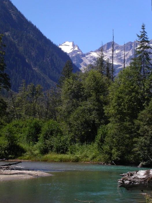
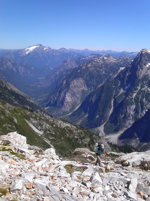
We got going soon after sunrise and started hiking up-valley looking for any hints of trail leading down to Big Beaver Creek. We hiked for maybe 15 or 20 minutes, spotting brief glimpses through the trees of what was surely the Access Creek drainage. At some point we felt we'd gone far enough and turned off-trail for the short 'schwack to what we hoped was a log spanning the creek. The log crossing eluded us, and so we hiked up-stream along the bank, following a path of boot prints and trampled brush to a sandy beach from where we could easily ford the creek. Once across the creek, we dried our feet, put our boots back on and dove back into the brush. Keeping Access Creek within earshot (at left), we made an ascending traverse through steep, though mostly open forest to where the basin levels off somewhat. We then continued traversing (some annoying brush), aiming for the large talus slope on the other-side of the creek. A good strategy seems to be to stay in the trees, but closely paralleling the edge of the brush, looking for the narrowest patch of alder between forest and talus slope at left. If done right (we stayed too high on the way in), one is rewarded with a bit of a path leading to a reasonably good creek crossing and a well cairned route through talus and grass into the upper basin.
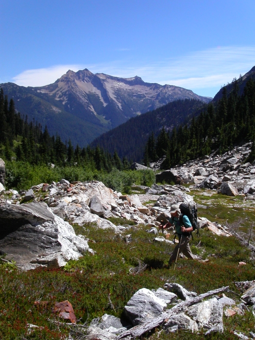
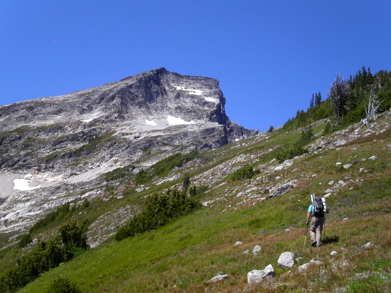
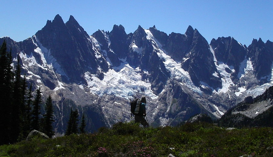
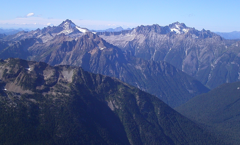
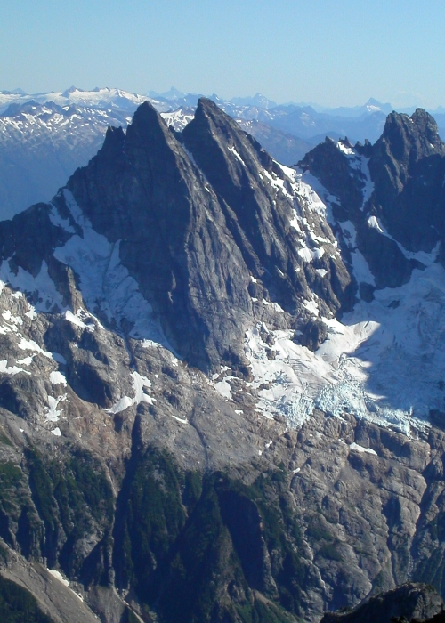
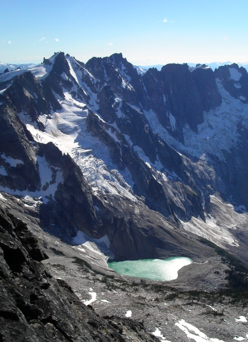
With the brush now comfortably behind us, we looked up in awe at the imposing wall of rock before us. It eventually dawned on us that we were actually looking at Luna's massive Southeast Face. "Wow, I wonder if anyone's climbed that face", I wondered out loud. As if to answer my question, the mountain released a small shower of rocks from its upper flanks. "More like, who'd be stupid enough to want to climb that face," I thought. Looking left, we could see a prominent bench above which two scree and heather gullies lead to the ridge crest above. The correct gully is not the obvious (and lower) one at far left, but rather the longer and partially hidden one just to its right. To get there, however, one must gain the aforementioned bench via a tedious and unstable debris fan. Combined with the gully above, this makes for about 1500ft of pure joy and during the hottest part of the day no less! If the approach up until this point were to have any redeeming qualities, I'd say that without a doubt, it'd be the awesome view of the Southern Pickets when first cresting the ridge. Soaked in bright mid-summer sun with the deep green of heather and forest, the glare of snow and ice above which precipitous black spires pierce the deep blue sky, these mountains would hold their own in any of the world's mountain ranges. We traversed a short, but steep grassy slope (sketchy when wet) and made our way towards a small stand of trees on a heather bench for a short rest in the shade. Looking across the basin behind us, only a short traverse and talus climb remained between us and our next stop at Luna Col.
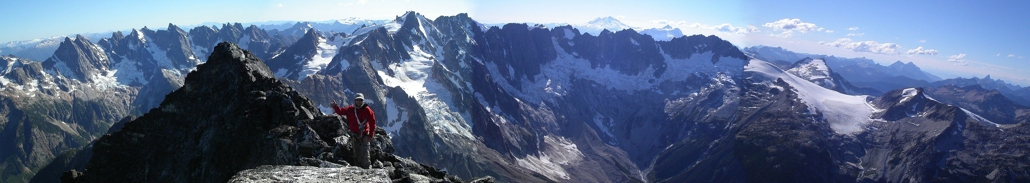
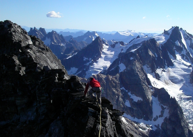
It was about 5pm when we reached the col and easily located a comfortable bivy site. I was amused at the lengths someone must have gone to to build a flat rock patio in the sandy floor ...they must have had a lot of time on their hands! With a large boulder protecting us from the northern wind and running water a short distance below on the north-side, this was a primo bivy site. But, now was no time to rest, for Luna Peak was calling! A quick scramble saw us up to the false summit, whereupon we eyed the short ridge-run to the true summit. Though it probably wasn't entirely necessary, we roped up for the easy, but loose and exposed 3rd-class (some 4th) ridge climb. After the monotony of the approach, the final scramble imparted the welcome feeling that we were actually "climbing" again. Unbeknownst to us both, that would be about all the climbing we'd do on this trip...but, I digress. How about the view? I'll spare you the florid description this time - Nelson/Potterfield's description in Selected Climbs v.1 sums it up quite nicely. So, what's left to say? We came, we saw, but alas we didn't exactly conquer. It seems the sun decided to take the following day off - the day we were to climb Mt. Fury. Eventually giving-up all hope for an improvement in the weather, we packed up camp in the steady rain and high-tailed it out of there. We lost about 30 minutes poking about in the fog looking for the entrance to the dreaded descent gully, but with it still raining down in Access Creek at noon, we felt we had made the right decision to bail.
Besides, with the water-taxi reserved for the following day and significant others expecting our timely return, we didn't really have time to simply wait it out...right? I certainly needn't remind myself that I'd probably have no less than 4 bars of cellular service from the false summit of Luna. In any event, it only seems fitting that the clouds would completely disappear by late afternoon, with the upper South Glacier and summit of Mt. Fury teasing us again from that one vantage point along Big Beaver Creek. Yea ha ha! Very funny! I suppose Fury will have to wait till next year. Ugh.
Click here to view photos.
![]()


