


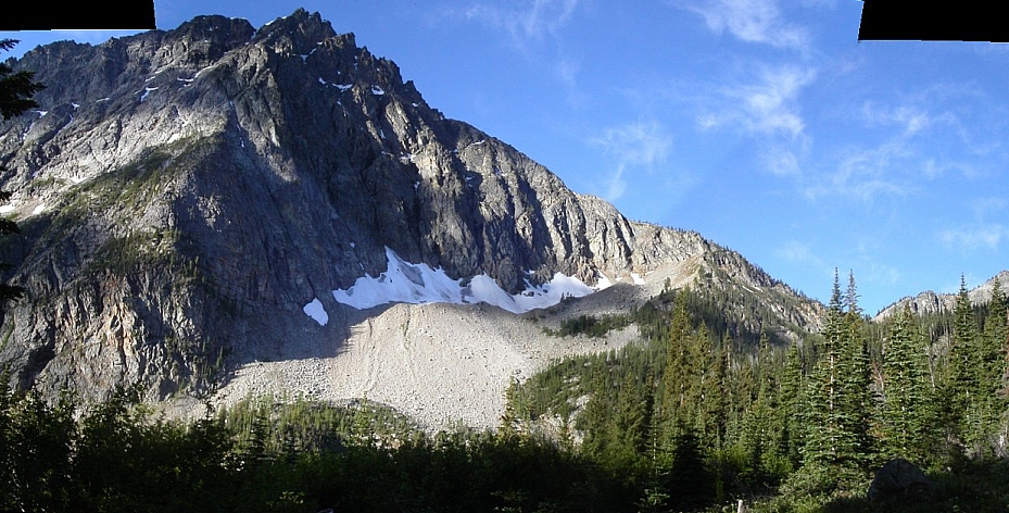
Reynolds Peak - Northwest Ridge of North and South Summits, July 2005

Trying to escape the lousy weather on the "West-Side" last Fall, Eric and I decided to head east and attempt the elusive NW Ridge of Reynolds Peak's North Summit. Beckey's vague, yet intriguing description, "...five pitches of excellent 5th-class rock" piqued our curiosity enough to check it out. Reportedly comprised of granitic rock, the route appears to follow an obvious and aesthetic line starting from a gentle saddle literally at the end of the Reynolds Creek trail. Starting with 3rd-class scrambling along the ridge crest, and finished with a few pitches of technical climbing, the route seems to have the makings of a classic with what we hoped was only a moderate amount of difficulty. But, alas, we were turned back by wildfires and would have to wait till next season to explore this enigma.
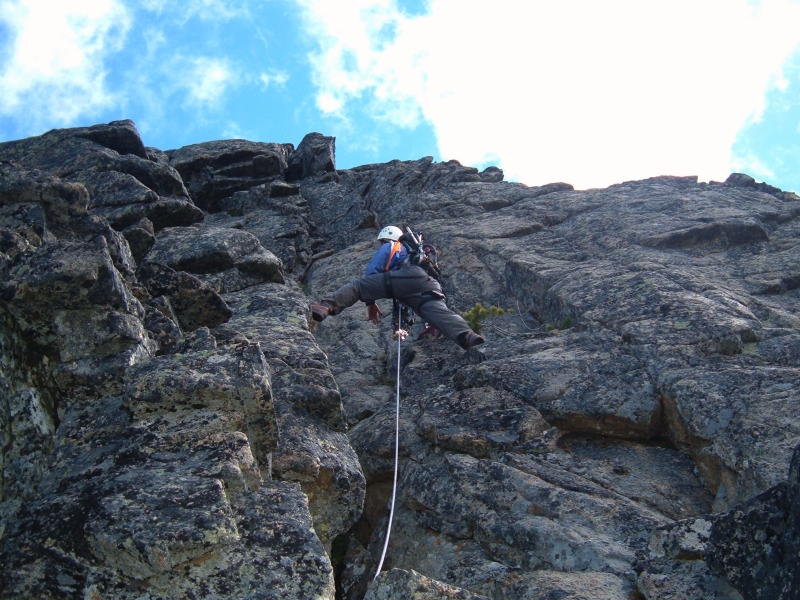
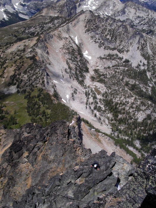
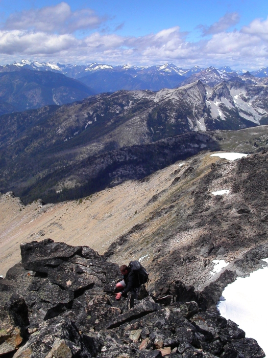
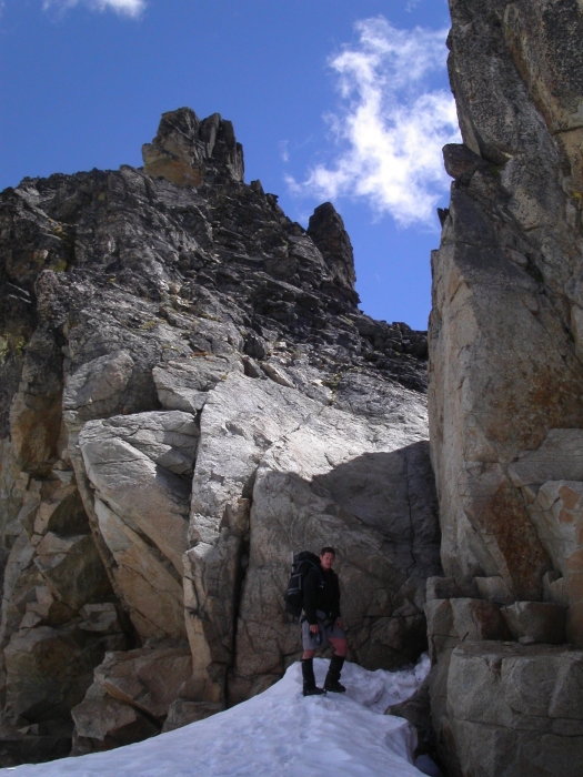
With marginal weather once again forecast for the west slopes of the Cascades in early July of 2005, Tom and I again ventured east in search of drier weather. It seemed like the perfect opportunity for another go at Reynolds Peak. Armed with recent route beta from Eric and Andy's ascent only a week earlier, Tom and I planned to climb the NW Ridge of Reynolds Peak's North and South summits in a day, car-to-car (with trailhead bivy). We began hiking up Reynolds Ck trail at 5:30 on Monday morning and got to the pass (6875') at ~ 8:00 (6.6 miles). We then hiked up the ridge immediately E of the pass to gain the NW Ridge. We roped up at the first gendarme (there are four prominent gendarmes on the route) and proceeded to take advantage of running belays on the entire route, enjoying pleasant climbing on relatively sound rock throughout the duration of the climb.
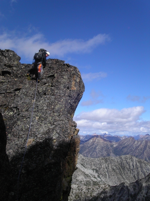
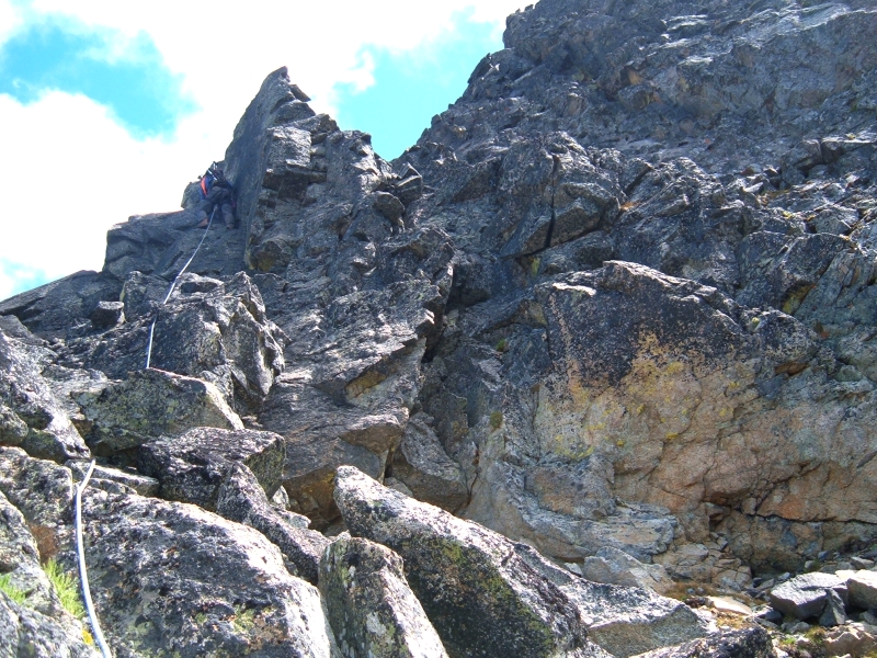
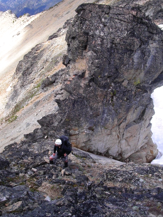
With beta from Eric, we decided to bypass the first gendarme (traversing right) so as to avoid the rappel on the other side. Following in Eric and Andy's footsteps, we also passed on the next, larger gendarme before re-gaining the ridge crest. To this point, the climbing was mostly 3rd and 4th class with only moderate exposure. Now, staying on the crest, we encountered steeper 4th-class rock with occasional 5th-class moves here and there, including down-climbing. An interesting looking chimney pitch beckoned us up the final gendarme, yielding the most enjoyable climbing on the route ~ 5.5. From there, a short down-climb and some loose rock in a gully (probably better to stay on crest) saw us back to the crest for the final scramble to the top.
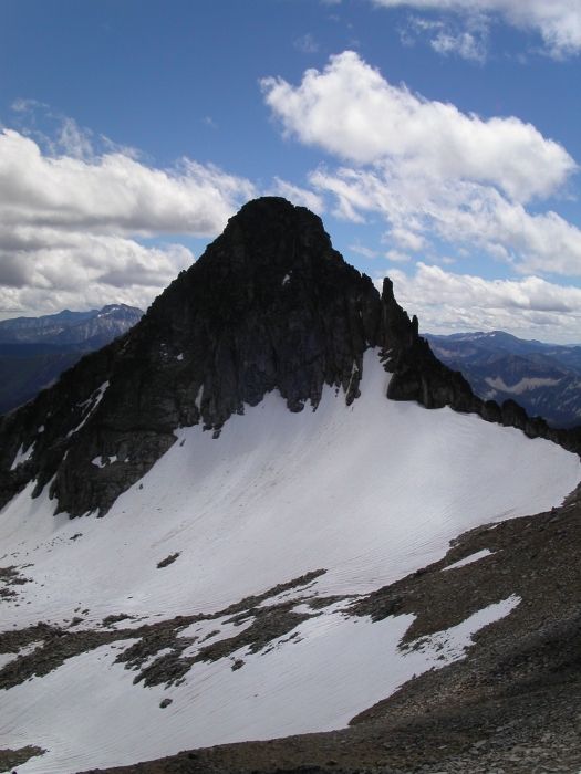
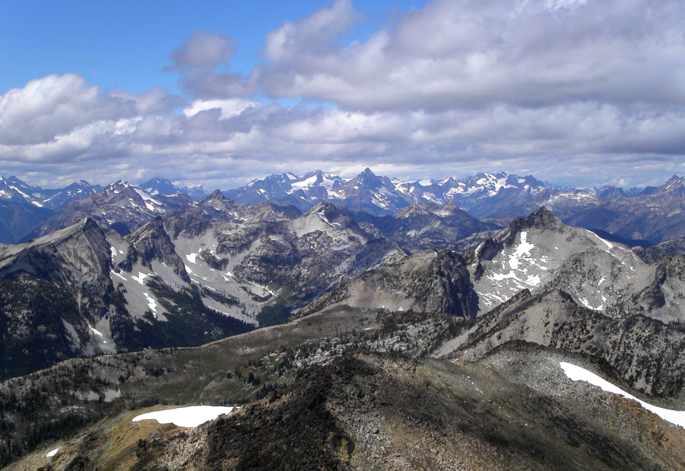
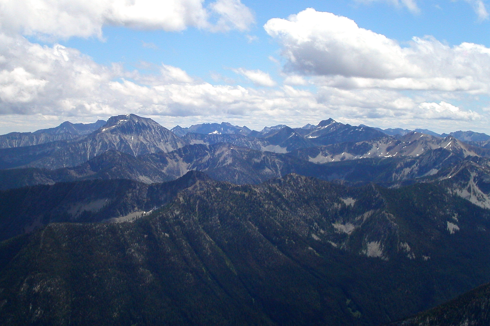
We passed on the highest point of the North Summit and instead scrambled down to the snow patch between the two summits. We easily located the key 4th-class slab pitch just before the largest snow finger below the North Face of South Summit (see arrow). After scratching up the slab (Tom found the easier 3rd-class variation by staying left), we climbed up easy, blocky terrain beneath a large gendarme. Veering right, but staying left of a smaller gendarme just off the crest, we traversed an easy, but exposed ledge on the South Face to reach a loose gully. We climbed the gully a short distance to a notch (some 4th-class) then scrambled easily to the summit of the South Peak. We topped out at 1PM and enjoyed spectacular views over to Bonanza and the Entiat range, the peaks of the Ptarmigan Traverse, south to Stuart and as far North as Redoubt.
We descended the SW ridge (to 6400'), eventually contouring around the west basin where the wildflowers were in full bloom (as were the 'skeeters). Back to the car at 5:35 for a 12 hour day. A huge thanks to Eric Hoffman who provided much of the route info for this climb. Beckey's 13 word route description in CAG doesn't say much, and without Eric's info we would have had to scratch our heads a great deal more than we did.
Click here to view photos.
![]()


