


Snowking Mountain - Kindy Ridge, November 2002

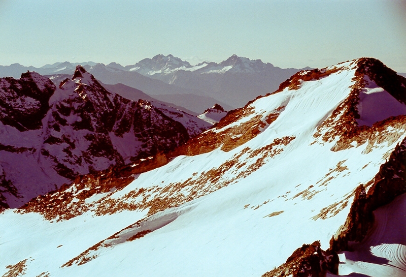
It was late November and barely a dusting of new snow graced the high peaks of the North Cascades. The clear and relatively warm weather that we Western Washingtonians enjoyed through October and the first part of November proved to be very persistent and was still very much with us towards the end of November. As is often the case when sunny weather is forecast for the weekend, I found myself drawn once again to the hills. A casual review of my climbing wish list (we all have one, don't we?) yielded numerous options, of which Snowking Mountain somehow appealed to me the most. Located roughly east of the Sauk River valley, south of the Skagit River valley and southwest of the Cascade River valley, Snowking Mountain is uniquely situated to offer sweeping views of the Cascade Pass/Boston Basin peaks to the east-northeast and a panorama from Mount Baker to Snowfield Peak panning from the northwest to the northeast.
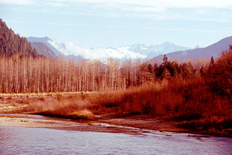
Though a climb of Snowking Mountain can generally be accompished on a long summer day, I opted for an overnighter given that it now gets dark around 5:00pm. Finding a partner for this outing proved to be quite challenging as it was also "Apple Cup" weekend, and most of my climbing partners tend to be either WSU or U of W grads. Fortunately I was able to persuade Tom into joining me with the promise that I would bring my shortwave radio in hopes that we could pick up the game once at camp. Crossing the Skagit River one could clearly see Dorado Needle and Eldorado Peak above the Marble Creek basin. About 14 miles up the Cascade River Road, we turned right onto FSR 1570. It is while driving this road that we would encounter the "crux" of the climb. Numerous water runoff drainage humps have been installed diagonally across the road which proved very challenging to navigate over in a lowered VW. We finally reached the washout and I breathed a sigh of relief knowing that I at least made it to the "trailhead" with exhaust sytem intact. We hiked the 1.5 miles up what remains of the road, ignoring the orange tagging at a clear-cut on the right side. We reached the end of the road shortly after the first and only switchback and easily located the trail that led steeply upwards.
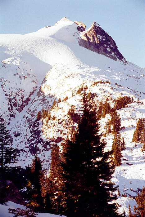
The trail skirts the edge of some clear-cutting before entering the steep timbered slopes above. We followed the trail up though the forest to where the grade eased off a bit and patchy snow made staying on the trail difficult. We would locate the trail on and off as we made a gradual ascending traverse leftwards towards the forested ridge top. As we approached what appeared to be a bit of a saddle in the ridge, we moved to the right of an obvious gully locating more orange flagging indicating we were on route. We climbed up towards the ridge top, now covered in snow with an annoying breakable crust. At about 5,500ft we had our first views of Snowking Mountain as the sun was setting behind it. We set up camp at a flat spot on the ridge (roughly 5,700ft), polished of a fifth off Black Velvet between us, and promptly passed out for the night. By the way, radio reception of Apple Cup was extremely faint with lots of interference. We were unable to discern what the score was.
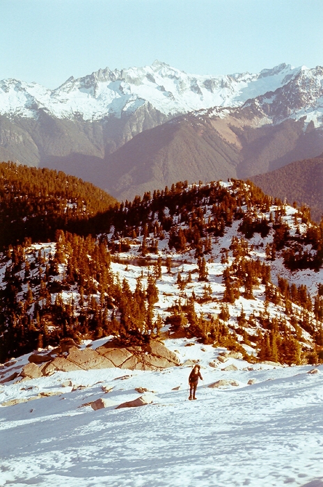
We got a bit of a late start that following morning thanks in part to my watch being 12 hours off. We left camp with snowshoes on and weaved up, down and between huge boulders and a bit of a canyon on the ridge's high point before beginning the easy descent towards the first of numerous saddles in the ridge. We followed the ridge to an obvious junction and were now faced with choices. Beckey's CAG suggests taking the ridge left of Cyclone Lake. That option however appeared lengthy and certainly not nearly as direct as the ridge that extended along the right side of Cyclone Lake. We opted for the direct route and hoped for the best. We traversed slopes right of Cyclone Lake until reaching a cliffy impasse near a creek at the lake's outlet. Though it was probably possible to bypass the cliffs on the right by dropping several hundred feet, we instead proceeded left and set up a fixed line on a 20ft section of cliff. We would probably need the rope to climb back up the cliffy section and so left it behind, hoping that we wouldn't need it as we continued up the mountain. Once beyond the creek crossing, the slope opened up and we easily gained the upper ridge and the glacier's edge.
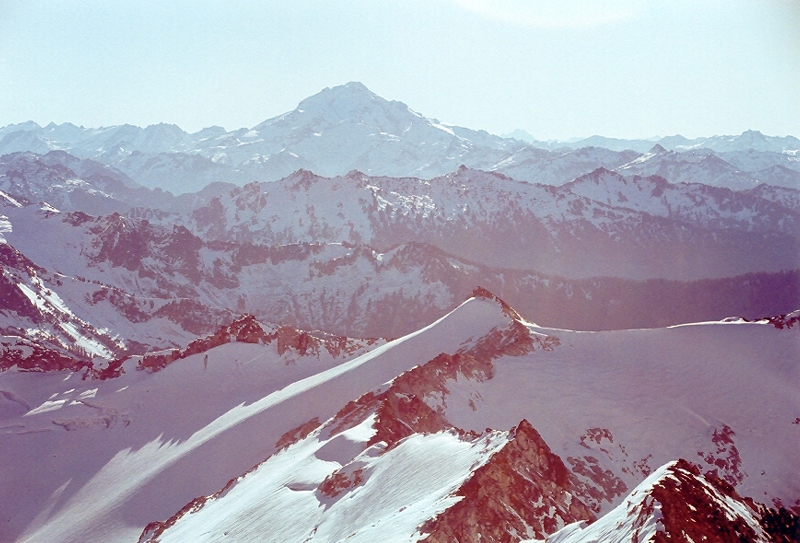
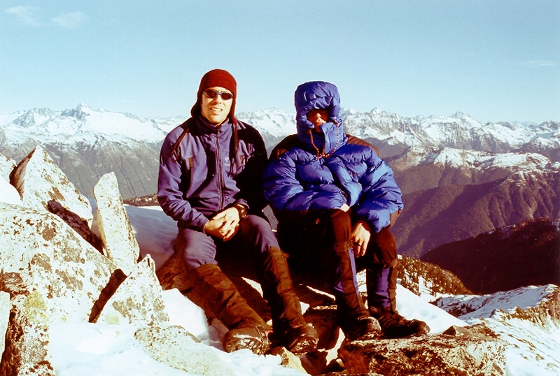
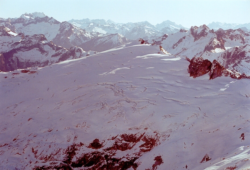
Still with snowshoes on, we climbed up the edge of the Snowking Glacier (about 30 degrees) to a bit of a neve. I reached the final summit ridge, took off my snowshoes and scrambled up the mostly snow-free rocks to the summit (class 2 - 3). Tom reached the summit a few minutes later. We both exulted in the impressive view of the glaciated peak across the cirque - Mutchler Peak (7,160+ ft). We left the summit around noon and retraced our foot steps back to camp. We broke down camp and headed back down, reaching the trailhead shortly before dark. Tom and I staggered the remaining 1.5 miles on the road back to the car. But, it wasn't over yet! The 20-odd drainage humps had to be carefully driven back over, now in the dark. It took a team effort, with Tom running out before each obstacle and gesturing "go right" or "go left" until the humps were all over with. We managed only two solid scrapes doing this, and I still have my exhaust intact.
Click here to view photos.
![]()


