Last Updated: October 19, 2024


Start

Recent content updates are viewable under what's new.

Reports in the queue for posting are coming soon!

Upcoming reports & photos:

Oh my! Quite the backlog here...

  • Lizzie Lake (Long, Tynemouth, Arrowhead, Tabletop & Anemone) - scramble (August 2023)
  • Armchair Traverse - scramble (August 2023)
  • Snowspider Mountain - scramble (September 2023)
  • Mount Trorey - scramble (September 2023)
  • Macleod Peak - scramble (September 2023)
  • Ben Lomond - scramble (September 2023)
  • Mount Killam (Gambier Island) - hike (September 2023)
  • Lone Goat & Snow Camp Mountain - hike (September 2023)
  • Isollilock Peak - scramble (October 2023)
  • Mount Manson - Mount Hatfield Traverse - scramble (October 2023)
  • The Gargoyles & Columnar Peak - scramble (October 2023)
  • Opal Cone and Lava Glacier - hike (October 2023)
  • Park Butte (WA) - hike (October 2023)
  • Trappers Peak (WA) - scramble (October 2023)
  • Rattlesnake Ledge (WA) - hike (November 2023)
  • Sauk Mountain (WA) - hike (November 2023)
  • Sunshine Coast (Mount Daniel, Pender Hill) - hike (November 2023)
  • Mount Dickerman (WA) - hike (November 2022)
  • Verona Peak AKA Winter's End - snowshoe (November 2023)
  • Dolomites (IT) - snowboard (December 2023)
  • Red Rock Canyon (NV) - scramble (January 2024)
  • Flute Summit & Oboe Summit - snowboard (February 2024)
  • Whistler Miscellaneous (Train Wreck, Loggers Lake, Shadow Lake and more) - hike (February 2024)
  • Mount Underhill - hike (March 2024)
  • Bombtram Mountain - snowshoe (March 2024)
  • Steep Peak - snowboard (March 2024)
  • Ruby Mountain (WA) - snowshoe (April 2024)
  • Blustry Mountain - hike (April 2024)
  • Sowerby Peak (Barr East) - snowshoe (April 2024)
  • Picacho Peak (AZ) - hike (April 2024)
  • Kitt Peak Observatory (AZ) - (April 2024)
  • Mount Wrightson (AZ) - hike (April 2024)
  • Saguaro National Park (AZ) - April 2024)
  • Superstition Peak/Benchmark (AZ) - scramble (April 2024)
  • Mount Humphreys (AZ) - hike (May 2024)
  • Petrified Forest National Park (AZ) - (May 2024)
  • Piestewa Peak (AZ) - hike (May 2024)
  • Channeled Scablands (WA | Columbia Gorge, Ancient Lakes, Potholes Lake, Palouse Falls and more) - hike (May 2024)
  • Rhododendron Mountain ("Pk. 2220") - snowshoe (June 2024)
  • Flora Peak - hike (June 2024)
  • Gibson Peak - snowshoe (June 2024)
  • Mount Urquhart - scramble (June 2024)
  • Rock Mountain (WA) - hike (July 2024)
  • Ladies Pass Quartet (WA | Cape Horn, Ladies Peak, Snowgrass NE Peak, Snowgrass Mountain) - scramble (July 2024)
  • Old Snowy (WA) - scramble (July 2024)
  • Dog Mountain (WA) - hike (July 2024)
  • Mount Ratney & Mount Bardean - scramble (July 2024)
  • Torrent Peak - scramble (July 2024)
  • Steep Peak - Darkside Peak Traverse - scramble (July 2024)
  • Silvertip Mountain - scramble (July 2024)
  • The Old Settler - scramble (July 2024)
  • Silent Hub Peak - scramble (August 2024)
  • Saint Jacobs Mountain - scramble (August 2024)
  • Mount David (WA) - scramble (August 2024)
  • Goat Mountain West Peak & Table Mountain (WA) - hike (August 2024)
  • Griswold Pass (Tuber Hill, Glacier View Peak, Subatomic Peaks: Baryon, Meson, Muon, Lepton) - scramble (September 2024)
  • Yellow Aster Butte (WA) - hike (September 2024)
  • Mazama Dome (WA) - hike (September 2024)
  • Ptarmigan Ridge - (WA | The Portals East Peak, Coleman Pinnacle) - hike (September 2024)
  • Tetrahedron Peak - scramble (September 2024)
  • Lone Cone & Peak 86 (Tofino) - hike (September 2024)
  • Mount Athelstan ("Pk. 2460") - scramble (September 2024)
  • Excelsior Peak and Cowap Peak - hike (October 2024)
  • Hollyburn Peak - hike (October 2024)
  • Cheam Peak - hike (October 2024)
  • Blanchard Needle - scramble (October 2024)

*As of 10/13/2024


Database

Query the reports database, selecting from criteria which include name, location, type, season etc.

Quick Links

Essential links & whatnot:


Jump To

Select from list below to jump to a specific area on this site.


| Featured Trip Report |


Last Updated: December 10, 2002

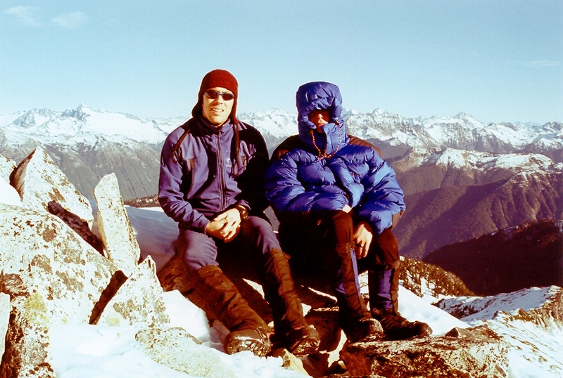
Snowking Mountain - Kindy Ridge, November 2002


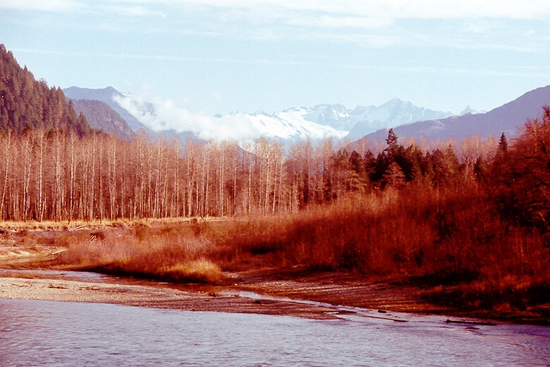
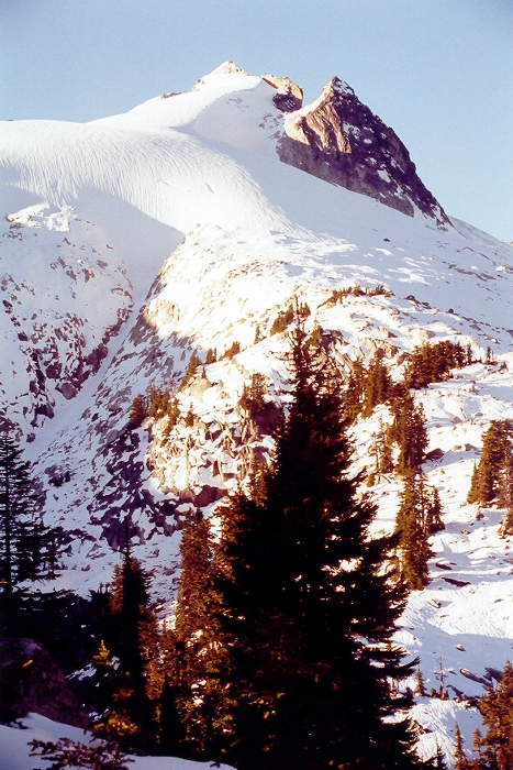
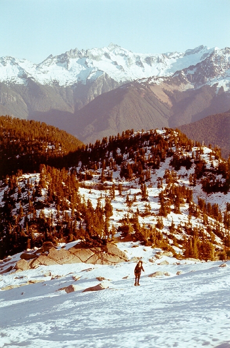
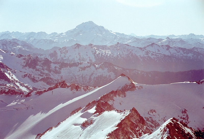
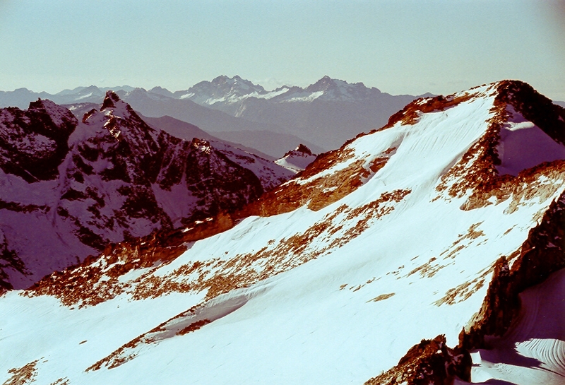
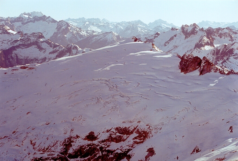
It was late November and barely a dusting of new snow graced the high peaks of the North Cascades. The clear and relatively warm weather that we Western Washingtonians enjoyed through October and the first part of November proved to be very persistent and was still very much with us towards the end of November. As is often the case when sunny weather is forecast for the weekend, I found myself drawn once again to the hills. A casual review of my climbing wish list (we all have one, don't we?) yielded numerous options, of which Snowking Mountain somehow appealed to me the most. Located roughly east of the Sauk River valley, south of the Skagit River valley and southwest of the Cascade River valley, Snowking Mountain is uniquely situated to offer sweeping views of the Cascade Pass/Boston Basin peaks to the east-northeast and a panorama from Mount Baker to Snowfield Peak panning from the northwest to the northeast.

Though a climb of Snowking Mountain can generally be accompished on a long summer day, I opted for an overnighter given that it now gets dark around 5:00pm. Finding a partner for this outing proved to be quite challenging as it was also "Apple Cup" weekend, and most of my climbing partners tend to be either WSU or U of W grads. Fortunately I was able to persuade Tom into joining me with the promise that I would bring my shortwave radio in hopes that we could pick up the game once at camp. Crossing the Skagit River one could clearly see Dorado Needle and Eldorado Peak above the Marble Creek basin. About 14 miles up the Cascade River Road, we turned right onto FSR 1570. It is while driving this road that we would encounter the "crux" of the climb. Numerous water runoff drainage humps have been installed diagonally across the road which proved very challenging to navigate over in a lowered VW. We finally reached the washout and I breathed a sigh of relief knowing that I at least made it to the "trailhead" with exhaust sytem intact. We hiked the 1.5 miles up what remains of the road, ignoring the orange tagging at a clear-cut on the right side. We reached the end of the road shortly after the first and only switchback and easily located the trail that led steeply upwards. (more...)

Click here to view photos.
home | email | copyright

All photos and text for sverdina.com are copyright © 2002-2024

It would be very much appreciated if you please ask before copying and/or re-publishing content from any part of these pages. To do so, please click here to send a message via feedback form.

Thank You.

©2024 sverdina.com |