


Alpha Mountain - East Ridge, August 2008
Serratus Mountain - North Face, August 2008

Tantalizing. A word that best describes glimpses of the Tantalus Range as seen from the Sea-to-Sky Highway, and probably the origins of the name ascribed to the prominent group of peaks west of the Squamish River. How many times have my eyes gazed longingly upon its serrate ridges and fractured glaciers while driving to and from Whistler, BC? As any avid climber can attest, one can only ignore these peaks for so long before they get under your skin and slowly fester into a persistent and nagging itch that one is powerless not to scratch. The opportunity to once and for all stop scratching arose finally when Tony Tsuboi invited me to join himself and David Eldred on a sojourn in the range. I in turn invited Aaron Misiuk, making for a solid four-man team.
Alas, that trip amounted to little more than Tony and David making an exploratory helicopter flight across the Squamish River Valley. The alpine and our intended drop-off location at the Serratus-Dione Col (aka Red Tit Col) were completely socked-in, and would remain that way for the next few days. Tony and David cut their vacation short, while Aaron and I spent a few days climbing in Squamish, hopeful that the clouds and rain would subside enough for a heli drop. The weather did eventually improve, but by that time the economics of flying-in were no longer justified considering the limited number of days we had available. Instead, I somehow allowed myself to be talked into climbing the East Ridge of Alpha via the notorious tyrolean traverse across the Squamish River. I'll spare you the juicy details of what transpired that day by the tram platform, but needless to say there was just no way I was prepared to suspend myself 50-feet off the ground from the primary cable and hand-over-hand it to the opposite bank. Tight-roping across seemed like an easier alternative, until I made it about 50 yards from the platform at which point the uncontrollable swinging started. Much to Aaron's frustration and with a new respect for those that do not think twice about such things, I retreated from the platform and walked in shame back to my car.
Not quite able to put the idea to rest after that experience, I talked long-time climbing buddy Eric Hoffman into joining me for another go. Like before, the weather prognosis on the day we were scheduled to fly-in wasn't all that good, but the meteorologists were predicting a steady improvement in the days following. If the weather wasn't enough to deter us, surely the longer-than-usual drive should have. Unfortunately, a massive rockslide on the Sea-to-Sky south of Squamish forced all Whistler and Squamish-bound traffic through the Fraser River Canyon and Lillooet, before turning south through Pemberton. A relatively straightforward four-hour drive was now a nine-plus hour odyssey much of it on narrow and poorly maintained 2-lane roads. There was enough novelty for Eric and me to experience the scenery along this drive once, but we were really hoping that the road repairs would be complete in time for our return four days later.
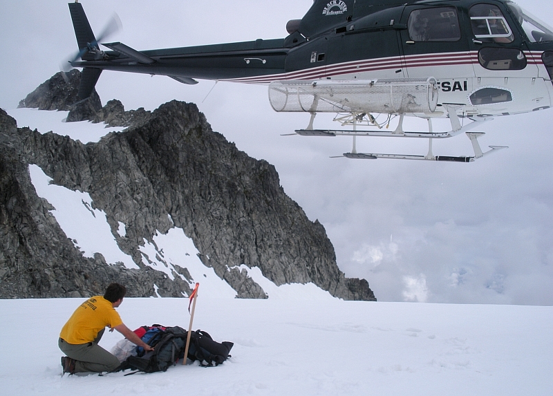
We had a 10 am departure booked with Black Tusk Helicopters the morning after our arrival in Squamish, but weren't too overly optimistic considering the heavy cloud cover that lingered. Much to our surprise, the pilot indicated that he'd just flown a party down from the col only minutes ago and that we should go ahead and start loading-up our gear. We found ourselves hovering high above the Squamish River Valley moments later and having cleared most of the low clouds were able to get a bird's eye view of what we'd be dealing with over the next few days. Eric and I disembarked after touching down near the Haberl Hut (our home for the next three nights), unloaded our gear and waved our pilot off as the heli lifted-off and disappeared into the clouds below the Serratus Glacier.
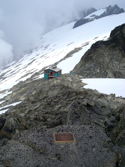
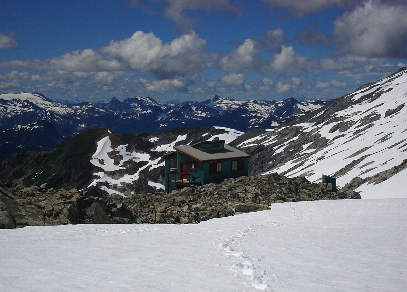
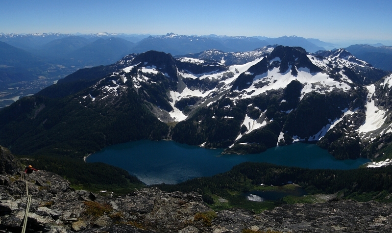
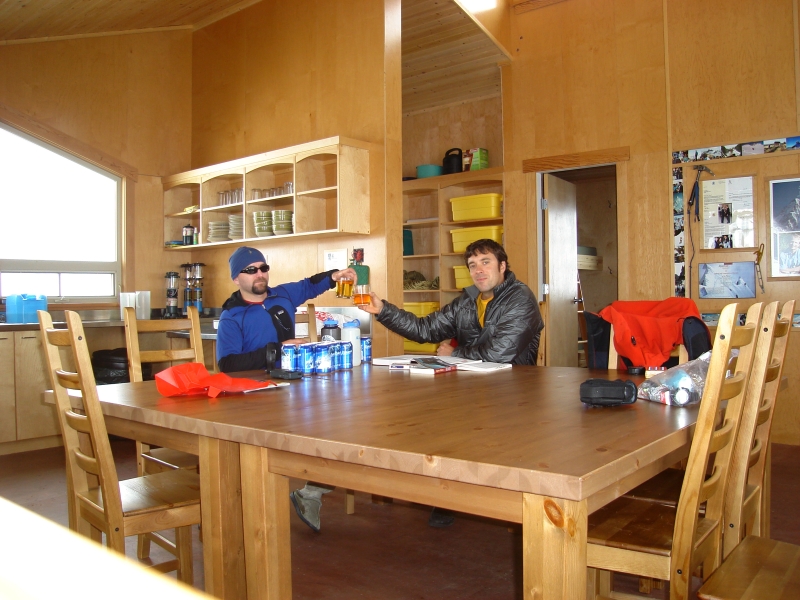
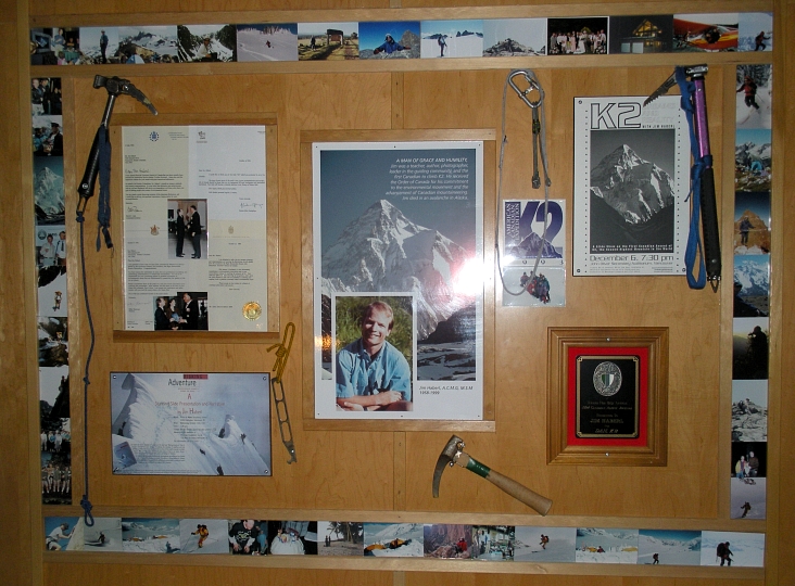
Completed in 2005, the Jim Haberl Memorial Hut is among the nicest ACC huts I've ever experienced, second only to perhaps the Kain Hut in the Bugaboos. Clearly, a tremendous amount of effort and expense went into the construction of this hut and Eric and I couldn't believe our good fortune to have the entire place to ourselves. We took refuge in separate rooms, each consisting of padded single as well as queen-sized bunks. As in many ACC huts, there are propane cook-tops as well as a propane-fired furnace to help keep the place comfortably cozy. There are large double-paned windows all-around with expansive views from the Georgia Straights all the way to the distant Pemberton Icefields. Jim Haberl earned his fame by being the first Canadian to summit K2. He died in an avalanche in Alaska.
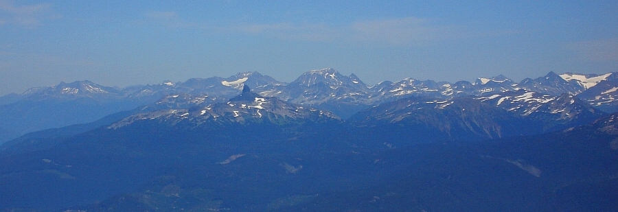
Aspirations for "running" up nearby Serratus slowly diminished as the weather progressively worsened. The clouds came and went; it rained and even snowed some. Inside the hut however, the heater was running and the Kokanee flowing, as we played game after game of cribbage. Early that evening, about an hour before dark, the weather finally started showing encouraging signs of breaking. Plans to climb Tantalus the next day were revised in order to allow time for the dusting of snow on the rock to hopefully melt off. Conditions seemed ideal for a go at the North Face of Serratus, followed by either Alpha or Tantalus on the following day.
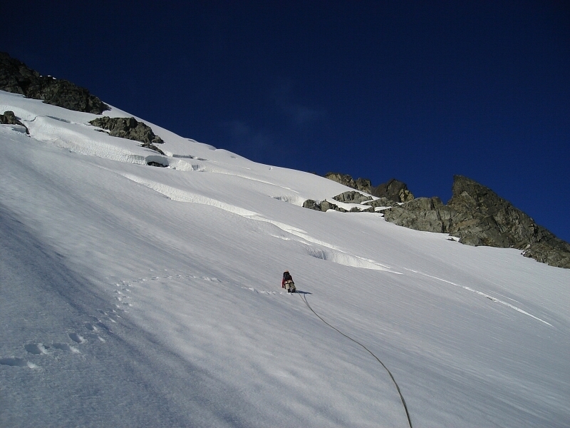
We awoke to our 5:00 am alarm to discover the only two clouds in the sky clinging to both Dione/Tantalus and Serratus. Serratus was to be a short day anyway, so we went back to sleep for another hour or so hoping that the pesky clouds would burn off. By 6:00 am the clouds were mostly gone, and so after coffee and cereal bars we were off and trudging down...yes, down as opposed to up, the Serratus Glacier. We made haste passing beneath a small icefall before gaining the North Face proper. From what we could see, the route looked to be in good shape, with the fresh dusting adding to the bootability of the snow.
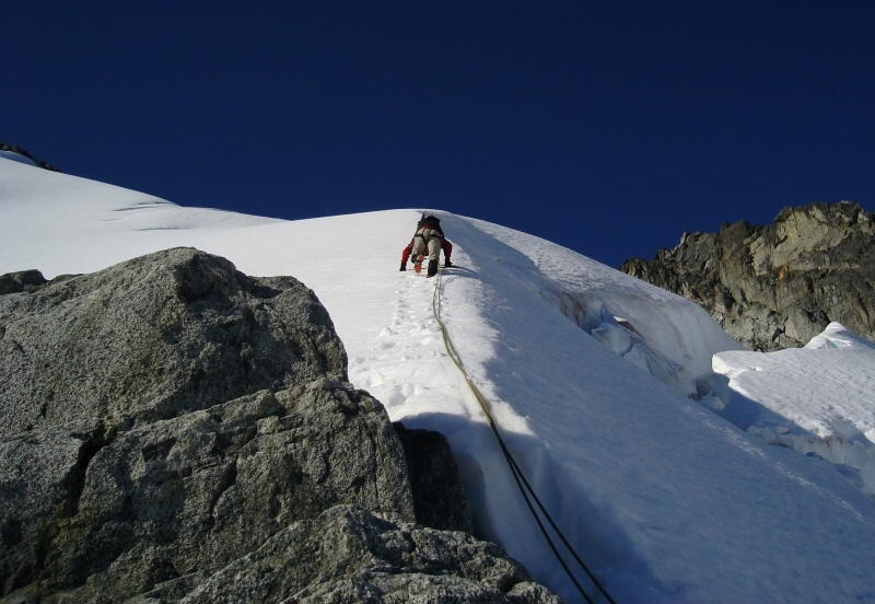
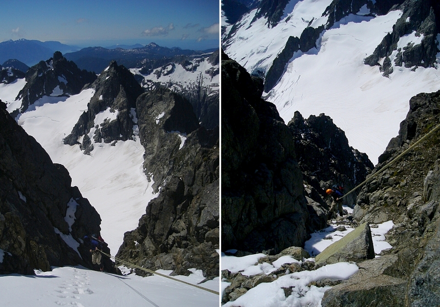
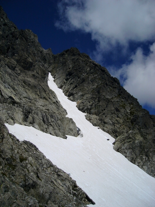
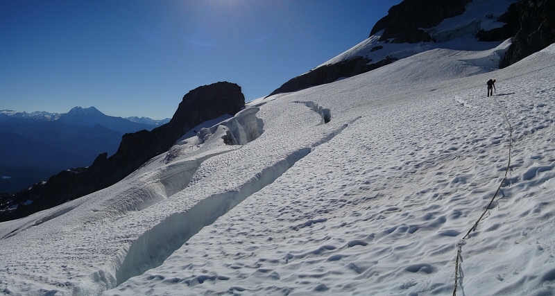
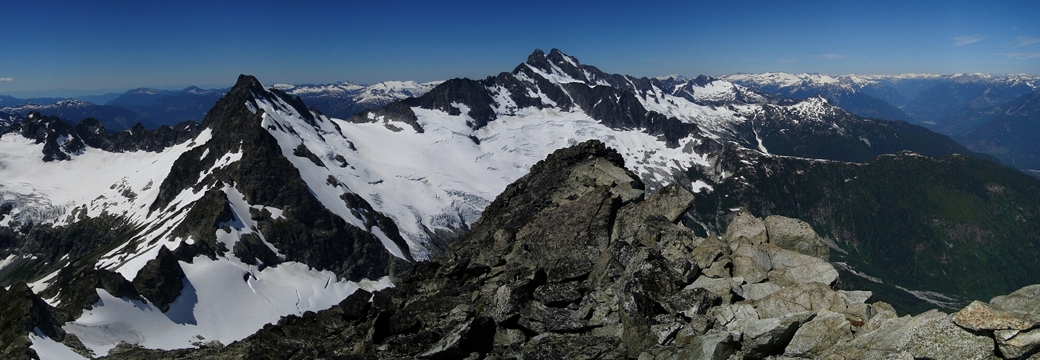
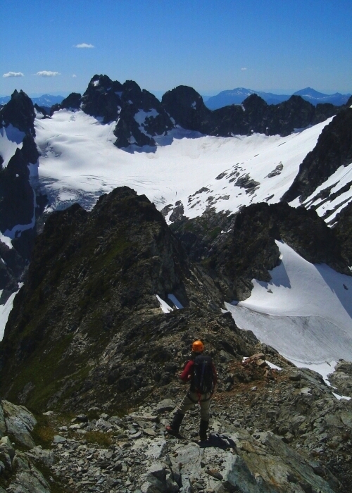
We wound around a few crevasses and started up a steeper portion of glacier before running into a near impasse. I say 'near impasse' because there was a way through via a steep snow traverse over to a small, but suspect bridge with yawning crevasse below. We decided to play it safe and Eric retreated from his highpoint and followed my tracks across the slope to a rock outcrop that we could scramble over to bypass the aforementioned impasse. Back on snow, Eric continued up an aesthetic snow arete just left of the previously mentioned icefall. At the top of the arete, we veered right and passing over a bridge spanning a bergschrund near the top of the North Face, cut back left and climbed the final steep pitch onto Serratus' summit.
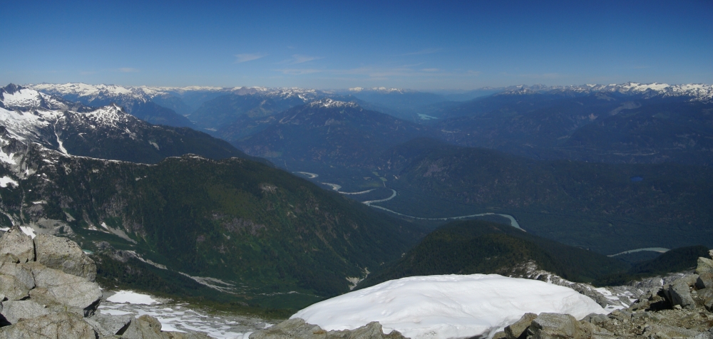
It found it remarkable how much fresh snow there was up top - I doubt this is a normal occurrence for early August. Sitting between Alpha and Dione/Tantalus, Serratus' position is unique and offers sweeping views in all directions. The climb took us a grand total of two hours from the hut, now if only the descent was that straight forward! Descending the incredibly loose and well-dusted Southwest Spur was a test of nerves until we gained the equally shitty coulior that descends to the Ionia-Serratus Col. We found ourselves on continuous snow after four rappels or so, and down-climbed 45+ degree snow for what seemed like an eternity before reaching lower-angled snow in the Ionia-Serratus Basin. A short stint towards Alpha to punt up the unappealing descent route on its southwest side (we were hoping to make time for a Tantalus climb) was nixed in favor of climbing the East Ridge the following day instead.
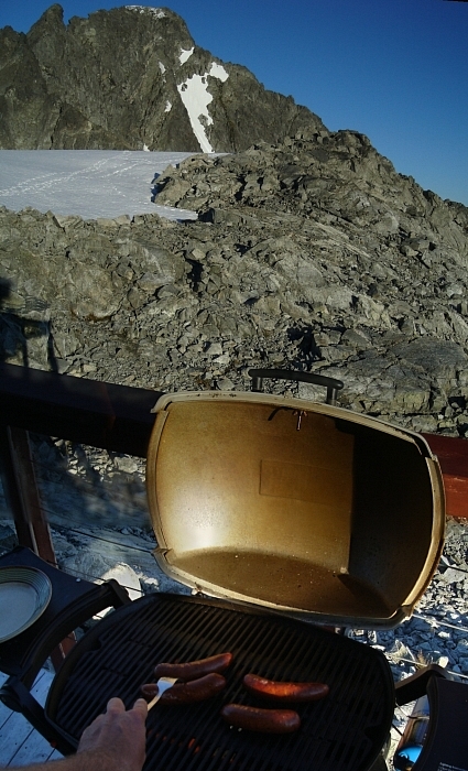
We trudged back to the Ionia-Serratus Col in the full afternoon heat, then continued beneath Serratus' West Face (there's supposed to be a route here, but neither Eric or I could see the line) en route to the Serratus-Dione Col, reaching the hut before 3 pm. We made an impressive dent in our liquor supply later that afternoon and evening and I finally managed to win my first game of cribbage. Based on our experience that day, we decided to push the Tantalus climb to our final day, as a fair amount of snow was still clinging to the rock and instead go for the lower Alpha Mountain. We knew the Alpha climb would be a full day, with a fair amount of glacier navigation, ridge scrambling and a hot and exhausting slog back to the hut, and so we left the alarm clock unchanged. Go figure. The Haberl Hut is good style for sure, but a true alpine start is next to impossible with such plush accommodations.
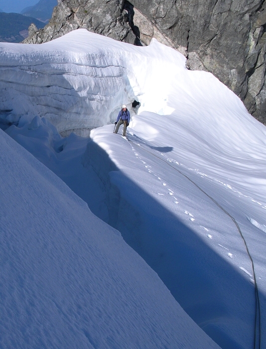
We awoke to another cloudless sky and went about the usual pre-climb ritual of brewing coffee, frying-up eggs, strips of bacon and so forth. I know, I know...we were really roughing it up there, eh? Oh, and you should see the view from the outhouse window! Did I mention how hard it was to motivate for the climb? When I could finally stall no longer, I sauntered over to where Eric was strapping on his crampons and followed suit. We roped-up and started plodding down the glacier once again. This time, we descended a fair bit lower than previously, aiming for a slabby outcrop at right near the edge of a large icefall low on the Serratus Glacier. Squeaking by on a steep, narrow finger of ice between the icefall and cliffs at left, we descended to the glacier flats between Alpha and Serratus, losing about a 1000 feet total from the col.
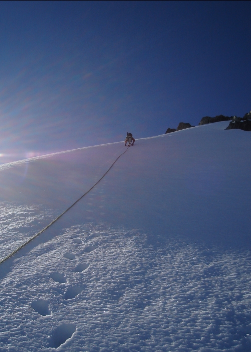
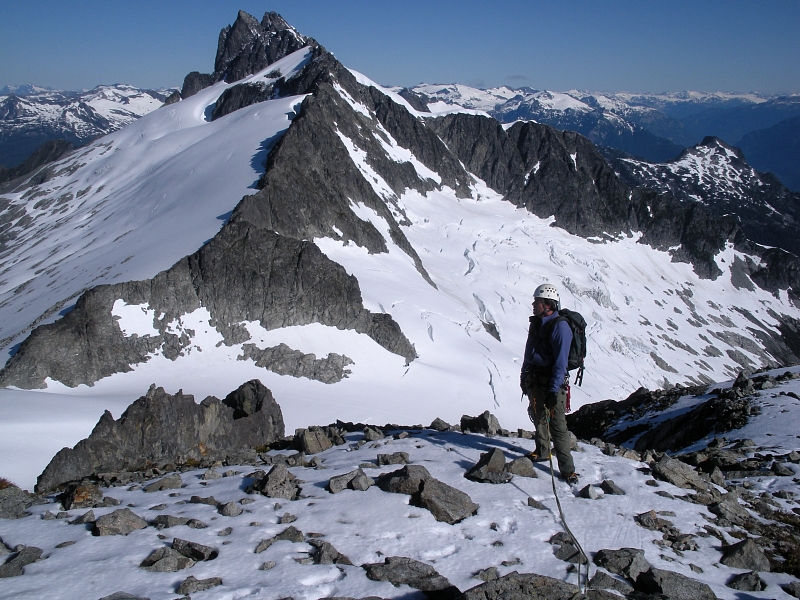
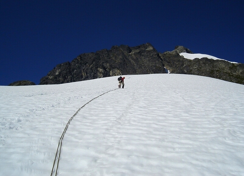
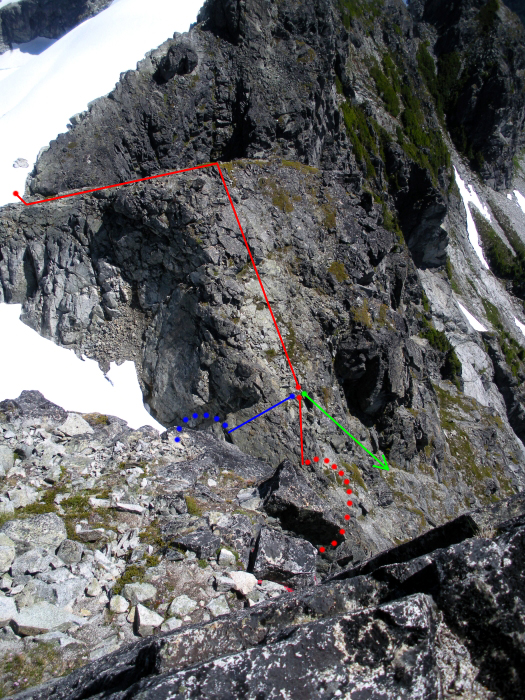
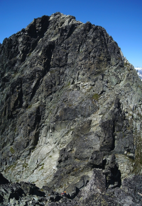
Easily gaining the north slopes of Alpha from here, we made a gradual ascending traverse, dodging crevasses here and there, aiming for a break in the peak's Northeast Spur. We ascended a final steep glacier slope with East Ridge looming above. From there we continued up and across the final bit of glacier to a low notch in the ridge and changed into our rock shoes. We scrambled 3rd class rock to the obvious step that comprises the crux moves of the route. I had Eric put me on belay, and climbed up onto a ledge at the base of the vertical 5.8 hand crack. (blue). There was a piton above, but felt awkward getting to it. I chickened-out and decided to explore my options around to the left. Having read of a 3rd-class bypass at left (green), I worked my way around the ledge looking for something a little more up my alley.
In hindsight, I should probably had sucked-it up and gone for the 5.8 crack, for I ended up climbing a desperate pitch on steep, junk rock with more than one awkward move to eventually reach a slung block atop a large ledge (red). I passed what appeared to be a rappel station in a small alcove on my way up and can only assume that I had climbed the rappel route. The climbing felt no easier than 5.8, with suspect holds and poor pro for most of the pitch. Eric followed the pitch rather quickly I thought, until reaching the final pumpy move below the belay block. Commenting on how he needs to spend more time in the gym, Eric pulled himself up to the ledge while I reeled him in with still-shaking hands.
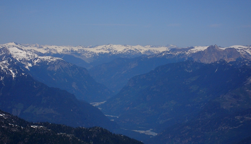
A short walk on the ledge lead to a roof that I passed by working left across a slab (~5.6/5.7 for a move or two). I gave Eric a belay from a comfortable platform above the slab and decided to resume simul-climbing, as the route from here appeared considerably easier than that which we had just climbed. Indeed, the rest of the climbing was casual 3rd and 4th -class rambling with occasional low 5th moves that could probably be avoided if one was so inclined. We reached the summit and celebrated with high-fives all around while rock shoes were removed and sun block was applied. Alpha's position at the eastern-most edge of the range affords it a view superior to that from Serratus. I tried to make out the Whistler - Blackcomb ski area up north, but wasn't able to distinguish it from the slopes around Black Tusk and Wedge Mountain behind. The deep cut the Squamish River makes near its headwaters at the
We basked in the sun on top of Alpha for a good 45 minutes before starting down the west - southwest slopes. Generally a hike down loose terrain, the idea is to trend left of a rotten gully near the bottom to reach a saddle at the head of the small glacier between Alpha and Serratus. In hindsight, traversing this glacier on the north side of the crest to Alpha-Serratus Col seems the better way to go if returning to the Haberl Hut. Following the recommended decent route description in the guidebook, we instead hiked down steep heather and grass south of the saddle, making one rappel over a short cliff band to reach snow slopes above Lambda Lake. Traversing south-facing snow slopes for what seemed like an eternity, we eventually reached the Ionia-Serratus Col, then followed our footsteps from the previous day back to the hut.
Eric and I were pretty trashed after all that and had doubts we'd be able to pull-off a climb of Mount Tantalus and make it back to the hut in time for our heli pickup scheduled for 3 pm the next day. Sure, we could reschedule to as late as 5 pm (there's cell coverage from the Col near the Red Tit Hut), but Tantalus is by every account a full day's affair from the Serratus-Dione Col. We'd lost a day from our original itinerary as it is and didn't feel like pushing our luck. There also wasn't much appeal to us in going for Dione instead. No, it has to be the mighty Tantalus, and preferably via the seemingly more aesthetic North Ridge, but that'll be an adventure we'll leave for next summer. For now, we had pasta dinner and the rest of the Cavassier to polish off.
The skies were abuzz with aircraft the next morning, including a high-speed fly-by of the hut. I was washing dishes at the time, looking out the window towards Dione and literally made eye contact with a passenger in the back seat so close the heli was. Another heli dropped a single climber off at the hut around 10 am, who promptly disappeared leaving his gear unattended outside the hut. We never did figure out where he'd gone off to. With the dishes washed, floor swept, gas valves turned-off and an entry added to the guest book, Eric put in a call to Black Tusk Helicopters to move-up our pick up time. We were flying back out within the hour. I had brought a small FM radio up to the hut and learned that the Sea-to-Sky repairs had thankfully been completed a day earlier than forecasted. With that monkey off our backs, we could relax for an easy trip back home. Somewhere outside Horseshoe Bay I looked back out the car window for a final glimpse of Mount Tantalus and Dione. Hell, if I strained my eyes I could almost make out the hut at the col. It's a good feeling knowing I've been up there, one that I'll no doubt be reminded of each and every time on my way to ski at Whistler or climb rock at Squamish.
Driving home, Eric and I cracked some jokes at the expense of the Oregon party who'd arranged a pick-up from the hut the morning we flew in. They apparently endured nothing but foul weather the entire 4 days they were up there, and failing to realize the existence of the Haberl Hut prior to being dropped-off, spent most of the time cooped-up in leaky tents. Their entry in the guest book mentioned seeking refuge in the hut's 'vestibule' for a night or so before resorting to dialing the hut custodian (his number is posted outside the locked door) for the door combination. The rockslide also happened during their stint in the Tantalus, so a grueling drive back to Portland was no doubt also in the cards. Oh boy! Anyhow, all this underscores how fortunate we were and how variable the experiences in the Tantalus can be. Fingers crossed for success on Mount Tantalus next summer!
Click here to view photos.
![]()


