


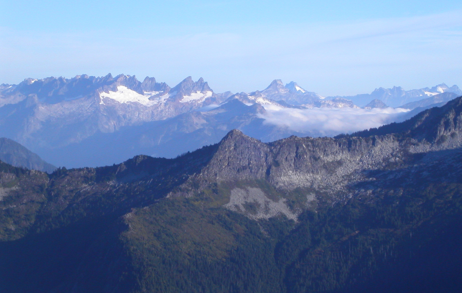
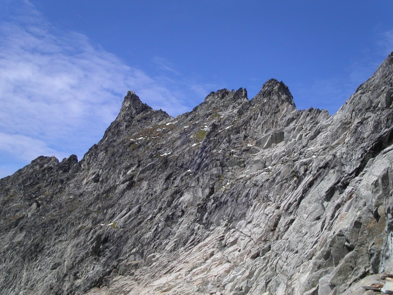
The Triad - East Ridge, September 2004
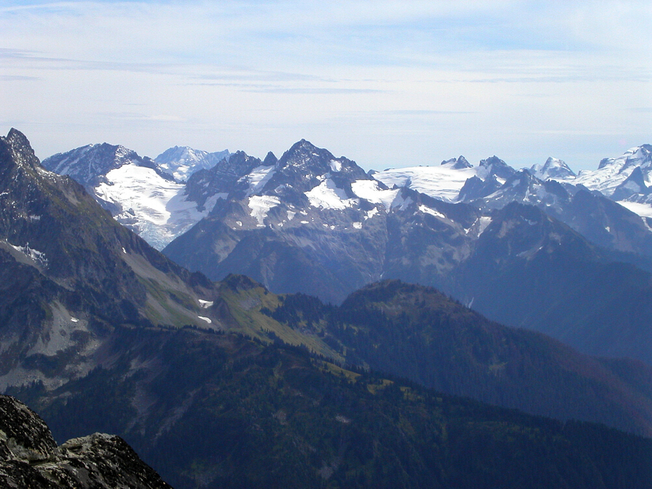
 as seen from high on the Eldorado Glacier.")
Trying to escape the lousy September weather on the "West-Side", Eric and I decided to head east and attempt the NW Ridge of Reynolds Peak's North Summit. To our dismay, we found the trail closed due to wildfire (we could smell smoke at the trailhead), but against our better judgment we went for it anyway. There was ample evidence of prior burning right alongside the trail, but only after seeing actual licks of flame a few miles in did we give our decision to go a second thought. We were obviously violating some local ordinance and with the real threat of fire it just seemed stupid to keep going. We turned around and got the heck out of there. Seeing a fire crew heading in the opposite direction up the Twisp River Road, presumably to put out spot fires that had popped up along the Reynolds Creek Trail, confirmed that we made the right choice. Close call!
We decided to salvage what was left of the day by sport climbing in Mazama. Fun Rock never disappoints! We had ambitious plans to climb Dorado Needle the following day, and so drove on to the Sibley Pass Trailhead (we were all bored of the Eldorado Creek Trail approach) later that evening after a fine rib dinner at Clarks. The million dollar question however, was whether or not the sun was finally going to make an appearance. Paul Klenke pulled up around 10pm. We chatted a bit and then all retired to our respective sleeping quarters - Paul and I in our cars and Eric in his parking lot bivy. Stars filled the night sky...
With a 6am departure, we made good time up to Sibley Pass, but, soon found ourselves at an impasse. In short, we were stymied by very hard glacier ice (not aluminum crampon friendly!) where the approach makes a short jog on the north-side of the ridge above North Fork Sibley Creek. Valuable time was lost searching for another way around and it was becoming increasingly apparent that we weren't going to be able to pull off Dorado Needle on this day. Surprisingly, there were patches of fresh snow down in the meadow at around 5500ft, and the west faces of Eldorado Peak, Dorado Needle and the more distant Forbidden, Boston and Sahale Peaks all had a significant dusting of new snow.
We reluctantly called off the climb, but, now what? Time permitting, we had talked of tagging The Triad on our return from Dorado Needle (the approach passes directly beneath it) and now made it our primary objective. About a third of the distance out to Dorado Needle, we figured The Triad would be a quick-and-dirty consolation prize. Not so! Now that traversing below the north-side of the ridge was not an option, we were forced to descend into the basin on the sunny south-side. Would we be able to reach the talus and slab slopes below The Triad's South Face this way?
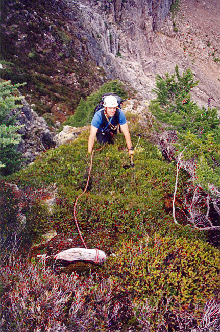
After some steep, meadowy side-hilling and some talus we gained a grassy buttress and found ourselves at another impasse. Steep cliffs below blocked access into the next basin. Looking down the buttress a short distance, a bench seemed to break the buttress and connect with a grassy slope and brushy cliffs, seemingly providing a viable route down into the basin. The grassy slope, it turns out, was very steep and still slick with dew and patches of melting snow. It would have been a long ride down to the boulders in the basin below should one of us have lost our footing there! We looked to the brushy cliffs for options. While Eric and I waited above, Paul eventually managed to descend steep trees and brush interspersed with minor cliff bands to finally reappear on talus slopes in the basin below. Not particularly motivated to second Paul's down-route, I chose to rappel wet heather directly along the cliff's edge. 2X30m raps saw me into the basin, with 15 feet of mossy chimney to down-climb at the very bottom. We would later call this portion of the route the "jungle pitch". Not liking what he was seeing and presumably fed up with the many obstacles that day, Eric uncharacteristically decided enough was enough and returned to Sibley Pass to scramble up Hidden Lakes Peak instead. We would see him many hours later back at the car.
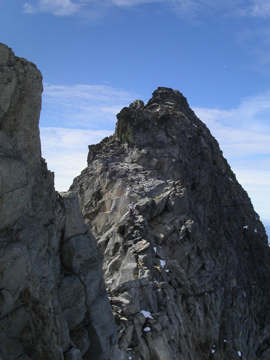
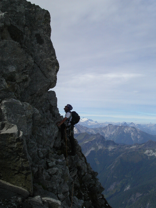
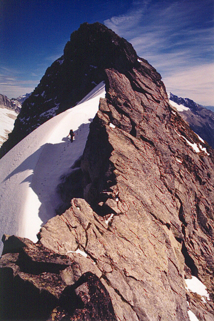
We dumped some gear, continued on to the saddle, and commenced the ridge climb. The climbing was easy (3rd and 4th-class), but exposed. The rock wasn't the best, but made for enjoyable climbing nonetheless. We belayed two 30m pitches and running-belayed the rest. I had a minor fit when I saw what I feared was a front moving in from the west and urged Paul to consider bailing. He consoled me with the promise that he'd fork over $100 if it started to rain. With the technical difficulties now behind us, only a short scramble to the summit remained.
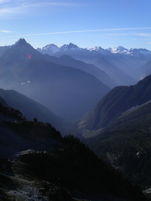
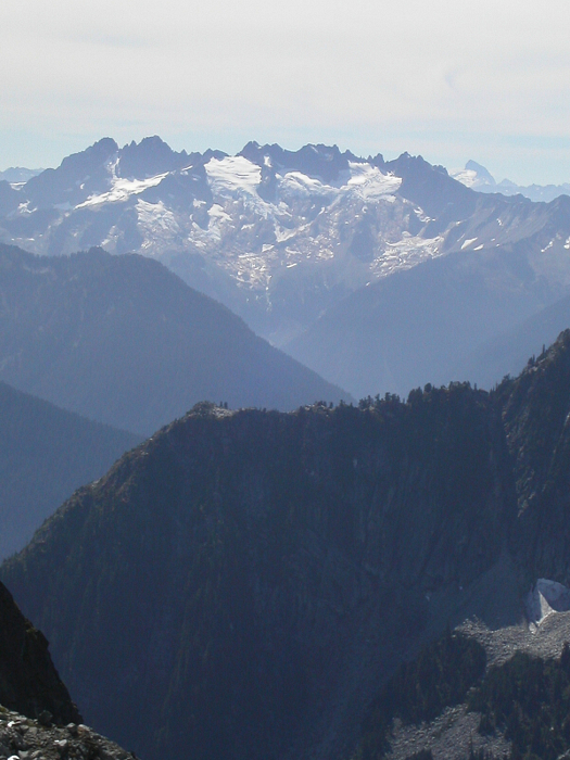
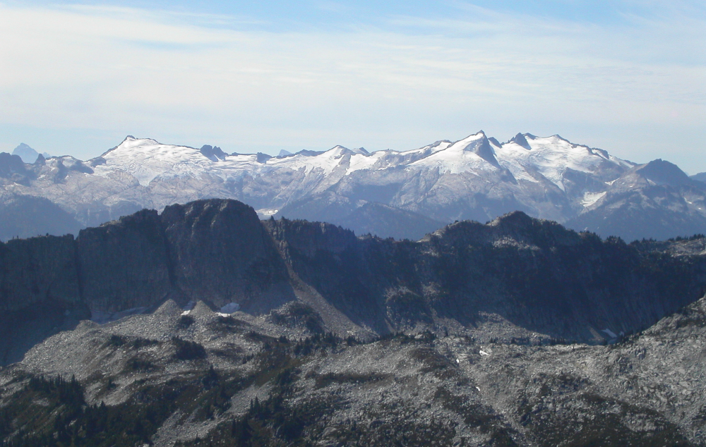
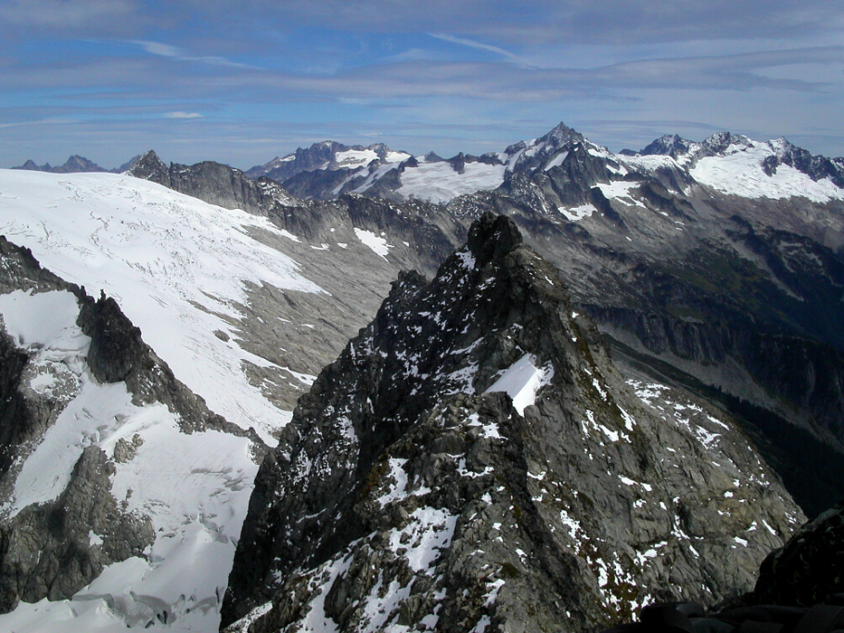
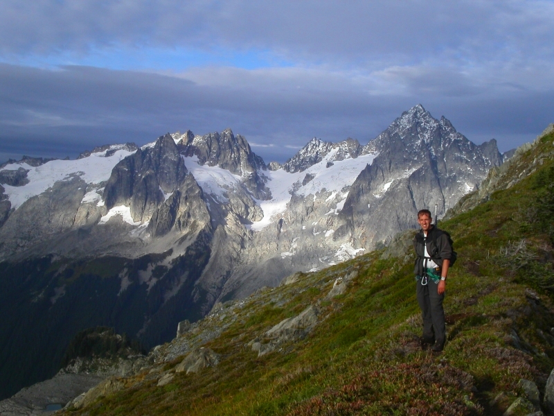
Rain it didn't, and by 2pm, we were sitting on the summit, losing ourselves in the views of Marble Creek Valley with Dorado Needle and Eldorado Peak towering above the cirque. From nowhere else that I have been do the peaks of the Ptarmigan Traverse show themselves as prominently as they do from The Triad - from Cascade Pass all the way to Spire Point...it's all laid out for you to behold! Eventually, it was time to head back. We scrambled down from the summit and belayed each other down one of the steeper and more exposed portions of the route. We then scrambled back to the next minor ridge tower, located the rap station and rapped back down (a 50m rope would suffice). A short snow traverse on the north-side of the ridge and a little more scrambling and we were back on easy terrain.
From there, we retraced our steps back to the jungle pitch and running belayed back up it. The remaining hike out was tiresome, but, the awesome scenery made up for what we lacked in endurance. We made it back to the car (and Eric) before full-dark. The "Double Whammy" at Good Food never tasted so good!
Click here to view photos.
![]()


