


Mount Fury - Southeast Glacier, August 2006

I had some unfinished business in the Northern Pickets to attend to. As arranged, I rendezvoused with Paul, Peggy Goldman and Eric Johnson at Luna Camp the evening following their climb of Mount Prophet. The three would then join me for a full day of brush and sweat up to high camp at Luna Col and with me staying behind make a quick afternoon jaunt up Luna's Southwest Ridge. Peggy and Eric would then return the following day while Paul and I continued on to climb Mount Fury. We'd then return to Big Beaver landing on the final day, retrieve (and drink) the 6-pack I stashed in the lake and revel in our successes while waiting for the water taxi to arrive...or so we hoped.
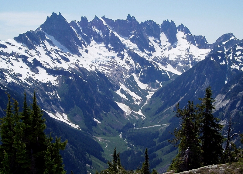
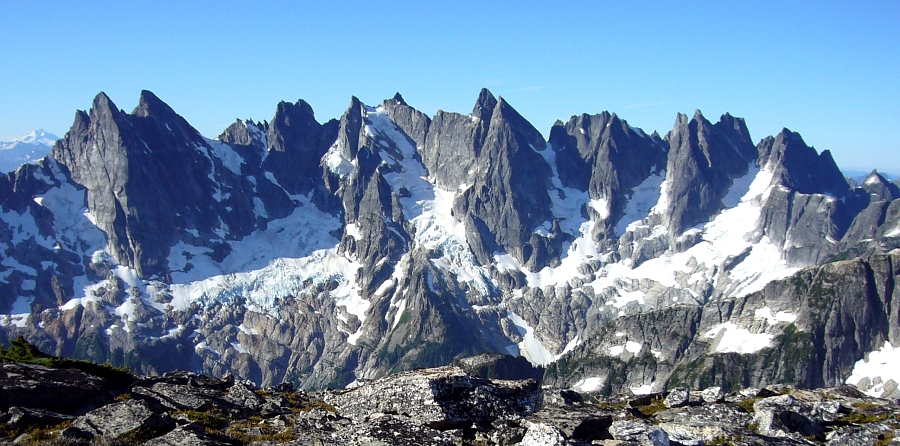
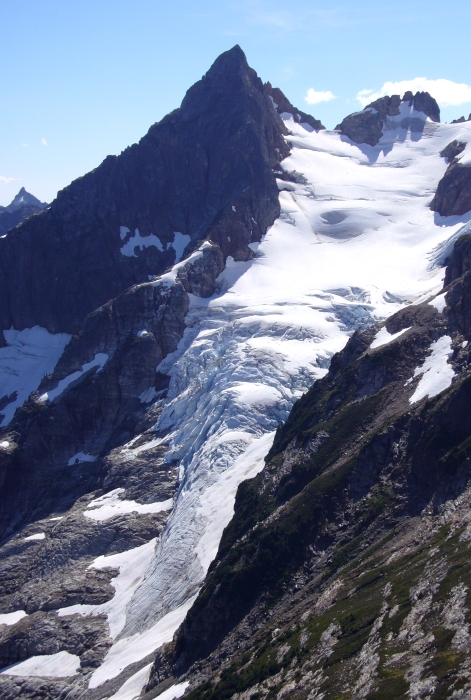
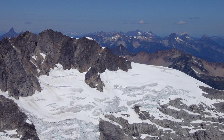
And while Fury's SE Glacier route is not the most exciting line on the peak given its remoteness and distinction of being situated in what is arguably the most sublime group of peaks in the lower 48, any route would do for me. Considering that a 15-minute speedboat ride up Ross Lake, 10+ miles of good trail through old growth forest, a frigid ford of Big Beaver Creek and a character-building grunt up along Access Creek will only see you to a glorious high-camp at Luna Col, it's clear that the approach is not for the weak willed. The reward comes later - starting with a well positioned ridge scramble and relatively direct glacier climb with aesthetic snow arete finish, this climb represents some of the best the Pickets have to offer. Yes it's true that Eric Hoffman and I were thwarted by weather on an attempt at Fury last summer. I did not take the defeat lightly and was determined to succeed my second time around. What are the odds of getting stuffed by weather two times in a row anyway? Hey, I wasn't about to burn another 4 days without something to show for my efforts. Right?
Alas Peggy and Eric J. awoke the morning of our Access Creek ascent to soreness and fatigue from the previous days' Prophet climb and promptly called the Luna outing off. Now down to two, Paul and I set out looking for the 'marker' (rocks stuffed into the exposed face of a sawed-off log) indicating the point at which one should leave the trail for the thrash towards Big Beaver Creek. As I feared, the creek was running high and fast courtesy of last winter's big snow pack and rapid melt-off. There'd be no fording today. We then proceeded to thrash about the brush for the next several hours in a desperate attempt to locate a suitable log crossing. We eventually located such a log - about 30 minutes on trail from Luna Camp and another 20 minutes of flailing across a mosquito infested bog to reach the bank. The log was partially submerged making for an interesting cheval across with a strong current tugging at our legs.
Once across the creek we proceeded to make an ascending traverse until reaching an impasse - a steep-sided canyon-like feature with fast-flowing water. Failing to notice that we had in fact reached Access Creek, we foolishly decided to cross over to the other side and lost about 500ft (and more time) in our efforts to find a suitable spot to cross. It didn't take long for us to realize our mistake at which point we simply kicked up the steep but open forest parallel to Access Creek. We crossed back over the creek once the forest leveled-off but then crossed back left too soon and endured slider alder hell before finally reaching continuous talus uninterrupted by the annoying swaths of alder (a path bears along the grassy bank parallel to Access Creek). Just making it to upper-Access Basin consumed most of the daylight and so we called it a night and set up camp next to a large boulder. We ate dinner as high cirrus clouds drifted by. Hmm... With bivy sacks weighed-down by rocks and fortified against mischievous rodents, we set out for the bench above the upper-basin early the next morning. In stark contrast to the conditions Eric and I encountered last August, the long gully (second from left) and bench were still buried underneath several feet of bulletproof snow and ice. With the upper-half of the gully pitching up to about 35 - 45 degrees, a fall here would be impossible to arrest.
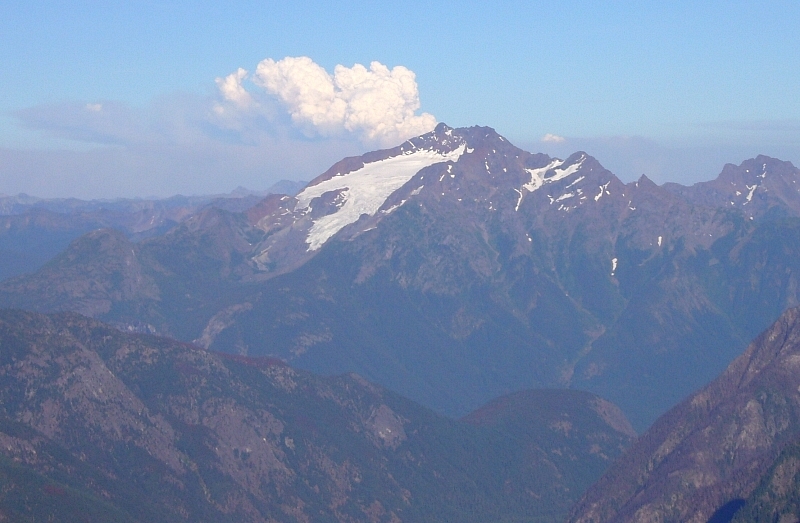
Spirits sunk as we reached the high notch above Access Creek Basin. An ominous blackness was looming just south of the Southern Pickets. Looking south from higher in the basin beneath Luna's South Face, I could barely make out Mt. Triumph shrouded behind a wall of rain. I felt the first drops moments later. Determined to at least bag Luna Paul raced ahead while I plodded along unenthusiastically. With rain blowing sideways Luna Col was a cold and miserable place to sit and wait. While Paul scooted along the exposed summit crest far above, I descended to a soggy heather outcrop, sat down and sulked in the rain. Having completed his successful ascent of Luna, Paul quickly returned back to where I was waiting. We briefly debated the merits going for Fury despite the weather, but ultimately nixed the idea on account of the wetness and generally slow progress we would make in those conditions. It was now also already after 10AM and with an estimated 5 - 8 hours (one-way) to reach the summit from the col, it didn't seem possible that we'd be able to return to our Access Basin camp before nightfall. Furthermore, we weren't particularly excited with the idea of having to descend the icy gully, much less do so in the dark.
Then something totally unexpected happened. Not five minutes into our retreat, the clouds began to part and within 15 minutes yielded to completely cloudless skies. No joke. Now, it's one thing to get shut down by weather, particularly when the forecast calls for 20% POP. But, for the sun to come back out while the objective is so tantalizingly close yet still unattainable is just plain rude! I seethed with anger over the insult. It apparently wasn't enough for me to just be doomed to repeat the increasingly expensive water taxi ride, endlessly boring trail and unpleasant Access Creek approach for the third bloody time. No wait...if counting my Mt. Challenger climb a few years back, that makes four times on both the water taxi and Big Beaver Trail. Argh!
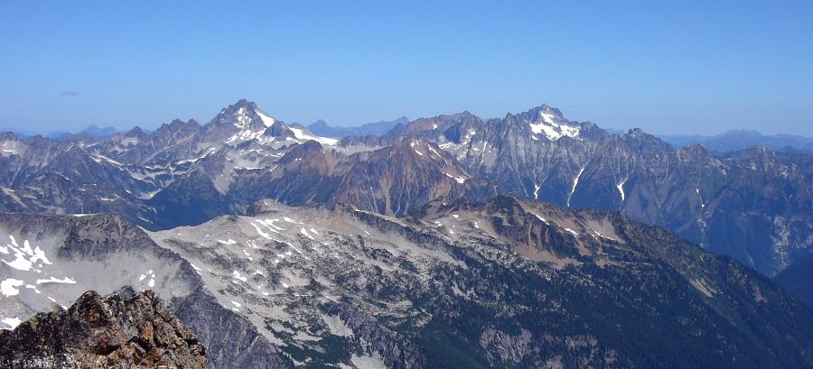
With motivation at an all-time low I followed Paul back to the aforementioned notch. Traversing steep heather just below the craggy crest south of the sketchy gully, we were able to reach a low saddle overlooking upper-Access Basin. Descending from here we'd still have to contend with hard snow down to the bench and below, but the slope below was neither as steep nor as long as the gully. Satisfied with having discovered a more savory descent alternative, Paul convinced me to join him on a ridge traverse out to "Lunatic Peak" - Pt. 6115 near the end of the ridge separating the Access and McMillan Creek drainages. This wasn't an FA per se as there was evidence of prior human visitation, but if nothing else the view from Lunatic offers a unique perspective of the Southern Pickets, Fury and the Redoubt - Spickard Group.
Back at the saddle, we made two tree raps (single 30m rope) to reach a moat at the edge of the snow slope. Tedious down-climbing for what seemed like hours finally saw us back to camp. We endured another evening of mosquito swatting and another rain shower sometime after midnight. Awaking to a light drizzle, we packed-up and proceeded to make the soggy descent back down Access Creek. Big Beaver was flowing higher than before making for an even more exciting cheval back across the log. Another mind-numbing 4 hours of trail saw us to our Ross Lake beer stash. Salvation at last! "But, what, who, where...NOOOO!!!" Much to my dismay the six-pack had either floated off or was taken by someone for I could not locate it. Fuck. What better way to make a lame trip even lamer, eh? Perhaps I should just stay home the next July 4th weekend.
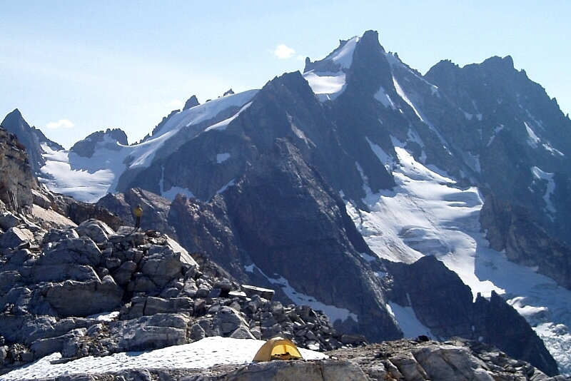
Fast-forward a month almost to the day - lo and behold, there I am once again hiking the Big Beaver Trail. Now together with Eric, the ford across Big Beaver and ascent to Luna Col was trivial...similar to our first attempt in August '05. We made camp with hours of daylight to spare this time. The skies were clear without a hint of a threat of cloud or rain. I didn't have to keep my fingers crossed either for I had done my penance. Resting on a smooth slab I drank deeply of the superb scenery and warming afternoon sun. Downing the last of the whiskey a day early I toasted Eric, Fury and the weather gods. Tomorrow was going to be a good day!
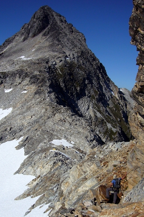
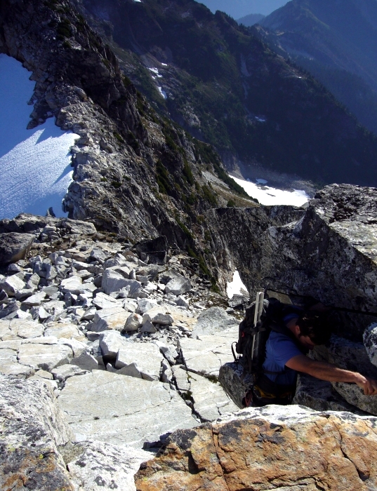
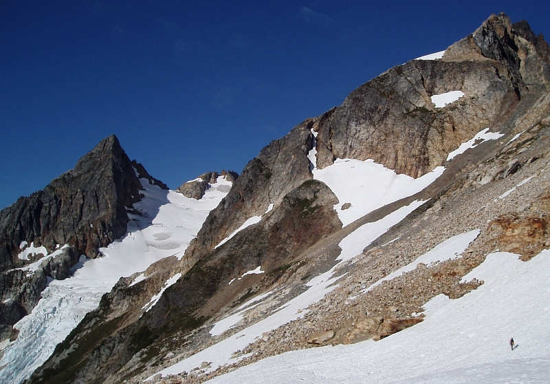
Leaving camp around 7AM, we quickly gained the obvious ledge visible from camp. The ledge is wide and far less intimidating that it appears. Continuing along the broad, heathery ridge top we encountered an impasse beyond the next rise. Looking left (south) we located a ramp and gully that leads down to snow slopes, now on the right (north) side of the crest. We were able to avoid the still icy snow by staying in the moat and soon found ourselves standing at a saddle and looking up at the next rise. The portion of ridge above this saddle involves a short 5th-class rock step. Continuing along the crest we reached a notch from which we made a descending traverse (left of the crest) to a talus and snow basin. Traversing this basin we soon gained ledge at about 6600ft.
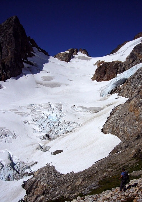
We inched along the loose and somewhat exposed ledge until reaching steep scree slopes above the SE Glacier snout. A short traverse of this slope soon allowed us to descend to the SE Glacier proper. We roped-up and traversed onto the glacier (hanging ice above - caution is advised). Turning right, we proceeded up the glacier towards a steeper section. A short pitch of 35-40 degree snow led to lower-angled slopes beneath the next glacier step. Continuing left across a large snow bench below the cliff band on the SE face we soon encountered a large 'schrund. We crossed the 'schrund on a snow bridge, though staying low and traversing farther left avoids it entirely.
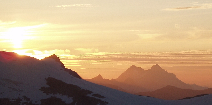
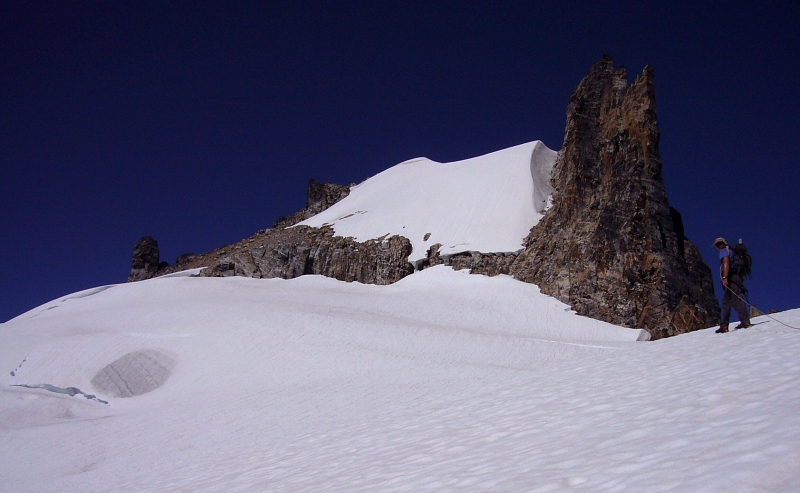
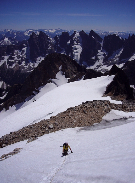
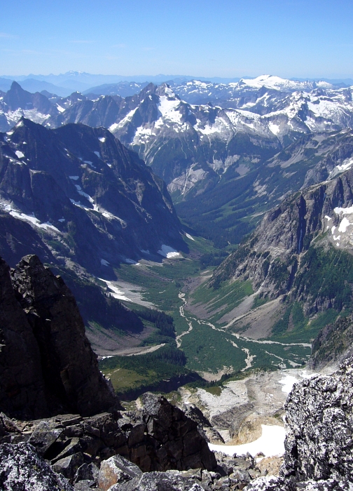
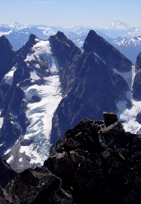
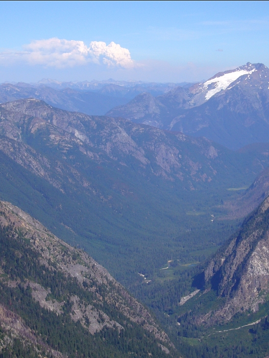
A short scree slope followed by a long pitch of 35-40 degree snow leads to the final, short snow arete. A quick stroll along the arete then led to the summit (~5 hours from camp). Considering the blood, sweat and tears involved in finally getting to the top of Fury, we were in no particular hurry to leave this amazing vantage point. I was captivated by the incredible view down upper-Goodell Creek Valley (seen here). Flipping though the summit register was like a who's-who of Cascade mountaineering with all the usual "Cascade-a-holics" represented. It took us about four hours to return to camp from the summit. After another night at the col, we hiked for about seven hours to eventually reach the Big Beaver boat landing (much faster than expected). Fortunately this time the beer was there where I stashed it! We took a refreshing dip in the lake and lounged around in the sun waiting for the water taxi to arrive one last time. Rest assured it'll be a LONG time before we set foot on the Big Beaver Trail again, eh Eric?
Click here to view photos.
![]()


