


Gannett Peak - Gooseneck Ridge, August 2011

Recalling the good 'ol days of road trips past, I set forth to explore the Beartooth and Wind River mountain ranges. Specifically, I took a week off to bag the Montana and Wyoming state highpoints - Granite Peak and Gannett Peak. Each being well over 12,000ft in elevation, these oft-visited summits offer sweeping vistas over some of the more scenic mountainous areas of the lower 48 states. I proceeded to climb Gannett following success on Granite a couple days prior.
70 miles to the southeast of the iconic Grand Teton and situated in the heart of the Wind River Range stands 13,804-foot Gannett Peak. Gannett sits on the border between two large wilderness areas, the Bridger and the Fitzpatrick. The mountain is the most remote of all the state high points in the lower 48 states. Using the primary route, it is a 40-mile round-trip to the summit from the trailhead. The climb involves trail hiking, some cross-country travel, scrambling and glacier travel.
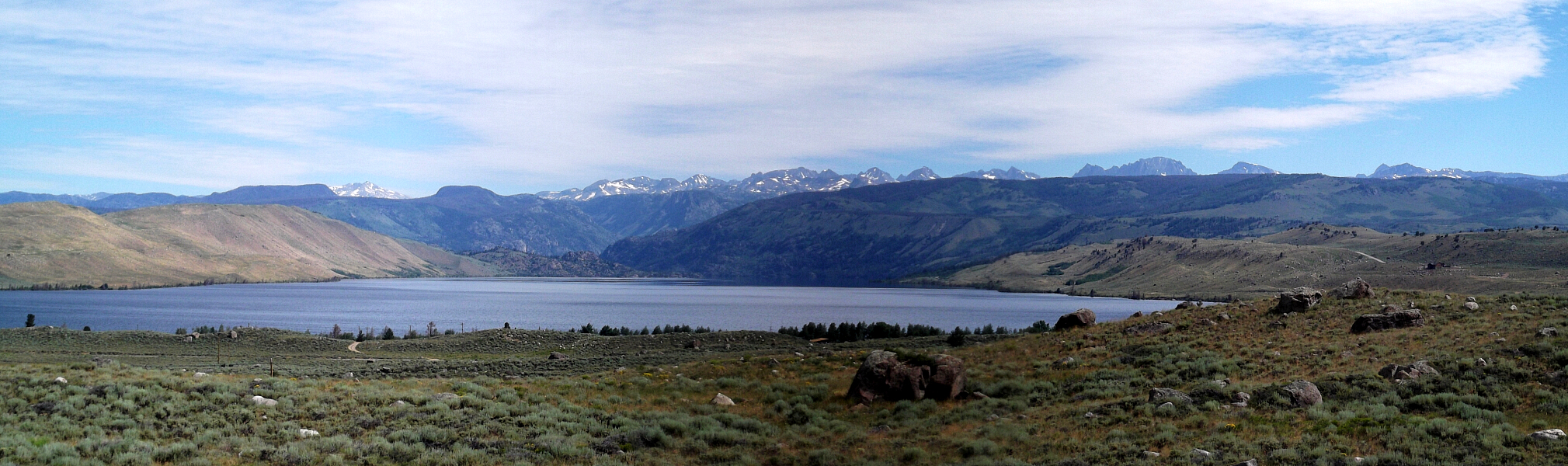
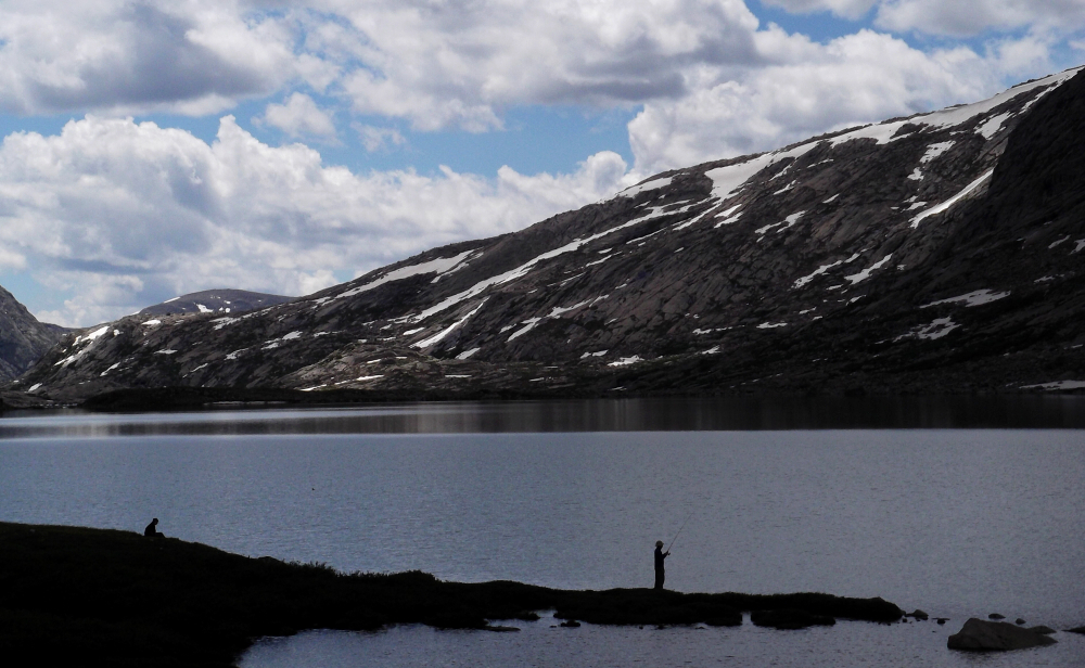
Arriving in Pinedale late the morning of August 2nd, I checked in at the local outdoor shop for some last minute supplies and a conditions update before I was off kicking dirt on the Pole Creek Trail. Fremont Lake is the second largest natural lake in Wyoming. Located just four miles from Pinedale, this lake is eleven miles long and ½ mile wide. Most of the lake is within the Bridger-Teton National Forest, consequently, most of the shoreline is undeveloped and in its natural setting at the base of the Wind River Mountains. A great place to wash-up after climbing Gannett!
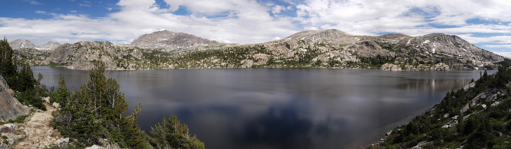
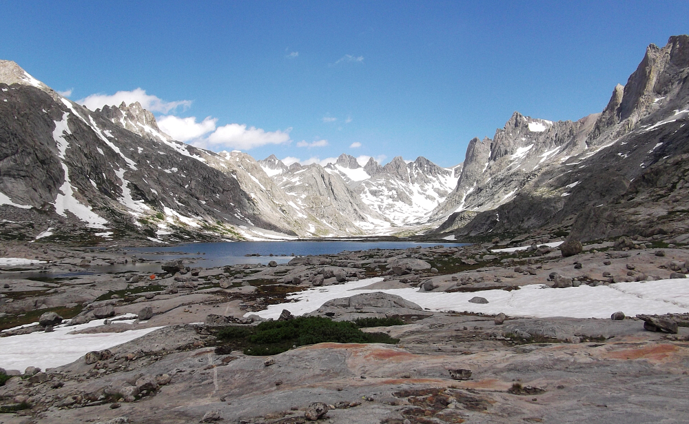
Seneca Lake is one of the larger lakes on the hike to Titcomb Basin. I hiked past a number of smaller but also very scenic lakes to get here: Eklund Lake, Barbara Lake, Hobbs Lake etc, and as you might guess with all that water sitting around there are also lots and lots of mosquitos to 'help' one keep up the pace! Island Lake is about 10 miles in and makes for an ideal place to stop and make camp if doing the approach to Titcomb Basin in two days (or if you started hiking in the afternoon as I did). Island Lake is unfortunately also a very popular place for backpackers, so don't come here expecting a quiet wilderness experience.
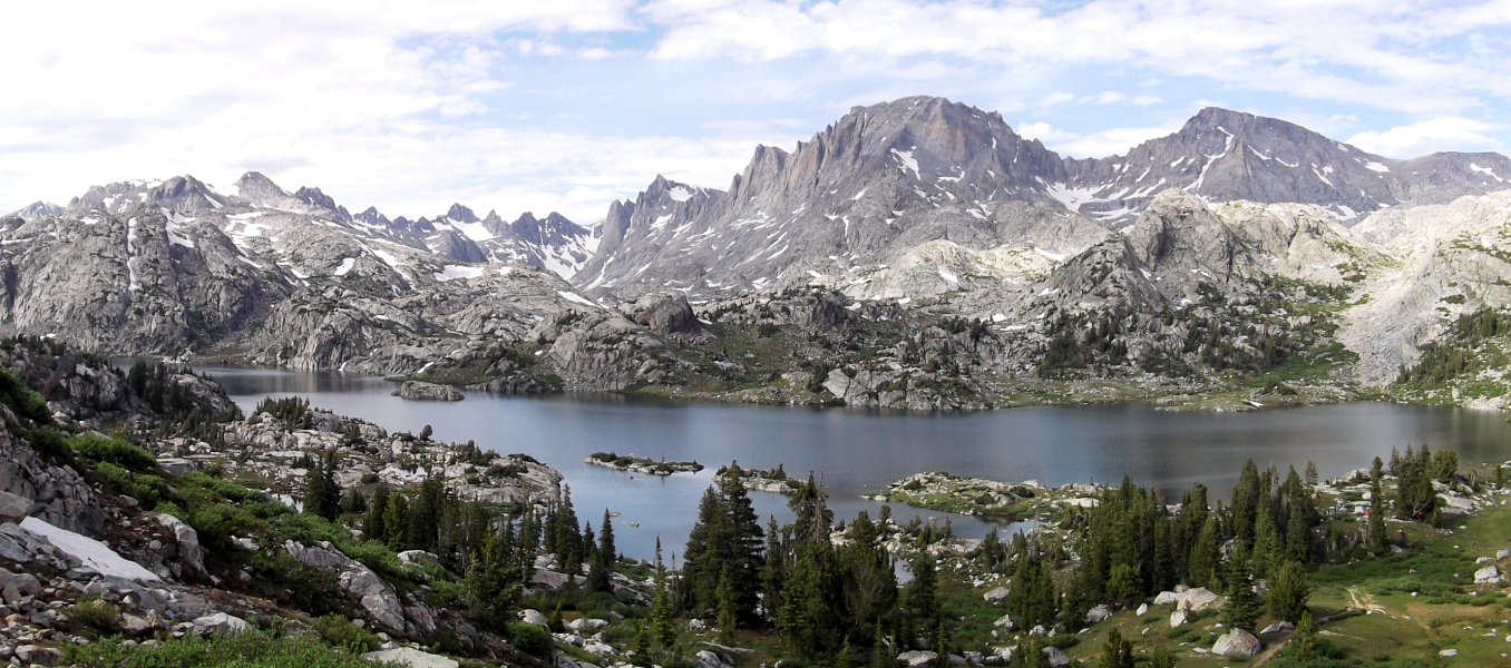
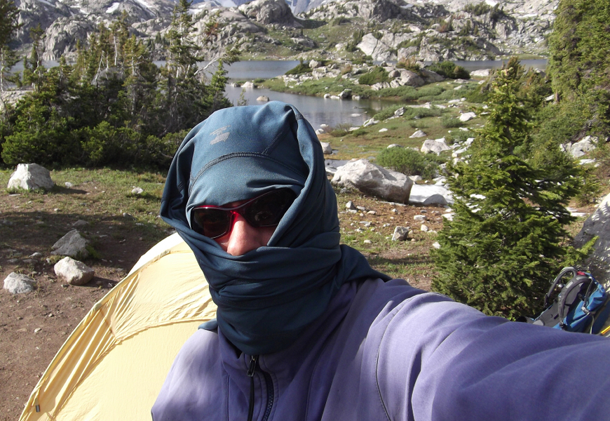
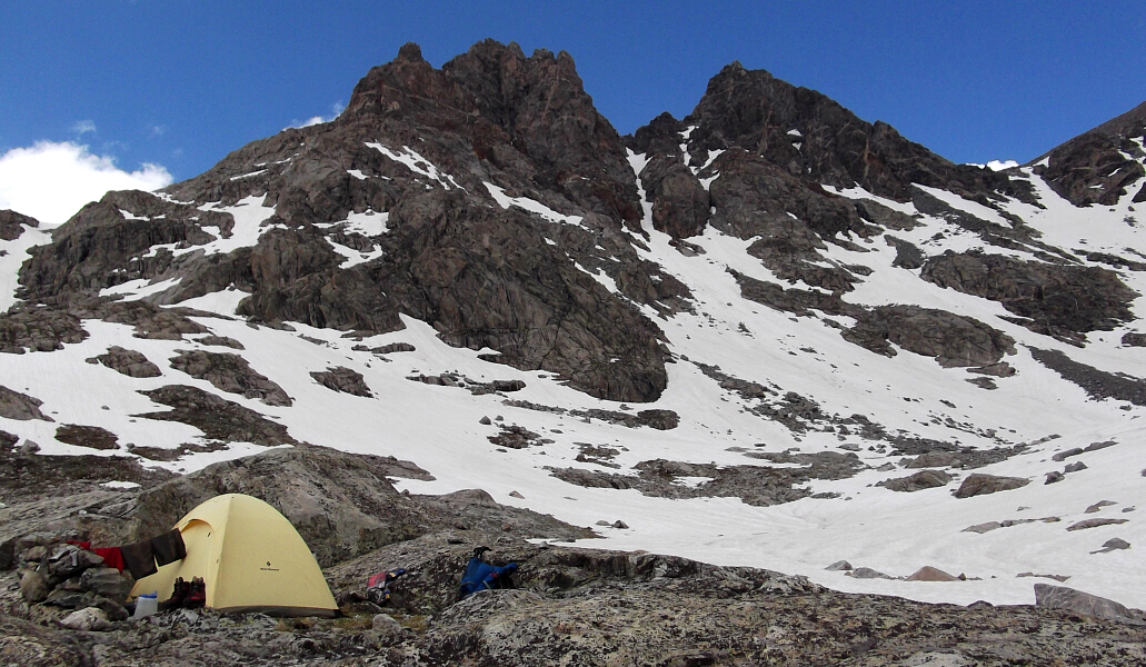
Swarming mosquitos inspired some creative alternatives to bug juice, that is until I couldn't stand it any longer and barricaded myself in the tent for the rest of the evening. Seriously folks, the bugs here are as bad as they get! Do not forget to bring a head net. Since I had an easy approach day ahead of me, I slept in that morning allowing the sun some time to dry my tent from the previous night's rain. Oh, and you'd think that the bugs would gradually diminish the higher one gets in Titcomb Basin, but holy hell did it ever get worse before finally improving! After a day-and-a-half of easy hiking, I could at last revel in the mosquito-free sunshine with only a passing hailstorm to briefly interrupt the peace. I witnessed a number of parties returning from successful summit bids as the afternoon wore on, but nobody it seemed was planning on going up the following day. Is it possible that I'd have the summit to myself?
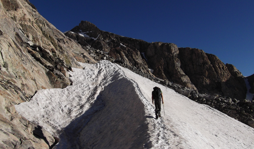
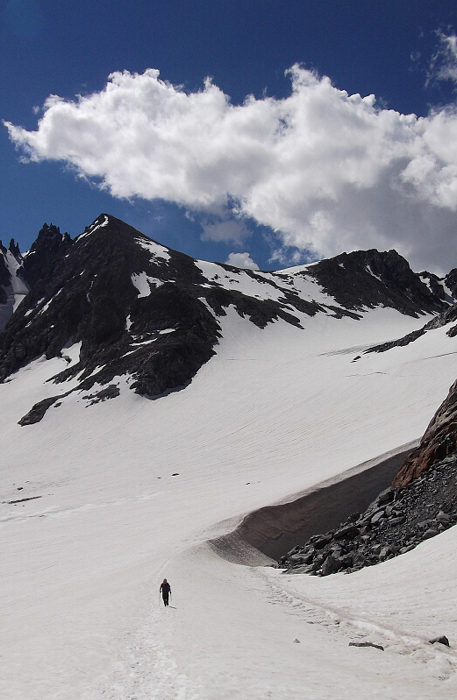
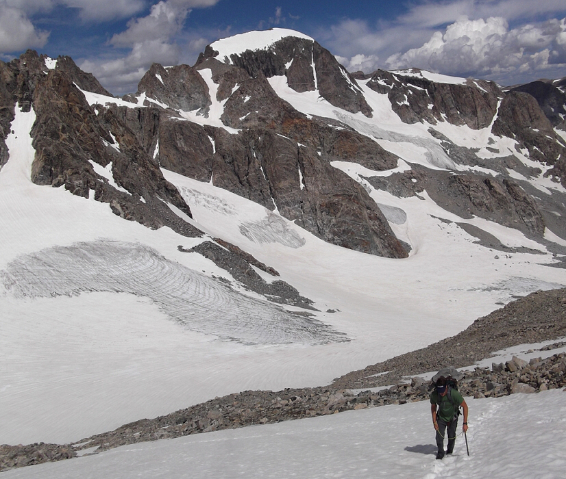
I left camp around dawn and made good time kicking steps up to Bonney Pass where I would meet the only other party on the mountain that day - Brett from Bend Oregon. A moderately steep and firm snow descent down the other side of the pass delivered us to the glacier flats flanking Gannett's east side. An aesthetic snow arete lead towards Gooseneck Ridge. From here we continued up and right over snow and a bit of rubble towards a low saddle on the ridge proper before finally turning left and proceeding upwards. Avoiding a steep glacier pitch at right, we traversed left up a snowy headwall and then scampered up talus and boulders to reach lower-angled snow again. We followed this to the base of the notorious bergshrund which we booted up without any difficulty to gain Goosneck Ridge proper.
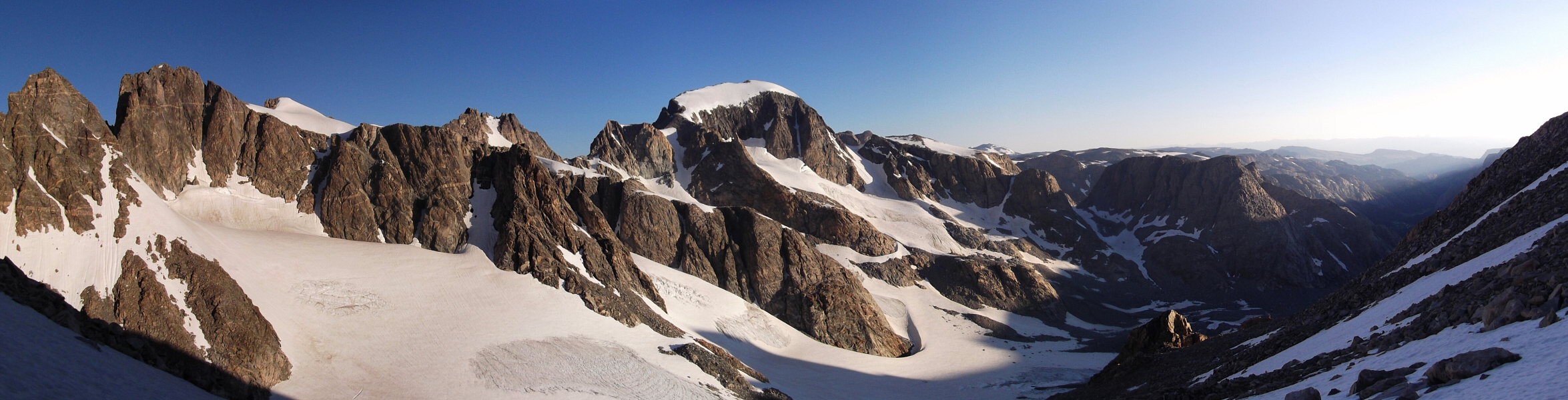
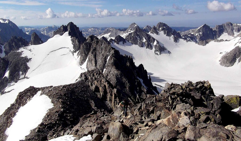
Easy walking over talus and scree with increasingly grand views in all directions finally brought us up to the large snowfield below the summit. A bit of a snow arete at the top of the aforementioned snowfield made for a classic finish. A short pitch of easy scrambling then lead to Gannett's summit where if it's a nice day you'll find it very hard motivating yourself to leave. Named in 1906 for American geographer Henry Gannett, Gannett Peak is the apex of the entire Central Rockies; the largely continuous group of the chain occupying the states of Wyoming, Idaho and Montana. Gannett Glacier, which is likely the largest single glacier in the American portion of the Rocky Mountains, flows down from the northern slopes of the mountain.
What should have been a pleasant final evening in the Winds, however turned into a terrifying night of hurricane-force winds, torrential rains, thunder and lightning flashes lasting 10 seconds or longer! I cannot recall the last time I shivered with fear quite like I did during those tense early morning hours, but rest assured there's nothing like a 'little' inclement weather to put the fear of God in you! Hiking out from Titcomb Basin the next morning, we enjoyed an inexplicably mosquito-free ~8 hour hike back to the trailhead. I'm not sure if they all perished due to the noticeably cooler weather or were simply blasted by the intense winds over into South Dakota. I guess if there's a silver lining to the crazy thunderstorm we experienced, this would be it. Just be careful what you wish for next time Brett...evidently your prayers for "no more mosquitos please" were heard loud and clear!
Click here to view photos.
![]()


