


Golden Ears (North) - Panorama Ridge, July 2006

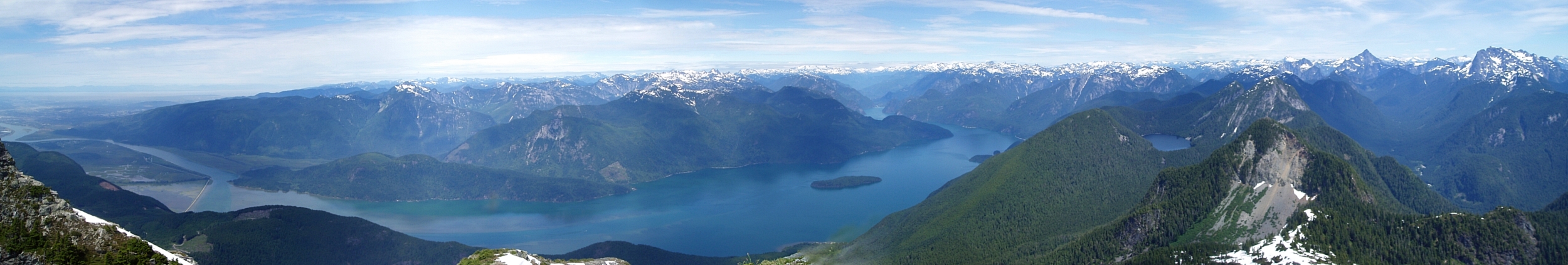
Golden Ears is one of the largest and possibly also the most popular provincial parks in British Columbia. The park was named after the twin peaks of Mount Blanshard, which shine gold from the setting winter sun. Located in the South Coast Mountains, north of the Fraser River, Golden Ears extends about 34 miles north through untamed mountain wilderness to the peaks and valleys bordering Garibaldi Provincial Park.
For driving and approach details, a good place to start would be the park brochure available on the BC Parks site. Most fit parties should easily be able to pull-off a North Ear outing in a day (it took me about 10hrs door-to-door from my in-law's North Vancouver residence). Follow the West Canyon Trail which links with the Golden Ears Trail to eventually reach the summit of the North Ear (~7.5 miles one-way) - part of the two horn-shaped granite formations easily spotted from as far away as Bellingham. An alpine cabin sits below the summit on Panorama Ridge and sleeps eight. Many climbers apparently use the cabin as their base to make an approach to the Golden Ears - a mere hour-long slog and scramble away.
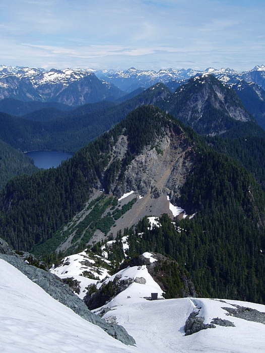
The West Canyon Trail follows an old logging road for about a mile-and-a-half. Then, branching left onto the Golden Ears Trail, one makes a moderately steep ascending traverse through forest before reaching the Gold Creek overlook and a small basin with the first camp sites shortly thereafter (about 3-miles in). The extremely well-marked trail continues just north of camp and follows what appears to be another abandoned and rocky logging road carved from the hillside. Occasional clearings revealed glimpses of Panorama Ridge up ahead and the South Ear from across the basin.
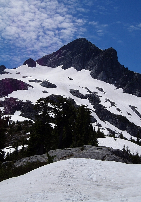
The trail then departs the abandoned road, and turning right, switchbacks up steep forested slopes eventually reaching a shallow, lightly forested crest with good views of both Ears. I continued on to gain the toe of Panorama Ridge, and soon also the first snow. Booting up the snowy ridge, I passed the cabin (more of a bivouac really) aiming for the lower saddle just left of the North Ear (ice axe recommended, but not required). The trail continues up from the saddle (yes, it's flagged all the way to the summit with distance traveled marked in half-Kilometer increments) and continues directly over the top of the rocky hump just left of the summit block (some steep-ish class 3 scrambling). From the upper-saddle, I finished-up the "climb" by scrambling near the crest (class 2/3), reaching the bug-infested summit about 4 hours after leaving the car.
Returning from the summit, I encountered a diverse group of folks slogging up the snow. From day-trippers wearing tennis shoes and Camelbacks to Wanderstock-wielding characters clad in jeans and sleeveless t-shirts to finally a rowdy pack of youths rocking-out to their MP3 players. After stopping briefly to describe where the "trail" goes and how long it might take to reach the summit, I continued down, reaching the car in under 3.5 hours and a tasty BBQ dinner about an hour-and-a-half later.
Click here to view photos.
![]()


