


Matriarch-Macabre-Grimface Traverse, July 2008

Inspired my Michael Stanton's trip report and having to make good on last summer's failed attempt, it was finally time to again endure the long drive along BC's Crowsnest Highway for another go at Cathedral Park's classic ridge traverse. Apparently still needing to feed his climbing rat following an ascent of Forbidden's East Ridge with me a week earlier, Eli graciously offered to drive and joined me on the climb.
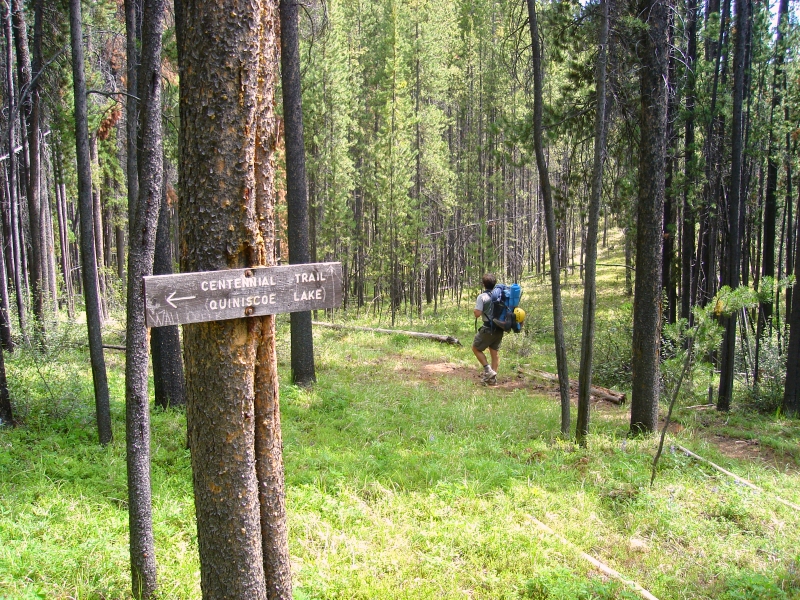
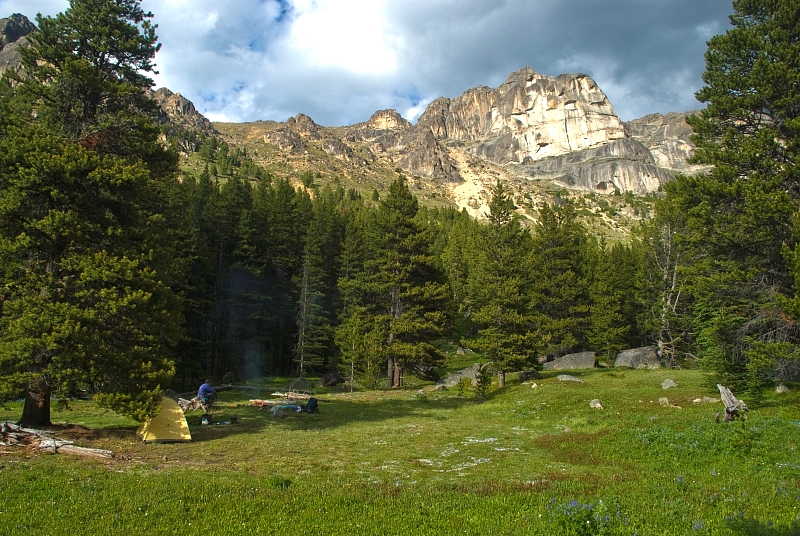
We left town around 7 or 8 am and reached the trailhead about 7 hours later. The description in the Cascade Alpine Guide (CAG) is spot on: park at the 39km marker on Ashnola River Road and look for the large pedestrian bridge crossing the river. Hiking on the Centennial Trail is easy going - it is either flat or a moderate uphill. After an hour or so of hiking we encountered the familiar fork in the trail (sign here), taking the right fork up into Wall Creek Valley. It's mostly a boring valley hike from here to the meadows, whereupon the first real views of anything mountainous are had. The trail wanders through some boggy areas, but is nevertheless easy to follow providing one stays on the logs laid down to keep feet from getting wet. I think it took us about 3 - 3.5 hours to go the ~10 miles to a good campsite in the first open meadows encountered along the trail. We camped beneath a tree at the exact same spot where Martin and I camped last August. However, if one continues a few more minutes up the trail, better and more established campsites are available (recommended).
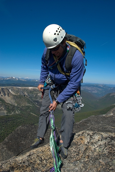
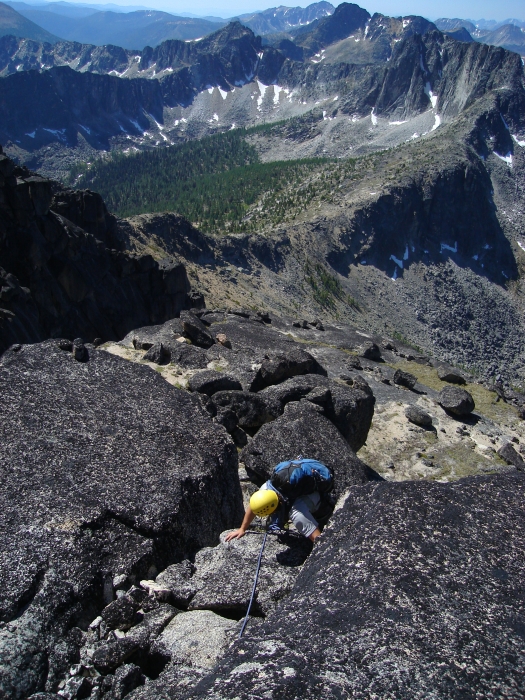
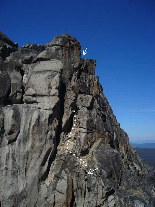
No sooner did we come to a stop and take off our packs than bloodthirsty mosquitoes began to swarm around us. Eli and I promptly doused ourselves in DEET and practically sat in the fire we had started hoping that the heat and smoke would keep the bugs at bay. This then was the routine for the two evenings we endured here. We ate a hasty dinner and retired to the tent before dark for some peace and quiet and get a head start on sleep. The relentless skeeters were most happy to greet us first thing in the morning, prompting Eli and I to forego breakfast and chug our cups of coffee so that we could just get moving and stay a step or two ahead of the little vampire bastards. From the meadows, we made an ascending traverse up the left side of the valley aiming for an open scree and talus slope beneath a gully and notch-like feature in the ridge above. Most of the elevation gain was done here, and it was thankfully in the shade of morning. We roped-up at the notch and scrambled up to the top of a blocky ramp whereupon an exposed move is made out right onto a face for a short pitch of 5.4-ish climbing that ends on the broad and flat ridge crest.
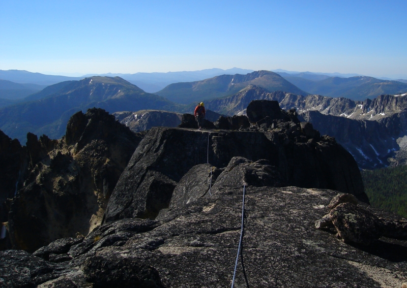
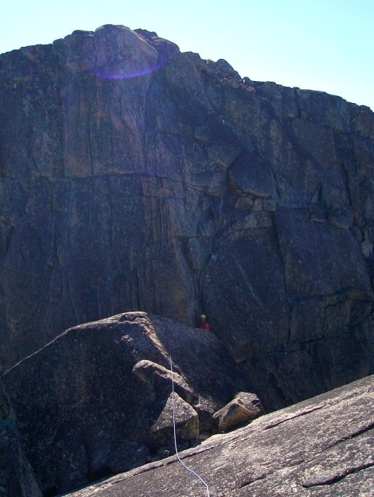
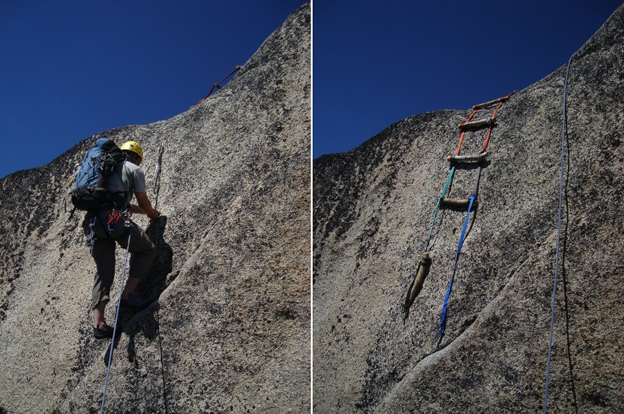
From here we simul-climbed into and back out of two notches, one of which I recall had a fixed rope attached to bolt anchors. A bit of walking got us to the final short, but narrow chimney pitch before Matriarch's summit. I decided to forego the 5.8 crack just right of the chimney and instead flailed my way up the "5.3 chimney." I then hauled the packs and gave Eli a quick hip belay to the flat summit area. From the top of Matriarch, we walked to a bolted rappel station and rappelled down to another bolted station deep in the next chasm. Easy climbing on slabs (clipping a bolt or two along the way) saw us to another bolted rappel station before another deep notch. A couple bolted rappels interspersed with a short bit of down climbing brought us to the next notch. Finally, a pitch of low-5th climbing back out of the notch saw us to a platform beneath the much-anticipated 15ft aid wall. The branch-and-webbing ladder mentioned in a CascadeClimbers report from last year could be seen lying at the top of the wall, and I tried in vain to lasso it with a cleaning tool tied to the rope. In any case, 3 or 4 closely spaced bolts allows easy aiding over this blankness, and Eli made short work of it with two personals and a foot loop. As a courtesy, he lowered the ladder down for me (the lower rung could use some mending).
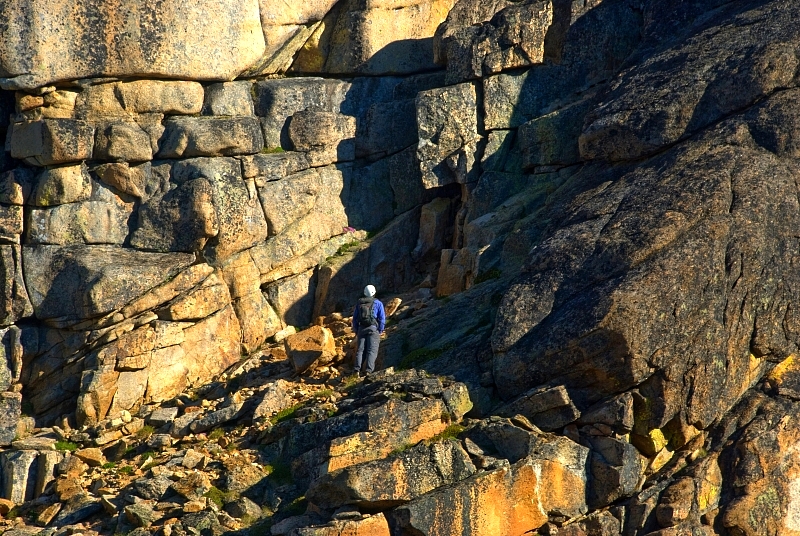
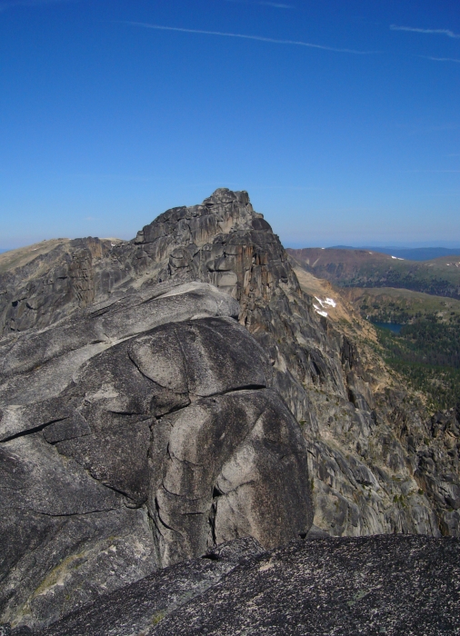
A bit of scrambling then saw us to the top of Macabre Tower. We walked over to a bolted rappel anchor and rapped down about 40 feet to another set of bolts in a notch on the opposite side of the large chockstone. Easy low angle slabs up over the next domed feature (with good view of the way ahead to Grimface) leads to a short dirty, lichen-covered slab descent ending at sandy ledges adjacent to a deep cleft in the ridge. There's a huge flat area here, good for a lunch break and a contemplative rest. A rappel off of bolt and slung block got us down a steep chimney to a sandy amphitheater. Now looking across at Grimface had me scratching my head as where to go to next, but it really just looks worse than it is. There is a steep and thin-looking ridge perpendicular to the main crest that can easily be crossed via a gully directly opposite the rappel chimney. From there, either a short sandy walk across or a scramble along the aforementioned ridge (clipping a bolt or two along the way) got us to the base of Grimface's SE notch route.
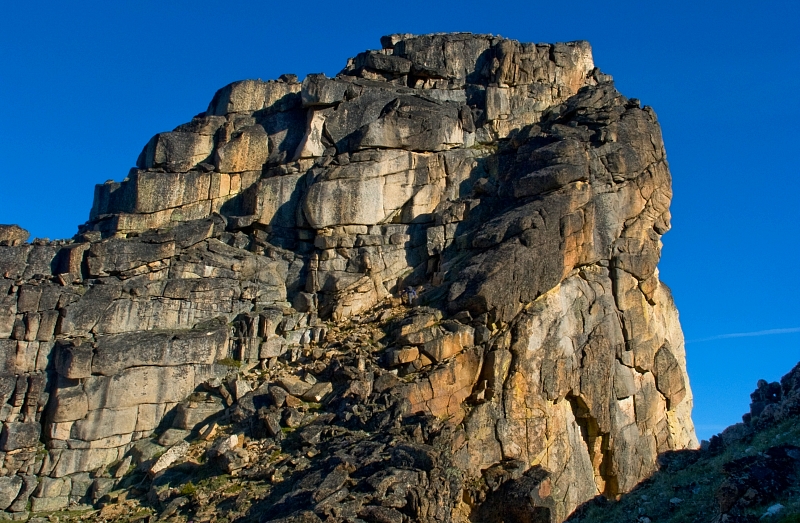
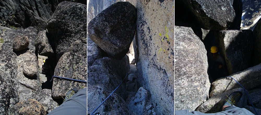
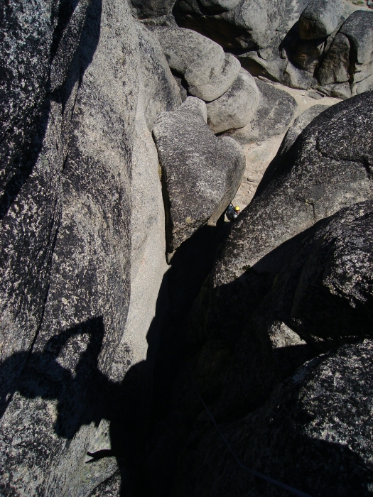
We climbed a short pitch up the obvious chimney with chockstone (Eli trailed the packs behind him this time), then scrambled up and left to a small, flat alcove from where we set up the next belay. A move out and right from the alcove leads to a ledge, up and over a high boulder and then into the next large chimney. A short lieback move under a large chockstone deep in this chimney gets one to near the exit guarded by, you guessed it, another chockstone. It was a tight exit, so I removed my pack and attached it to my harness with a runner before making the moves out to the next spacious alcove. A short hand-crack then some scrambling saw us to a large sandy amphitheater below the final dome of Grimface. I couldn't tell which of the cracks was the "strenuous wide crack", reported to go at 5.7, but the alternate chimney route was certainly hard to miss. Once again, I left it to Eli to deal with the packs as I squeezed my way up the deep and extremely narrow chimney. A bulge about half-way in made for some exciting moves as I wedged my body sideways between the narrowing sides and squirmed my way up and over. The chimney opens-up a bit after this bulge and ends at the flat summit area.
It was quite amusing first hearing, and then finally watching Eli struggle up the chimney with two packs in tow. The sound of the packs scraping against rock was frequently punctuated by loud cursing, and it was all I could do to hold back the laughter. I honestly didn't think it was possible to drag two packs through there while attempting to climb at the same time, but Eli somehow managed to pull it off. Had I not placed gear in the chimney, it would probably have been wiser to again haul the packs up the smooth rock face to the side. In any case, now I have further justification to finally retire my old, smelly and very well worn pack! We dropped our gear at the chimney's exit and scrambled the remaining bit to the true summit. The top is nice and flat.
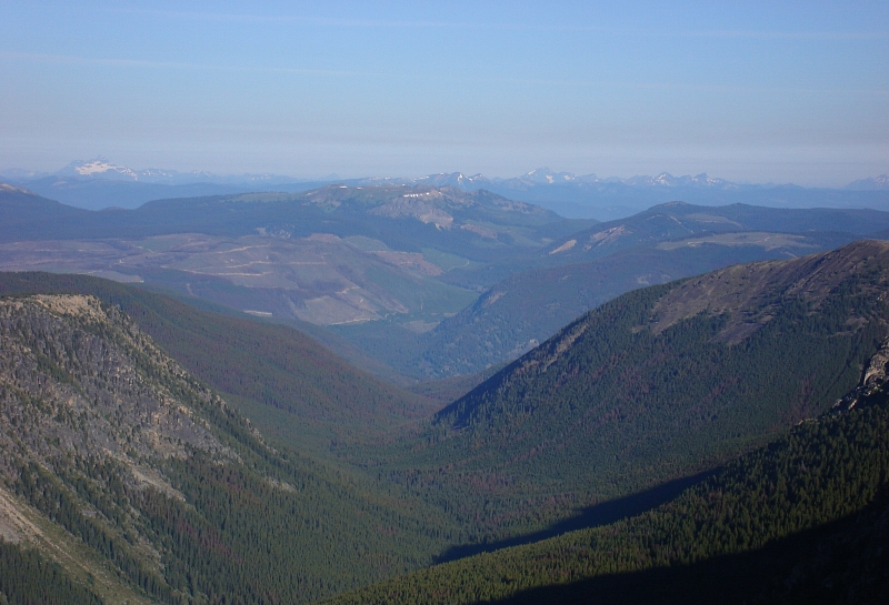
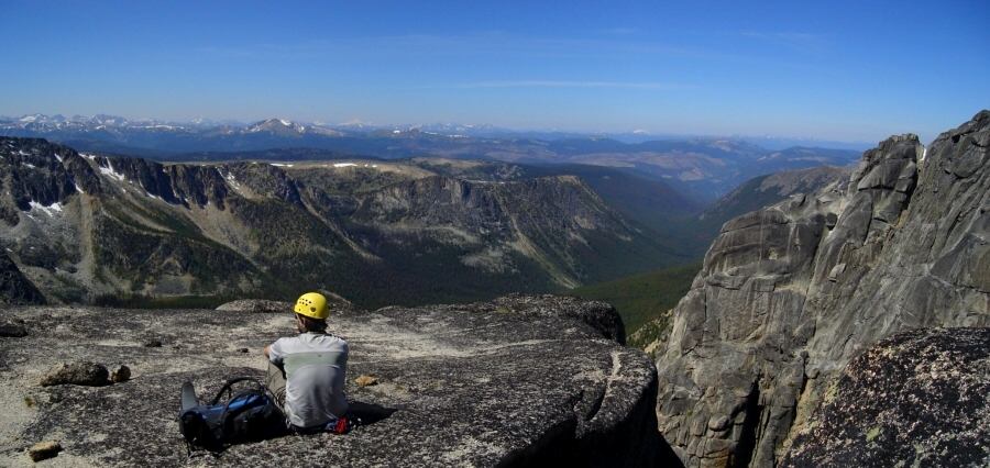
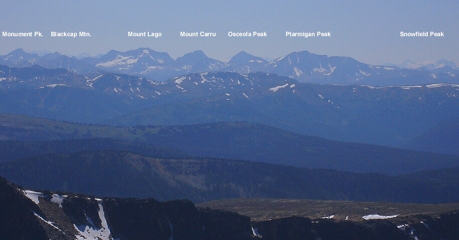
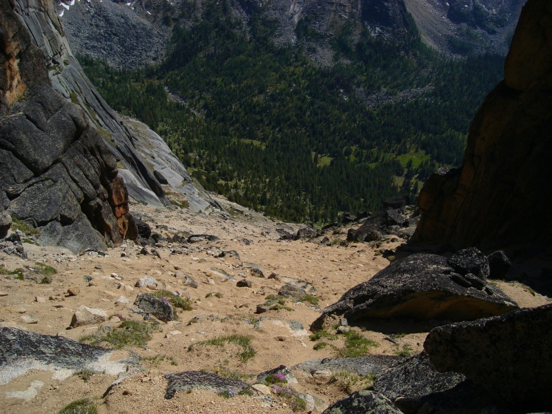
The views from this remote corner of the cascades are unique and give a really good perspective on the Cathedral/Amphitheater and Lago Group peaks. Jack Mountain rises most prominently to the southwest, as does a peak that seems to lie at the head of Ross Lake which I'm guessing is Silvertip Mountain. North of the 8000-ft+ Matriarch - Grimface crest, the Cascades fall off dramatically, and are really nothing but rounded mounds (the skiing here must be phenomenal). Looking west, the descent route seems to drop off into oblivion. However, it just appears that way as the route down is full of several little slabby drop offs and twists and turns down the ridge crest. We kept a close eye on the cairns, as they got us down the right way even when it seemed to lead us off route. There are lots of little 4th class bits and a single rappel bolt for one tricky part right at the end that can just as easily be down-climbed. This got us down to a large sand and scree basin that we boot-surfed back down before stumbling across a faint trail that winds through heather and flowers before reaching the aforementioned camp meadows, and of course the waiting mosquitoes.
We lounged about in the sun reading pages from Eli's Economist Magazine for the remainder of the afternoon and tried our best to avoid donating any more blood than was absolutely necessary. Finally, after having burned-up the rest of the woodpile (and the pages we had read) and with the rest of the whiskey polished off, it was time to retire to the tent for the night. Swarming mosquitoes the next morning expedited our breaking-down camp, and we wasted little time getting on with the hike back out. Back at the car, Eli retrieved the beer he had stashed by the river and we relaxed with feet soaking in the cool, fast flowing water. We stopped in sweltering Osoyoos, BC on the drive home for a quick lunch then continued south through Okanogan and Winthrop for an excruciatingly long drive back to Seattle.
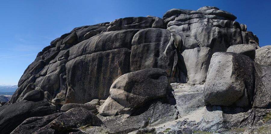
In summary, I think the climb took about 10 hours at a fairly casual pace. Descents are possible from several of the notches encountered along the way, as well as the sandy amphitheater that marks the start of the SE Notch Route. Though I'm not entirely sure where the 5.7 mentioned in the CAG was, the climbing was entertaining and fun. I also took a liking to the rock in this area, as it is really quite solid. It has a bubbly, Bedrock of Flintstones fame look to it, which is best described in the CAG as being "peculiarly eroded into immense semi-spheroidal masses which have the external appearance of stucco." And finally, hats off to whoever installed the bolted rappel chains/stations along the route, as the going without these would be considerably more difficult.
Click here to view photos.
![]()


