


Mesahchie Peak - North Ridge, June 2005
 as seen from Tricouni Peak in April 2004.")
Having just overcome the soreness in my thighs from the previous Mount Maude climb, Eric and I helped ourselves to another serving of North Cascade suffering. On the menu this time was the North Ridge of Ragged Ridge's main summit - Mesahchie Peak. Certainly the most aesthetic (and solid) line on the mountain, Mesahchie's North Ridge offers a bit of everything for the aspiring alpinist in us all. A character-building footsore traverse, easy glacier slog and a short, but exciting ice pitch, topped with about 600 feet of exposed class 3/4 (some 5.0) ridge climbing on surprisingly solid rock.
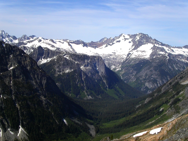
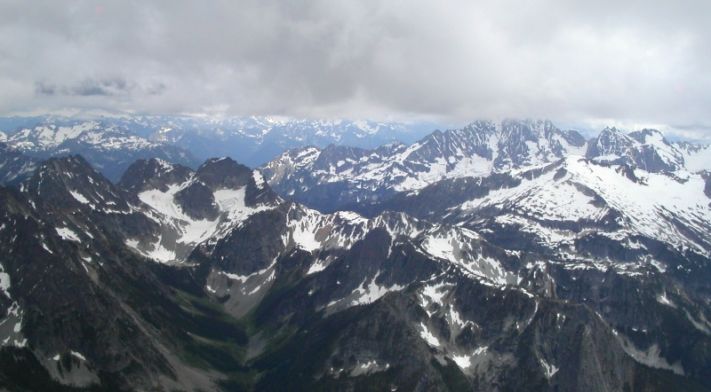
One might speculate why the peak was named Mesahchie, meaning "wicked" in the Chinook jargon, in the first place. Perhaps its striking pyramid-shaped appearance from Easy Pass conjures up wickedly good vibes, or something. The peak is certainly surrounded by impressive scenery. With the deep, u-shaped Fisher Creek Valley gently curving toward Mount Logan and its expanse of glacier ice, Mesahchie Peak is definitely in the company of some of the best the North Cascades has to offer. Personally, if you exclude the North Ridge, I think "wicked" better describes the general rock quality on the peak...as in wickedly loose! Both the Southeast Slope and West Gully route, which we took on descent, are guaranteed to exhaust your appetite for choss. But, more on that later...
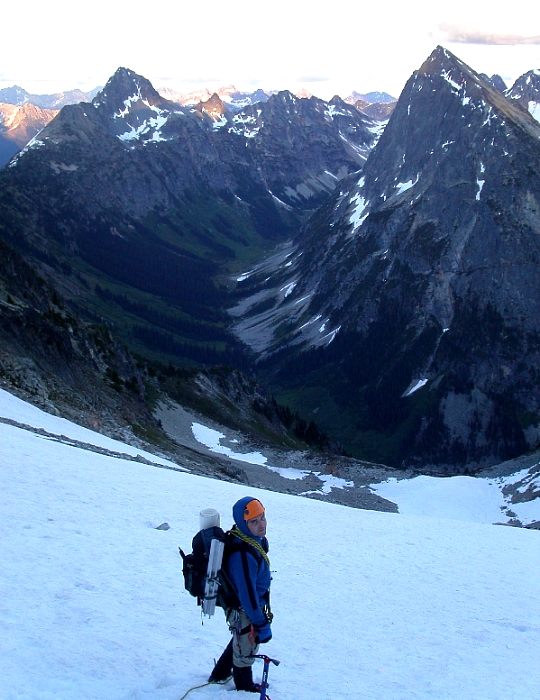
To beat the wicked weather once again forecast for the weekend, Eric and I both took Friday off from work, hoping to pull-off the route in a long day from Seattle (we left at 4am). We planned to descend the West Gully and make an ultra light bivy in the basin beneath Mesahchie - Katsuk Col. We'd spare our feet another endless footsore traverse back to Easy Pass by descending to Fisher Creek and taking a good trail back to the car the following morning. We left the trailhead at 7:30am and hiked 3.6 miles up to Easy Pass (6520 ft+). From the pass, we side-hilled up steep grass and heather beneath the ridge crest to about 7100 ft. Maintaining that elevation, we traversed steep scree and boilerplate (ouch!) for about a mile before reaching a small basin (good campsites - camping at Easy Pass is prohibited) with flat saddle directly above. We descended into this basin (snow till July most years) and continued up to the saddle crest.
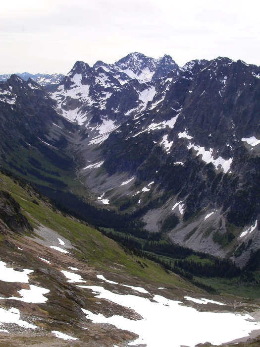
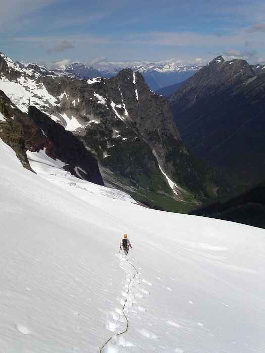
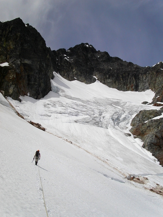
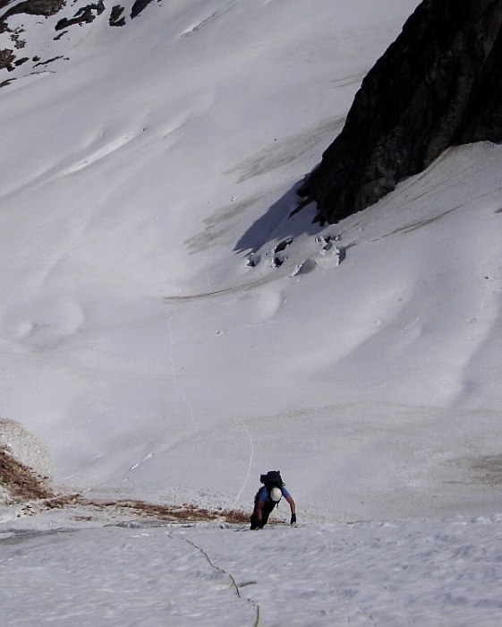
Overlooking the Mesahchie Glacier from the crest, we located the best spot to descend at far left. Now tied in and with 'pons on the feet we slogged across the glacier towards the small icefall. Eric led up the icefall (more snow than ice in June) by staying far left. Near the top, a crevasse forced a short, but spicy rightward descent to a bridge, followed by a low-angle pitch of hard glacier ice to reach easier terrain above. The ice pitch really had me wishing that I tightened my boots before venturing onto the glacier. My lightweight aluminum axe wasn't cutting it, and so I pulled out my second tool and swung away until reaching the one ice screw Eric had placed.
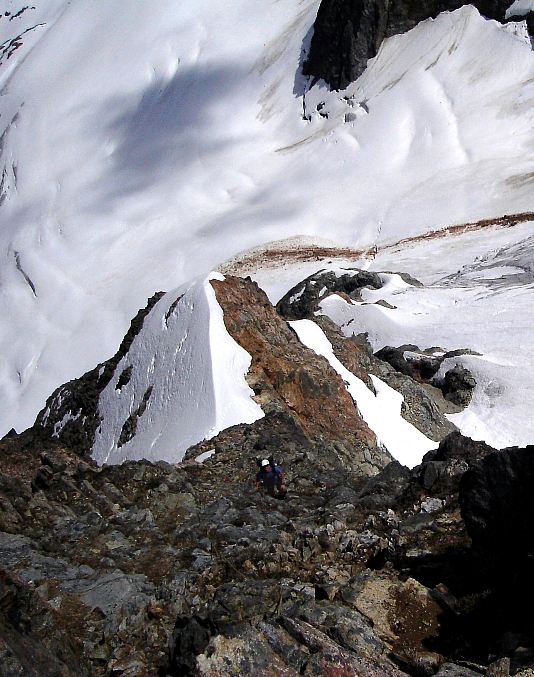
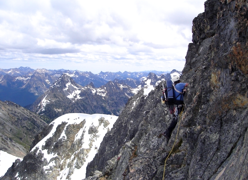
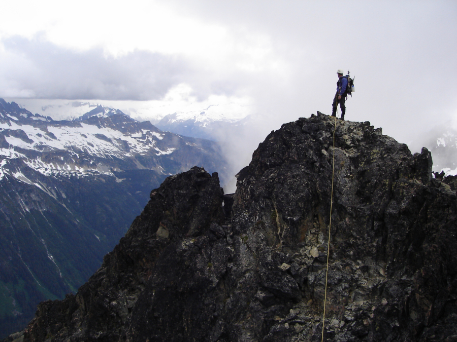
Once above the ice, we traversed right, towards a small subsidiary spur coming off of the North Ridge. We removed our crampons and scrambled up easy 3rd-class rock and some snow, to reach the crest around 1pm. With clouds and deteriorating weather moving in from the west, I led out up the ridge (3rd-class at first). The ridge gradually became steeper and more exposed, and the climbing somewhat more difficult. Trying to stay on the crest, I repeatedly encountered steep, licheny rock and was forced to traverse out left onto the exposed, but otherwise blocky face (some 5th-class??). When possible, I would work back right onto the ridge crest and continue climbing upwards. I think we only belayed 2 or 3 pitches, and simul-climbed the rest. Gear placements and horns to sling seemed adequate, but the exposure felt intimidating.
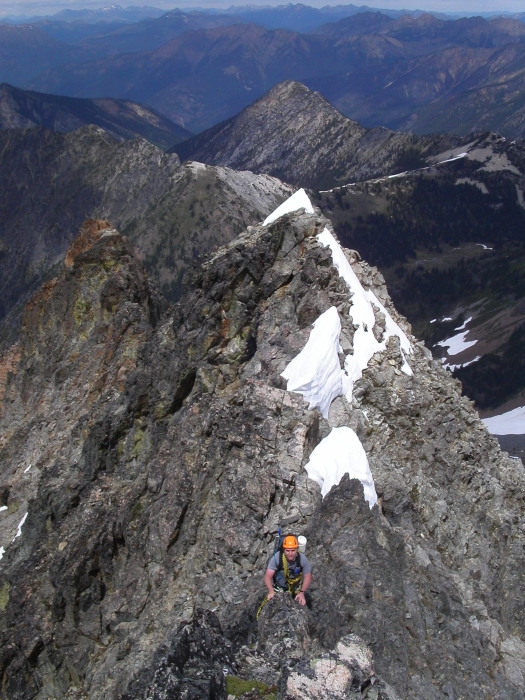
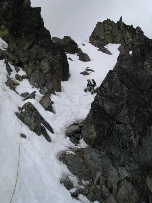
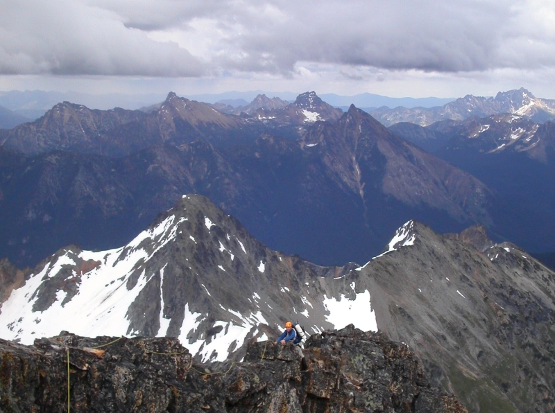
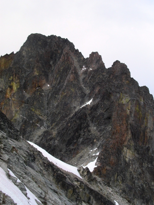
Near the top, the ridge eased off somewhat, and terminated in a patch of steep snow. Here, Eric took over and carefully traversed into a wet snow gully and booted up to reach the crest of the East Ridge (3 hours on ridge to here). Following up the gully, I yelled out to Eric, asking him what he saw up there. "We've got more work to do" was his response. Hmm... With the Southeast Slope directly beneath our feet, we scrambled up towards the next tower. Bypassing steeper rock via snowy ledges on the tower's north side, we were able to work back onto the crest of the East Ridge. To reach the summit from here, a succession of seemingly endless towers and ridge bumps had to either be scrambled directly over or bypassed on the left.
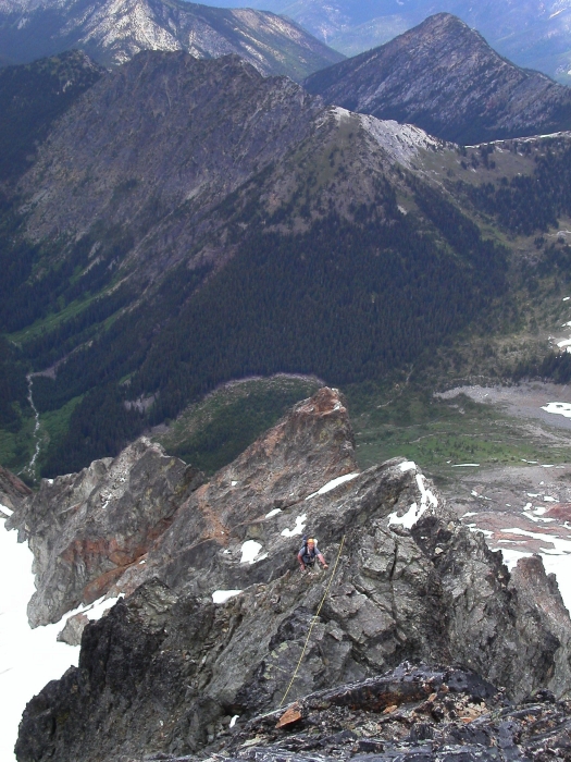
It took us a good hour to complete this traverse, reaching the summit at 5pm. After about 5 minutes, we began poking around for the short chimney that leads down into the West Gully, just as the first clouds engulfed the summit area. Well, as I've said before, the West Gully is a REAL treat. I'm not sure how many times I asked Eric "who in their right mind would take this as their up-route", but suffice to say, only swearwords were uttered with more frequency. Near the bottom of the gully, we traversed slightly left and down-climbed a short chimney before reaching the Mesahchie - Katsuk Col. From the Col, we traversed down-sloping slabs and loose blocks just beneath the ridge crest to reach the prominent buttress beneath Katsuk Peak (not to be confused with a smaller intermediary buttress).
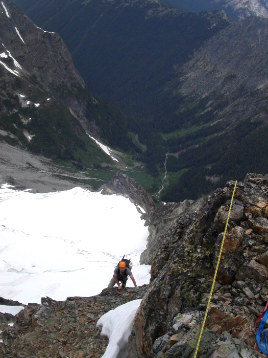
Taking note of a prominent tower of reddish rock rising up before us from this buttress, we descended an obvious gully to the right (it curves left out of view). We exited left at the earliest opportunity (cairn here). Slabs then a "path" descend into another gully beneath the aforementioned tower and led to yet more exposed down-climbing on boilerplate, scree and choss covered ledges (the occasional cairn marked the way). Eventually, the buttress became less defined to form a shallow divide between the two basins below (looking down, we camped in the left basin). Avoiding cornices lower down on the ridge, Eric located a gully that allowed us to descend into the upper (left) basin. From here, easy hiking down snow finally saw us to good snow-free bivy sites. It was now 9pm.
It sprinkled on and off that night, but fortunately the monsoons decided to take the evening off. We awoke to light drizzle and fog and so high-tailed it down 1500 feet of wet heather and brush to Fisher Creek Trail. From there, it was an easy hike back up to Easy Pass and finally back to the Pilsner...err, I mean the car...and yes, the stoke from having completed this route in the manner that we did, does feel wickedly good!
Click here to view photos.
![]()


