


Mount Shasta - Avalanche Gulch, June 2010

Tired of the recent weather and needing a change of scenery, I decided it was about time for a road trip down south where I was hopeful to find some sun and corn snow. First up on my volcano-bagging agenda was Mount Shasta and being that I was flying solo, just the standard Avalanche Gulch route would do. The big draw of course would be the ride down off of the summit, or more accurately from somewhere above the infamous Red Banks. Alas I only 'boarded Shasta back to the car from Lake Helen camp (10,400ft to ~ 7000ft) as the upper mountain was way too firm and windy for my taste and I was in no mood for getting knocked around with a couple sails on my back. With the snowpack reportedly 140% of average and conditions unseasonably cool and icy, I was content just with completing the route on foot. Though the winds subsided somewhat in the afternoon, the icy slopes from about 11k and upwards weren't going to soften anytime soon.
Predictably, a shit-show of epic proportions was well underway on that long slope below the Red Banks by the time I emerged from my tent around 6am on summit day. At least 40 parties camped at Lake Helen the night before, almost all of which posessed little to no prior mountaineering experience. With no less than three ice axes either skittering down the firm snow or miraculously stuck upright in the ice, followed by a couple trekking poles, an empty water bottle, a backpack and yes...inexplicably...THREE (live) bodies zipping on by, I began to wonder if I wasn't in fact still dreaming. Later that afternoon another person was apparently also pelted by falling ice and suffered a broken leg. In all 3 climbers had to be evacuated by helicopter. I tried to explain the benefits of using the ice axe leash to one of the people I saw retreating below the Red Banks that morning, but my efforts were mostly lost on him. Most if not all of the retreating parties did so because of the strong winds in the viscinity of the Red Banks. Of all the parties, only about 3 or 4 made it to the summit that day myself included.
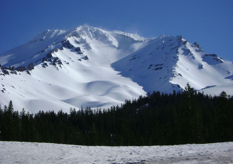
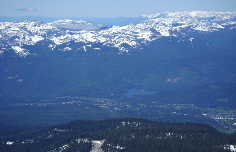
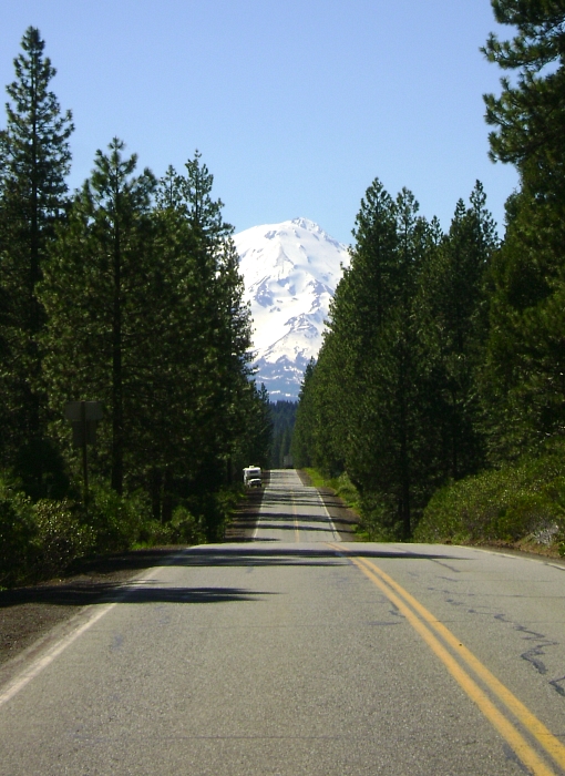
Okay, I've gotten ahed of myself again. Back to the beginning. After 8-hours of driving in a near constant downpour, I arrived in sunny Shasta City. I proceeded up to the end of the plowed Everitt Memorial Highway at the Bunny Flats parking area. As with a number of other parties, I settled in for an unexpectedly chilly night of car camping. The clouds lingering around Mount Shasta vanished overnight leaving in its place some high winds streaming over the Red Banks. I somehow missed the obvious cattle trail as it makes a jog to the left right above the parking area, and instead proceeded to work my way up a forested ridge just east of the lower Avalanche Gulch drainage. I emerged from the trees only to find myself approaching a feature named Green Butte, from where I could enjoy a commanding view of the entire Avalanche Gulch area as well as Sargents Ridge. This accidental approach variation allowed for some solitude as well as a more aesthetic way to reach camp at Lake Helen. With scarcely 3500 feet to climb in order to reach camp, I tried my best to slow my pace and took numerous breaks along the way.
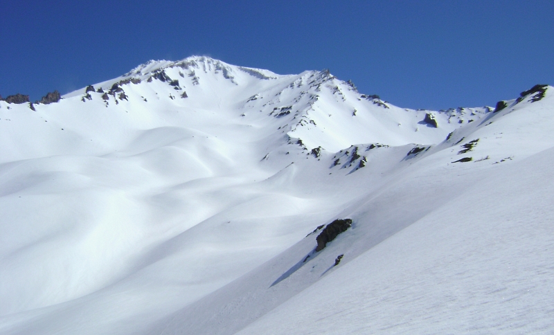
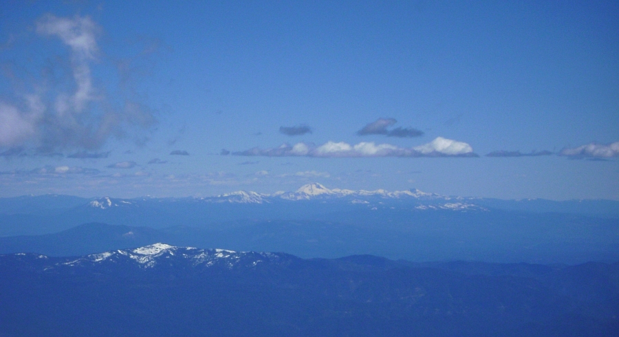
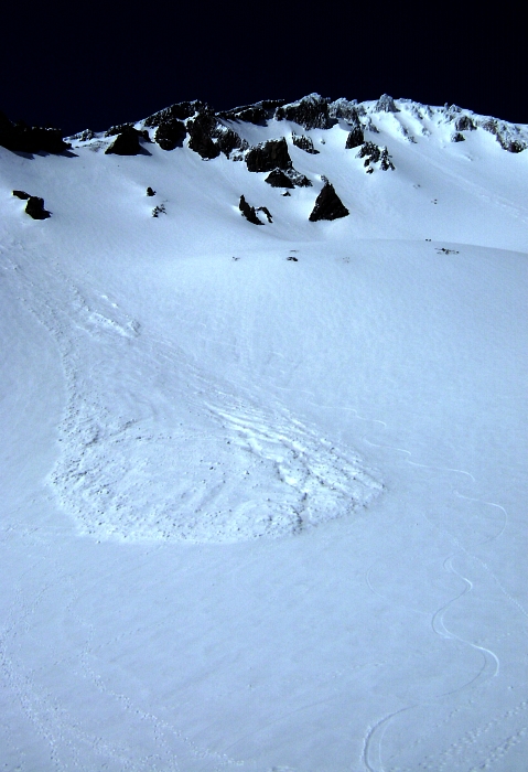
The Lake Helen camp seems less like a lake and more like convienient flattish area near an old terminal moraine directly beneath the main bowl of Avalanche Gulch. Countless other parties took their places alongside my tent as the afternoon wore on, while a couple parties on skis descended from a saddle lookers left of the Red Banks (left of a feature called The Heart). At around 10,400ft, Lake Helen is a high camp comparable to Mount Rainier's Camp Muir. Thie views from here are far and wide, and off in the distance it is easy to make out the southern-most volcano of any significance - Lassen Peak. After a brief nap I figured the snow was about as soft as it was going to get on this day and toured up above camp for some turns. I skinned and booted up to a break in the ridge up and left and rode back down from there. The first pitch was still mighty firm, despite being fully exposed to the afternoon sun. This did not bode well for the upper-mountain softening by afternoon of the following day.
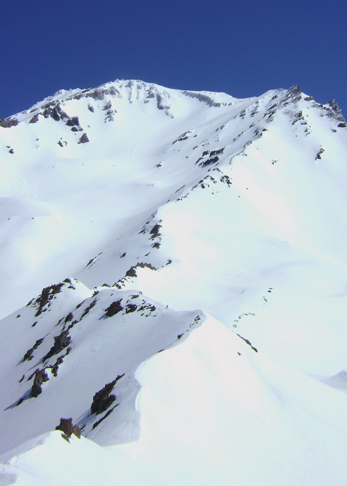
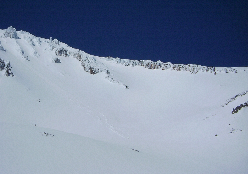
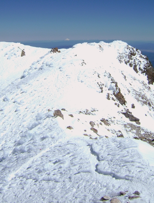
As mentioned previously, I left my tent around 6am and casually wandered up towards the Red Banks. The winds were howling even down at camp all that night and morning, and looking up I could see the entire slope above littered with people either still ascending or already in full retreat. I made my way up through the aforementioned chaos taking a couple hard hits to the chest from falling ice before nearing the Red Banks proper. A number of variations seem possible, and I decided on a short but steep pitch near the right edge to see me through. A short bit of front-pointing got me above the difficulties after which I continued again along a worn path up Misery Hill to a bit of a plateau.
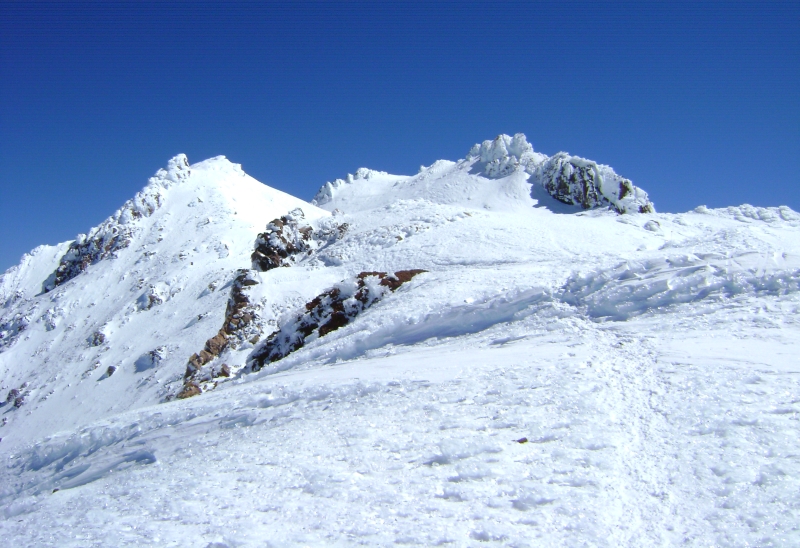
Above the plateau, a seemingly endless grind sees one to a bit of a false summit from where the true summit can for the first time be seen. Continuing along a worn path, I descended to wide flat area below the final rimed-up summit tower and noted much to my surprise that the wind here was all but gone. Still following a worn path, I continued up traversing beneath the summit block, then a couple switchbacks before reaching a saddle in the final summit ridge. An easy, albeit once again windy walk along the ridge saw me to the true summit. i stayed long enough to snap a few photos before heading back down in hopes of getting out of the wind. I'm not sure if it's a common experience, but it was nice having Shasta's summit all to myself.
I took a short nap upon returning to camp before packing up and riding back down. The 3500+ feet of turns all the way back to the parking area were smooth and ripper, and over with all too soon. The parking area was practically standing room only when I got there. The assortment of ambulances, SAR vehicles and helicopters flying in and out was mesmerizing and probably a suitable response to situations that were sadly entirely avoidable. I was in a hurry to get out of there and pointed the car in the direction of one of California's less-crowded national parks where hopefully I would find some respite from the hubbub on Shasta.
Click here to view photos.
![]()


