


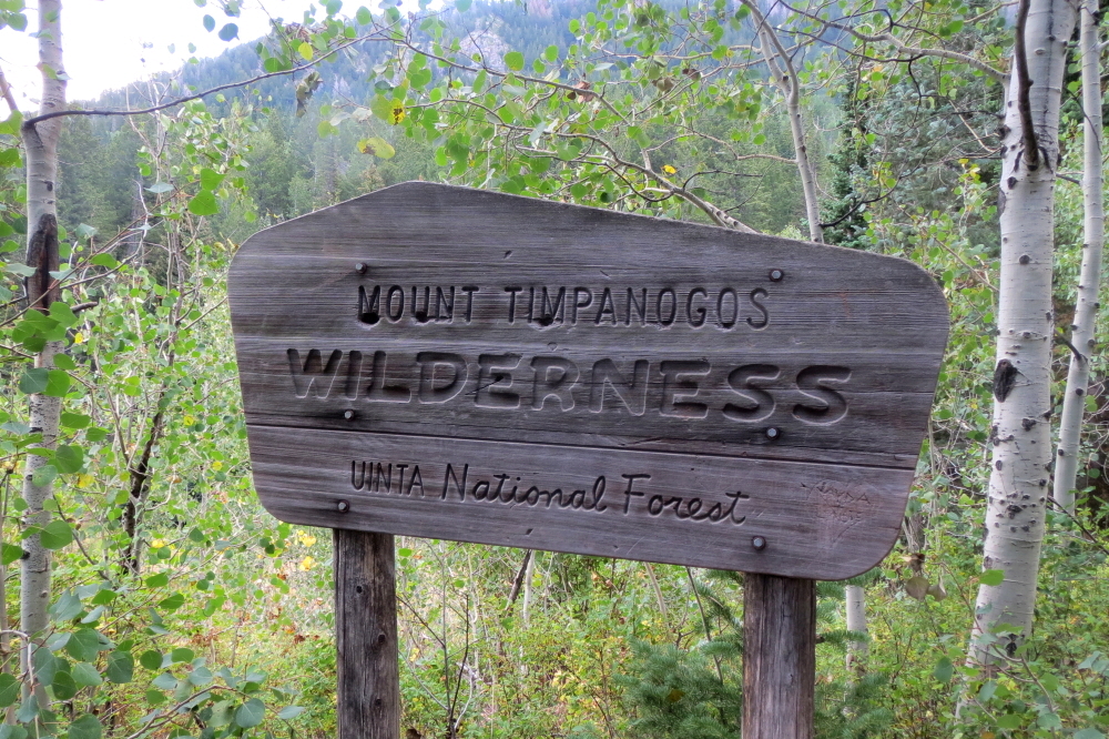
Mount Timpanogos - Timpooneke Trail, August 2013

With less time off work than I had hoped for, I settled on the Beehive State as the venue for my annual Get-The-Hell-Outta-Dodge © summer road trip. No, this wasn't about revisiting Bryce Canyon, Arches, Capitol Reef or Dinosaur National Monument for that matter, and I was many months too late (early?) to partake of the legendary Wasatch powder. Rather, this was about rediscovering what it is that draws me to the mountains time and time again, be it the contentment that comes with solitude in the alpine or a passion for exploring the various mountain ranges of the continental US. With these criteria in mind, I arrived at two likely candidates - Mount Timpanogos and Kings Peak.
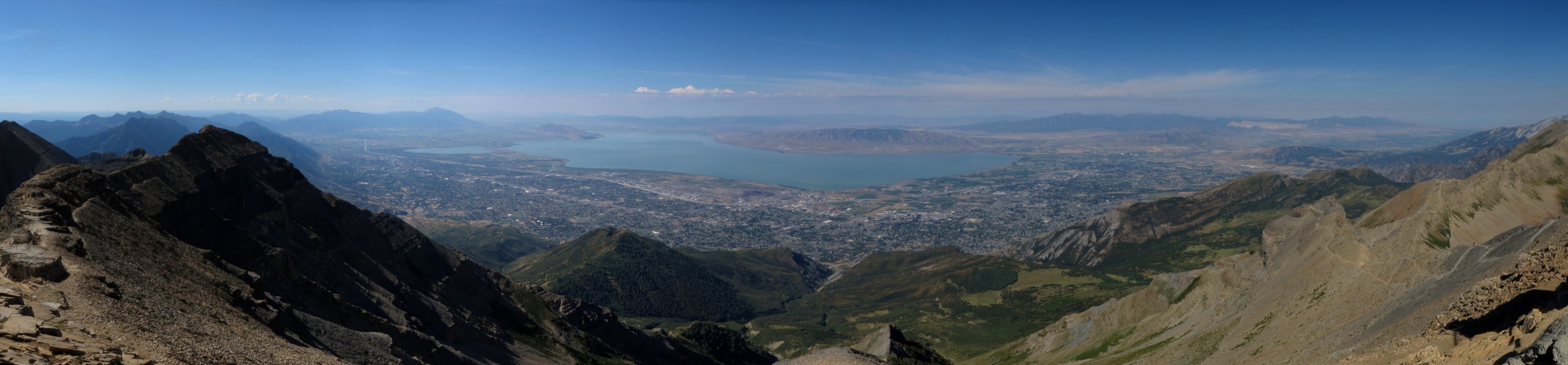
While Mount Nebo to the south is the highest peak in the Wasatch Range, runner up Mt. "Timp" gets most of the attention due to its prominence and proximity to the urban areas of Provo, Orem and of course Salt Lake City. It rises 7000 feet from the valley floor and features a commanding panorama overlooking Utah Lake to the west. The peak also ranks number 20 of the 35 "Great Peaks of the Continent" featured in the 1984 book by Fred Beckey. Kings Peak on the other hand is the tallest peak in the High Unitas and the highpoint of Utah. In contrast to Timp, Kings seemed significantly more remote and isolated. The valleys are broad with large talus plateaus, lonely summits and expansive views looking out over what could be described as a Martian landscape was it not for the meadows and forest down lower in the valleys. Timp was a casual day-trip and Kings was easily dispatched in two. Both offer something unique by Utah standards and give a good overview of the Wasatch and High Unitas mountain ranges. If you happen to find yourself in the area, you'd do well to check them out for yourself!
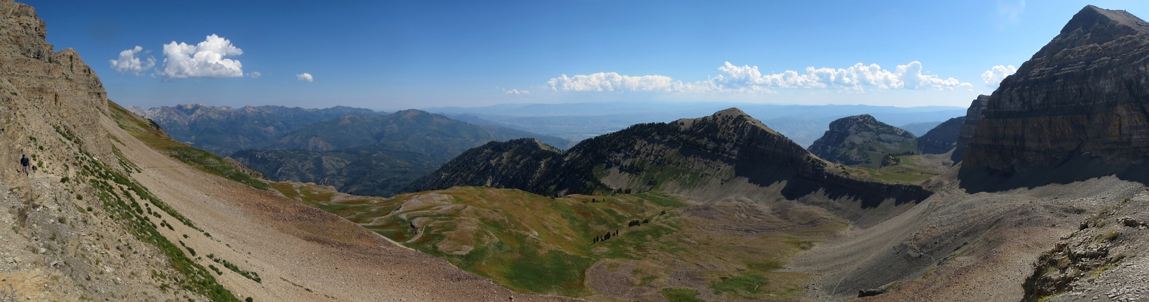
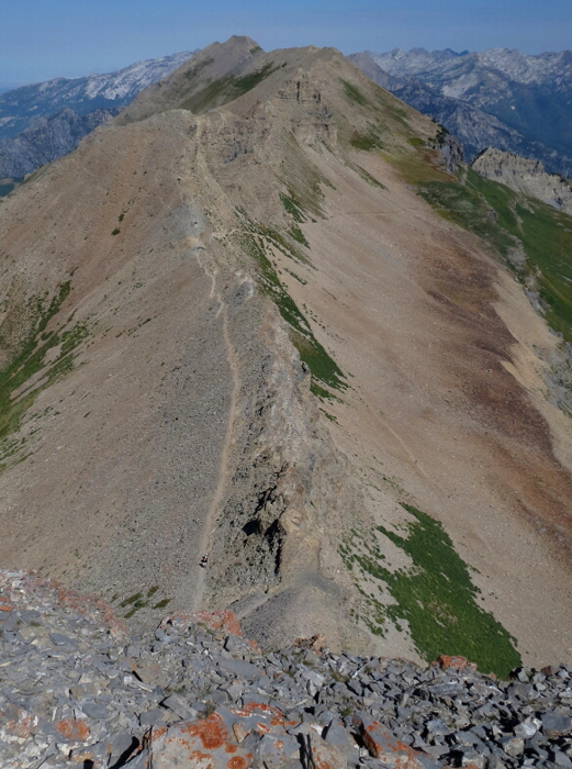
Starting at an elevation of 7,360 feet with about 4389 feet of gain, the Timpooneke Trail approach averages about 14+ miles round trip. Although about a mile longer than the Aspen Grove trail, reports suggest that Timpooneke is the more interesting of the two. There's apparently also the option of going up one of these trails and returning via the other using a seldom used way trail that connects the two. I considered doing this, but given the threat of afternoon thunderstorms I decided to just stick with the Timpooneke Trail. The Trail starts out gradually and soon switchbacks repeatedly from one side of the basin across to the other side, crossing a swampy area along the way. It then continues up past a fork leading to Scout Falls at left before reaching the first of several prominent benches and where I spotted a rather large moose. Continuing up this "Giant Staircase" feature, one begins to appreciate the unique geology of the area. Once again, the trail meanders to the opposite side of the basin before turning sharply left for a long straight section with North Timp towering overhead. The trail then makes another sharp left and traverses the headwall back to the far left side of the basin.
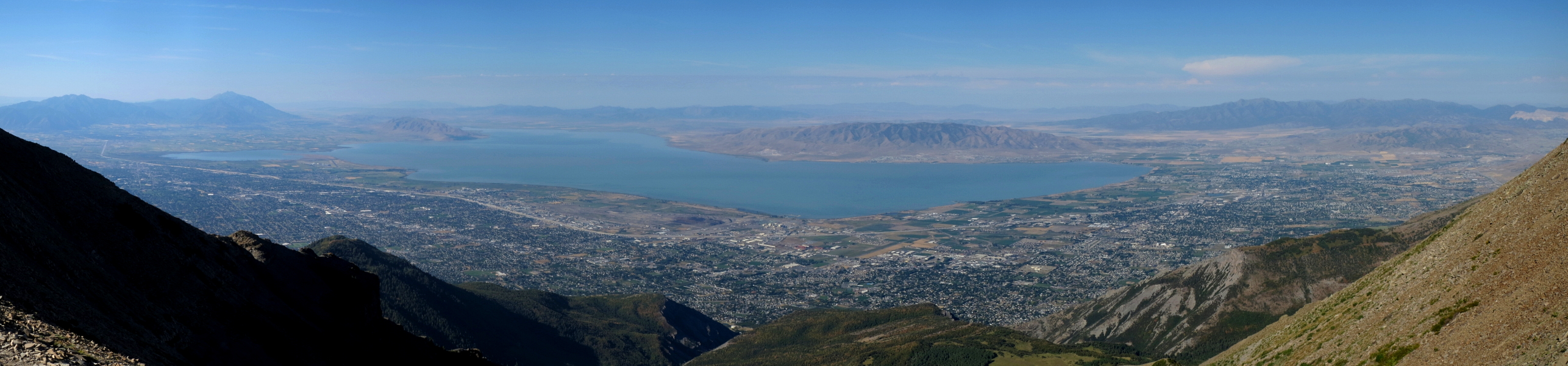
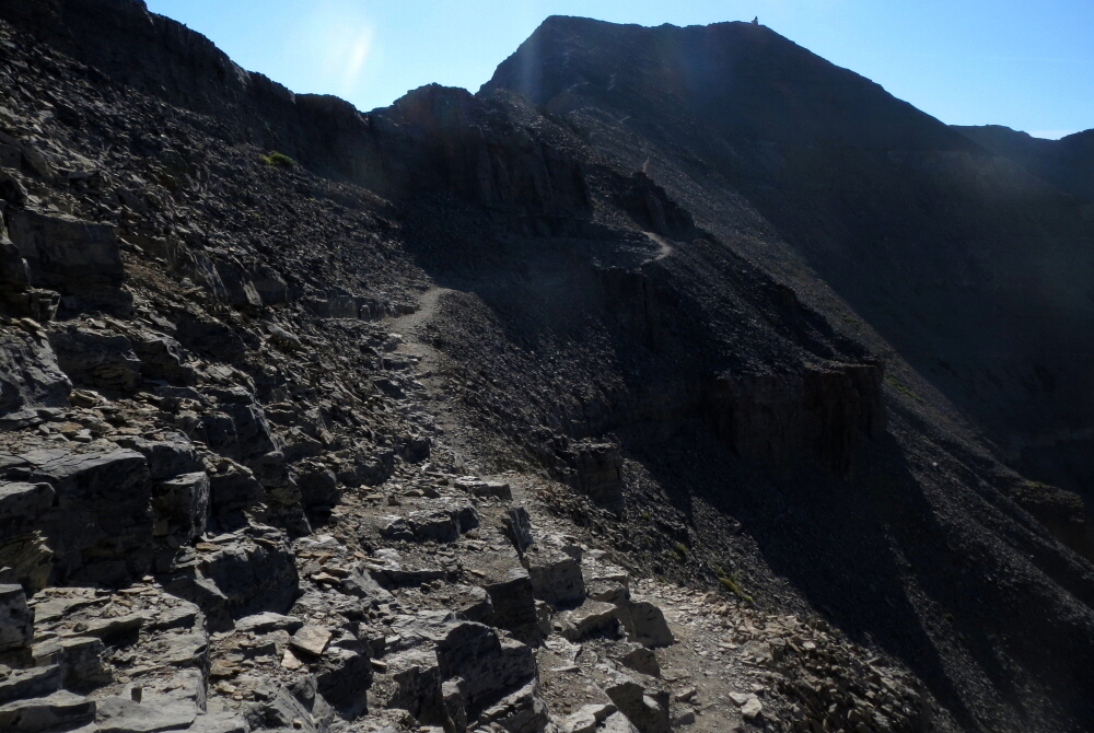
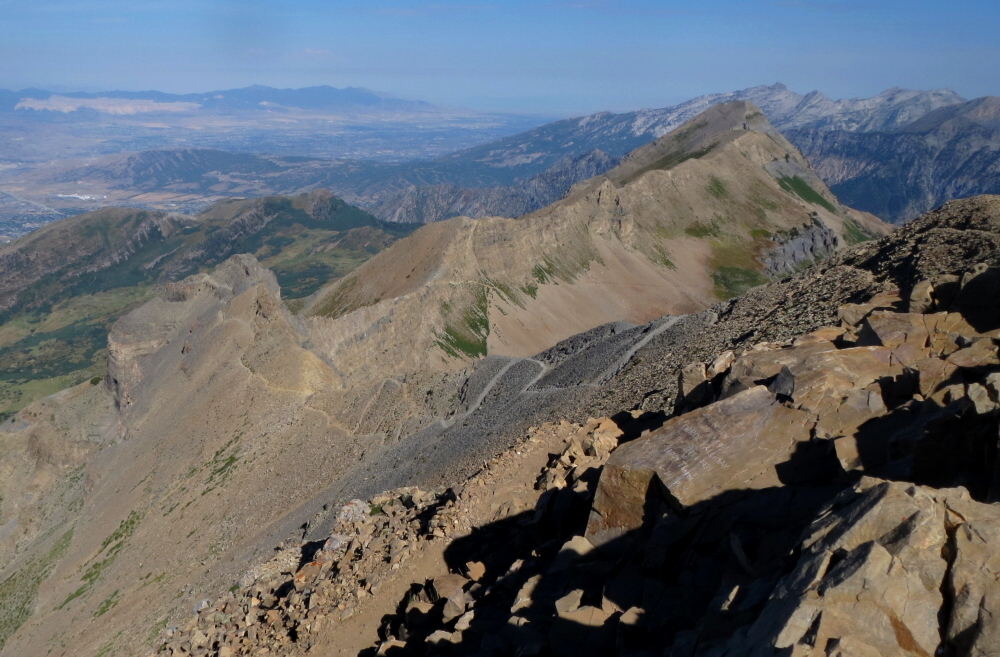
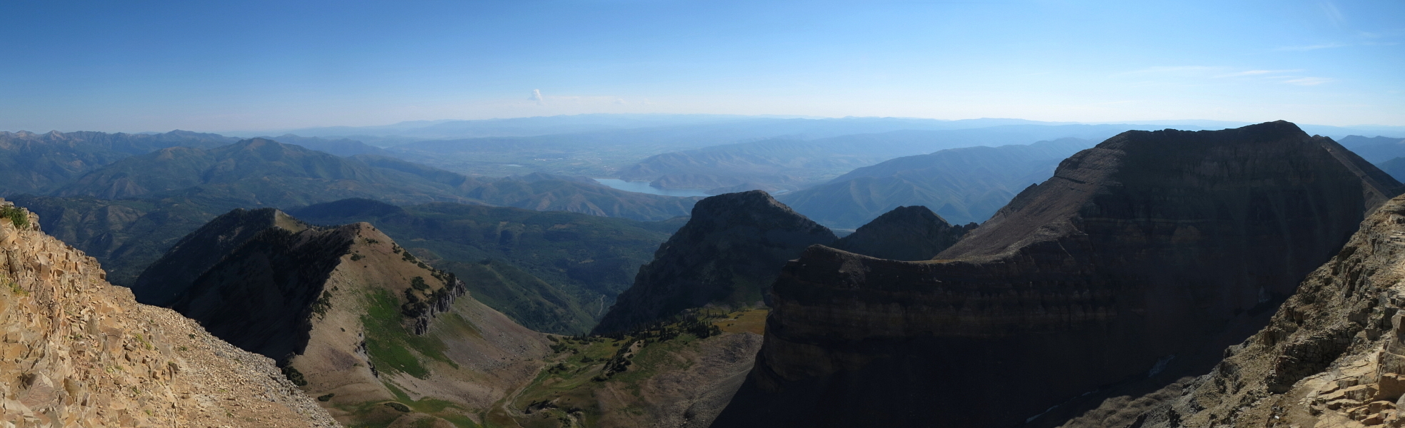
Some talus and heather slopes soon gave way to meadows in a large, flat basin at about 10k feet with an impressive view of Timp's North Face. The view of the 1630-ft North Face is an impressive piece of geology to behold. The Timpooneke Trail continues to the far right of the basin before switchbacking again up the headwall between Timp and North Timp. A final dusty traverse leads to a prominent saddle with views aplenty. The Aspen Grove Trail intersects the Timpooneke Trail just prior to reaching the saddle. From the saddle, you get tremendous views down onto the cities of Provo and Orem and further out to Utah Lake and the mountains beyond. At this point only another 700 feet of elevation gain and about 1/2 mile of trail remains to reach the summit. The trail continues beneath a rock wall at left and seems to come to an end at a small amphitheater. Looking closely, one will notice a path that makes tight switchbacks up blocky steps and gravel to the top of the amphitheater. As you round another corner, the remaining section of trail to the summit comes into view.
A final bit of trail leads to a summit hut of sorts. The hut was apparently built as a triangulation station for Utah County in the 1920's. And yes, the views from the summit are superb! If you're not too terribly put off by throngs of teenagers hiking down (yes, down) in the early dawn hours, the occasional trail runner not to mention the moose one is likely to encounter somewhere along the way, the otherwise easy hike to the summit is well worth the effort. It goes without saying that these mountains are very much prone to afternoon thunderstorms, so a pre-dawn start is advisable for most parties considering climbing Mt. Timpanogos.
Click here to view photos.
![]()


