


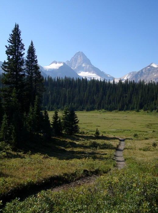
Mount Assiniboine - North Ridge, August 2009
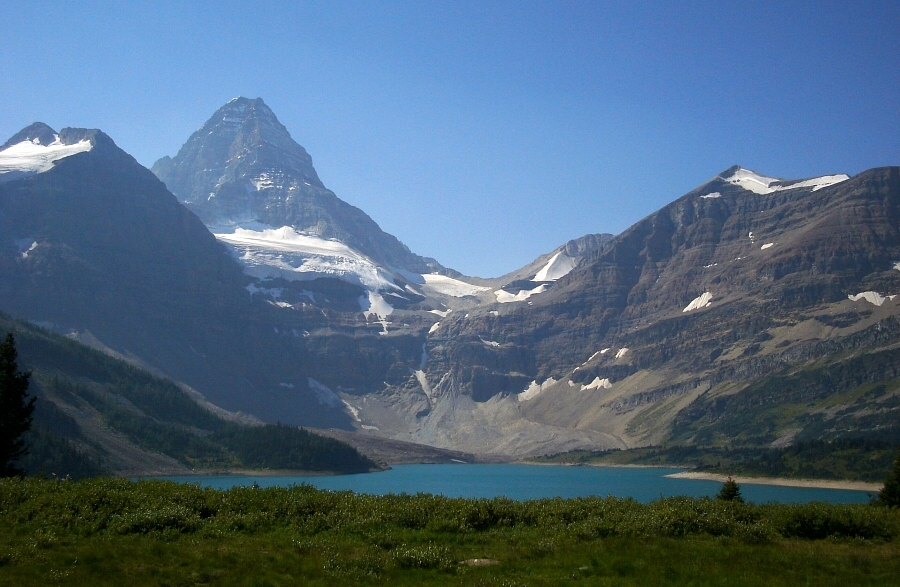
 as seen from near Assiniboine Pass.")
The iconic Matterhorn of the Canadian Rockies, Mount Assiniboine is a classic peak popular among climbers the world-over. I first heard the calling several years ago when Eric Hoffman and I intended to climb the peak during a 10-day stint in the Rockies and Selkirks of British Columbia. Unfortunately, reports suggested that conditions weren't favorable for an ascent of the North Ridge, as a late-August storm had plastered the peak with considerable amounts of fresh snow. Enter plan 'B'. Leaving Lake Louise, we pointed the car north on the Icefields Parkway and went on to climb Mount Athabasca instead.
Come August 2009, it seemed as if Eli and I were doomed to suffer a similar fate. A storm the week prior to our two-week trip in Canada once again blasted the top 1500 feet with new snow. Hoping to capitalize on the week's worth of forecasted sunshine and warmer temperatures in and around Kananaskis Country, we delayed our Canadian Rockies itinerary so as to allow time for some of the new snow to melt off. Now, after having burned through the first half of our trip gallivanting in the Coast Range, we felt conditions up on Assiniboine were about as good as they were going to get for us. With Eli's WRX packed to the gills, we departed North Vancouver for the long drive over to Lake Louise.
The LL hostel was fully booked when we got there but we managed to reserve a couple beds at the Banff hostel instead. As expected, downtown Banff was crawling with tourists, adding insult to the frustration of locating the hostel. Finally, after claiming our bunks for the night and having eaten a hasty dinner, we stepped back outside to poach free parking lot wi-fi and plan our Assiniboine climb. Coincidentally, I'd gotten an email suggesting Fred Beckey was in the area and looking for partners to climb Assiniboine with. Though nothing came of Fred's partner request, we would cross paths several days later on the Cavell Meadows Trail. But anyway...
It appears that most helicopter-in to the Assiniboine Lodge thereby avoiding a long, albeit easy approach. The flights start from the Mount Shark heli-pad, which is about a mile shy of the Watridge Lake trailhead, and are exclusively reserved through the lodge. Fly days are Sundays, Wednesdays and Fridays. However, given that it was Saturday night and that bookings could only be made Monday through Friday left us in a bit of a quandary. Alternatives were discussed, but we eventually resigned ourselves to hiking-in via the standard Watridge Lake/Bryant Creek approach towards Lake Magogg and Mount Assiniboine just beyond.
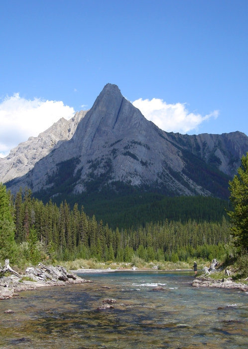
As with the helicopter, the Assiniboine Lodge manages all hut bookings. Not being able to call and reserve our spots in advance, we were at the mercy of how many climbers were already staying up at the hut. One can certainly climb the peak from the Lake Magogg Campground, but that would make for a much longer day. Located on a barren, windswept plateau directly opposite Assiniboine's North Ridge, the hut is obviously the ideal base camp for those looking to climb the peak. In any case, things had gone well for us so far so we crossed our fingers and drove south to Canmore. Turning off the main road through Canmore, we made our way onto Spray Lakes Road and endured a long, dusty drive along the Spray Lakes Reservoir before taking a right at the junction indicated by the Mount Shark heli-port sign. Finally reaching the Watridge Lake Trail parking area, we proceeded to unload and pack our gear. The first 7 km (4.3 miles) of trail is actually a dirt and gravel road (bikes allowed on this portion only) leading beyond Watridge Lake to the national park boundary. We let ourselves through a gate then walked past the warden station along a wide trail that heads up Bryant Creek Valley.
Although it's possible to hike to the Lake Magogg Campground (or nearby Assiniboine Lodge), and possibly also the R.C. Hind Hut in a long day, we decided to split the ~18 mile approach over a rather casual two days. The bulk of the approach to Assiniboine Provincial Park (and the peak itself) is spent crossing Banff National Park. As such, we needed overnight permits to camp in the national park. Having sorted the permit business at the ranger station in Banff earlier that morning, we arranged to camp two nights at Allenby Junction (coming and going), which is about 17km (10.5 miles) from the parking area at the Watridge Lakes trailhead. We would then hike the remaining 7 or 8 miles to the R.C. Hind Hut the following day, providing there was room in the hut for us in the first place. Also, if by some stroke of luck there was availability in the heli for a ride out the day after our climb, we agreed to eat the additional $150CAD/person for a gloriously short 10-minute shuttle back to the car.
We encountered several parties along the way, one of which was all too happy to offer a wide-eyed account of their failure on Assiniboine the previous day. No sooner did I say hello, this guy dives right into some epic tale of whiteout conditions this and rock plastered in snow and verglass that. Apparently, only a pair of "very good" climbers made it up that day. Well, I'm not sure Eli and I qualify as "very good", but I could have done without the unsolicited verbal diarrhea. I'll form my own opinions of what goes and what doesn't thank you very much!
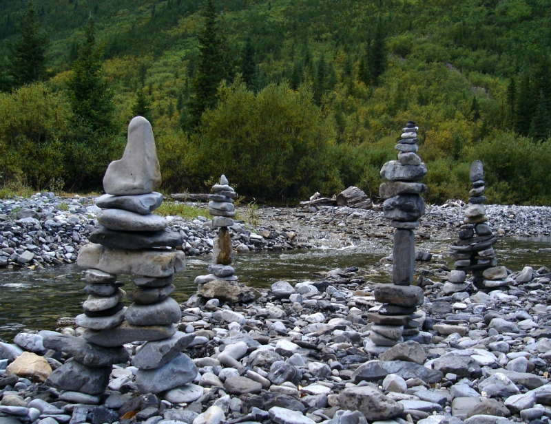
We arrived at camp around 4pm and proceeded to while away the afternoon not doing much of anything. I was grateful when the helicopter ferrying guests to and from the Mount Assiniboine Lodge every thirty minutes finally ceased operations for the day. Finally some peace and quiet! Eli read his book while I explored the stream nearby not to mention my new aptitude for cairn building. Bedtime came shortly after dinner. Eli mumbled in his sleep while I had a lucid dream of a grizzly sniffing about our tent that night.
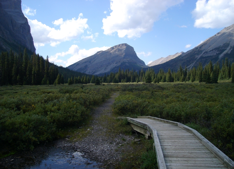
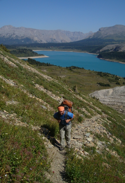
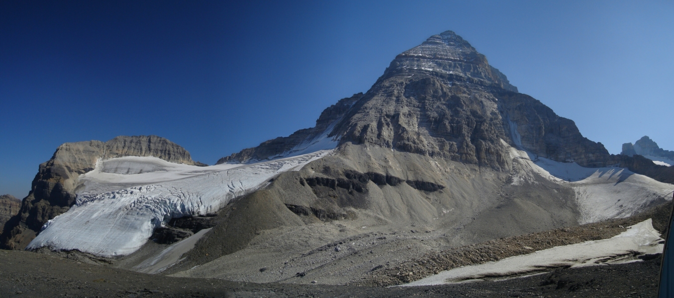
Departing camp around 9am the next morning, we made our way over Assiniboine Pass and back into BC, and enjoyed our first good glimpse of the objective. Such a striking and aesthetic peak that Assiniboine is! A short distance beyond the pass sits the Mount Assiniboine Lodge. We dropped in to inquire about the hut. Good news! There were only two guides and their three clients staying at the hut, so there was plenty of room for Eli and me. Inquiring with the lodge custodian as he was running our credit cards, we were reassured that the snow still noticeably clinging to the peak would not cause us much difficulty. Not that it mattered much to me at the time though, as the delicious smells wafting over from the kitchen were lulling me into a trance. Were it not for Eli dragging me back outside, I could have easily had myself lunch and a cold beer (or two). Someone had a telescope out on the patio and invited us to come over and take a peak. Our timing was perfect, for we got to see the guided threesome make their way over the false summit and begin their descent of the North Ridge! After stashing unneeded gear in a shed behind the lodge, we started making our way along the trail paralleling the western shore of Lake Magogg. Looking ahead, the objective is to gain a ledge system high on the headwall above the lake and make a traverse left towards a lower-angled talus slope that provides easy access to the basin above.
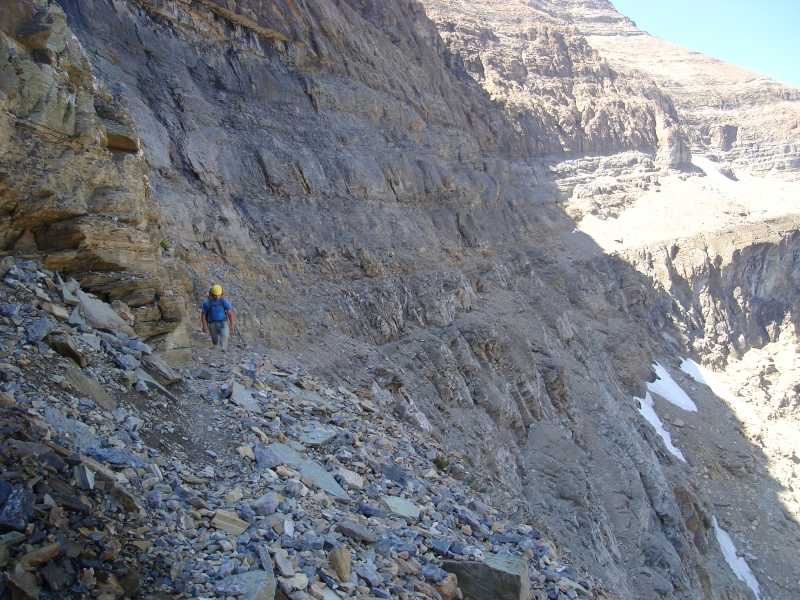
The headwall seems imposing from afar and one is left wondering if there really is a viable route across it. Occasionally (and falsely) described as the crux of the entire Assniniboine climb, the traverse across the Gmoser Ledges is a fairly well travelled route. Providing one follows the path of least resistance, none of it should feel particularly sketchy or desperate. If the ledge you're on blanks out or the way ahead just doesn't seem right, stepping back a couple paces and climbing up a step or two to the ledge above will usually get you back on track. But anyway, I'm getting ahead of myself...
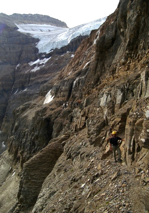
Following a climber's path up from the meadows, we angled upwards towards an obvious gully breaking the initial cliff band. Above the gully, we continued along a well-worn path towards a hidden chimney in the next cliff band. Traversing a loose scree slope above the chimney, we rounded a minor spur then turned up and kicked steps in steep, unscarifiable dirt to the base of a rock step. Initially marked by cairns, the ledge traverse starts above this step and is relatively easy to follow. That said the ledges are definitely loose and exposed in places. There are a couple spots I like to call fat man's misery, a reference to an exposed portion of Mount Shuksan's Ficher Chimneys route. The rock bulges out from the ledge forcing a brief but stimulating sideways shimmy to get past.
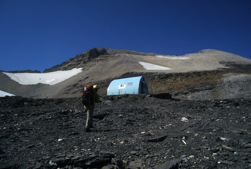
The ledge ends unceremoniously in a talus slope beneath a gully with small stream. Climbing a rock step (climber's) left of this stream, we then traversed back right into the gully and scratched our way up onto the debris fan above (beware rock fall). The path then zigzags to avoid some gullies before the slope angle kicks back and yields to a large talus basin opposite the toe of Assiniboine's North Ridge. Continuing beyond a snow finger up and right, we proceeded towards a large plateau comprised of dark shale (not visible from below). The R.C. Hind Hut sits on this plateau. Certainly better than bivying out in the cold, the hut nevertheless could benefit from some serious maintenance work. The windows no longer seal very well and the interior is generally run down. The foamies are disgusting and have lost most of their density to boot (recommend bringing a mattress). However, there is a propane cook top and a radio to call the lodge with. We found the radio particularly useful in obtaining an updated weather report, not to mention arranging a helicopter flight out the day after our climb. The Alpine Club of Canada is apparently considering taking over management of the hut from the provincial park. Hopefully that will pave the way for it seeing the attention it deserves.
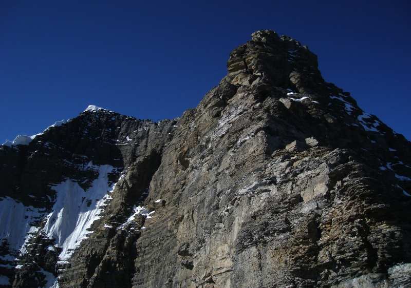
Assiniboine's North Face looms above the hut and does little to help with the intimidation factor. Despite what the lodge custodian told us, it sure looked like there was a lot of snow still lingering on the rock. Either way, we certainly had our work cut out for us. Before long, we started hearing the "on-rappel" calls of the party descending the North Ridge. Using a pair of binoculars found inside the hut, we located the climbers somewhere in the vicinity of the Red Band. It seemed to take forever to descend from there, but watching them helped take some of the mystery out of where the route goes. Accompanied by guides Larry Stanier and someone else who's name now escapes me, the clients were a merry bunch of long-time climbing buddies from New Zealand, Australia and Alberta respectively. Joined by solo-climber Ramin Sherkat later that evening, it was rather cozy with eight people in the hut that night (max occupancy is apparently 12 - 15). Having approached from the Sunshine Village ski resort, Ramin would join us on the North Ridge climb, and using both our ropes greatly speed-up our rappels on descent. Mentioning having made maybe "20 steps in the snow", Larry allayed most of our concerns regarding the route and added that conditions were about as good as they get. Though I should have slept soundly that night, pre-climb jitters kept me mostly awake and wishing the night would hurry up and end.
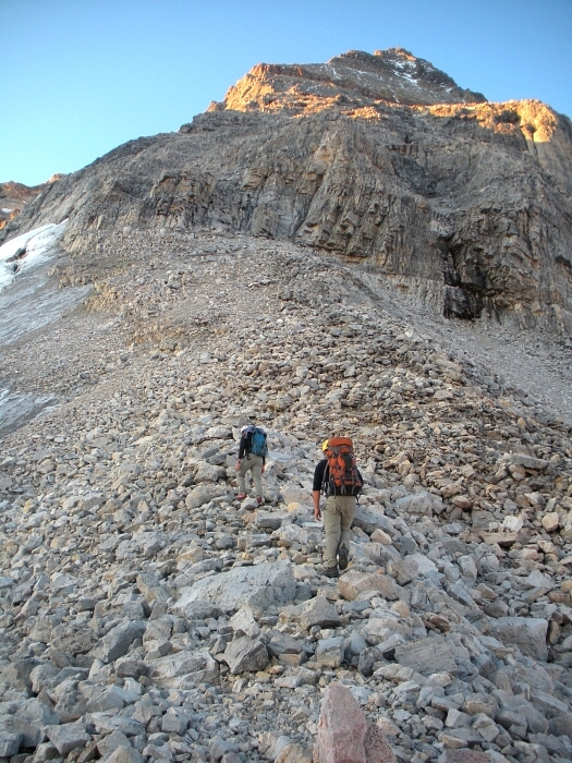
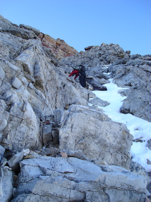
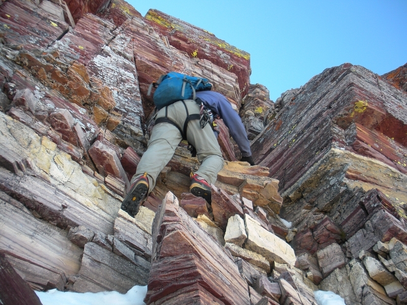
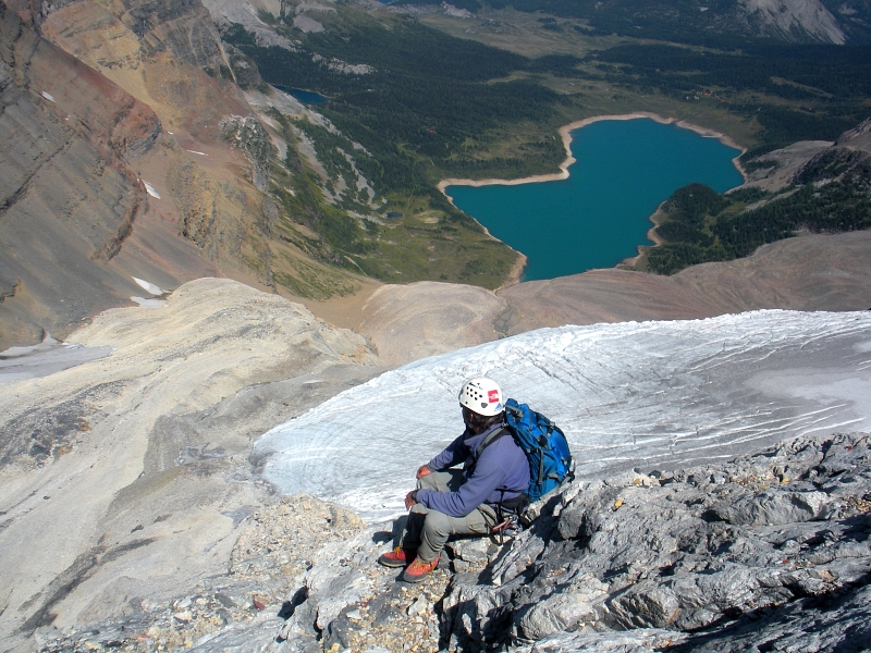
It was a cold morning when we finally left the hut around 6 or 7 am and started making our way towards Assiniboine. Descending a large talus slope, we crossed the basin and kicked back up steep scree to gain a talus spur extending from the toe of the North Ridge. The spur leads to a couple parallel gullies breaking the cliffs that guard the North Ridge proper. Scrambling up easy rock in the left-most gully, we continued up into a long section of class 2 - 3 choss on the far left side of the North Face. A band of steeper gray colored rock just below the infamous Red Band offered some enjoyable climbing. Easily avoiding the occasional bits of verglass, we climbed up through a gully below a prominent ledge that spans the North Face. Clearly visible from the hut, we were aiming for a weakness that necks-down into the Red Band offering an easy exit onto the slope above.
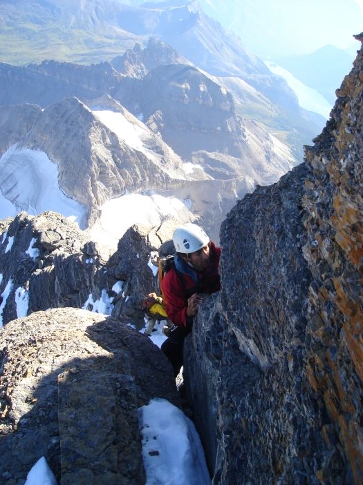
Having scrambled through the Red Band, we then walked back left over scree to finally reach the crest of the North Ridge. Looking over to the left, the sheer East Face falls away impressively to a glacier far below. It's humbling knowing this face has been climbed. Easy scrambling along the crest leads to gendarme that must be passed by working a bit over to the right side of the ridge. Now scrambling on steep, solid rock we proceeded up a shallow gully with small roof above. Passing the roof by making a couple airy moves back to the left, we topped out on the gendarme and with that put the alleged 5.5 crux through the so-called "Gray Band" behind us.
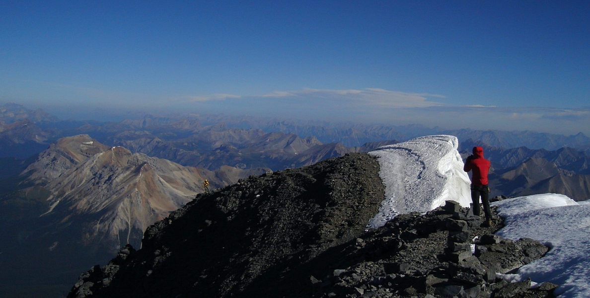
Continuing up along the crest, we approached a steep band of darker colored rock with a couple parallel chimneys offering the easiest route through. Some fun stemming through the left chimney gave way to easier scrambling shortly below the false summit. A somewhat bouldery and exposed move out to the right got us over the final step beneath the false summit. Finally, an easy but lightheaded walk in gale force winds along the low-angled summit ridge led to the true summit. I think it took us around four hours to reach the top, not using any protection or rope obviously having contributed to our relatively speedy ascent.
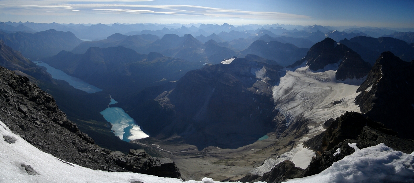
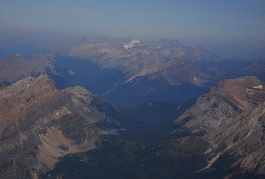
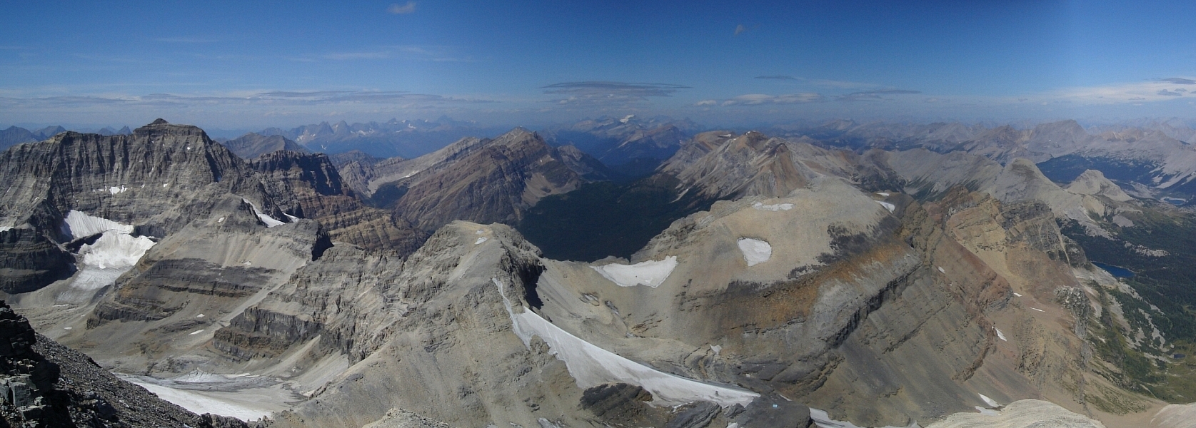
What they say is true - Assiniboine does indeed tower above most everything in the southern Canadian Rockies. Looking east, a pesky sightseeing helicopter could be seen buzzing about the glaciated basin above Gloria and Marvel Lakes. Rising from a cluster of peaks off to the northwest in the vicinity of Lake Louise, I could make out the prominent South Face of Mount Temple and probably also Mount Victoria. Farther off to the WNW, I could see peaks in the general area of Rogers Pass. Looking due west, even the Bugaboo spires were easily identifiable. Far below us, we could see the guided party make their way back down from what looked like a casual climb of Wedgewood Peak. Yes indeed, that other thing they say is also true - Assiniboine's North Ridge is really not much more than a glorified scramble, but with such a commanding view and aesthetic position the peak's classic status is undisputed!
We spent about 45 minutes on top before having had enough of the wind and cold. Five rappels, using existing stations and some down climbing got us below the crux gendarme. We made one more rappel through the Red Band before descending the heinously loose lower half of the route. It wasn't so bad going up, but I definitely would not risk having a party above trundling rocks onto me. We made it back to the hut unscathed thankfully and clocked a round-trip time of about 8.5 hours. With family awaiting his return at the Assiniboine Lodge, we wished Ramin well as he departed the hut later that afternoon. For Eli and me on the other hand, another evening of story telling and jokes with our hut mates awaited. It was inspiring to hear of all the places and climbs the guides had under their belts.
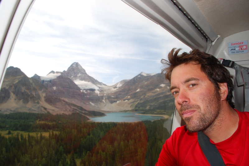
We returned casually to the lodge the following morning, and hopped a ride on the 11 o'clock shuttle back to the heli-port where a fresh batch of tourists and climbers alike awaited their next adventure. While the Asssiniboine adventure had come to a close for us another one was about to begin, as we made our way north towards Jasper to tackle yet another Rockies' classic.
Click here to view photos.
![]()


