


Mount Baker - North Ridge, June 2003

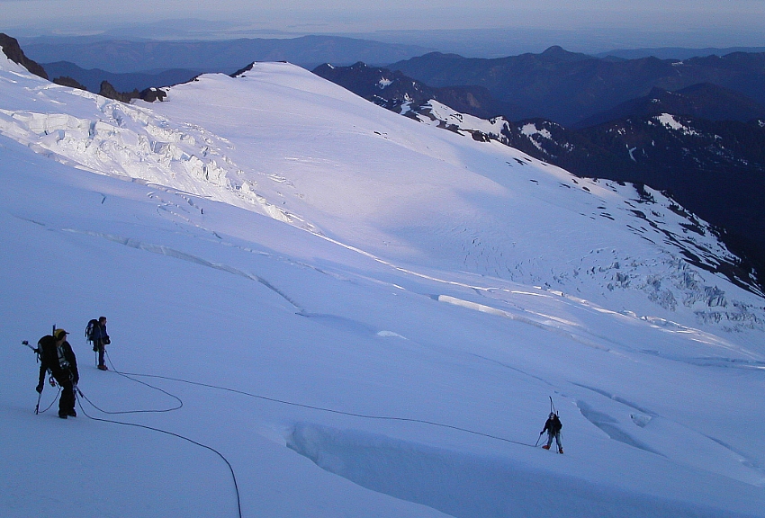
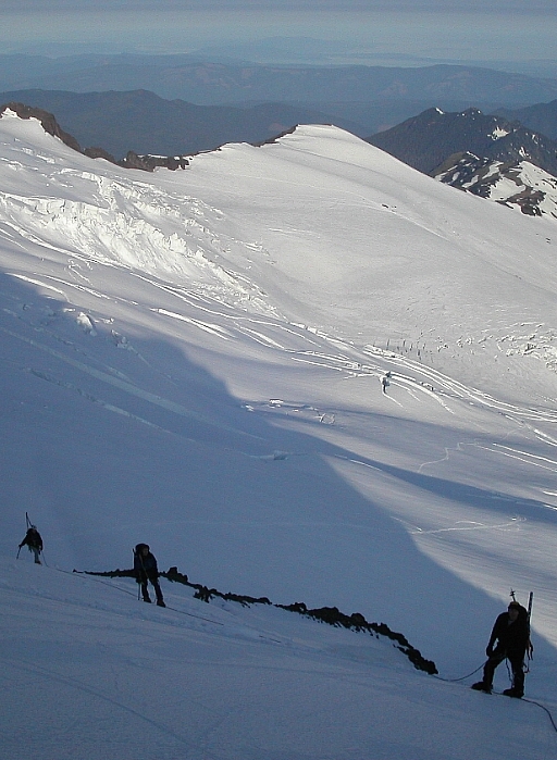
Corey, Dan, Scott and myself climbed the North Ridge of Mount Baker in a single day push starting from the Heliotrope Ridge Trailhead. Scott and I also schlepped our board/skis along so that we could enjoy a rapid and enjoyable descent back down the Coleman Glacier. With over 7000ft of gain from trailhead to summit, we had our work cut out for us and therefore planned on an early morning start (12:30am). After a few hours of attempted car-sleeping at the trailhead, the alarms started beeping and it was time for us to go. We made good time hiking up through forest to the toe of the Coleman Glacier. We stopped to rope-up here before continuing. In the early glow of sunrise we walked up the firm snow of the glacier to reach a broad area of lower-angled slopes. There a decision had to be made. We could proceed upwards, towards the Colfax Peak-Baker saddle and then traverse left below the Roman Nose and Coleman Headwall towards the North Ridge (easier crevasse navigation but with some elevation loss). Alternatively, we could go left then descend a couple hundred feet onto the Coleman Glacier proper and find a line through a vast maze of crevasses that would lead to the base of the North Ridge ice cliff. We chose the latter option as it appeared more direct and recent reports suggested glacier navigation wasn't yet an issue.
In no time, we located a boot path through the glacier and followed it as it wound over snow bridges and around enormous crevasses. The snow was very firm, perfect for cramponing, and all snow bridges were well frozen. We continued traversing upwards on a steep and exposed slope towards a relatively level bench on the lower arm of the North Ridge. We rested here, eating breakfast (it was 7am) and enjoying the warming sunshine. We all contemplated the conditions on the ice cliff, a seemingly short distance above us. After about 30 minutes we continued up towards the ice cliff. Dan and Corey headed up first, while Scott and I followed some distance behind. Damn! It was a slow grind up that slope. Already I was pooped, and the hours of constant traversing and booting up steep slopes in Randonee boots were really doing a number on my feet. Scott shared my sentiments. Packing our board/skis up on our backs wasn't helping either. Oh well, just suck it up, I told myself.
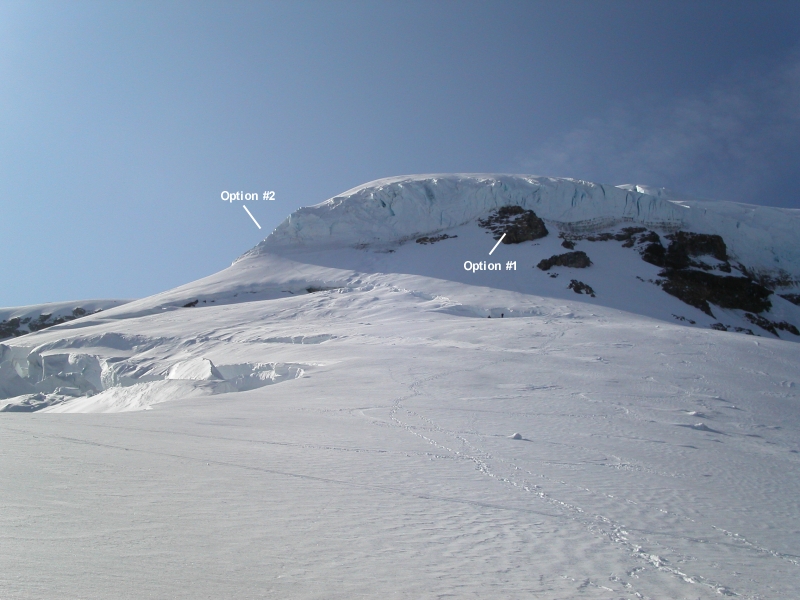
Scott and I stopped for another rest at a flat spot below a small bergschrund, as Dan and Corey began making their way up and left, to the standard beginning of the route. Another more direct (more difficult?) alternative, is to climb a small ramp directly above the rock. With Corey on belay, Dan led a short pitch of 60 - 70 degree ice to a small ledge cut in the ridge. With an ice screw belay, Dan brought up Corey. I led up next. Clipping into the one screw Dan placed in the ice and with some dinner plating near the top, I reached the tiny ledge where Dan and Corey were standing. The stunningly chaotic mess of the Roosevelt glacier now lay directly beneath our feet at this extremely cramped and exposed belay; and yet we had to make room for one more. Things were about to get interesting.
It was around this time that a search and rescue chopper looped around the mountain and hovered above the Coleman Glacier, apparently to look at (rescue?) us. I can tell you that standing there with the ominous chopper hanging above our heads and certain death looming all around us, I was a little unnerved. I was relieved to see the chopper move on and disappear back behind the mountain. With Scott about to join us on the ridge, Corey reluctantly led directly upward towards the serac that guards the North Ridge's gentler upper slopes. No sooner had I finished belaying Scott, the chopper returned and again hovered nearby. Ok, this was getting ridiculous. I was getting nervous and impatient, and wanted to be off the rapidly warming and softening ice cliff. With Corey setting protection below the serac, I led up and left and set a screw beneath a dripping overhanging section. I continued traversing left (recommend proceeding straight up from belay instead), switching to a running belay as the rope paid itself out, until I was able to climb steeply around and above the serac.
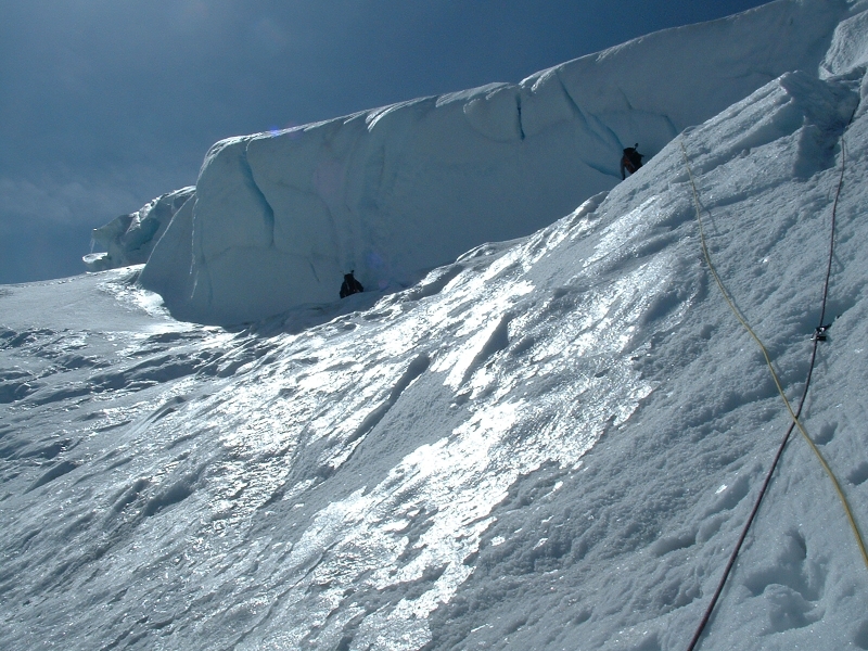
I was hoping for easier ground above, but was instead faced with what I initially thought was an impasse - vertical serac walls before me and to my right, and an endless drop down to the Roosevelt Glacier to my left. Worst of all, the one section of serac that I felt would go was baking in the sun and looked about as soft and unconsolidated as the foot-deep mush in which I was now standing. I set up a belay for Scott and began to consider our options. The longer I thought about it, the more nervous I became. The exposure below that seemingly soft and dangerous wall was very thought provoking. With the others still below and out of sight, I tried relaying my observations to them, suggesting the possibility of retreat. Scott, however, would hear none of it and insisted on coming up and seeing the wall for himself.
Scott eventually reached my belay. He too wasn't altogether pleased with what he saw either. We decided to wait for Dan and Corey. We waited and waited, and still the other two didn?t show. I called to them repeatedly and each time got the same response, "we're coming." Finally, I could wait no longer. The prospect of retreat was also beginning to sound like the more dangerous of our options. As Mark Twight apparently said: time to fail upwards. I placed a screw in the ice, as high as I could reach, clipped the rope and nervously started traversing right and up that wall. I encountered a few inches of soft, mushy snow over firm ice and was getting much better purchase with my tools than I expected. This wasn't so bad after all. A few moves later, I pulled myself over a small bulge near the top and immediately sank a picket into the firm snow.
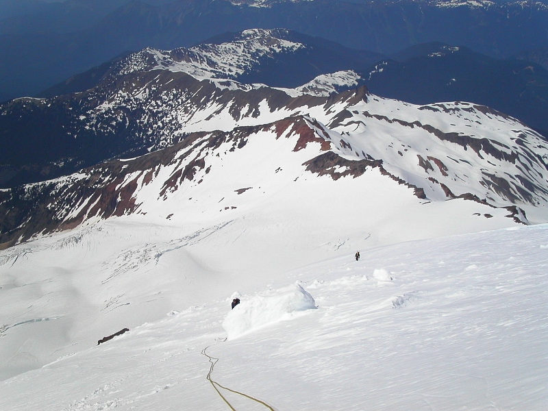
We're home free now, I told myself. I worked up along the crest of the ridge, sank another picket and belayed up Scott. I could now again see footprints in the windswept snow of the ridge. Actually, it looked like there was about an inch or two of new snow accumulation since the last prints were made. My crampons were balling up pretty bad by now. I asked Scott to lead, so that I could follow in his tracks. The slope was still quite steep and exposed, and we were both thoroughly exhausted. In the interest of safety we did a running belay with pickets all the way up this portion of the climb. Occasionally, I would look back to see if Dan and Corey had made it up that crux ice wall. They were no where to be seen. I was getting worried. Finally, I saw Corey's trekking poles, protruding over the top of his pack. They were safe. Phew!
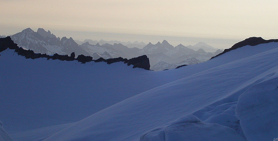
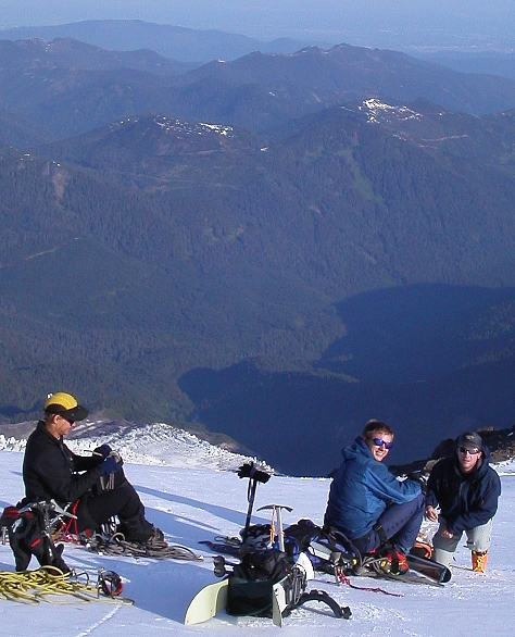
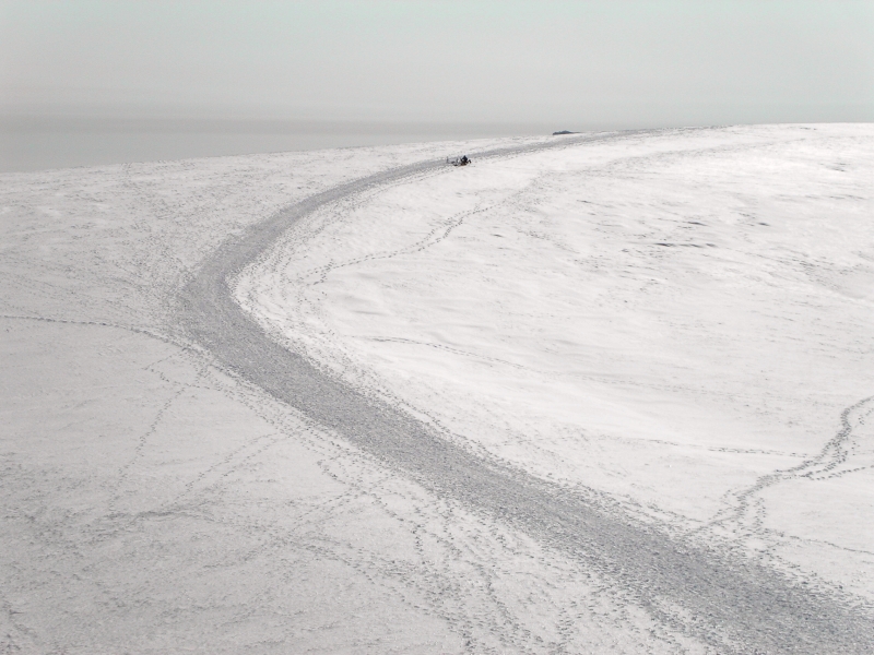
Scott's pace was slow, but I was happy to follow in his tracks. Eventually, Dan and Corey caught up with us and agreed to break trail for the final steep traverse above the Coleman Headwall towards the large, flat summit area. Soon, Dan and Corey disappeared out of view onto the gentle slopes of the summit area. Minutes later, I too found myself walking casually along the flat summit plateau, save for the occasional tug from Scott, who was still ascending that last slope. I could see Dan and Corey waiting for us just below the final summit mound. Scott and I dropped our packs on a wide swath of footprints somewhere between the true summit, and where the Coleman-Demming Route tops out on the summit plateau. Scott immediately collapsed to the ground, whereas I walked over to where Dan and Corey were waiting for me. It was now 5:30pm. Needless to say, it has been a long day! Together, we made the final steps to the true summit and congratulated each other for the feat we had just accomplished. We snapped the obligatory summit shots, though the haze (smog?) was really quite thick, before walking back to where Scott was resting.
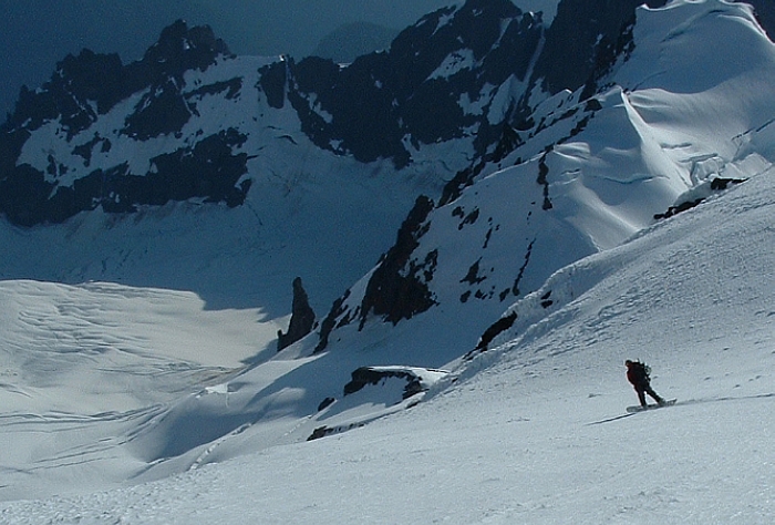
As Dan and Corey carefully plunge-stepped down the Roman Wall, Scott and I cut turns in the sun-baked spring corn down to the Colfax Peak-Baker saddle, all the way down the Coleman Glacier and to where the trail enters the forest at roughly 4500ft. We dispatched a roughly 5000-ft descent in about 30-40 minutes. At last glance, Dan and Corey were still working their way down the Roman Wall. 50 minutes later, we were back at the trailhead. It was now 8:00pm and we had been gone for about 20 hours straight. I really wouldn't change anything were I to climb this route again, save for perhaps going straight up instead of traversing underneath that dripping serac. There were certainly moments of nervous tension and uncertainty, but that's just par for the course as far as I'm concerned. The route was actually in really good shape and in hindsight, I welcome the little route finding adventure that led us a bit off the beaten track.
Click here to view photos.
![]()


