Last Updated: April 2, 2024


Start

Recent content updates are viewable under what's new.

Reports in the queue for posting are coming soon!

Upcoming reports & photos:

Oh my! Quite the backlog here, eh?

  • Slahanay Peak - hike/scramble (April 2023)
  • American Mountain & Mount Lincoln - hike/snowshoe (May 2023)
  • Mount Mclean Attempt, Red Rock Trail, Dragons Back Trail - hike (May 2023)
  • Stawamus Chief (South, Middle & North) - hike/scramble (June 2023)
  • Flint & Feather - hike/scramble (June 2023)
  • Goat Ridge (Squamish) - hike (June 2023)
  • Grouty/Mortar Peaks - hike/scramble (June 2023)
  • Pebble-to-North Creek Traverse incl. Pebble, Thiassi, Wesley & Sugus - hike/scramble (July 2023)
  • Mount Truax - hike/scramble (July 2023)
  • Blackcomb Buttress - rock climb (July 2023)
  • Whitecap Peak - hike/scramble (July 2023)
  • Mount Hanover - hike/scramble (August 2023)
  • The "Long Traverse" incl. Long, Tynemouth, Arrowhead, Tabletop & Anemone - hike/scramble (August 2023)
  • Armchair Traverse - hike/scramble (August 2023)
  • Snowspider Mountain - hike/scramble (September 2023)
  • Mount Trorey - hike/scramble (September 2023)
  • Macleod Peak - hike/scramble (September 2023)
  • Ben Lomond - hike/scramble (September 2023)
  • Mount Killam & Gambier Island - hike (September 2023)
  • Lone Goat & Snow Camp Mountain - hike (September 2023)
  • Isollilock Peak - hike/scramble (October 2023)
  • Manson - Hatfield Traverse - hike/scramble (October 2023)
  • Gargoyles & Columnar Peak - hike/scramble (October 2023)
  • Opal Cone and Lava Glacier - hike (October 2023)
  • Park Butte (WA) - hike (October 2023)
  • Trappers Peak (WA) - hike/scramble (October 2023)
  • Rattlesnake Ledge (WA) - hike (November 2023)
  • Sauk Mountain (WA) - hike (November 2023)
  • Mount Daniel & Pender Hill (Sunshine Coast) - hike (November 2023)
  • Mount Dickerman (WA) - hike (November 2022)
  • Winter's End (Verona Peak) - hike/snowshoe (November 2023)
  • Dolomites (Italy) - snowboarding (December 2023)
  • Red Rock Canyon (NV) - hike (January 2024)
  • Flute & Oboe - split tour (February 2024)
  • Whistler misc. (Train Wreck, Loggers Lake, Shadow Lake etc.) - hike (February 2024)
  • Mount Underhill - hike (March 2024)
  • Bombtram Mountain - hike (March 2024)
  • Steep Peak - split tour (March 2024)

*As of 04/02/2024


Database

Query the reports database, selecting from criteria which include name, location, type, season etc.

Quick Links

Essential links & whatnot:


Jump To

Select from list below to jump to a specific area on this site.


| Featured Trip Report |


Last Updated: Jan. 25, 2005

North Chiwaukum Tour - Lake Ethel to Whitepine Creek, December 2004


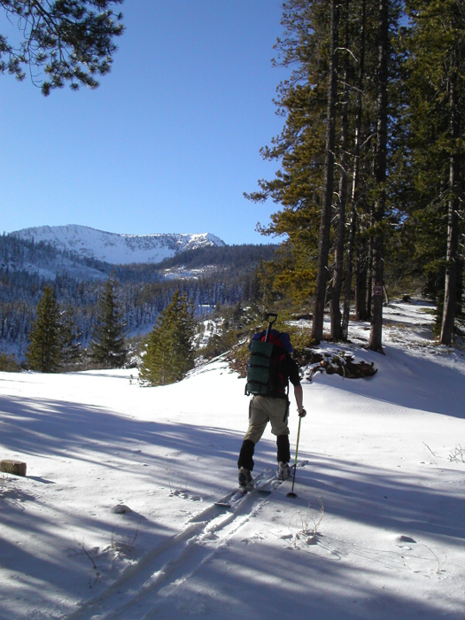
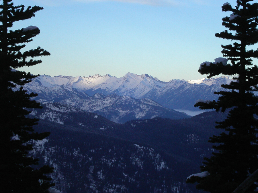
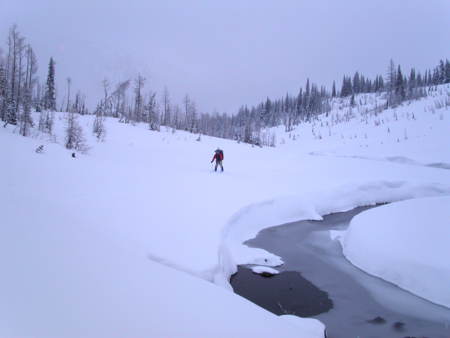
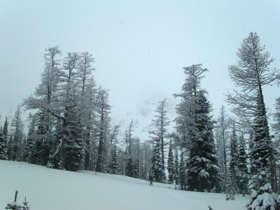
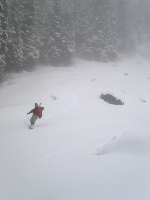
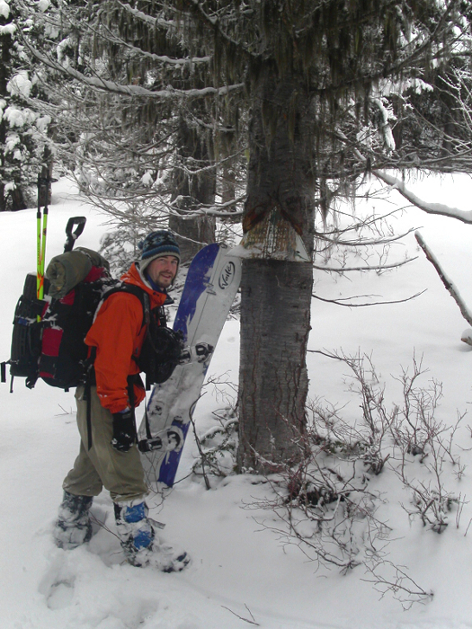
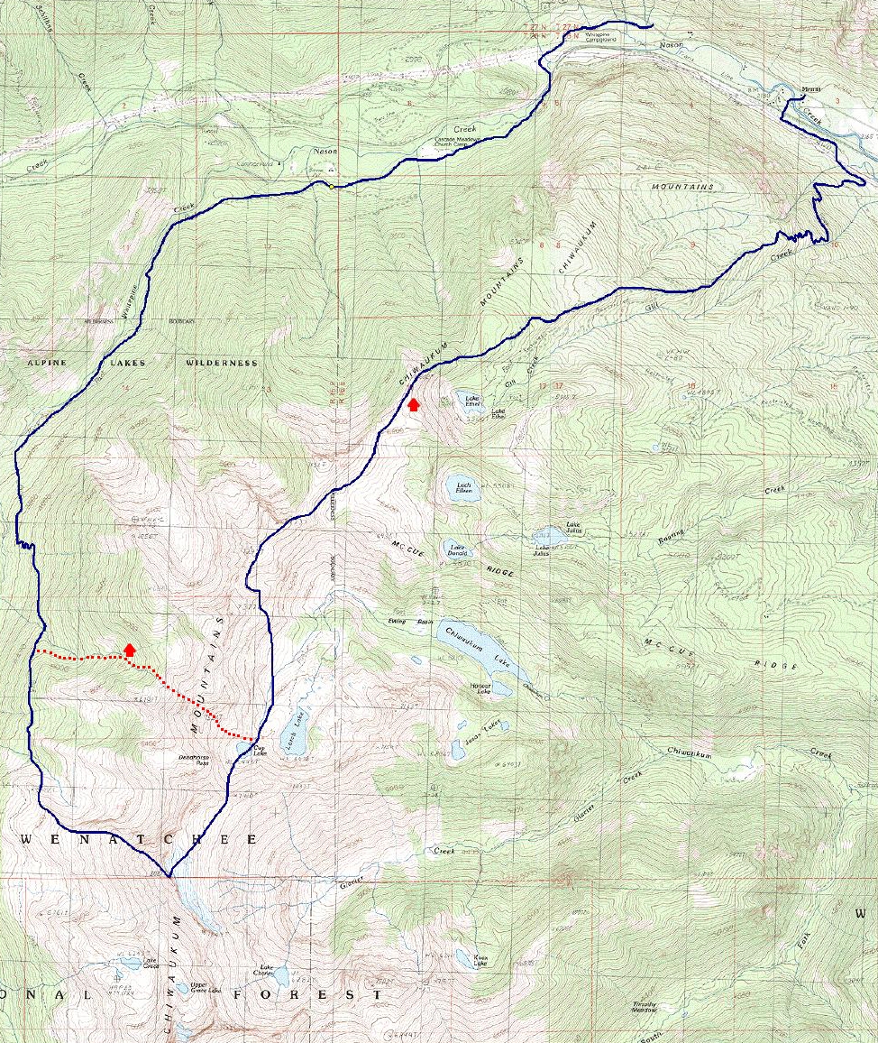
With time to burn between Christmas and New Years, Tod and I embarked on another adventure deep in a remote corner of the Central Cascades. Having been in the Chiwaukums before (Icicle Creek to Whitepine Creek via Snowgrass Mountain), Tod was quite familiar with the area. This time, however, we'd approach the range from the north, via Lake Ethel, and traverse the northern crest of the Chiwaukums as far as possible before being forced to descend into Larch Lake basin. The original itinerary called for the summit of Big Chiwaukum via a shallow saddle directly above and south of Cup Lake. We'd then tour up Chiwaukum's east facing remnant glaciers (an area missed on Tod's previous tour), scramble over the summit and ride down the west facing slopes - touted to be very amenable to skiing. We'd complete the loop by riding and hiking out Whitepine and Whitehorse Creek Trails.

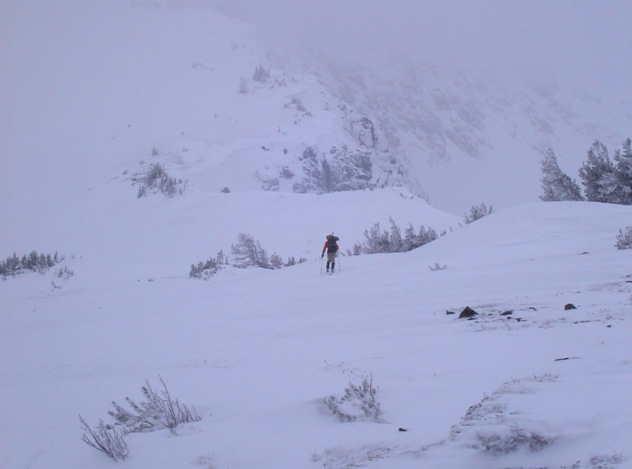
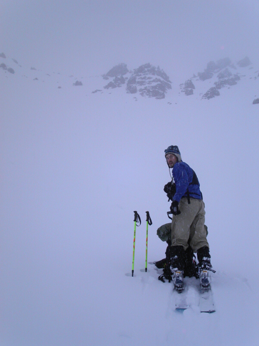
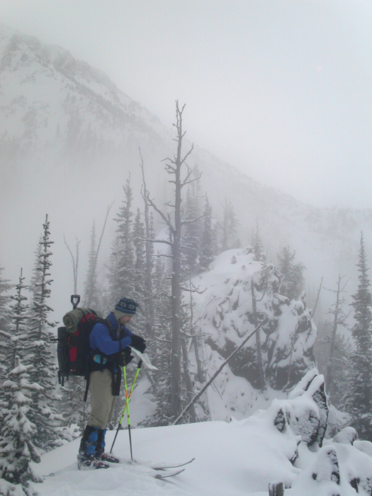
That was the original plan, but conditions on the second day of our three-day tour (the day we were to summit Big Chiwaukum) forced us to cut the loop short. Plagued with poor visibility, occasionally heavy snowfall and slow travel through deep, fresh powder, just making it to Cup Lake was an accomplishment. Foregoing the summit, we decided to play it safe and cross over the crest via Deadhorse Pass. We'd then make camp in a large, flat basin about 500ft below the pass and complete the loop the following day. Thanks to the whiteout, we unknowingly missed the pass entirely and topped out on Pt. 7534 (Deadhorse Peak) instead. In the rapidly waning daylight we then made a blind descent into unfamiliar terrain. We'd only know where we went wrong that next day after the weather cleared somewhat and we could reconcile terrain features with our topo maps. (more...)

Click here to view photos.
home | email | copyright

All photos and text for sverdina.com are copyright © 2002-2024

It would be very much appreciated if you please ask before copying and/or re-publishing content from any part of these pages. To do so, please click here to send a message via feedback form.

Thank You.

©2024 sverdina.com |