


Big Four Mountain - Dry Creek Route (attempt), June 2006

Big Four is well known around these parts for two reasons: the stupendous North Face and the ice caves at the foot of the North Face. The North Face is plainly visible from Mountain Loop Highway at several locations and from the viewpoint/picnic area near the highway. This face is 4,000 ft high. It rises like a palisade from the ice caves in a series of high-angle ribs and gullies. The ribs rise up to form five distinct nubs that look like brass knuckles. Indeed the symbolism is apt, for there is no easy way to the top of this peak and you might be punished for trying. Interestingly, the mountain does not take its name from the knuckles on its summit crest (there are five knuckles, not four). Instead, it apparently got its name from the giant "4-shaped" snowpatch on the East Face, which I've never seen. The peak is everywhere rugged. The easiest route is from the east (from Dry Creek). The North Face relents with difficult ice climb routes but it is generally avoided in summer (loose rock). The NE Ridge contains a hard rock route called the Tower Route.
The ice caves have been a tourist trap for years. An inn was even built at where the present Big Four viewpoint is located. The caves have melted back quite a bit over the years but they are still worthy of a visit (especially since the approach trail is short). What are the ice caves, then? Essentially, there is an avalanche debris cone that forms (or has formed over the centuries) at the base of the North Face. This cone is known as "Rucker's Glacier." Waterfalls plummeting down the face enter at the back of the cone and subsequently flow under it. The water eventually exits at the base of the cone in a series of streams. The combination of ground surface heating characteristics and airflow has excavated large tunnels under the base of the cone. To enter these tunnels is quite dangerous (people have been killed when caves collapse), but they are pretty interesting. People have been known to ice climb near the mouth of the caves or on isolated ice blocks nearby. Walking perpendicular to the caves, one might also encounter temperature variability in the breeze that flows out from the caves - warm, then cool, then warm again...much like the constructive/deconstructive sound wave effects of a good pair of stereophonic speakers.
There is really only one approach to Big Four that is worthy of mention here. The intrepid explorer might approach the peak from the south (from Spada Lake) but, if he/she does, they won't be coming here for the information. In my case, I will only elaborate on the north side approaches (from Mountain Loop Highway). Though some hardcore types may that say if you don't go up the North Face then you are cheating, may I suggest that the Dry Creek Route is no pushover either. The route features a river crossing (hopefully on a log), an open-forest and dry creek bed approach, route finding issues in the lower basin, a steep couloir that's avalanche-prone (especially in winter and spring), a rocky headwall to gain the notch above the couloir, a scrub pine brush bash up the South Ridge, steep snow traverses (if early season), and an expansive open summit. The route has a lot of features. So, where does the fun all begin?
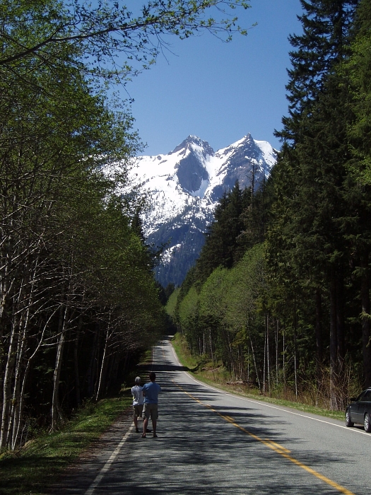
We parked at milepost 27 on the Mountain Loop Highway. (This milepost is one of the few on the road; it is on the south side of the road near a long bend.) Hiking down through open forest towards the river, we encountered a broad gravel wash at a river bend with an easy log crossing. Once in the forest on the other side of the river, we followed plenteous orange and pink tagging on a shallow ridge that forms west of the river where it turns slightly south upstream of the log. The ridge soon departs the river then parallels Dry Creek (which really is dry; the water flows under the surface). Continue on with almost no bushwhacking to where the tagging leads down to the gravel and boulder streambed of Dry Creek. Follow the dry bed south to where it opens up on the east side of the mountain.
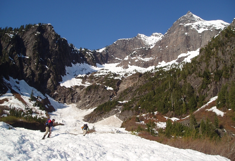
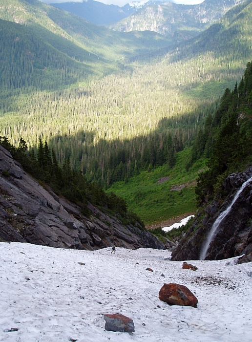
Conditions in winter and spring may be different than in summer and fall. In winter and spring the gullies leading up through the cliffs may be snow filled. Later in the season when the snow has melted out the gullies may be impassable. The most feasible gully is on the right (north) side of the lower basin. This gully angles up and right toward the towers of the NE Ridge. A prominent waterfall plunges down on the left side of the basin. You could try your luck over yonder but no guarantees. When Andy, Eric and I attempted the route earlier this May, we were able to boot up snow (large avalanche debris pile) to reach the base of a small waterfall on the right side of the lower basin. From there, we traversed right on a ledge then proceeded to climb upwards (and slightly left) on wet, brushy slabs aiming for the aforementioned right-angling gully. Booting up the large snow-filled gully, we soon found ourselves on snow slopes at the far right of the upper basin. Wallowing in waist-deep slush across the basin towards the mouth of the upper couloir didn't seem like the smart thing to do - it was only 9am and pushing 80 degrees.
We turned-back at a point just before a nerve-wracking traverse beneath unstable snow slabs...there was evidence that sections of these slabs had slid already. No sooner did we arrive back at the car, did we hear a massive rumble emanating from somewhere on the east side of the mountain. Good thing we turned back when we did! Come to find out, this day would mark the first in a series of unseasonably warm (upper 80's) days we had this May. Needless to say, big snow year + first day of record springtime temps = death on a stick...well, so much as Big Four is concerned!
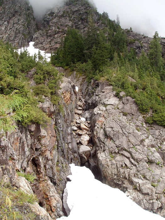
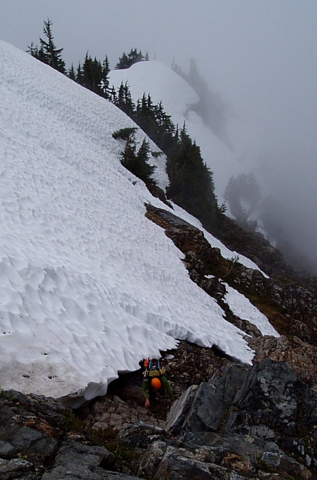
By the time Eric and I returned for another go at the peak in June, the avalanche debris pile beneath the lower cliffs had shrunk, leaving us to sniff-out another means by which to gain the key snow-filled gully. Traversing a bit left of where we gained the slabs last time; we located a horribly brushy ramp that angled up and right to reach the base of the gully. Bypassing a deep slot in the rocks, we thrashed up more brush on the left, before finally descending to snow. Hopeful that the gully would still be continuous snow leading to the upper basin, we began making our way up. We easily passed the first melted-out constriction on the left, a bit unnerved by the 20-foot deep moat we saw there. Continuing up, it became clear that the second, steeper and narrower constriction would give us trouble. With an enormous moat separating us from the gully continuation and overhanging boulders running with water, we were forced to look for alternatives.
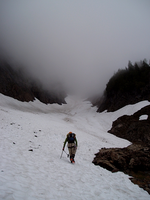
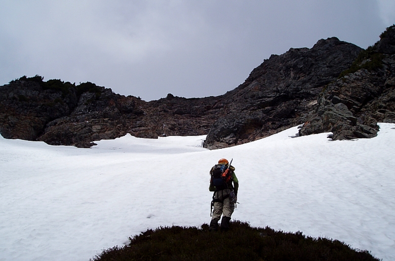
Looking around we located a short, rubbley gully at a point where the upper gully wall makes an 'S'. An undercut tongue of snow provided access to the gully, whereupon we easily scrambled up to a small bench (rap slings on tree). Next, we traversed left, crossed a small stream and then proceeded upwards on slabs and steep brush before finally reaching the snowy upper basin. Now, traversing left, we made good time reaching the base of the upper couloir. Booting up the broad couloir, we came upon the snow-free constriction described in the CAG. The easiest way up this portion appears to be on steep class 3/4 rock (wet) just right of the waterfall. Crossing back left over the watercourse once above the falls, we continued up on rock to reach a small heather outcrop beneath the upper amphitheater.
The thin snow finger at far left, where I hoped we could gain the high saddle from, turned out to be severely undercut and pitched-up to a ridiculously steep angle (60 - 65 degrees?). There'd be no way to get off that thing and onto the rock...moreover, there'd be no way to rap back down onto it. As an alternative, the CAG suggests climbing "the rock slope westward near the right side of the face to the summit ridge saddle." Looking over in that direction, we saw nothing to indicate a class 3 route leading up to the saddle. But, looks are often deceiving when looking at things head-on, so we began booting up steep snow to get a closer look.
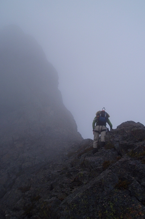
Trending right, we exited onto heather and began scrambling upwards, eventually reaching the crest of the Northeast Ridge. Looking at the headwall at left, now in profile, the rock looked steeper than it did from below. "Where the hell does this route go" I wondered out loud. Continuing up on the crest, we soon reached an impasse beneath a tower that makes up the false summit. Now what? If we went left, we'd find ourselves on the same un-protectable, slabs we were looking up at from below. Furthermore, the descent from the saddle looked like it'd require at least 3 or 4 rappels to reach the highest snow (60m rope), with limited or no opportunities to build an anchor once below the saddle. Venturing right around the tower was clearly not an option...one look down the sheer North Face and you'd know why. Going directly up the tower looked difficult and scary. Stymied again...
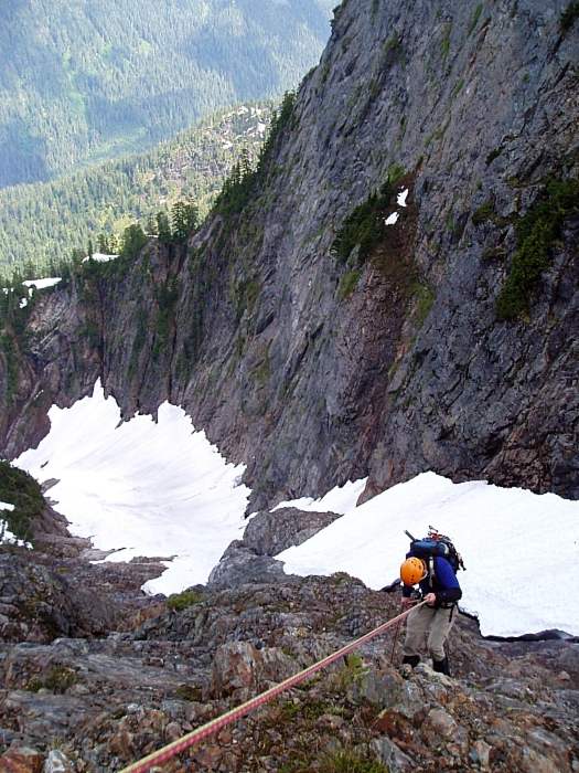
Though we wanted to investigate other options for getting up the headwall, time was not on our side. It was already past 2pm and we'd burned countless hours battling the brush down low. Furthermore, there's apparently bit more dealing up from the saddle to reach the summit, followed by what was sure to be a frantic race against darkness, with tired bodies, back down the sketchy couloir. Disappointed, we turned and carefully headed back down the loose NE Ridge. Making two rappels down steeper rock below the upper amphitheater, we down-climbed the exposed pitch at the constriction and continued down easy snow in the lower couloir.
We then reversed our route back across the basin and down through the lower cliff band (one more rappel to gully), eventually reaching the lower avalanche debris pile. Needlessly burning 30 extra minutes flailing around looking for a way around the bog, we finally located our log crossing, reaching the car around 7:30pm. I'm not sure I'd go back for this one, but the route definitely favors the early season. A clear, cold and stable day in March would be ideal - and combine that with a gnarly ski descent from the summit a'la Phil, Jason and Josh!
Click here to view photos.
![]()


