


Clark Mountain - Southeast Route, July 2008

This trip was as much about the views as it was about tying-up loose ends. You see Scott and I attempted to climb Clark's Walrus Glacier in day several years ago, but a 'minor' navigational mishap, one that cost us a couple hours at least, and my having to be back in town no later than 9 pm ultimately spelled failure for us. We reached the glacier's edge and were literally out of time. That is to say, we had insufficient time to complete the glacier slog and remaining summit scramble. We however did have about an hour to lounge in the sun below the Southeast Peak, and so took advantage of the beautiful weather and great views and soaked-in some vitamin D.
Ever since that trip, however I've had this nagging itch to go back for the 360-degree view from Clark's summit. Granted, the Southeast Route I took this time can scarcely be considered a climb per se (ice axe/crampons never left my pack) and you may be wondering wherein this glorified hike lies the appeal, but I had a day to burn before the forecasted rain arrived and could think of nothing better to do solo. That said, it's nice to do a relaxing trip in the mountains for a change. And so 'relax' I did, at least to the extent that I am capable of. But first I had to fight my way through afternoon rush hour traffic, reaching the trailhead around 6 pm wondering if I'd make it up to camp below Boulder Pass before dark.
Ok, I'll admit it - I cheated. The first four miles of White River Trail consists of mostly flat or gently rolling pine needle covered single track, ideal for uh...um horses, yeah horses. I was actually fortunate enough not to encounter any horses this time, but it continues to amaze me that pack animals are permitted on this trail while other forms of non-motorized transportation are not. But, I digress. It took me about two hours to reach the campsites in the basin below Boulder Pass. I met a party of three elderly gentlemen there who were also planning on climbing Clark's Southeast Route. Their plan was for a 3-day affair on Clark - and why not? Too often we run to-and-from the mountains and don't take the time to smell the flowers, so to speak. We chatted over supper for a while; a member of the elderly threesome kept repeating "we're old, we like to maximize our time in the mountains." Words to live by indeed! They actually make mention of me in a NWHikers.net report stating that they "...were joined a couple of hours later by a climber who had left Seattle about the time we were fording the creek. He headed up Clark the next morning as we were starting and I think he was probably back home about the time we were reaching the summit." LOL!
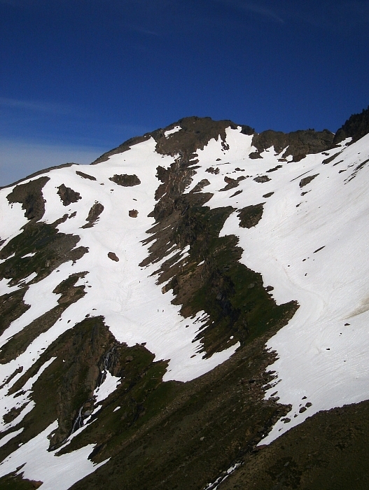
I woke up to the noise of the threesome rustling about camp that next morning, and groggily crawled out of my tent to mooch a cup of fresh drip coffee from my camp-mates. On the go a short while later, I took a left fork off the Boulder Pass Trail, crossed Boulder Creek once again and continued up and west into a pleasant basin below the Southeast Peak's South Spur. Blindly following the trail all the way to the crest of this spur, I continued up either directly on the crest or hiking and scrambling on either side (a faster and easier option would be to leave the trail once in the upper-basin and angle north toward the highest snow patches). Scrambling exposed 3rd-class rock on the crest, I eventually reached a notch which I expected lead to the gully that descends to Clark's west slopes. No such luck, and so I kept heading up along the crest to where it levels-off. The rock here isn't terribly solid, but it felt more like 'climbing' and is probably more fun than kicking steps up steep dirt and hardpan on the south side of the spur. You decide.
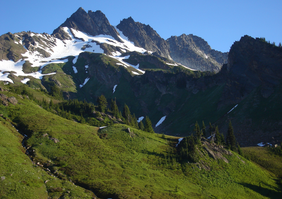
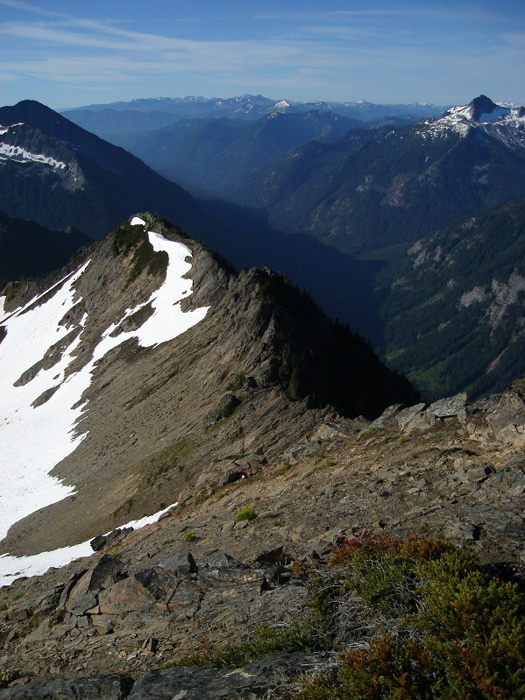
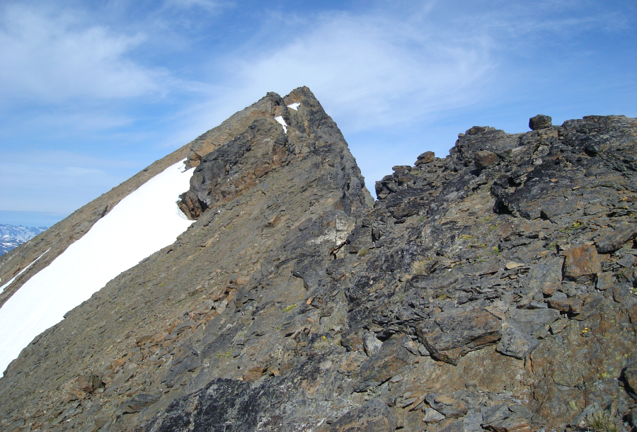
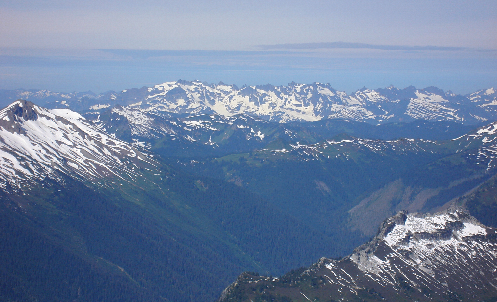
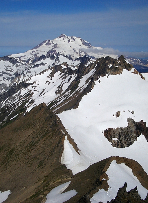
I walked past a bivy site and located the elusive gully shortly thereafter. A steep, loose descent saw me down into the basin west of Clark, which I traversed on the upper of two obvious, sloping benches. Aiming for a low-point in the saddle between Clark and the Southeast Peak, I booted-up to the highest snow, then scrambled a short bit of loose rock to gain the crest of Clark's South Ridge. Class 2 scrambling on or just west of the crest, with occasional class 3 forays on the east side of the crest made for an entertaining conclusion to the climb. The views alone are definitely worth the effort. The deep cut the White River Valley makes west of the high ridge that comprises the "American Poet" peaks, Mount Saul and Indian Head Peak toward the headwaters near Thunder Basin is impressive. Looking north, the glaciated crest of the DaKobed Range continues in a line culminating with Glacier Peak itself. I took one look down on Luahna Peak and decided then and there that it wasn't in the cards for me that day. Sometimes it pays not to be a Top 100 peak-bagger. To the east, the lush Napeequa River Valley and countless peaks beyond provide a nice encore to Clark's position.
On return, I boot-surfed scree and dirt down the West 'Ridge' to reach high snow on the lower of the aforementioned sloping benches. I followed this bench most of the way back to the South Spur gully, where I finally encountered the threesome from camp. We chatted briefly, wished each other well and parted ways one last time. Taking a more direct line down from the South Spur, it didn't take me long to reach camp. Hiking back down Boulder Creek Valley, I encountered Eli and friends who were on their way to climb the Walrus Glacier. They spoke of throngs of day hikers and such on the White River Trail, which given my chosen method of approach along that portion of trail made me a bit nervous. I next encountered a ranger followed by several backpackers, who quizzed me about the descent from Boulder Pass to Napeequa River Valley. It turns out that the PCT was re-routed up and over Boulder Pass. Uh oh.
Much to surprise and relief, I encountered not a soul along the 4-miles of White River Trail back to the parking area. This absence of hikers was not for lack of vehicles parked at the lot either. It seems most were taking the trail serviced by the large bridge over the White River, though I'm not sure where that leads. In any case, the important part is that I made back unscathed, again. Ahh...now I can breathe easy again. So much for relaxing in the mountains, eh?
Click here to view photos.
![]()


