Last Updated: April 17, 2024


Start

Recent content updates are viewable under what's new.

Reports in the queue for posting are coming soon!

Upcoming reports & photos:

Oh my! Quite the backlog here...

  • American Mountain & Mount Lincoln - hike/snowshoe (May 2023)
  • Mount Mclean Attempt, Red Rock Trail, Dragons Back Trail - hike (May 2023)
  • Stawamus Chief (South, Middle & North) - hike/scramble (June 2023)
  • Flint & Feather - hike/scramble (June 2023)
  • Goat Ridge (Squamish) - hike (June 2023)
  • Grouty/Mortar Peaks - hike/scramble (June 2023)
  • Pebble-to-North Creek Traverse incl. Pebble, Thiassi, Wesley & Sugus - hike/scramble (July 2023)
  • Mount Truax - hike/scramble (July 2023)
  • Blackcomb Buttress - rock climb (July 2023)
  • Whitecap Peak - hike/scramble (July 2023)
  • Mount Hanover - hike/scramble (August 2023)
  • The "Long Traverse" incl. Long, Tynemouth, Arrowhead, Tabletop & Anemone - hike/scramble (August 2023)
  • Armchair Traverse - hike/scramble (August 2023)
  • Snowspider Mountain - hike/scramble (September 2023)
  • Mount Trorey - hike/scramble (September 2023)
  • Macleod Peak - hike/scramble (September 2023)
  • Ben Lomond - hike/scramble (September 2023)
  • Mount Killam & Gambier Island - hike (September 2023)
  • Lone Goat & Snow Camp Mountain - hike (September 2023)
  • Isollilock Peak - hike/scramble (October 2023)
  • Manson - Hatfield Traverse - hike/scramble (October 2023)
  • Gargoyles & Columnar Peak - hike/scramble (October 2023)
  • Opal Cone and Lava Glacier - hike (October 2023)
  • Park Butte (WA) - hike (October 2023)
  • Trappers Peak (WA) - hike/scramble (October 2023)
  • Rattlesnake Ledge (WA) - hike (November 2023)
  • Sauk Mountain (WA) - hike (November 2023)
  • Mount Daniel & Pender Hill (Sunshine Coast) - hike (November 2023)
  • Mount Dickerman (WA) - hike (November 2022)
  • Winter's End (Verona Peak) - hike/snowshoe (November 2023)
  • Dolomites (Italy) - snowboarding (December 2023)
  • Red Rock Canyon (NV) - hike (January 2024)
  • Flute & Oboe - split tour (February 2024)
  • Whistler misc. (Train Wreck, Loggers Lake, Shadow Lake etc.) - hike (February 2024)
  • Mount Underhill - hike (March 2024)
  • Bombtram Mountain - hike/snowshoe (March 2024)
  • Steep Peak - split tour (March 2024)
  • Ruby Mountain (WA) - hike/snowshoe (April 2024)
  • Blustry Mountain - hike (April 2024)
  • Sowerby Peak (Barr East) - hike (April 2024)

*As of 04/21/2024


Database

Query the reports database, selecting from criteria which include name, location, type, season etc.

Quick Links

Essential links & whatnot:


Jump To

Select from list below to jump to a specific area on this site.


| Featured Trip Report |


Last Updated: Aug. 15, 2007

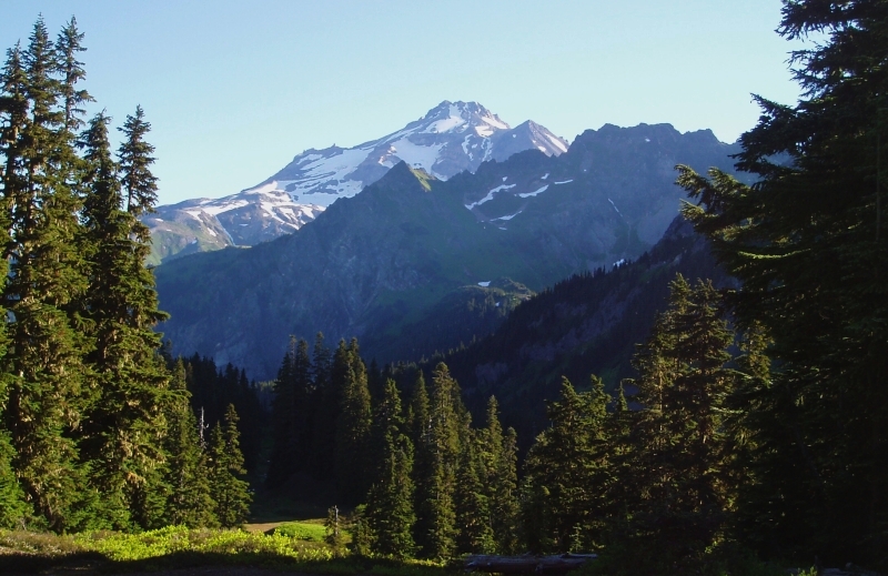
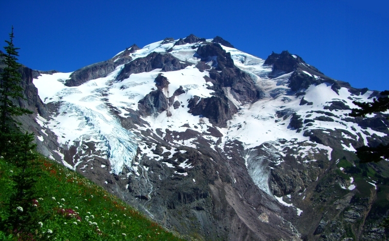
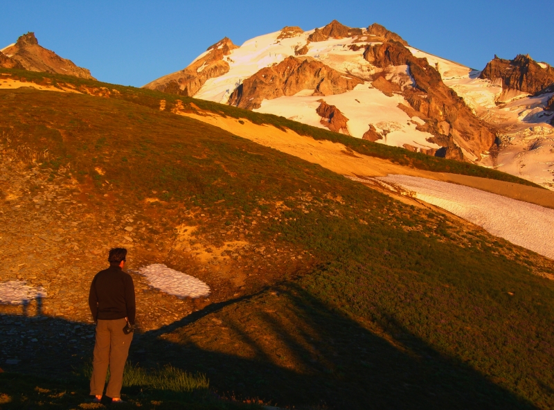
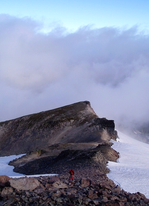
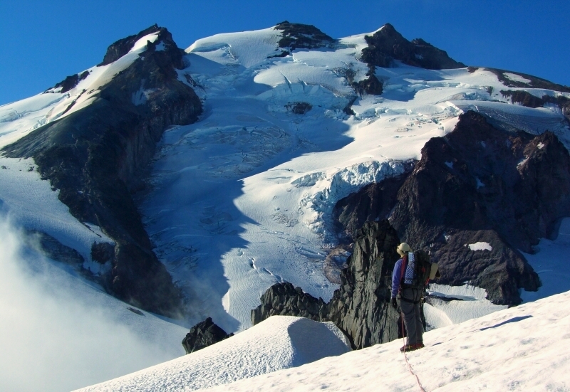
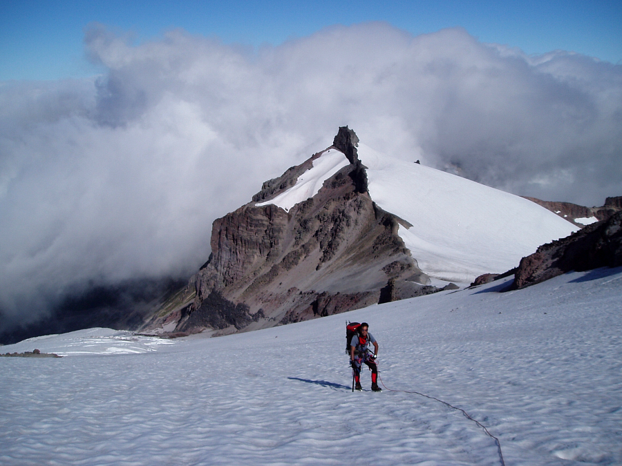
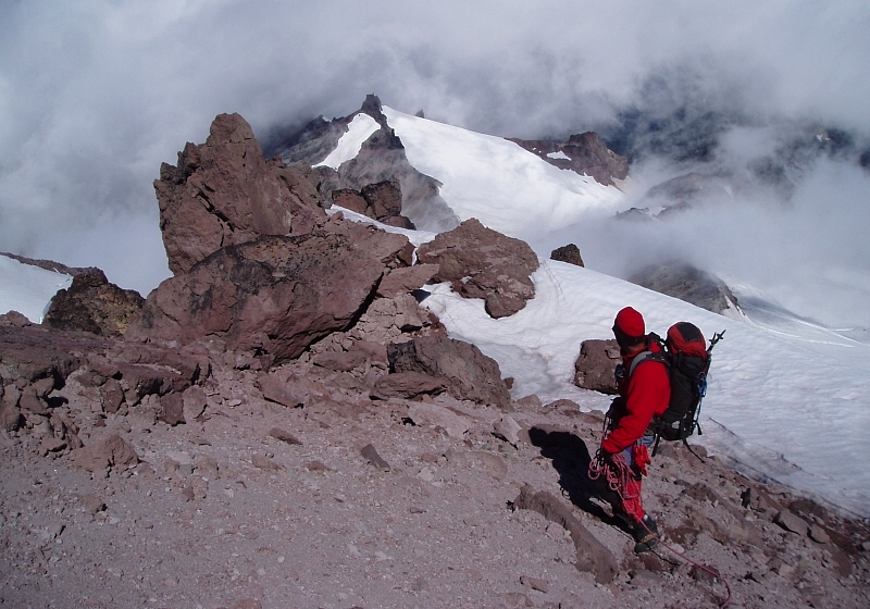
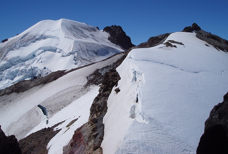
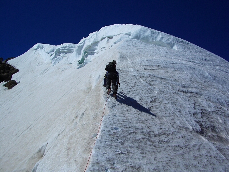
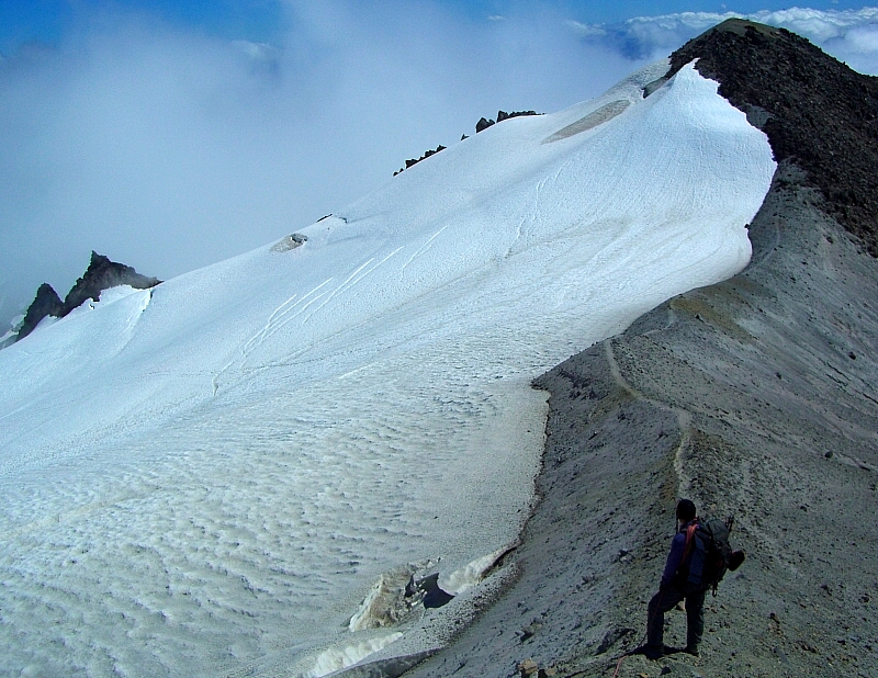
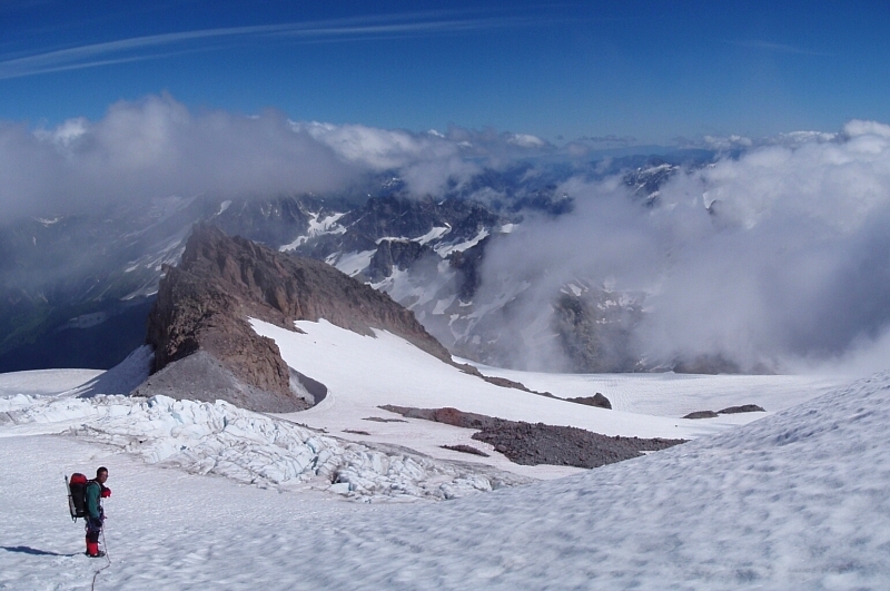
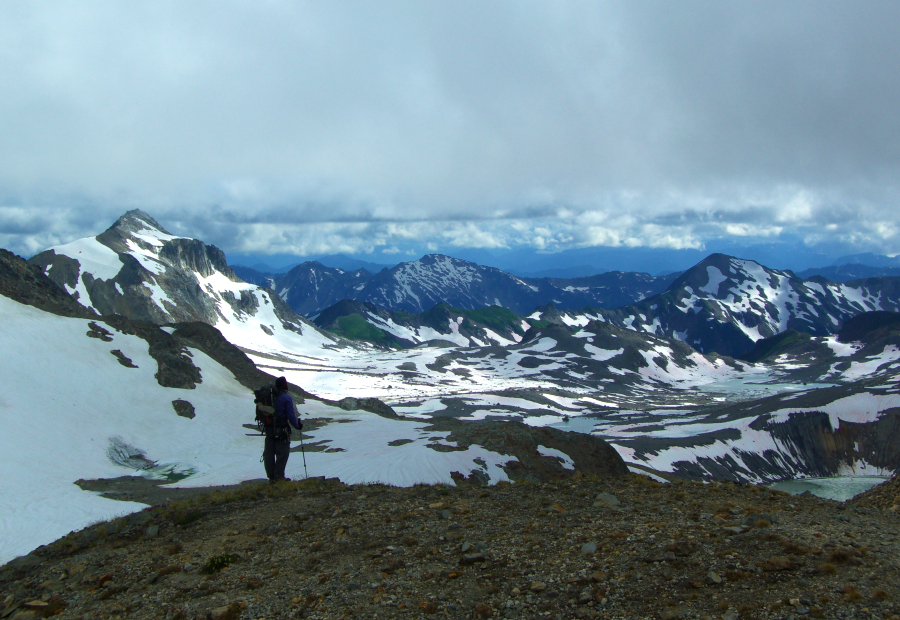
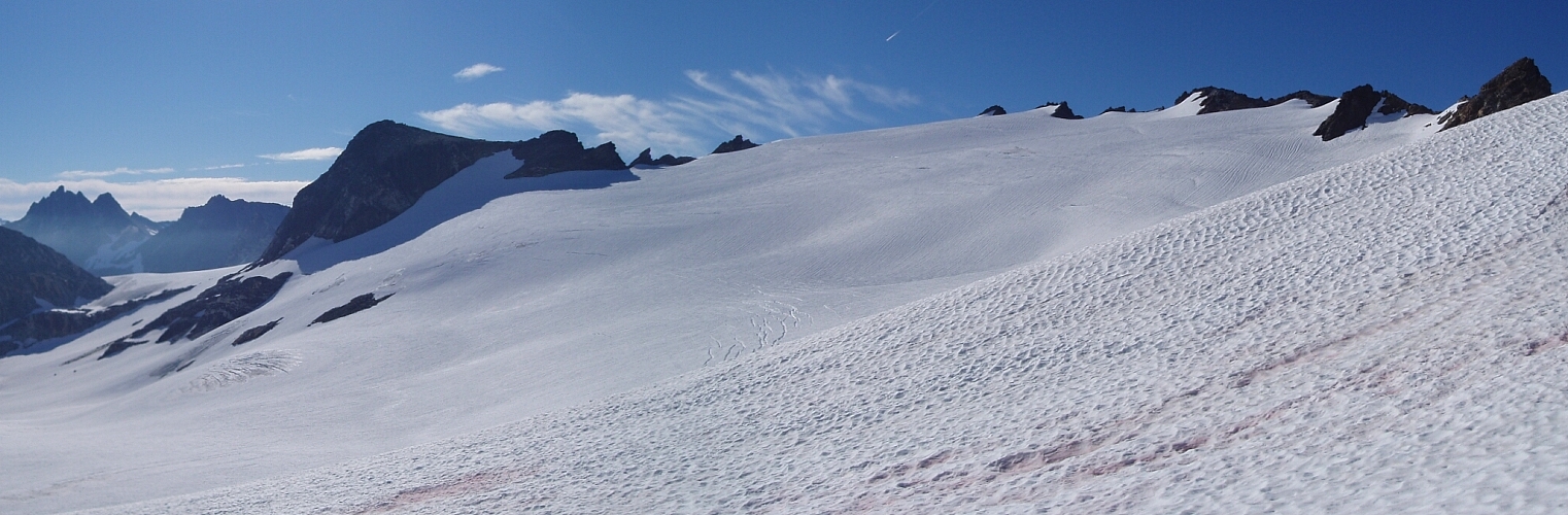
Glacier Peak - Frostbite Ridge-Cool Glacier Traverse, August 2007


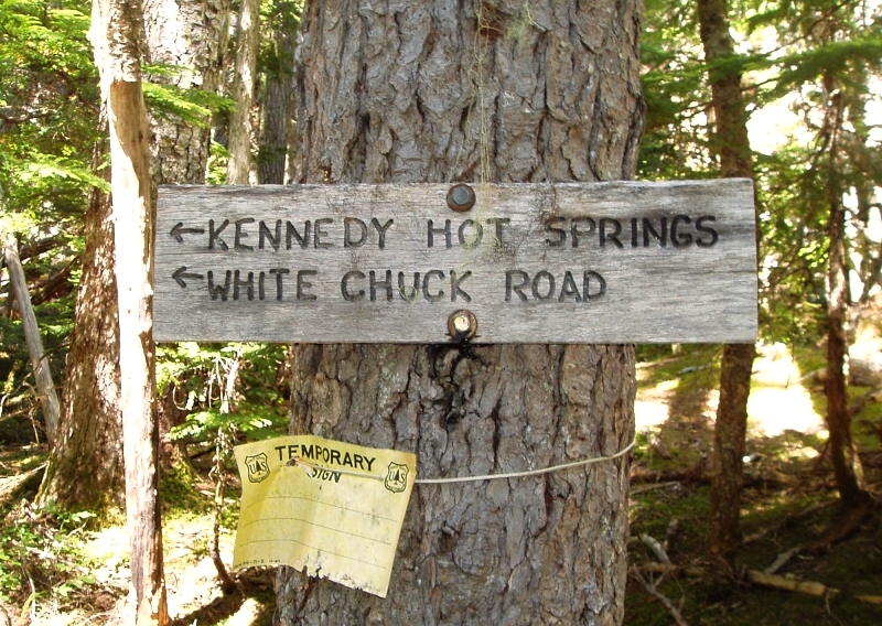
"This trip was about as much of Glacier Peak as I could hope to see in two days" - at least so says currently recuperating climbing partner Eric Hoffman of his solo Frostbite Ridge-Cool Traverse back in 2001. And while our trip took almost twice as long, given the current state of the White Chuck River Road and trailhead, Eric's report helped convince me that it would all be worth it in the end. I debated putting the trip on hold in hopes the Forest Service would get it together and finally repair the White Chuck River Road (washed-out back in Oct. 2003), but given the endless bureaucratic red tape that seems to precede any repairs to roads within national forest land, I doubt the Forest Service has the resources (or desire?) to actually start performing the work. Combine a seemingly endless environmental impact assessment process (there was a road there to begin with, right?) and a determined, but vocal minority that seems intent on simply letting Mother Nature reclaim all forest roads rendered defunct by acts of nature, the prospects of this and countless other roads of ever being repaired aren't good. With that in mind, I finally resigned myself to the fact that if I really wanted to climb this route, I'd be looking at a considerably longer outing both in terms of duration and mileage. And yes, I really wanted to climb Frostbite Ridge...

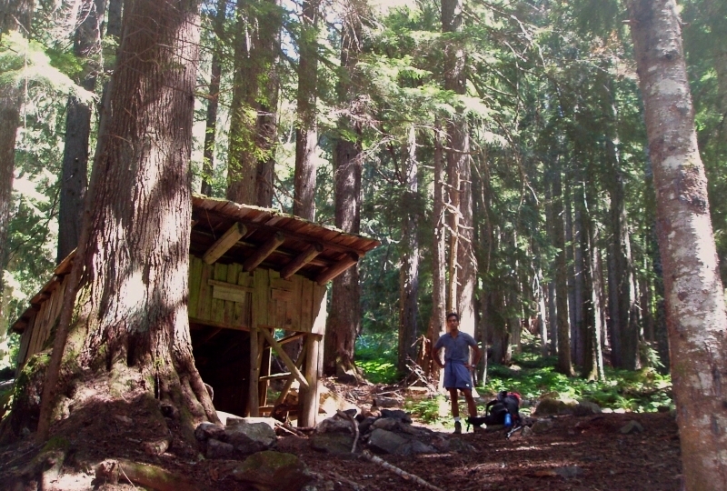
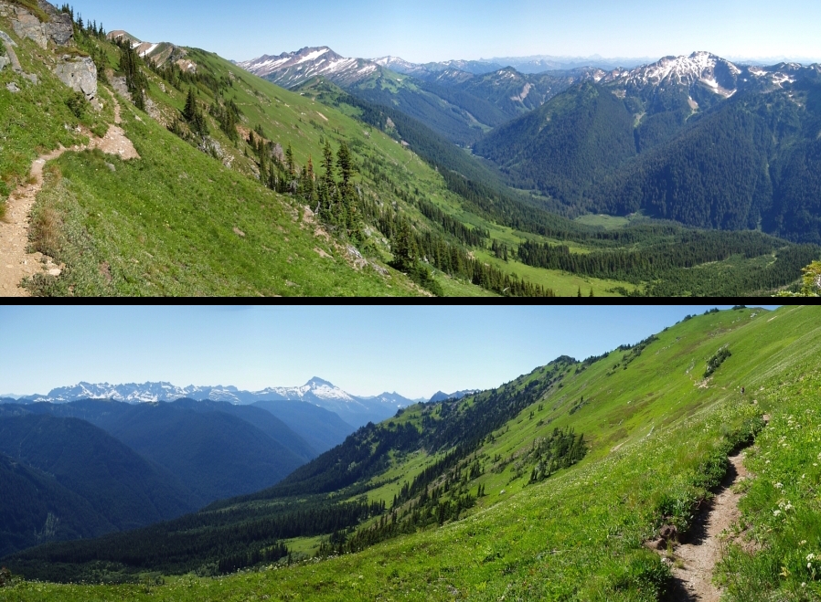
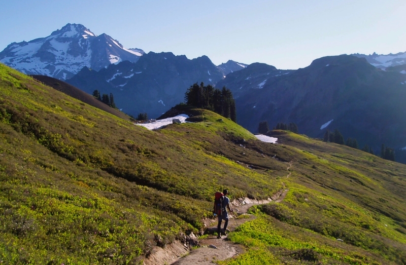
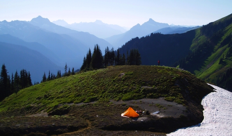
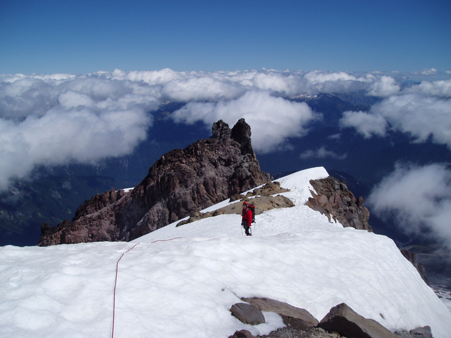
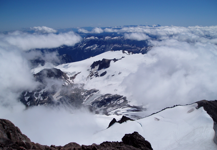
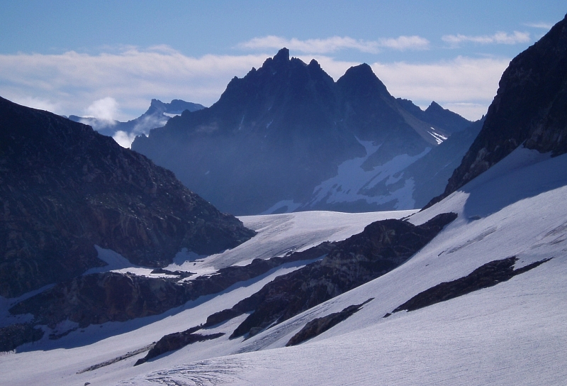
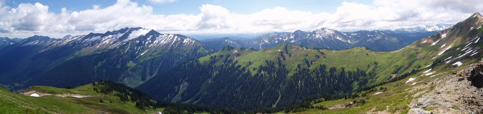
Our trip started just 2.5 miles shy of the North Fork Sauk River Trailhead...well, sort of (road closed due to bridge damage). The road (and bridge) is actually still drivable beyond the closed signs, and so Jerry dropped the packs (and me) off before driving the car back across the bridge, parking and then jogging back. The trail meanders along the valley for about five miles before climbing (shortly after Mackinaw Shelter), and reaches the Pacific Crest Trail (PCT) in about 7 miles. We camped that night at Red Pass, about a mile further. (more...)

Click here to view photos.
home | email | copyright

All photos and text for sverdina.com are copyright © 2002-2024

It would be very much appreciated if you please ask before copying and/or re-publishing content from any part of these pages. To do so, please click here to send a message via feedback form.

Thank You.

©2024 sverdina.com |