


Johannesburg Mountain - Northeast Buttress, August 2011

(Introduction by Tom Sjolseth)
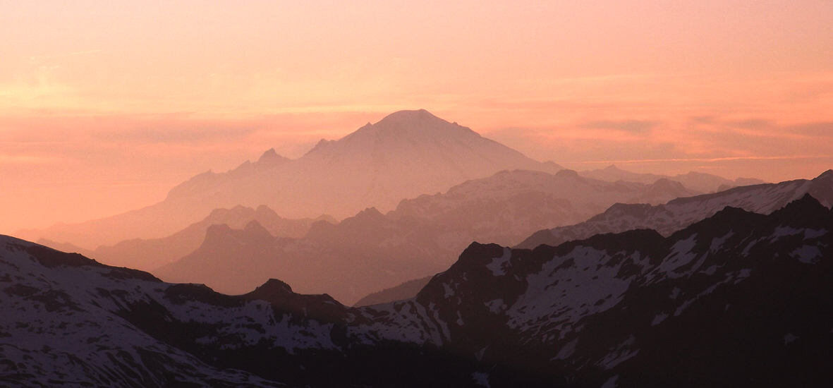
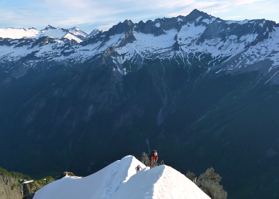
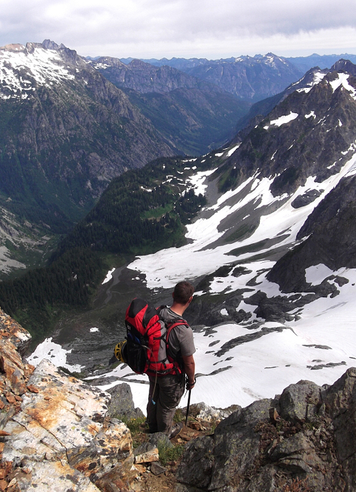
Johannesburg Mountain. Its N Face is one of the most striking facades in the North Cascades. A twenty-minute hike gets you to its base, but from there, the summit is a world away. In the 4600' of relief from the Cascade Pass parking area to the summit, this mountain has a bit of everything alpine - dramatic waterfalls, vertical brush, towering walls of rock, and eroding glaciers crumbling and falling to the valley below. Along with the sights, the sounds of Johannesburg are equally impressive. Rarely does a day go by where one cannot hear the mountain rumbling. The last time I climbed Johannesburg, I told myself that I wouldn't be back for a while.. that there were other, new places for me to go visit and enjoy. But for someone who lives and breathes the challenge of the North Cascades, I silently waited for another opportunity to arise to climb this iconic symbol of our great range. When Wayne told me he was interested in climbing it after four prior, failed attempts, my ears perked up. I knew that Sergio was also interested, so I asked him to come along. Eliciting an emphatic "sure" from Sergio, we were now a team of three.
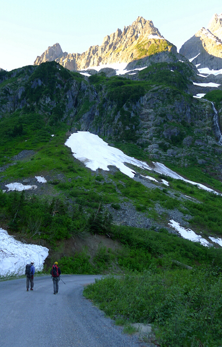
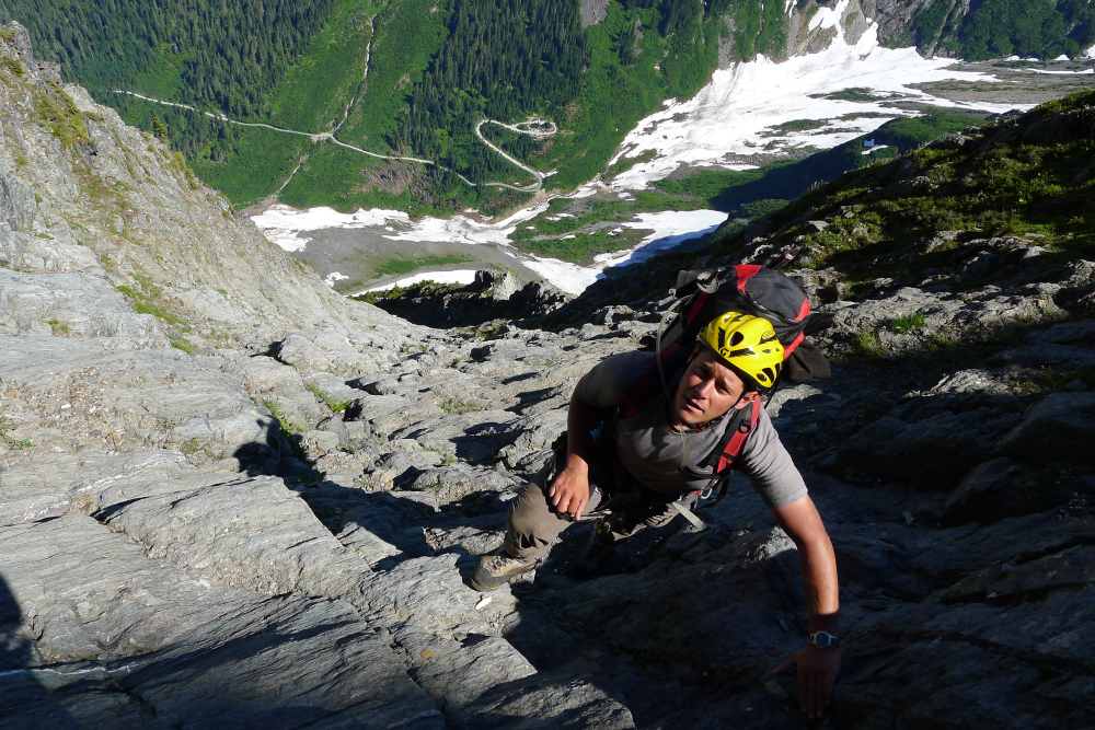
Wayne and Sergio met me at my place after work on Friday, and we were finally leaving Everett at 7:15. We arrived to a nearly-full parking lot just before 10PM, which was a bit surprising considering it was a Friday. We turned in soon after we arrived. We awoke at 6AM and put on harnesses & helmets (an approach rarity). Crossing upper Cascade River was easy this time compared with the past two times I've done it, thanks to a snow bridge left over from this Winter's huge avalanche debris piles. Within a half hour, the approach was done, and the climbing began. On last year's climb with Steph, we got onto the rock at ~4400' in the C-J Couloir. That resulted in a rather sketchy pitch of ~5.7 with sparse pro. This time, we got onto the rock at the very base of the couloir, and didn't need the rope (class 3-4).
I must have a bad memory or something, because the rest of the climb seemed a bit more difficult than I remembered - either by perception or reality, I'm not really sure. Wet brush and mud (and damp moss on rock) did make things a bit tougher this time around. But aside from conditions, the route finding seemed trickier, and whereas last year we didn't use a rope after the very first pitch out of the couloir, this time we roped up for a steep, loose, sketchy pitch just below the bivy site. Once through the sketchy pitch (~5.8 loose, which Wayne led), it was a short scramble on the exposed ridge crest to the bivy site, which was still as magnificent as ever. Perhaps this is what keeps me coming back?
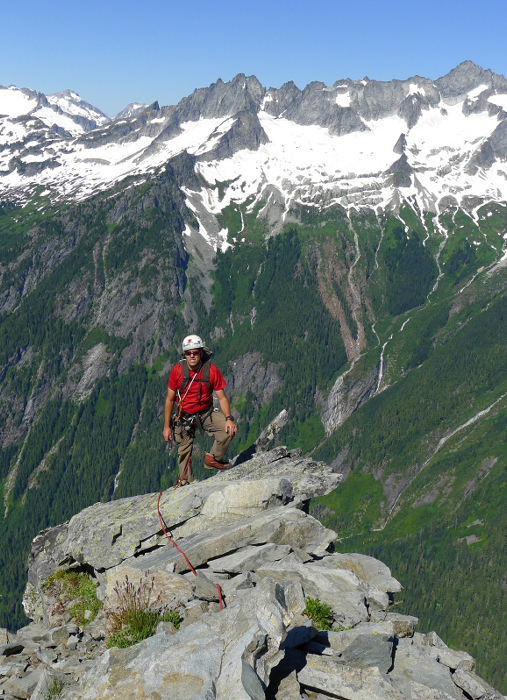
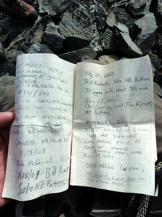
The next morning we awoke and continued up to the summit, with a few more challenges than I expected. A few crevasses and schrunds were open, and the arete was sharper in places than it was last year. Nobody had signed the summit register since Steph and I summitted last July. The register dates back to 2008, and this was my third time signing it. The descent was as expected, and we wound up making two rappels this time (on my prior two visits, I was able to down climb the entire descent route). Back to the cars at 4:00. 17.5 hours of total climbing, which is exactly how long it took last time. Okay that's it for introductions. Here's the rest in nauseating detail...enjoy!
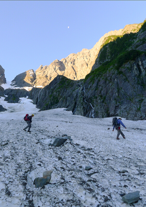
After a night of bivying in the parking lot-an activity interestingly shared by numerous other (and noisy) parties that evening, I awoke with a feeling of dread for the task at hand. But now was no time for self-doubt or hesitation, and I proceeded to double-back my harness and shouldered my pack for the "arduous" 5 minute hike down the paved road. Leaving the road at the first obvious switchback below the Cascade Pass parking lot, we descended to the creek, easily finding a crossing on snow. From there it was a short climb back up a talus headwall before reaching the snowy debris fan below the Cascade-Johannesburg (C-J) Coulior. We made a hasty and slightly ascending traverse of the fan towards an obvious snow finger immediately above a small waterfall. Carefully removing our crampons on the slick, mossy rock at the edge of the snow, we were soon confronted with the first challenge the NE Buttress would present us with that day.
Forced up and right by steep rock overhead, we found ourselves peering down a steep gully that fell away into a deep chasm. A spicy stem across this abyss brought us to the relative security of a soggy down-sloping ledge which we surmounted by tenuously pulling on clumps of vegetation to reach friendlier terrain above. From here it was easy going up the gully, before being forced left onto a brushy spur. We followed this spur to reach more open, lower-angled terrain below a headwall. Traversing left below a cliff, we soon reached a small waterfall fed by some unseen source high above. Here we stopped for a break and to refill our water bottles.
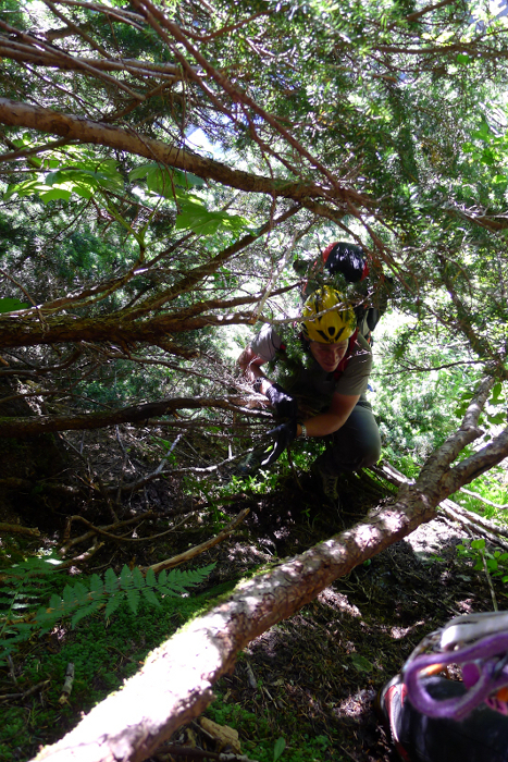
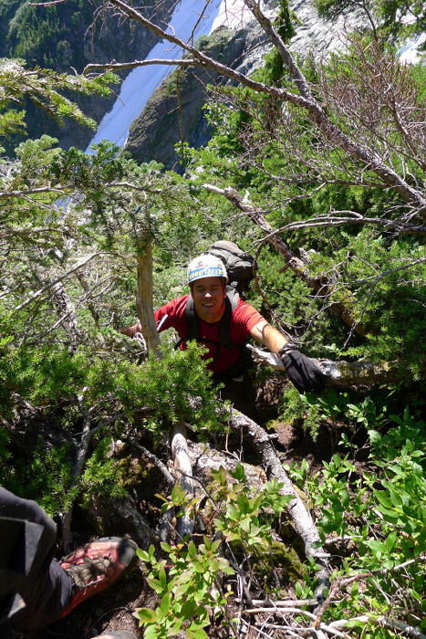
The way forward from this point wasn't entirely obvious, but we found it easiest to work right from the base of a watercourse into a steep patch of waist-high brush barely clinging to slabby, moss-covered rock (I peeked around the corner at right before going up this, but that way did not appear to go). At the top of the brushy, moss-covered slabby bit was...you guessed it, yet more greasy rock, only now it was near vertical and almost impossible to get any kind of purchase on. A desperate series of pull-ups on successive slide alder branches with practically no feet delivered me above the troublesome step where I could finally rest my arms. Having kicked away most of the moss and dirt as I flailed up this pitch, I found it both amusing and slightly worrisome seeing my partners struggle here. Once above this, more lower-angled slide alder forest led to an opening at the lower (lookers) right edge of the Sill Glacier. I recall noting how from this spot it was totally possible to traverse up and left on slabs and then the Sill proper to gain the upper part of the C-J Coulior.
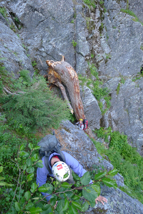
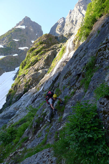
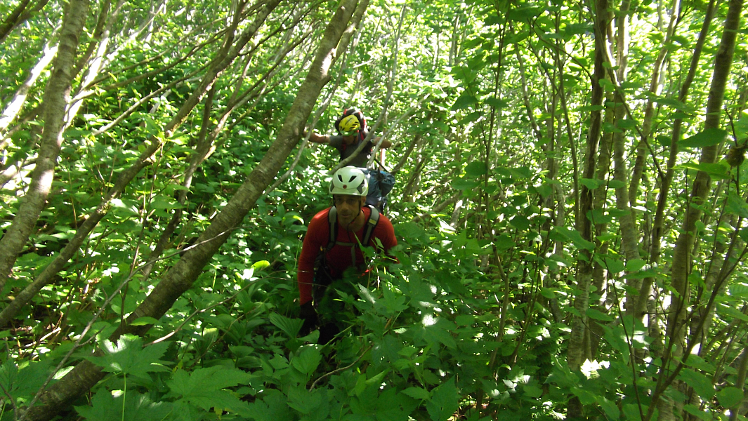
After a refreshingly long break, we dove back into the brush at right for what became increasingly steep and slick climbing either directly up or just right of a watercourse before reaching a temporary impasse in a patch of vertical forest adjacent to said watercourse. As the way forward entailed a sketchy move back onto slick, exposed rock complete with running water, we had no option but to break out the rope and protect this awkward pitch. Tom led this admirably and belayed myself and Wayne up into the thick brush above he gully. From here we continued sans rope up continuously steep, brushy terrain to reach yet another impasse beneath a cliff. While Tom investigated the way right, Wayne went left along a brushy ledge. Going right didn't prove viable, but Wayne reported seeing an empty beer can (Tom's from his previous climb of this route we quickly determined) so we knew his route would likely go. Taking another break here (the largest ledge since the open area adjacent to the Sill Glacier), we powered up on candy bars and thirsty gulps of water for the hard work ahead. Following Wayne's lead, we proceeded out left and when there was no more left to be had, we climbed directly up a steep rocky pitch topped with a mildly unnerving series of feet-less pull-ups on branches. Now making a delicate dance on springy branches, we proceeded left to reach the next (and final) steep duff step which once again demanded all the upper-body strength I could muster. Above this point, the brush finally relented to patchy forest which soon gave way to steepish heather.
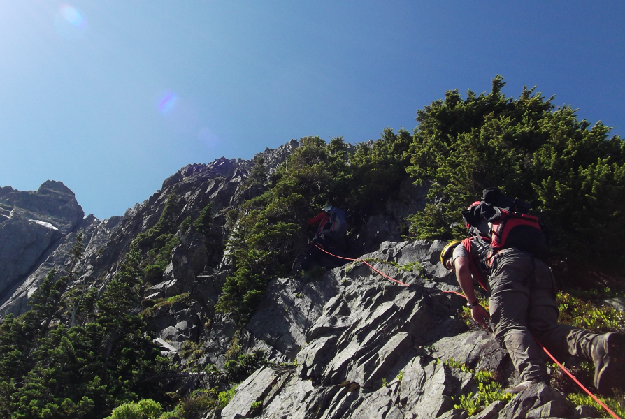
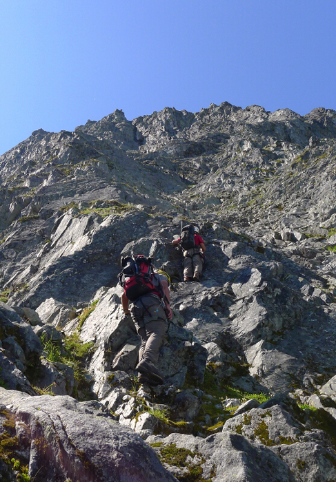
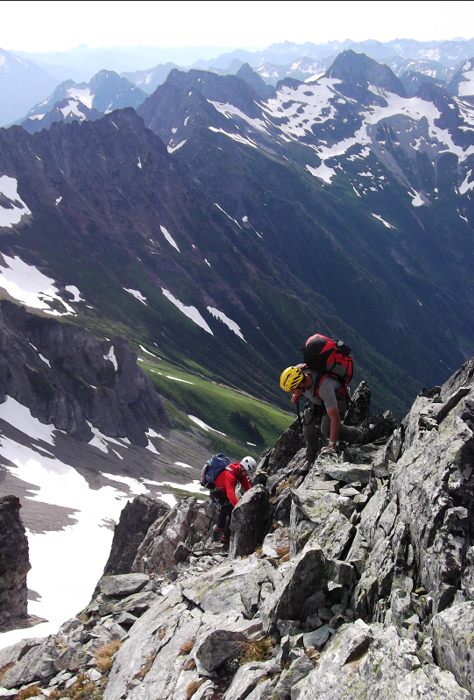
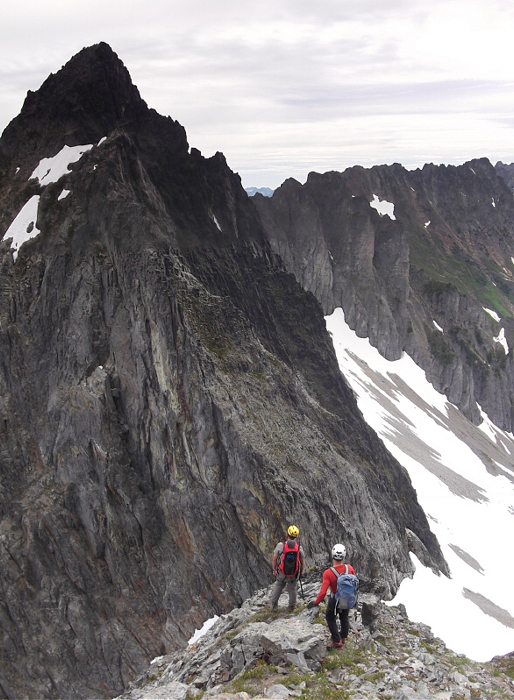
Although still draped in heather, the NE Buttress progressively became more defined the higher we went. Leaving the last of the stunted evergreens and occasional krumholtz behind, we started scrambling up a sharpening crest on surprisingly solid rock. As the rib threatened to vanish into steepening rock above us, we worked right into a large amphitheater of slabby steps (easily visible from the parking lot far below). The "continuation" of our rib was now above and right of this amphitheater, and may actually be where our 1951 and the 1957 (West Rib variation) routes actually intersect. In any case, enjoyable worry-free scrambling eventually led to a short headwall that I probably would not solo a second time around (advise climbing the crest at right).
From this point onward the scrambling wasn't particularly difficult, but remained exposed with the constant stress of encountering terrain of uncertain difficulty ahead. Ever the confident and capable climber, Wayne pulled ahead of both Tom and I at this point and would unknowingly lead us into a bit of a precarious situation. Having apparently ignored Tom's calls to exit stage right via a relatively large ledge that seemed to give easy access to the ridge crest we were aiming for in the first place, I blindly chased after Wayne only to quickly find myself climbing increasingly technical and exposed rock. When I finally decided I could go no further and not relishing the prospect of down-climbing that which i had just come up, it was clear to me that it was time for the rope. Of course it was little comfort knowing that I happened to be in possession of the rope, but not a rack or anything else to secure myself with for that matter.
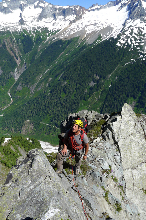
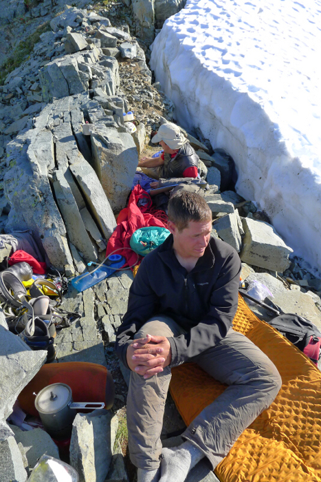
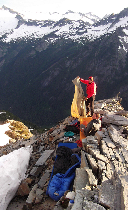
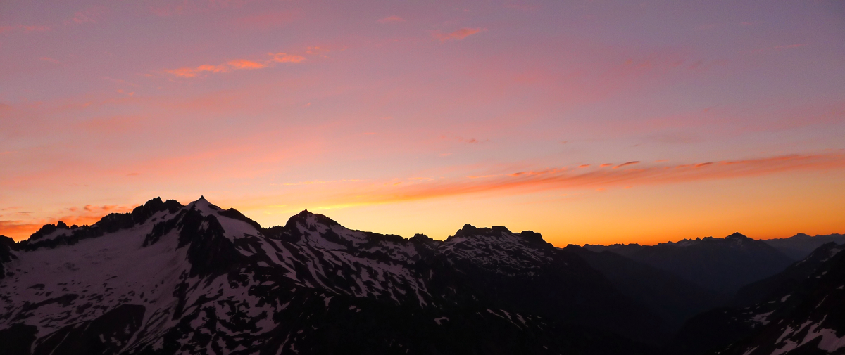
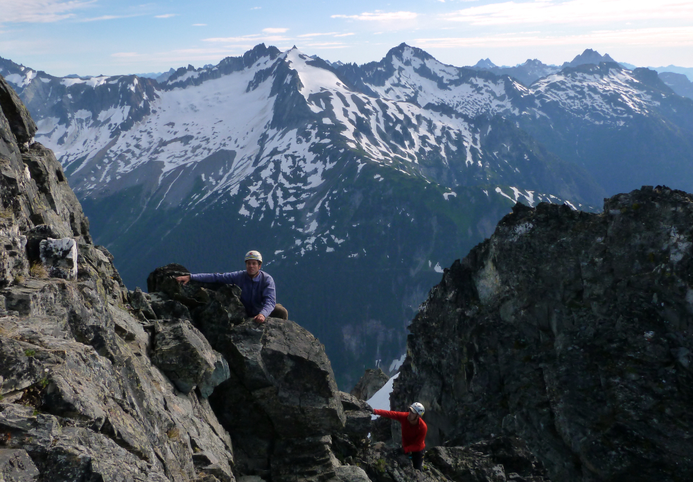
Thankfully, Wayne did eventually come through and tossed a hand line constructed of girth-hitched runners down to us from a fortuitous belay platform. With a belay at this platform, two pitches of steep, sketchy rock (both of which Wayne led) eventually saw us to the crest of the buttress. A short scramble along the crest brought us to the infamous bivy site I had heard so much about. We arrived at the bivy ledge with hours to spare and could easily have completed the route and descended to C-J Col before dark had we wanted to. Smaller than an average office cubicle and perched on a narrow ridge with sheer drop offs on either side; this is a tight space for a party of three. There may have been other spots suitable for a single person a bit below on the north side of the bivy but they were still mostly buried beneath this year's thick snowpack. Since Tom and Wayne claimed the main portion of the "cubicle", I was left with a sloping ledge sandwiched between a short wall and a moat. After a bit of masonry work, we improved this ledge into a relatively spacious and surprisingly comfortable 'bed'. Having polished off the last drops of Wayne's tequila and with bellies full of tasty freeze-dried fare, we crawled into our 'bags for the night. A spectacular sunset made for a fitting close to a great day.
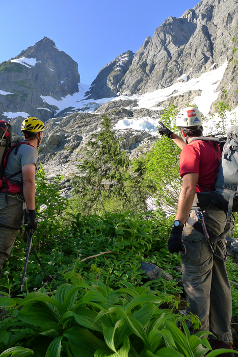
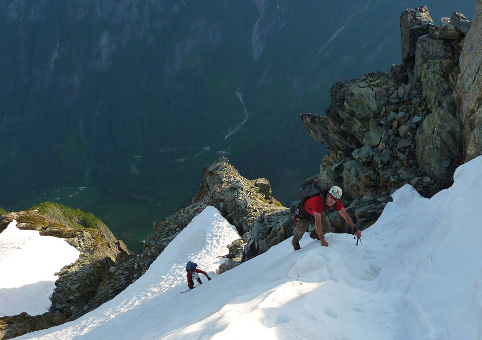
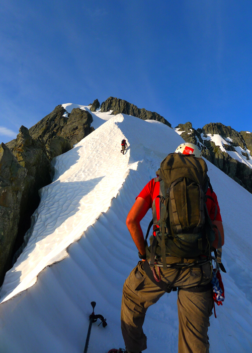
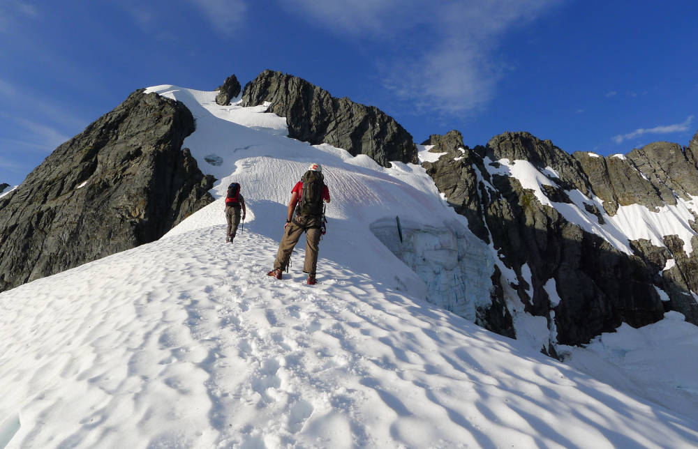
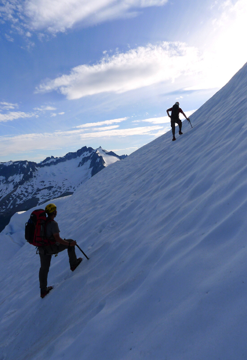
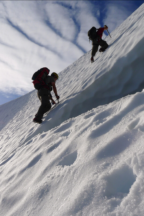
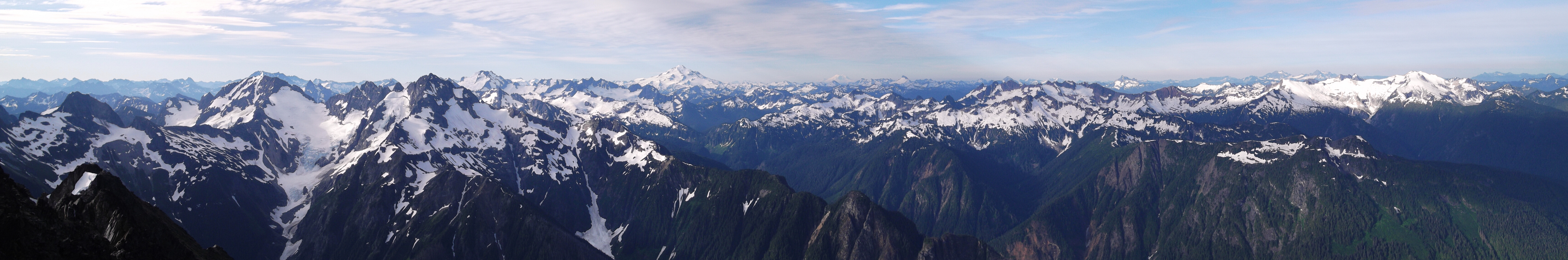
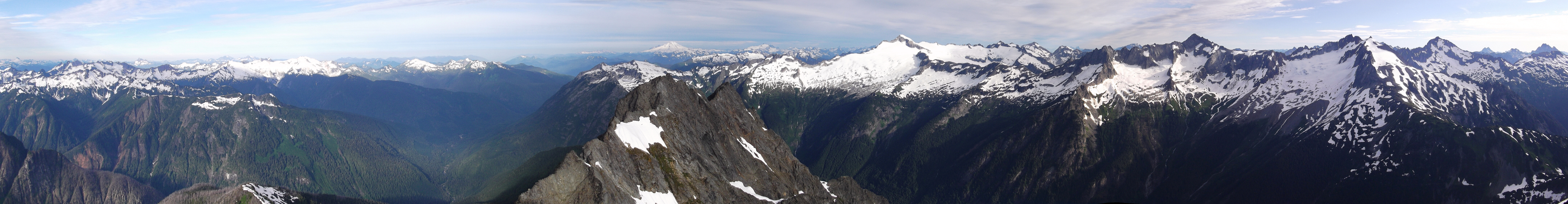
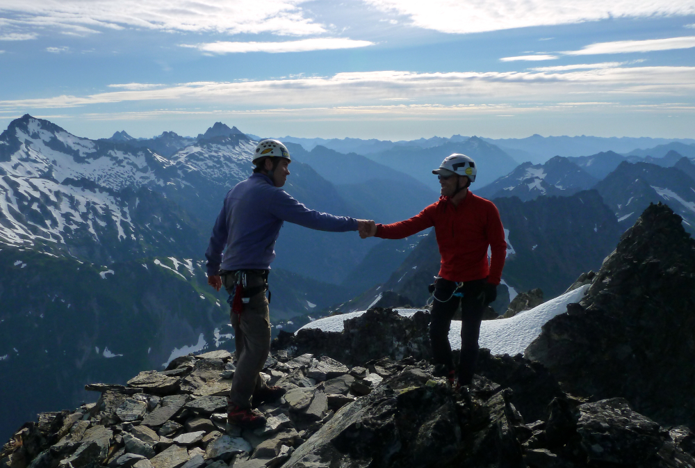
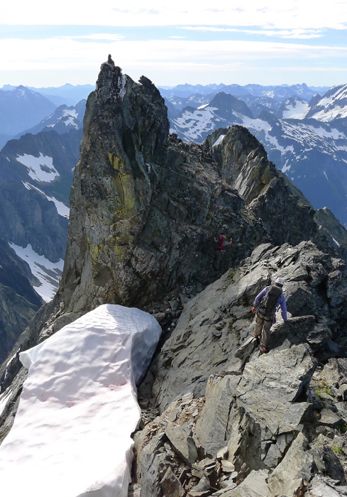
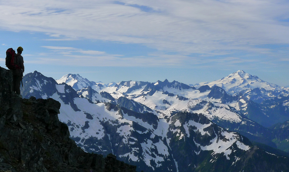
Departing camp at a leisurely 7 a.m. or so, we proceeded up a steep snow pitch to gain the start of the classic snow arete that most (myself included) consider the highlight of the route. The arete eventually fades into a bigger-than-expected glacier that clings to the upper reaches of the mountain. Weaving around cracks and crevasses, we kicked steps up a steep headwall to reach the rock of East Ridge. A short scramble then led to the summit of Johannesburg Mountain. I've lost sleep thinking about climbing this mountain and so reaching the summit was a huge weight off of my chest. And yes, the worrying was mostly for nothing. Despite some unpleasant bushwhacking down low, the NE Buttress is actually an enjoyable climb in a setting that has few rivals in the Cascade Range. The perspective on Forbidden, Boston and Sahale is perhaps no better than from Johannesburg, and for me particularly poignant considering these were the peaks where I cut my teeth climbing in the North Cascades.
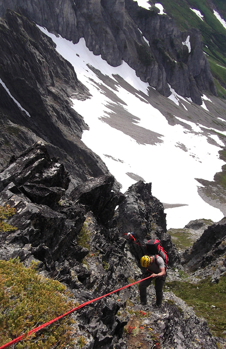
The East Ridge descent seemed fairly straight forward with only the occasional exposed traverse on loose rock on the right-side of the crest. Without losing any more elevation than necessary, we rounded the crest of a ridge that forks off to the right. Veering left at this point, we traversed across a gully before gaining a rib which we followed down for short distance before continuing left into a much larger gully. Carefully picking our way down the left side of this gully, we soon reached the top of a large patch of steep snow just below a constriction. Sticking to a theme that had treated us well up until this point, we continued going left to reach a notch overlooking a steep couloir rising up from the Sill Glacier far below. With the aforementioned snow patch now to our right, we worked our way down another rocky rib intersecting a steep, grassy gully at right and a large talus and grass slope at left. One rappel down this rib led to a notch from which we then made another rappell off to the left to the talus and grass slope. Aiming for the far left edge of this slope overlooking the Sill Glacier and C-J Coulior, we hiked down to reach the headwall above C-J Col. Easy scrambling saw us down to the col proper whereupon we stopped for a well-deserved rest.
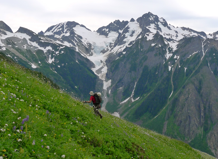
Leaving the col, we made a descending traverse on snow, talus and finally grassy meadow below Cascade Peak. Now climbing back up into the large basin between Cascade Peak and Mixup Peak, I reluctantly resisted the temptation to climb up to the obvious low saddle between the peaks and instead followed Tom's lead for the higher Doug's Direct notch. If it feels like you're awfully close to the summit of Mixup itself, you're probably on-route! Scrambling down the other side of the DD notch, we soon reached the Cache Glacier. From the Cache, we followed the well-travelled and familiar trail back out to Cascade Pass where a welcoming party of gawking day hikers appeared to be awaiting our arrival.
All in all I found Johannesburg's NE Buttress to be a very rewarding climb, and one that fortunately did not live up to its reputation for epic situations and big time stress. Yes, there's a fair amount of wallowing to put up with, but the awesome position of the exposed rock on the buttress or the super-aesthetic snow arete more than makes up for it. Time will tell whether or not I'll endeavor a repeat performance similar to Tom's, but for now I'm content with finally having succeeded in reaching the top of the mighty "J-burg" - a mountain I was convinced at one time that I would never climb!
Click here to view photos.
![]()


