Last Updated: April 17, 2024


Start

Recent content updates are viewable under what's new.

Reports in the queue for posting are coming soon!

Upcoming reports & photos:

Oh my! Quite the backlog here...

  • American Mountain & Mount Lincoln - hike/snowshoe (May 2023)
  • Mount Mclean Attempt, Red Rock Trail, Dragons Back Trail - hike (May 2023)
  • Stawamus Chief (South, Middle & North) - hike/scramble (June 2023)
  • Flint & Feather - hike/scramble (June 2023)
  • Goat Ridge (Squamish) - hike (June 2023)
  • Grouty/Mortar Peaks - hike/scramble (June 2023)
  • Pebble-to-North Creek Traverse incl. Pebble, Thiassi, Wesley & Sugus - hike/scramble (July 2023)
  • Mount Truax - hike/scramble (July 2023)
  • Blackcomb Buttress - rock climb (July 2023)
  • Whitecap Peak - hike/scramble (July 2023)
  • Mount Hanover - hike/scramble (August 2023)
  • The "Long Traverse" incl. Long, Tynemouth, Arrowhead, Tabletop & Anemone - hike/scramble (August 2023)
  • Armchair Traverse - hike/scramble (August 2023)
  • Snowspider Mountain - hike/scramble (September 2023)
  • Mount Trorey - hike/scramble (September 2023)
  • Macleod Peak - hike/scramble (September 2023)
  • Ben Lomond - hike/scramble (September 2023)
  • Mount Killam & Gambier Island - hike (September 2023)
  • Lone Goat & Snow Camp Mountain - hike (September 2023)
  • Isollilock Peak - hike/scramble (October 2023)
  • Manson - Hatfield Traverse - hike/scramble (October 2023)
  • Gargoyles & Columnar Peak - hike/scramble (October 2023)
  • Opal Cone and Lava Glacier - hike (October 2023)
  • Park Butte (WA) - hike (October 2023)
  • Trappers Peak (WA) - hike/scramble (October 2023)
  • Rattlesnake Ledge (WA) - hike (November 2023)
  • Sauk Mountain (WA) - hike (November 2023)
  • Mount Daniel & Pender Hill (Sunshine Coast) - hike (November 2023)
  • Mount Dickerman (WA) - hike (November 2022)
  • Winter's End (Verona Peak) - hike/snowshoe (November 2023)
  • Dolomites (Italy) - snowboarding (December 2023)
  • Red Rock Canyon (NV) - hike (January 2024)
  • Flute & Oboe - split tour (February 2024)
  • Whistler misc. (Train Wreck, Loggers Lake, Shadow Lake etc.) - hike (February 2024)
  • Mount Underhill - hike (March 2024)
  • Bombtram Mountain - hike/snowshoe (March 2024)
  • Steep Peak - split tour (March 2024)
  • Ruby Mountain (WA) - hike/snowshoe (April 2024)
  • Blustry Mountain - hike (April 2024)
  • Sowerby Peak (Barr East) - hike (April 2024)

*As of 04/21/2024


Database

Query the reports database, selecting from criteria which include name, location, type, season etc.

Quick Links

Essential links & whatnot:


Jump To

Select from list below to jump to a specific area on this site.


| Featured Trip Report |


Last Updated: Jul. 10, 2006

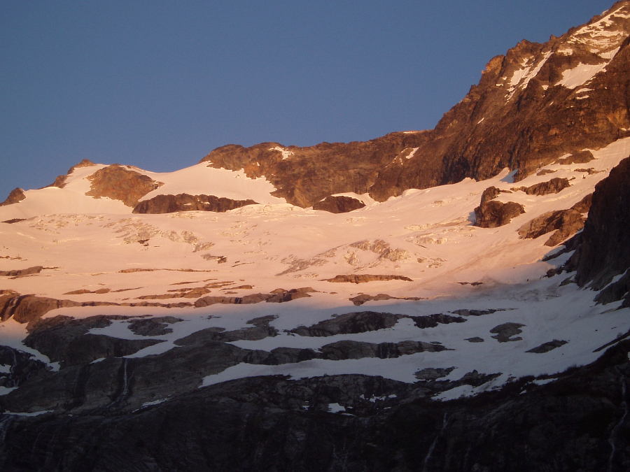
Mount Logan - Douglas Glacier, June 2006


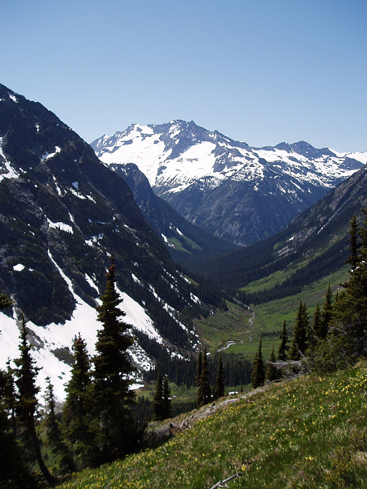
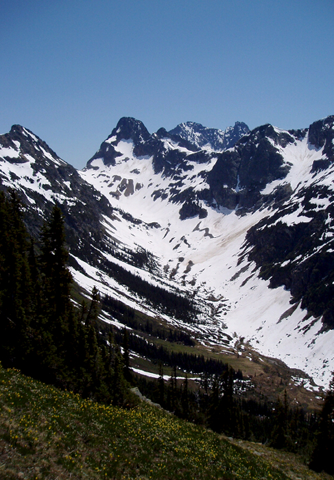
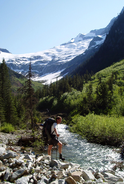
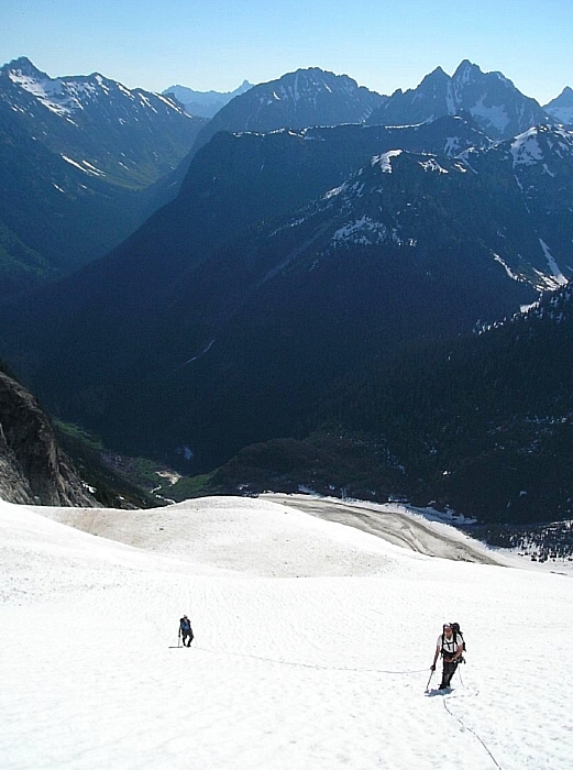
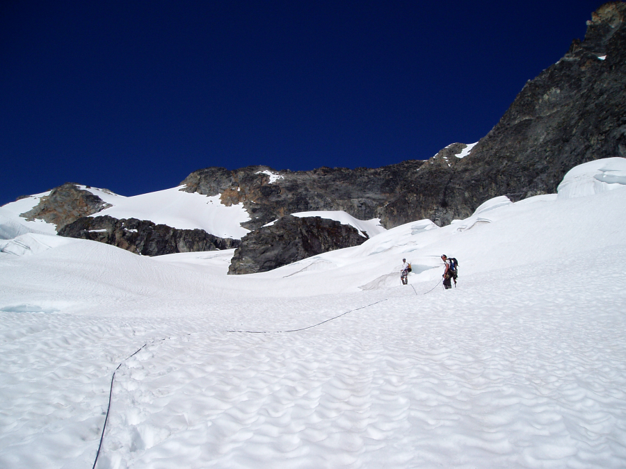
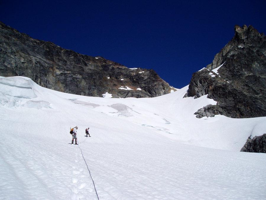
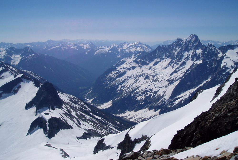
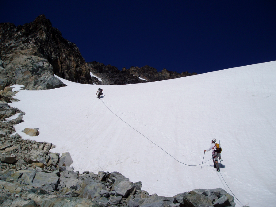
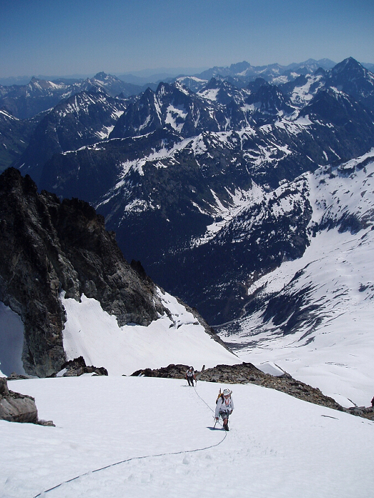
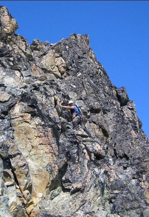
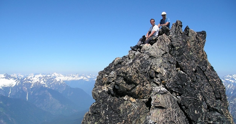
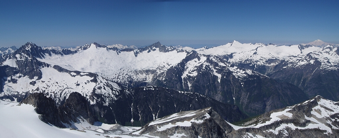
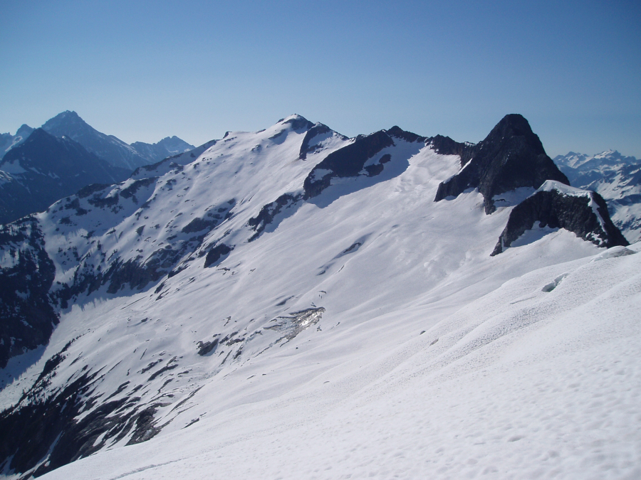
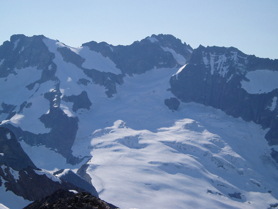
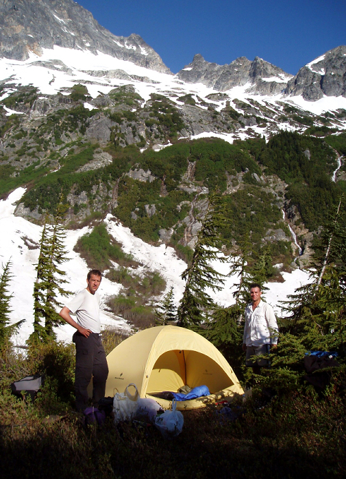
Mount Logan is a large, important massif situated in the heart of the North Cascades National Park. Easily seen from such places as Eldorado Peak, Black Peak and Mount Goode (to name a few), Logan's presence is hard to miss or ignore. At just over 9000 feet, the peak is also among the elite few non-volcanic "nine-thousanders" in Washington State. Draped on all sides by relatively large glaciers (Freemont, Banded and Douglas), Logan offers numerous routes with varying aesthetic qualities and approach considerations. For us, the decision to climb the Douglas Glacier was an easy one - the approach is perhaps the shortest, albeit without a trail for the thrash up the valley draining the Douglas.

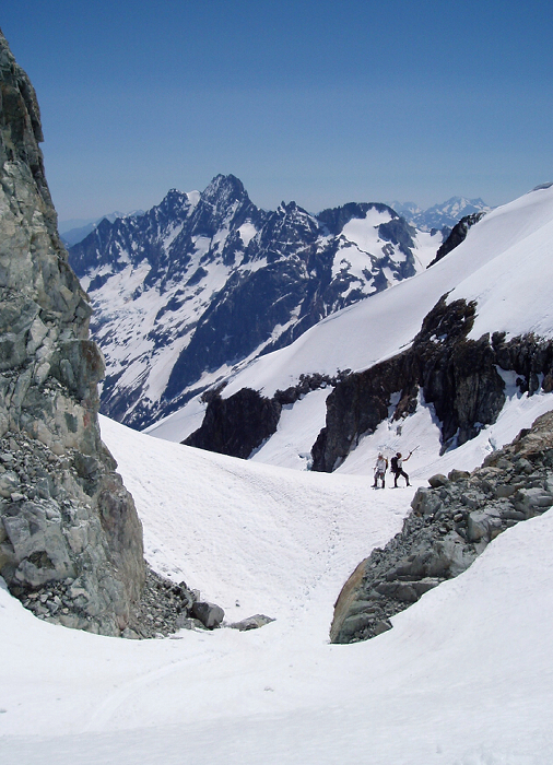
Jeff, Paul and myself, met up on a Saturday morning in late June and drove to the Marblemount Ranger Station to sign in. We reached the Easy Pass Trailhead around 11:00am - there was only one other car there. The temperature was already bordering on being uncomfotably warm, knowing full-well that it was only going to get hotter. After dividing up gear and going though the usual pre-climb motions, we shouldered packs and headed up the trail. Hiking up towards Easy Pass was uneventful aside from a creek crossing on a long, narrow, slippery log to help make the otherwise monotonous slog interesting. Snow on the trail started about two miles in, but was firm underfoot making travel easy - we made the pass in about 2 hours, 20 minutes. The Fisher Creek side of the pass was devoid of snow and subject to the full intensity of the afternoon sun, but offered unobstructed views of our objective along with the other peaks of the area. Descending into the valley, we encountered two familiar climbers and their four-legged companion at the junction of Fisher Creek. They were out for Mesahchie Peak and possibly Katsuk. (more...)

Click here to view photos.
home | email | copyright

All photos and text for sverdina.com are copyright © 2002-2024

It would be very much appreciated if you please ask before copying and/or re-publishing content from any part of these pages. To do so, please click here to send a message via feedback form.

Thank You.

©2024 sverdina.com |