


Mount Lyell - Lyell Glacier, July 2010
 as seen from the John Muir Trail along the Lyell Fork of the Tuolumne River Valley.")
At 13,114 ft, Mount Lyell is the tallest peak in Yosemite National Park. It offers a fantastic vantage point from which one can survey almost the entire ~1200 square mile park. While by no means a technical ascent, the climb offers a short stretch of enjoyable scrambling on surprisingly steep class 3 rock. But this is only had after a relatively long 11-mile valley trail approach, a couple miles of off-trail hiking on slabs and snow, and finally a crossing of California's second largest glacier - the Lyell Glacier.
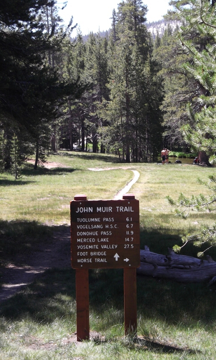
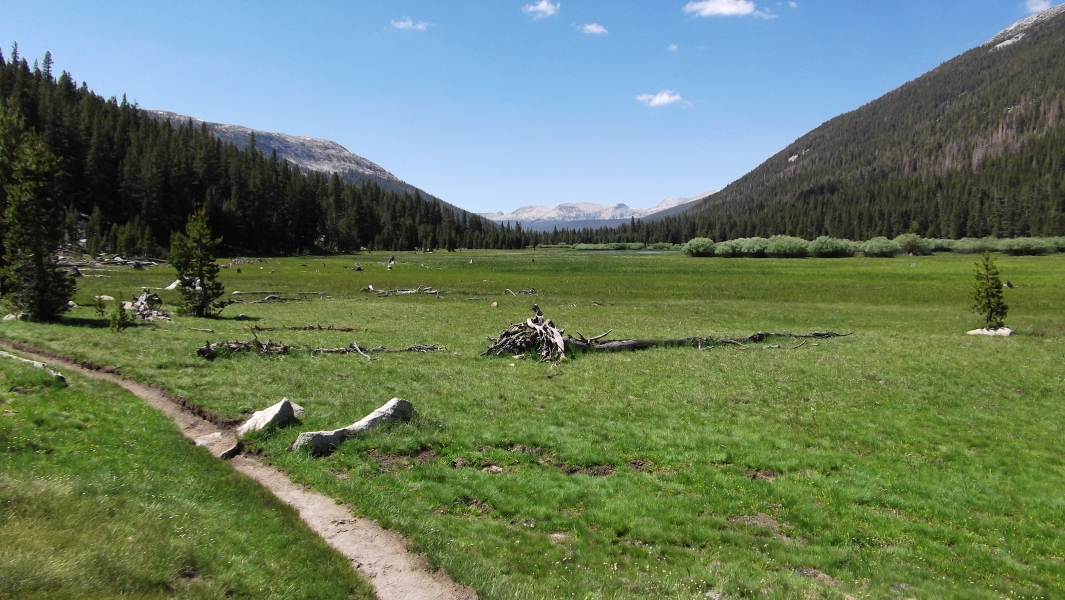
After two days of driving from Seattle to Yosemite National Park, I was more than ready to don my boots and start kicking dirt on the legendary John Muir Trail (JMT). I found the roughly 11-mile approach to a pleasant albeit buggy camp basin before Donohue Pass somewhat more taxing than I had expected. Almost all of the vertical gain is made in the last couple miles, which incidentally is also where the better campsites are located. But with aching feet and an inflamed hip tendon, I was off to pretty lousy start. On top of that, my pack was frustratingly heavier than I had wanted no doubt due to the cumbersome bear canister, which I rented from the park service and was required to take with me. Nevertheless, I reached camp with hours of daylight to spare and had ample time to both rest and do battle with the relentless mosquitoes.
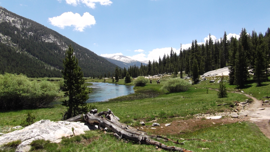
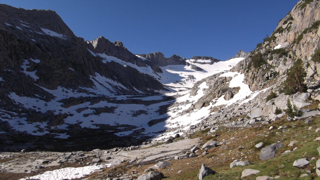
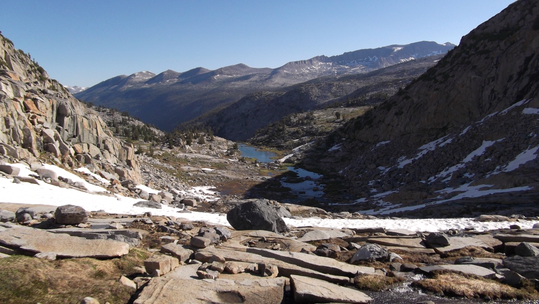
A menacing thunderstorm was just beginning to roll through the area as I arrived in Tuolumne Meadows. Looking west in the direction of Mount Dana and Conness, the skies were black and angry. Better to get the unsettled weather over with sooner rather than later, I thought...and hoped. Visiting from all places in the US and the World, through-hikers comprise the bulk of the traffic along the JMT. I only encountered two other parties en route to or returning from Lyell during the two days I was in the area. This very well traveled trail is obviously easy to follow; save for the couple spots where raging creeks flowing down from the side of the valley have flooded much of the trail and surrounding area. The winter's big snow, late and cool spring and subsequent melt have left Yosemite and the Sierra's in general with a much heavier snowpack than is normal for July. Though I encountered a few decent camp spots early on the hike up the valley, most of the better ones were scarcely four or five miles from the trailhead and are apparently considered to be off limits by the park service. Where the trail begins climbing towards the end of the valley, I noticed a few smallish spots alongside the creek. By far the best and most scenic camp spots however, are found up in the basins near the headwaters of the Lyell Fork of the Tuolumne River between about 10,200ft and 10,500ft.
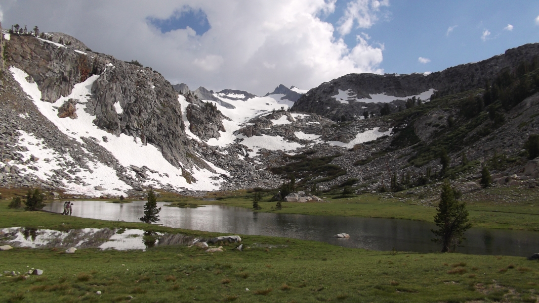
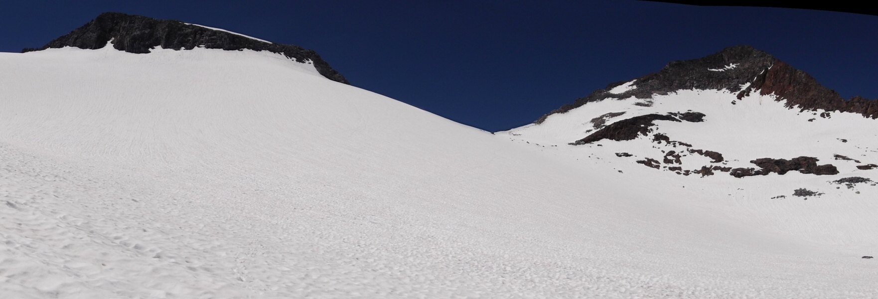
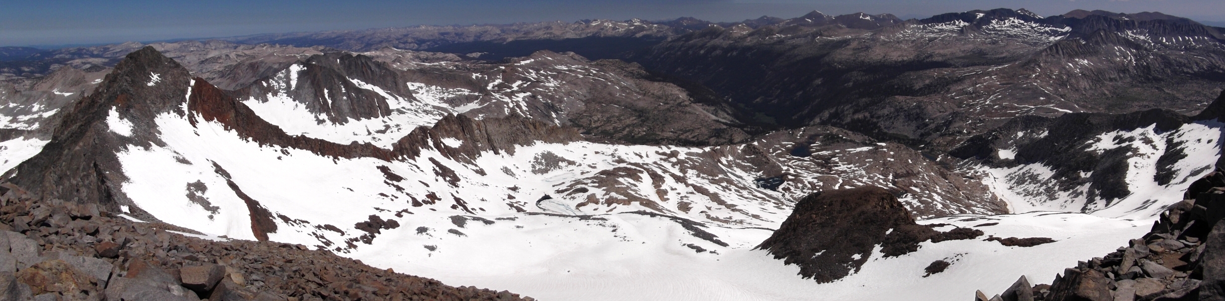
JMT through-hikers traveling to and from the Mammoth Lakes area via Donohue Pass wandered past my camp all that afternoon and evening. By nightfall I counted only two or three parties that stopped to camp in the general area where I was. Its been a while since I last did a solo-overnight trip, so simply knowing that there were others camped-out relatively nearby helped me to relax and fall asleep. I awoke at six or seven the next morning and got moving shortly thereafter. Following the trail up from the camp basin, I hiked up over the surrounding headwall leaving the trail shortly before it makes a final descent into the small basin directly beneath Donohue Pass. Aiming for the obvious glacier-carved canyon before me, I veered rightwards off the trail just west of where it crosses the headwaters of the Lyell Fork of the Tuolumne River (~10,500ft) and traversed heather then snow slopes to reach the extensive low-angled slabs below the terminal moraine of the Lyell Glacier. Walking high along the slabs, I aimed for a large buttress that splits the Lyell Glacier. I stopped to strap on crampons at a steep snow headwall. With ice axe in hand, I booted up-and-right eventually contouring around the right side of the aforementioned buttress to gain the main rightmost (north) lobe of the glacier. Continuing across bottomless suncups on the glacier flats, I made an ascending traverse aiming for the Lyell side of the Lyell-Maclure Col. With the exception of glaciers on Mount Shasta, California's glaciers are notably different from those found in the Cascades. It's nice not having to worry about falling into a crevasse for a change!
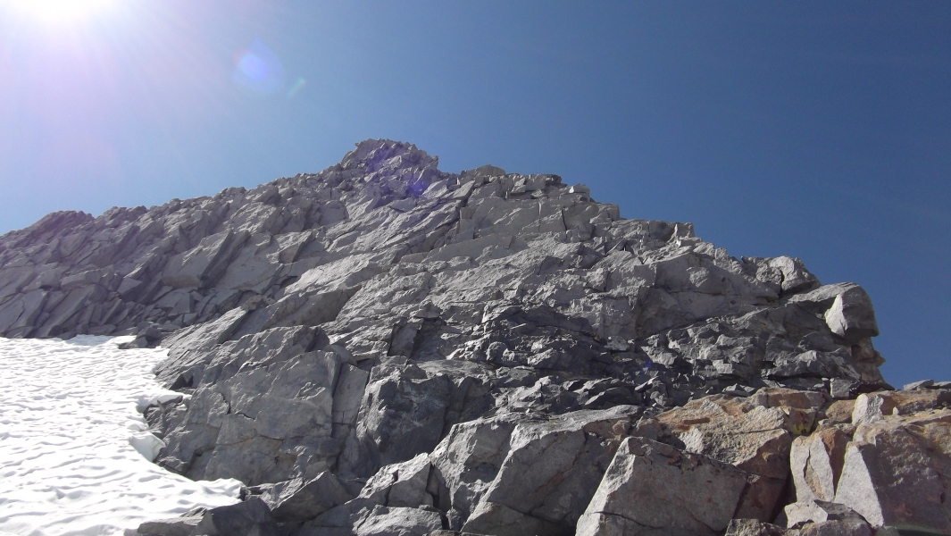
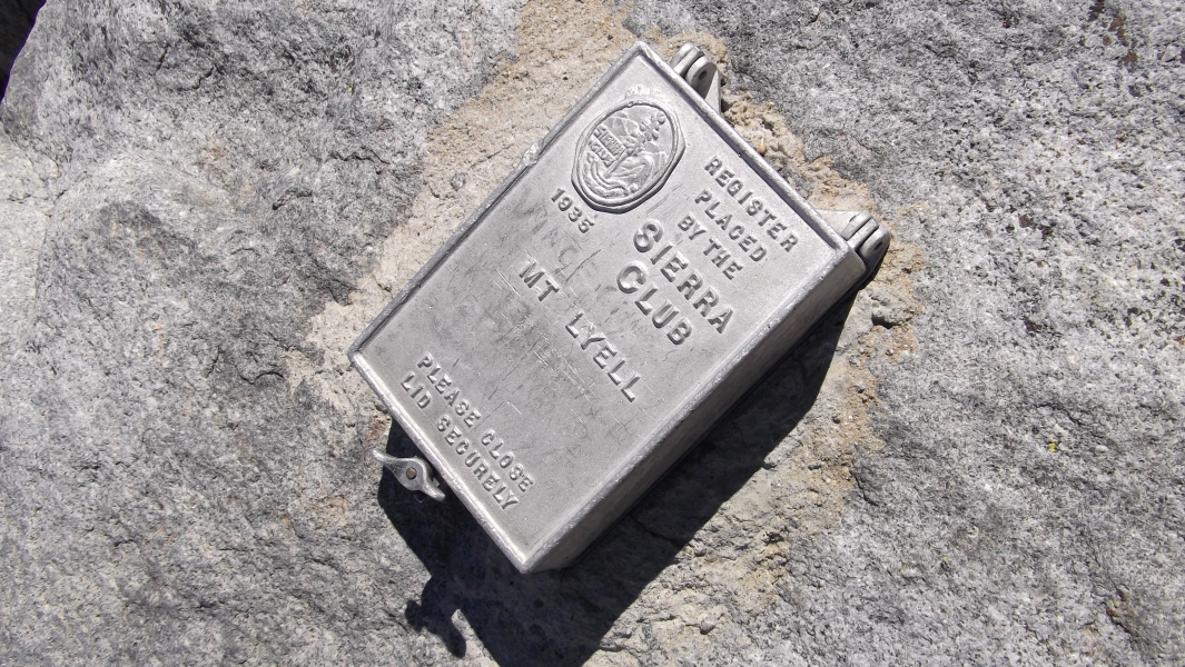
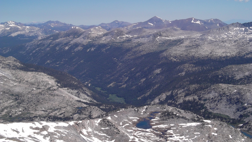
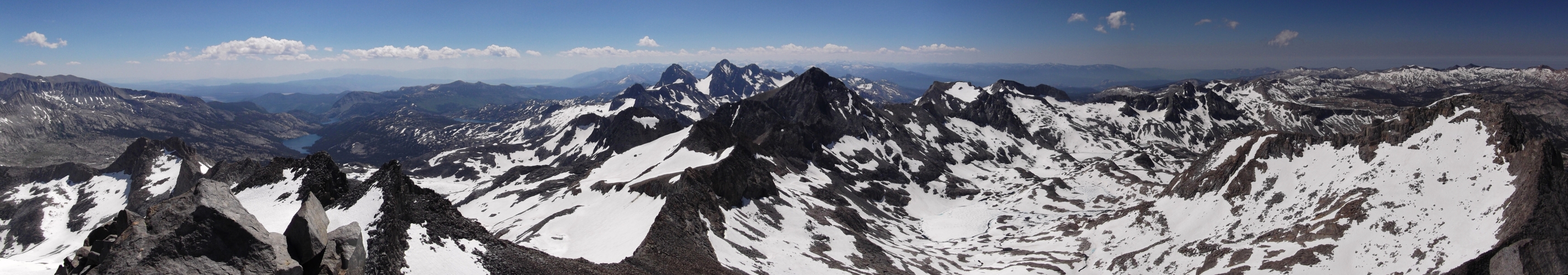
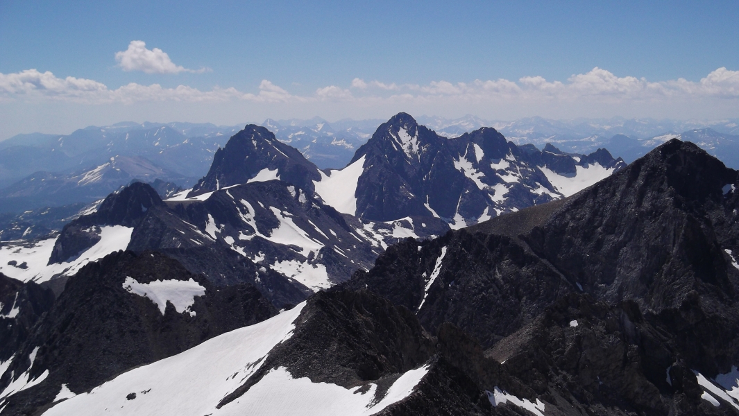
I left my ice axe and crampons here and scrambled up ledges below the crest to reach the lower-angled talus slopes below the summit. The true summit was a little bit farther than I was expecting with a false summit or two encountered along the way. Nevertheless, it wasn't long before I found myself basking in the sun on Lyell's summit rocks and signing my name in the hard-to-miss summit register. Note that if sticking to the ridge crest proper up from the saddle, one quickly runs into steep 5th-class terrain. There is indeed a grand view from the summit! Looking directly west, Half Dome and Yosemite Valley look small and are lost amongst a sea of much larger peaks and valleys. With a distant view of Mount Conness on the horizon, the aesthetic Lyell Fork of the Tuolumne River Valley makes a graceful curve on its way to Tuolumne Meadows. In all directions granite peaks and domes rise up out of the ground-no wonder this area is ground zero for rock climbing in the US! I think it took me around two-and-a-half to three hours to reach the summit, and despite this being a weekend I hadn't seen another soul since shortly after leaving camp. I finally encountered a somewhat tardy party of two on their way up back at the slabs, but really I expected to see much more traffic on Lyell.
The mosquitoes of course helped accelerate my breaking down camp and I soon found myself hobbling along the JMT. Once again my hip tendon caused me to limp for miles on end while the new pair of thicker insoles I was sporting continued to aggravate my foot cramps. Fortunately, the final mile or two, which I shared chatting with a young couple from France, really helped take my mind off my aches and pains. I reached my car late that afternoon and proceeded to stake my claim on a site at the nearby campground, ate dinner and sacked out. One down...three to go.
Click here to view photos.
![]()


