Last Updated: July 18, 2024


Start

Recent content updates are viewable under what's new.

Reports in the queue for posting are coming soon!

Upcoming reports & photos:

Oh my! Quite the backlog here...

  • Mount Truax - scramble (July 2023)
  • Blackcomb Buttress - rock climb (July 2023)
  • Whitecap Peak - scramble (July 2023)
  • Mount Hanover - scramble (August 2023)
  • The "Long Traverse" incl. Long, Tynemouth, Arrowhead, Tabletop & Anemone - hike/scramble (August 2023)
  • Armchair Traverse - scramble (August 2023)
  • Snowspider Mountain - scramble (September 2023)
  • Mount Trorey - scramble (September 2023)
  • Macleod Peak - scramble (September 2023)
  • Ben Lomond - scramble (September 2023)
  • Mount Killam & Gambier Island - hike (September 2023)
  • Lone Goat & Snow Camp Mountain - hike (September 2023)
  • Isollilock Peak - hike/scramble (October 2023)
  • Manson - Hatfield Traverse - scramble (October 2023)
  • Gargoyles & Columnar Peak - hike (October 2023)
  • Opal Cone and Lava Glacier - hike (October 2023)
  • Park Butte (WA) - hike (October 2023)
  • Trappers Peak (WA) - scramble (October 2023)
  • Rattlesnake Ledge (WA) - hike (November 2023)
  • Sauk Mountain (WA) - hike (November 2023)
  • Mount Daniel & Pender Hill (Sunshine Coast) - hike (November 2023)
  • Mount Dickerman (WA) - hike (November 2022)
  • Winter's End (Verona Peak) - hike/snowshoe (November 2023)
  • Dolomites (Italy) - snowboarding (December 2023)
  • Red Rock Canyon (NV) - scramble (January 2024)
  • Flute & Oboe - split tour (February 2024)
  • Whistler misc. (Train Wreck, Loggers Lake, Shadow Lake etc.) - hike (February 2024)
  • Mount Underhill - hike (March 2024)
  • Bombtram Mountain - snowshoe (March 2024)
  • Steep Peak - split tour (March 2024)
  • Ruby Mountain (WA) - snowshoe (April 2024)
  • Blustry Mountain - hike (April 2024)
  • Sowerby Peak (Barr East) - snowshoe (April 2024)
  • Picacho Peak (AZ) - hike (April 2024)
  • Kitt Peak Observatory (AZ) - (April 2024)
  • Mount Wrightson (AZ) - hike (April 2024)
  • Saguaro Nat'l Park (AZ) - April 2024)
  • Superstition Peak/Benchmark (AZ) - scramble (April 2024)
  • Mount Humphreys (AZ) - hike (May 2024)
  • Petrified Forest Nat'l Park (AZ) - (May 2024)
  • Piestewa Peak (AZ) - hike (May 2024)
  • Channeled Scablands (Columbia Gorge, Ancient Lakes, Potholes Lake, Palouse Falls etc.) - hike/bike (May 2024)
  • Rhododendron Mountain ("Pk. 2220") - snowshoe (June 2024)
  • Flora Peak - hike (June 2024)
  • Gibson Peak - snowshoe (June 2024)
  • Mount Urquhart - scramble (June 2024)
  • Rock Mountain (WA) - hike (July 2024)
  • Ladies Pass Quartet (Cape Horn, Ladies Peak, Snowgrass Mtn. NE Peak, Snowgrass Mtn.) - scramble (July 2024)
  • Old Snowy (WA) - scramble (July 2024)
  • Dog Mountain (WA) - hike (July 2024)
  • Mount Ratney & Mount Bardean - scramble (July 2024)
  • Torrent Peak - scramble (July 2024)
  • Steep-Darkside Traverse - scramble (July 2024)
  • Silvertip Mountain - scramble (July 2024)

*As of 07/24/2024


Database

Query the reports database, selecting from criteria which include name, location, type, season etc.

Quick Links

Essential links & whatnot:


Jump To

Select from list below to jump to a specific area on this site.


| Featured Trip Report |


Last Updated: Sept. 9, 2010

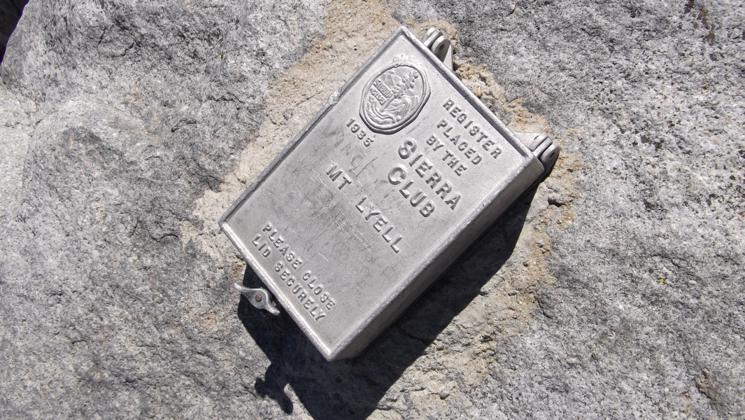
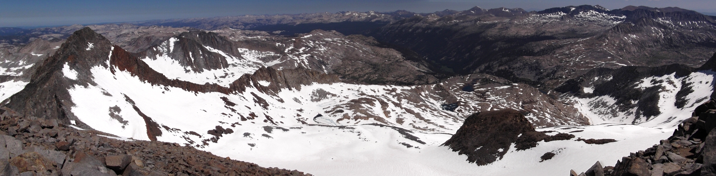
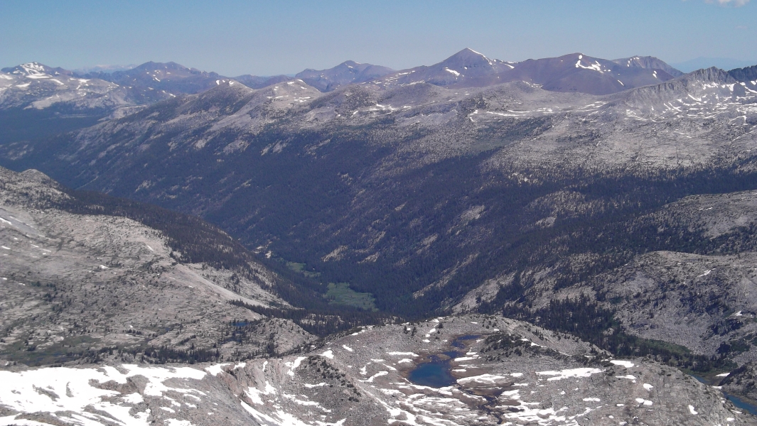
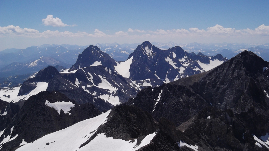
Mount Lyell - Lyell Glacier, July 2010


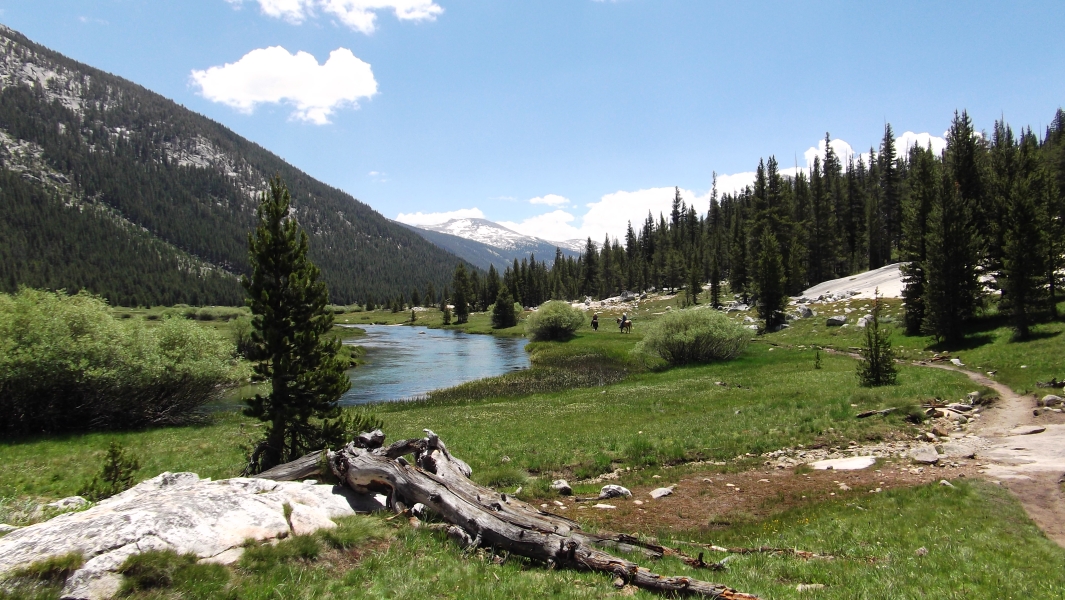
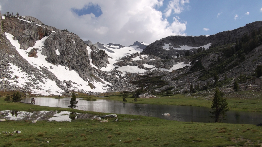
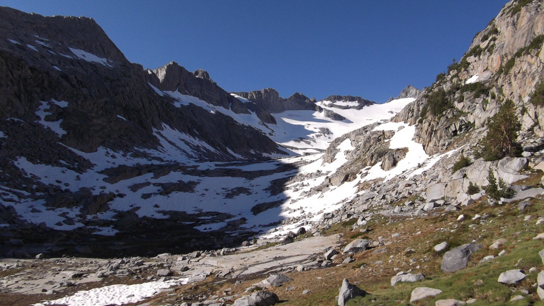
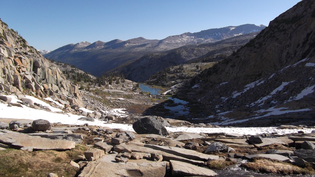
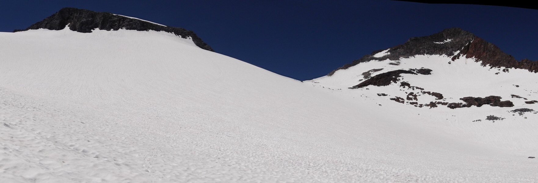
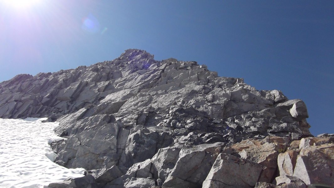
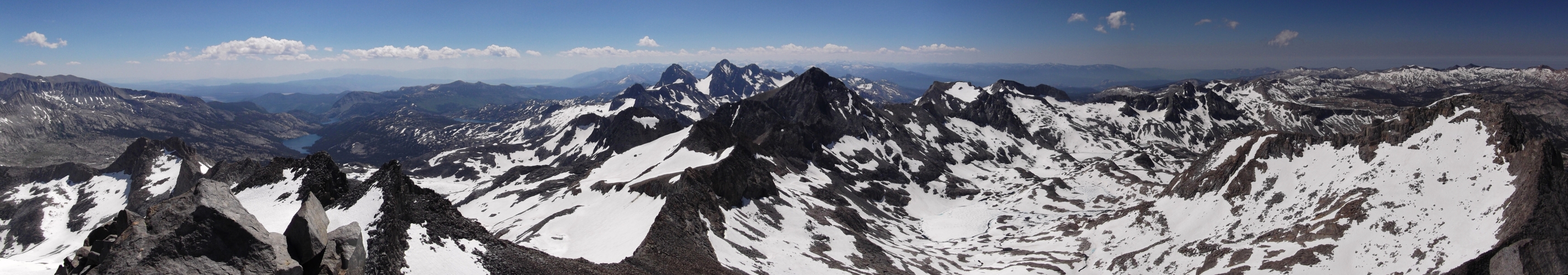
At 13,114 ft, Mount Lyell is the tallest peak in Yosemite National Park. It offers a fantastic vantage point from which one can survey almost the entire ~1200 square mile park. While by no means a technical ascent, the climb offers a short stretch of enjoyable scrambling on surprisingly steep class 3 rock. But this is only had after a relatively long 11-mile valley trail approach, a couple miles of off-trail hiking on slabs and snow, and finally a crossing of California's second largest glacier - the Lyell Glacier.

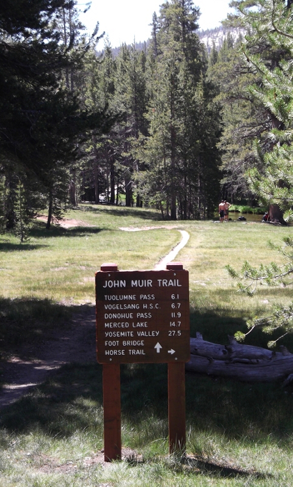
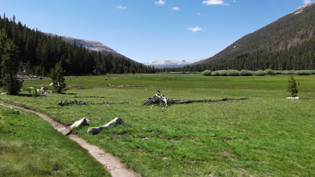
After two days of driving from Seattle to Yosemite National Park, I was more than ready to don my boots and start kicking dirt on the legendary John Muir Trail (JMT). I found the roughly 11-mile approach to a pleasant albeit buggy camp basin before Donohue Pass somewhat more taxing than I had expected. Almost all of the vertical gain is made in the last couple miles, which incidentally is also where the better campsites are located. But with aching feet and an inflamed hip tendon, I was off to pretty lousy start. On top of that, my pack was frustratingly heavier than I had wanted no doubt due to the cumbersome bear canister, which I rented from the park service and was required to take with me. Nevertheless, I reached camp with hours of daylight to spare and had ample time to both rest and do battle with the relentless mosquitoes. (more...)

Click here to view photos.
home | email | copyright

All photos and text for sverdina.com are copyright © 2002-2024

It would be very much appreciated if you please ask before copying and/or re-publishing content from any part of these pages. To do so, please click here to send a message via feedback form.

Thank You.

©2024 sverdina.com |