


Mount Rexford - Ensawkwatch Enchainment, September 2007
, as seen from Mount Larrabee.")
I first learned of Mt. Rexford several years ago while perusing route descriptions on Bivouac.com for other peaks in BC. At that time, Dru Brayshaw's photo essays of climbs on Rexford's West and East Ridges inspired me to one day climb the peak myself. The years went by and my Bivy.com account eventually expired, but Rexford still remained unclimbed by me. Then last year Martin Cash asked me if I wanted to join him on the Ensawkwatch Enchainment - a classic ridge traverse that climbs the North Ridges of both North and South Ensawkwatch Spires, finishing on Rexford itself via the deep notch between it and the South Spire. I declined his offer as Eric and I had scheduled a trip to the Canadian Rockies around that time, but my curiosity was piqued once again. That curiosity turned to envy when I saw Martin's report on Summitpost.com later that year. I made a promise to myself to finally visit the area in summer 2007. I repeatedly peppered Martin for beta in the months preceding my Rexford climb, but it wasn't until September before the stars aligned and finally graced us with one of the fairest-weather weekends in recent memory. I couldn't think of any more appropriate venue than a late summer climb in the Chilliwacks!
With Jeff Rodgers behind the wheel, we drove north into BC then on towards the now familiar Chilliwack Lake Road. After about 30 kilometers, we turned right onto a gravel road (look for Riverside Campground sign at left) and then took another right onto the Nesakwatch Creek Road a couple hundred yards beyond. Although rough, the road was no match for Jeff's brand new GMC truck. Evidence of the road having been recently graded, however, suggested that logging is once again active in this valley. Caution is advised. We barely managed to squeeze by the vehicles crammed along the road side near the Slesse Creek Trailhead, reminding me of a recent CC.com post claiming that the Pocket Glacier had finally slid (the 'glacier' apparently never slid last summer). No doubt this was THE WEEKEND to climb Slesse's Northeast Buttress. We encountered several more cars again hugging the edge of the road a short, bouncy ride up from the Slesse Creek Trailhead, and figured we had finally arrived at the informal trailhead for climbs in the Rexford area. With the truck parked, we started hiking up an overgrown spur road that forks left from the main road. After a short detour to secure our obligatory creek stash, Jeff and I were surprised to see a well used Suzuki Tracker parked where the 'road' switchbacks left. This certainly wasn't the first time I'd witnessed a Tracker at the end of a washed-out or overgrown BC logging road which I'd previously dismissed as impassable to vehicular traffic. A disposable 4WD vehicle with enough clearance and a compact profile to get you places where nothing else can - the quintessential BC trailhead car!
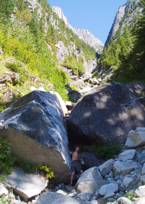
Continuing up the road a short distance, we noticed a brushy path at right heading up into large swath of clear cut. The path then enters forest before crossing a small stream. Be sure to tank-up here, for there isn't any running water beyond this point (we melted snow at camp). The path continues through steep forest before reaching the base of an immense granite wall. Following the path as it traverses beneath this wall, Jeff and I pondered if the slabs have seen any ascents. Almost vertical and unusually compact, I half expected to see a line of bolts leading up towards one of the large roofs above. Up ahead, a prominent ridge outline was starting to peek above the forest. Stopping to rest at the last stand of trees in the basin beneath the North Spire, I shared my seasoned seaweed snacks with Jeff and gazed longingly at Mount Slesse taunting me from across the valley. Pass the sake please!
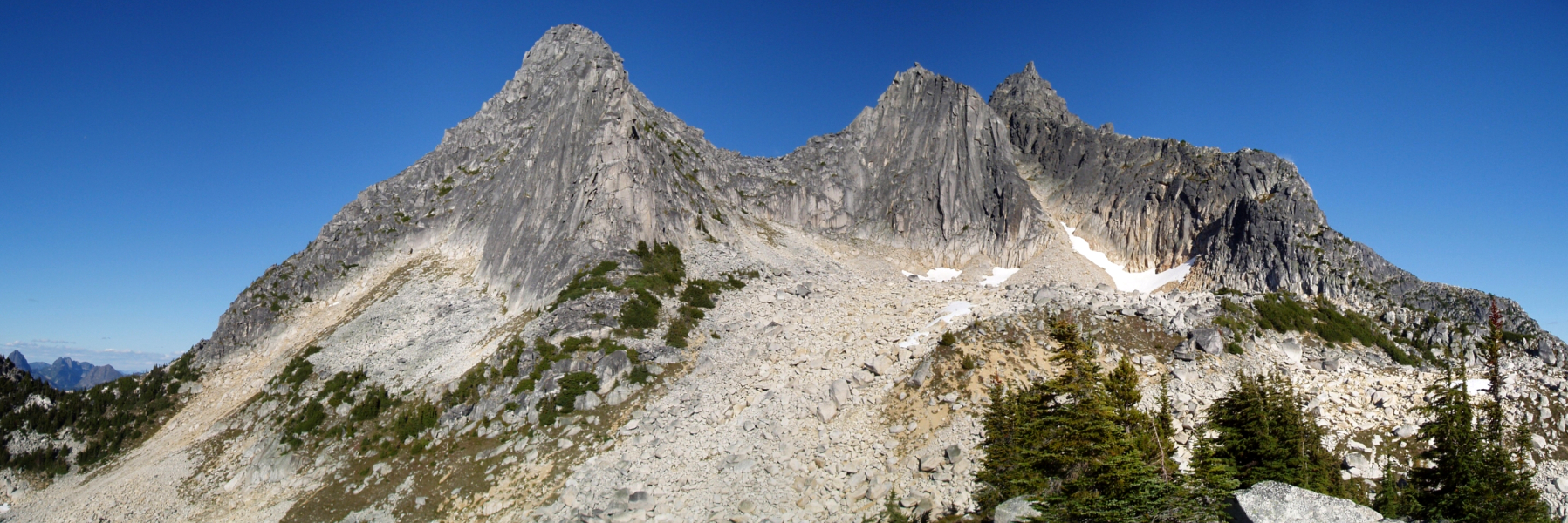
The path continues up on the left-side of the basin, and then traverses right on talus beneath the South Face of the North Spire. Nearing the campsites situated on a minor spur south of the saddle between the North and South Spires, we soon noticed a collection of tents, both on the large, flat slab/boulder and around it. In speaking with the folks at camp, we learned that they were members of a guided party of ten planning on climbing the West Ridge of Rexford the following day. Part of that group was actually climbing the North Ridge of the North Spire (NRNS) at that time. We later noticed a party of two finishing-up the final pitches on the South Face of the South Spire (SFSS) with at least two other parties returning to camp via the gully between the South Spire and Rexford, presumably after having climbed the South Face themselves. It goes without saying that this is a popular area!
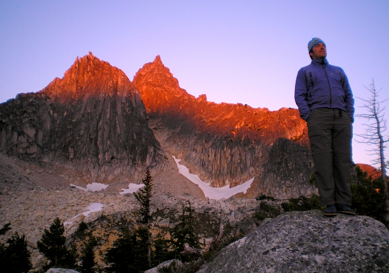
We located what was probably the last of the available campsites at the southern-most point of the aforementioned spur and set up the tent. Jeff and I took our seats on a large boulder facing the spires and Rexford, and indulged ourselves on canned oysters and Jeff's trademark Gatorade/Vitamin Water screwdrivers while watching the climbing action unfold before us. The last of the SFSS parties appeared to be having some difficulties a couple pitches below the summit, but finally managed to top-out shortly before darkness. Meanwhile, the NRNS party completed their climb, scrambled down to the saddle between the spires and was in the process of rappelling down into the basin. With the last stragglers stumbling out onto the talus fan below the South Spire - Rexford gully minutes before full dark, Jeff and I finished our freeze-dried dinners and slowly retired to the tent for the night.
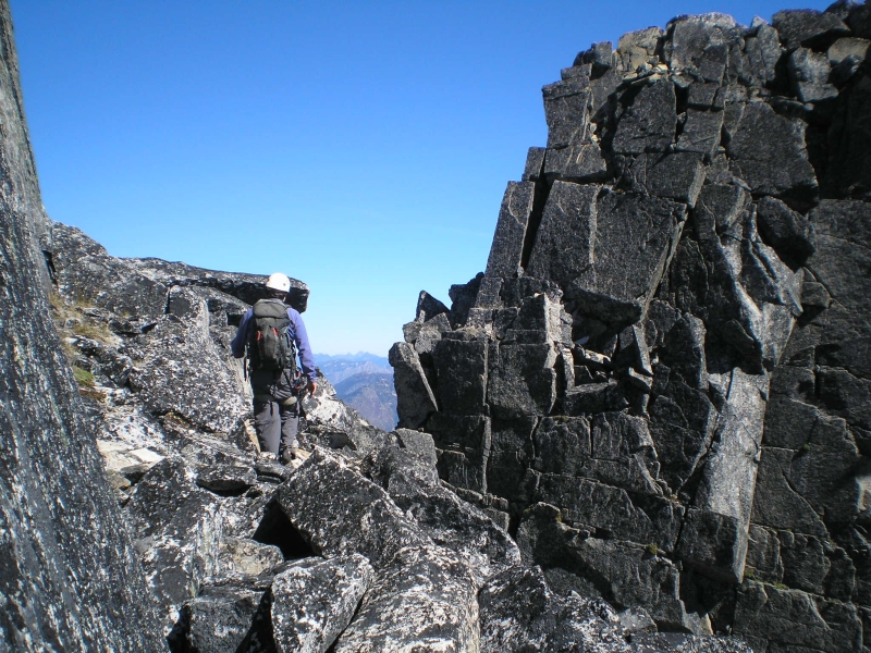
Jeff and I were slow to rise the next morning, but hearing the other campers rustling about with their pre-climb preparations was finally enough to motivate us. After coffee and a quick breakfast, Jeff and I departed camp for the NRNS around 7:30. Traversing talus, scree and sand, we gained the ridge crest just above the low saddle and proceeded to scramble enjoyably clean and solid rock, stopping only to rope up a few minutes later. Now simul-climbing, I led out, avoiding a steep hand crack by traversing ramps and ledges just right of the crest. Once back on the ridge crest, I continued up into a small amphitheater and though I was tempted to climb up into a steep chimney at right, I instead worked left and climbed a fun pitch up a shallow groove to just beneath the summit. A short slab saw me to the summit proper, whereupon I coiled-in rope as Jeff climbed up to join me. Only one hour from camp to summit - so far so good!
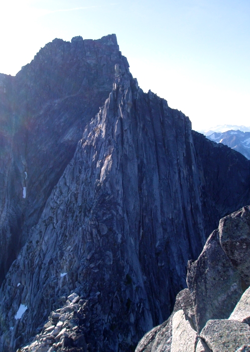
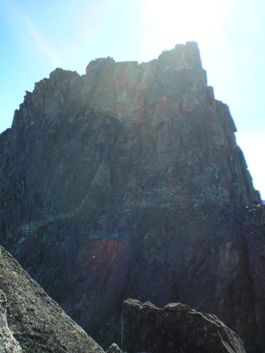
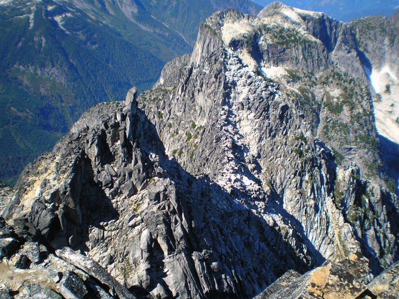
The view of the South Spire and Rexford behind it is impressive, if not a bit intimidating. We descended loose rock to the saddle between the spires, and then continued simul-climbing again on solid rock. While there appear to be several options for tackling the South Spire, we took the path of least resistance and traversed ledges just left of the crest before climbing a gully/chimney (seen here) to reach another amphitheater with steep splitter cracks and chimneys above. Jeff was eager to lead, so I handed him the rack and put him on belay for what was probably the most difficult and enjoyable pitch of the entire enchainment. Of course, my camera decided this very moment to cease functioning, but suffice to say that Jeff did an admirable job leading this 5.7-ish pitch to a comfortable belay in the warm sun. I took the next short pitch around the right-side of the summit pinnacle to just beneath the notorious 30-foot 5.7 off-width crack. Looking west, Mt. Slesse's impressive East Face was impossible to ignore from this vantage. Though in hindsight we could have probably wedged chock stones in the crack for protection and possibly also for the rappel, Jeff and I had previously agreed to pass on the 'true' summit of the South Spire. Besides, I didn't find Martin's description of simul-rappelling with the rope simply draped over either side of the 30-foot tall block particularly appealing.
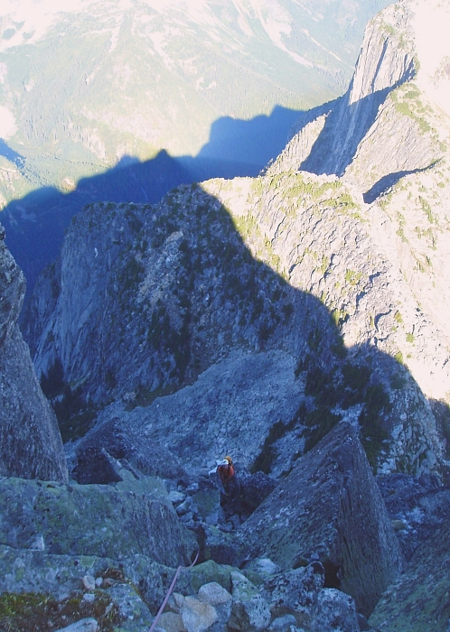
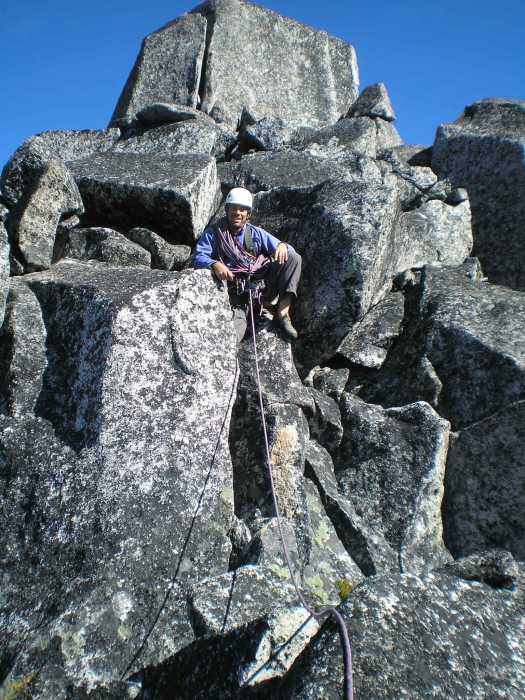
We scrambled down towards the notch between the South Spire and Rexford and quickly located a rappel station. A single rappel brought us down to some rubble which we descended to reach the notch. Scampering on loose rock now on the Rexford-side of the notch, Jeff and I set up a belay in a small alcove beneath a steep rock gully. I chose to avoid the gully and worked left up steep, licheny and somewhat loose rock, then back right to reach another sandy alcove. Following a ramp and flakes trending left-to-right, I continued up more steep rock and stretched the pitch out to the end of my 60-meter rope. Looking right, I was relieved to find a convenient belay at what appears to be a rappel station just below where the West Ridge route traverses beneath Rexford's false summit. We had seen several West Ridge parties en route to or returning from the summit via this short traverse, and knew we were near the end. Jeff and I untied and packed away the rope and rack, and proceeded to scramble up increasingly solid and steep rock reminiscent of the north ridges on the preceding spires we had just climbed. Although some parties may prefer to rope up for the last bit to the false summit, the climbing here generally doesn't exceed mid-5th. Now walking along the mostly flat summit area, Jeff and I passed an intermediate tower via ledges on the right-side (seen here) to reach the final short chimney pitch beneath the summit proper.
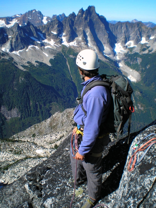
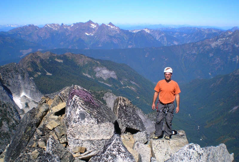
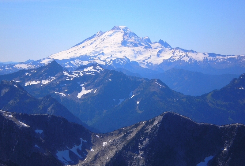
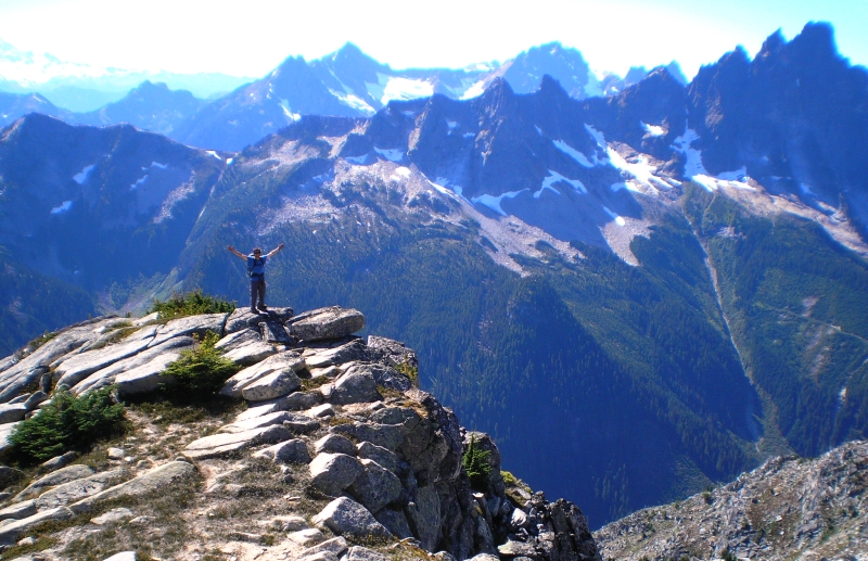
Jeff was having such a good time, I couldn't deny him the final lead and so handed him the rack and put him on belay for one last time. Under the watchful eye of an unusually large raven (we called him 'Dougie' in deference to Doug Rexford for whom the peak is named), Jeff opposition-ed his way up the chimney and scrambled onto the summit shortly thereafter (~5 hours from camp). I soon joined Jeff on the perch 'Dougie' had just vacated for us and ogled at the dramatic views of glacier-clad peaks and precipitous rock faces rising out of deep, dark and lush valleys. In a summer where my climbing successes can best be described as mediocre, this was easily the highpoint (figuratively speaking). After spending entirely too little time on the summit courtesy of that nagging descent back to the car and ensuing drive back to Seattle, Jeff and I proceeded to rap down the short summit pitch, then made three additional raps down from the false summit. Traversing south beneath the false summit, we stopped to pack away the rope, rack and harnesses and started down the sandy upper-West Ridge. An easy and pleasant hike along the crest leads to a short, heathery ramp that descends right to a meet a parallel ridge. Passing on a steep gully that appears to descend directly into the basin, Jeff and I instead continued down this lesser ridge, scrambling and down-climbing occasionally steep and exposed rock to eventually reach the basin. Traversing slabs and talus back to camp, it was apparent that we were the last one's left. We packed-up camp, and started down only two hours after having left the summit. We reached Jeff's truck in another couple hours and were soon bouncing down the logging road back to civilization.
They say good things come to those who wait...and boy, has my patience been tried this year! But, in the end it was all worth it. Jeff's camaraderie and the perfect weather only added to the enjoyment of climbing the incredibly clean and solid granite found on the Ensawkwatch Enchainment. With any luck, next year we'll find ourselves climbing that other granitic peak across the valley from Rexford...
Click here to view photos.
![]()


