


Mount Stuart - Ice Cliff Glacier, June 2004

After awaking to the disappointing pitter-patter of rainfall on a soggy May morning below Mount Stuart's north-side, Eric and I packed up and headed home empty handed. We vowed only to return when the weather was forecasted to be better than NOAA's "40 percent chance of showers." The unseasonably late-spring snow that continued to fall at higher elevations would hopefully help prolong good climbing conditions on the route - a mantra I kept repeating to myself as I impatiently watched and waited for the opportune moment to be lured back...and lured back we were. Tales of technical climbing through ice-steps down low, sketchy 'schrund crossings, and a funky "belly flop" move over the final cornice guarding the couloir's exit, it turns out, weren't as serious as I'd envisioned. Though the climbing ended up being fairly moderate for us, the Ice Cliff Glacier is nevertheless still a committing route, with, as we quickly came to appreciate, a host of objective dangers to contend with.
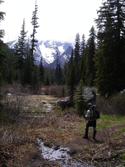
With a trailhead bivy, Eric and I started hiking the Stuart Lake Trail by 5:15am. We proceeded left off-trail at a switchback about a mile past the junction with the Colchuck Lake Trail. Following a faint climber's path, we located a far better log crossing across over Mountaineer Creek than that which we used in our previous attempt. Watchful for the occasional shred of flagging and cairns, we hiked over a bare hump or two before descending into the forested valley. When boulder fields were encountered at the forest's edge, we resisted the temptation to follow cairns leading across. Instead, we continued descending towards the creek where once again the climber's path was located. The path parallels the creek for some distance. It pleasantly winds its way along open forest with only minor brush to deal with. As the path faded, we veered upwards to the right and again located it in a narrowing strip of forest sandwiched between the creek on the left and the left-edge of a boulder field on the right. The basin was reached shortly thereafter about 2 1/2 hours travel-time from the car.
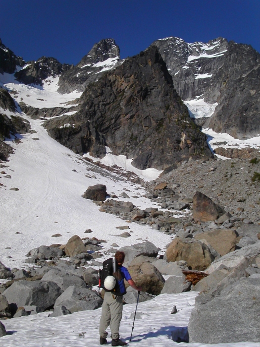
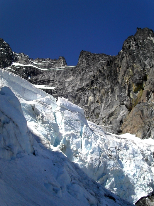
We traversed the mosquito-infested boulder field at the right-edge of the basin with an urgency that bordered on desperation. A breezy snowfield below the Sherpa Glacier afforded us some reprieve from the bloodsuckers and there a much-needed rest was had. We then scrambled up the Ice Cliff Glacier's terminal moraine and descended onto snow to rope up. Gazing up at the intimidating looking ice cliff, we heard the "on-belay" calls of a party on the lower North Ridge. Like us, they clearly had lots of climbing still ahead of them. As we were discussing who would initially take the lead, a chunk of the ice cliff broke away and shattered onto the ledge below. Only one basketball-size block made its way into the gully on the left side where we intended to gain the lower glacier. It occurred to me then how warm it actually was and that good portions of the ice cliff were already basking in sunlight. Eric asked, "Are you sure about this route?"
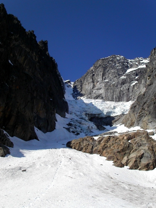
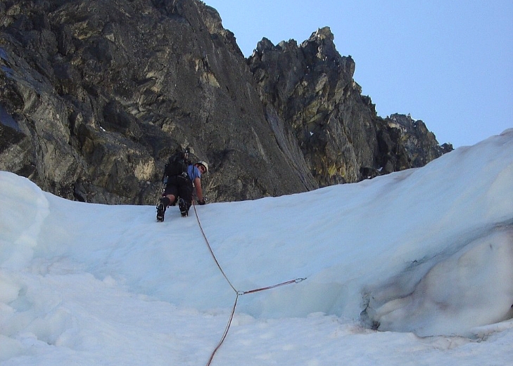
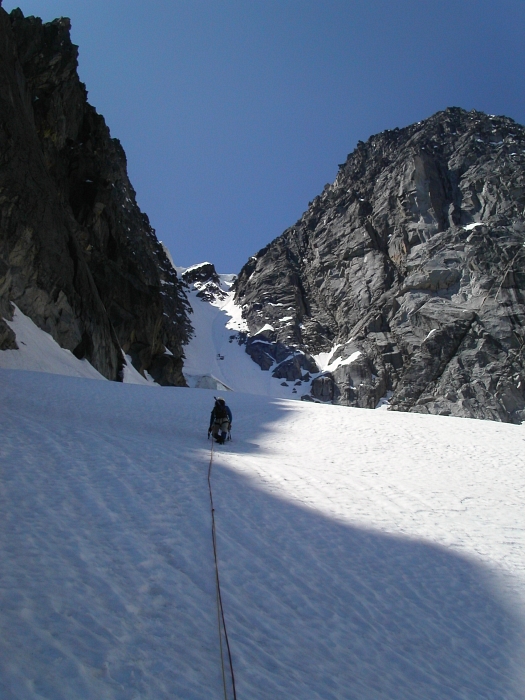
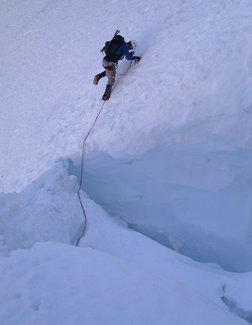
Thankfully, the ice cliff remained subdued while we climbed the gully and started up past the cliff. The snow was soft and not very steep until about a pitch below the top of the cliff where some fractured ice made for enjoyable climbing. As I prepared to lead a final, short 55+ degree ice step, an enormous serac just to our right collapsed, crashed onto bare slabs below, then thundered down into the basin where we had just hiked up from about a half-hour earlier. The noise was deafening and it felt as if the entire glacier was going to go...with us on it! I only used one screw on the ice step. Above it I set up a deadman anchor and belayed up Eric as another serac released. Now unnerved, we made haste postholing onto the glacier flats with Eric now in the lead. After skirting a large crevasse on the right-side, we reached the infamous 'schrund below the Ice Cliff Glacier Couloir and decided to pass it on the left. We crossed two bridges spanning the 'schrund, the latter of which was particularly thin, but was sufficiently protected with a single cam placed in a nearby rock outcrop.
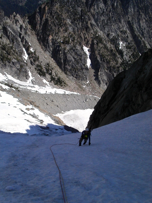
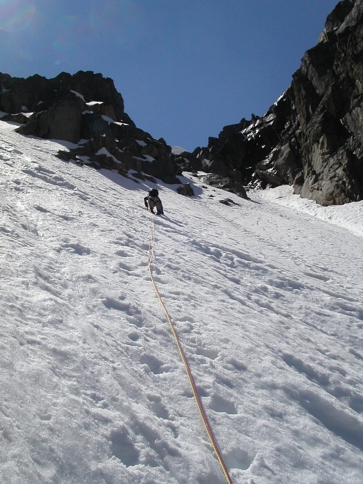
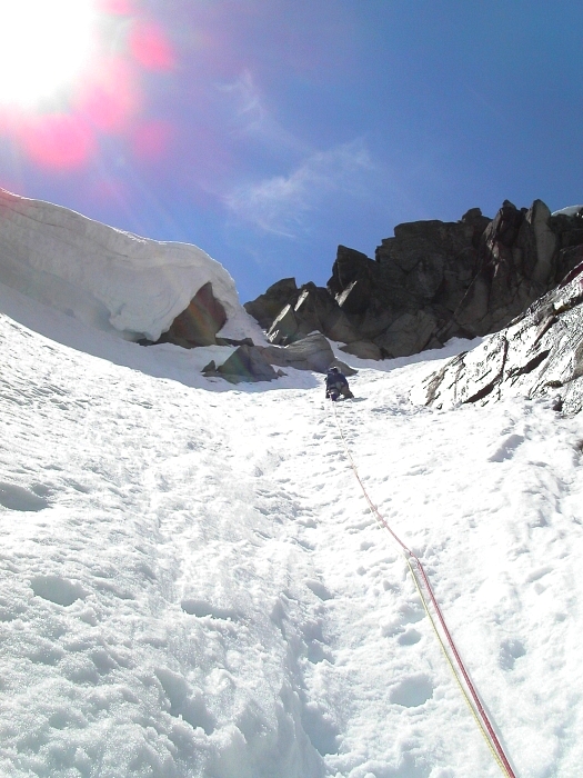
Maintaining a consistent 50-degree slope for about 800 feet, the couloir-top was ringed with overhanging cornices baking in the sun. Consistent with other trip reports that we had read, the couloir took longer to climb than we had expected. The constant threat of falling cornices gave us further incentive to go sooner than later. Near the top, Eric crossed over to the right couloir branch and kicked steps upward beneath the final cornice problem. He climbed to the right side of the cornice and made a short traverse back left on steep snow to reach a narrow rock and snow corner. Eric placed a nut and a cam before committing to the final moves. With some rope drag and a little grunting, he successfully pulled over the top and declared that he was "...done with this bitch!" With a belay, I turned the corner and hacked away what little ice and snow there was left in my effort to climb over the cornice. Hooking a tool in a nice crack on the right, I lifted a knee onto the cornice and pulled myself to safety. There would thankfully not be any belly flops today.
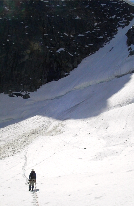
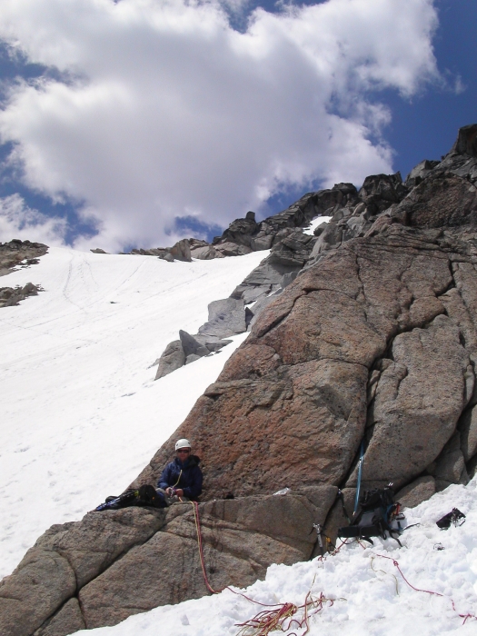
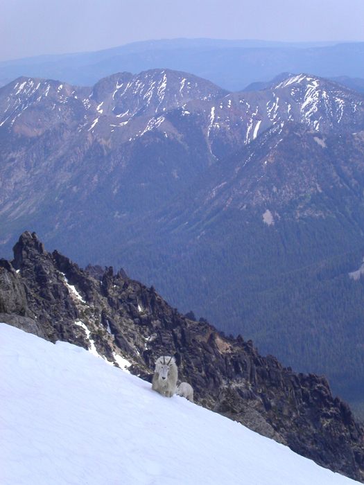
It was now 1:45pm. Upon estimating that it would take two hours round-trip to the summit from here, we decided to forgo the remaining summit slog, opting rather for a long break and a head start on our descent. We had both previously been to the summit anyway. While savoring the relaxing break in the sun, we watched a curious goat and her kid come up the snow slope to within 50 feet of us. Neither of us felt obligated to urinate (goats like salt) and so they continued on up to Stuart's false summit. On the return we traversed below a small tower to the top of the Sherpa Glacier then began nearly 1,000 feet of face-in down climbing.
The 'schrund crossing at the base of the couloir was fortunately a non-issue. We casually descended the glacier and soon found ourselves back down in the basin battling mosquitoes. As if this was our first time, we totally botched the climber's path to Stuart Lake Trail linkup and lost time thrashing around in brush trying to reorient ourselves. Back on the trail, my dehydrated mind was preoccupied with the beers Eric had stashed at the first creek crossing. I privately contemplated how I would go about consuming said beer. Would I restrain myself and savor it one sip at a time or would it just go down the hatch all at once? Which method would ensure maximum satisfaction? One "gulp" later, and I had my answer...and a question for Eric: "Is there any more?"
Click here to view photos.
![]()


