Last Updated: April 17, 2024


Start

Recent content updates are viewable under what's new.

Reports in the queue for posting are coming soon!

Upcoming reports & photos:

Oh my! Quite the backlog here...

  • American Mountain & Mount Lincoln - hike/snowshoe (May 2023)
  • Mount Mclean Attempt, Red Rock Trail, Dragons Back Trail - hike (May 2023)
  • Stawamus Chief (South, Middle & North) - hike/scramble (June 2023)
  • Flint & Feather - hike/scramble (June 2023)
  • Goat Ridge (Squamish) - hike (June 2023)
  • Grouty/Mortar Peaks - hike/scramble (June 2023)
  • Pebble-to-North Creek Traverse incl. Pebble, Thiassi, Wesley & Sugus - hike/scramble (July 2023)
  • Mount Truax - hike/scramble (July 2023)
  • Blackcomb Buttress - rock climb (July 2023)
  • Whitecap Peak - hike/scramble (July 2023)
  • Mount Hanover - hike/scramble (August 2023)
  • The "Long Traverse" incl. Long, Tynemouth, Arrowhead, Tabletop & Anemone - hike/scramble (August 2023)
  • Armchair Traverse - hike/scramble (August 2023)
  • Snowspider Mountain - hike/scramble (September 2023)
  • Mount Trorey - hike/scramble (September 2023)
  • Macleod Peak - hike/scramble (September 2023)
  • Ben Lomond - hike/scramble (September 2023)
  • Mount Killam & Gambier Island - hike (September 2023)
  • Lone Goat & Snow Camp Mountain - hike (September 2023)
  • Isollilock Peak - hike/scramble (October 2023)
  • Manson - Hatfield Traverse - hike/scramble (October 2023)
  • Gargoyles & Columnar Peak - hike/scramble (October 2023)
  • Opal Cone and Lava Glacier - hike (October 2023)
  • Park Butte (WA) - hike (October 2023)
  • Trappers Peak (WA) - hike/scramble (October 2023)
  • Rattlesnake Ledge (WA) - hike (November 2023)
  • Sauk Mountain (WA) - hike (November 2023)
  • Mount Daniel & Pender Hill (Sunshine Coast) - hike (November 2023)
  • Mount Dickerman (WA) - hike (November 2022)
  • Winter's End (Verona Peak) - hike/snowshoe (November 2023)
  • Dolomites (Italy) - snowboarding (December 2023)
  • Red Rock Canyon (NV) - hike (January 2024)
  • Flute & Oboe - split tour (February 2024)
  • Whistler misc. (Train Wreck, Loggers Lake, Shadow Lake etc.) - hike (February 2024)
  • Mount Underhill - hike (March 2024)
  • Bombtram Mountain - hike/snowshoe (March 2024)
  • Steep Peak - split tour (March 2024)
  • Ruby Mountain (WA) - hike/snowshoe (April 2024)
  • Blustry Mountain - hike (April 2024)
  • Sowerby Peak (Barr East) - hike (April 2024)

*As of 04/21/2024


Database

Query the reports database, selecting from criteria which include name, location, type, season etc.

Quick Links

Essential links & whatnot:


Jump To

Select from list below to jump to a specific area on this site.


| Featured Trip Report |


Last Updated: Jul. 13, 2004

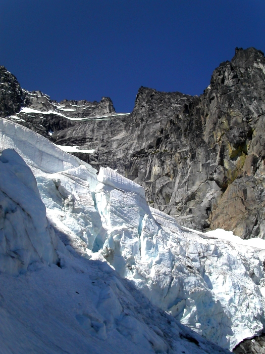
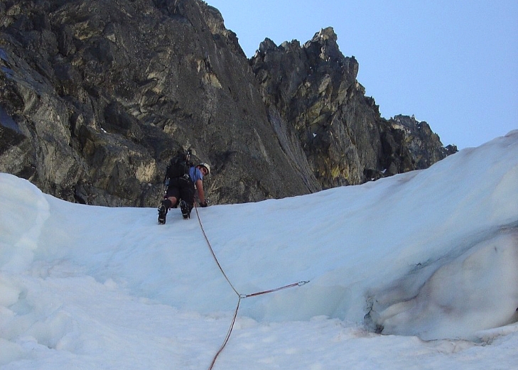
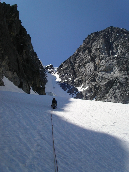
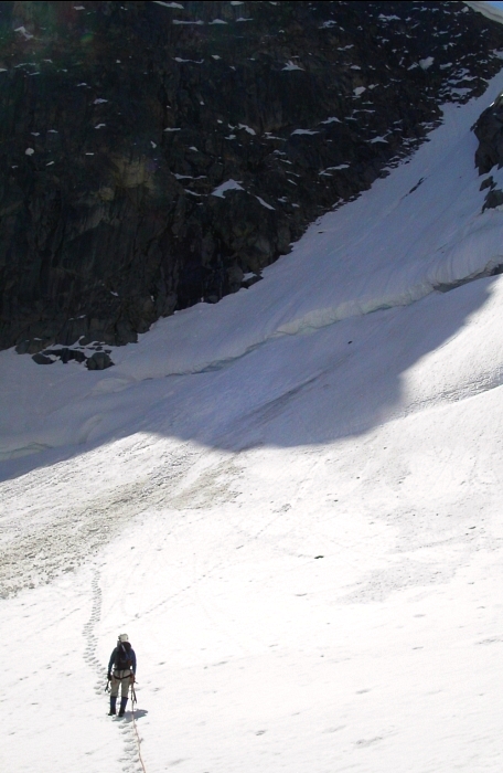
Mount Stuart - Ice Cliff Glacier, June 2004


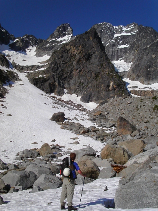
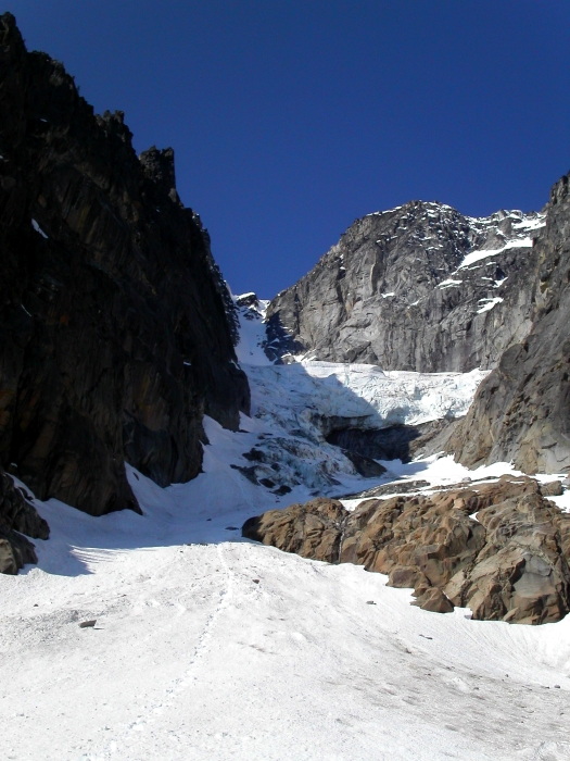
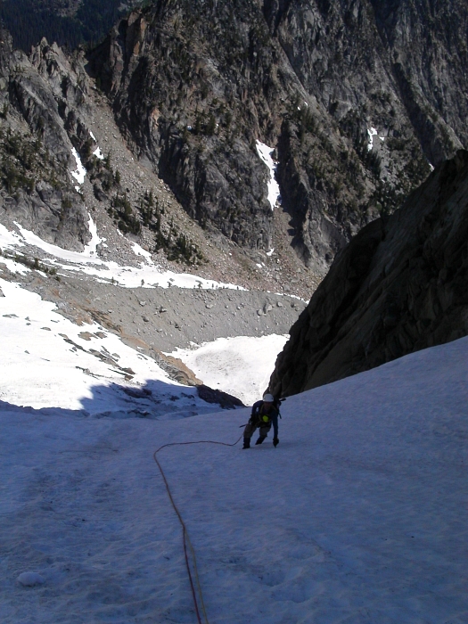
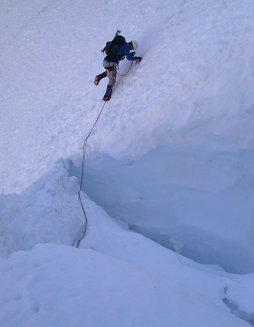
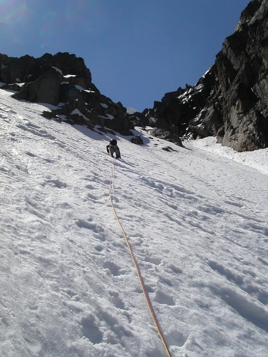
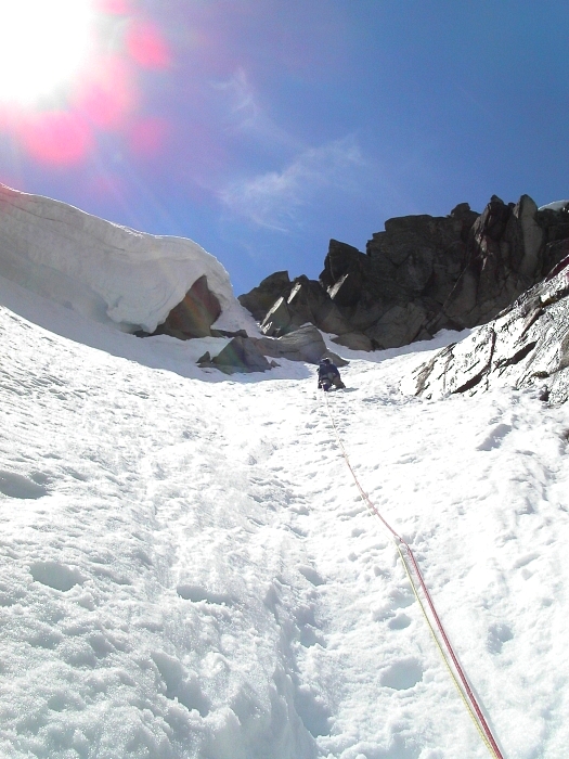
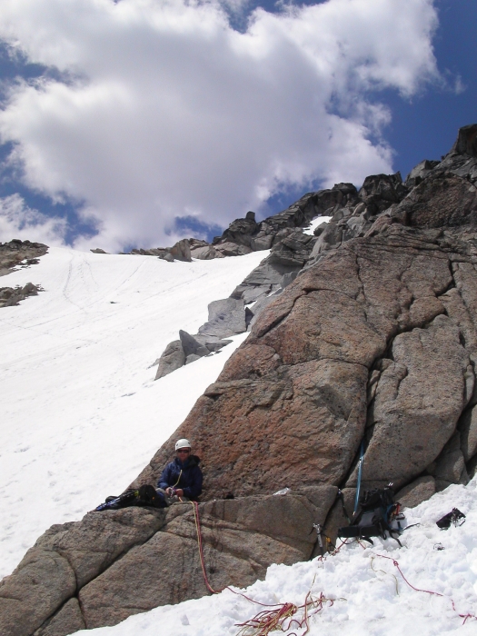
After awaking to the disappointing pitter-patter of rainfall on a soggy May morning below Mount Stuart's north-side, Eric and I packed up and headed home empty handed. We vowed only to return when the weather was forecasted to be better than NOAA's "40 percent chance of showers." The unseasonably late-spring snow that continued to fall at higher elevations would hopefully help prolong good climbing conditions on the route - a mantra I kept repeating to myself as I impatiently watched and waited for the opportune moment to be lured back...and lured back we were. Tales of technical climbing through ice-steps down low, sketchy 'schrund crossings, and a funky "belly flop" move over the final cornice guarding the couloir's exit, it turns out, weren't as serious as I'd envisioned. Though the climbing ended up being fairly moderate for us, the Ice Cliff Glacier is nevertheless still a committing route, with, as we quickly came to appreciate, a host of objective dangers to contend with.

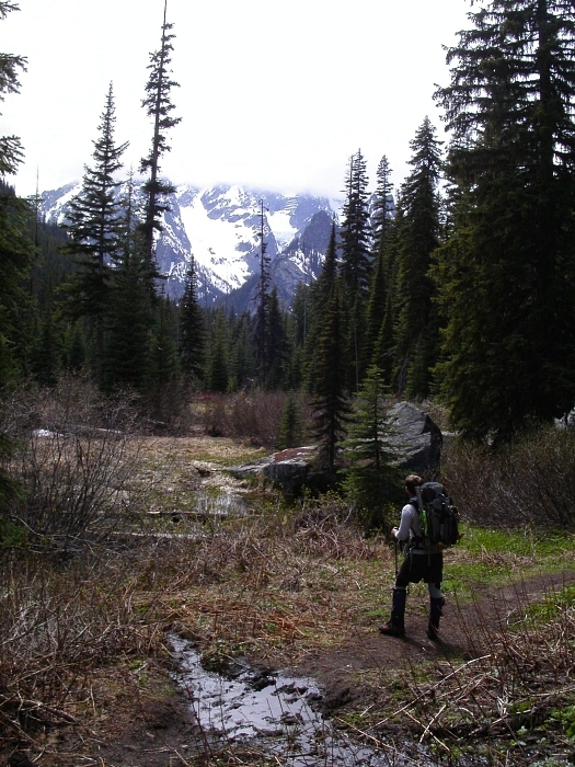
With a trailhead bivy, Eric and I started hiking the Stuart Lake Trail by 5:15am. We proceeded left off-trail at a switchback about a mile past the junction with the Colchuck Lake Trail. Following a faint climber's path, we located a far better log crossing across over Mountaineer Creek than that which we used in our previous attempt. Watchful for the occasional shred of flagging and cairns, we hiked over a bare hump or two before descending into the forested valley. When boulder fields were encountered at the forest's edge, we resisted the temptation to follow cairns leading across. Instead, we continued descending towards the creek where once again the climber's path was located. The path parallels the creek for some distance. It pleasantly winds its way along open forest with only minor brush to deal with. As the path faded, we veered upwards to the right and again located it in a narrowing strip of forest sandwiched between the creek on the left and the left-edge of a boulder field on the right. The basin was reached shortly thereafter about 2 1/2 hours travel-time from the car. (more...)

Click here to view photos.
home | email | copyright

All photos and text for sverdina.com are copyright © 2002-2024

It would be very much appreciated if you please ask before copying and/or re-publishing content from any part of these pages. To do so, please click here to send a message via feedback form.

Thank You.

©2024 sverdina.com |