Last Updated: May 18, 2023


Start

Recent content updates are viewable under what's new.

Reports in the queue for posting are coming soon!

Upcoming reports & photos:

Oh my! Quite the backlog here, eh? Busy with life and adding to the queue every chance I get...

  • Camelshoof Mountain - hike (June 2022)
  • Askom Mountain - hike (June 2022)
  • Metal Dome - hike (July 2022)
  • Mount Sproatt - hike (July 2022)
  • Mission Ridge/Peak - hike (July 2022)
  • Harris Ridge & Nea Peak - hike (July 2022)
  • Three Brothers Mountain - hike (July 2022)
  • Zupjok, Llama & Alpaca Peaks - hike (July 2022)
  • Shulaps Mountain - hike/scramble (August 2022)
  • Mount Sheer & Ben More - hike/scramble (August 2022)
  • Cathedral Mountain - hike/scramble (August 2022)
  • Mount Penrose - hike/scramble (August 2022)
  • Caltha Peak - hike/scramble (September 2022)
  • Beauty Peak - hike (September 2022)
  • Markhor-Needle Traverse & Flatiron - hike/scramble (September 2022)
  • Conway Peak - hike (September 2022)
  • Green Mountain/Pk 2200 - hike/scramble (September 2022)
  • Mount Brew (Whistler) - hike (September 2022)
  • Mount Barbour - hike/scramble (October 2022)
  • Mount Gillespie - hike/scramble (October 2022)
  • Cougar Mountain - hike/scramble (October 2022)
  • Barn Bluff (Red Wing, MN) - hike (October 2022)
  • Mount Steele - hike/snowshoe (November 2022)
  • American Mountain (attempt), Hunter Lookout - hike (November 2022)
  • Belcarra Mountain - hike (November 2022)
  • Oyster Dome - hike (November 2022)
  • Mount Thom & Cilliwack Mountain/Hillkeep - hike (December 2022)
  • Frenchman Mountain (Las Vegas, NV) - hike (January 2023)
  • Rolley Peak/Lookout - hike (January 2023)
  • Round Mountain - ski tour (February 2023)
  • Blowdown Peak - ski tour (February 2023)
  • Silverdaisy Mountain - ski tour (March 2023)
  • Spearhead Glacier/Husume Coulior - ski tour (March 2023)
  • Cowboy Ridge/Peak 2026 - ski tour (April 2023)
  • Slahanay Peak - hike (April 2023)
  • American Mountain & Mount Lincoln - hike (May 2023)
  • Mount Mclean Attempt, Red Rock Trail, Dragons Back Trail - hike (May 2023)
  • Coast Mountain Circle Route w/ family - drive/sightseeing (May 2023)
  • Stawamus Chief (South, Middle & North) - hike (June 2023)

*As of 06/05/2023


Database

Query the reports database, selecting from criteria which include name, location, type, season etc.

Quick Links

Essential links & whatnot:


Jump To

Select from list below to jump to a specific area on this site.


| Featured Trip Report |


Last Updated: Nov. 12, 2003

Mount Triumph - Northeast Ridge, September 2003


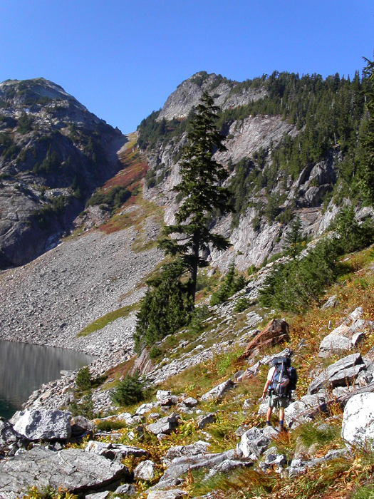
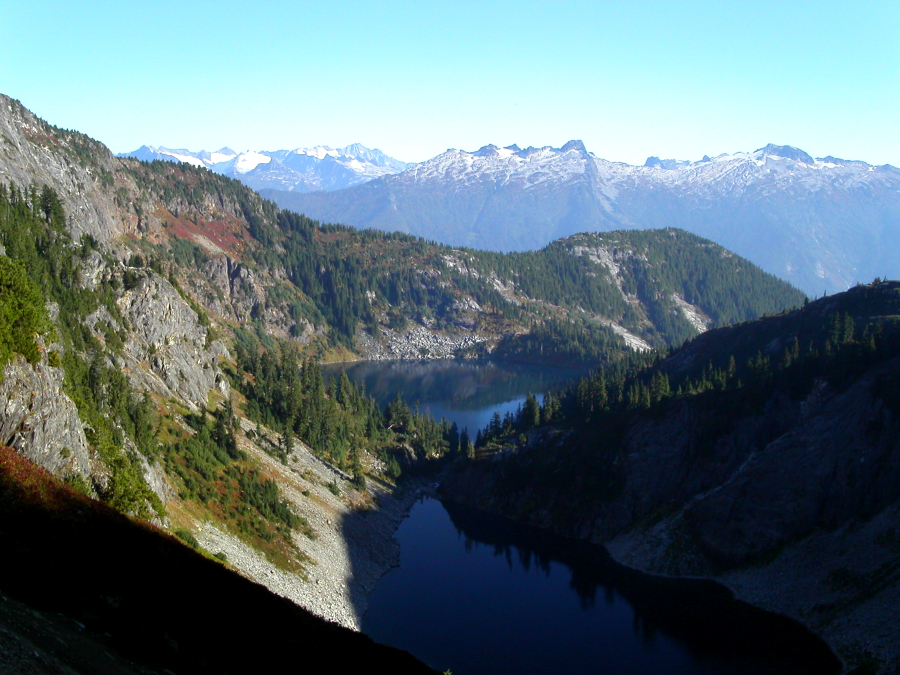
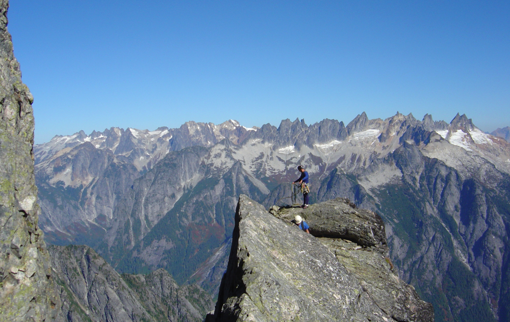
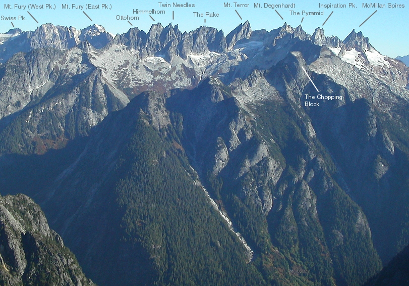
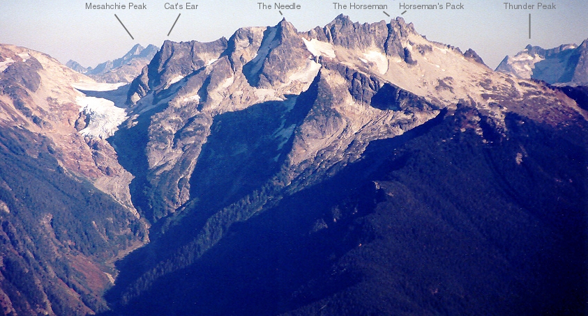
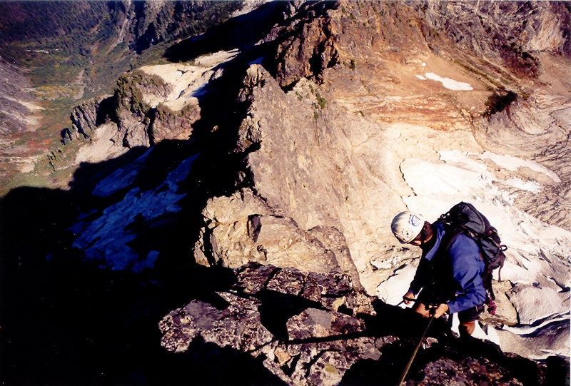
It was potentially the last fair-weather weekend of Autumn and therefore a prime opportunity for a remote yet classic alpine rock climb. Long a sought-after goal of ours, Paul, Eric and I made plans to finally climb Mount Triumph's spectacular Northeast Ridge. We left Seattle around 9:45 and started up the Thornton Lake Trail around 1pm. About 4 miles of easy trail hiking (first two miles being on an overgrown road and therefore bike friendly) brought us to the Thornton Lakes overlook and the first good photo opportunity (the col, our camp and upper third of the Northeast Ridge clearly visible in front of us). The profile of Mount Triumph's Northeast Ridge, even from this distance, made me nervous. But, that would be tomorrow's problem. For now, we had about 500 feet of hard-earned elevation to loose, before having to make it all back up again.

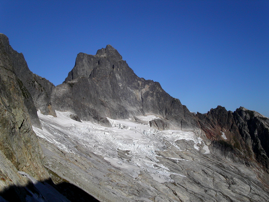
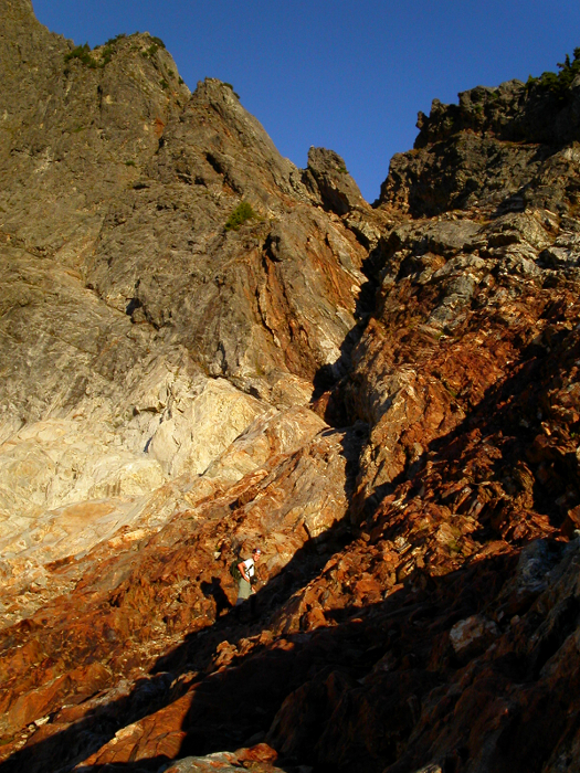
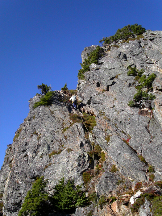
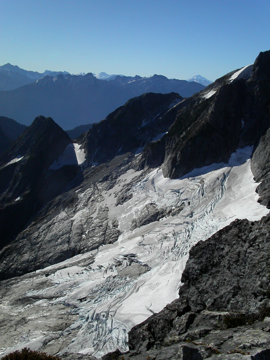
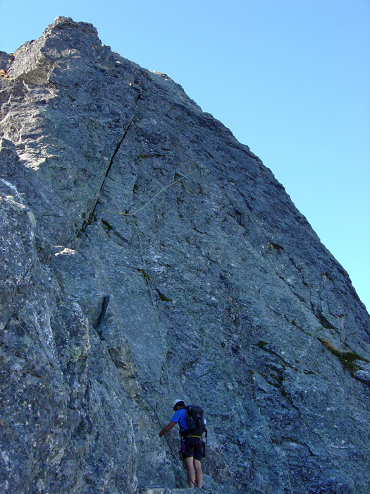
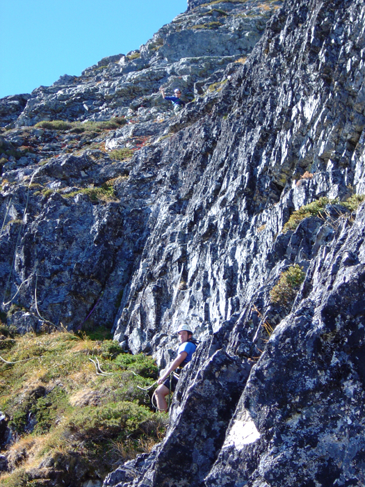
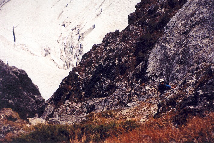
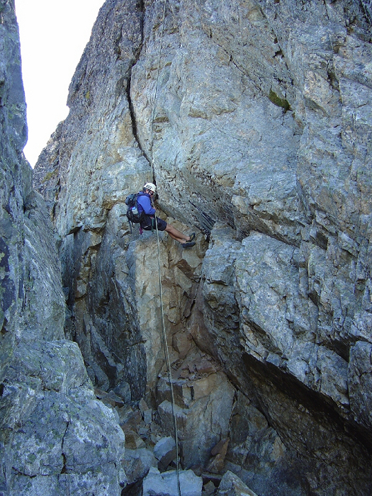
From the overlook, the trail descends 500ft down to the lake, skirting the left edge of the first lake, crossing the outlet between the first and second lake and diving in for a final helping of brush on the right side of the second lake. We hiked another brutally hot 800 feet on grass, talus and scree to bivy sites at the col (barely enough flat-space for my 2-man tent). It was warm that night, but a fierce wind howled through the col and I feared the tent would get blown away with us in it. Consequently, I enjoyed very little sleep, despite the Oxycodone and Canadian Club. We left camp around 6:30 the next morning, after I wolfed down a packet of oatmeal Eric was generous enough to share with me. The glacier has receded significantly and so we traversed low-angle, polished slabs, with only one crossing of hard/icy snow (crampons/axe required). It seemed wise to hurry across the slabs; passing around big blocks of ice that had fallen from above. Getting creamed by one of those blocks would definitely ruin your day! At other end of the basin (45 min from col), we scrambled up a shallow, mostly 3rd class gully (right-trending), then followed ledges of bright red/orange rock and grass back left up to a small notch in the ridge (easier than it looks from afar). (more...)

Click here to view photos.
home | email | copyright

All photos and text for sverdina.com are copyright © 2002-2023

It would be very much appreciated if you please ask before copying and/or re-publishing content from any part of these pages. To do so, please click here to send a message via feedback form.

Thank You.

©2023 sverdina.com |