


Welch Peak - South Ridge, September 2006
.")
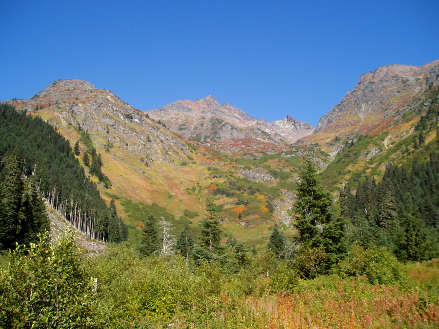
My uncle was wrapping up his trip through Western Canada by spending a few days at Harrison Hot Springs near Hope BC. Not having seen each other for at least five years, I felt obligated to pay him a visit (3hr drive from Seattle) and spent a relaxing Saturday afternoon catching-up and brushing up on my rusty German. Since Onkel Heinz was scheduled for a return flight to Germany the next morning, I hoped to make the most of my whereabouts and scramble up a nearby peak on Sunday. As the Cascades' northern-most sub-range of any significance south of the Fraser River Valley, the Cheam Range has long been an area I've wanted to explore. With Welch Peak being the tallest in the range and also the one that's most commonly climbed, I felt that it was worthy of my consideration. Flipping through the CAG, I noticed Beckey's description of the South Ridge including his comment stating, "This is a recommended route." Hmm... A recommended class 3 - 4 ridge route on a peak I can actually see from the shores of Harrison Lake. Sold!
After almost closing down the pub that night, I wished my uncle well and vowed not to wait another five years before seeing each other again. Reluctantly going our separate ways, my uncle returned to his hotel while I continued a short distance north to the Hicks Lake campground (Sasquatch Provincial Park) and called it a night. Sleeping through the alarm, I awoke a couple hours later than intended, frantically broke down the tent and jumped in the car. Even from my relatively nearby location the drive to the Chilliwack River Road (CRR) turnoff took more time than expected. I turned north onto Foley Creek Road (a reasonably 2wd-passable logging road) after about 17 miles on the CRR and proceeded to the T-junction immediately following the bridge over Foley Creek. Turning right, I continued slowly eventually reaching Foley Lake in about five-and-a-half miles. I parked at a pullout overlooking the west end of the lake, donned my boots and pack and started down a trail I hoped was the Williamson Lake Trail. It was now 10am.
Crossing the logjam at the Foley Lake outlet, I briefly contoured around the northwestern end of the lake before growing tired of thrashing about in the brushy forest. Turning uphill, I stumbled upon some pink flagging which I was able to follow up annoyingly steep and brushy terrain before reaching open forest above. The trail then ended abruptly at a large clear-cut area. Now continuing laboriously up though the clear-cut, I began traversing right eventually reaching the end of a logging road spur. I followed this road a short distance to a large U-turn whereupon I was faced a large basin choked with brush. Not seeing any evidence of a trail through this brush (I neglected to look farther right to locate the trail at the other end of the U-turn), I dropped into a dry creek bed and tried following it, occasionally tunneling underneath brush, as it snaked towards the left (west) side of the basin. The going wasn't easy or particularly direct. Fortunately, it wasn't long before I heard a voice off in the distance to my right. The voice drew closer; it said "hello bear." Someone was obviously on a trail nearby. I clawed my way up the muddy bank, waded though some more brush and voile' - the trail!
Soon catching-up with the lone hiker, we followed the trail as it cuts across the brushy basin from right to left and enters the last bit of forest at far left. Now easy to follow, the trail exits the forest and traverses back right through heathery terrain to eventually reach a somewhat underwhelming Williamson Lake (~3hrs from car, 3600ft gain over about 4 miles). I allowed myself a quick snack but had to ration the one-liter of water I brought up with me on this hot day. Ugh! I snapped a photo of the solo hiker using his camera and set out for the South Ridge. A bit of mud, talus and heather soon saw me to a steep, mossy gully that breaks the lower cliffs above the left side of the lake. Above the gully, I continued up more talus then slabby rock to eventually reach the gentle crest of the lower South Ridge.
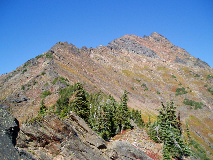
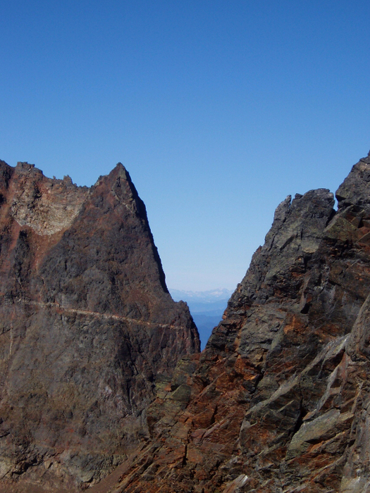
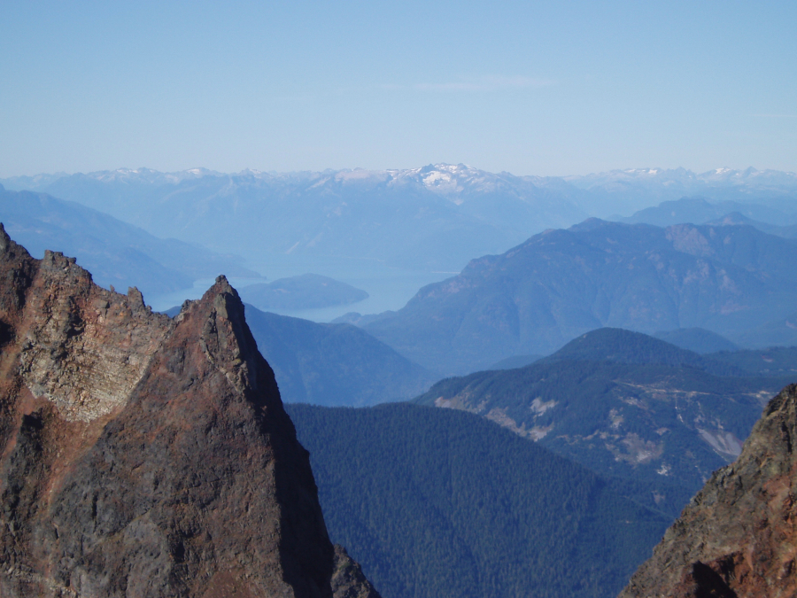
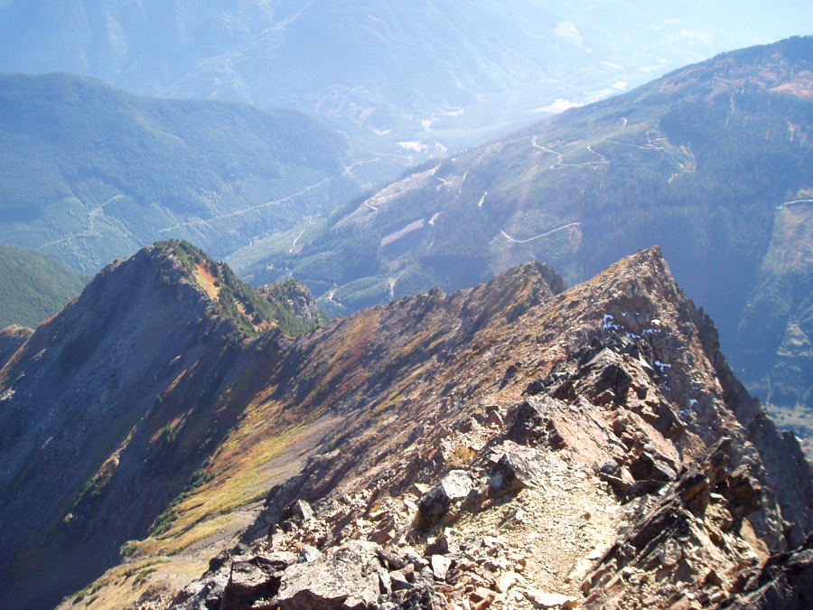
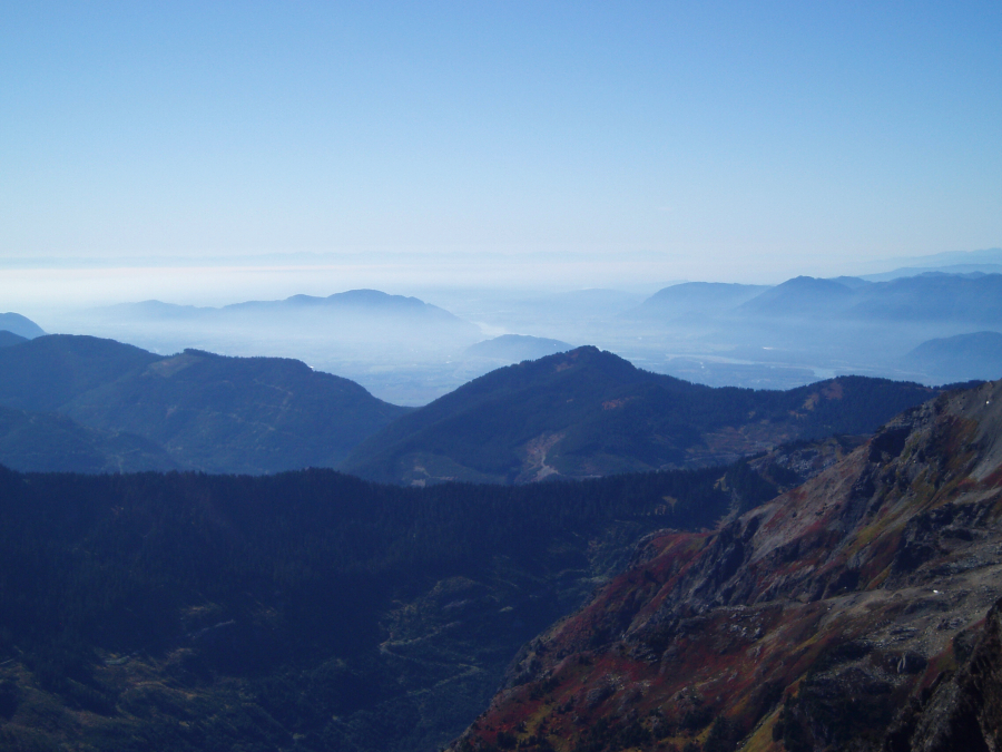
The ridge scramble started out easy class 2 and 3, but soon became mostly 3rd-class with the occasional 4th-class step. I tried staying on the crest as much as possible but was forced right (east) on occasion when the climbing became too steep. While the ridge itself is comprised of relatively sound rock, my forays off of the crest were met with loose rubble and boilerplate. I reached the false summit in two-and-a-half hours from the lake and sat down briefly to work out the cramps in both of my quadriceps...yes, I was already dehydrated. I took a few photos, then dropped my pack and completed the final scramble to the summit. It was nice to get a different perspective on Harrison Lake to the north, where I was just the day before. Looking south, the entire collection of peaks near Chilliwack Lake including Mount Rexford and the unmistakable Mount Slesse were laid out before me.
Returning to the false summit, I began searching for the proper spot from where to start the Southeast Face descent. Based on a page photocopied from the Scrambles in Southwest British Columbia guidebook I obtained earlier from the solo hiker, not only would this descent be faster than down-climbing the ridge, but it would also allow me an opportunity to re-hydrate. Staying right (south) of a minor rib that descends from the false summit, I carefully picked my way down loose rock and scree until able to traverse back left towards the SE Face. Now continuing down slabs, I passed the shattered remains of an old external frame backpack - thankfully there wasn't a body attached to it. Following the path of least resistance I descended into a talus basin while mountain goats trundled rocks from far above. At the watercourse I drank until the brain-freeze became unbearable, then traversed further left before descending to the large talus slope above Williamson Lake.
Reaching the south end of the lake sometime after 5pm, I began retracing my steps back down the path. Cutting back across the brushy area near the U-turn, the path ends at a spur road on the left (east) side of the basin. Going on recommendation of the solo hiker, I followed this spur road back to the U-turn area, and staying left continued down a well-traveled logging road back down into the valley. Somewhere far below an ATVer was going full-throttle - at this point I was prepared to pay for a ride back to my car! Always staying on the main, downhill track I turned left at a T intersection and continued down past a yellow gate (open) to eventually reach the bridge over Foley Creek. After crossing the creek, the road climbs up alongside Foley Lake to rejoin the Foley Creek Road. I reached the car not long thereafter (~7pm) and drove back to North Van for a much needed shower and a meal.
To anyone looking to do this outing, I highly recommend taking the logging road in lieu of the Williamson Lake Trail. True, a logging road may not be as aesthetic as the trail, but it is MUCH faster. The water-bars weren't too deep and any Subaru Forester or Outback-type vehicle should easily be able to make it to the U-turn area (doing so would shave about two hours from the approach). If nothing else, bike up the logging road - the descent alone is sure to be worth the effort!
Click here to view photos.
![]()


