


White Chuck Mountain - Northwest Route via White Chuck Glacier, June 2006
.")
Having read a thread on Cascade Climbers dot com some time ago describing White Chuck's Northeast Ridge as an appealing route reportedly with the potential for being a local classic, I felt compelled to check it out for myself. For Paul, the allure had more to do with ticking off a peak from his prominence list, though he too expressed interest in the route. We recruited Jeff to join us on the climb who having been up the standard route once before, seemed content with exploring a different line on the mountain.
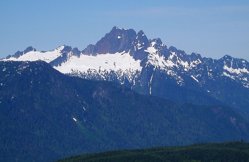
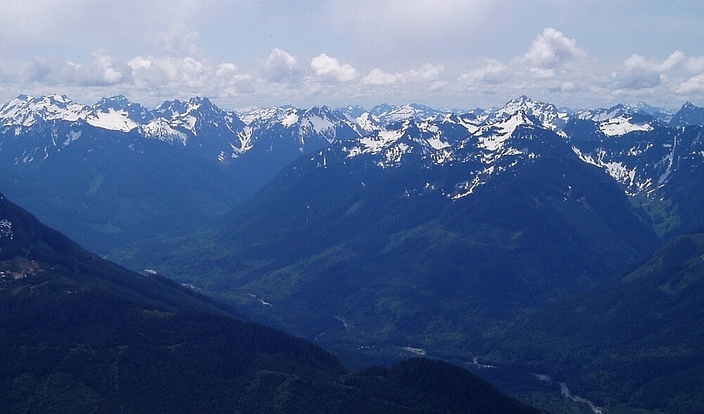
We departed from Seattle early on a sunny June morning - a day where the forecast called for afternoon thunderstorms. Proceeding north from the Darrington corner gas station, we turned right onto Sauk Prairie Road and continued for approximately 2 miles (crossing over the Sauk River just south of the mill) before turning right onto FR 2400 (Dan Creek Road). Following this road for several miles, we turned left (north) at a junction near the head of the valley onto FSR 2430. In another half mile, we took the right fork onto FSR 2435. Ignoring a few spur roads here and there, we stayed on FSR 2435 and soon gained an open, logged-off ridge crest extending northwest from White Chuck's Northwest Peak. We followed the road along the spine of the crest until stopped by snow at about 4,600 ft. The view from this location is impressive - Whitehorse, Pugh, Bedal, Sloan and much more. With the beer stashed in a snow bank on the edge of the road, we proceeded to kick steps up to a saddle just above where the road normally ends.
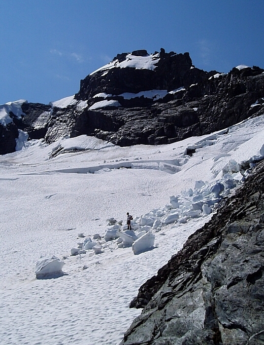
Now following a broad, forested ridge to the southeast, we began a gradual downward traverse to the left towards the toe of the North Ridge of the NW Peak. Contouring around this feature, we soon reached polished slabs low in White Chuck's north-facing basin. Easily scrambling up these slabs, we quickly gained the toe of the glacier and took in our first view of the route (the ridge at far left). The standard approach via slabby rock just above the upper glacier margin was running with water and featured a menacing, house-sized and partially collapsed block of snow perched above...definitely not my cup of tea. Fortunately, the abundance of snow allowed for a relatively easy slog to a point a bit lower on the Northeast Ridge. But first, we had to make an easterly dash across the glacier and avoid being clobbered by snow blocks collapsing off of the North Face!
Following Paul's footsteps along the exposed NE Ridge, Jeff and I came upon a small notch that required some 4th-class down climbing to get into. Beyond this point, a second notch was encountered that proved to be more of a challenge. Already spooked by the bowling alley glacier traverse and not liking the looks of the upper ridge - slabby and wet with another seemingly unstable snow block that we'd either have to climb onto or somehow traverse beneath, I began to have serious reservations about continuing. Paul and Jeff made a few half-hearted attempts at climbing out of that second notch, but in the end they backed-down as well. We reversed our route along and down the ridge and zipped back across the glacier without further drama.
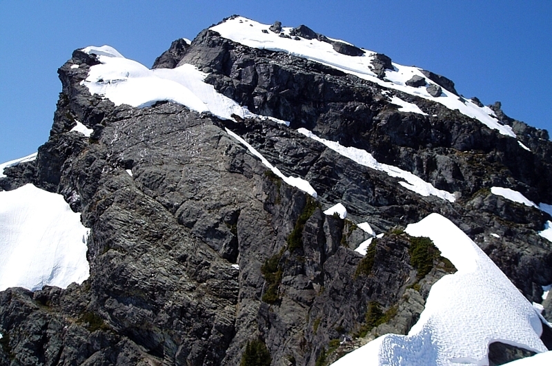
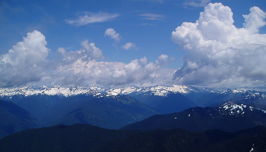
Stopping in a spot of relative safety somewhere beneath the low notch between the NW Peak and main peak, we had a bite to eat and discussed our options. The slabby rock above us looked like it would provide a viable route to the notch, whereby we could finish-up the climb by punting up the standard Northwest Route. Ahh, yes...punting! We donned our harnesses, "just in case" and set out up the rock. The scramble ended up being quite enjoyable, with a final sting in the tail requiring a bit of extra concentration. After a short rest, Paul continued up from the notch like a rocket. The seemingly improbable Northwest Route has little going for it, other than it being a quick line to the summit. Traversing bits of steep heather interspersed with steep, exposed scree and boilerplate, the "trail" eventually leads to another small notch above which the final few class-3 moves see you to the summit. Echoing sentiments I've heard elsewhere, there are portions of this route that are genuine "don't fuck-up terrain", particularly when covered in snow. What a joy to have to reverse that sketch traverse...but, not before lounging on the summit and watching the thunderheads grow!
Returning to our gear-stash just above the first notch, Paul and I followed Jeff down the south-side of White Chuck. Steep, slippery snow slopes had to be down-climbed with care, after which we traversed right to reach the obvious gully beneath the NW Peak. Forced to leap over a moat, we then enjoyed a quick glissade down into a small basin. From there, we slogged to the northwest, soon gaining bits of trail on the forested ridge from earlier that morning. We reached the car soon thereafter. Trying desperately not to spill the beer, I dug my fingernails into the supple upholstery of Paul's Forester XT as he did his best Mario Andretti impersonation back down the logging roads. Before I knew it, we were pulling into the Darrington Shell station for more Heineken. Thunderheads loomed all around us as a rain-soaked biker trio rolled up. Somewhere, the clouds had finally unleashed...but, fortunately not on us!
Click here to view photos.
![]()


