


Mount Whitney - Mountaineer's Route, July 2010

For my final High Sierra venue of the summer, I felt Mount Whitney would make for an appropriate finale to an unforgettable week's worth of classic alpine rambling. I was not to be deterred by the peak's US states highpoint status (excluding AK) and the masses of hopeful summiteers that typically flock to places bearing such proud distinctions. Accepting the fact that I would not experience the solitude I had enjoyed on the preceding climbs, I would count myself among the 100+ that make the pilgrimage each and every summer's day. To me, Whitney was simply about ticking off an iconic peak from my long list of climbing objectives. As they say, "when in Rome."
The East Face route appealed to me the most, but at a sandbagged 5.6 it's one that I would want a partner and a rope for. Since I had neither, I had to settle for something a little friendlier. There are at least two easy and popular routes that lead to Whitney's summit. The vast majority of Whitney climbers do so via the class 1 Mount Whitney Trail. About 22 miles in length (round trip) and gaining over 6000 feet from the trailhead, this sounds like a mind numbingly painful affair that not even I would dream of trying. Fortunately, for those seeking somewhat more adventure, no crowds and a significantly shorter 12-mile round trip trek, there's The Mountaineer's Route. Mountaineer's shares the same start as the Whitney Trail and so also entails over 6000 feet of gain. But in dry summer conditions like I experienced, a 10-hour round trip time is perfectly doable for a fit and reasonably fast party.
By far the crux of the aforementioned routes involves securing a climbing permit, particularly for "drop-ins" like myself. The staff at the Lone Pine ranger station manages the rather convoluted permitting system and I'm still not entirely sure I understand how it all works. As best I can tell permits for the Whitney Trail (including The Mountaineer's Route) are limited to a 100 day-hiker quota. Permits can be reserved ahead of time (for a fee) and are typically booked out up to a year in advance. However, a small percentage of the daily quota is thankfully reserved for drop-ins. This is where the infamous Whitney permit lottery comes into play, and where I found myself at 11am on a blisteringly hot Friday in July.
Hovering around the ranger like so many vultures waiting for a fatally wounded antelope to die, it was obvious that there were quite a bit more of us than there were permits. The ranger seemed taken aback by the unexpectedly large group circling him to whom someone made a cynical remark about 10% unemployment and the flagging economy. We all had a good laugh, myself especially that is until the first number was drawn from the hat. Needing only one permit, I figured I stood a good chance. But when numbers were repeatedly drawn before mine for parties of three or more, my chances quickly slipped away. Well, so much for that.
But don't despair! There's another "lottery" at 2pm for the reserved but unclaimed permits. Reserved permits must apparently be claimed by noon the day prior to the reservation date (or day of climb). Certainly a lot can happen in 12 months and out of say 80 reserved permits for a busy Saturday climb, there may be about 10 or more that wind up unclaimed. At least that's how it worked for me. I just waltzed up to the counter, got my permit and left. No lottery, no lines, no drama. If you ever find yourself in my situation, spare yourself the headache and just show up at 2pm for a hassle free permit experience instead.
With the red tape finally taken care of I began driving up the Whitney Portal Road towards a seemingly distant gash in the mountains flanking the western wall of the immense Owens Valley. There are a couple decent campgrounds in the flats alongside the road that usually have vacancies and are far cheaper than the campground at Whitney Portal proper. I only learned this after the fact of course, and was lucky to secure the last available spot at the Whitney Portal Campground. It seems I'm onto a familiar theme here as it was a reserved, but unclaimed spot to be exact. Unlike the free climbing permit however, this stroke of good luck cost me $20. Ouch!
I departed camp a little before 5am and drove the short distance up to the large trailhead parking area. There wasn't a vacant spot to be seen anywhere and so I ended up filing in behind a long queue of vehicles parked on the shoulder alongside the road. Upon reaching the trailhead, I took my place behind a procession of headlamps and amused myself listening to the conversations of those ahead of me. The trail crosses Carillon Creek and makes a long traverse before reaching the next stream crossing. Here I left the main trail and instead followed a lesser use trail that branches off to the right. Making steep switchbacks through trees, I soon caught up with a party of three and spent the next while hiking and chatting with them.
The sun was beginning to rise by the time we left the wooded slopes and crossed the stream for a second time. From here we entered a brushy area complete with tunnels through dense aspen, before working our way up and eventually back right across the drainage to once again cross the stream this time at a small, soaking waterfall. Following the base of prominent cliffs, solo climber Larry whom I chased up a chute then across the famed Ebersbacher Ledges passed by us as if we were standing still. The zigzag route via the ledges avoids the worst of the brush and deposits one just shy of the basin feeding the aforementioned stream.
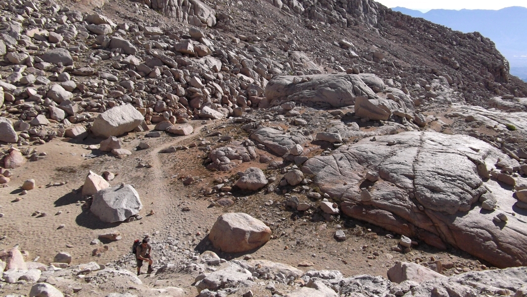
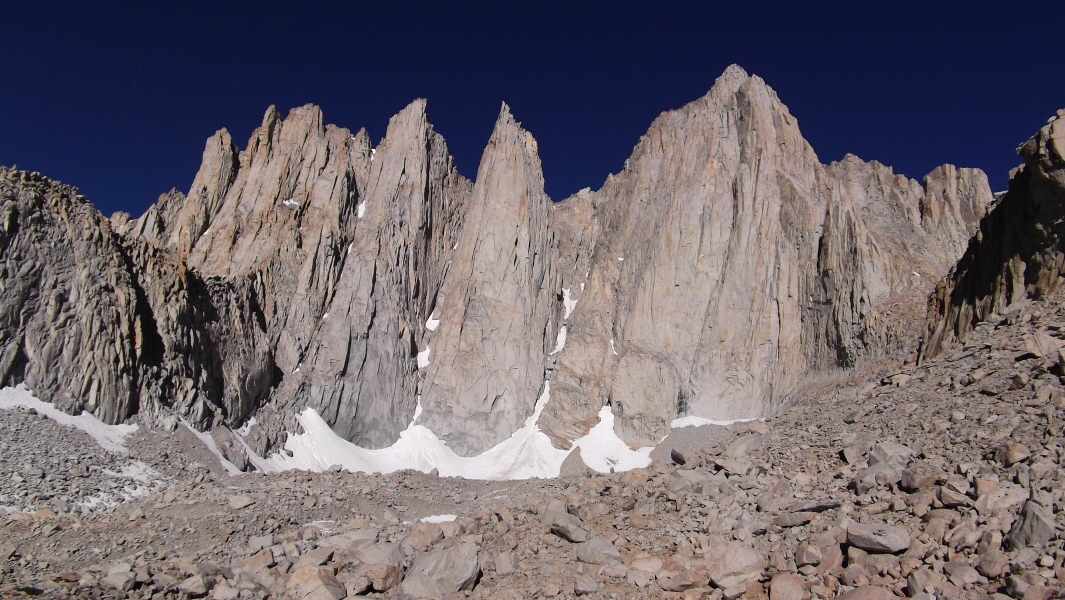
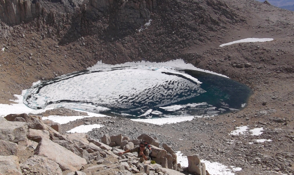
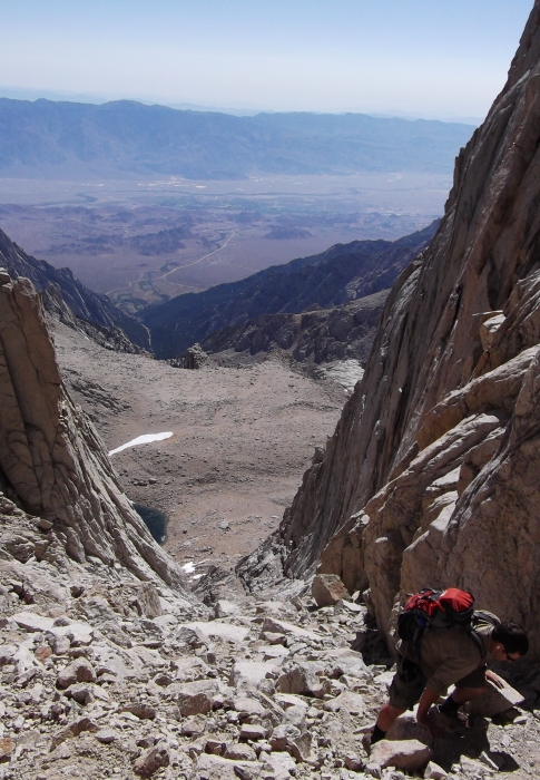
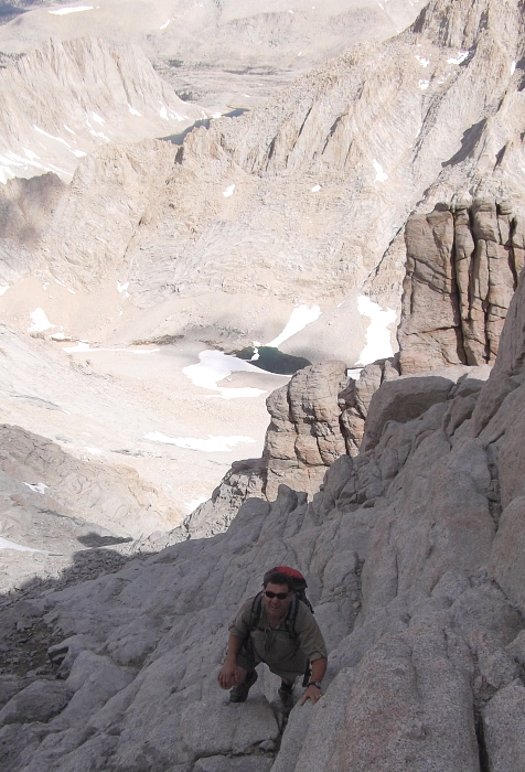
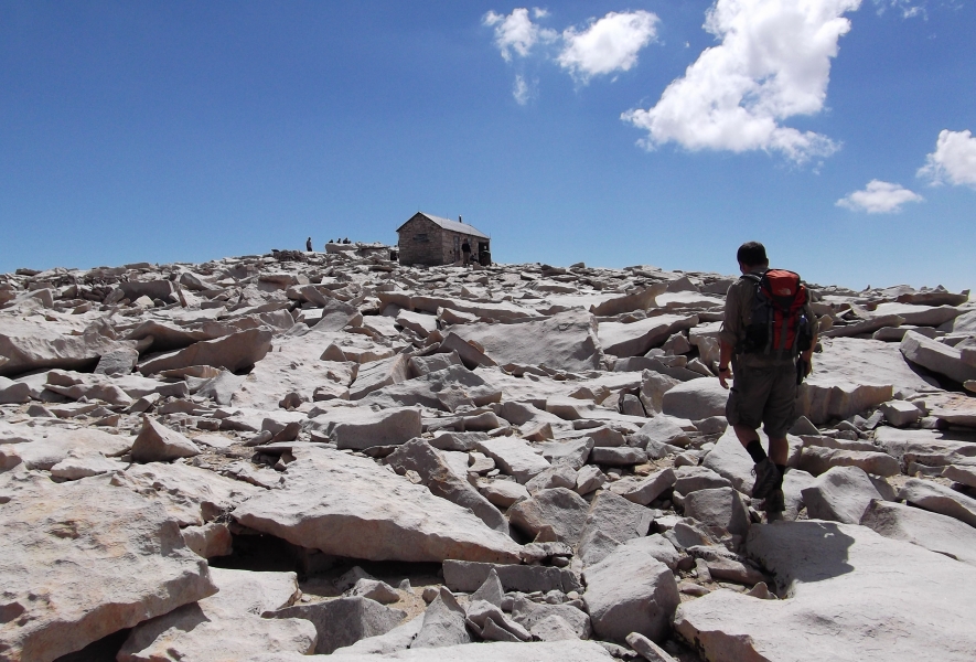
Once in the basin proper, Larry and I crossed the stream back left and followed the trail through brush and talus around the left side of Lower Boy Scout Lake (look for cairns). Skirting to the left of cliffs, the trail led up low-angled slabs for a bit followed by more brush to eventually deposit us near the outlet of upper Boy Scout Lake. From there the trail heads south, climbing steeply through slabs and talus near the right side of the basin. Eventually the trail turns west and slogs over seemingly endless moraines. High on the cliffs above to the right is a seep after which a gully system offers a path through a headwall to reach Iceberg Lake, the usual camp spot for eastern Whitney climbs. From Iceberg Lake we scampered up solid rock climber's left of the obvious gully and soon reached a bit of a notch with a ramp leading into the bowels of the coulior.
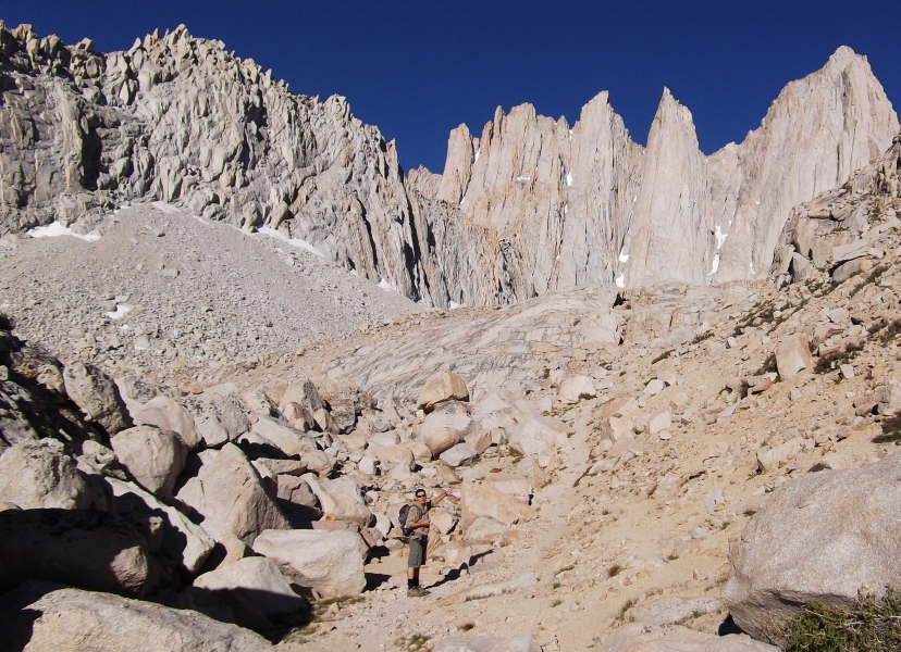
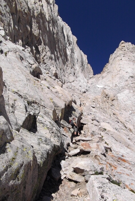
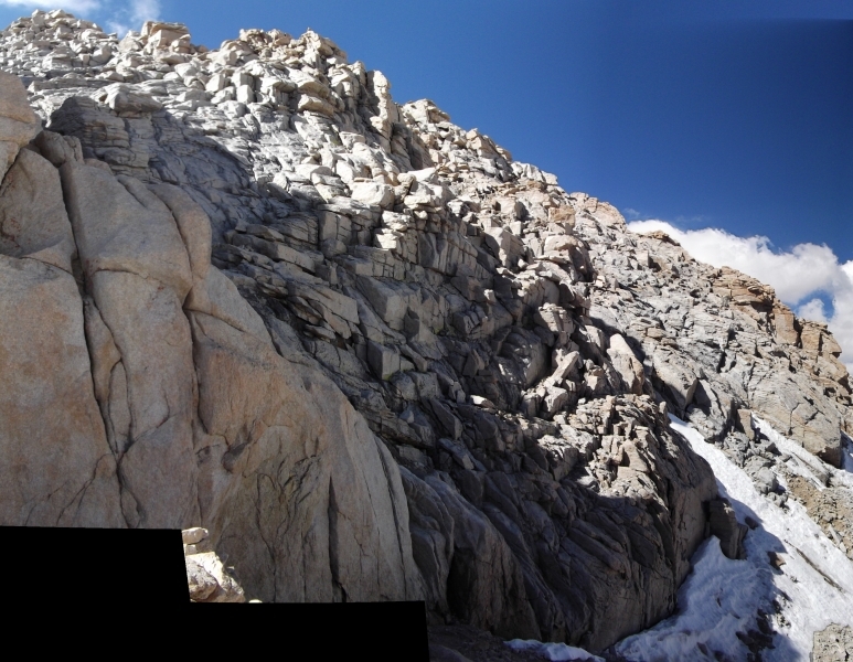
Once in the coulior proper the rock turned to total crap and we found ourselves flailing up a gravely two-steps-forward-one-step-back nightmare of a slope. This then was the order of the day until we reached the saddle atop the coulior. Traversing out from the saddle a short distance, we made our way up the first weakness in the wall to our left. There appear to be a number of ways to go here and snow coverage will certainly add a little more spice to what is otherwise a trivial scramble on dry rock. I had my ice axe and crampons with me but should have just left them in the car.
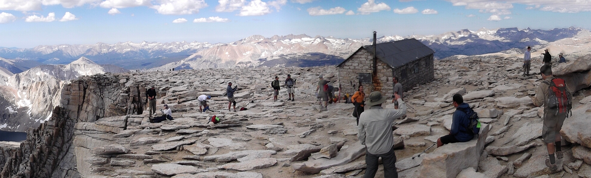
Continuing up the final pitch, we enjoyed some fun scrambling up slabs and then over and around large blocks after being forced right by firm snow and ice. This fun pitch ends rather abruptly at the broad summit plateau. A short walk to the east leads to the summit proper along with the Smithsonian Hut Shelter and a couple dozen Whitney Trail hikers milling about. No sooner did I come to a stop and set my pack down, than some 20-something woman loudly yelled "FUUUCK enter name of my former employer here." Ahh, the irony and such impeccable timing to boot! I love it!
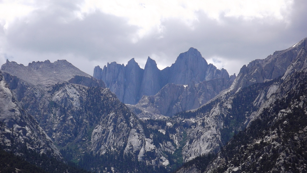
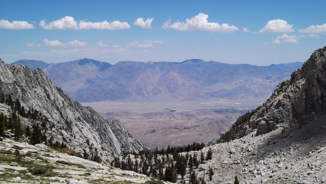
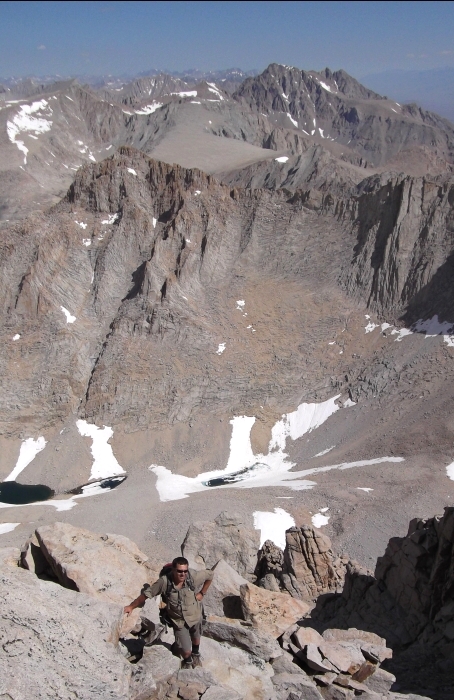
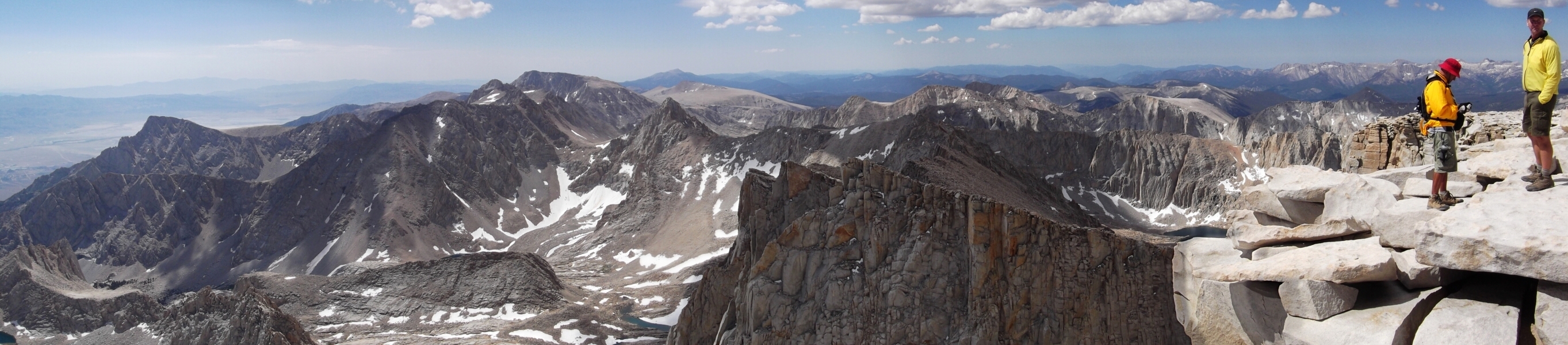
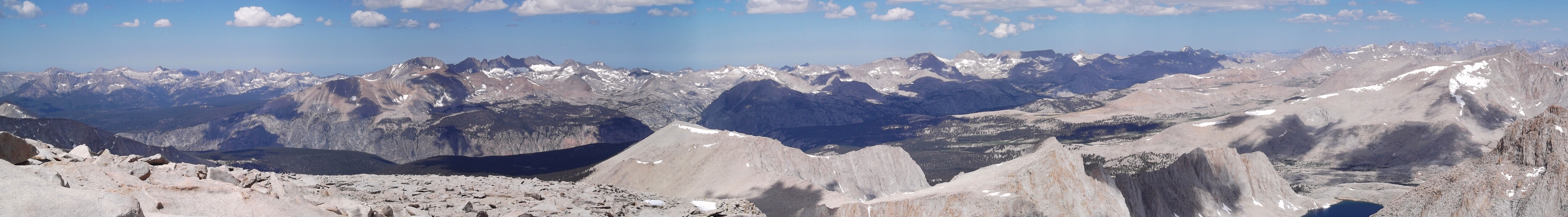
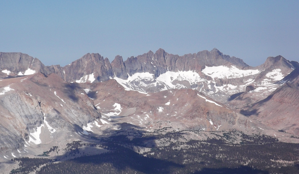
Mount Whitney repeat offender Larry claimed the best seat in the house, and dared me to do the same (I chickened out). Looking around, I found it remarkable how Whitney's dramatic eastern facade reveals nothing of its gentle western slopes. I can only imagine the relief in topping out to such a scene after a grueling climb of the East Buttress or East Face Direct. Looking south from the summit area, the Mount Whitney Trail traverses the basin at left and eventually wraps around to gain a wedge of dark colored rock. Yes, a LONG way indeed!
Larry and I didn't linger to too long on account of the forecasted afternoon thundershowers. The harmless little clouds that morning did indeed grow to frightful proportions and blacken the skies along the Eastern Sierra by late afternoon! The descent to Iceberg Lake and finally the trailhead was simple enough, save for my briefly getting disoriented on a couple occasions. You see, Larry was late for dinner with his wife and needed to hurry back down leaving me to hike out by myself at my significantly slower pace. No biggie I figured. It's a trail for the most part and it's not like I didn't hike it once already, right? But when I lost my way on the confounding Ebersbacher Ledges, I finally took note of how tricky the Mountaineer's approach can be, especially if one isn't paying attention (I apparently wasn't). I must say, however that it's easy to make a wrong turn here and on the evidence of foot traffic I wasn't the only one to go left when I should have gone right. There are cairns where you need 'em most, so keep your eye's peeled!
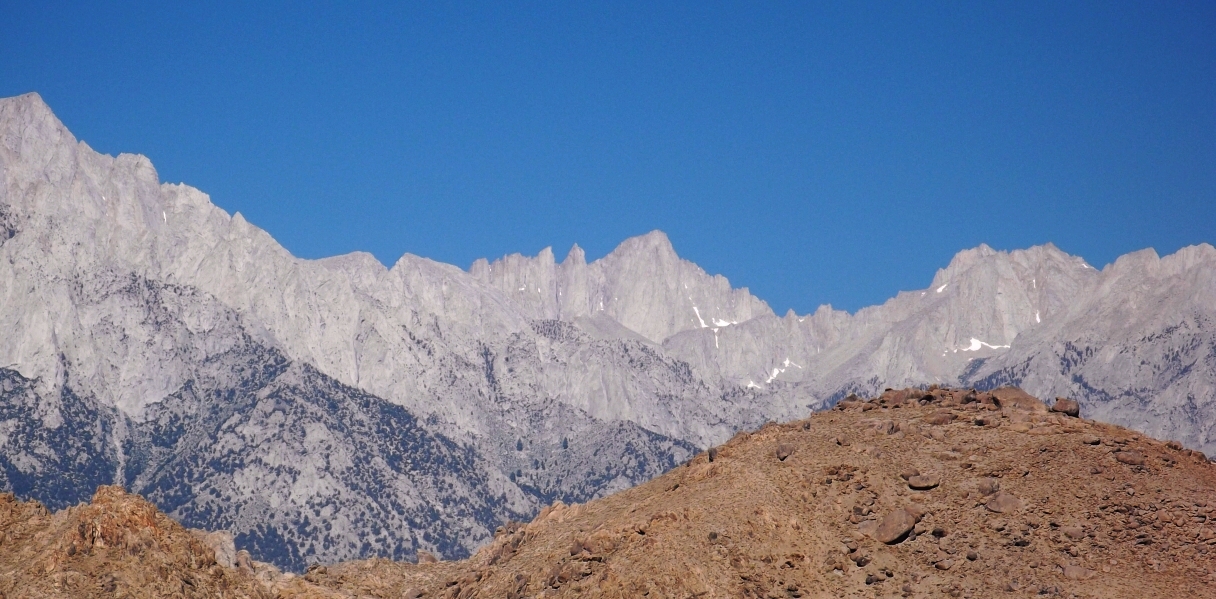
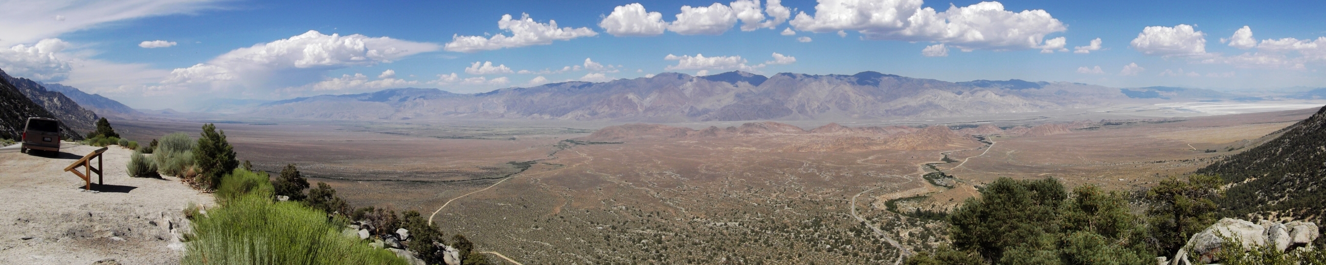
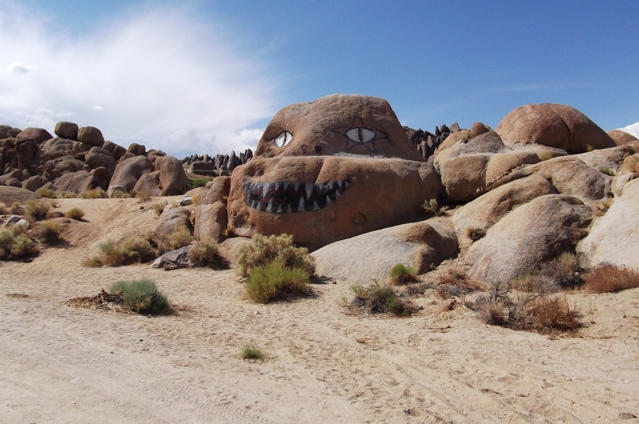
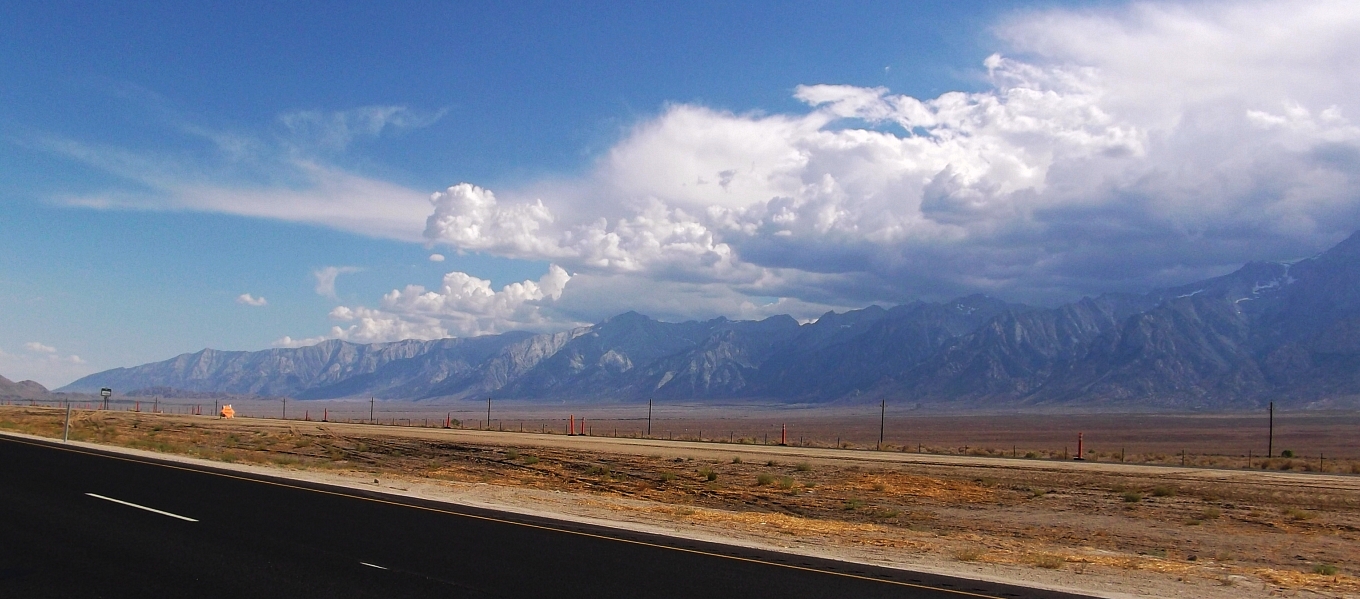
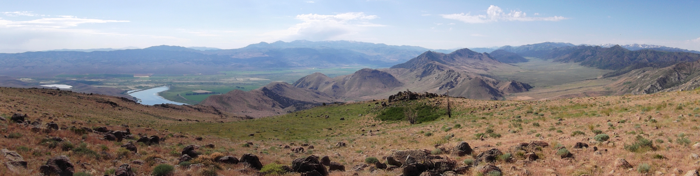
Driving back down from the campground, I momentarily lost myself in the sweeping vista overlooking the expansive Owens Valley. Flanked by the White Mountains and Inyo Mountain to the east and the Eastern Sierra to the west, this is truly an amazing place; so different from the mountain ranges I've grown accustomed to. The mountain peaks on either side rise to 14,000 feet in elevation, while the floor of the Owens Valley is at 4,000 feet, making the valley one of the deepest in the United States. And from these depths rise the Alabama Hills, which are well worth a visit in their own rite. While I failed to stop and visit the dozens of natural arches, it does appear as if Jabba The Hut calls the Alabamas home. You'll just have to go there yourself and see. Can't miss it!
And so my High Sierra trip had finally come to a successful conclusion. Bound by afternoon thunderstorms on either end, I managed over a weeks worth of adventure and personal discovery under perfectly sunny skies. I'd covered a lot of ground both behind the wheel and on foot in a relatively little amount of time, and greatly expanded my horizons in terms of exploring the mountain ranges of the West Coast. Granted, I barely scratched the surface of what the Sierra's have to offer, but as an introduction I don't think I could have asked for anything more. Either way, I had a lot of time to reflect on the prior week during the 17+-hour drive back to Seattle from Lone Pine.
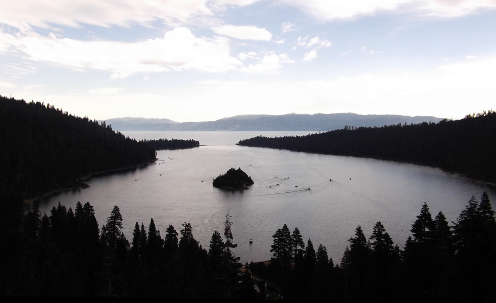
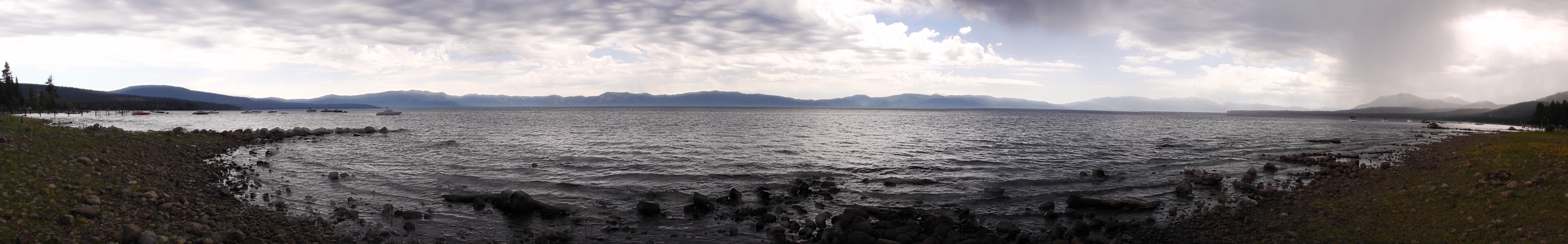
Rather than make a beeline for I-5, I took the scenic route north of Lee Vining, up and over Monitor Pass towards Lake Tahoe. Stopping to snap a couple photos at the overlook popular with legions of tourists, I quickly became mired in a traffic jam just as a soaking thunderstorm rolled through the area. The rest of the drive north and west on hwy89 via Lake Almanor, and finally reaching I-5 at Red Bluff was a blur of small country towns and windy mountain roads. After a good 12 hours of driving, I could no longer keep my eyes open and pulled into the only campground I could find alongside the interstate near Salem.
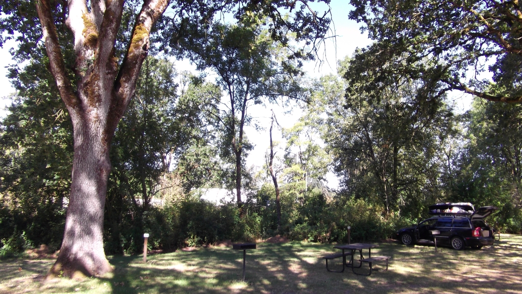
With only a thin barrier of bushes separating me from the semis thundering by on I-5 only a few yards away, this was easily the loudest campground I have ever spent the night in! Exhausted as I was thanks to the long drive and a week's worth of exertion, not to mention the satisfaction in having such a memorable trip under my belt, I took no notice of the traffic noise and slept like I haven't slept in weeks.
Click here to view photos.
![]()


