Last Updated: April 17, 2024


Start

Recent content updates are viewable under what's new.

Reports in the queue for posting are coming soon!

Upcoming reports & photos:

Oh my! Quite the backlog here...

  • American Mountain & Mount Lincoln - hike/snowshoe (May 2023)
  • Mount Mclean Attempt, Red Rock Trail, Dragons Back Trail - hike (May 2023)
  • Stawamus Chief (South, Middle & North) - hike/scramble (June 2023)
  • Flint & Feather - hike/scramble (June 2023)
  • Goat Ridge (Squamish) - hike (June 2023)
  • Grouty/Mortar Peaks - hike/scramble (June 2023)
  • Pebble-to-North Creek Traverse incl. Pebble, Thiassi, Wesley & Sugus - hike/scramble (July 2023)
  • Mount Truax - hike/scramble (July 2023)
  • Blackcomb Buttress - rock climb (July 2023)
  • Whitecap Peak - hike/scramble (July 2023)
  • Mount Hanover - hike/scramble (August 2023)
  • The "Long Traverse" incl. Long, Tynemouth, Arrowhead, Tabletop & Anemone - hike/scramble (August 2023)
  • Armchair Traverse - hike/scramble (August 2023)
  • Snowspider Mountain - hike/scramble (September 2023)
  • Mount Trorey - hike/scramble (September 2023)
  • Macleod Peak - hike/scramble (September 2023)
  • Ben Lomond - hike/scramble (September 2023)
  • Mount Killam & Gambier Island - hike (September 2023)
  • Lone Goat & Snow Camp Mountain - hike (September 2023)
  • Isollilock Peak - hike/scramble (October 2023)
  • Manson - Hatfield Traverse - hike/scramble (October 2023)
  • Gargoyles & Columnar Peak - hike/scramble (October 2023)
  • Opal Cone and Lava Glacier - hike (October 2023)
  • Park Butte (WA) - hike (October 2023)
  • Trappers Peak (WA) - hike/scramble (October 2023)
  • Rattlesnake Ledge (WA) - hike (November 2023)
  • Sauk Mountain (WA) - hike (November 2023)
  • Mount Daniel & Pender Hill (Sunshine Coast) - hike (November 2023)
  • Mount Dickerman (WA) - hike (November 2022)
  • Winter's End (Verona Peak) - hike/snowshoe (November 2023)
  • Dolomites (Italy) - snowboarding (December 2023)
  • Red Rock Canyon (NV) - hike (January 2024)
  • Flute & Oboe - split tour (February 2024)
  • Whistler misc. (Train Wreck, Loggers Lake, Shadow Lake etc.) - hike (February 2024)
  • Mount Underhill - hike (March 2024)
  • Bombtram Mountain - hike/snowshoe (March 2024)
  • Steep Peak - split tour (March 2024)
  • Ruby Mountain (WA) - hike/snowshoe (April 2024)
  • Blustry Mountain - hike (April 2024)
  • Sowerby Peak (Barr East) - hike (April 2024)

*As of 04/21/2024


Database

Query the reports database, selecting from criteria which include name, location, type, season etc.

Quick Links

Essential links & whatnot:


Jump To

Select from list below to jump to a specific area on this site.


| Featured Trip Report |


Last Updated: Jul. 10, 2006

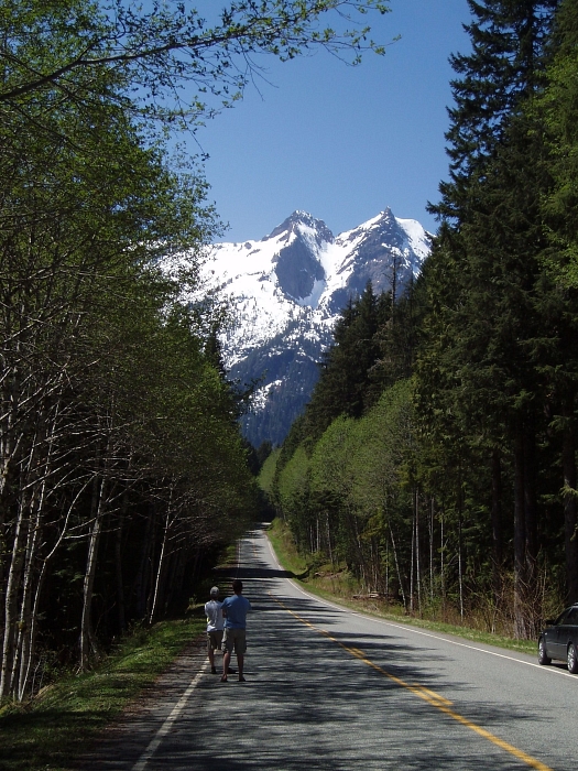
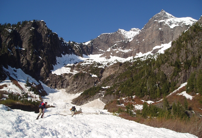
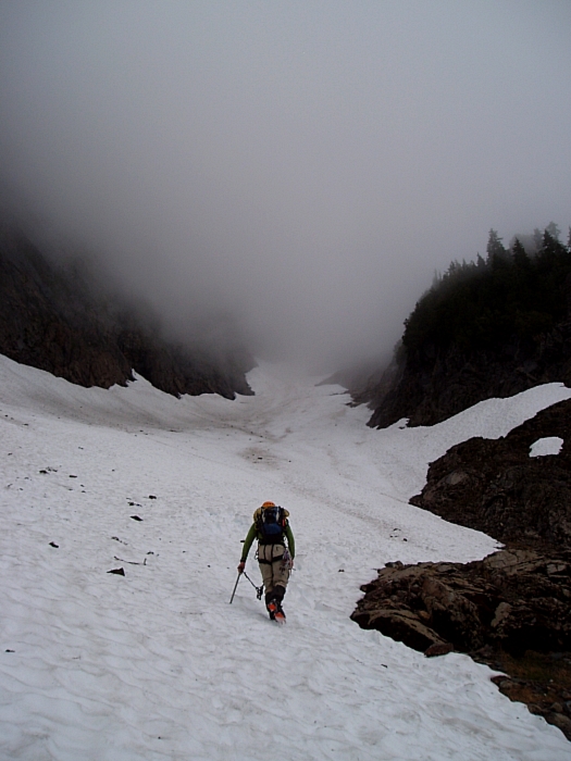
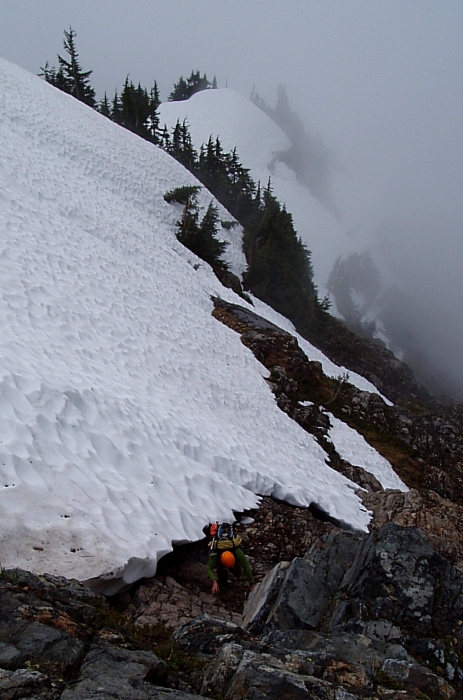
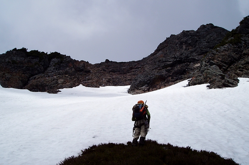
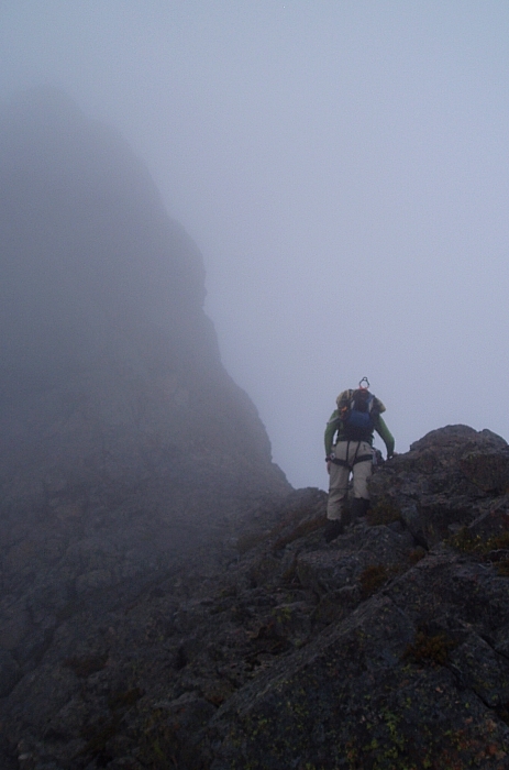
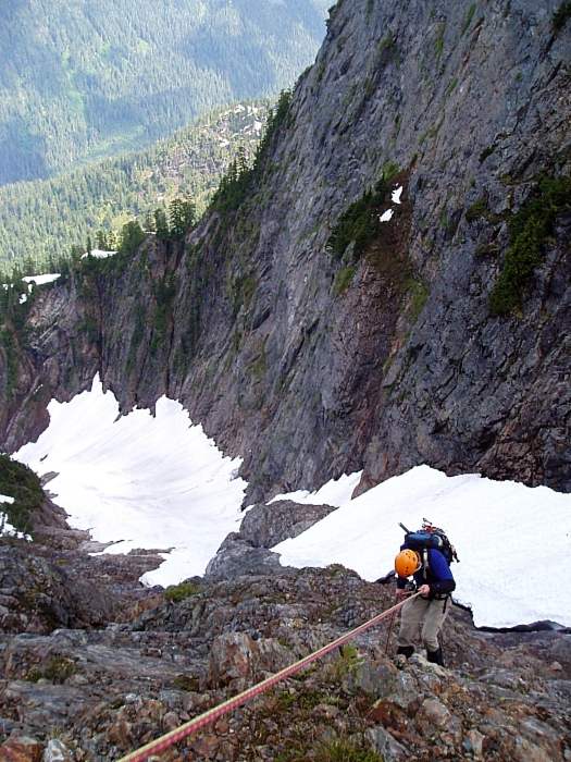
Big Four Mountain - Dry Creek Route (attempt), June 2006


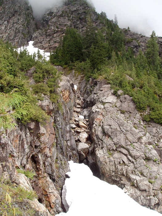
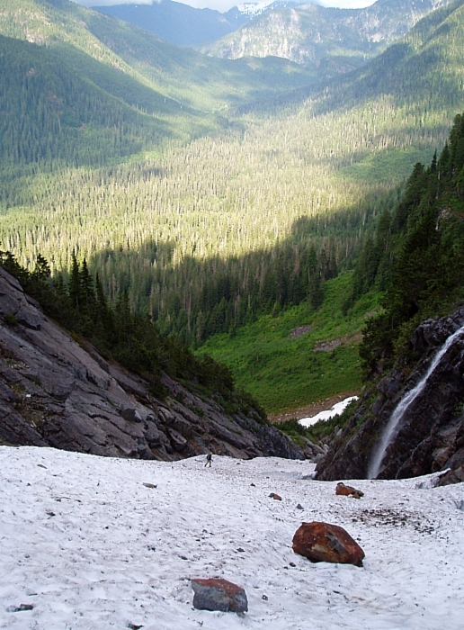
Big Four is well known around these parts for two reasons: the stupendous North Face and the ice caves at the foot of the North Face. The North Face is plainly visible from Mountain Loop Highway at several locations and from the viewpoint/picnic area near the highway. This face is 4,000 ft high. It rises like a palisade from the ice caves in a series of high-angle ribs and gullies. The ribs rise up to form five distinct nubs that look like brass knuckles. Indeed the symbolism is apt, for there is no easy way to the top of this peak and you might be punished for trying. Interestingly, the mountain does not take its name from the knuckles on its summit crest (there are five knuckles, not four). Instead, it apparently got its name from the giant "4-shaped" snowpatch on the East Face, which I've never seen. The peak is everywhere rugged. The easiest route is from the east (from Dry Creek). The North Face relents with difficult ice climb routes but it is generally avoided in summer (loose rock). The NE Ridge contains a hard rock route called the Tower Route.

The ice caves have been a tourist trap for years. An inn was even built at where the present Big Four viewpoint is located. The caves have melted back quite a bit over the years but they are still worthy of a visit (especially since the approach trail is short). What are the ice caves, then? Essentially, there is an avalanche debris cone that forms (or has formed over the centuries) at the base of the North Face. This cone is known as "Rucker's Glacier." Waterfalls plummeting down the face enter at the back of the cone and subsequently flow under it. The water eventually exits at the base of the cone in a series of streams. The combination of ground surface heating characteristics and airflow has excavated large tunnels under the base of the cone. To enter these tunnels is quite dangerous (people have been killed when caves collapse), but they are pretty interesting. People have been known to ice climb near the mouth of the caves or on isolated ice blocks nearby. Walking perpendicular to the caves, one might also encounter temperature variability in the breeze that flows out from the caves - warm, then cool, then warm again...much like the constructive/deconstructive sound wave effects of a good pair of stereophonic speakers. (more...)

Click here to view photos.
home | email | copyright

All photos and text for sverdina.com are copyright © 2002-2024

It would be very much appreciated if you please ask before copying and/or re-publishing content from any part of these pages. To do so, please click here to send a message via feedback form.

Thank You.

©2024 sverdina.com |