


Bugaboo Spire - Kain Route (South Ridge), August 2004

Dave and Michael's reports following their adventures in the Columbia Mountains during the summer of 2003 inspired me to make this road trip. Home to UNESCO World Heritage Site and Canada's first National Park - Banff National Park, I have long wanted to experience southeastern British Columbia for myself. Ironically, the suggestion to make the long journey, and tick off a few noteworthy peaks, sprang from Eric and me lamenting the poor weather forecast for the North Cascades (and elsewhere). "They (The Rockies) are well east of the crest", I recall mentioning to Eric, implying that the mountains lie in a rain shadow of sorts. With this skewed logic, we were quick to put our 4-day Luna/Fury climb on hold and went about making last-minute plans for a 5-day whirlwind tour of the Canadian Rockies. Our ambitious "power weekend" itinerary allowed for only one or two days worth of climbing in the Bugaboos. Time permitting; we'd enjoy a day of sightseeing in Yoho and Banff National Parks in The Rockies proper, and finally one last day of climbing in Glacier National Park. We'd be burning two entire days just driving there and returning to Seattle. A crash-course in classic Rocky Mountain weather, elation in success, frustration in failure, and a sense that our proverbial mountaineering "backyard" had expanded by some immeasurable amount followed.
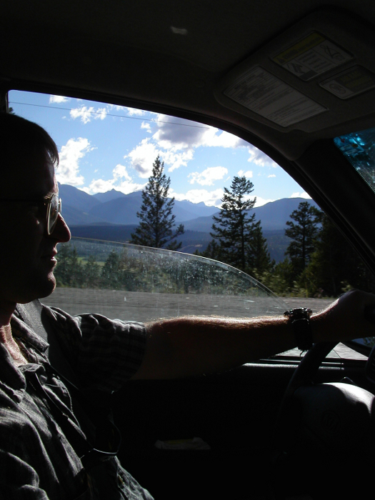
Figuring on about 8 hours of driving time from Seattle to reach the Bugaboo Provincial Park turnoff, and about 2 hours of hiking to reach the luxurious Kain Hut, we weren't in too terrible a hurry to leave town. Punctuated by thunderstorms and heavy rain, the otherwise monotonous drive east to Spokane did little to bolster our optimism for nicer weather up north. The drive north through Coeur d'Alene and Sandpoint, however, brought back fond memories of my many ski trips to Schweitzer Mountain as an undergrad at WSU. Near the border, the Kootenay River Valley, through which we were traveling, took on a different, broader, almost Rockies-like appearance, minus the rocky peaks. It would later dawn on me that these gentle, forested mountains make up the Selkirk Range foothills of the Columbia Mountains, culminating with the rugged and heavily glaciated peaks within Glacier National Park and beyond. For now, however, the Selkirks would have to wait, for we were headed for Cranbrook, the town at the headwaters of the Columbia River and gateway to the Purcell Range and Rocky Mountains.
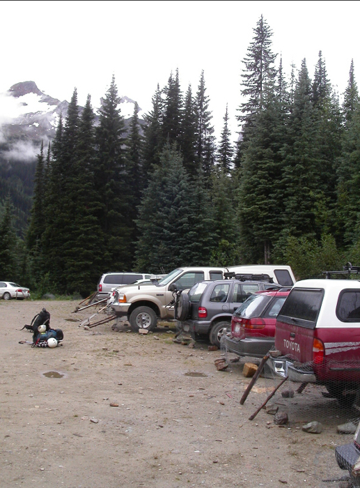
North from Cranbrook the road followed the north-flowing Columbia River for many sunny miles before the obscure Bugaboo Provincial Park turn-off at Brisco. We had been on the road for over 8 hours, and now had to endure about 40 kilometers of slow travel on a dirt road. The motivation to hike on up to the Kain Hut that evening was rapidly waning. After about 45 minutes we reached the final fork in the road and decided to check out the exclusive Canadian Mountain Holidays (CMH) lodge at the end of the left fork. Talk about fancy accommodations, not to mention the view from the front lawn of the Bugaboo Glacier spilling into the valley. Wow! But, where was everyone? With Eric intent on scoring a quick dinner here, we milled about the lodge grounds for a bit, and then walked inside. I reluctantly followed. Sure enough, the guests were all seated to dinner, but, as expected, a CMH employee politely informed us that we were not welcome. We agreed to leave, but managed to purchase a couple nice maps of the Provincial Park from the lodge gift shop. We drove back to the fork, turned left and continued on to the Conrad Kain Hut Trailhead parking area. We parked and began preparing freeze-dried treats for dinner.
Speaking with a couple old kooks camped out in a camper van a few cars down; we learned the legend of the brake-line chewing porcupines. Aha! So that would explain the chicken wire secured with rocks and sticks wrapped around lower half of all the cars we saw. How bizarre! I privately wondered if they would take to chewing on my ears if I slept out in the open that night. Just as I was preparing to crawl into my parking lot bivy, the first drops of rain began to fall. Yup, the goddam rain had caught up with us again. I jumped in Eric's tiny Kia and tried to find comfort in lying diagonally across the two front seats. Curled up in the back seat, Eric didn't look too awfully comfortable either. With a leg draped over the steering wheel and stick shift poking me in the ass, I settled in for a worthless night of cramping and snoring. So, this would be my introduction to the Canadian Rockies, eh? Occasionally, I would hear something rustling up against the chicken wire and figured it must be those damn porcupines trying to get at that tasty brake fluid. For a moment...only a brief moment, I was happy to be sleeping in the car.
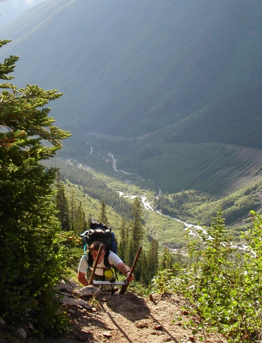
The 5am alarm rang, but, with clouds still hanging low in the valley, we had little incentive to get going. At 7am we peeked up at the sky again and saw small "sucker-holes" poking through. Good enough for us! Groggily, we got up, ate breakfast and prepared for the short but strenuous hike up to the Kain Hut. Within minutes, we caught the slower of the two retired medical doctors we spoke with at the parking lot the night before and together hiked the remaining distance to the hut. We learned of their Bugaboo Spire - NE Arete climb just a couple days earlier. They apparently had weather-induced difficulties with locating the proper descent route, rappelled down the wrong-side of the mountain and ultimately resorted to making a nerve-wracking descent via the NE Arete in the dark, returning to the hut sometime after midnight. Now, after a couple days of golfing and recuperating in nearby Radium, these two were back for more punishment...proof that there's life after age 60!
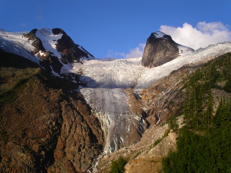
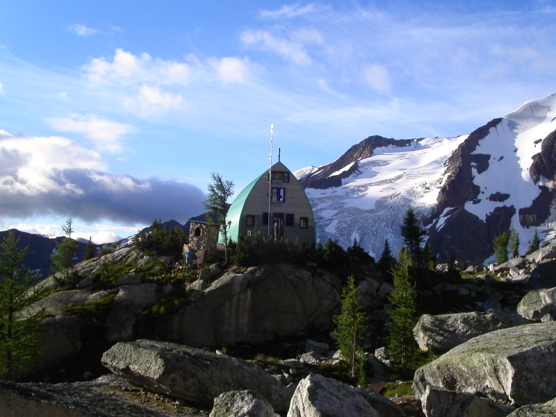
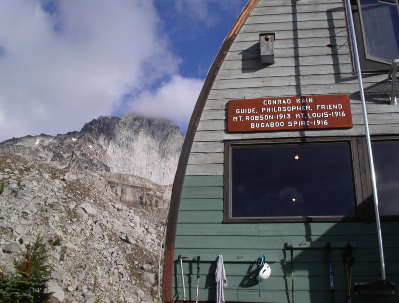
With stunning views of the Hound's Tooth and Marmolata Spire (any relation to the Dolomites' Marmolada?) rising out of the incredibly fractured Bugaboo Glacier, the hike to the Kain Hut takes longer than one might think. Once there, I was impressed by its size and amenities - hot, running water, electricity, gas stoves, gorgeous hut custodian...you get the picture. I even paid for a night's lodging by credit card ($15/person)! We dumped gear in the upstairs loft (no pads necessary) and stepped back outside to savor the morning sunshine. Eric smoked a cigarette while I gawked at the unfamiliar vistas.
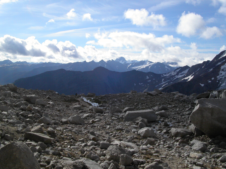
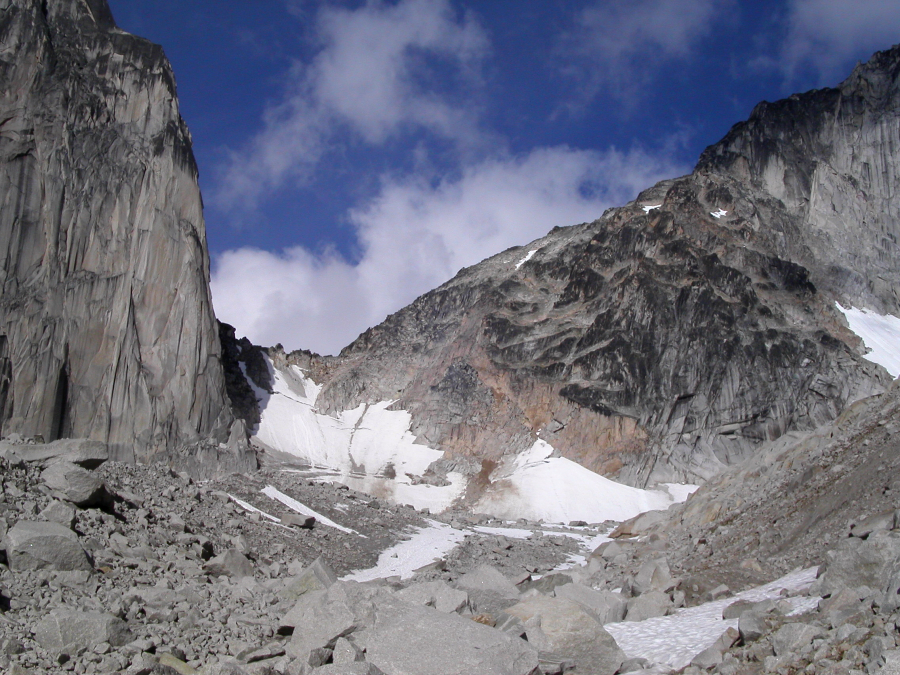
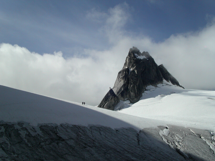
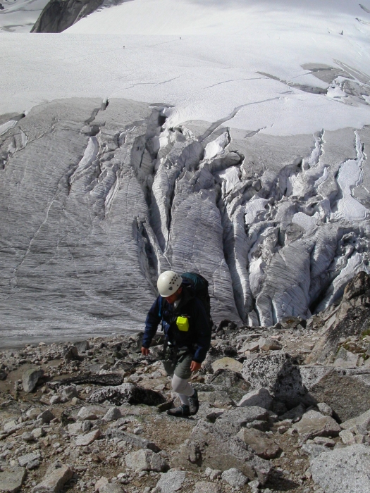
The snow slope climbing up to the col has been the scene of numerous fatalities in years past and so we proceeded with caution. Mindful of the constant threat of rock fall, we made haste climbing up through a crevassed section about halfway up (some low-angle glacier ice here), and proceeded to kick steps up 40-degree snow to the bergschrund. We easily passed the 'schrund on its extreme right and continued up, treading carefully on bits of verglas as the snow faded into mud and scree just below the col. At the col, we encountered another party preparing to make the glacier traverse out to climb Pigeon Spire's West Ridge. The faster of the two old farts from earlier had also caught up with us and started on his way over to a col below Snowpatch Spire's southeast corner. And so it came to be, that three separate parties would simultaneously radiate out from the col, each embarking on their own individual quest for granite heaven.
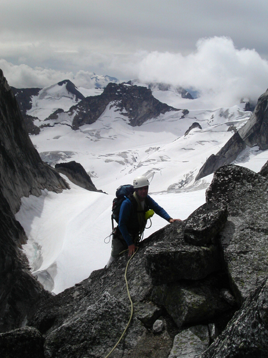
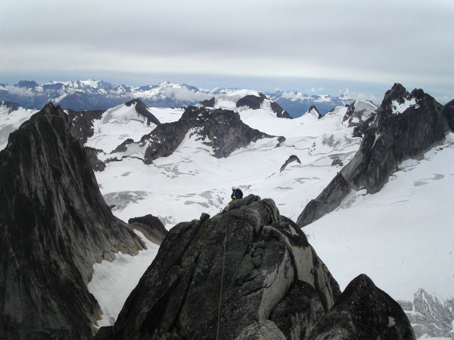
For Eric and I, the first half of Bugaboo Spire's South Ridge involved lots of third and fourth class scrambling. We roped up at some point where the rock looked to be getting steeper, but, as the climbing was still quite easy, we continued simulclimbing for a while longer. Staying on or near the ridge crest, we eventually reached the first "4th-class" chimney pitch described in the guidebook. With a belay, I led up the first of two consecutive chimneys to reach a flat pedestal w/ bolts/chains on the ridge crest (crux moves in second chimney felt more like mid-5th as far as I'm concerned). Near the short knife-edge portion of the ridge crest with Snowpatch Spire at left and Pigeon Spire at right.
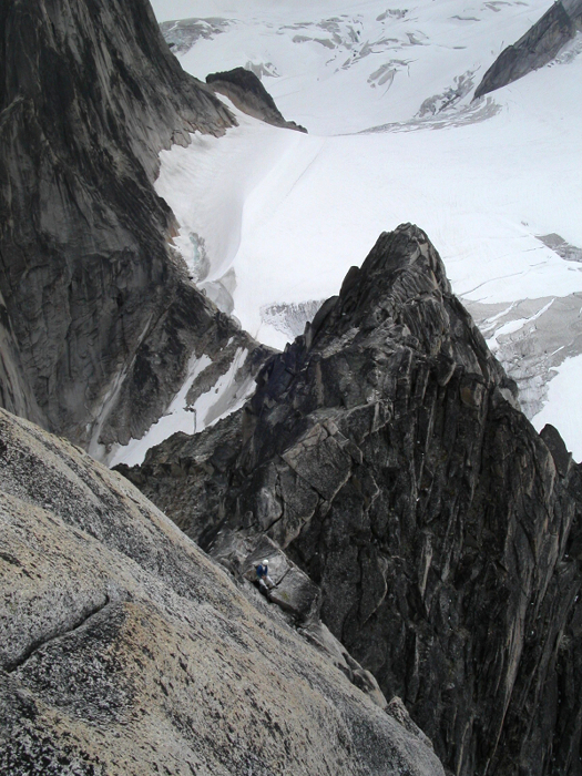
We then scrambled the near horizontal ridge crest to a good belay spot below the next steep step in the ridge. Though I may have been off-route here, I followed a small ledge/gully, then, aiding off a runner, made a few difficult moves up a short hand crack (no feet) just right of the crest to reach a comfortable belay block with bolts and chains. Struggling to second my route, Eric cleaned the few pieces that I had placed and worked to the left side of the belay block where I was standing for what he hoped was easier climbing. Tension ran high as Eric scratched his way up the short pitch. Adding to the drama, a loop of rope snagged below on the block.
For the next pitch, I followed up a groove just right of the crest, but immediately below the infamous gendarme to a large detached flake with bolts/chains of rap route at right. Once atop the flake, I turned left and climbed past fixed pins in diagonal cracks on the steep South Wall of the gendarme. An easy, but exposed (no pro.) friction-slab traverse across the west side of the gendarme led to a small horizontal crack just below a large, flat ledge. Another party had just finished-up their climb of the NE Arete and was threading the rope through the rap chains located on the backside of the gendarme as I scrambled onto the ledge.
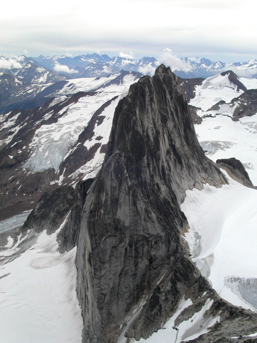
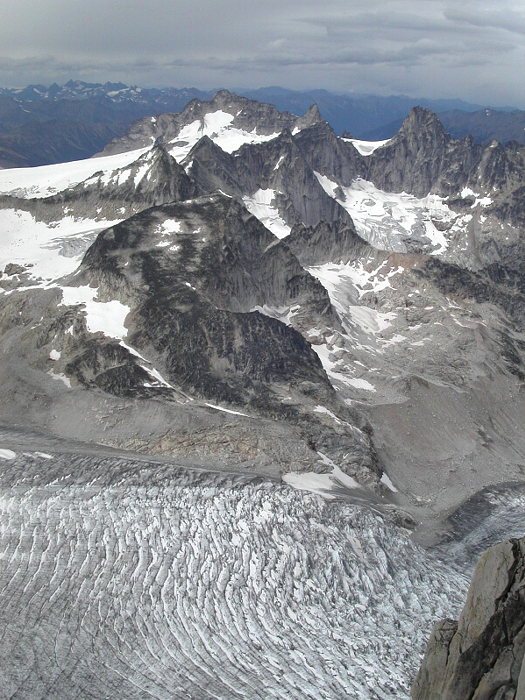
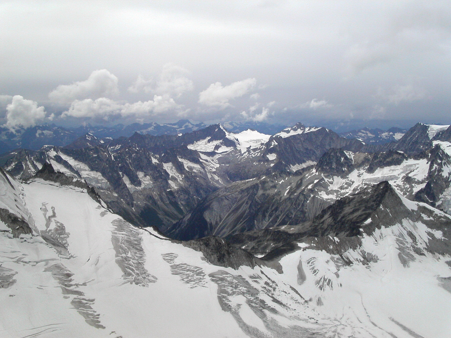
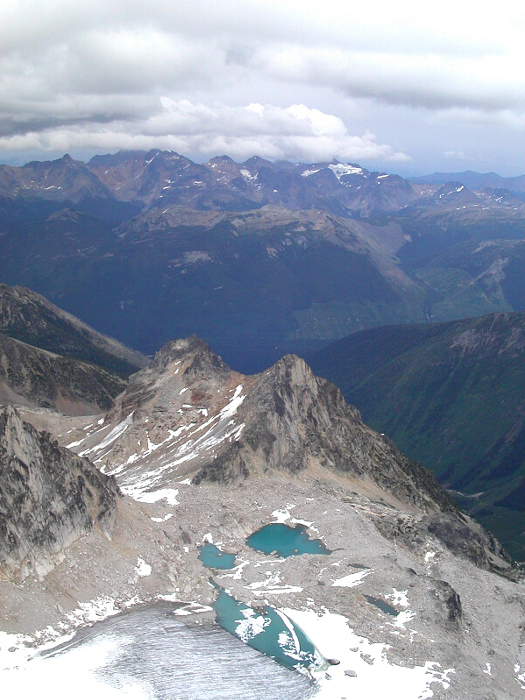
After belaying Eric up, we untied, dropped packs, and free-climbed the remaining pitch (4th - low 5th) to the summit. Deteriorating steadily during the course of the day, the weather now began to flurry. All hopes of attempting Pigeon Spire's West Ridge on this day had evaporated. It sure is a killer view from atop Bugaboo Spire though. What an awesome setting!
We carefully down-climbed from the summit, and, following the chains, made three rappels to near the horizontal portion of the ridge crest (a single 50m rope would suffice). Two more raps from the crest and we were back on easier terrain (one or two more additional raps are possible, though, not necessary). We scrambled back down the lower South Ridge, and wasted 15 - 20 minutes looking for my boots, which I had done an all-too-good of a job stashing away. Nearing the col, we could hear, though not see, the sixty-something party still climbing Snowpatch Spire, and wondered how much they were enjoying the drizzle that was now falling. With crampons on and facing into the slope, we carefully down-climbed from the Bugaboo - Snowpatch Col, and in the light rain, high-tailed it back to the hut, arriving sometime around 8pm.
While most everyone in the hut was going about the business of boiling pasta, fresh vegetables and other good vittles, Eric and I unenthusiastically settled for another freeze-dried dinner. Liberal amounts of our standard apres-climb beverage of choice, Canadian Club, made up for what was lacking. The sun went down, rainfall intensified and folks gradually disappeared upstairs for some sleep and an early start the next morning. The weather forecast, posted daily in the hut, however, did not look too promising. It was beginning to look as if the Kain Route would be all we would accomplish on this trip to the Bugs. With a marginal forecast on the day of our Bugaboo Spire climb, I s'pose we can be happy to have summited anything.
True to form, the Snowpatch Spire party finally staggered into hut around midnight. This time, the late start, and some route finding issues meant they would end-up reaching the summit just as it got dark. All that rapping in the dark and then having to down-climb in the rain by headlamp from the col....uhghh! I've really got to hand it to these guys...two back-to-back punishers in the Bugs, with some golf and spa treatment in between to make it all ok again. How many years till I retire again?
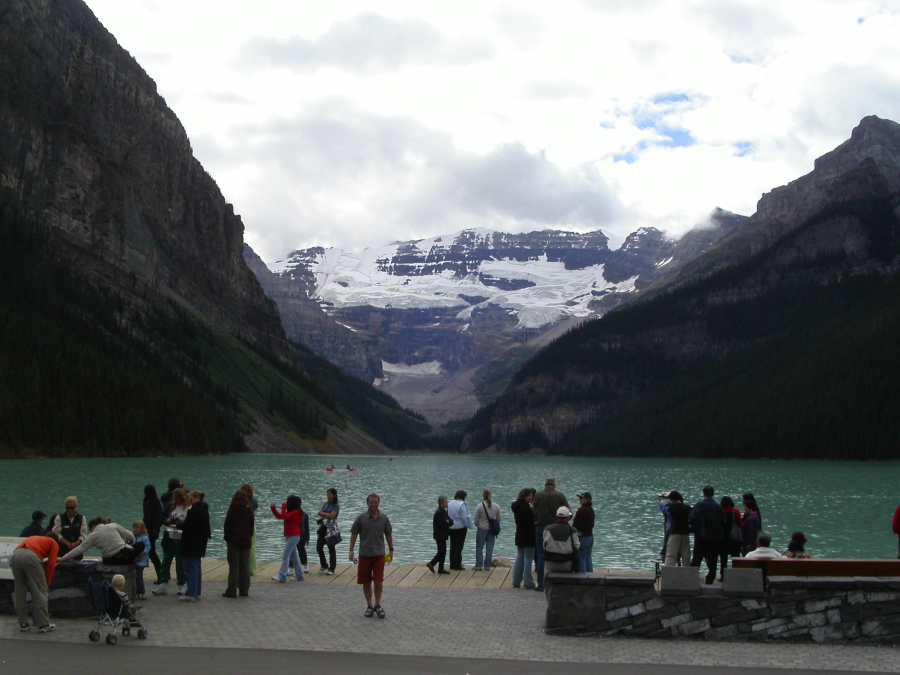
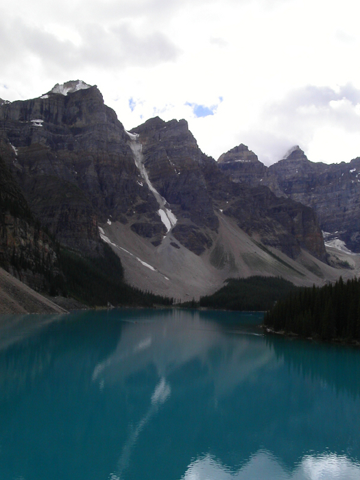
Morning brought more steady rain and long faces from parties who had hoped for better weather. It is apparently not uncommon for parties to wait in the hut for up to a week for decent weather. We packed up, said our goodbyes and returned to the car. It was still early, and with the crummy weather, decided we'd take a day off and join the rest of the tourons milling about at Lake Louise and Moraine Lake. The drive east through Yoho and Banff National Parks is impressive. The hanging glaciers and distant ice fields visible from the road are spectacular.
I wanted to continue driving north along the Ice Fields Parkway into Mt. Robson Provincial Park, but, it was time to turn back and poise ourselves for the next major objective - Mt. Sir Donald in Glacier National Park. Back in the town of Golden with Rogers Pass only about an hour away, the clouds still looked dark and moisture-laden. Would the sun make an appearance tomorrow? This nagging struggle with the weather was really getting old!
Click here to view photos.
![]()


