


Mount Catherine, April 2003

So, once again, Paul and I hatched plans for a ski/board tour up some peak in the Snoqualmie Pass area. We finally settled on climbing Lundin Peak after I failed to convince him to do Red Mountain instead (Paul rarely repeats climbs). Time permitting, however, Paul did agree to climb and ski Red Mountain after descending from the summit of Lundin Peak.
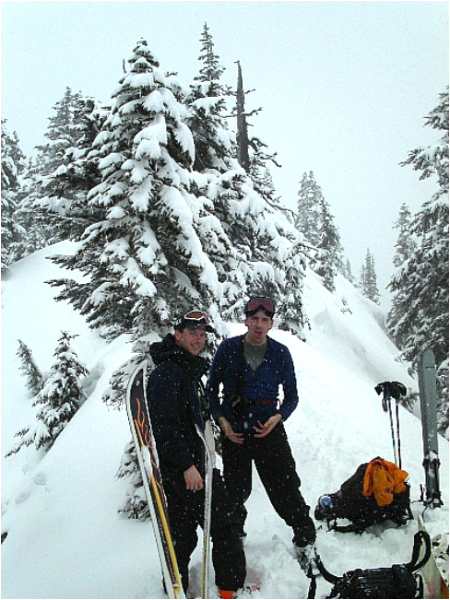
Anyway, Scott finally decided to grace us with his presence on this particular outing. After meeting and shuttling gear into my car at the Issaquah Park-n-Ride, the three of us were on our way up to The Pass. The poor visibility and pounding snowfall up at The Pass did little to motivate us to get out of the car. After some confusion in locating a public toilet and hesitation with where to park, we finally got all our gear together and began walking towards Alpental. No more than maybe ten yards from the car, I turned around and looking at Paul and Scott asked if they still felt like climbing Lundin Peak. A somewhat unenthusiastic "yeah" was the answer. Given the conditions, I knew we wouldn't reach the summit and though avalanche conditions were reportedly moderate, I didn't feel too comfortable hiking though the Commonwealth Basin en route to Lundin Peak with all the new snow that had accumulated. As an alternative, I suggested skiing/boarding Mount Catherine. Both Paul and Scott seemed interested. Armed with an objective we were all comfortable with, we piled back into my car and drove over to the Mount Hyak Ski Area.
With only some vague idea of where to park and begin the ascent to the base of Mount Catherine, we motored around the chalet community until we found a spot where we could park. I had no guarantees that my car would be there where I left it upon our return, but I conveniently parked directly off the main Hyak ski run (now closed for the season) about 300ft up from where the lifts start. Paul started trudging up the ski run on foot and with skis on his back (I forgot to bring skins for him) while Scott and I ascended the run on skis. Visibility was limited and it was flurrying; and yet, it wasn't exactly cold. We were thoroughly sweat-soaked by the time we reached the top of the ski run. We stopped for a rest there and had a bite to eat.
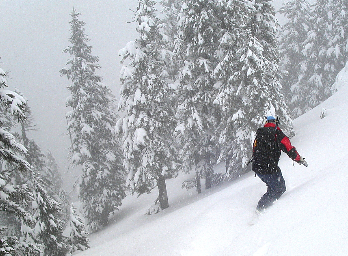
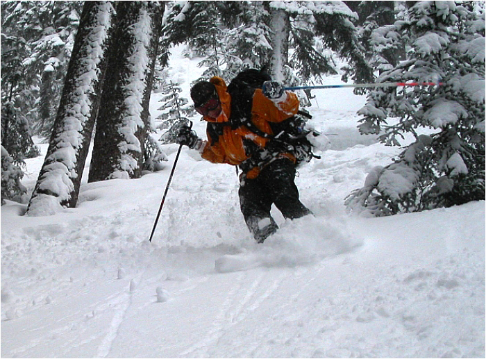
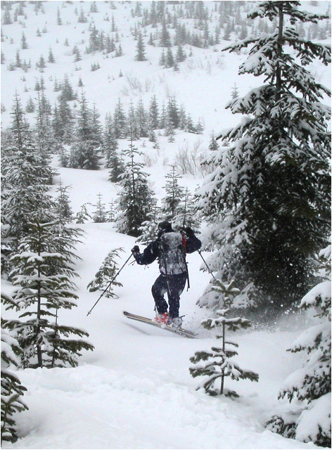
We skied an access road down the back-side of the Mount Hyak ski area and weaved through re-growth beneath an ancient and now unused (?) chair lift until we reached a stream crossing. After the creek we gained a logging road which turns out to be part of a network of roads popular among cross-country skiers. We turned right and followed the road for a few hunded yards before veering left up a sparsely timbered slope. We reached the shelter of the forest and stopped for another, longer break. The snow in the trees on this side of Mount Catherine was steeper and firmer and we decided to boot it from this point on. We alternated leads through the forest, kicking steps through increasingly deeper, drier, more sugary snow over terrain that started out quite gentle and steepened considerably near the summit ridge. I dropped in first from the summit and intentionally swung wide across the inital slope, cutting back hard and aiming for the trees, to avoid the large, dry slough that had released. This happened twice to me, but was no cause for concern. The snow conditions weren't particularly life threatening and I knew that once in the trees proper, the snow would stay put. Glades, gullies, tight lines between trees; Mount Catherine has some really fun and protected terrain that makes it a wise choice when avi conditions are too risky elsewhere.
On our return, we stayed on the road, crossed the stream by the bridge and made it back up to the Hyak ski area in no time at all. The freshiez that had accumulated on the ski run leading back down to where we had parked was an unexpected but pleasant grand finale to an already very enjoyable day of backcountry skiing/boarding. Best of all, my car was still there where I left it!
Click here to view photos.
![]()


