


Chimney Rock - East Face Direct, July 2004 (by Paul Klenke)
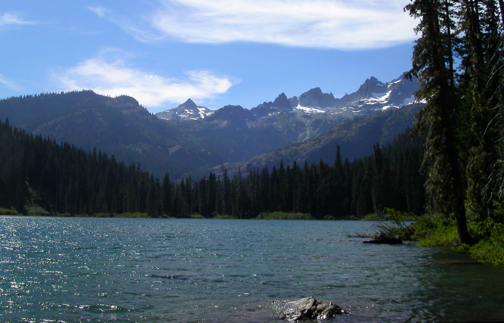
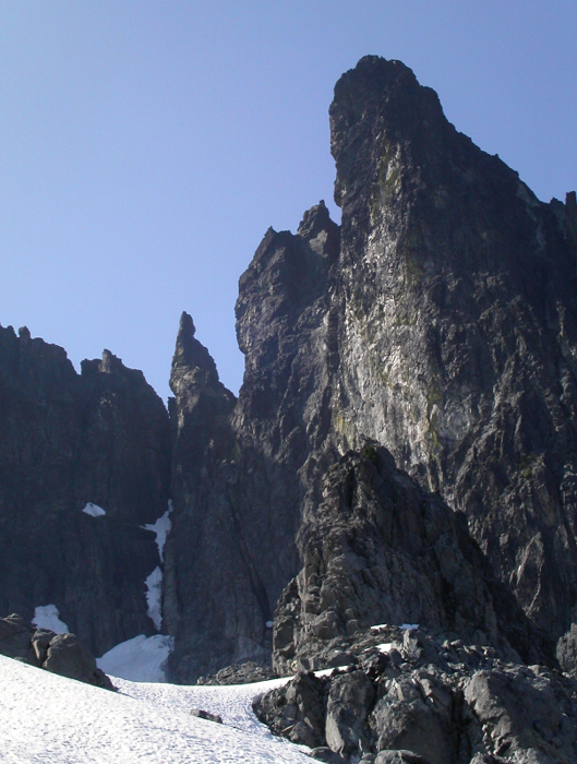
 as seen from the basin below Chimney Glacier.")
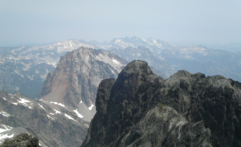
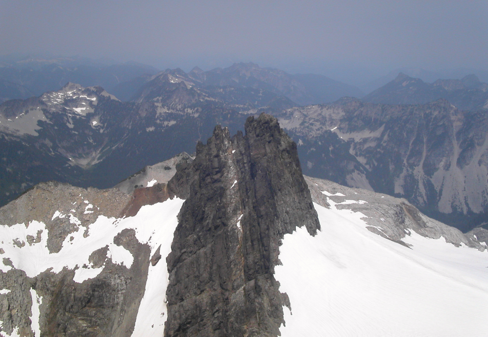
Sergio and I climbed Chimney Rock on a particularly smoky day in the Cascades. How fitting. Other than the reduction in distant viewing pleasure, though, the smoke didn't faze us. Besides, we were more concerned with sweeping our way up the Chimney than eyeing whatever notable peaks might be displaying their curvaceous features to us. As for Chimney Rock, it doesn't really have a curvaceous figure. More appropriately, its form is dominated by hard lines: vertical chimneys, tilted chimneys, diagonal ramps, and horizontal ledges. Sergio wondered if Chimney's name came from the many chimneys on its East Face. I figured the peak was named before the first ascent and therefore its name comes from its cylindrical towering form when viewed from a distance, particularly from the south (like from Three Queens).
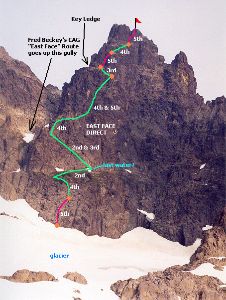
Our route of choice was the East Face Direct (EFD). All in all, from my technical alpine experiences, this route possessed similarities to Cutthroat Peak's South Buttress, Mt. Triumph's NE Ridge, and Mt. Goode's NE Buttress. As a side note, I'd like to point out that this route appears much easier than the "East Face" Route; that is, the route that goes up the big gully left of the face. This gully (couloir?) still had snow in it and the snow looked hella steep. Not my idea of fun climbing. The EFD starts out as technical mid-Class 5 but mostly eases to Class 4 in the intervening pitches before the Key Ledge which the East Face route comes to eventually. Really, the East Face Route is a misnomer. It should be called the East Gully Route or something like that to distinguish it from the East Face Direct, which, in a sense, ought to be called the East Face Route. Anyway, I'll confuse you no more and get on with our story...
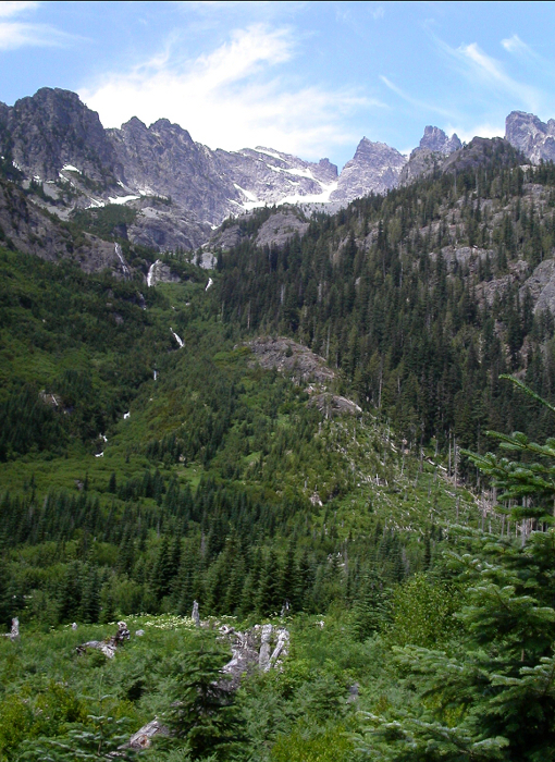
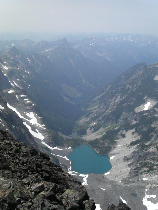
Sergio and I made a nice leisurely Mediterranean start from the Pete Lake Trailhead (2,800 ft) at 1:30PM. It is 4 miles to Pete Lake (2,980 ft). Yes, that's right, you gain a whopping 180 ft in 4 miles. I think I speak for all of us when I say "flat trails suck!" At a nice brisk pace we were at the lake in 1 hour, 15 minutes. We took a short break at the lake and were swayed into departing when one of the campers there decided to strip down to his underwear. I sure was glad he wasn't some nut job, just a guy who wanted to bathe in the lake. In another hour-and-a-half or so we found ourselves at the end of the maintained trail in the avalanche swathe. This time Sergio identified the PCT switchback in the swathe. You have to be observant. If you're looking the wrong way, you'll miss it. From this point, we could look left to see waterfalls coming down from a hanging basin. That basin was our objective. Because Sergio had been up there with Eric Hoffman on July 17 in a failed bid for Chimney (they realized they had bit off more than they could chew before they even began chewing), he knew the route up the forested slope right of the waterfalls. There was actually a fairly nice climber's path at times. At other times, the path was obscured by brush. In that event, the plethora of pink flagging helped. We arrived at the basin (c. 4,600 ft) in 4.5 hours, not bad for two 30-year-olds. Even the wasp sting on the back of my ankle didn't bother me.
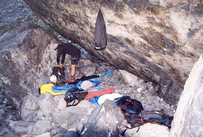
The bivy we selected was one of the bestest in the Northwestest. In the middle of the rocky basin is a gargantuan boulder the size of a one-car garage. Three bivy sites are situated around this boulder. The first one up for consideration was on the boulder's north side but it was too windy (katabatic winds from the glacier). The second one on the south side of the boulder was better, but when Sergio found the third choice while scouting for a cooking area, our minds had finally been made up. Beneath the overhanging south side of the boulder is space enough for two bivy sacks. Luxury. While we sat there with bellies full of vienna sausage, Canadian Club, and dehydrated heaven, we enjoyed the views to the southeast. Two EA-6B Prowlers strafed our position. Well, actually they just flew by at high speed. Often you'll hear them but not see them. This must be about the fifth time I've seen them in the Cascades.
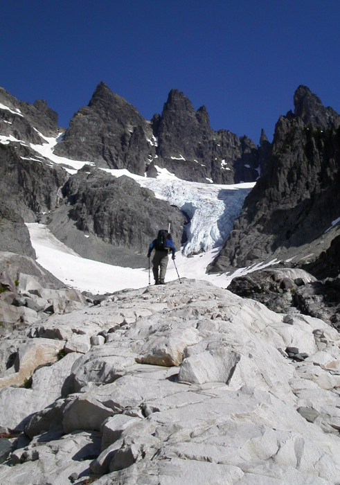
The next morning we had trouble getting up at 4:30AM, so we got up groggily at 5:00AM instead. Powdered coffee was brewed. We didn't get started until 6:30AM due to those "morning personal requirements." Based on info from Tod Bloxham, we chose to avoid the routes to the upper glacier that go up next to the icefall or farther left. Instead, we chose Tod's route up the ridge on the east. You can mount this ridge rather close to camp (Class 2) then follow it up a stream course then eventually around the corner to the east-facing snow basin east of the icefall. As it turns out, this was a good choice compared to the far-left route, for all throughout the day but especially at the moment we wound have been climbing up it, a huge slab of snow sloughed off the rocks on the left and tumbled down the lower glacier n?v?. We would have been clobbered, or had a hard time playing dodgeball with the many careening snow blocks (Photo of Eric Hoffman taken during previous attempt).
We could have descended into the east-facing basin about 400 vertical then turned left. This seemed like too much elevation loss, so we instead followed the ridge up to the left. A notch in the ridge provided a temporary impasse but we were able to get into it and up the other side by descending down to a mid-sized tree on the south side then up 20 feet of gully to the notch. Once on the other side, a few hundred more yards of ridge climbing got us to the point where we could effectively leave the ridge to make way for the glacier. The snow was hard so we put on aluminum crampons and descended around a buttress then up to the saddle that separates the east-facing basin and the upper glacier (the glacier mainly flows south). I stopped for an interminably slow Nalgene fill-up on a melting snow overhang and thereby wasted 20 minutes. But the water was necessary for later.
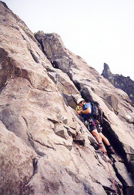
Once I got to the saddle Sergio was pretty much already to the base of the East Face (c. 6,600 ft). As he clambered up to the moat and stepped onto rock, I hied along as fast as I could to catch up. Fortunately, the glacier was not heavily crevassed for this traverse. By 8:30AM we were both at the base of the route geared up and ready to go. Sergio led out. He aimed for the pink runner hanging in a dihedral above. He didn't find the climbing directly above this runner to his liking so worked left to an open book. Setting two pieces here, he went up and then traversed back right to an end in the rope and belayed me up. We rated this pitch mostly low-5th but the first moves of the rightward traverse were the crux (est. 5.6).
From the belay, I took the lead on Class 4 and we soon found ourselves on the grassy ledge (Class 2). We walked the ledge rightward to the ramp diagonalling back up and left. Sergio was able to refill his camelbak here. The ramp was Class 2 but I slung a horn anyway merely because it was primed for it. The ramp ended at a shear drop-off to the East Gully. Our route would continue to the right of the corner. I continued leading out in a running belay. It was mostly Class 4 but there weren't many cracks or horns with which to protect oneself. This lack of protection made things all the more interesting when I found myself among Class 5 terrain on a number of occasions. As is my style of leading, I have a tendency to look around when I should just climb.
I went left then right then back left to my original position, all this while Sergio nervously waited for me to do something. He didn't like where he was. And the set protection between us was suspect--as in, there wasn't any. I kept going up and eventually came upon the Key Ledge about 40 feet right of its right end. I think we may have climbed up slightly right of the normal route, but all the rock is the same through here, so you could choose any number of variations. From the right side of the Key Ledge, another, thinner ledge descends and narrows as it bears northward along the face. Based on the featurelessness of the headwall above this thin ledge, we pretty much figured we needed to go left to the big Key Ledge.
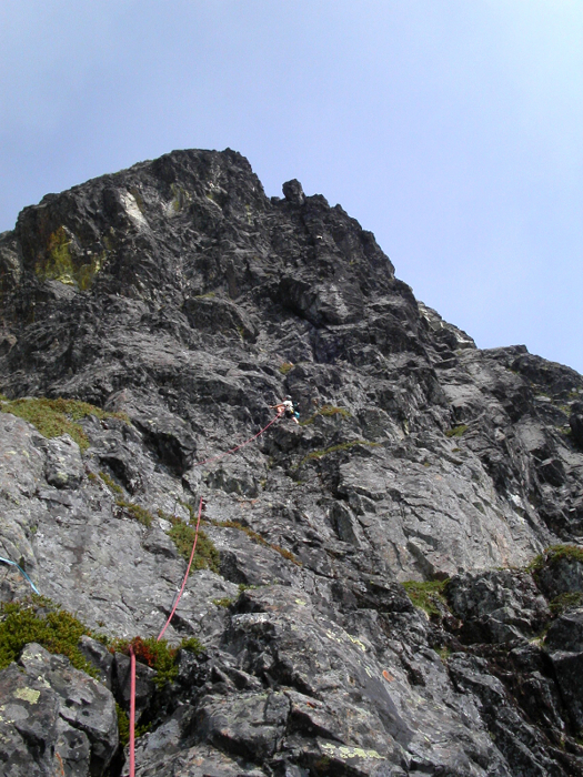
Sergio then took the lead. An obvious chimney provided the next pitch. At its middle was a bouldery bulge that comprised the crux (5.4). When the rope began to run out Sergio wanted to know how much rope was left but I couldn't understand him. The echo of our voices coming off the impressive South Face of the Northeast Peak made it impossible for us to effectively communicate. It was one of those "okay, he's pulling up the rope so he must be setting up a belay" routines. Eventually I followed and got to his anchor. I said that that pitch wasn't much; that he should lead the next pitch too. We needed to traverse right and slightly up for the next pitch. Sergio went and quickly had me follow. He had come to two chimney's with a small ledge running across their bases. Which chimney is the correct chimney? Which tower above is the summit tower? There was supposed to be a narrow off-width chimney with a chockstone in it. Hmmm, no sign of that. The right chimney looked too narrow for our tastes. The left one looked much more amenable to rock climbing. Moreover, by reading a few trip reports we had available, we figured that the middle tower between the chimneys was most probably the summit. Even so, we weren't certain.
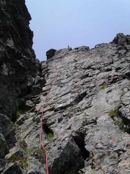
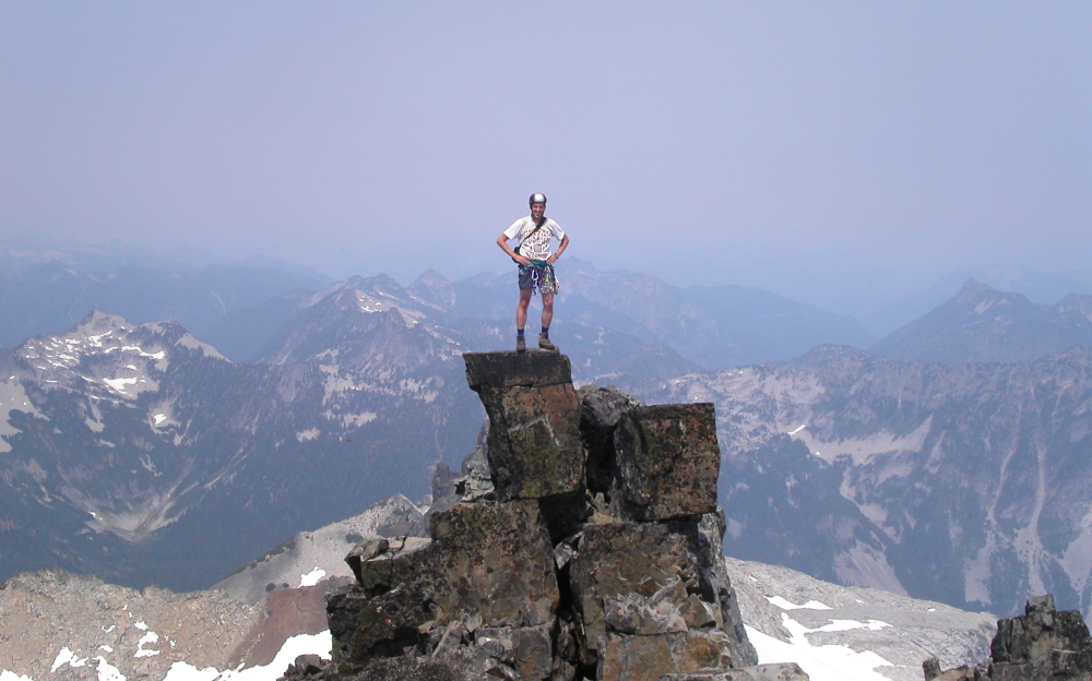
Sergio let me lead this pitch (the left chimney). It would be the final pitch. The chimney was not hard for the first half. However, the second half gets absorbed into a deep cleft (a vertical cave). It would have been folly to climb into there so I worked right onto the final groove/face. As I climbed up to an overhanging jumble of blocks I still didn't know if this was the high point. The crag to the left had that look of being the highest. Anyway, for fun, I climbed up through the overhanging jumble (5.6 but circumventable). Moments later it became obvious I was on the summit (7,727 ft): nothing was higher than me. I set up a belay and brought up Sergio. I positioned myself so I could witness him grunt and groan his way past the overhang. It was 12:50PM (6 hours and 20 minutes from camp). We belayed 3 pitches, running-belayed 3 pitches, and simul-climbed the rest on the easy ledges.
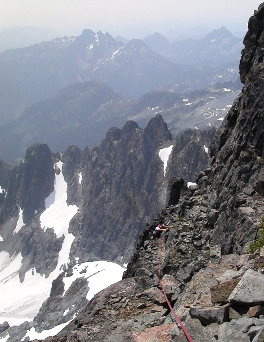
While I took in the smoky views (or lack thereof), Sergio called his wife to revise his estimate of when he'd be home since the spectre of a long afternoon's worth of rappelling loomed before us (we had one trip report stating 13 rappels!). As it turns out, we would only have to do 8 rappels (on a 60m rope) to get back to snow. There were plenty of rap stations at our disposal but we downclimbed wherever we safely could. It took just over two hours to do the rappelling and downclimbing. It took almost another two hours to get back to camp. I don't care how speedy you are on open ground; moraine-like rocky terrain is hard to negotiate. You have to be careful with each step on talus because the rocks might move. If you choose the scree path, you have to watch out for that ball-bearings-on-linoleum action.
We were back at our big boulder bivy at around 6:00PM. There we witnessed another jet fly by: this time an F-15E! We left camp at 6:30PM and by 7:30PM were back at the PCT. With the mosquitoes orbiting us incessantly, we tried to go faster than they could fly. But it seems some mosquitoes are lucky enough to get inside a hiker's slipstream boundary layer and subsequently onto your skin and subsequently into your skin and subsequently into your blood. But if the bugger doesn't do its thing quick and get out quick (do they ever?), they run the risk of being smashed. For Sergio, the skeeters preferred his biceps. For me, they preferred my wrists. Sergio and I preferred neither. All we preferred during that long arduous trek out on boring flat trail was Samuel Adams Boston Lager and Gatorade. 3.5 hours out from camp. Back at the trail at 10:00PM. Back home to Seattle after midnight.
Click here to view photos.
![]()


