


Clark Mountain - Walrus Glacier (Attemp), June 2003

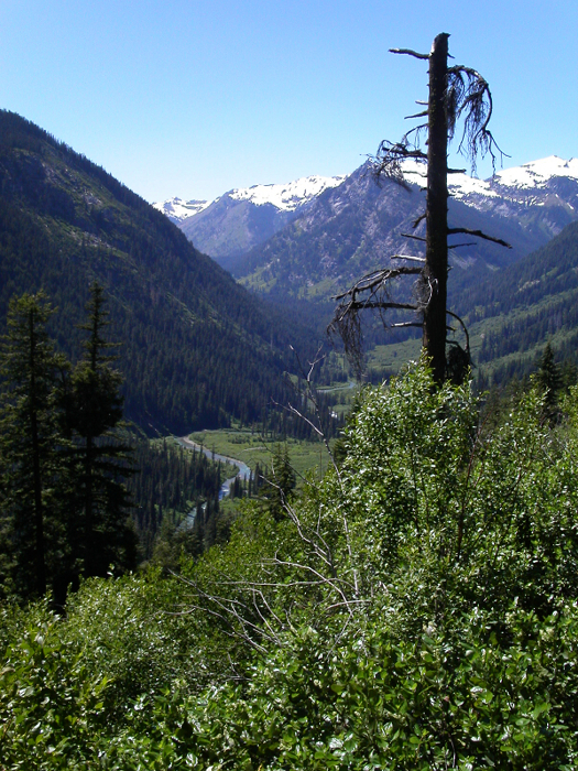
After having climbed Mount Baker's North Ridge the previous weekend, I wanted to climb something a little less involved but still interesting. Clark Mountain satisfied this requirement. I had spied the peaks of the Dakobed Range from various other summits over the years (Mt. Maude, Seven Fingered Jack and Chiwawa Mountain, for example) and promised myself that I'd visit the area someday. Scott and I ambitiously settled on Clark as a day trip with a trailhead bivy the night before. We headed east on US-2 (Stevens Pass) to the Lake Wenatchee turn-off (Coles Corner, about 20 miles east of Stevens Pass). We turned north onto Lake Wenatchee River Rd (SR 207); bearing left after crossing Wenatchee River and proceeding west along the north shore of the lake, passing the Lake Wenatchee Ranger Station. About 1.5 miles after the ranger station, we turned right onto the White River Road (FS 6400). We followed this road for about 11 miles to where it ends at the White River Trailhead.
Scott folded the rear seats down in his Legacy wagon, and we tried to get some quick sleep before our 3:30am wakeup time. Our one-day ascent was dictated by my having to be back in Seattle by 9pm the same day. With over 10 miles to reach Boulder Pass (near glacier's edge) we had a big day ahead of us. To help speed things along (albeit illegally), Scott and I brought our bikes for the four miles of the mostly flat White River Trail. We hopped on our bikes and cruised easily along the White River Trail. It was little after 4am. Seldom did we have to get off and push our bikes. The trail, however, was covered in bear scat; a detail I will pay more attention to in the future. We reached the junction with the Boulder Creek Trail in less than 45 minutes. Bikes stashed, it is here that I would make a navigational blunder. Knowing that the approach entails at least one creek ford, I ignored the obvious and stupidly assumed that we had to cross the White River.
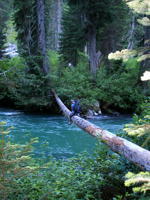
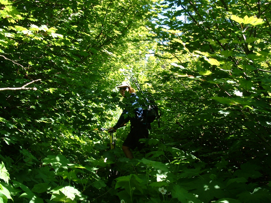
Wearing sandals, I attempted to cross the fast-moving and breathtakingly frigid waters of the river. A few feet across, I encountered thigh-deep water and a frightfully strong current. I spied a log crossing upriver and returned to the river bank. Scott was already inching his way across the log when I arrived. It was too small to cross on foot, so we scooted along on our butts. The rough bark was particularly pleasant against the inner thigh, while troublesome branch stumps helped ratchet up the difficulty rating. Iâm aware of the bushwhack rating system, but is there such a thing as a log crossing rating? If so, this one was easily LC3+ or LC4 even (LC5 being the most difficult). Once on the other side of the river, Scott and I struggled to locate the "trail". We bushwhacked uphill for about 700ft, following what we later realized were faint game trails. Something just didn't make sense. "The trail can't be that hard to find," I suggested to Scott. We stopped to look at a map and read a route description. The mosquitoes swarmed. It then hit me like a freight train. We were on the WRONG side of the river! I immediately lost all hope of making it to the summit and back within our time window. How infuriating! Back down we go.
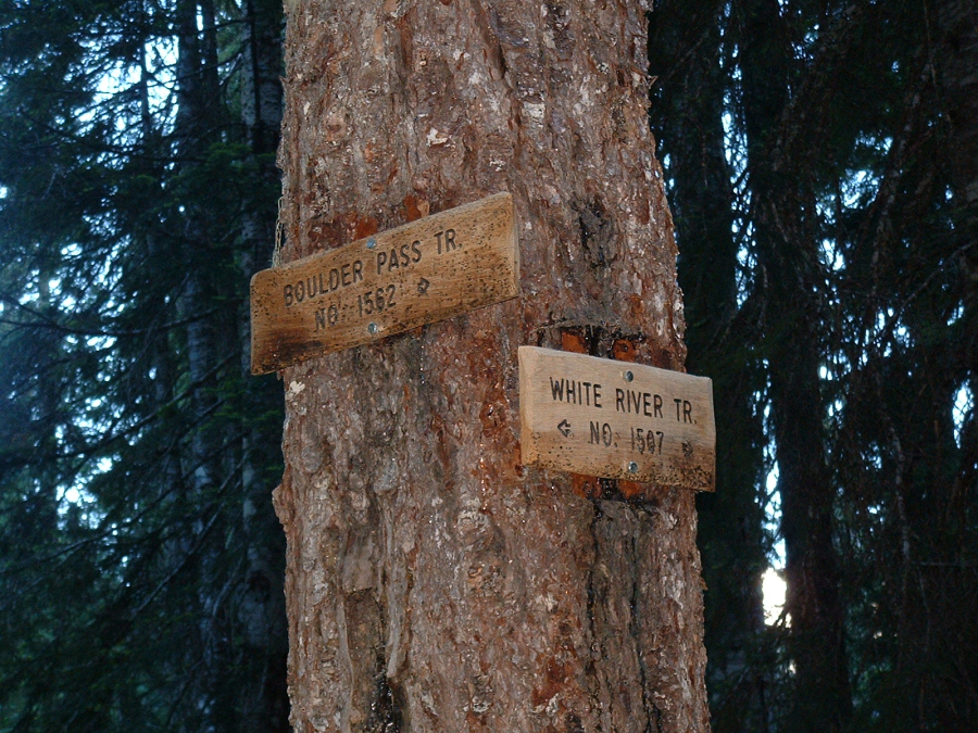
At an open boulder field overlooking the river from about 200ft above, Scott and I literally ran into a mother bear and her cub. The two ran off in opposite directions, the cub to our right and mother down and to our left. We were petrified! Mother bear was obviously quite agitated, making that jaw popping/grinding noise that bears often make when threatened. Furthermore, mother bear was now thrashing about the brushy flats near our (only?) log crossing back across the White River. In a very concerned voice, Scott asked "what do we do?" I suggested laying low for a while to let the bears sort themselves out. We waited for a few minutes until we lost visual contact with the bear somewhere in the brush below us. We then descended carefully, making a wide leftward traverse back down to the river's edge, talking loudly and hitting our trekking poles against each other. We located the log crossing and hurried back across it to the other side. Phew! Our little foray into bear country cost us about two hours. I paused to look up at the obvious sign nailed to the tree at the trail junction. The Boulder Creek Trail led clearly off to our right, AWAY from the White River. Apparently, I can't follow directions.
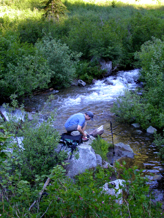
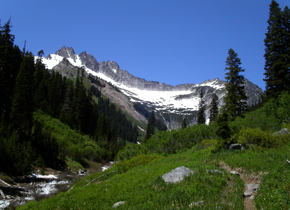
Back on route, we established a blistering pace up the Boulder Creek Trail. The trail makes wide switchbacks through forest for about a 1000ft before heading up into the Boulder Creek drainage. At 4000ft, the trail crosses Boulder Creek. We were able to walk across a log on the first crossing, and forded the next. We continued up into the basin, hiking through scenic parkland that reminded me very much of the upper Bachelor Creek Trail on the approach to Dome Peak. Passing by campsites at the edge of a clearing (~5000ft), Scott and I continued on the obvious trail for about another 1000ft to Boulder Pass. It was now 11:00am and only about 2500ft remained to the summit. We paused for a snack and debated our turn-around time. I figured 1:30pm, perhaps 2:00pm at the very latest, would put us back at the car around 7pm and back at Scott's house in Everett around 9:00pm. As for the remaining 30miles back to Seattle, I would have to warp space-time in order to arrive there before 9:00pm. Realistically, we had just less than 3 hours to reach the summit and return to the pass. Begrudgingly, Beckey's description allows for five hours, merely to reach the summit from the pass. Hmm...
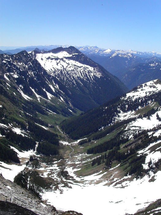
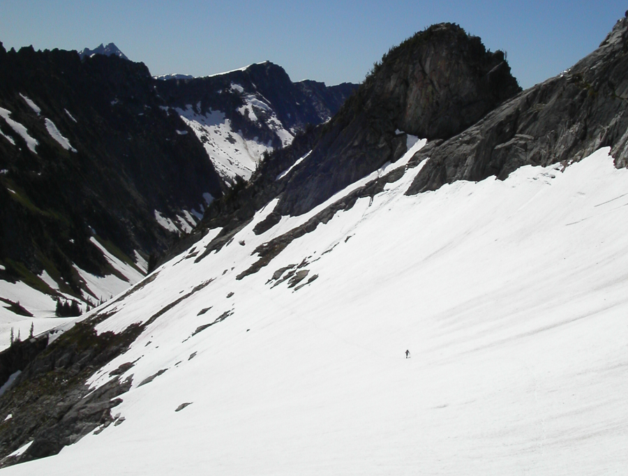
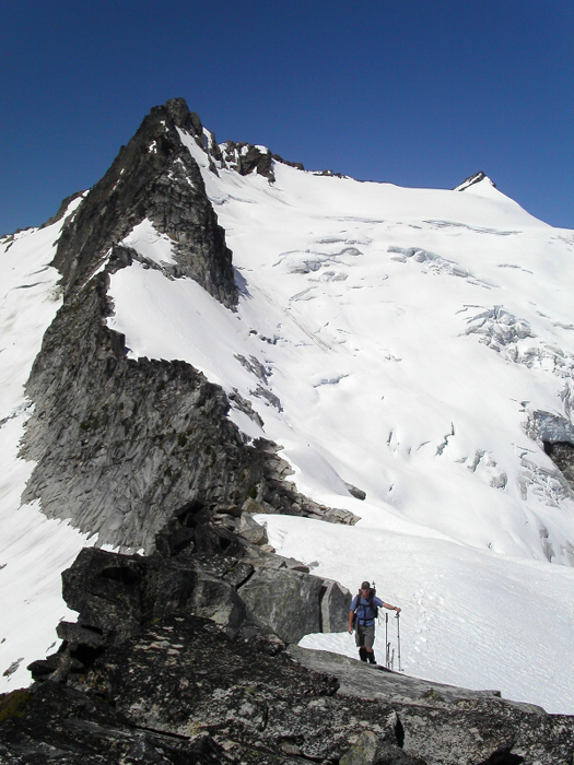
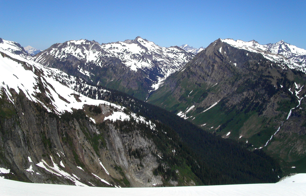
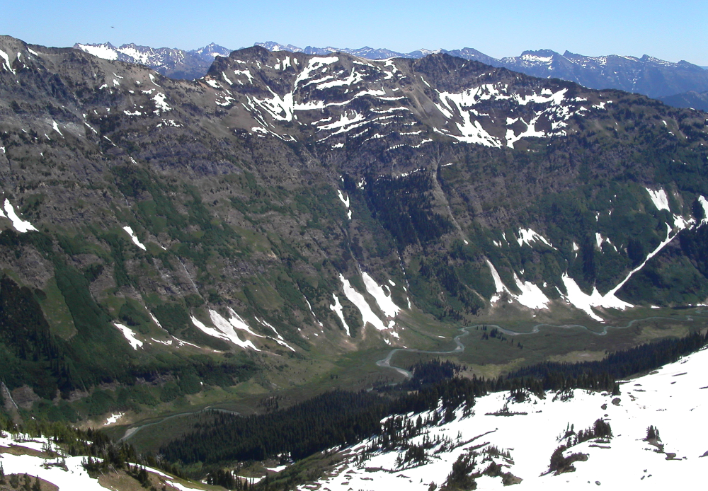
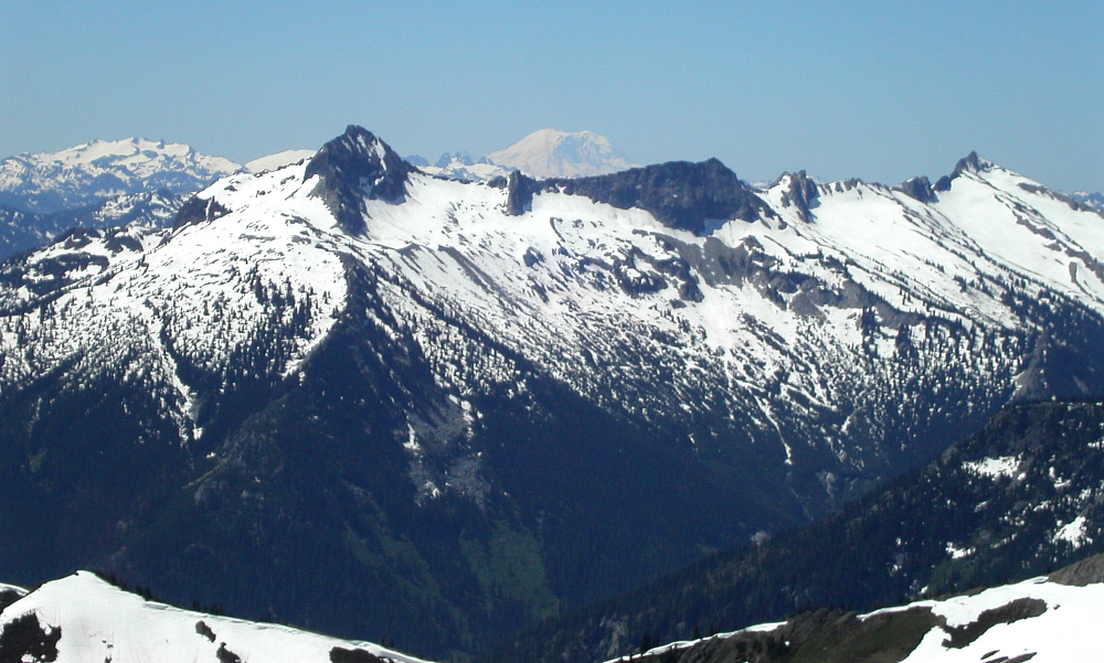
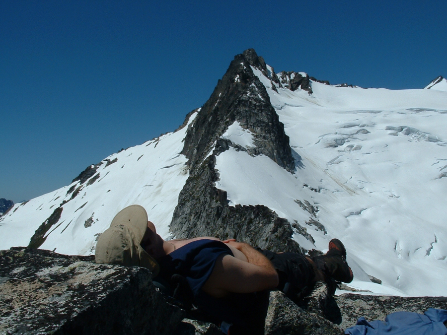
From the left side of the pass, we followed a rising traverse across the basin (steep snow slopes over cliffs) until crossing the Northeast Ridge at 6,700ft. 45 minutes from the pass to this point. Looking up from the ridge, the stunning Walrus/Clark Glacier lay close yet deceivingly far away. The route looked to be in great shape. I waited for Scott who was apparently beginning to feel the miles already traveled. We descended a broad snow slope towards the base of the glacier, bypassing the first large crevasse on our left. I stopped at a low-point on the glacier, a logical place to rope-up, and again waited for Scott to reach me. With just under two hours left for the round trip journey to and from the summit, I knew I would either have to stop here or forget about making it back in town by 9:00pm. Despite the otherwise stellar weather and direct route up the glacier, I decided to call it a day. Instead, we slogged up to the 7000ft rocky high point on the Northeast Ridge and took an hour-long nap. The views down into the Napeequa River Valley, Boulder Creek Valley, and across at Buck Mountain, Fortress Mountain and Chiwawa Mountain were truly magnificent.
Lying there in the sun was truly relaxing. It was hard motivating ourselves to leave. Shortly before 1:00pm we reluctantly got up, shouldered our packs, and began the slippery slog back to Boulder Pass. The descent went quickly, and before long we're doing standing glissades down snow patches below the pass. Farther down-valley, we encounter several parties hiking up to camp. Judging by their oversize packs, they were clearly preparing to spend a night, if not several nights near the pass. I can tell you that packing in all that heavy overnight gear, in the sweltering heat, did not look pretty. Scott and I stopped briefly to chat with the passing climbers. We lied and told them we were returning from the summit. They looked impressed.
The remaining hike down to the junction and subsequent 4-mile bike ride back to the trailhead went without incident. I wished I had brought my bike shoes, for the White River Trail is really fun on a mountain bike. We reached the car around 4:30pm, and stopped at the 50's diner at Coles Corner for some eats. I made it back home by 9:00pm, showered, and got dressed for the Mark Farina show. Cutting rug till well after 2:00am after 20+ miles of trail and snow was easily the crux of the day.
Click here to view photos.
![]()


