


Mount Edith Cavell - East Ridge West Ridge, August 2009

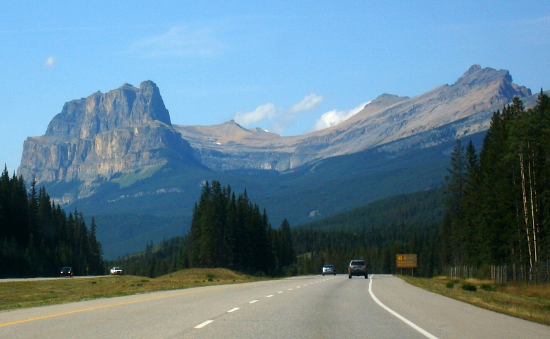
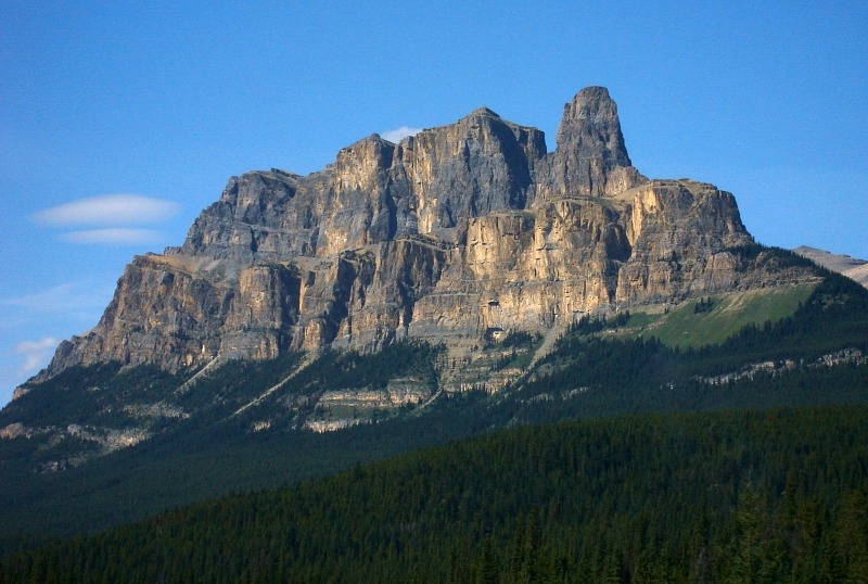
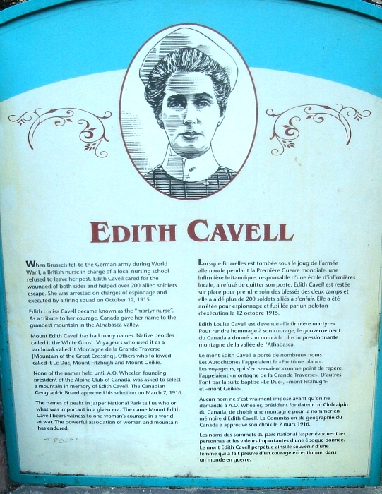
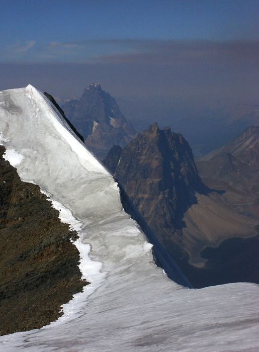
With our two weeks in Western Canada coming to a close, there was just enough time for one last Rockies' classic before returning home. Named after a nurse who was executed by the Germans for helping allied solders escape from occupied Belgium to the Netherlands during World War I, Mount Edith Cavell is arguably the most popular and frequently climbed peak in Jasper National Park. Although the North Face has the honor of being included in Steck and Roper's book Fifty Classic Climbs of North America, the aesthetic (and moderate) East Ridge deservedly gets the most attention. Having previously glimpsed the hulking shale wall with its characteristic tilted bands of snow and ice seemingly emanating from the prominent East Ridge, the peak has long been an obvious must-do climb for me.
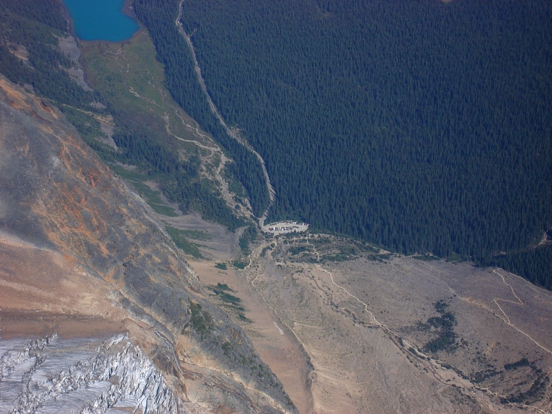
The Edith Cavell hostel is conveniently situated about a mile before the Cavell Meadows Trailhead. It's considered a "wilderness hostel", with limited creature comforts but the view of the peak's North Face sure is hard to ignore from the hostel grounds. In either case, we weren't as interested in a flush toilet and wifi access as we were for a good night's sleep the night before our East Ridge climb. Thanks to an orchestra of snores in the hostel bunkhouse, sleep was unfortunately in rather short supply that night and I cannot remember a more dreaded 4am wakeup call than the one on August 27, 2009.
Staggering through a talus field in total darkness with only the fading light of an LED lamp to guide the way is a surreal experience. Were we even going the right way? The guide suggests taking to the moraines and climbing talus when the trail makes a switchback to the trees. Did we miss this switchback, and where are the trees anyway? First a paved wheelchair accessible trail and now this, and where's the goddam moon?!
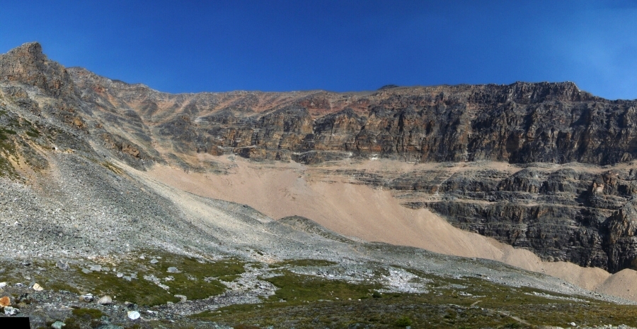
Finally the gods took pity on our misguided souls and with the rising sun revealed to us the trail we had missed all this time. It seems we indeed "took to the moraine", ignoring an easy trail conveniently a few yards off to our left. For how long were we paralleling the trail in the annoying talus? I suppose I could have advised the party behind not to follow us but why spoil the fun? Eventually reaching a lunar-like basin below what I gather is the saddle at the start of the East Ridge route, I looked around to notice three or four other parties just behind or off to either side of us. It looked like it was going to be a busy day on the mountain.
Still groggy and nauseous from my futile efforts to drink myself to sleep the night before, I took a deep breath and started up that final mess of a slope. Eli must have fared worse than me, for after only short while battling up the sandy scree he decided he'd had enough. Yeah, I was somewhat disappointed but truth be told I was probably in no state to climb this thing in the first place. I was briefly tempted to solo the route, but hesitation and uncertainty set in and it seemed irresponsible to continue. With that monkey now off our backs, we allowed ourselves a much more casual downhill pace taking in the scenery we'd missed in the dark early morning hours. The alpenglow cast on Cavell's red rock added an aura of mystery to the majestic walls rising out of a moraine lake dotted with mini icebergs. Farther down the trail a frail old man wearing a touque was slowly hiking up towards us. Could it be? How many chance encounters with good 'ol Fred is that now? I suppose I should've have said something in passing, but instead greeted him with a silent nod and continued down to the trailhead.
We'd gone 6 days without a shower and stank pretty good by now. The first order of business later that morning then was to get a shower in Jasper, followed by lunch. The rest of the day was spent napping (me) and reading (Eli), not to mention the countless hands of Gin Rummy we played. Only I was interested in climbing the peak the next day, and so rather than stress over what difficulties I might or might not encounter on the East Ridge, the plan was for me to solo the easier West Ridge instead. I slept soundly that night, no doubt thanks largely due to the fact that there wasn't anyone else in the bunkhouse with us disturbing the peace with his or her vibrating nasal tissue.
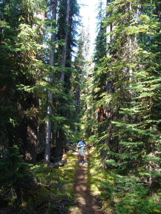
The trailhead literally starts opposite the hostel and proceeds past Cavell Lake for a couple miles up the Astoria River Valley to reach a footbridge over Verdant Creek. We expected to locate a trail paralleling the creek into upper-Verdant Creek valley near here, but this was not the case. It took us about 30 minutes before realizing we'd somehow missed a relatively obvious fork with a dilapidated sign a quarter mile earlier on along the trail. A couple miles hiking along the forested Verdant Creek trail leads to Verdant Pass, where as agreed, Eli would hang out and wait for me to return from my trip up Edith Cavell.
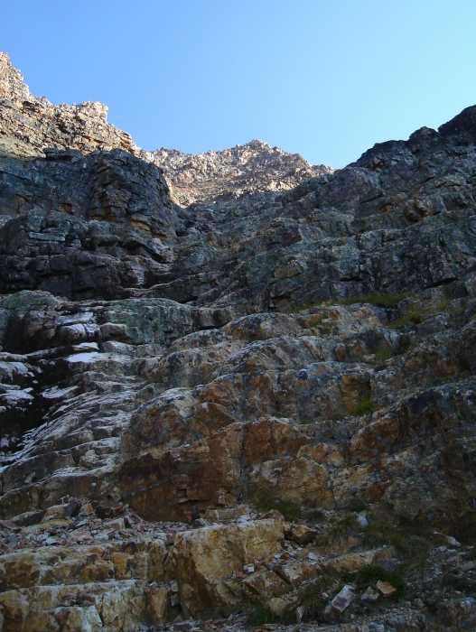
Following the trail, I proceeded into a large meadow area before a prominent cirque formed but the West and South Ridges of Mount Edith Cavell. Now following cairns, I hiked up a large talus fan to the base of the headwall before me, aiming for the back of the cirque where a snow finger or watercourse must be evident earlier in the season. The rock low on the scramble up the headwall below the West was unfortunately as good as it gets on the route. Scrambling up easy, ledgy terrain I soon reached the large talus slope that comprises the upper-half of the headwall. Flailing up this portion of the route was taxing to say the least and for this reason alone I would not recommend the West Ridge as a worthwhile alternative to the East Ridge. Really folks, it sucked well beyond what I thought was possible.
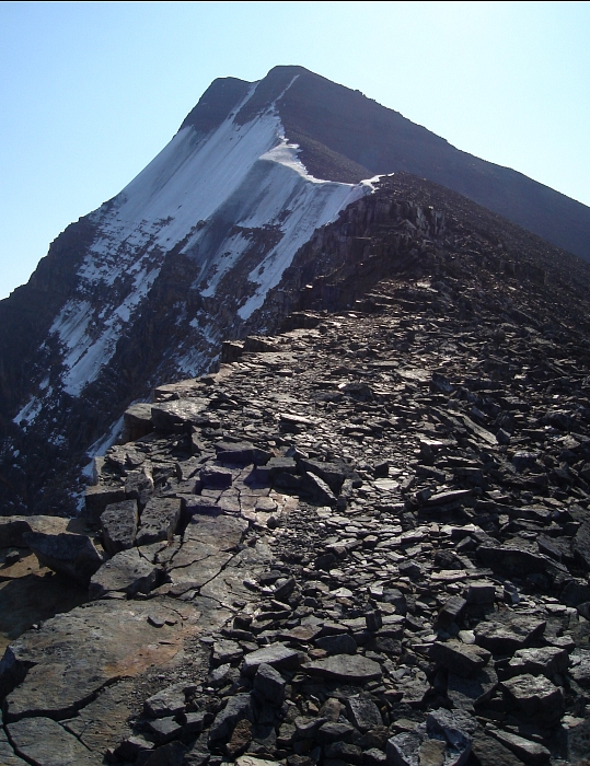
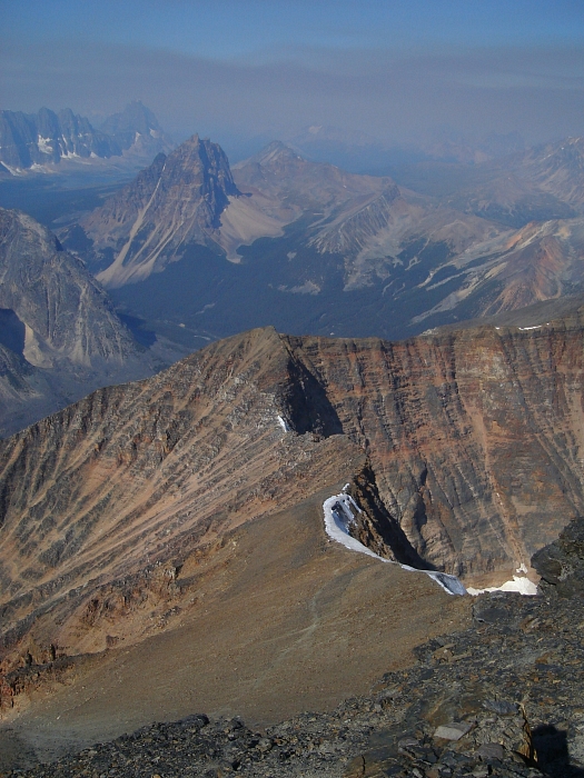
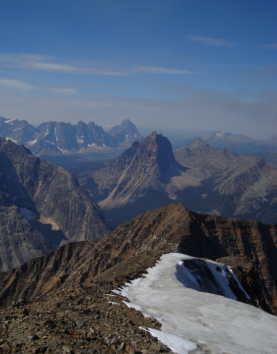
Now on the West Ridge, I walked easily along low angled slabs, talus and finally scree towards a prominent sub-summit rising before me. Rather than scramble up what appeared to be highly friable rock on the sub-summit, I instead traversed out right over an impossibly loose slope and contoured to the south of this point before turning and crawling up finely ground rock and sand to regain the ridge. From there an easy walk lead to a point that I surmised was the true summit. Just to be sure I continued along the long summit ridge over a series of bumps to where the East Ridge tops out. There I met someone that had just soloed the East Ridge. Not having done much in the way of technical climbing in his experiences in the mountains, the soloist pointed out that the East Ridge is really not much more than an enjoyable scramble with a few low-fifth steps thrown in there for good measure. Boy, did I feel cheated after hearing that!
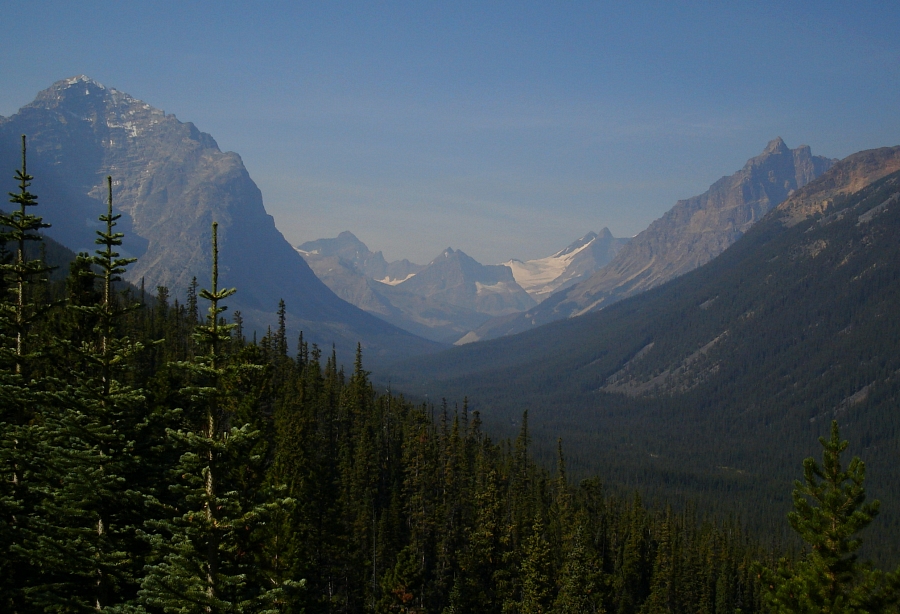
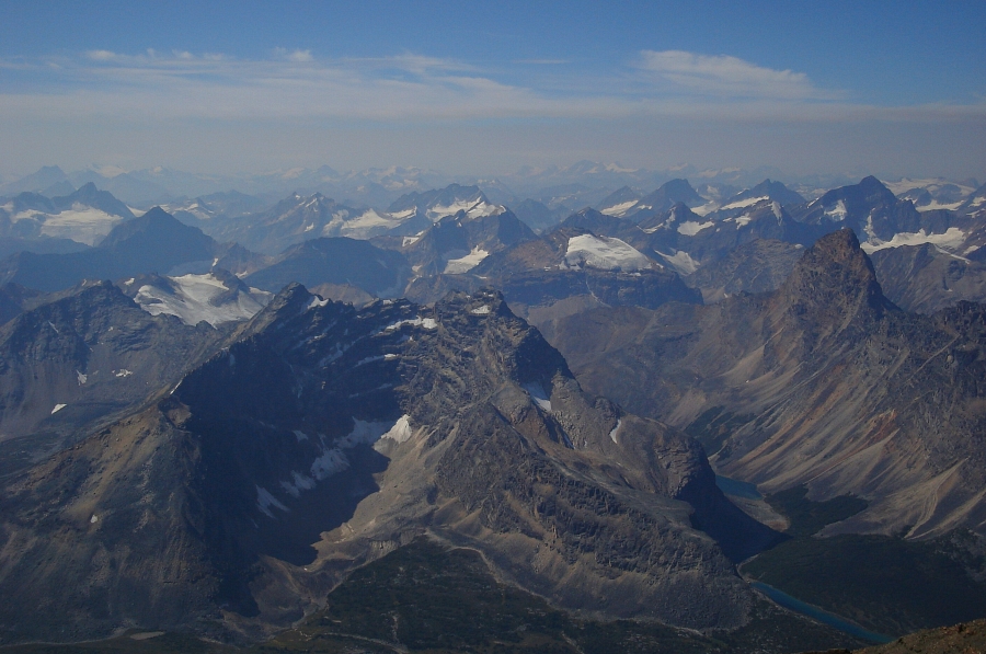
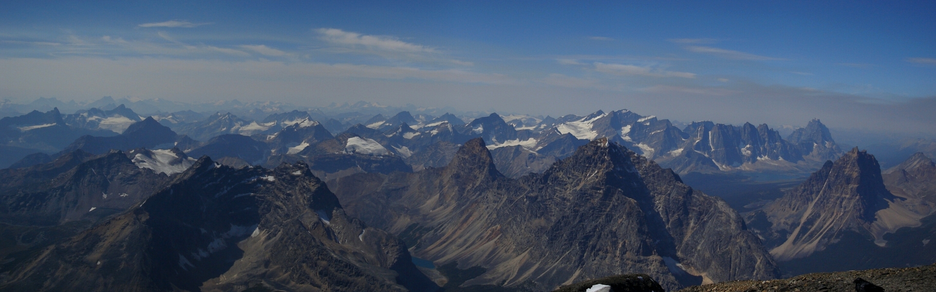
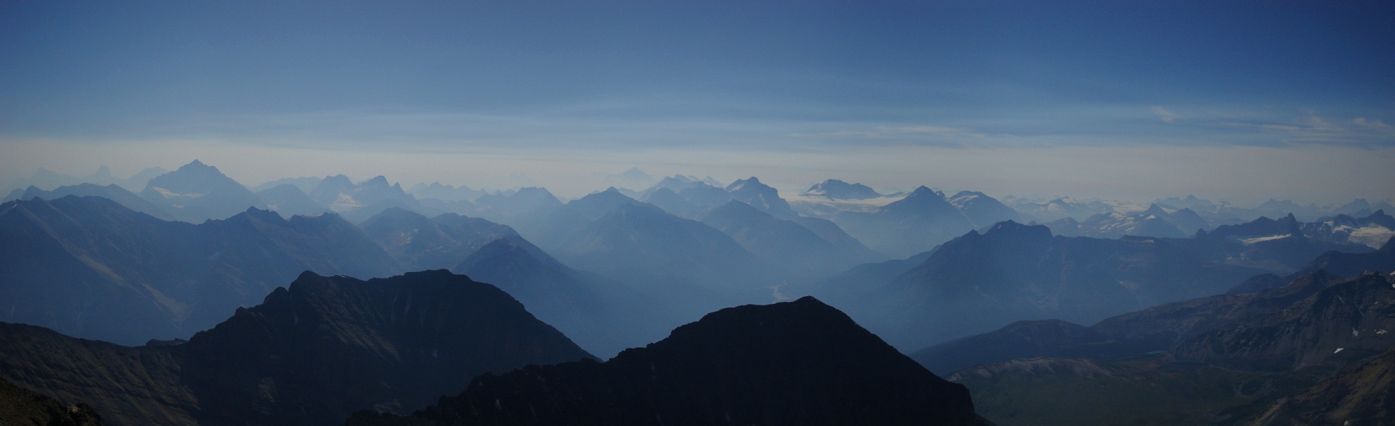
There was a lot of smoke in the air, presumably from a prescribed burn somewhere nearby. The smoky air reminded me of the drive from Vancouver over to Banff several days earlier. At all times during the drive it seemed as if a plume of smoke could be seen rising from the forests somewhere alongside the road. Each of these plumes had either a couple helicopters or a water-bomber circling it, obviously as part of some firefighting effort. Needless to say, it's been an unusually hot and dry summer here in the greater Northwest. I guess the Canadian Rockies didn't fare much better.
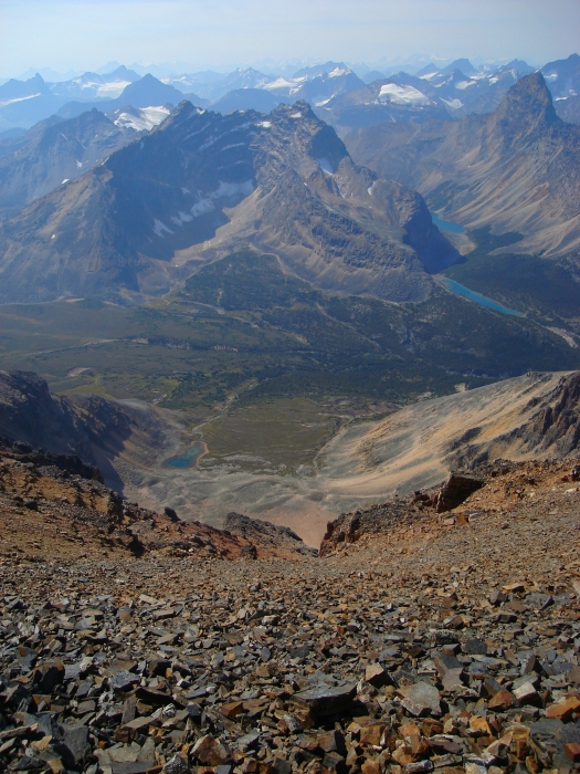
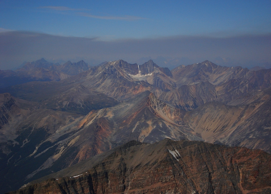
Returning to the summit proper, I met the other soloist whom I'd seen below me ascending the headwall guarding the West Ridge saddle. Together with the solitary raven that seems to call the summit home, we were the only ones up there that day. Views to the north, east and south along the Athabasca River Valley were nonexistent for the most part. Otherwise though, the views from Edith Cavell's summit were spectacular. Without the smoky air, apparently even the mighty Mount Robson is visible one hundred-some kilometers away to the northwest.
With the other West Ridge scrambler choosing to hang back for a while and let us get a head start on the descent, I led the other party down the West Ridge route to the meadow below the cirque. He was planning on camping there for the night, so I wished him well and hurried back to where Eli was waiting. I'm not certain but I seem to recall Eli mentioning having waited about 6 hours for me?? Wow, how time flies!
We returned to the Astoria River trail without incident, and fortunately never had cause to use the can of bear spray I was advised to bring along with me specifically for this particular section of trail. Wasting little time packing the car, we then sped off for Rte. 16 eventually stopping for the night somewhere before Kamloops. We finished the remainder of the drive back to Seattle the following day. A huge thanks to Eli for volunteering his car and driving the countless miles, both paved and unpaved. Five peaks, two ranges and two provinces - we'd covered a lot of ground in two sunny weeks in August and greatly expanded our appreciation for the mountains within our proverbial 'backyard.' If only it was always like this...stay thirsty my friends!
Click here to view photos.
![]()


