


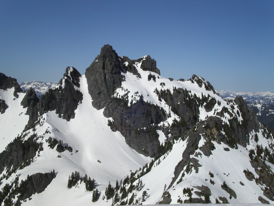
Gunn Peak - East Peak, April 2004
 as seen from Monte Cristo Peak.")
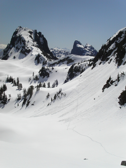
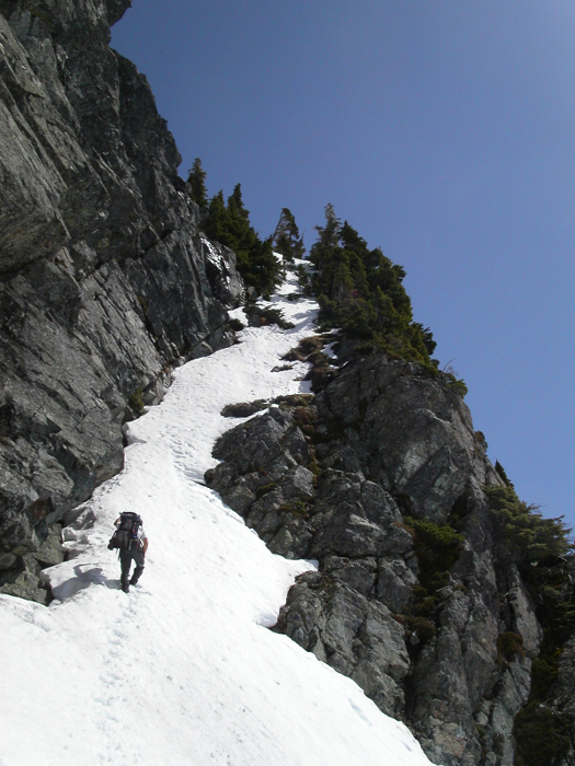
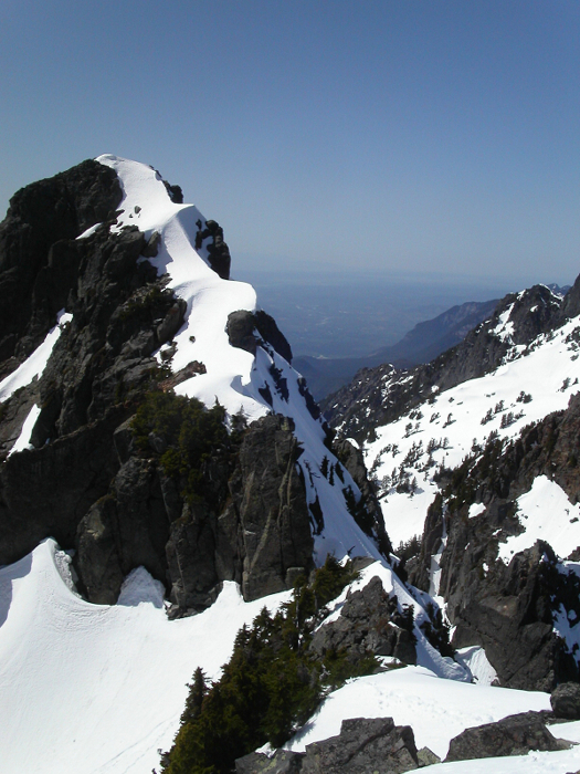
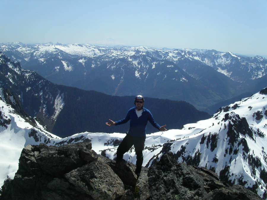
Paul and I attempted Gunn Peak on April 26th. We failed on Gunn's main summit but managed to climb to the East Peak (6,160+ ft). The ledge on the north side that leads to the summit was literally an 80-degree snowslope with cliffs below. A slip here would be deadly in these conditions. Furthermore, it must have been the warmest day yet this spring and the unconsolidated, wet snow provided little in the way of secure footing. We briefly discussed exploring an alternative summit route via the Southwest Face, but given the conditions we were reluctant to commit ourselves to it. Our consolation prize was Peak 5842 (AKA Tailgunner Peak) and from where were able to take in the western views blocked to us on the East Peak by the true summit.
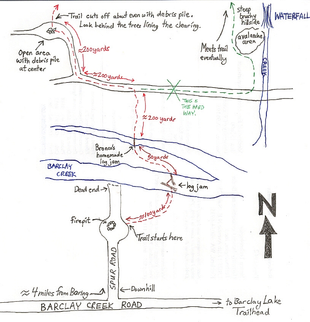
Leave the Barclay Creek Road at the spur heading north approximatly 1 mile from the trailhead parking-lot. The trail to the logjam is flagged to the east of the wide area on the spur road (where the fire pit is located). In 100 yards the trail gets to the logjam crossing. It was easy for us though slick. A second crossing of the creek is necessary shortly thereafter. This one was a little harder due to unsecure 8-inch rotting logs. The trail then travels north to an old road bed for maybe a 1/4 mile. Turn to the west (left) on the road and continue for approximatly 100 yards to where an even more overgrown road branches off to the north again. Follow that road a short distance to a small grove-like landing, where the road comes to an end. At the other-end of the landing, look for flagging and the start of the climber's trail.
The trail beyond the landing is not very obvious, but, worth trying to sniff out as there is some unpleasant bushwhacking to deal with otherwise. Follow the trail literally to the toe of the rock walls left of the watercourse (visible from parking area). At about 4,000 ft the trail begins skirting the rock walls at the south foot of Tailgunner. Alder and class 3 scrambling is to be found (including the odd class 4 rock sections). Later a steep dirt/duffy downclimb to a picturesque waterfall is encountered. Cautious moves get you down into the waterfall creek. The other side of the creek is more steep gully with ample green belays. Beyond there it gets easier (though still steep at times) to the major basin draining south from between Tailgunner and Pk 5760.
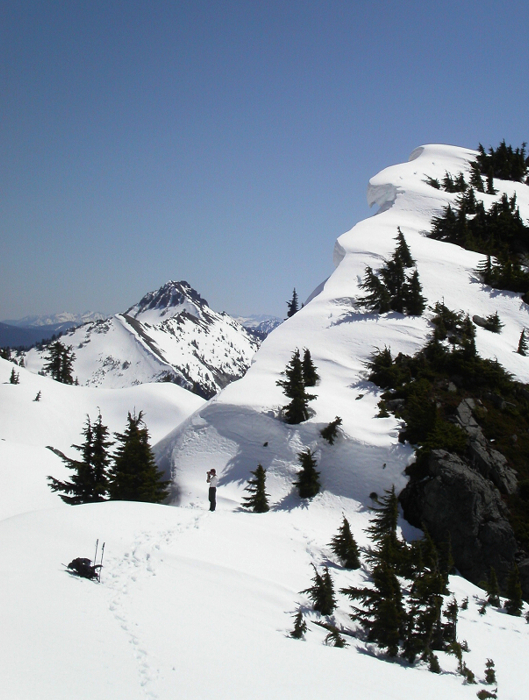
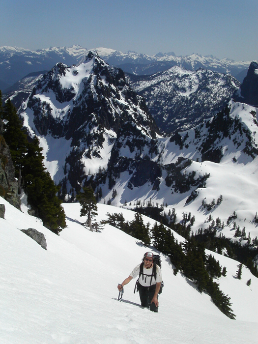
We hiked west (left) along the saddle to find an easy way down over the cornices guarding the basin below Gunn's southeast side. From the saddle to below Gunn Peak was pretty straighforward for us despite the thermal truncheon beating down on us from above. The gully leading back up and right to the snowfield below Gunn's upper south side was steep and a little hard in the early afternoon. Plus, there was an annoying moat forming at about center. However, we managed to get up it without belay. (On the return we opted to rappel it with our two 30m ropes.)
The gully leading back up and right to the snowfield below Gunn's upper south side was steep and a little hard in the early afternoon. Plus, there was an annoying moat forming at about center. However, we managed to get up it without belay. (On the return we opted to rappel it with our two 30m ropes.) The rappell back down the gully went without incident, but, I did manage to step into a hidden moat on the descent at the base of Gunn's main summit tower. I was down up to my armpits in this "elephant trap", with feet kicking in empty space. So, this is what a crevasse fall must feel like, eh?
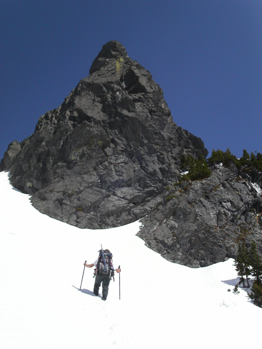
After failing on getting Gunn, we managed to boot up the east side of Tailgunner in about 20 minutes from the long saddle on its east. More specifically, we finished the climb on the SE ridge/side. We managed to get back to the car from that saddle in about 1 hour 45 minutes. 5.5 hours from car to Gunn's East Peak. The East Peak only required class 3 scrambling from the central notch.
Click here to view photos.
![]()


