Last Updated: April 17, 2024


Start

Recent content updates are viewable under what's new.

Reports in the queue for posting are coming soon!

Upcoming reports & photos:

Oh my! Quite the backlog here...

  • American Mountain & Mount Lincoln - hike/snowshoe (May 2023)
  • Mount Mclean Attempt, Red Rock Trail, Dragons Back Trail - hike (May 2023)
  • Stawamus Chief (South, Middle & North) - hike/scramble (June 2023)
  • Flint & Feather - hike/scramble (June 2023)
  • Goat Ridge (Squamish) - hike (June 2023)
  • Grouty/Mortar Peaks - hike/scramble (June 2023)
  • Pebble-to-North Creek Traverse incl. Pebble, Thiassi, Wesley & Sugus - hike/scramble (July 2023)
  • Mount Truax - hike/scramble (July 2023)
  • Blackcomb Buttress - rock climb (July 2023)
  • Whitecap Peak - hike/scramble (July 2023)
  • Mount Hanover - hike/scramble (August 2023)
  • The "Long Traverse" incl. Long, Tynemouth, Arrowhead, Tabletop & Anemone - hike/scramble (August 2023)
  • Armchair Traverse - hike/scramble (August 2023)
  • Snowspider Mountain - hike/scramble (September 2023)
  • Mount Trorey - hike/scramble (September 2023)
  • Macleod Peak - hike/scramble (September 2023)
  • Ben Lomond - hike/scramble (September 2023)
  • Mount Killam & Gambier Island - hike (September 2023)
  • Lone Goat & Snow Camp Mountain - hike (September 2023)
  • Isollilock Peak - hike/scramble (October 2023)
  • Manson - Hatfield Traverse - hike/scramble (October 2023)
  • Gargoyles & Columnar Peak - hike/scramble (October 2023)
  • Opal Cone and Lava Glacier - hike (October 2023)
  • Park Butte (WA) - hike (October 2023)
  • Trappers Peak (WA) - hike/scramble (October 2023)
  • Rattlesnake Ledge (WA) - hike (November 2023)
  • Sauk Mountain (WA) - hike (November 2023)
  • Mount Daniel & Pender Hill (Sunshine Coast) - hike (November 2023)
  • Mount Dickerman (WA) - hike (November 2022)
  • Winter's End (Verona Peak) - hike/snowshoe (November 2023)
  • Dolomites (Italy) - snowboarding (December 2023)
  • Red Rock Canyon (NV) - hike (January 2024)
  • Flute & Oboe - split tour (February 2024)
  • Whistler misc. (Train Wreck, Loggers Lake, Shadow Lake etc.) - hike (February 2024)
  • Mount Underhill - hike (March 2024)
  • Bombtram Mountain - hike/snowshoe (March 2024)
  • Steep Peak - split tour (March 2024)
  • Ruby Mountain (WA) - hike/snowshoe (April 2024)
  • Blustry Mountain - hike (April 2024)
  • Sowerby Peak (Barr East) - hike (April 2024)

*As of 04/21/2024


Database

Query the reports database, selecting from criteria which include name, location, type, season etc.

Quick Links

Essential links & whatnot:


Jump To

Select from list below to jump to a specific area on this site.


| Featured Trip Report |


Last Updated: Sep. 10, 2005

Mount Index (North Peak) - North Face, August 2005


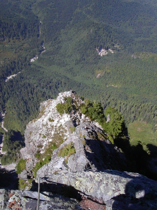
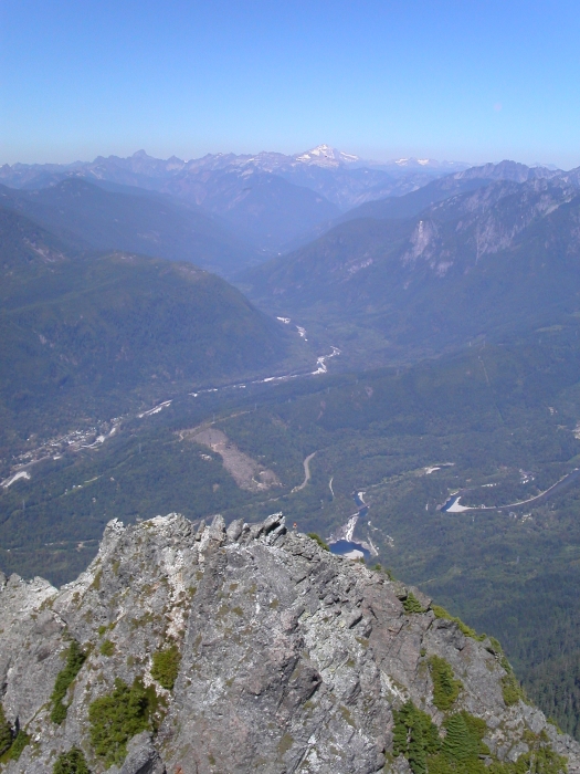
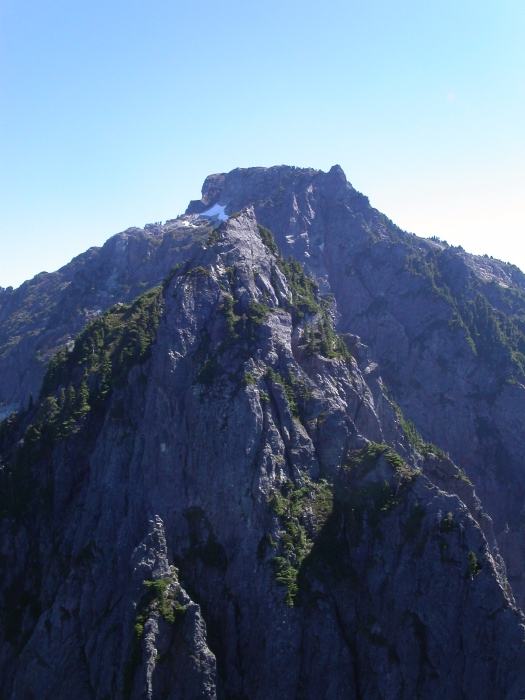
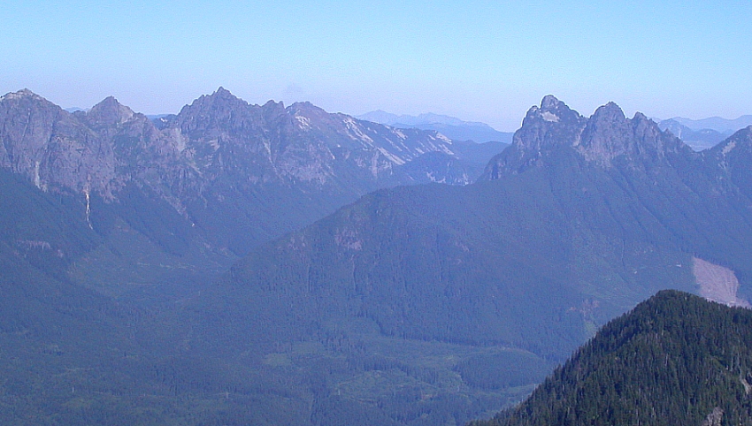
Surrendering all hope for favorable climbing conditions north of the border this season, Eric and I resigned ourselves to climbing that pesky little sub-alpine brush-fest off of hwy 2. Yep, we finally succumbed to the allure of Mount Index's prominent North Peak. No more would we have to tolerate the drive to and from Stevens Pass, wondering why anyone would willingly endure such a vague and brushy route only to reach the lower of Index's three summits. That said, one could certainly traverse the three summits, and thereby truly summit the peak (in fact there've been numerous such ascents this year alone), but that would be a bit more than what Eric and I had in mind. In any case, a climb of the North Peak in dry mid-August conditions similar to what we encountered, is only for those with an acquired taste for "the savagery of the Cascades". Take Beckey's terse warning - "Be prepared for a bivouac on this climb" and mix in equal parts fatigue, dehydration and notoriously difficult route finding, and you've got yourself a surprisingly tall order for a summit that barely reaches 5300 feet. Sweet, sign us up!

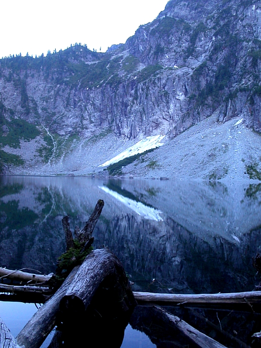
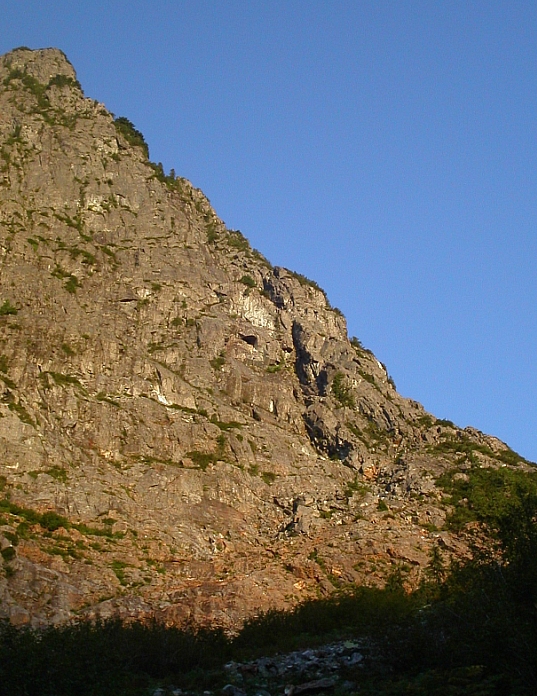
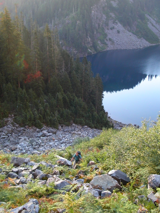
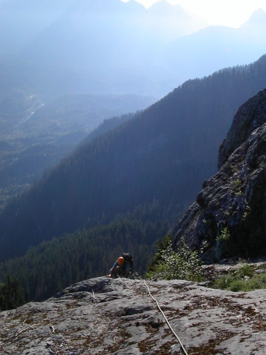
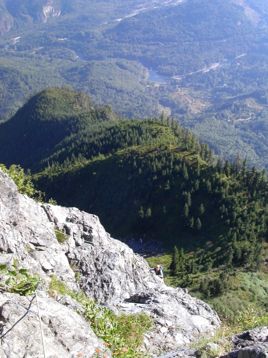
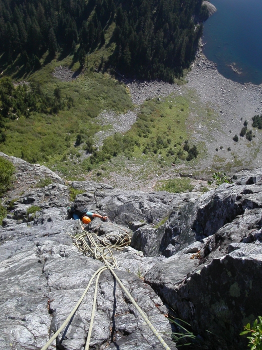
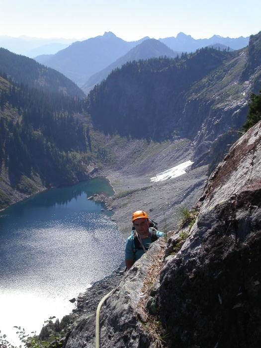
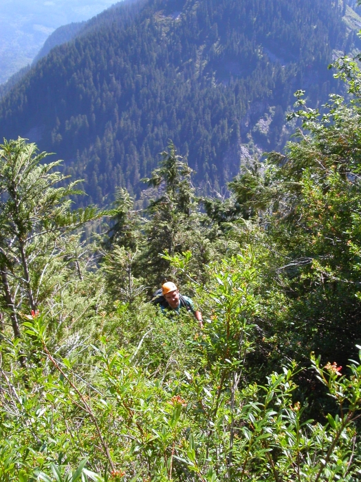
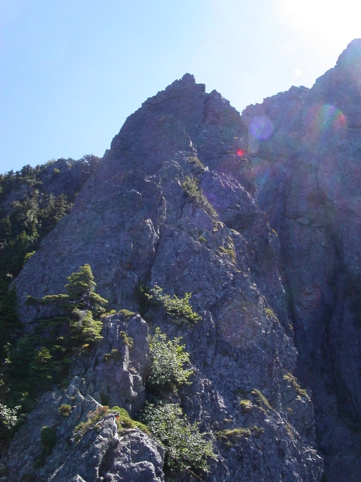
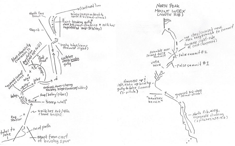
We left Seattle late in the afternoon and made the short drive over to the Lake Serene Trailhead. A pleasant hike that gets somewhat steep near the end saw us to the picturesque Lake Serene. A trailhead notice advises against camping within 500 feet of the lake, but fails to suggest where else one should camp. Locating the only reasonably flat and brush-free patch of dirt directly alongside the trail, we dropped our packs and laid out our bivy sacks for a warm night among mosquitoes and shards of broken glass. We departed camp at first light and made our way towards the obvious talus slope beneath the Northeast Spur. Following a bit of a path through thick brush, we reached the crest of the brushy spur and changed into our rock gear. Climbing up from this point, we simul-climbed about two pitches of slabby and mossy rock to reach the base of the "steep wall" mentioned in the CAG. Working left, a short pitch up a brushy gully/dihedral led to a good stance from where to belay the "exposed corner" pitch. A short dihedral led around the corner, whereupon I began working up clean rock on a small rib. (more...)

Click here to view photos.
home | email | copyright

All photos and text for sverdina.com are copyright © 2002-2024

It would be very much appreciated if you please ask before copying and/or re-publishing content from any part of these pages. To do so, please click here to send a message via feedback form.

Thank You.

©2024 sverdina.com |