Last Updated: April 17, 2024


Start

Recent content updates are viewable under what's new.

Reports in the queue for posting are coming soon!

Upcoming reports & photos:

Oh my! Quite the backlog here, eh?

  • American Mountain & Mount Lincoln - hike/snowshoe (May 2023)
  • Mount Mclean Attempt, Red Rock Trail, Dragons Back Trail - hike (May 2023)
  • Stawamus Chief (South, Middle & North) - hike/scramble (June 2023)
  • Flint & Feather - hike/scramble (June 2023)
  • Goat Ridge (Squamish) - hike (June 2023)
  • Grouty/Mortar Peaks - hike/scramble (June 2023)
  • Pebble-to-North Creek Traverse incl. Pebble, Thiassi, Wesley & Sugus - hike/scramble (July 2023)
  • Mount Truax - hike/scramble (July 2023)
  • Blackcomb Buttress - rock climb (July 2023)
  • Whitecap Peak - hike/scramble (July 2023)
  • Mount Hanover - hike/scramble (August 2023)
  • The "Long Traverse" incl. Long, Tynemouth, Arrowhead, Tabletop & Anemone - hike/scramble (August 2023)
  • Armchair Traverse - hike/scramble (August 2023)
  • Snowspider Mountain - hike/scramble (September 2023)
  • Mount Trorey - hike/scramble (September 2023)
  • Macleod Peak - hike/scramble (September 2023)
  • Ben Lomond - hike/scramble (September 2023)
  • Mount Killam & Gambier Island - hike (September 2023)
  • Lone Goat & Snow Camp Mountain - hike (September 2023)
  • Isollilock Peak - hike/scramble (October 2023)
  • Manson - Hatfield Traverse - hike/scramble (October 2023)
  • Gargoyles & Columnar Peak - hike/scramble (October 2023)
  • Opal Cone and Lava Glacier - hike (October 2023)
  • Park Butte (WA) - hike (October 2023)
  • Trappers Peak (WA) - hike/scramble (October 2023)
  • Rattlesnake Ledge (WA) - hike (November 2023)
  • Sauk Mountain (WA) - hike (November 2023)
  • Mount Daniel & Pender Hill (Sunshine Coast) - hike (November 2023)
  • Mount Dickerman (WA) - hike (November 2022)
  • Winter's End (Verona Peak) - hike/snowshoe (November 2023)
  • Dolomites (Italy) - snowboarding (December 2023)
  • Red Rock Canyon (NV) - hike (January 2024)
  • Flute & Oboe - split tour (February 2024)
  • Whistler misc. (Train Wreck, Loggers Lake, Shadow Lake etc.) - hike (February 2024)
  • Mount Underhill - hike (March 2024)
  • Bombtram Mountain - hike/snowshoe (March 2024)
  • Steep Peak - split tour (March 2024)
  • Ruby Mountain (WA) - hike/snowshoe (April 2024)
  • Blustry Mountain - hike (April 2024)

*As of 04/17/2024


Database

Query the reports database, selecting from criteria which include name, location, type, season etc.

Quick Links

Essential links & whatnot:


Jump To

Select from list below to jump to a specific area on this site.


| Featured Trip Report |


Last Updated: May 18, 2004

Gunn Peak - East Peak, April 2004


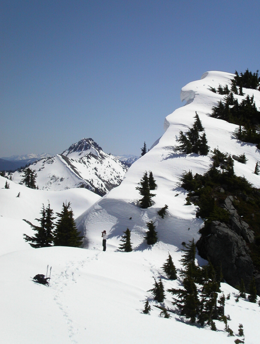
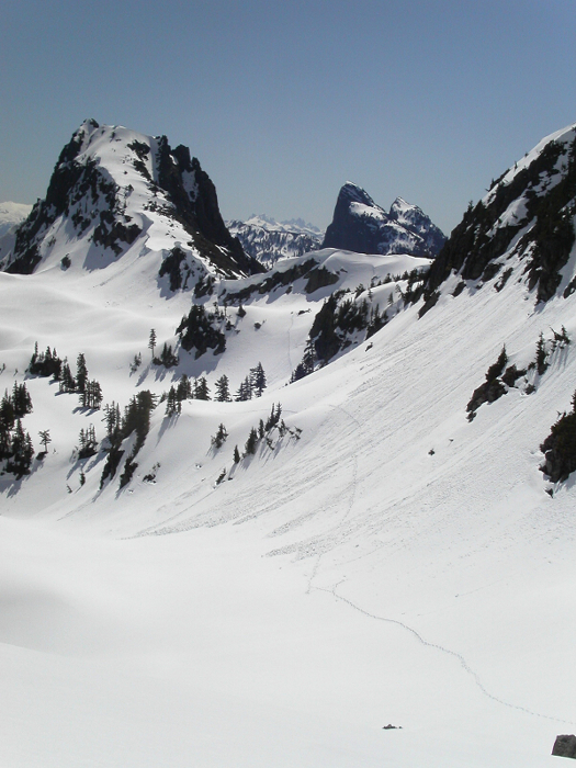
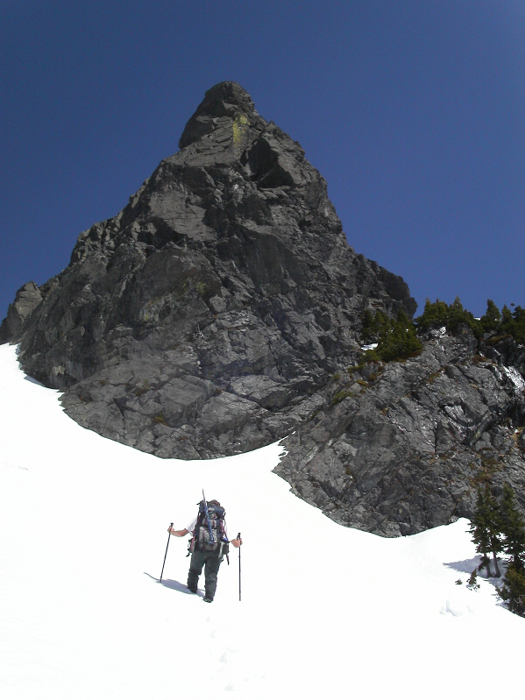
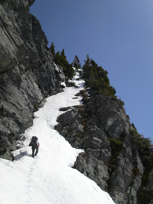
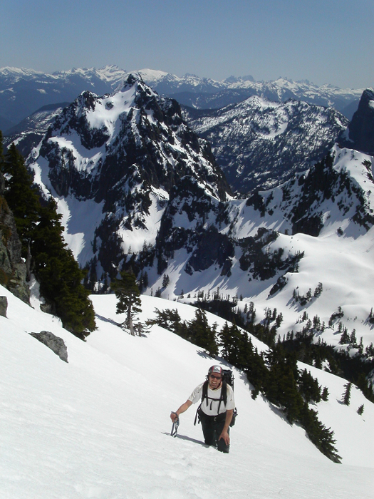
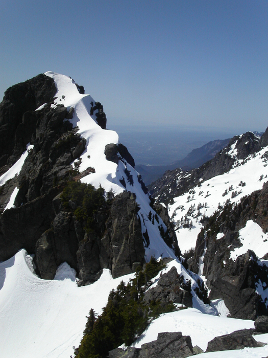
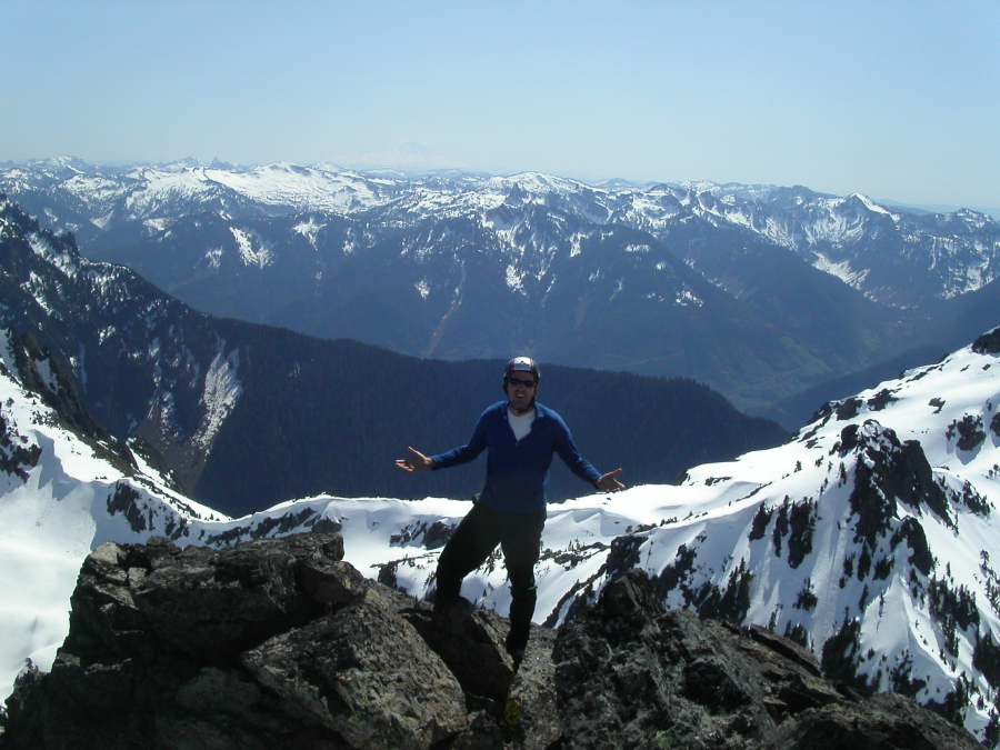
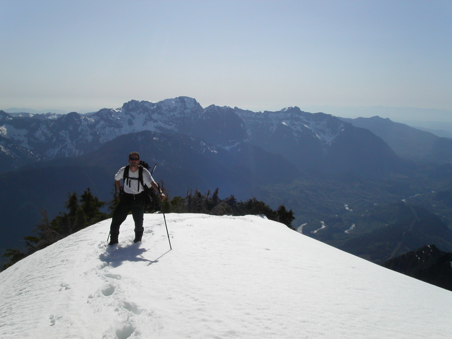
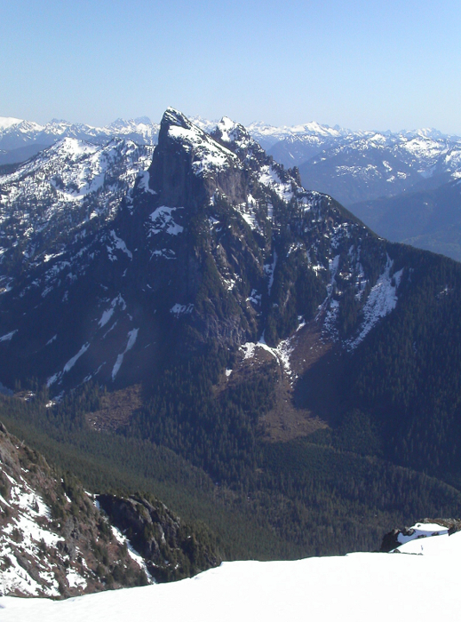
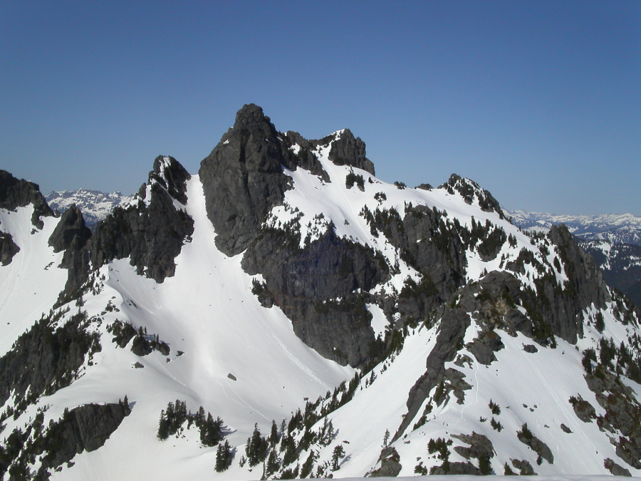
Paul and I attempted Gunn Peak on April 26th. We failed on Gunn's main summit but managed to climb to the East Peak (6,160+ ft). The ledge on the north side that leads to the summit was literally an 80-degree snowslope with cliffs below. A slip here would be deadly in these conditions. Furthermore, it must have been the warmest day yet this spring and the unconsolidated, wet snow provided little in the way of secure footing. We briefly discussed exploring an alternative summit route via the Southwest Face, but given the conditions we were reluctant to commit ourselves to it. Our consolation prize was Peak 5842 (AKA Tailgunner Peak) and from where were able to take in the western views blocked to us on the East Peak by the true summit.

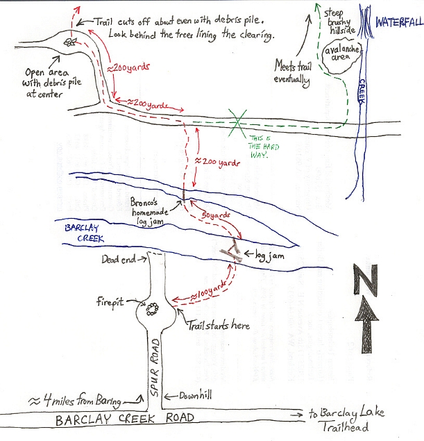
Leave the Barclay Creek Road at the spur heading north approximatly 1 mile from the trailhead parking-lot. The trail to the logjam is flagged to the east of the wide area on the spur road (where the fire pit is located). In 100 yards the trail gets to the logjam crossing. It was easy for us though slick. A second crossing of the creek is necessary shortly thereafter. This one was a little harder due to unsecure 8-inch rotting logs. The trail then travels north to an old road bed for maybe a 1/4 mile. Turn to the west (left) on the road and continue for approximatly 100 yards to where an even more overgrown road branches off to the north again. Follow that road a short distance to a small grove-like landing, where the road comes to an end. At the other-end of the landing, look for flagging and the start of the climber's trail. (more...)

Click here to view photos.
home | email | copyright

All photos and text for sverdina.com are copyright © 2002-2024

It would be very much appreciated if you please ask before copying and/or re-publishing content from any part of these pages. To do so, please click here to send a message via feedback form.

Thank You.

©2024 sverdina.com |