Last Updated: December 14, 2024


Start

Recent content updates are viewable under what's new.

Reports in the queue for posting are coming soon!

Upcoming reports & photos:

Oh my! Quite the backlog here...

  • Mount Manson - Mount Hatfield Traverse - scramble (October 2023)
  • The Gargoyles & Columnar Peak - scramble (October 2023)
  • Opal Cone and Lava Glacier - hike (October 2023)
  • Park Butte (WA) - hike (October 2023)
  • Trappers Peak (WA) - scramble (October 2023)
  • Rattlesnake Ledge (WA) - hike (November 2023)
  • Sauk Mountain (WA) - hike (November 2023)
  • Sunshine Coast (Mount Daniel, Pender Hill) - hike (November 2023)
  • Mount Dickerman (WA) - hike (November 2022)
  • Verona Peak AKA Winter's End - snowshoe (November 2023)
  • Dolomites (IT) - snowboard (December 2023)
  • Red Rock Canyon (NV) - scramble (January 2024)
  • Flute Summit & Oboe Summit - snowboard (February 2024)
  • Whistler Miscellaneous (Train Wreck, Loggers Lake, Shadow Lake and more) - hike (February 2024)
  • Mount Underhill - hike (March 2024)
  • Bombtram Mountain - snowshoe (March 2024)
  • Steep Peak - snowboard (March 2024)
  • Ruby Mountain (WA) - snowshoe (April 2024)
  • Blustry Mountain - hike (April 2024)
  • Sowerby Peak (Barr East) - snowshoe (April 2024)
  • Picacho Peak (AZ) - hike (April 2024)
  • Kitt Peak Observatory (AZ) - (April 2024)
  • Mount Wrightson (AZ) - hike (April 2024)
  • Saguaro National Park (AZ) - April 2024)
  • Superstition Peak/Benchmark (AZ) - scramble (April 2024)
  • Mount Humphreys (AZ) - hike (May 2024)
  • Petrified Forest National Park (AZ) - (May 2024)
  • Piestewa Peak (AZ) - hike (May 2024)
  • Channeled Scablands (WA | Columbia Gorge, Ancient Lakes, Potholes Lake, Palouse Falls and more) - hike (May 2024)
  • Rhododendron Mountain ("Pk. 2220") - snowshoe (June 2024)
  • Flora Peak - hike (June 2024)
  • Gibson Peak - snowshoe (June 2024)
  • Mount Urquhart - scramble (June 2024)
  • Rock Mountain (WA) - hike (July 2024)
  • Ladies Pass Quartet (WA | Cape Horn, Ladies Peak, Snowgrass NE Peak, Snowgrass Mountain) - scramble (July 2024)
  • Old Snowy (WA) - scramble (July 2024)
  • Dog Mountain (WA) - hike (July 2024)
  • Mount Ratney & Mount Bardean - scramble (July 2024)
  • Torrent Peak - scramble (July 2024)
  • Steep Peak - Darkside Peak Traverse - scramble (July 2024)
  • Silvertip Mountain - scramble (July 2024)
  • The Old Settler - scramble (July 2024)
  • Silent Hub Peak - scramble (August 2024)
  • Saint Jacobs Mountain - scramble (August 2024)
  • Mount David (WA) - scramble (August 2024)
  • Goat Mountain West Peak & Table Mountain (WA) - hike (August 2024)
  • Griswold Pass (Tuber Hill, Glacier View Peak, Subatomic Peaks: Baryon, Meson, Muon, Lepton) - scramble (September 2024)
  • Yellow Aster Butte (WA) - hike (September 2024)
  • Mazama Dome (WA) - hike (September 2024)
  • Ptarmigan Ridge - (WA | The Portals East Peak, Coleman Pinnacle) - hike (September 2024)
  • Tetrahedron Peak - scramble (September 2024)
  • Lone Cone & Peak 86 (Tofino) - hike (September 2024)
  • Mount Athelstan ("Pk. 2460") - scramble (September 2024)
  • Excelsior Peak and Cowap Peak (WA) - hike (October 2024)
  • Hollyburn Peak - hike (October 2024)
  • Cheam Peak - hike (October 2024)
  • Blanchard Needle - scramble (October 2024)
  • Debeck's Hill & 4 Lakes Loop - hike (October 2024)
  • Mount Hallowell - hike (November 2024)
  • Anderson Mountain (WA) - hike (December 2024)
  • Sumas Mountain (WA) - hike (December 2024)

*As of 12/04/2024


Database

Query the reports database, selecting from criteria which include name, location, type, season etc.

Quick Links

Essential links & whatnot:


Jump To

Select from list below to jump to a specific area on this site.


| Featured Trip Report |


Last Updated: June 20, 2008

Steamboat Prow - Interglacier, June 2008


"Juneuary" they're calling this unseasonably wintry weather we're having this late spring. Indeed, it must be extremely rare to find over a foot of fresh powder snow on the Interglacier in June. Sure, one could always snowmobile into Glacier Basin in the winter and establish camp for the weekend and hopefully find the Interglacier in stable conditions, but to nail such conditions right after the White River Road has opened is remarkable. Perhaps what's more remarkable was the weather we encountered on this fine day. With only Mt. Baker, Little Tahoma and presumably Mount Adams to the south also poking above the sea of clouds, the forecast was actually accurate for a change; it was indeed cloudy and rainy below the cloud deck. We here in the PNW are very fortunate to have a mountain like Mt. Rainier to play on, as it affords us the opportunity to get up above the weather. And what a burly mountain it is!

Speaking of, I noticed an interesting phenomenon - it almost seems as if the Emmons Glacier itself is significant enough to create its own microclimate. While thick cloud cover hung over the entire Puget Sound Basin and Cascade Range, and surrounded Mount Rainier on all sides to about the 7000-ft level, a portion of the valley draining the Emmons was free of clouds oddly enough. It's almost as if an unseen current was flowing down the glacier and pushed the clouds back a couple miles from the glacier's toe. Whatever the cause, this effect gave us the illusion that it was a sunny day above 5500-ft, until of course we got high enough to see the clouds everywhere else. It was probably the only 'sucker hole' in Western Washington that day!

Anyway, Eric, Rob, Preston and I were the first on the Interglacier that morning, passing several parties that had camped at Glacier Basin the night before. It became increasingly gusty the higher we toured up the glacier, but we topped out on Steamboat Prow in good time. We reveled in our good luck with the weather and snow conditions, at times being downright goofy (was it the altitude ~9600ft?), before gearing up for a descent we knew would be, um...dare I say epic? Well, it could certainly be considered Epic for June 7.

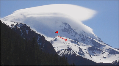
Wind-scoured slopes near the top quickly gave way to nice wind-deposited powder for most of the 3600-ft descent, save for the final pitch into Glacier Basin itself, which had already started to glop-up. I was briefly tempted to skin back up for another lap, but instead opted to end it on a celebratory note and make it back to the beer sooner rather than later. A massive lenticular 'hat' engulfed Rainier's summit as were hiking out. I took one last look back before entering the forest and tipped my hat back at the mountain. Thank you Sir Rainier! Till we meet again...

Click here to view photos.
home | email | copyright

All photos and text for sverdina.com are copyright © 2002-2024

It would be very much appreciated if you please ask before copying and/or re-publishing content from any part of these pages. To do so, please click here to send a message via feedback form.

Thank You.

©2024 sverdina.com |