


Lemah Mountain - Lemah Glacier, July 2004
 as seen from a high point on the descent.")
The name Lemah, meaning fingers in native Chinook, intrigued me. Having lived in Indonesia for many years, I know the local word for the number five is "lima." Could there be some correlation between the two? It seems plausible that in some distant past, the words for the number five and fingers (or hand) were essentially one and the same. At camp that night, Eric and I debated the possible etymological roots of "lemah", concluding that Native Americans and Indonesians (and their respective languages) derive from a common source, having made its way to this continent via some ancient arctic land bridge. The possibilities of this link fascinated me!
It turns out that the native "lemah" is the French word for hand ("le main") borrowed into the Chinook jargon. "Although the Northwest was never part of the French colonial claims in North America, and only one or two French ships visited the outer coast during the early fur trade era, the French language was the main outside influence on the development of the jargon until the widespread influx of English-speaking Americans and British from the 1830s onwards."* Well, so much for our theory. French speaking natives aside, this trip initially started out as an attempt on Chimney Rock's classic East Face. The weather gods, unfortunately, had other plans in mind. *Source here.
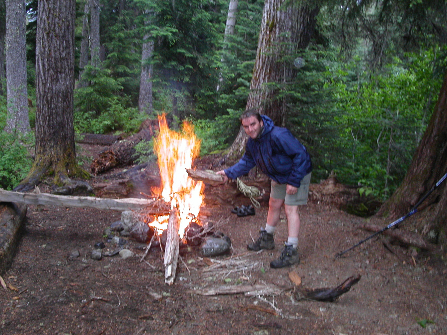
After about 2 hours of driving from Seattle, we took the Roslyn-Salmon la Sac Exit off of I-90 then followed signs to Cooper Lake, arriving at the Pete Lake Trailhead around 4:00pm. By the time we reached the junction with the Lemah Lake Trail (about 6 miles in - first 2.6 miles approved for bikes) it was raining steadily. We decided to make camp, hoping the weather would improve as forecasted. At worst, we figured, Lemah Mountain would be an easy and non-technical backup climb if conditions didn't improve. It rained through the night, but, the trees offered a nice protective canopy (for me at least) - so effective, that I slept right through my 4:30am alarm. Finally, by 8am we were up, the rain had stopped (it apparently stopped raining around 5am) and promising patches of blue could be seen through the low clouds. Already several hours behind schedule, Chimney Rock was now off the table, but, we decided to make a go for Lemah. Incidentally, of it's 5 summits, the 3rd is the tallest.
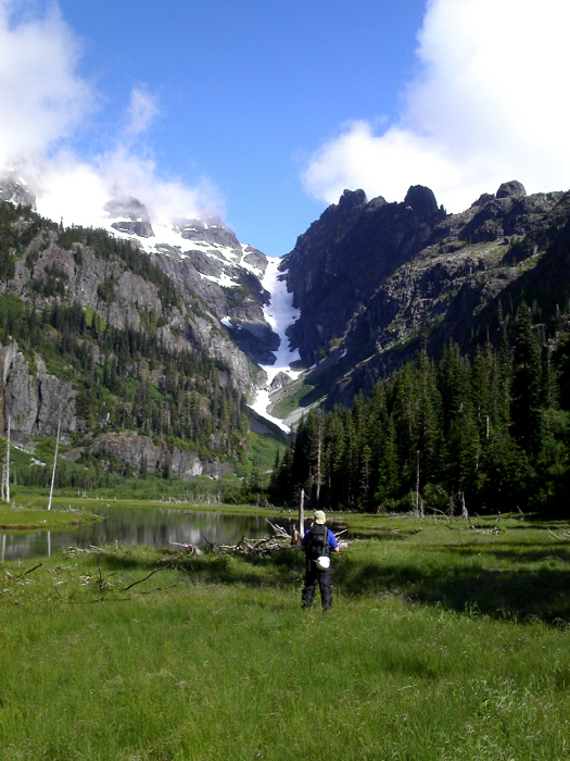
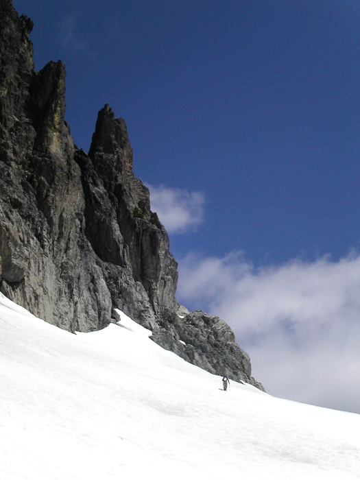
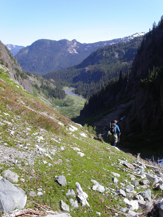
By 8:20am we were hiking north on the Lemah Mountain Trail to the junction with the PCT. We turned south and continued about a mile to the small camp site just before the short bridge over Lemah Creek. We started up the right side of the creek following a very faint and brushy path. The path led us up out of the forest over numerous mossy slabs (look for cairns) from where we had partial views of our objective. At the left edge of the highest of these slab domes, we dove back into the trees for a short, downward thrash to reach an open, marshy basin. In the distance, a prominent snow gully on Lemah 5's north-side demanded to be skied...providing one could stomach the thought of hauling skis all this way. Unsure of exactly how to bypass the cliffs guarding Lemah's upper slopes, Eric and I aimed for the gully, hoping to find the sloping bench trending back left above the cliffs as mentioned in the Smoot guide.
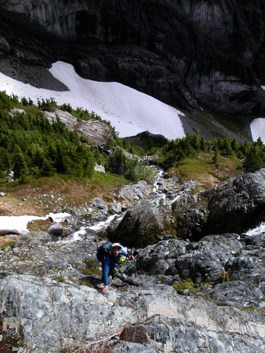
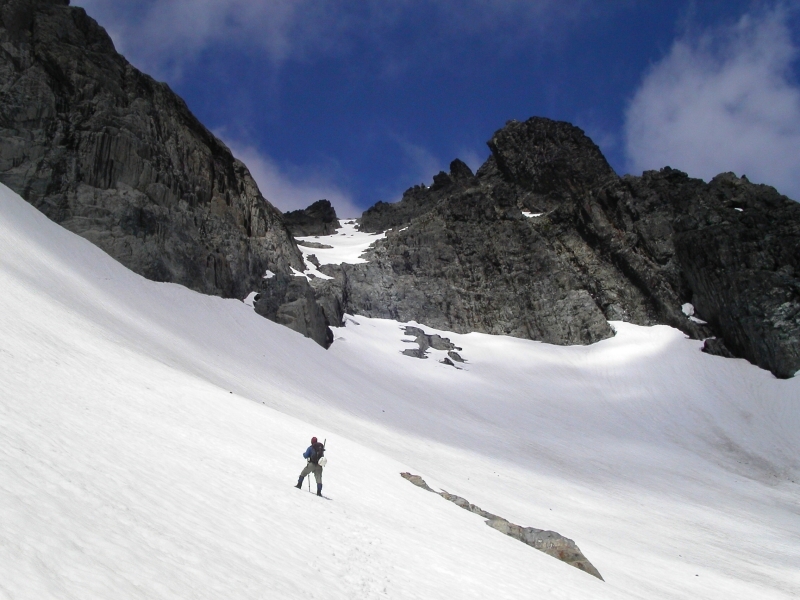
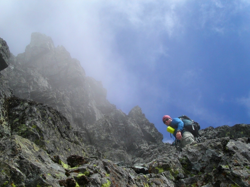
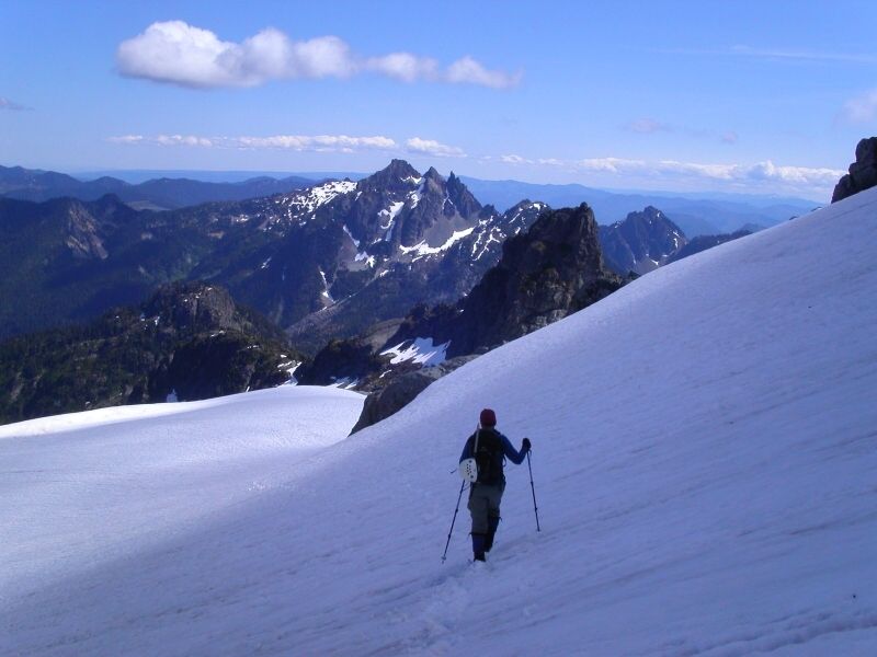
At about 4800' we left the gully and started up a heathery bench. Traversing below cliffs, we scrambled a short, wet rock step just right of a small waterfall to reach snowfields in a picturesque cirque. We traversed southwards and hiked up a short heather slope at the cirque's far left-end to reach the glacier moraine above. Once on the moraine we headed up and left to reach the Lemah Glacier proper. We quickly ascended the low-angle slopes below Lemah Two then traversed north until below Lemah's main summit. We continued up steep snow aiming for the rock hourglass directly above (moats easily stepped over).
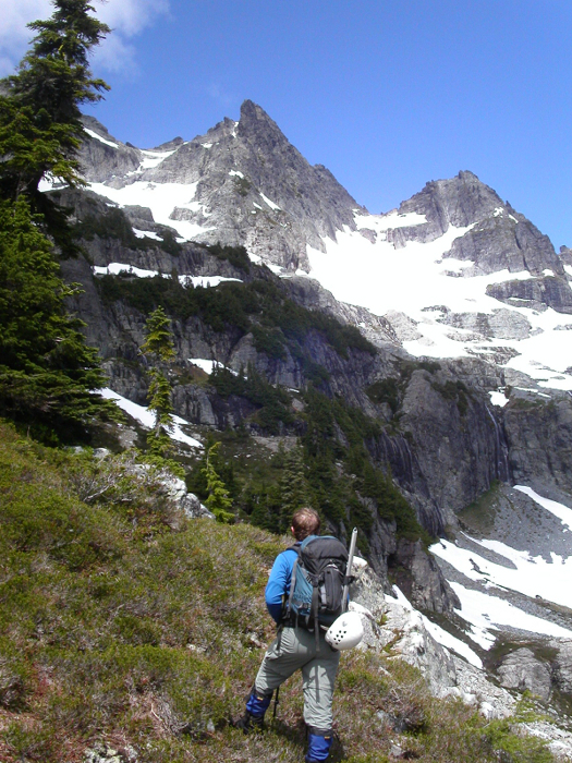
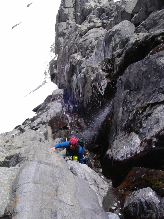
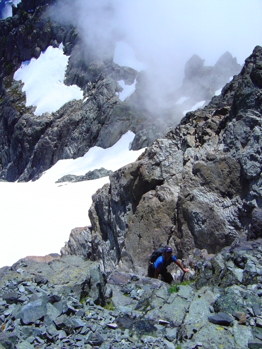
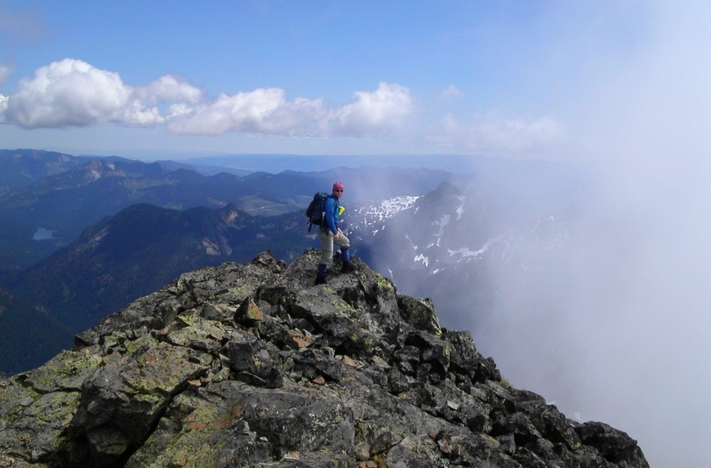
Passing a small waterfall with a few moves in a wet, 10-foot chimney (crux) we quickly reached the upper snowfield. From this snowfield, it is advisable to work up and left, aiming for the obvious col (we returned this way) and scramble the ridge to Lemah's summit. Misled by Smoot's poor description and diagram, we instead climbed rightwards on steep snow into a narrow, steep snow and rock gully. The upper gully was loose 4th class and exposed...a way we preferred not to descend. Once on the ridge crest, we scrambled steep rock (some 4th class - mostly on, or just left of the crest) to the summit (I actually explored an alternative "scramble" route farther around to the left that I'd not recommend). The clouds seemed to be holding just west of the Lemah-Chimney-Daniel crest (similar to what I experienced in the Pickets last summer), with nice northeastern views of Mounts Daniel and Hinman.
On our return we continued past the top of the unpleasant 4th class gully and stayed on the broad ridge crest, and from where we easily descended to the aforementioned col. The trailhead was reached around 8pm. With an early trailhead start, this would be a reasonable day-trip. Though lacking the elevation and broad glaciers of peaks in the North Cascades, the range is certainly rugged with much local relief. Whether it be the long valley approach, bushwhacking, remoteness, route-finding or scenery, the climbing in this area definitely takes on the character of a North Cascades outing. Well worth a visit!
Click here to view photos.
![]()


