


Mount Rainier - Liberty Ridge, June 2003

Great weather, stable snowpack and very manageable glacier crossings made for a most enjoyable climb of one of Rainier's most challenging routes! All in all, it was a relatively straightforward climb for us and thanks to the boot path we made it up to Liberty Cap from high camp (just below Thumb Rock ~ 10k ft) in around 7 hours. We encountered sustained 40 - 50 snow/ice and exposure, but nothing really "technical" per se. We soloed most of the route (about half of it in the dark since we left camp at 2am) except to belay a funky move getting over the bergschrund right at Liberty Cap. We didn't encounter anybody on the route and judging by those snoring away at Thumb Rock when we passed by there early that morning, we weren't going to.
There's something to be said about climbing this route in total darkness...one can't SEE the exposure. Also, Tom and I somehow got separated in the dark and each took our own line for a couple hours before regrouping at the top of the Black Pyramid. Imagine - a thin crescent moon, the stars, the orange glow of city lights in the distance, the faint light reflecting off of ice cliffs looming overhead above Willis Wall and Ptarmigan Ridge...and then there's you, swinging tools and front pointing up an endless face of snow and ice. Yep just you, the mountain and that nagging question you keep asking yourself - "what the hell am I doing?" It was surreal, intense and exhilarating all at the same time. We walked across the vast summit area from Liberty Cap to the Emmons Glacier. Not feeling the need to slog over to the "true summit", we simply descended down to Camp Schurman and returned to the car feeling more than elated with what we had accomplished.
But I'm getting ahead of myself as there's so much more to tell. Let's rewind to the very beginning where Tom and I got a slow start the afternoon of our first day on the mountain. Our detour to the nearest ATM machine located in Packwood didn't help much either. It seems the National Park Service can afford to outfit their ranger stations with the latest in computing equipment, including 17-inch flat screen monitors, but to purchase a climbing permit by credit is completely out of the question. I should know better by now I suppose. Yes, things certainly have changed since I obtained my last Mount Rainier climbing permit back in August 2001. As of this writing they now charge you a flat $30 fee that is good for an entire year. I guess I now have reason to visit Mt. Rainier again, before my permit expires.
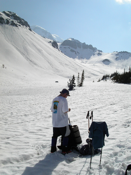
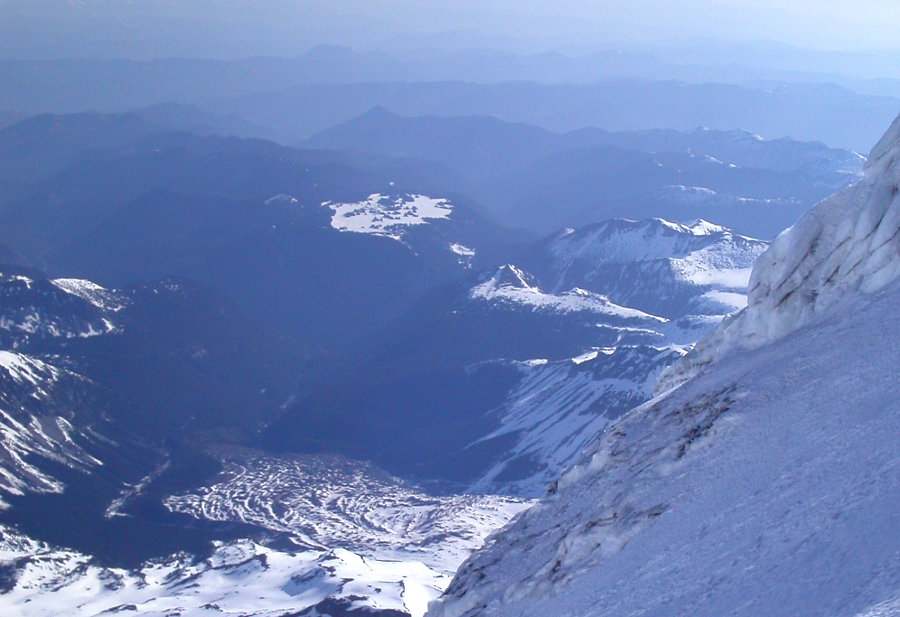
Our high point for the first approach day would be Saint Elmo Pass. We then set up camp at a previously dug out camp site on the edge of the Winthrop Glacier, just below Saint Elmo Pass. Dinner was prepared and eaten using various crude implements (we had forgotten to bring our cutlery). Tom was scooping up rice with the flat desiccant package found in my freeze dried packaging, whereas I balanced my spaghetti with meat sauce on the narrow file of my Leatherman tool. Dessert consisted of Jim Beam. By the looks of it, we weren't going to run out of booze on this trip either. After yet another lazy start that next morning, Tom and I finally packed up and start heading out across the Winthrop Glacier. I wasn't feeling so hot, thanks to the Beam. We crossed Curtis Ridge, eventually reaching camp sites overlooking the Carbon Glacier, with the spectacle of Willis Wall, Liberty Ridge, the Russell Glacier ice cliffs, and Ptarmigan Ridge towering before us. Liberty Ridge is the prominent ridge, just right of center, separating the two steep walls capped by ice cliffs. The glacier crossing was relatively trivial, save for two or three bottomless crevasses we had to leap over. Did I mention bottomless?
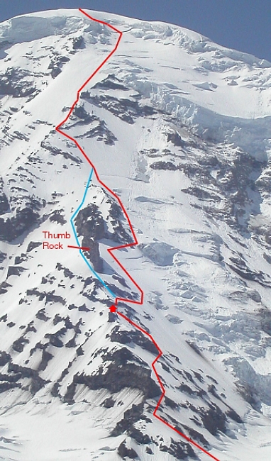
As we weren't able to secure a permit to camp at Thumb Rock that night, we instead got a permit to camp on the Carbon Glacier. An attempt on the summit from the Carbon would entail about 6000ft of climbing. A big day however you slice it. We gambled, and kept going, hoping to find a relatively flat spot near Thumb Rock that would make an adequate camp site. We located a spot that yielded a perfect high camp site (after some shoveling). We affectionately named our ad hoc camp spot Fraggle Rock. The mighty Carbon Glacier could be seen far below us from our vantage point. With the tent site dug out and the tent pitched we got started on resting up for the task at hand. It was only 3pm. The sun would continue to blaze for many more hours. Tom cooked an early but delicious dinner and melted snow for us to replenish our supplies for the next day. I tried to get some sleep, read a few chapters of Hyperion, listened to the radio for a bit, and did my best to stay out of the sun. My arms and neck were feeling very hot. Surely, I was already sunburned.
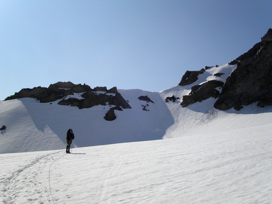
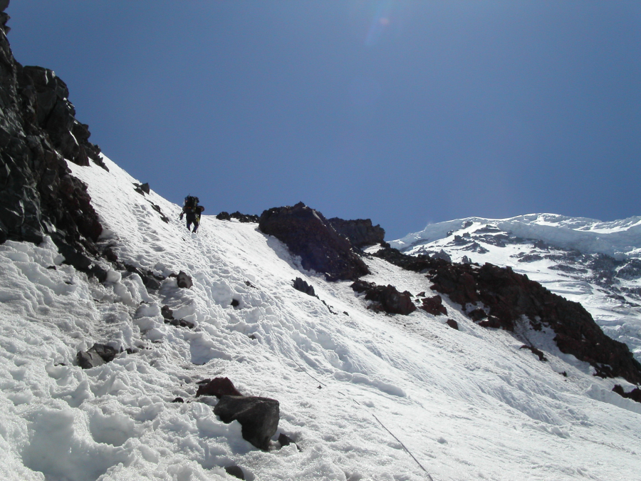
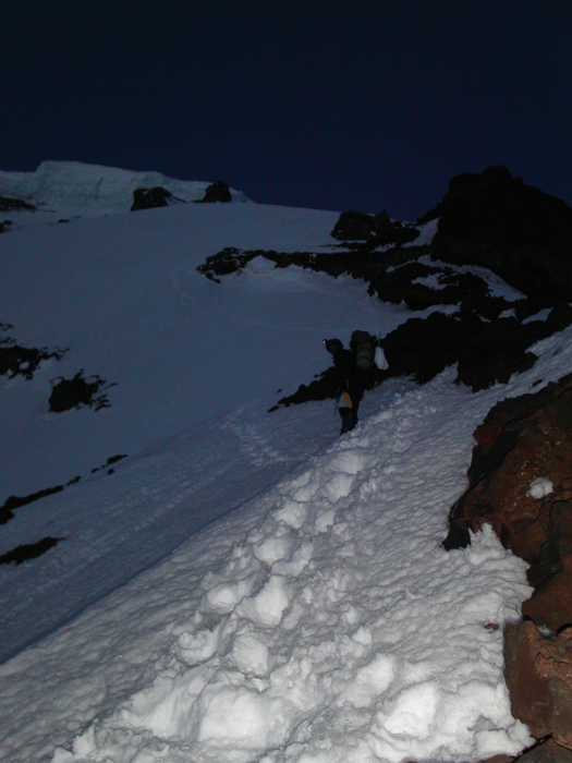
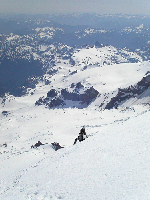
We woke up at 12am and got going by 2am. We followed a frozen boot path that took us up and over some unsavory loose rock on the ridge top, then back onto snow again. When it appeared the boot path would again lead up onto more loose rock, I opted not to follow behind Tom, and instead traversed out and right onto steepening snow and ice slopes. Ironically, it was here that I encountered the steepest climbing of the entire route. It was pitch dark, and I could barely make out the silhouette of Thumb Rock against a black sky above me. After was seemed like an eternity, I reached the camp sites at Thumb Rock. Everyone there was still fast asleep. Tom was nowhere to be seen. Then I saw a faint light above me, and heard the telltale sound of Tom's ice screws striking each other as they dangled from his harness. He was somewhere left of the rock above Thumb Rock. Judging by my observations earlier that afternoon, there appeared to be a better route to the right. I went right, expecting to join up with Tom somewhere near the Black Pyramid.
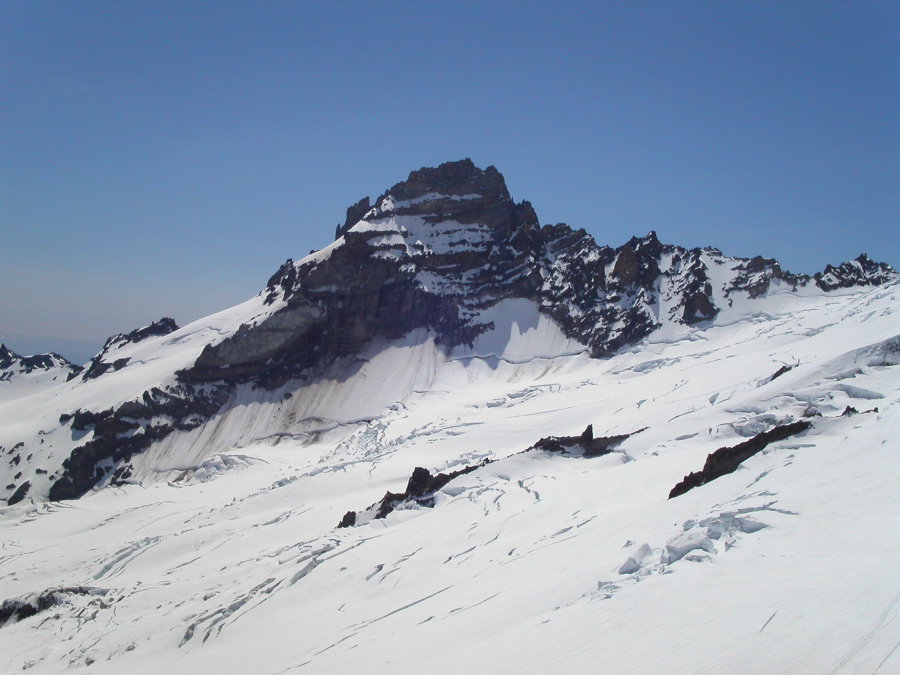
I will never forget the next hour or two of midnight solo climbing. My inner voice was telling me to turn around and go back down. At the same time, however, I was really getting into being alone on this majestic mountain, on this beautifully calm and pleasant morning. As I said before, it was surreal, almost spiritual. Sure enough, just as I began traversing below the Black Pyramid, I heard Tom calling for me. I looked down, but couldn't see his headlight. Through the darkness I heard him tell me that his headlight batteries were dead. Fortunately, the early glow of sunrise was now on the horizon. I waited for Tom to reach me, and together we traversed out below the Black Pyramid and rested briefly before climbing the final slope to the summit ice-cap.
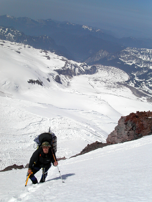
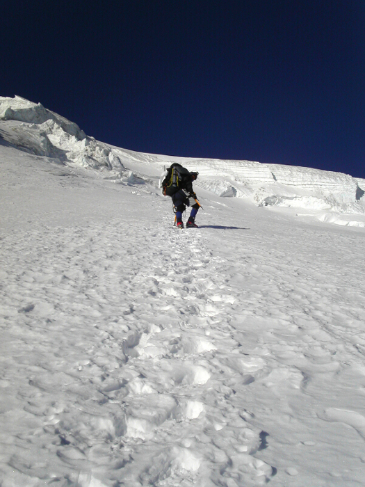
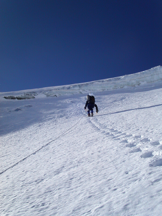
Well, the slope just went on forever. My toes were now cramping like it was nobody's business. We couldn't reach that ice-cap soon enough, as far as I was concerned. The slope tapered off a bit just below the bergschrund. Other tracks trended left towards the ice cliffs, but we didn't bother to check out where they led. Tom was eager to lead up and over the 'schrund. I gave Tom a belay as I watched him awkwardly flail up and over the 'schrund. It was my turn next. I'm afraid my style was no more graceful than Tom's. The snow was soft, the kind you drive your ice axe shaft into, not the pick. Pulling on my tools without yanking them free, I kicked one foot into the soft wall of the 'schrund and brought up my knee and rested it on a snow ledge cut into the wall above the 'schrund. Carefully, I brought up my other leg, stood up and stepped out onto the slope above the 'schrund. A ladder would have been nice.
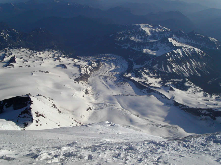
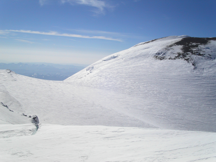
Easy climbing, in a stiff wind brought us up onto Liberty Cap. Now with the true summit at right and our return route via the Emmons Glacier below the saddle at left, we traversed across the immense summit plateau. Having completed the route, we began the descent. It was a LONG boring slog down the Emmons. We finally reached Camp Schurman, scrambled up Steamboat Prow, and enjoyed magnificent views of the Emmons Glacier. The Emmons route was very direct and in excellent shape. Liberty Ridge - a classic route that I would love to repeat someday. Not having anyone else on the route with us was also a rare treat!
Click here to view photos.
![]()


